November 6 , 2025.
Hawaii , Kilauea :
HAWAIIAN VOLCANO OBSERVATORY DAILY UPDATE, U.S. Geological Survey
Wednesday, November 5, 2025, 8:51 AM HST (Wednesday, November 5, 2025, 18:51 UTC)
19°25’16 » N 155°17’13 » W,
Summit Elevation 4091 ft (1247 m)
Current Volcano Alert Level: WATCH
Current Aviation Color Code: ORANGE
During the lapse in appropriations, the USGS Hawaiian Volcano Observatory (HVO) continues to maintain monitoring networks and issue updates and notifications of volcanic activity via the Hazard Notification Service. Volcano monitoring data will continue to be available on the HVO website. Static website content will not be updated until further notice and information may become outdated over time.
Activity Summary:
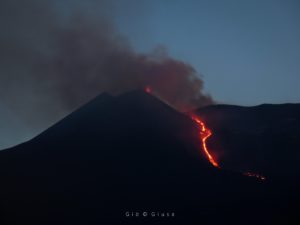
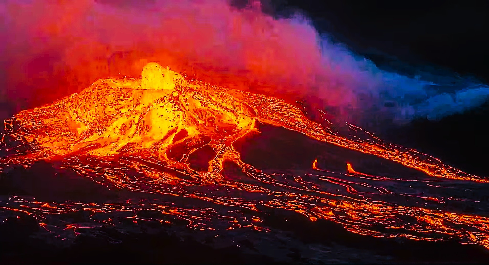
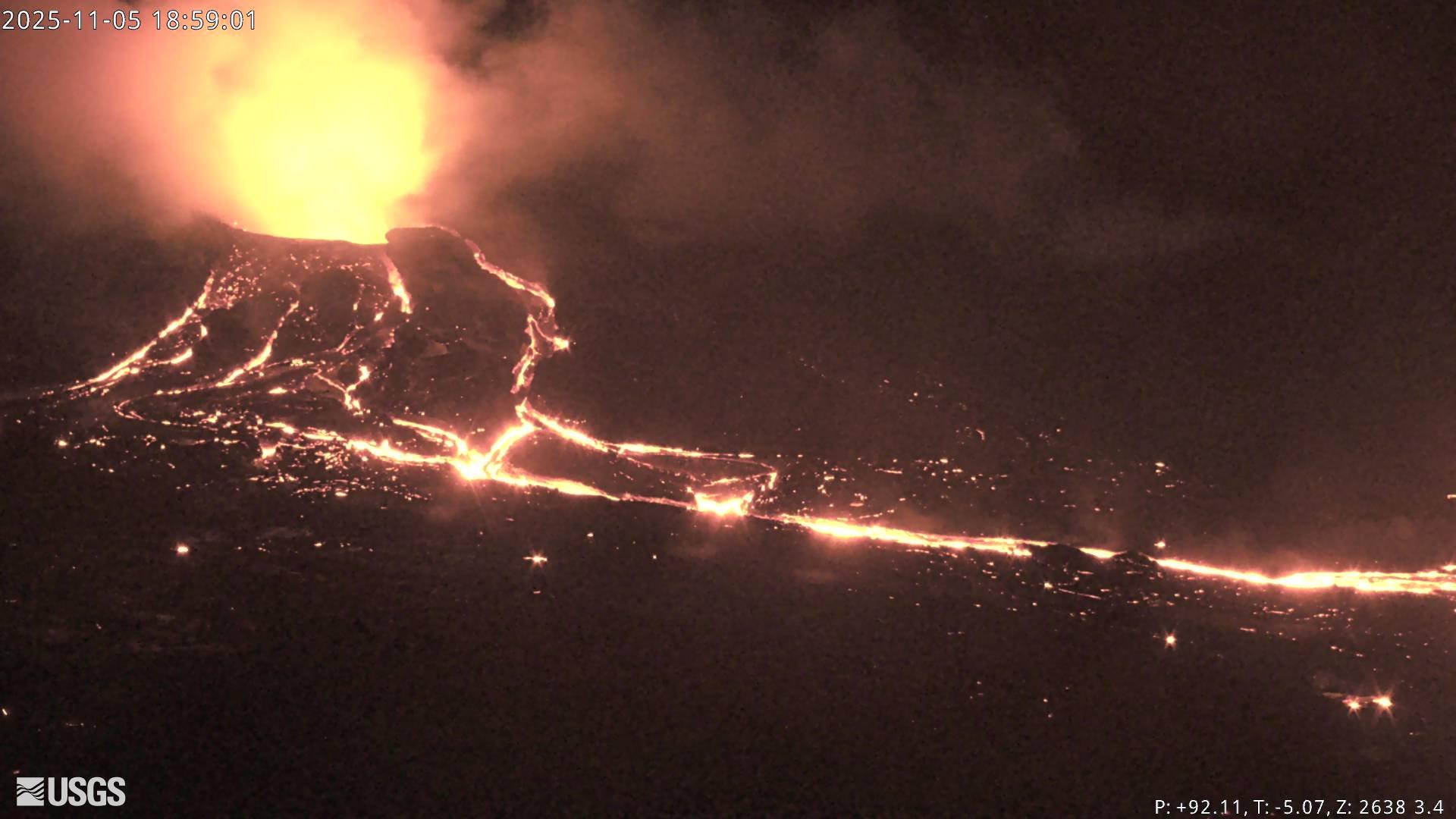
Overflows of degassed lava continued from the south vent last night and grew in size and duration. While the north vent glowed intermittently overnight, all of the overflows have come from the south vent since just before 3 a.m. HST on October 4. Slow inflation of Kīlauea summit continued over the last 24 hours; however, repeated overflows from the north and south vents indicate the start of episode 36 is close. Models suggest a likely forecast window of November 5–8 for episode 36 with November 5-7 most probable.
Summit Observations:
The early morning hours were dominated by large overflows from the south vent that lasted up to 1 hour and 20 minutes. During these events lava overflowed from all sides of the south vent cone and greatly enlarged the small channelized pāhoehoe flow field growing around the cone. The last 3 events were the largest and longest lasting of the 14 overflows that have occurred since yesterday morningʻs update. These large overflows differed from the passive pond overflows of the previous events and instead had well developed hemispherical dome fountains 15-30 feet (5-10 meters) in diameter. Both the passive pond overflows and the dome fountains had very little spattering until drainback, indicating that mostly degassed magma is being erupted at this time. The north vent glowed intermittently last night, but there were no standing lava or overflows since early yesterday morning, October 4.
The summit continues to inflate. The Uēkahuna tiltmeter (UWD) has recorded approximately 0.5 microradian of inflationary tilt over the past 24 hours and 25.7 microradians of inflationary tilt since the end of episode 35. Tremor patterns were consistent through most of the last 24 hours with periods of low tremor correlating with pond filling and/or overflows followed by short 5-10 minute tremor spikes related to drainback. That pattern changed just after 3 a.m. HST with much longer overflows (up to 1 hour 22 minutes) followed by long periods of higher tremor that decreased slowly over the next hour.
Plumes of gas continue from both vents this morning and sulfur dioxide (SO2) gas emissions remain at background levels, typically between 1,200 and 1,500 tonnes per day. Yesterday wind conditions were favorable and the SO2 array southwest of the vent detected « puffs » of gas related to drainback events as is expected during gas pistoning events.
Source et photos : HVO
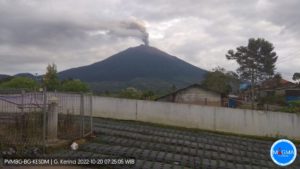
Chile , Planchón Peteroa :
Special Volcanic Activity Report (REAV), Maule Region, Planchón Peteroa Volcanic Complex
November 6, 2025, 00:43 local time (Mainland Chile)
The Chilean National Geology and Mining Service (Sernageomin) is publishing the following PRELIMINARY information, obtained through monitoring equipment from the National Volcanic Monitoring Network (RNVV), processed and analyzed at the Southern Andes Volcanological Observatory (OVDAS):
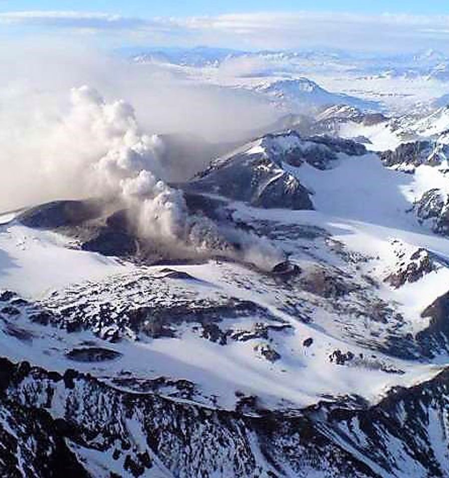
Today, Thursday, November 6, images from monitoring cameras installed near the Planchón Peteroa Volcanic Complex revealed a column of gas and pyroclastic material observed at 02:43 UTC (November 5, 23:43 PT). This column reached a height of 900 meters above the crater and dispersed in a southeasterly direction.
Based on the latest volcanic activity reports published by SERNAGEOMIN for this system, and considering the above, the possibility of further episodes of similar or greater energy, of low to medium magnitude, affecting the immediate vicinity of the active craters, cannot be ruled out.
OBSERVATIONS: A tremor-type event, characterized by a fluid displacement of 7.8 cm, was recorded prior to the reported surface activity.
The volcanic alert level remains at: YELLOW Volcanic Alert
Source : Sernageomin
Photo : Segemar
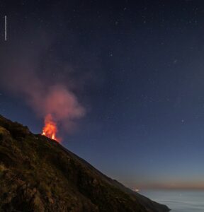
La Martinique , Mount Pelée :
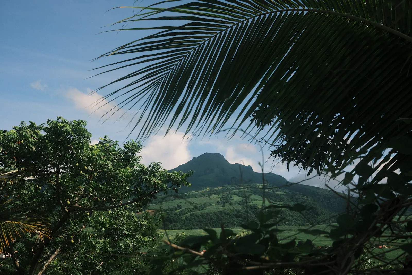
Mount Pelée is an active, explosive-type volcano that has experienced numerous magmatic and phreatic eruptions in the past. Since the end of the last magmatic eruption in 1932, which was associated with the emplacement of a lava dome, its activity has decreased significantly, culminating in the cessation of fumarolic activity in 1970 and a generally very low level of seismic activity.
Since April 2019, volcanic seismic activity has exceeded its baseline level established from continuous instrumental observations over previous years. This new activity is characterized by numerous low-energy volcano-tectonic earthquakes, mostly shallow, the appearance of shallow tremor and long-period seismic signals indicating the movement of overpressured fluids in the hydrothermal system, and a few deep hybrid and long-period earthquakes (located between 15 and 40 km deep in the vicinity of the volcanic edifice) that may indicate deep magmatic fluid circulation. Areas of degraded vegetation on the southwest flank of Mount Pelée, observed since 2019, indicate diffuse CO2 degassing from the ground. A degassing zone at sea (presence of low-temperature CO2 bubbles) north of Saint-Pierre is being monitored in partnership with the Martinique Marine Natural Park to track the evolution of this phenomenon and its potential relationship to the volcano’s activity. Primarily between 2021 and 2023, deformations of the volcano measured by the GNSS sensor network indicated slight swelling that could be interpreted as a shallow source of localized pressurization beneath the summit of Mount Pelée. This source could be generated by the upwelling of limited volumes of hydrothermal and/or magmatic fluids (gas, hydrothermal water) into the volcanic edifice from the depths of the magmatic system. All of these observations reflect a reactivation of the volcanic system, which was still ongoing in September 2025, although the observations showed fluctuations over the months.
In September 2025, volcanic seismic activity increased significantly compared to previous months. Shallow volcano-tectonic seismicity was particularly intense and accompanied by shallow, long-period and hybrid earthquakes. The seismic energy released by all shallow earthquakes also increased significantly, but no volcanic earthquakes were confirmed as felt by the population. A few deep, long-period earthquakes continued to occur. The temperature and acidity (pH) of the edifice’s thermal springs showed no significant variation. Deformations of the edifice were minor and showed no marked inflation of the summit area. It is worth noting that during periods of volcanic reactivation, periods of increased activity, particularly seismic activity, often alternate with periods of reduced activity.
The probability of an eruptive activity in the short term remains low. However, considering all the observations collected since the end of 2018 and their nature, and based on the observations recorded by the OVSM-IPGP during September 2025 and summarized in this bulletin, we cannot rule out a change in the situation in the medium term (weeks, months, years).
In accordance with the measures put in place by the authorities, the alert level is currently: YELLOW = VIGILANCE
Source : Institut de physique du globe de Paris, OVSM.
Photo : Adeline Rapon
Colombia , Chiles / Cerro Negro :
San Juan de Pasto, November 4, 2025, 4:40 PM
Regarding the monitoring of activity at the Chiles-Cerro Negro Volcanic Complex (CVCCN), the Colombian Geological Survey (SGC), an agency under the Ministry of Mines and Energy, reports the following:
During the period from October 28 to November 3, 2025, the main variations in monitored parameters compared to the previous week were as follows:
● A significant increase in the number of earthquakes was recorded. However, the seismic energy released was lower. The largest earthquake during this period reached a magnitude of 2.7.

● Seismicity associated with rock fracturing processes within the volcanic edifice remains predominant, followed by fluid dynamics events and hybrid earthquakes. Earthquakes were located primarily beneath the summit of Chiles Volcano, within a 2 km radius. Although the depth reached 11 km at this source, most earthquakes were concentrated between 3 and 4 km. Other earthquakes were located within the CVCCN’s zone of influence, up to 5 km from the summit of Chiles Volcano (4,700 m altitude), mainly along the Chiles-Cerro Negro fault.
● Analysis of data from satellite sensors, GNSS stations, and tiltmeters continues to reveal variations in the volcanic zone. These variations are
possibly related to changes in seismic activity.
Based on the assessment and correlation of monitored parameters, the Geological Survey of Colombia (SGC) recommends closely monitoring their evolution by consulting the weekly bulletins and other information published through its official channels, as well as the instructions of local and departmental authorities and the National Unit for Disaster Risk Management (UNGRD).
Volcanic activity remains at the yellow alert level: active volcano with changes in the baseline behavior of monitored parameters and other manifestations.
Source et photo : SGC
Alaska , Katmai :
ALASKA VOLCANO OBSERVATORY INFORMATION STATEMENT , U.S. Geological Survey
Wednesday, November 5, 2025, 1:43 PM AKST (Wednesday, November 5, 2025, 22:43 UTC)
58°16’44 » N 154°57’12 » W,
Summit Elevation 6716 ft (2047 m)
Current Volcano Alert Level: NORMAL
Current Aviation Color Code: GREEN
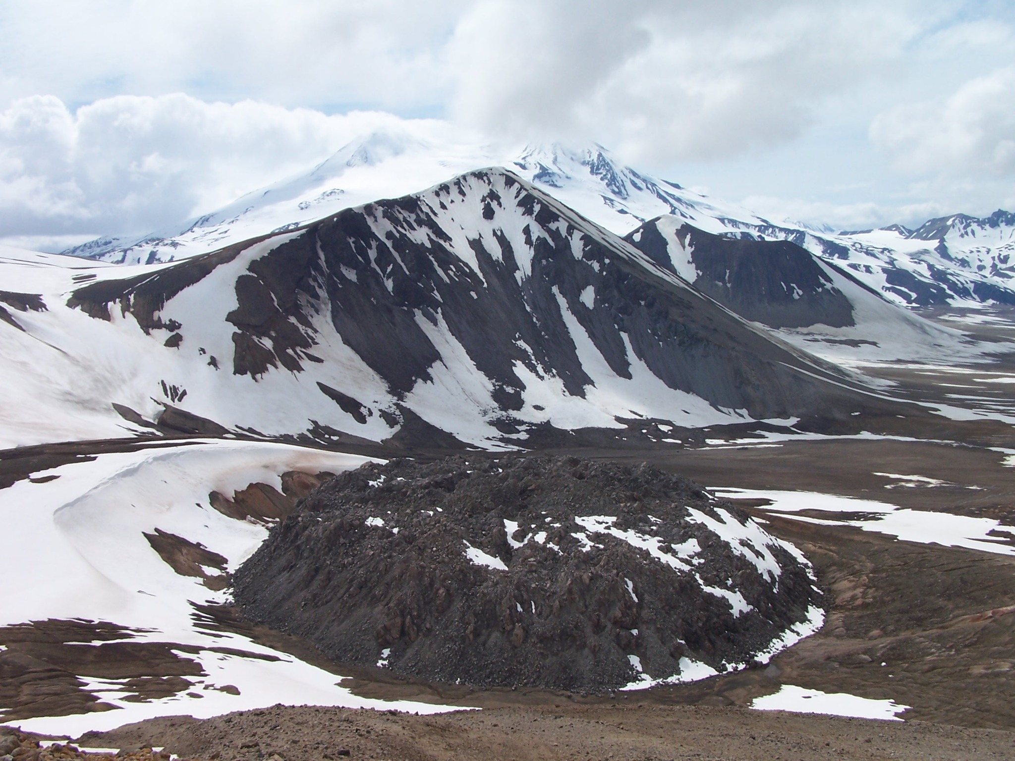
Strong northwesterly winds in the vicinity of Katmai and the Valley of Ten Thousand Smokes have picked up loose volcanic ash erupted during the 1912 Novarupta-Katmai eruption and are carrying it to the southeast. The National Weather Service has issued a SIGMET for this low-level event and suggests that the maximum cloud height is 6,000 ft (1.8 km) above sea level.
This phenomenon is not the result of recent volcanic activity and occurs during times of high winds and dry snow-free conditions in the Katmai area and other young volcanic areas of Alaska. No eruption is in progress. All of the volcanoes of the Katmai area (Griggs, Katmai, Novarupta, Mageik, Martin, Snowy and Trident) remain at Aviation Color Code GREEN and Alert Level NORMAL. Resuspended volcanic ash should be considered hazardous and could be damaging to aircraft and health.
Source : AVO
Photo : P. Izbekov, AVO/UAF-GI. USGS, DGGS .