August 22 , 2025.
Italy / Sicily , Etna :
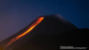
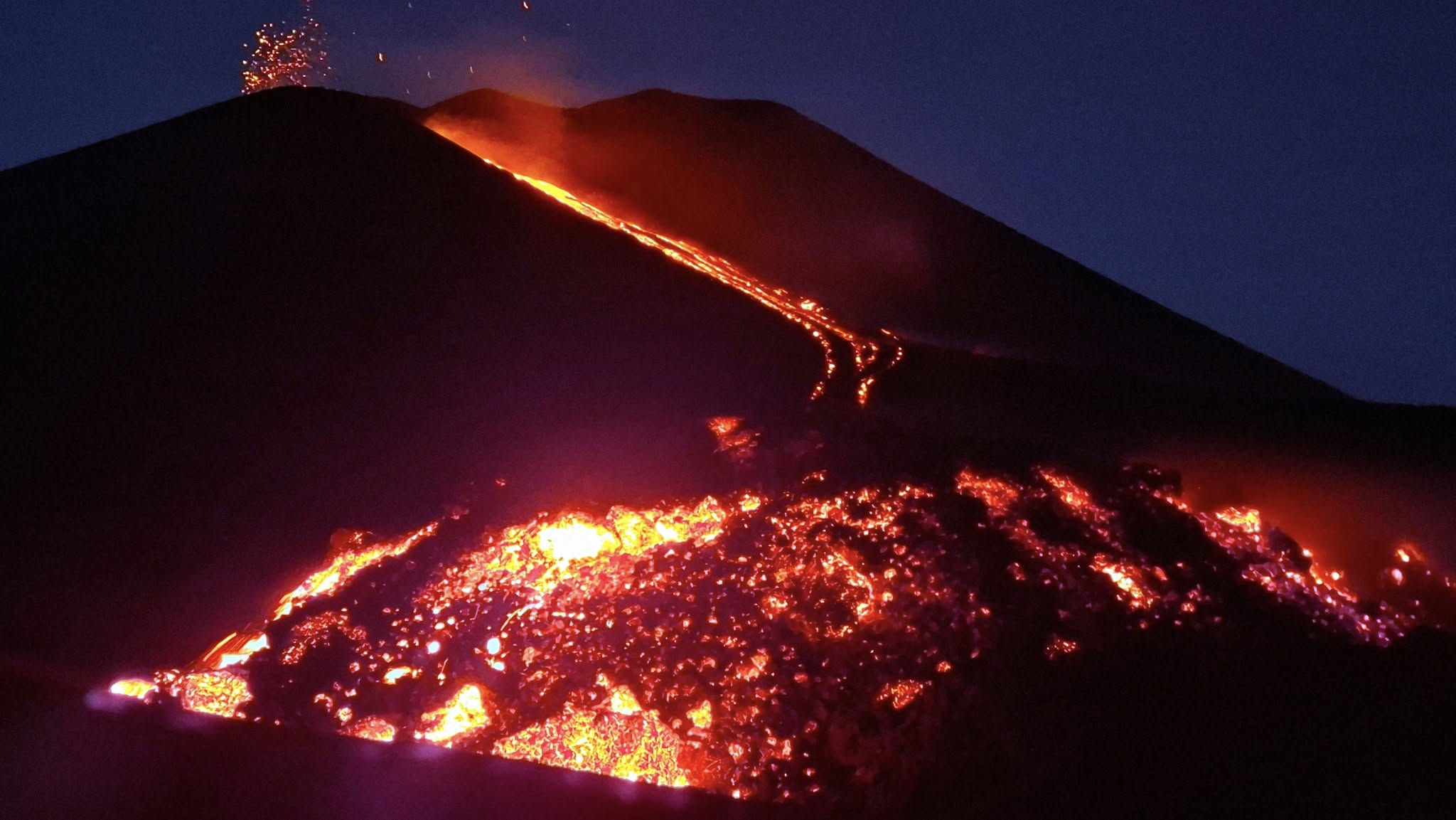
Etna Activity Statement, August 21, 2025, 7:04 PM (5:04 PM UTC)
The National Institute of Geophysics and Volcanology, Osservatorio Etneo, reports, based on volcanological observations carried out by INGV personnel at the summit and
analysis of images acquired by the video surveillance network, that the effusive vent located at approximately 3,200 m above sea level, on the southern flank of the southeast crater, is exhibiting spattering activity and feeding a lava flow heading southwest. The most advanced front has reached 3,030 m above sea level.
Effusive activity continues at the two vents located at 3,100 m and 2,980 m above sea level. Strombolian activity at the Southeast Crater continues, with pyroclastic eruptions
emerging from the crater rim. Regarding the average amplitude of volcanic tremor, the phase of increasing high values observed since August 18 continues.
The centroid of the tremor sources is located in the Southeast Crater area, at a depth of approximately 3,000 meters above mean sea level.
The presence of strong summit winds has affected the automatic detection and localization of infrasound events. However, seismogram analysis revealed an increase in activity from the early hours of the day, with modest-amplitude events located in the southeast crater.
Ground deformation signals recorded by GNSS and inclinometer networks currently show no significant variation. The DRUV dilatometer station continues to display a slow variation in decompression, accumulating to date, since the beginning of the current effusive activity, a total of approximately -15 nanostrains.
Updates will be provided shortly.
Source : INGV
Photo : Boris Behncke
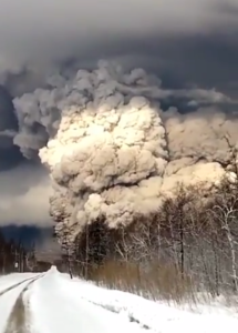
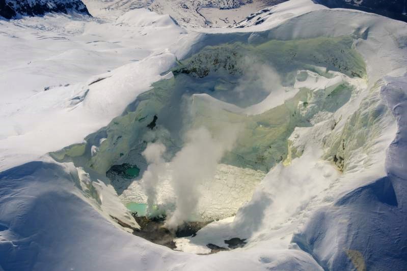
Alaska , Spurr :
AVO/USGS Volcanic Activity Notice
Current Volcano Alert Level: NORMAL
Previous Volcano Alert Level: ADVISORY
Current Aviation Color Code: GREEN
Previous Aviation Color Code: YELLOW
Issued: Wednesday, August 20, 2025, 10:07 AM AKDT
Source: Alaska Volcano Observatory
Notice Number: 2025/A510
Location: N 61 deg 17 min W 152 deg 15 min
Elevation: 11070 ft (3374 m)
Area: Cook Inlet-South Central
Volcanic Activity Summary:
Over the past several months, signs of volcanic unrest at Mount Spurr—including small earthquakes, gas emissions, melting ice, and surface changes—have been gradually decreasing. No ground deformation has been detected since March 2025. Taken together, this means that the movement of magma toward the surface, which began in early 2024, has stopped. As a result, the chances of an eruption in the near-term are now considered extremely low.
Because of this, the Alaska Volcano Observatory (AVO) is lowering the Aviation Color Code to GREEN and the Volcano Alert Level to NORMAL, indicating that the volcano is currently quiet.
Small earthquakes are still occurring more frequently than before the unrest began in February 2024, and volcanic gases are still being released from the summit crater and the Crater Peak vent on the south flank of the volcano. This is normal for volcanoes where magma has moved upward but has not erupted. Minor gas emissions and a slightly higher number of small earthquakes could persist for many months to several years.
Although the potential for an eruption occurring in the near-term has passed, the volcano poses hazards for recreators on Mount Spurr. High levels of carbon dioxide gas detected on the rim of Crater Peak suggest that hazardous amounts of this odorless and colorless gas may be present within the crater, but not in local communities.
Source : AVO
Photo : Loewen, Matt/ AVO/USGS.
Japan , Suwanosejima :
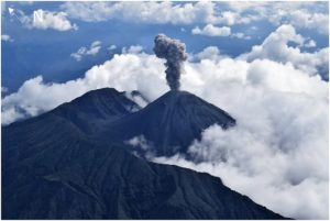
The Japan Meteorological Agency (JMA) reported that eruptive activity at Suwanosejima’s Ontake Crater continued during 11-18 August. Incandescence was observed nightly in webcam images. Volcanic earthquakes below the W flank had been at low levels but became more frequent on 14 August. Explosions at 21h30 on 13 August, at 20h46 on 14 August, at 00h23 and 00h49 on 15 August, at 21h02 on 15 August, and at 02h37 on 16 August produced ash plumes that rose as high as 1.4 km above the crater rim and drifted SW and W; plumes from the first and last explosions were not characterized. Large blocks were ejected 700 m above the crater rim. Eruptive events during 14-16 and 18 August produced ash plumes that rose as high as 1.4 km above the crater rim and drifted SW, W, and NW. The Alert Level remained at 2 (the second level on a five-level scale) and the public was warned to be cautious within 1.5 km of the crater.
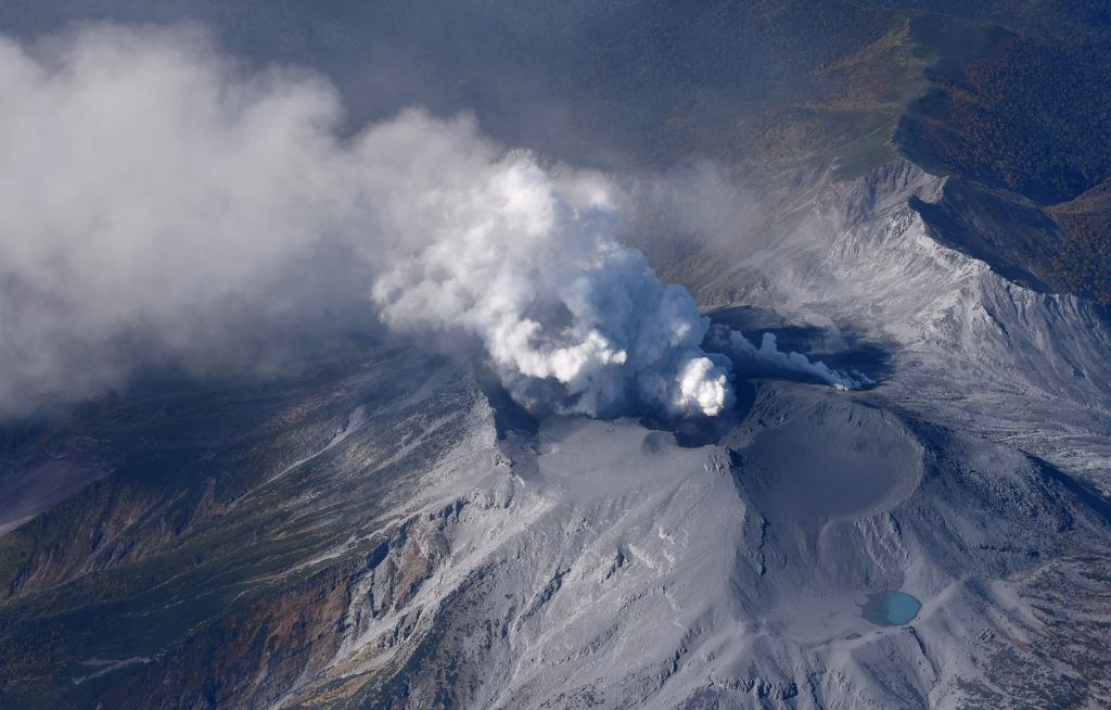
The 8-km-long island of Suwanosejima in the northern Ryukyu Islands consists of an andesitic stratovolcano with two active summit craters. The summit is truncated by a large breached crater extending to the sea on the E flank that was formed by edifice collapse. One of Japan’s most frequently active volcanoes, it was in a state of intermittent Strombolian activity from Otake, the NE summit crater, between 1949 and 1996, after which periods of inactivity lengthened. The largest recorded eruption took place in 1813-14, when thick scoria deposits covered residential areas, and the SW crater produced two lava flows that reached the western coast. At the end of the eruption the summit of Otake collapsed, forming a large debris avalanche and creating an open collapse scarp extending to the eastern coast. The island remained uninhabited for about 70 years after the 1813-1814 eruption. Lava flows reached the eastern coast of the island in 1884. Only about 50 people live on the island.
Sources: Japan Meteorological Agency (JMA) , GVP
Photo : Ontake , Masanori Genko
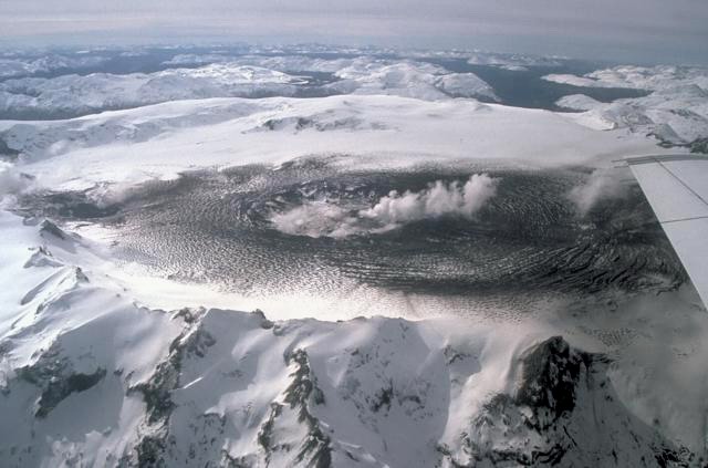
Chile , Hudson :
Special Report on Volcanic Activity (REAV), Aysen del General Carlos Ibanez del Campo Region, Hudson Volcano, August 19, 2025, 3:40 PM local time (Continental Chile)
The National Geology and Mining Service of Chile (Sernageomin) announces the following preliminary information, obtained using the monitoring equipment of the National Volcanic Monitoring Network (RNVV), processed and analyzed at the Southern Andean Volcano Observatory (OVDAS):
On Tuesday, August 19, 2025, at 2:59 PM (17:59 UTC), monitoring stations installed near Hudson Volcano recorded an earthquake associated with both rock fracturing and fluid dynamics within the volcanic system (Hybrid Type).
The characteristics of the highest-energy earthquake after analysis are as follows:
TIME OF ORIGIN: 2:59 PM local time (5:59 PM UTC)
LATITUDE: 45.971°S
LONGITUDE: 72.917°W
DEPTH: 0.5 km
LOCAL MAGNITUDE: 3.0
REDUCED DISPLACEMENT: 460 cm
Observation:
The surface surveillance camera is inoperative due to adverse weather conditions. Seismic activity was recorded, but of lower magnitudes.
The technical volcanic alert remains at GREEN.
Source : Sernageomin
Photo : Norm Banks, 1991 (U.S. Geological Survey).
Costa Rica , Turrialba :
Latitude: 10.025
Longitude: -83.767
Altitude: 3,325 m
Observed Activity:
LP events, double phases, and tonal codas were recorded. Two significant infrasonic double phases were observed (at 6:20 AM, magnitude 3.3 and at 7:04 AM, magnitude 2.9). The 6:20 AM event emitted ash and gas. A small gray plume was visible in the crater chamber. These two double phases are the largest recorded since late February 2025. Furthermore, seismic activity remains stable.
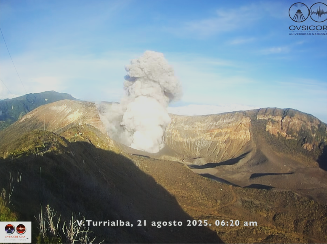
August 21, 2025. Ash emission was observed this morning. It was caused by a sliding of the inner walls of the crater, and the continuously emitted gas released this material into the atmosphere, dispersing westward. Other similar landslides have been observed in recent days, indicating the instability of the walls.
Activity Level: Warning (2)
Source et photo : Ovsicori