May 25 , 2025.
Indonesia , Lewotobi Laki-laki :
SPECIAL REPORT ON THE EVOLUTION OF THE ACTIVITY LEVEL OF LEWOTOBI LAKI-LAKI, FROM LEVEL IV (AWAS) TO LEVEL III (SIAGA) ON MAY 25, 2025
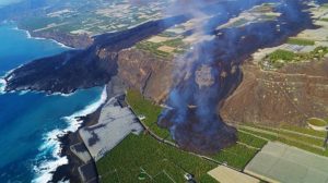
Mount Lewotobi Laki-laki is located in East Flores Regency, East Nusa Tenggara Province. Visual observations conducted during the period from May 19 to 24, 2025, showed a significant decrease in volcanic activity following the eruption of May 19, 2025, which produced an eruptive column reaching 4,000 meters in height. Currently, the average height of the eruptive column ranges from 100 to 2,000 meters. The summit morphology shows that the crater opening faces northeast, so the potential distribution of eruption material tends to be in that direction. The crater appears to widen in a northwest/northeast direction and is filled with black lava material covering an area of approximately 87,000 square meters.
After May 20, 2025, Lewotobi Laki-laki experienced only two eruptions. There were puffs of white, low-to-moderate smoke around the crater at an altitude of 100 to 800 meters above the summit. The roar was no longer audible, and the incandescence was no longer visible.
The earthquake records that occurred during this period are as follows:
30 eruption earthquakes
71 emission earthquakes
92 harmonic tremors
6 low-frequency earthquakes
77 deep volcanic earthquakes
11 local tectonic earthquakes
37 distant tectonic earthquakes
There were five continuous tremors.
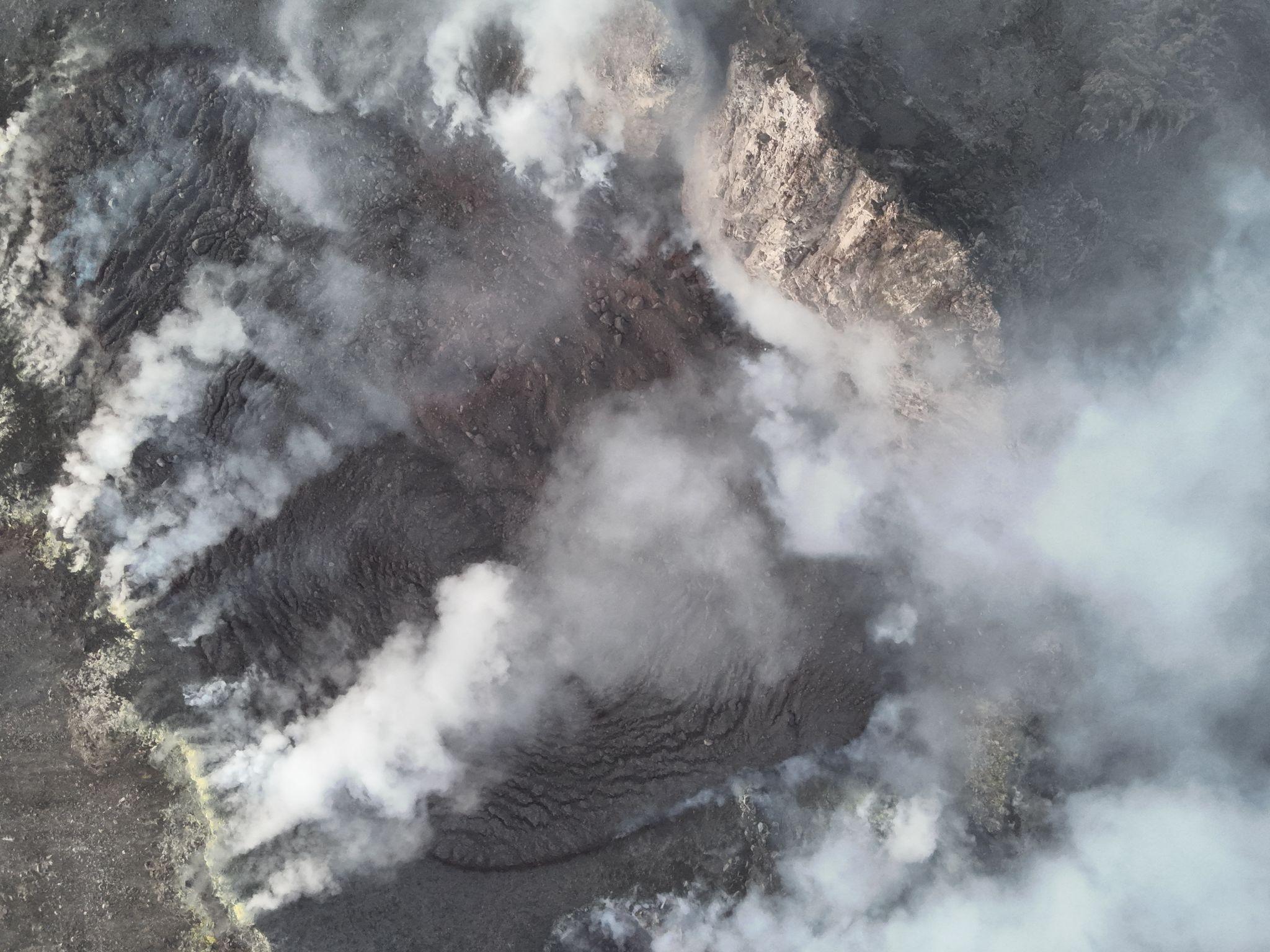
Seismic data show signs of a decrease in surface activity and an influx from deeper underground. Tiltmeter data also show a decrease, indicating that the pressure within the volcano is moving toward stability. Meanwhile, drone images show blackish-gray lava material visible at the bottom of the crater of Mount Lewotobi Laki-laki, with an area of approximately 87,000 square meters, so there is still the potential for an explosive eruption in the future.
The results of visual and instrumental analysis show that the activity of the Lewotobi Laki-laki volcano is tending to decrease, resulting in the volcanic activity level being lowered from Level IV (AWAS) to Level III (SIAGA) as of May 25, 2025, at 9:00 a.m. WITA. The public and tourists are advised not to carry out any activities within a 6 km radius of the eruption center, to remain calm, and to follow local government guidelines. The public is also urged not to believe information from unclear sources.
Source et photo : PVMBG.
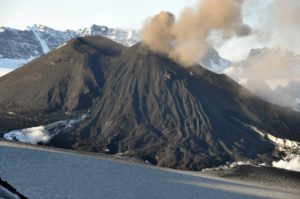
Hawaii , Kilauea :
Saturday, May 24, 2025, 8:38 AM HST (Saturday, May 24, 2025, 18:38 UTC)
19°25’16 » N 155°17’13 » W,
Summit Elevation 4091 ft (1247 m)
Current Volcano Alert Level: WATCH
Current Aviation Color Code: ORANGE
Activity Summary:
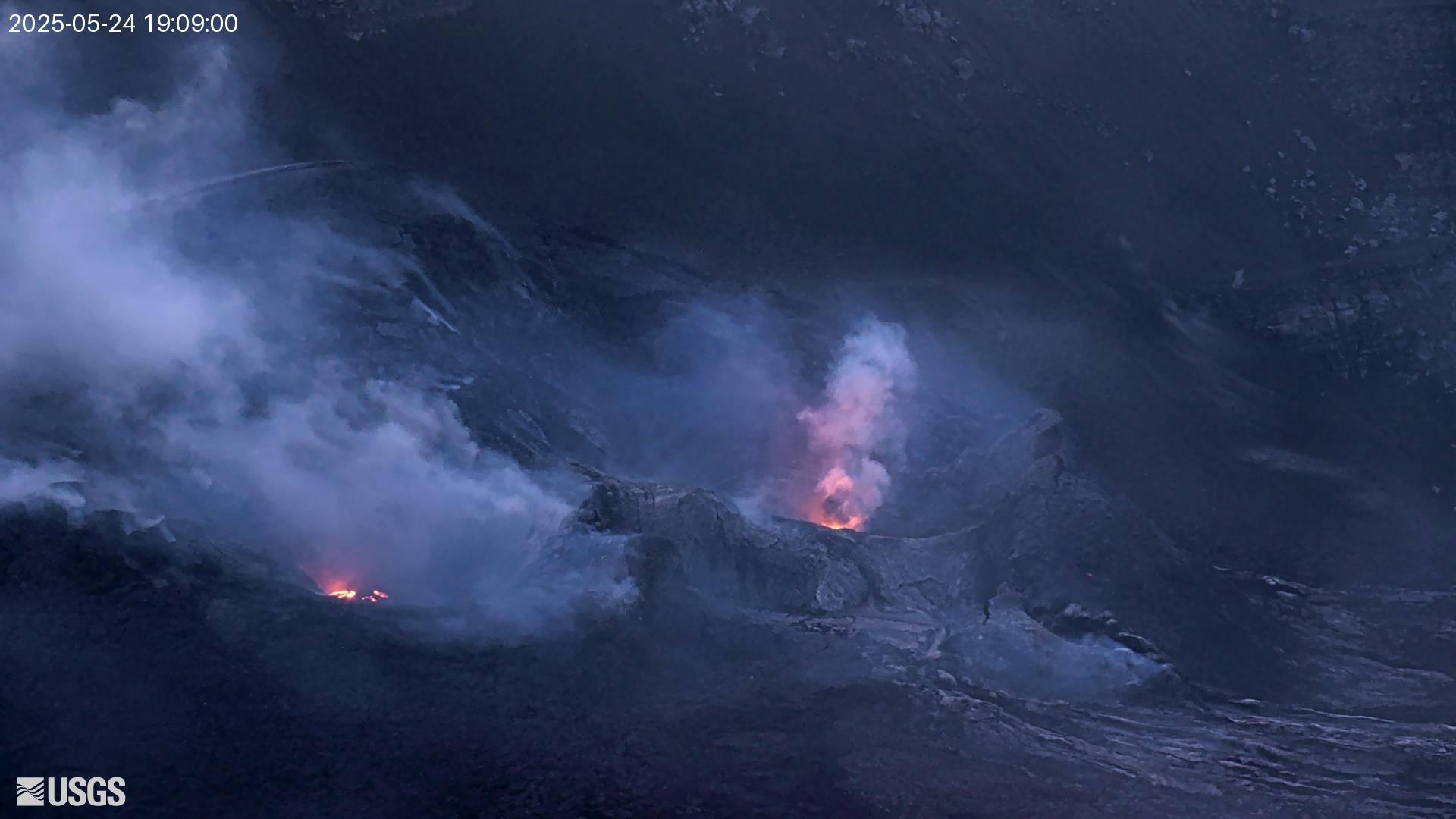
Episode 23 precursory activity continues but the rate of summit inflation remains low. Sustained fountaining could begin at any time through the weekend. The notable decrease in the rate of summit inflation since Wednesday has likely delayed the onset of sustained fountaining compared to previous episodes.
Kīlauea’s current eruption in Halemaʻumaʻu crater within Kaluapele (the summit caldera) began on December 23, 2024. There have now been 22 episodes separated by pauses in activity.
Summit Observations:
Ep. 23 precursory activity continues. Small lava fountains and lava overflows from north vent started around 11:30 a.m. Saturday May 24. Sustained fountaining could begin at any time through the weekend.
The rate of summit inflation has slowed significantly, with tiltmeters at Uēkahuna (UWD) and Sandhill (SDH) recording a total of 1 microradian of inflation since Wednesday. Small variations in summit tilt rates are not uncommon, but this represents a departure from previous inter-episode trends. Total inflationary tilt recorded at UWD is just under 10 microradians since the end of episode 22 on May 16. Low level tremor continues beneath Halemaʻumaʻu crater.
The average sulfur dioxide (SO2) emission rate remains around 1,200 tonnes per day (t/d), similar to rates recorded during prior pauses.
Source et photo : HVO
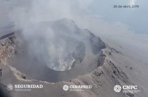
Chile , Lascar :
Seismology
The seismological activity for the period was characterized by the recording of:
6 VT-type seismic events, associated with rock fracturing (Volcano-Tectonic). The most energetic earthquake had a local magnitude (LM) value of 0.4, located 0.4 km south-southeast of the volcanic structure, at a depth of 1.8 km.
8 LP-type seismic events, associated with fluid dynamics within the volcanic system (Long Period). The size of the largest earthquake, estimated using the reduced displacement (RD) parameter, was 4 cm².
Fluid Geochemistry
Sulfur dioxide (SO2) emission data obtained using Differential Optical Absorption Spectroscopy (DOAS) equipment at the Emu station, located 6 km east-southeast of the active crater, showed an average SO2 flux value of 824 t/d for the period evaluated, with a maximum daily value of 1,547 t/d on May 7.
Three anomalies were reported in satellite images obtained by the Tropospheric Monitoring Instrument (TROPOMI) in sulfur dioxide (SO2) emissions into the atmosphere in areas near the volcano. The maximum emission value was recorded on May 13, reaching 218 tons of SO2 mass. These data were published by the Mounts Project and Global Sulfur Dioxide Monitoring.
Thermal Anomalies from Satellites
During the period, 34 thermal alerts were recorded in the area associated with the volcano, according to the MIROVA platform. The maximum value was 4.6 MW for the MODIS sensor on May 12. Sentinel 2-L2A satellite images from May 2, 7, and 12 show the continued presence of a radiance pattern characterized by three zones in the active crater. Similarly, the total radiance surface area calculated by the NHI (Normalized Hotspot Indices) platform (Marchese et al., 2019) for the active crater reported 11,700 m² for May 15, a value considered moderate.
![]()
Geodesy
The geodetic activity during the period was characterized by:
– Low vertical deformation rates (rates not exceeding 0.4 cm/month), with variations that do not suggest internal changes in the volcanic system, but rather changes attributable to seasonal processes.
– Average deformation rates along the line crossing the volcano (not exceeding 0.5 cm/month) and which respond mainly to a change in the PUNA station and seasonal processes, but not to evidence suggesting deformation of the volcanic system.
– No evidence of deformation according to radar interferometry (images updated to May 15, 2025), which is consistent with what was recorded by the GNSS equipment network.
Therefore, no evidence of deformation is observed in the volcanic system for the period evaluated.
Surveillance Cameras
Images provided by surveillance cameras installed around the volcano, when weather conditions permitted, recorded white degassing columns, mainly in a southeasterly direction, with a maximum height of 800 m above the crater on May 12. Incandescence was identified again on May 8 and was observed intermittently at night during the period under assessment, due to adverse weather conditions.
Instrumental data indicate that the volcanic system continues to show unusual signs of internal and surface activity. Seismic activity has been considerably lower compared to previous periods, with a marked decrease since March, with days without any detected events. At the surface, incandescence and recurrent gas emissions persist, although with gas columns of similar height to those of the previous two weeks.
Daily sulfur dioxide (SO₂) fluxes remain below the threshold considered abnormal for this volcano. However, satellite alerts related to the phenomenon continue to be observed. It is assumed that this behavior could be associated with increased magmatic input, reflected by persistent geochemical and thermal signals, which could lead to an intensification of activity. In this scenario, it is concluded that the system is maintaining anomalous behavior, so the technical volcanic alert remains at:
YELLOW TECHNICAL ALERT: Changes in the behavior of volcanic activity.
Source : Sernageomin .
Photo : Sernageomin / Gabriel Orozco.
Costa Rica , Poas :
Latitude: 10.20°N;
Longitude: 84.23°W;
Altitude: 2687 m
Current activity level: Caution
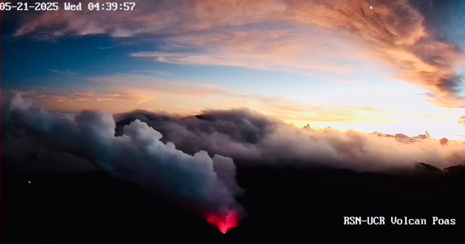
A major eruptive event was observed on May 19 at 4:08 a.m. local time, occurring at Boca A. It generated a column of gas, ash, and steam approximately 1 km high. It ejected incandescent boulder-sized rocks (> 64 mm) in the infrared band, which fell back into the crater.
Over the past seven days, seismic tremor has remained relatively weak compared to recent weeks. However, variations are observed. In particular, since the afternoon of May 18, the tremor amplitude has gradually decreased. Since the afternoon of May 20, the amplitude has been at a generally stable minimum. The most rapid decrease in amplitude occurred before the May 19 eruptive event.
The acoustic tremor remained almost constant with some variations, but was generally of low intensity. A significant decrease was observed 25 minutes before the May 19 eruptive event, after which it recovered. The eruptive event had an infrasound magnitude of 2.7.
Geodetic monitoring has detected vertical uplift and extension of the crater crust since December 2024, with amplitude varying over the weeks. Overall, ground uplift north of the crater has reached 3 to 4 cm, comparable to that observed during the 2017 eruption. During the past week, slight elevation and contraction of the crater have been recorded.
The Poás volcano continues to emit large quantities of magmatic gases, although less compared to the peak degassing that occurred in late April. The average SO2 flux measured by the fixed DOAS station decreased slightly this week (309 ± 21 t/d) compared to the previous week (387 ± 167 t/d). A mobile DOAS transect conducted on May 22 indicates an SO2 flux of approximately 3,000 t/d, a value similar to the previous week. The SO2 mass measured in the Costa Rican atmosphere by the TROPOMI sensor on the Sentinel-5P satellite shows variability this week, peaking on May 17 (1,000 tons).
Gas composition measurements are consistent with a surface magmatic source. The MultiGAS station located near Boca A measured an average SO2/CO2 ratio of 1.9 ± 0.4, while a drone measurement (in collaboration with José Sibaja, LAQAT-UNA) indicated a SO2/CO2 ratio of ~3.8. Both measurements indicate that the H2S/SO2 ratio is very low. The gases are interpreted as originating from a surface magmatic source, with no significant influence on the hydrothermal system.
A small permanent body of water remains at Boca C, which did not change significantly this week. Additional nighttime measurements using a thermal drone (credit: Blas Sánchez, CNE) showed apparent temperatures of 470°C at mouth A, while around 250°C were measured from the Visitors’ Viewpoint. Satellites detected a slight thermal anomaly between late April and May.
Source : Ovsicori
Photo : Capture d’écran RSN-UCR ,2025-05-22
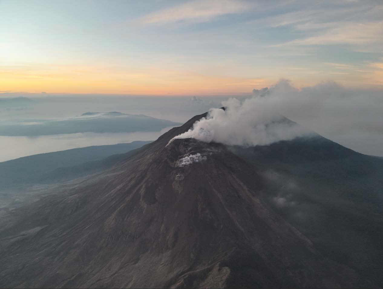
Ecuador , Sangay :
SANGAY VOLCANO DAILY STATUS REPORT, Saturday, May 24, 2025.
Information Geophysical Institute – EPN.
Surface Activity Level: High, Surface Trend: No Change
Internal Activity Level: Moderate, Internal Trend: No Change
Seismicity: From May 23, 2025, 11:00 a.m. to May 24, 2025, 11:00 a.m.:
Seismicity:
Below is the count of seismic events recorded at the reference station.
Explosion (EXP): 124
Rainfall/Lahars:
Since yesterday afternoon, no rain has been recorded in the volcano area. **Heavy rains could remobilize accumulated material, generating mud and debris flows that would cascade down the volcano’s flanks and flow into adjacent rivers**.
Emission Column/Ash:
Using surveillance cameras and satellite images, four gas and ash emissions were observed, with columns reaching heights between 1,000 and 2,500 meters above the crater, all in a southwesterly direction. In connection with this activity, the Washington-based VAAC agency published four reports corresponding to emissions with column heights between 1,200 and 2,100 meters above the crater level, oriented west-northwest, west, and west-southwest.
Gas:
There are no reports.
Other monitoring parameters:
Over the past 24 hours, the MIROVA-MODIS satellite system recorded one thermal anomaly.
Observation:
Since yesterday afternoon, until the submission of this report, the volcano has remained mostly cloudy.
Alert level: Yellow
Source : IGEPN
Photo : lenin.izaa via Volcan Sangay / FB.