January 23 , 2025 .
Hawaii , Kilauea :
Wednesday, January 22, 2025, 3:51 PM HST (Thursday, January 23, 2025, 01:51 UTC) . HAWAIIAN VOLCANO OBSERVATORY STATUS REPORT
U.S. Geological Survey
19°25’16 » N 155°17’13 » W,
Summit Elevation 4091 ft (1247 m)
Current Volcano Alert Level: WATCH
Current Aviation Color Code: ORANGE
Activity Summary:
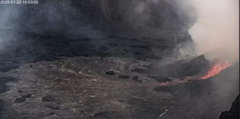
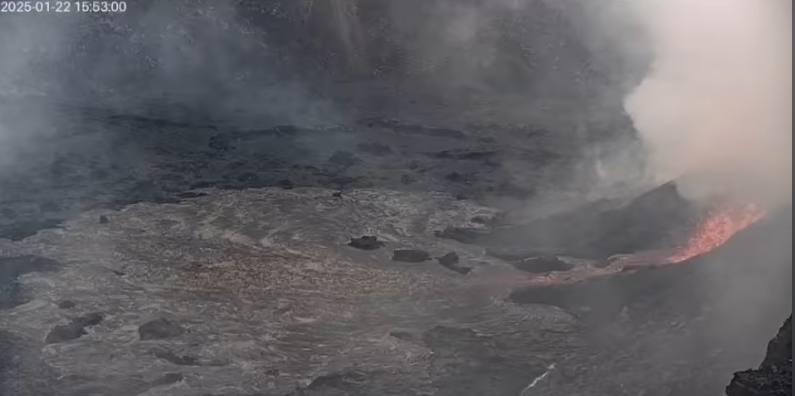
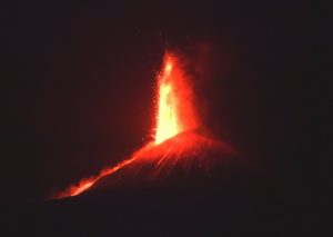
The eruption of Kīlauea within Kaluapele (summit caldera) resumed just before 3:00 p.m. HST today, January 22, 2025. This marks the beginning of the fifth episode of the current eruption that began on December 23, 2024, following the most recent pause that began on Saturday, January 18, 2025.
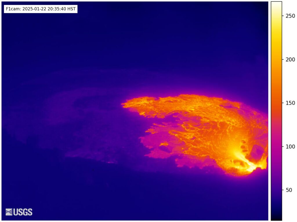
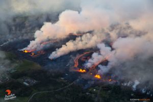
Episode 5 started with small spatter fountains at approximately 2:57 p.m. and lava flows beginning at 2:59 p.m. Current activity includes small dome fountains 16-33 feet (5-10 meters) high feeding a short lava flow from the north vent. Weak, intermittent spatter was observed earlier in the day but sustained effusive activity did not begin until just before 3:00 p.m. There are no signs of activity at the south vent.
Seismic tremor increased at 3:00 p.m. at the same time that effusion began. The tiltmeter at Uēkahuna continues to record inflation beneath Halemaʻumaʻu at the time of this report but is expected to transition to deflation as the eruption continues.
Each episode of lava fountaining since December 23, 2024, has continued for 14 hours to 8 days and episodes have been separated by pauses in eruptive activity lasting a less than 24 hours to 12 days.
HVO continues to closely monitor Kīlauea and will issue an eruption update tomorrow morning unless there are significant changes before then.
Source : HVO.
Photos : HVO
Colombia , Puracé – Chaîne volcanique Los Coconucos :
Popayán, January 22, 2025, 2:30 p.m. .
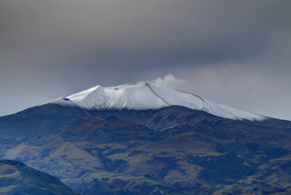
Monitoring the activity of the Puracé volcano – Los Coconucos volcanic chain, the Colombian Geological Survey (SGC), an entity attached to the Ministry of Mines and Energy, reports that:
On the afternoon of January 21, 2025, an increase in the energy of the continuous seismic signal reported in the last weekly bulletin was observed, which remains until the time of publication of this bulletin. In addition, degassing continues through the fumaroles of the Puracé volcano and the new foci generated during the ash emission that occurred on January 20, 2025 on the Curiquinga volcano. Sensors installed at the summit of the Puracé volcano continue to record significant levels of sulfur dioxide (SO2) emissions into the atmosphere. As a result, residents of the municipalities of Paletará, Puracé and Popayán (Cauca) have reported strong odors of sulfurous gas since yesterday afternoon: a natural reaction generated by the confluence between sulfur dioxide (SO2) coming out of the volcanic structure and the water present in the environment.
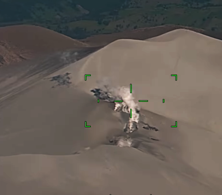
Yesterday, the Colombian Aerospace Force (FAC) flew over the Los Coconucos volcanic chain and recorded images of the Puracé, Piocollo and Curiquinga volcanoes. From these images, it was possible to appreciate the formation of a system of fissures and cavities of approximately 200 meters in length and variable widths of up to 30 meters, located between the northwest sector of the Curiquinga crater and the southern edge of the Piocollo volcanic structure. Ash accumulations are also observed at the summit and on the slopes of the Puracé, Piocollo, Curiquinga, Calambás and Paletará volcanoes, as well as impact craters of ballistic projectiles emitted during the activity of January 20, 2025.
The SGC reminds the community that in a yellow alert state, phenomena such as sporadic ash emissions (minor eruptions) may occur, the magnitude and effects of which are limited and the dispersion of ash depends on the direction of the wind, the presence of some incandescence, small explosions in the crater, low-energy thermal anomalies, noises, felt earthquakes, odors, precipitation of elemental sulfur near the crater and in hot springs and fumaroles, degassing in areas other than the crater. The formation of cracks and the appearance of minor mudflows, among others, are also observed.
Based on the above, the SGC calls on the population not to approach the areas closest to the craters of the Puracé, Curiquinga and Piocollo volcanoes. We also recommend that you closely follow the evolution of the situation through the extraordinary bulletins and other information published through our official channels, as well as the instructions of the local and departmental authorities and the National Disaster Risk Management Unit (UNGRD). The state of volcanic activity remains on yellow alert: active volcano with changes in the behavior of the base level of the monitored parameters and other manifestations.
Source : SGC
Photos : SGC , José María Arboleda C / Flickr .
Japan , Ontakesan :
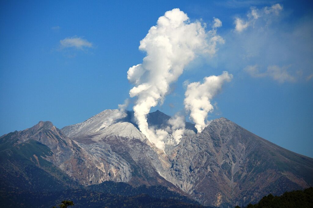
The Japan Meteorological Agency (JMA) reported increased seismic unrest at Ontakesan. The number of small volcanic earthquakes with epicenters near the summit had increased in mid-December 2024 and further increased in January 2025, most notably on 16 January. Volcanic earthquake totals of 5-8 per day were recorded during 10, 12-13, and 15 January. There were 24 and 19 volcanic earthquakes recorded on 11 and 14 January, respectively. Seismicity escalated on 16 January, with 27 volcanic earthquakes. The Alert Level was raised to 2 (on a scale of 1-5) at 22h00 on 16 January and the public was warned to stay 1 km away from Jigokudani Crater. Deformation data did not show any ground movement.
A total of 8-13 daily volcanic earthquake were recorded during 17-20 January. On 21 January the deformation network recorded summit inflation and the number of volcanic earthquakes significantly increased to 273 by 19h00. Fumarolic activity remained at normal levels; white emissions from Jigokudani Crater rose 200 m.
The massive Ontakesan stratovolcano, the second highest volcano in Japan, lies at the southern end of the Northern Japan Alps. Ascending this volcano is one of the major objects of religious pilgrimage in central Japan. It is constructed within a largely buried 4 x 5 km caldera and occupies the southern end of the Norikura volcanic zone, which extends northward to Yakedake volcano. The older volcanic complex consisted of at least four major stratovolcanoes constructed from about 680,000 to about 420,000 years ago, after which Ontakesan was inactive for more than 300,000 years. The broad, elongated summit of the younger edifice is cut by a series of small explosion craters along a NNE-trending line. Several phreatic eruptions post-date the roughly 7300-year-old Akahoya tephra from Kikai caldera. The first historical eruption took place in 1979 from fissures near the summit. A non-eruptive landslide in 1984 produced a debris avalanche and lahar that swept down valleys south and east of the volcano. Very minor phreatic activity caused a dusting of ash near the summit in 1991 and 2007. A significant phreatic explosion in September 2014, when a large number of hikers were at or near the summit, resulted in many fatalities.
Sources: Japan Meteorological Agency (JMA) , GVP
Photo : / Wikipedia , 2014.
Ethiopie , Fentale :
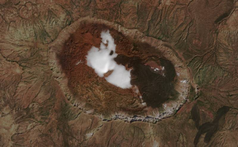
Satellite data analysis by the MIROVA team indicated that thermal anomalies over Fentale crater were visible during 13-14 January and progressively increased in size at least through 00h20 on 21 January (local time). No cause of these anomalies has been identified. A visible satellite image showed a possible gas plume over the crater. A 14 January news article stated that the Fentale crater typically hosts a small lake and that billowing plumes rise above the summit. The article also noted that 10,000 people evacuated from Seganto and possibly a total of 54,000 had been evacuated from higher-risk areas. The earthquakes damaged schools, buildings, a factory, and roads.
Latest images acquired today by SENTINEL-2 of the caldera of the Ethiopian volcano Fentale. We can see a new important gas emission centre (water vapour) as well as several fumarole emission points, close to the lava flow of 1820.
Fentale is a volcanic complex at the N end of the Main Ethiopian Rift that includes a main stratovolcano and caldera with various subsidiary features. Products are primarily rhyolitic obsidian lava flows with minor tuffs. Welded pantelleritic ash flows accompanied formation of a 2.5 x 4.5 km elliptical summit caldera, with steep-sided walls, that trends WNW-ESE, perpendicular to the rift. Post-caldera vents lie along the same orientation. Lava flows that appear to be more recent are present on the NE and SW flanks, and even darker trachytic and obsidian lava flows occur on the caldera floor. An eruption during the 13th century destroyed an Abyssinian town and church to the south. In 1820 CE basaltic lava flows effused from a 4-km-long fissure on the S flank; lava also flowed onto the caldera floor. During 2015 there was a seismic swarm and deformation NE of Fentale, caused by a dike intrusion that Temtime et al. (2020) determined was about 6 km long (striking N29°E) and 2 m wide, with a depth range of 5.4-8 km below the surface (volume change of about 33 x 106 m3).
Sources : MIROVA, VOA News , GVP.
Photo : Via Patrice Zwenger / FB
Philippines , Kanlaon :
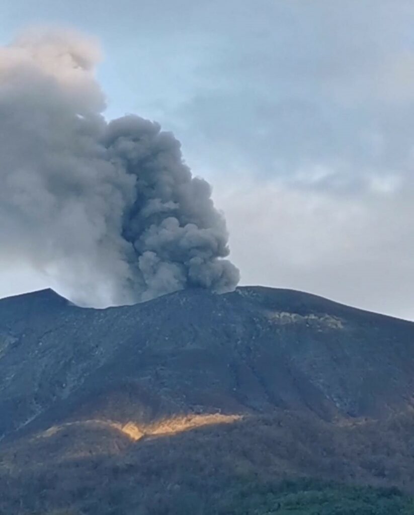
The Philippine Institute of Volcanology and Seismology (PHIVOLCS) reported continuing eruptive activity at Kanlaon during 14-21 January. The seismic network recorded 4-17 daily volcanic earthquakes that included 1-5 periods of volcanic tremor lasting five minutes to one hour and 36 minutes; volcanic tremor was not detected on 17 January. Average daily sulfur dioxide emissions ranged from 2,302 to 5,222 tonnes per day. Weather clouds prevented views on 14 and 17 January. There were 2-5 periods of ash emissions during 15-16 and 18-21 January, each as short as two minutes and as long as three hours and seven minutes. Gas-and-steam emissions and those occasionally containing ash rose as high as 300 m above the summit and drifted SW and W. Plumes were voluminous on 21 January.
The eruption continued to impact residents. The National Disaster Risk Reduction and Management Council (NDRRMC) report issued at 08h00 on 21 January stated that 9,869 people (3,117 families) were spread across 23 evacuation centers and another 8,376 people (2,648 families) were staying elsewhere. The Alert Level remained at 3 (on a scale of 0-5); the public was warned to stay 6 km away from the summit and pilots were warned not to fly close to the volcano.
Sources: Philippine Institute of Volcanology and Seismology (PHIVOLCS), The National Disaster Risk Reduction and Management Council (NDRRMC), GVP.
Photo : Norbert Gallosa , 18/10/224

