October 10 , 2024.
Philippines , Taal :
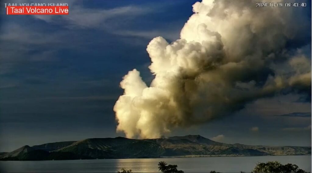
Philippine Institute of Volcanology and Seismology (PHIVOLCS) issued advisories for Taal reporting that a total of 30 phreatic events were recorded almost daily during 22 September-5 October. Five phreatic events during the morning of 5 October were recorded by the seismic network. A minor phreatomagmatic eruption began at 11h32 and lasted four minutes based on visual observations and seismic and infrasound data. The eruption ejected a short, black plume followed by a steam-rich plume that rose 2 km above the crater rim and drifted SW. Trace ashfall was reported in Agoncillo, Batangas, W of Taal Lake. Sulfur dioxide emissions averaged 2,068 tonnes per day (t/d) during 5-6 October and 1,267 t/d on 7 October, remaining at elevated levels.
One small phreatic event was recorded during 6-7 October, and two phreatic events lasting 1-4 minutes long were recorded during 7-8 October. Hot fluids upwelling in the lake were observed during 5-8 October along with emissions that rose 900 m above the crater rim and drifted SW. The Alert Level remained at 1 (on a scale of 0-5), and PHIVOLCS reminded the public that the entire Taal Volcano Island was a Permanent Danger Zone (PDZ) and recommended that the Main Crater and areas along the Daang Kastila fissure should remain prohibited.
As of October 10:
1 small Phreatic Eruption event (2 minutes long)
Seismicity
2 volcanic tremors (2 minutes long)
Temperature Main Crater Lake
72.7 ℃ (20 February 2024)
SO2 Sulfur Dioxide Flux
2256 tonnes / day (09 October 2024); observed upwelling of hot volcanic fluids in the Main Crater Lake
Plume
3000 meters tall; Voluminous emission; north-northwest and northeast drift
Sources : Philippine Institute of Volcanology and Seismology (PHIVOLCS) , GVP.
Photo : Taal volcano live
United-States , Mount Adams :
The Cascades Volcano Observatory (CVO) issued an information statement about seismicity at Adams. In the month of September six locatable earthquakes with magnitudes of 0.9-2 were recorded by one seismic station located 11 km SW of the summit and others located much farther away. Typically, at Adams, one earthquake is recorded every 2-3 years. CVO noted that there was no indication that the earthquake activity was a cause for concern; the Volcano Alert Level remained at Normal (the lowest level on a four-level scale) and the Aviation Color Code remained at Green (the lowest color on a four-color scale). CVO together with the Pacific Northwest Seismic Network (PNSN) plan to install temporary seismic stations in the Adams area, which will allow detection of smaller earthquakes and better estimates of size, location, and depth, information necessary to assess the significance of the activity.
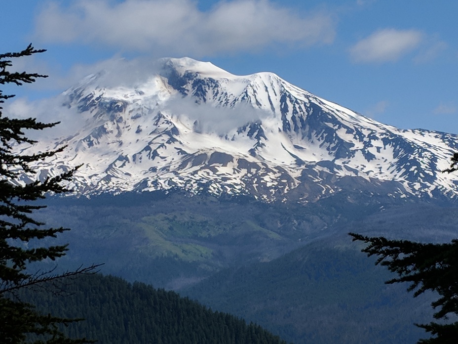
The andesitic-dacitic Mount Adams stratovolcano is second in volume only to Mount Shasta in the Cascade Range. The volcanic complex is elongated along a NNW-SSE line, and includes more than 60 flank vents over 200 km2. Volcanism began about 940 ka, with three main cone-building stages occurring at about 500, 450, and 30 ka. It was active throughout the Holocene, producing two dozen minor explosive eruptions from summit and flank vents. Six Holocene lava flows are located on the flanks between 2,100 and 2,600 m elevation. The most voluminous Holocene lava flows, some of which traveled 10 km or more, were emplaced between about 7,000 and 4,000 years ago. The latest eruption about 1,000 years ago produced a minor tephra layer and possibly a small lava flow down the E flank.
Sources : US Geological Survey Cascades Volcano Observatory (CVO) , GVP.
Photo : Diane / mountain – forecast . com .
Japan , Iwatesan :
Japan Meteorological Agency (JMA) reported increased unrest at Iwatesan. Data from instrumentation detecting deformation indicated inflation centered in deeper parts of the volcano beginning in February. The frequency of volcanic earthquakes had been somewhat high since April 2020, although the number of small volcanic earthquakes located near Kurokurayama began increasing in May and further increased in late July. Results in INSAR imagery collected on 26 September revealed very shallow inflation near Ojigokudani (erosional caldera to the W). At 1500 on 2 October the Alert level was raised to 2 (the second lowest level on a 1-5 scale) prompting access restrictions around the crater; the public was warned that an eruption could affect an area within a 2 km radius of the crater.
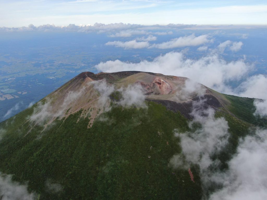
Viewed from the east, Iwatesan volcano has a symmetrical profile that invites comparison with Fuji, but on the west an older cone is visible containing an oval-shaped, 1.8 x 3 km caldera. After the growth of Nishi-Iwate volcano beginning about 700,000 years ago, activity migrated eastward to form Higashi-Iwate volcano. Iwate has collapsed seven times during the past 230,000 years, most recently between 739 and 1615 CE. The dominantly basaltic summit cone of Higashi-Iwate volcano, Yakushidake, is truncated by a 500-m-wide crater. It rises well above and buries the eastern rim of the caldera, which is breached by a narrow gorge on the NW. A central cone containing a 500-m-wide crater partially filled by a lake is located in the center of the oval-shaped caldera. A young lava flow from Yakushidake descended into the caldera, and a fresh-looking lava flow from the 1732 eruption traveled down the NE flank.
Sources : Japan Meteorological Agency (JMA) , GVP .
Photo : Outdoor Japan .
Colombia , Galeras :
San Juan de Pasto, October 8, 2024, 3:55 p.m.
From the monitoring of the activity of the Galeras volcano, the Colombian Geological Survey (SGC), an entity attached to the Ministry of Mines and Energy, reports that:
During the week of October 1 to 7, 2024, the activity of the volcano maintained a stable behavior. Compared to the previous week, the main variations in the monitored parameters were:
● A decrease in seismic occurrence was recorded with an increase in the energy released.
● The seismicity associated with the fracture of rocks within the volcanic system maintained its predominance, both in terms of occurrence and energy.
● The fracture earthquakes were located in two areas. The first, close to the active cone, at distances between 0.3 and 4 km, with depths between 1 and 8 km from the summit of Galeras (4200 m) and magnitudes less than 1. The second area was located to the northeast of the summit of Galeras, at distances between 14 and 16 km, with depths between 6 and 15 km from the summit and a maximum magnitude of 2.
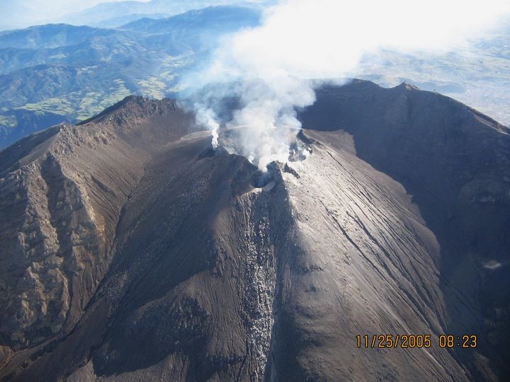
● From the main crater and the fumarole fields of Las Chavas, to the West; and El Paisita, to the North of the active cone, small columns of white gas emissions of variable height and dispersion due to the action of the winds were observed.
● The other volcanic monitoring parameters showed stability.
Based on the above, the SGC recommends to closely monitor the evolution through the weekly bulletins and other information published through our official channels, as well as the instructions of the local and departmental authorities and the National Disaster Risk Management Unit (UNGRD).
The volcanic activity remains in yellow alert status: active volcano with changes in the behavior of the base level of the monitored parameters and other manifestations.
Source et photo : SGC
Papua New Guinea , Manam :
The Darwin VAAC reported that ash plumes from Manam were identified in satellite and webcam images, and reported by the Rabaul Volcano Observatory, rising to 2.7 km (9,000 ft) a.s.l., or about 1 km above the summit, and drifting NW at 10h00 on 3 October. The ash emissions were continuous during 3-5 October, though weather clouds sometimes obscured views. The ash had dissipated by 21h40 on 5 October. At 12h50 on 7 October a continuous ash plume was identified in satellite images rising to 2.4 km (8,000 ft) a.s.l. and drifting NW.
The 10-km-wide island of Manam, lying 13 km off the northern coast of mainland Papua New Guinea, is one of the country’s most active volcanoes. Four large radial valleys extend from the unvegetated summit of the conical basaltic-andesitic stratovolcano to its lower flanks. These valleys channel lava flows and pyroclastic avalanches that have sometimes reached the coast. Five small satellitic centers are located near the island’s shoreline on the northern, southern, and western sides. Two summit craters are present; both are active, although most observed eruptions have originated from the southern crater, concentrating eruptive products during much of the past century into the SE valley. Frequent eruptions, typically of mild-to-moderate scale, have been recorded since 1616. Occasional larger eruptions have produced pyroclastic flows and lava flows that reached flat-lying coastal areas and entered the sea, sometimes impacting populated areas.
Sources : Darwin Volcanic Ash Advisory Centre (VAAC) , GVP.
Photo : Auteur inconnu (archive 2018)

