September 26 , 2024 .
Philippines , Kanlaon :
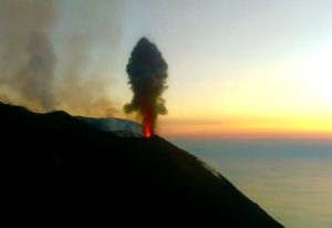
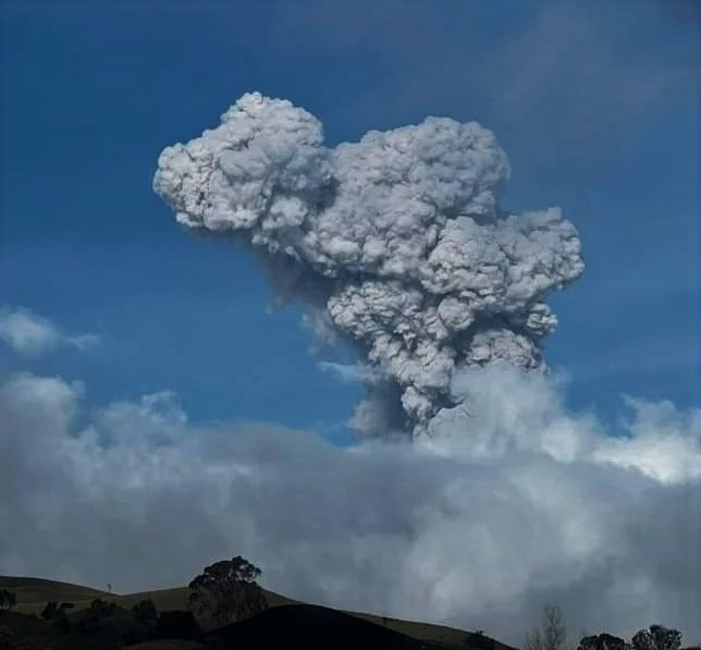
Philippine Institute of Volcanology and Seismology (PHIVOLCS) reported continuing unrest at Kanlaon during 17-24 September, characterized by increased seismicity and sulfur dioxide emissions. The seismic network recorded five volcanic earthquakes during 17-18 September and 15-55 daily volcanic earthquakes during the rest of the week. Weather clouds obscured views of the summit during 17-19 September. Voluminous gas-and-steam emissions rose 300-800 m above the summit and drifted in multiple directions during 20-23 September.
Sulfur dioxide emissions were recorded daily and continued to be high, averaging 5,362-10,449 tonnes/day. According to a Disaster Response Operations Monitoring and Information Center (DROMIC) report there were a total of 3,905 people in evacuation centers as of 22 September. The Alert Level remained at 2 (on a scale of 0-5) and PHIVOLCS reminded the public to remain outside of the 4-km-radius Permanent Danger Zone and warned pilots not to fly close to the volcano.
Sources : Philippine Institute of Volcanology and Seismology (PHIVOLCS), Disaster Response Operations Monitoring and Information Center (DROMIC) , GVP.
Photo : al 24 news . com
Japan , Sumisujima :
According to the Japan Meteorological Agency (JMA) discolored water around Sumisujima was observed on 18 September during an overflight conducted by the Japan Coast Guard. An area of pale-blue to white discolored water extended about 1.8 km NW of the N coast of the island. A very small amount of grayish-white material was floating in the same area as the discolored water and along the W coast. At 1100 on 19 September JMA issued an “eruption warning” noting that an eruption could affect the surround waters of the island.
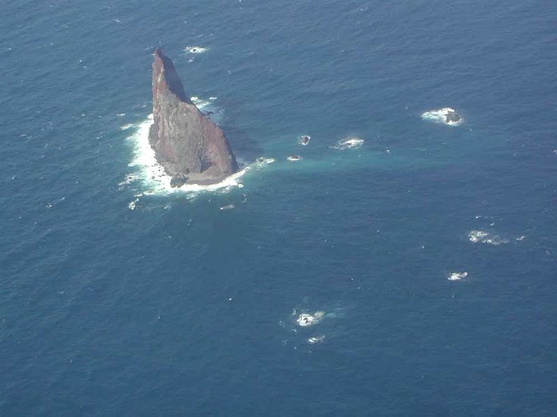
Sumisujima (also known as Smith Rocks) is a steep-sided basaltic pinnacle that forms part of the outer southern flank of a 8-9 km wide submarine caldera that truncates a 20-km-wide seamount. The caldera was formed between about 60,000 and 30,000 years ago. The Shirane dacitic central cone, 3 km wide and 800 m high, rises to within 8 m of the ocean surface in the eastern side of the caldera, whose 600-700 m walls and outer flanks expose basaltic, andesitic, and rhyolitic rocks. Two large submarine cones, Sumisu Knolls No. 1 and 2, lie west of the caldera. Submarine eruptions have been reported from a number of locations near Sumisujima, the last of which occurred in 1916. Water discoloration has frequently been observed since the 1970’s. In October 1992 a 6-km-long zone of discolored water was seen extending from the shallow Shirane rock mass near the eastern rim of the caldera, which rises to within 7 m of the ocean surface and is the youngest feature of the volcanic complex.
Sources : Japan Meteorological Agency (JMA) , GVP .
Photo : Japan Coast Guard / wikimedia.
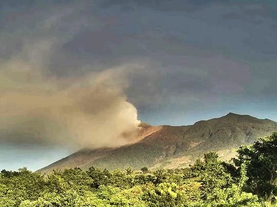
Indonesia , Ibu :
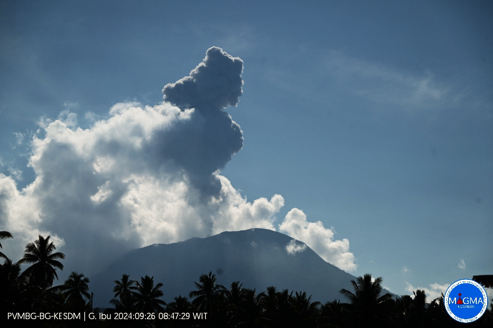
An eruption of Mount Ibu occurred on Thursday, 26 September 2024 at 08:45 WIT with the height of the ash column observed at ± 800 m above the summit (± 2125 m above sea level). The ash column was observed to be grey in colour with a thick intensity, oriented towards the South-West. This eruption was recorded on a seismograph with a maximum amplitude of 28 mm and a duration of 69 seconds.
VOLCANO OBSERVATORY NOTICE FOR AVIATION – VONA
Issued : September 26 , 2024
Volcano : Ibu (268030)
Current Aviation Colour Code : ORANGE
Previous Aviation Colour Code : orange
Source : Ibu Volcano Observatory
Notice Number : 2024IBU878
Volcano Location : N 01 deg 29 min 17 sec E 127 deg 37 min 48 sec
Area : North Maluku, Indonesia
Summit Elevation : 4240 FT (1325 M)
Volcanic Activity Summary :
Eruption with volcanic ash cloud at 23h45 UTC (08h45 local).
Volcanic Cloud Height :
Best estimate of ash-cloud top is around 6800 FT (2125 M) above sea level or 2560 FT (800 M) above summit. May be higher than what can be observed clearly. Source of height data: ground observer.
Other Volcanic Cloud Information :
Ash cloud moving to southwest. Volcanic ash is observed to be gray. The intensity of volcanic ash is observed to be thick.
Remarks :
Eruption recorded on seismogram with maximum amplitude 28 mm and maximum duration 69 second.
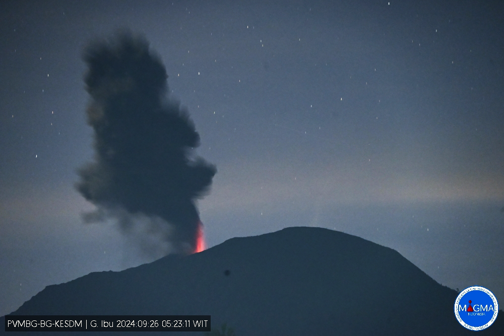
Pusat Vulkanologi dan Mitigasi Bencana Geologi (PVMBG) reported that activity at Ibu continued during 18-24 September with multiple eruptive events recorded daily. Daily gray or white-and-gray ash plumes that were sometimes dense rose as high as 1.5 km above the summit and drifted in multiple directions. Webcam images posted with the reports showed incandescence visible above the crater rim. The Alert Level remained at 3 (the second highest level on a four-level scale) and the public was advised to stay 4 km away from the active crater and 5 km away from the N crater wall opening.
Sources : Magma Indonésie , GVP.
Photos : Magma Indonésie
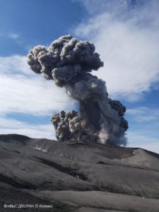
Kamchatka , Bezymianny :
VOLCANO OBSERVATORY NOTICE FOR AVIATION (VONA)
Issued: September 25 , 2024
Volcano: Bezymianny (CAVW #300250)
Current aviation colour code: ORANGE
Previous aviation colour code: Yelow
Source: KVERT
Notice Number: 2024-75
Volcano Location: N 55 deg 58 min E 160 deg 35 min
Area: Kamchatka, Russia
Summit Elevation: 2882 m (9452.96 ft)
Volcanic Activity Summary:
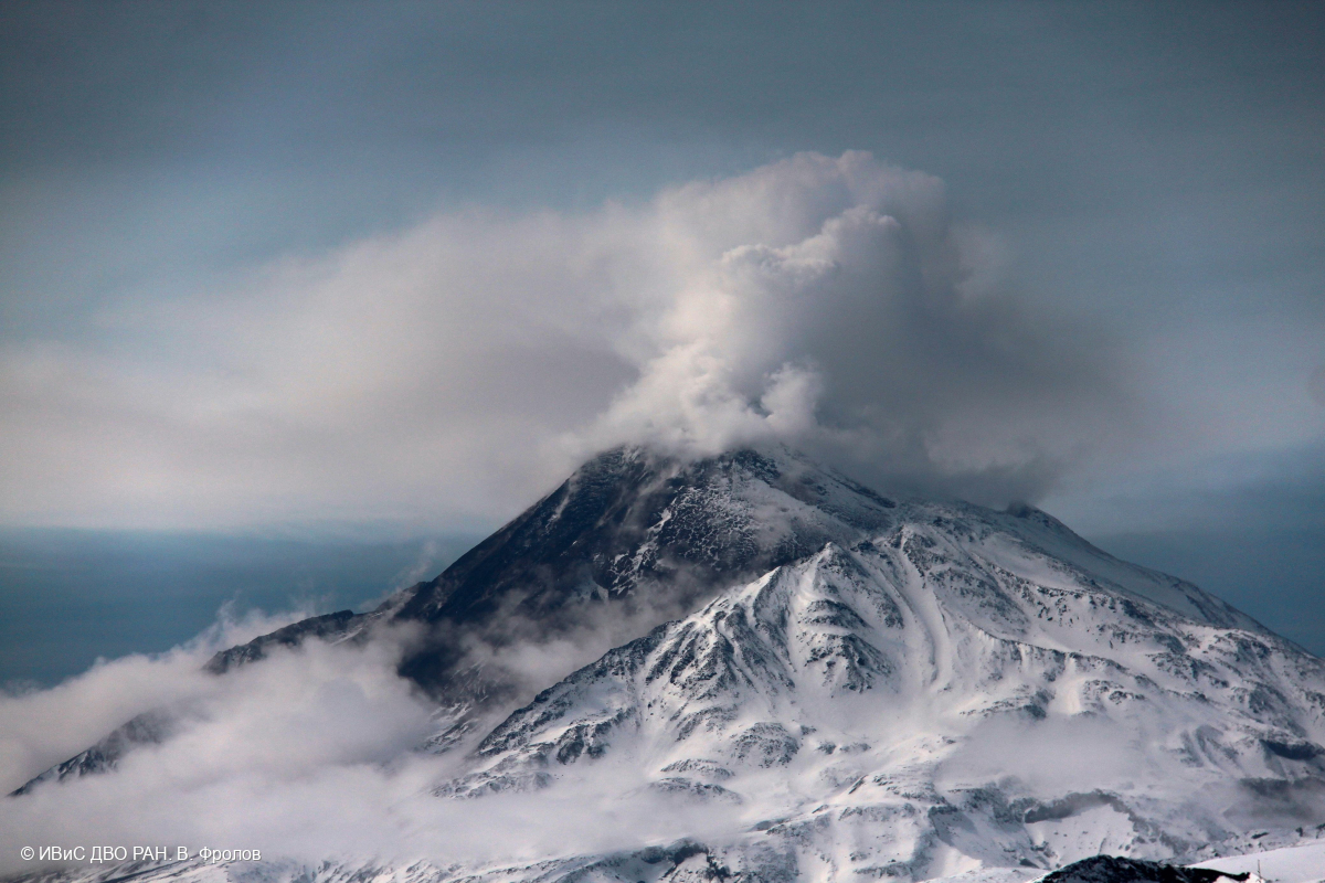
Video and satellite data by KVERT shows a strong wind lifts ash from the southern slopes of Bezymianny volcano, and a plume of resuspended ash is extending about 90 km to the east of the volcano.
An effusive eruption of the volcano continues. Ongoing activity could affect low-flying aircraft.
Volcanic cloud height:
2000 m (6560 ft) AMSL Time and method of ash plume/cloud height determination: 20240925/2310Z – Video data
Other volcanic cloud information:
Distance of ash plume/cloud of the volcano: 90 km (56 mi)
Direction of drift of ash plume/cloud of the volcano: E / azimuth 98 deg
Time and method of ash plume/cloud determination: 20240925/2230Z – Himawari-9 14m15
Remarks: an resuspended ash
Source : Kvert
Photo : V. Frolov. IVS FEB RAS ( 06/2024)
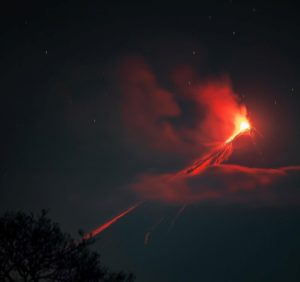
Colombia , Nevado del Ruiz :
Manizales, September 24, 2024, 7:20 p.m.
From the monitoring of the activity of the Nevado del Ruiz volcano, the Colombian Geological Survey (SGC), an entity attached to the Ministry of Mines and Energy, reports that:
From September 17 to 23, 2024, the volcano continued with unstable behavior. Compared to the previous week, the main variations in the monitored parameters were:
– The seismic activity associated with the fracturing of rocks inside the volcanic edifice increased in the number of earthquakes recorded and in the seismic energy released. The earthquakes were located mainly in the Arenas crater and on the East-Northeast flank, at distances of less than 3 km. To a lesser extent and in a dispersed manner, some earthquakes were located on the other flanks of the volcano, up to 11 km from the crater. The depths of the events ranged from 1 km to 7 km from the volcano’s summit. The highest magnitude of the week was 1.0, corresponding to the earthquakes recorded on September 18 at 01:07 (11 km west-northwest of the crater) and at 08:39 (2 km east-northeast of the crater), at depths of 7 km and 4 km, respectively.
– Seismicity related to fluid activity inside volcanic conduits increased in the number of earthquakes recorded and in the seismic energy released. This increase was particularly evident in a greater recording of signals associated with pulsatile ash emissions. The energy levels of the events ranged from low to moderate. Thanks to the cameras used to monitor the volcano and reports received from nearby areas, some ash emissions and several changes in the temperature of the emitted material. These phenomena were associated with some of the seismic events recorded.
– On the volcano, the emission of water vapor and gases into the atmosphere from the Arenas crater continued. Sulfur dioxide (SO2) degassing rates were variable and increased slightly compared to the previous week. The maximum height of the gas column vertically was 700 m and in dispersion it was 1800 m, both were estimated on September 18. The direction of dispersion of the gas column maintained a preferential trend towards the northwest and, to a lesser extent, towards the west-northwest of the volcano.
– When monitoring thermal anomalies at the bottom of the Arenas crater, from satellite monitoring platforms, good atmospheric conditions were maintained in the area during the week, allowing better detection of anomalies. Their energy levels were low to moderate.
Source : SGC
Photo : Entérate Ciénaga ( 03/2023).
Hawaii , Kilauea :
19°25’16 » N 155°17’13 » W,
Summit Elevation 4091 ft (1247 m)
Current Volcano Alert Level: ADVISORY
Current Aviation Color Code: YELLOW
Activity Summary:
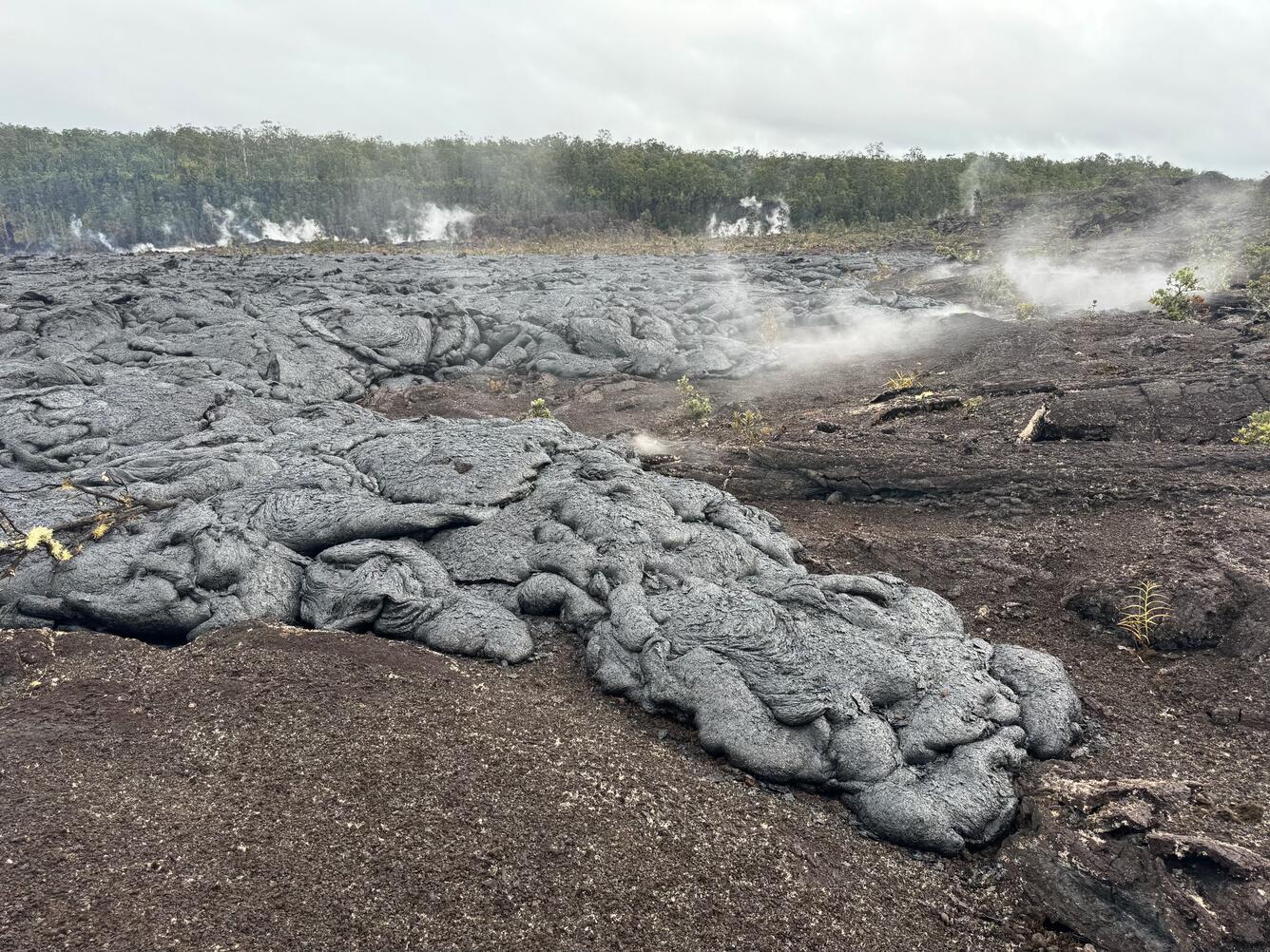
The eruption of Kīlauea volcano in and near Nāpau Crater has ended. Only a few intermittent small spots of residual glow could be detected on the flow field last night. Weak steaming at the vents continues. Geophysical signatures of eruptive activity have all returned to background levels. The Volcano Alert Level/Aviation Color Code was lowered from WATCH/ORANGE to ADVISORY/YELLOW on Monday, September 23rd. No changes have been detected in the lower East Rift Zone or Southwest Rift Zone.
Summit Observations:
One small earthquake was detected beneath the Kīlauea summit region over the past 24 hours. The tiltmeter at Uēkahuna recorded weak inflation over the past day, flattening over the past 4 hours. Similarly, the summit tiltmeter at Sandhill began indicating weak inflation over the past 4 hours, but at very low total magnitude. This pattern suggests that magma has likely stopped moving from the summit to the middle East Rift Zone. The most recent measurement of SO2 emission rate at the summit was 60 tonnes per day on September 17, 2024.
Rift Zone Observations:
The middle East Rift Zone (MERZ) eruption near Nāpau Crater has ended. The last eruptive activity stopped around 10 AM HST on the morning of September 20. Only minor intermittent glow can be seen from the eruption site at night since that time. No SO2 from the eruption site was detected on Monday, September 23rd, during measurements on Chain of Craters Road, indicating that MERZ SO2 emissions are approaching or at 0 tonnes per day.
Shallow earthquake counts remain very low in the MERZ and upper East Rift Zone with only 2 detected in the past 24 hours. Tremor is no longer being recorded on seismometers close to the eruption site. Tiltmeters in the MERZ continue to show no significant shallow deformation and GPS instruments show a major decrease or cessation of inflation at deeper levels beneath the area between Maunaulu and Nāpau Crater.
All recent activity was confined to the middle East Rift Zone between Makaopuhi Crater and Puʻuʻōʻō and there are no indications of any changes further downrift in the MERZ or in the LERZ.
Source : HVO
Photo : USGS / M. Patrick. ( 20/09/2024)