August 18 , 2024.
Kamchatka , Sheveluch :
VOLCANO OBSERVATORY NOTICE FOR AVIATION (VONA)
Issued: August 17 , 2024
Volcano: Sheveluch (CAVW #300270)
Current aviation colour code: RED
Previous aviation colour code: orange
Source: KVERT
Notice Number: 2024-54
Volcano Location: N 56 deg 38 min E 161 deg 18 min
Area: Kamchatka, Russia
Summit Elevation: 3283 m (10768.24 ft), the dome elevation ~2500 m (8200 ft)
Volcanic Activity Summary:
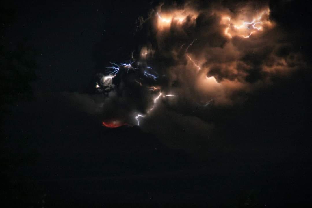
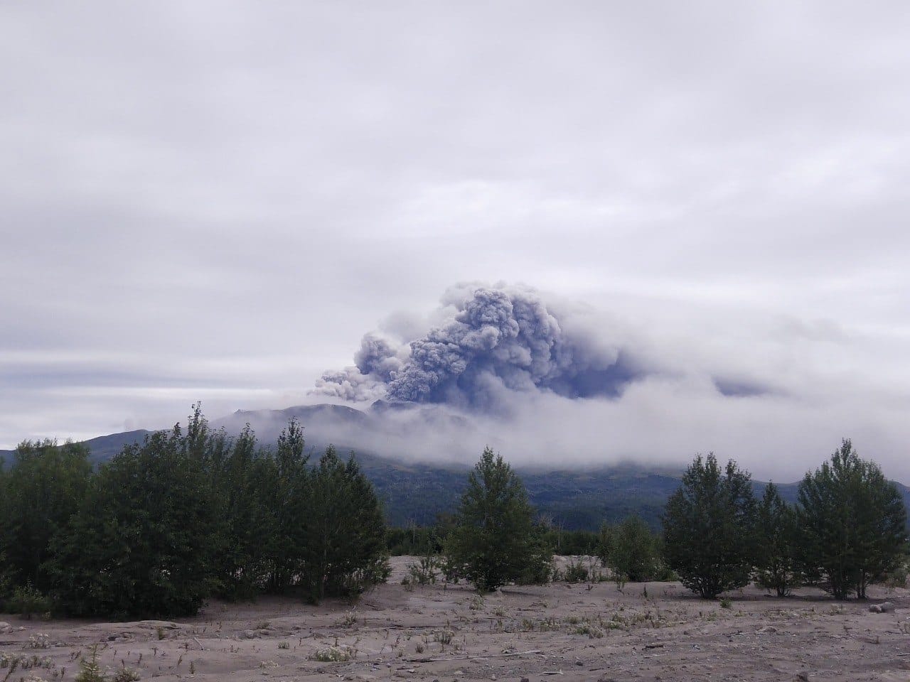
The explosive eruption of the lava dome 300 years RAS of the Sheveluch volcano began at 11:45 UTC on 17 August, 2024. Explosions sent ash up to 8 km a.s.l., and at 12:00 UTC explosions sent ash up to 9 km a.s.l. As of 15:50 UTC, ash plume extended for 492 km to the southeast (azimuth 115 degrees) of the volcano. Ashfall is occurring in the Ust’-Kamchatsk village. According to video data by KVERT IVS FEB RAS, the explosive eruption continues at now, the eruptive column rises up to 5 km a.s.l., ash plume is extending to the southeast of the volcano.
The explosive eruption of Sheveluch volcano continues. Ash explosions up to 10 km (32,800 ft) a.s.l. could occur at any time. Ongoing activity could affect international and low-flying aircraft.
Volcanic cloud height:
8000-9000 m (26240-29520 ft) AMSL Time and method of ash plume/cloud height determination: 20240817/1145Z – Himawari-9 14m15
Other volcanic cloud information:
Distance of ash plume/cloud of the volcano: 492 km (306 mi)
Direction of drift of ash plume/cloud of the volcano: ESE / azimuth 115 deg
Time and method of ash plume/cloud determination: 20240817/1550Z – Himawari-9 14m15
VOLCANO OBSERVATORY NOTICE FOR AVIATION (VONA)
Issued: August 17 , 2024
Current aviation colour code: RED
Volcanic Activity Summary:
The explosive eruption of the lava dome 300 years RAS of the Sheveluch volcano continues. Explosions sent ash up to 4.5-5 km a.s.l., and ash plume extended for 920 km to the southeast (azimuth 117 degrees) of the volcano. Ashfall is occurring in the Ust’-Kamchatsk, and probably at Nikolskoe of the Bering Island. KVERT continues to monitor the Sheveluch volcano.
The explosive eruption of Sheveluch volcano continues. The danger of ash explosions up to 10 km (32,800 ft) a.s.l. remains. Ongoing activity could affect international and low-flying aircraft.
Source : Kvert
Photos : Frolov Viktor via Philipp Stock ( FB 18/08/2024)
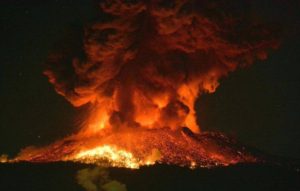
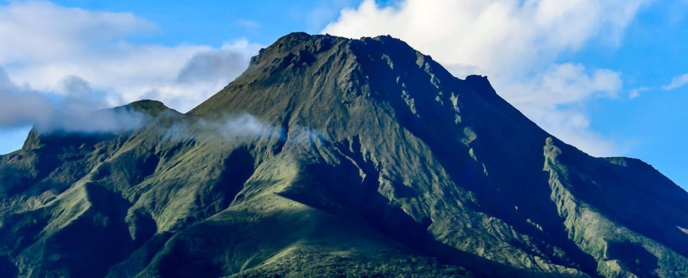
Italy / Sicily , Etna :
18 August 2024, 04:58 (02:58 UTC) . Statement on the activity of Etna .
The National Institute of Geophysics and Volcanology, Osservatorio Etneo, reports that from 02:30 UTC, from the images of the surveillance cameras, a Strombolian activity is observed at the level of the Voragine crater. The predicted dispersion pattern of the possible volcanic cloud indicates an East-North-East direction.
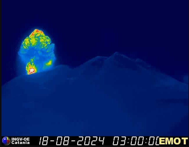
From 02:00 UTC, the tremor showed a rapid increase, the source locations correspond to the Voragine crater at about 2000 meters altitude. The infrasound activity is low in amplitude and number of events. Data from GNSS and inclinometric networks, for monitoring ground deformations, do not show significant variations.
Further updates will be communicated shortly.
Source : INGV
Indonesia , Lewotobi Laki Laki :
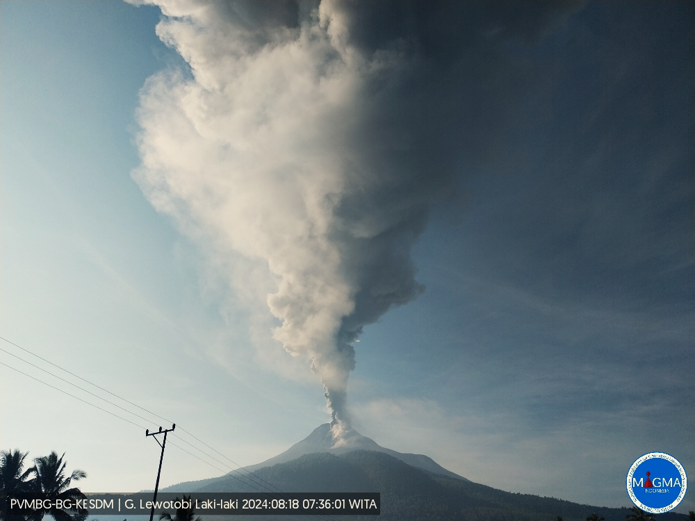
An eruption of Mount Lewotobi Laki occurred on Sunday, 18 August 2024 at 07:19 WITA with the height of the ash column observed at ±1500 m above the summit (±3084 m above sea level). The ash column was observed to be grey with thick intensity, oriented to the west and northwest. At the time of writing, the eruption was still ongoing.
VOLCANO OBSERVATORY NOTICE FOR AVIATION – VONA
Issued : August 18 ,2024
Volcano : Lewotobi Laki-laki (264180)
Current Aviation Colour Code : ORANGE
Previous Aviation Colour Code : orange
Source : Lewotobi Laki-laki Volcano Observatory
Notice Number : 2024LWK375
Volcano Location : S 08 deg 32 min 20 sec E 122 deg 46 min 06 sec
Area : East Nusa Tenggara, Indonesia
(Summit Elevation : 5069 FT (1584 M)
Volcanic Activity Summary :
Eruption with volcanic ash cloud at 23h19 UTC (07h19 local).
Volcanic Cloud Height :
Best estimate of ash-cloud top is around 9869 FT (3084 M) above sea level or 4800 FT (1500 M) above summit. May be higher than what can be observed clearly. Source of height data: ground observer.
Other Volcanic Cloud Information :
Ash cloud moving from west to northwest. Volcanic ash is observed to be gray. The intensity of volcanic ash is observed to be thick.
Remarks :
Eruption recorded on seismogram with maximum amplitude 7.4 mm and maximum duration 760 second.
Source et photo : Magma Indonésie .
Ecuador , Sangay :
DAILY STATE REPORT OF SANGAY VOLCANO , Saturday, August 17, 2024 .
Information Geophysical Institute – EPN.
Surface Activity Level: High , Surface Trend: No change
Internal Activity Level: High , Internal Trend: No change
Seismicity: From August 16, 2024, 11:00 a.m. to August 17, 2024, 11:00 a.m. :
Seismicity:
Below is the count of seismic events recorded at the reference station
Explosion (EXP): 196
Rainfall/Lahars:
No rain has been recorded in the volcano area. *In the event of heavy rain, it could remobilize the accumulated materials, generating mud and debris flows that would descend the sides of the volcano and flow into adjacent rivers.
Column emissions/ash:
Due to poor weather conditions, it was not possible to observe gas and ash emissions through the surveillance camera network, nor through the GOES-16 satellite system. However, the VAAC agency in Washington published a report indicating an emission of gas and ash with a column height equal to 900 meters above the crater level, in a westerly direction.
Other monitoring parameters:
In the last 24 hours, the FIRMS satellite system recorded 9 thermal anomalies, while MIROVA-MODIS and MIROVA-VIIRS detected 1 and 2 thermal anomalies, respectively.
Observation:
Since yesterday afternoon and until the submission of this report, the volcano has remained mostly cloudy. However, during the last night, thanks to the surveillance camera system, periods of incandescence were observed at the crater.
Alert level: yellow
Source : IGEPN
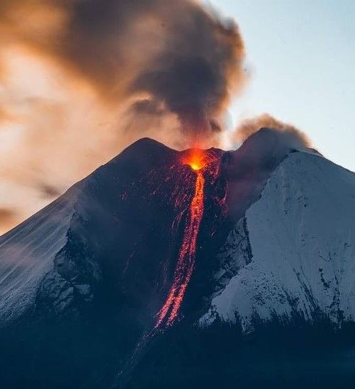
Photo : AlexBoasphoto ( 08/224).
La Martinique , Montagne Pelée :
Mount Pelée is an active explosive volcano that has experienced numerous magmatic and phreatic eruptions in the past. Since the end of the last magmatic eruption in 1932, which was associated with the formation of a lava dome, its activity has decreased significantly until the cessation of fumarolic activity since 1970 and overall very low seismic activity.
Since April 2019, seismic activity has risen above its baseline level established from continuous instrumental observations in previous years. This new activity is characterized by numerous low-energy superficial earthquakes, a few rare deep earthquakes (located at a depth of approximately 10-20 km beneath the volcanic edifice) and the appearance of tremor and long-period seismic signals, indicating movements of overpressured fluids in the hydrothermal system. The areas of degraded vegetation on the southwest flank of Mount Pelée observed since 2019, indicate diffuse degassing of CO2 by the ground. A zone of degassing at sea (presence of CO2 bubbles at low temperature) north of Saint-Pierre is monitored in partnership with the Martinique Marine Natural Park in order to follow the evolution of this phenomenon in possible relation to the activity of the volcano. Since June 2022, the deformations of the edifice measured by the GNSS sensor network indicate a slight long-term swelling that can be interpreted by a superficial source of slight pressurization located under the summit part of Mount Pelée. This source could be generated by the rise of limited volumes of hydrothermal and/or magmatic fluids (gas, hydrothermal waters) into the volcanic edifice from the depths of the magmatic system. All of these observations reflect a reactivation of the volcanic system which is still ongoing in July 2024, although at a level which has been relatively reduced in recent months on certain observables.
In July 2024, seismic activity of volcanic origin remained low compared to previous months. The seismic energy released by all superficial earthquakes is also low and no earthquake of volcanic origin was felt. The temperature and acidity (pH) of the thermal springs of the edifice show no significant variation. The deformations of the edifice are very low and seem stable in the short term. It should be remembered that during phases of volcanic reactivation, periods of higher activity, particularly seismic, often alternate with phases of lower activity. The probability of eruptive activity in the short term remains low. However, taking into account all the observations collected since the end of 2018 and their nature, and on the basis of the OVSM-IPGP observations recorded during the month of July 2024 and summarized in this bulletin, we cannot exclude a change in the situation in the medium term (years, months, weeks, see table in appendix). In accordance with the provisions provided by the authorities, the alert level is currently: YELLOW = VIGILANCE.
Source : IPGP
Photo : Ville-Saintemarie ( 2021)