November 23 , 2018.
Mexico , Popocatépetl :
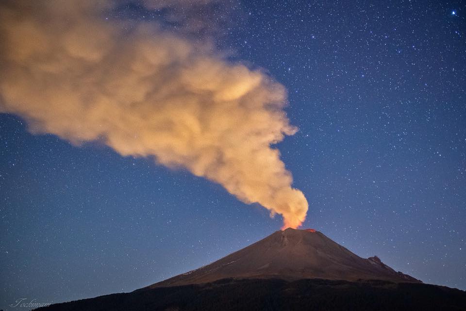
During the last 24 hours, thanks to the monitoring systems of the Popocatepetl volcano, 31 exhalations have been identified, accompanied by water vapor, gas and light amounts of ash. In addition, a long-term exhalation train with a duration of 1173 minutes was recorded from 14:27 yesterday and is ongoing at the time of this report. The intense phase lasted 790 minutes (13 hours) from yesterday at 16:07 and until today at 17:07. During this event, volcanic gas emissions and a trail of ash were observed. At night and early in the morning, emissions of incandescent fragments were observed on the upper slopes.
At the time of writing, it has been observed that emissions of water vapor, gas, and low ash content were dispersed to the north-northeast.
CENAPRED insists that the volcano, and in particular the crater, should not be approached, because of the risk of falling ballistic fragments and, in case of heavy rains, to move away from the bottoms of the ravines because of the risk of landslides field and mudslides.
The Popocatepetl volcanic warning light is located at Amarillo Phase 2.
The National Center for Disaster Reduction (Cenapred) reported that by overflight in the vicinity of the Popocatépetl volcano, the dome number 80 had been observed, with a diameter of 250 meters, an estimated thickness of 30 meters and a volume of 1.5 million cubic meters. Its extension rate is 31 m3 / s. Domes are usually destroyed by explosions. This could happen in the days to come.
Source : Cenapred.
Photo : Erik Gómez Tochimani Fotógrafo.
Alaska , Veniaminof :
AVO/USGS Volcanic Activity Notice
Current Volcano Alert Level: WATCH
Previous Volcano Alert Level: WARNING
Current Aviation Color Code: ORANGE
Previous Aviation Color Code: RED
Issued: Thursday, November 22, 2018, 11:05 AM AKST
Source: Alaska Volcano Observatory
Location: N 56 deg 11 min W 159 deg 23 min
Elevation: 8225 ft (2507 m)
Area: Alaska Peninsula
Volcanic Activity Summary:
Ash emissions at Veniaminof have decreased since yesterday afternoon but continue at lower levels. Therefore AVO is lowering the Aviation Color Code to ORANGE and the Volcano Alert Level to WATCH.
Recent Observations:
[Volcanic cloud height] Up to ~10,000 ft
[Other volcanic cloud information] Continuous low-level ash emissions observed in webcam
Remarks: Ash fall remains possible in nearby communities.
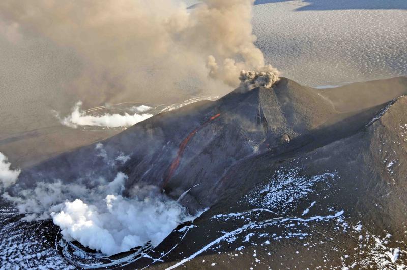
Aerial view of the eruption at Veniaminof’s intracaldera cone, August 18, 2013. This cone rises about 1000 feet above the surrounding icefield. It has been intermittently erupting lava, ash and steam since June 13, 2013. This photo shows the incandescent, orange stream of molten lava emerging from the active cone. Steam billows from the pit at the base of the cone where the lava encounters and melts ice and snow. A small, ash-rich plume rises just above the vent producing a diffuse ash cloud that drifts downwind. In the foreground, round white patches probably represent ballistic impact craters. Photo taken by Game McGimsey, AVO/USGS. This overflight of Veniaminof was co-sponsored by the National Geographic Society.
Continuous ash emissions occurred yesterday until 14:45 AKST (23:45 UTC). Satellite data indicated emissions resulted in a plume below 15,000 ft asl extended over 250 miles (400 km) to the southeast. A shorter emission pulse occurred between 00:46 and 02:26 UTC on 11/22 (15:26 and 17:26). Overnight and into this morning, lower ash emissions occurred with a diffuse plume below 10,000 ft asl extending 60 miles (100 km) to the south. Elevated thermal anomalies were noted in satellite imagery overnight, and incandescence was visible from a Perryville web camera, suggesting continued lava effusion. Seismic tremor decreased from a peak yesterday before the start of major ash emissions, but tremor continues.
Source : AVO
Photo : Game McGimsey.
Colombia , Galeras :
Weekly activity bulletin of Galeras volcano
The level of activity of the volcano continues as follows: LEVEL YELLOW ■ (III): CHANGES IN THE BEHAVIOR OF THE VOLCANIC ACTIVITY.
Following the activity of the VOLCÁN GALERAS, the COLOMBIAN GEOLOGICAL SERVICE (SGC) informs that:
For the period from 13 to 19 November 2018 and compared to the previous week, the seismicity of the Galeras volcano showed a decrease in frequency and energy released by earthquakes, which were caused by VT (Volcano-Tectonic earthquakes, associated with fracturing of the cortical material inside the volcano). These events were scattered at depths between 1.0 and 10.0 km and their local magnitude did not exceed M1.8 during that week. It is highlighted today the presence, at 0:31, of a volcano-tectonic earthquake, reported as felt by the inhabitants of the cities of Linares and Sandoná, located 11 km to the West-North-West Galeras, at a depth of 10 km and a local magnitude of 2.5 m.
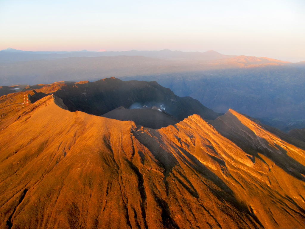
During the week under review, we observed white gas emissions, low pressure, low height and variable direction due to wind action.
The other geophysical and geochemical parameters of Galeras volcano monitoring did not show any significant variations.
The COLOMBIAN GEOLOGICAL SERVICE is attentive to the evolution of the volcanic phenomenon and will continue to inform in a timely manner of the observed changes.
Source : SGC
Photo : CAPRA
Japan , Meakandake :
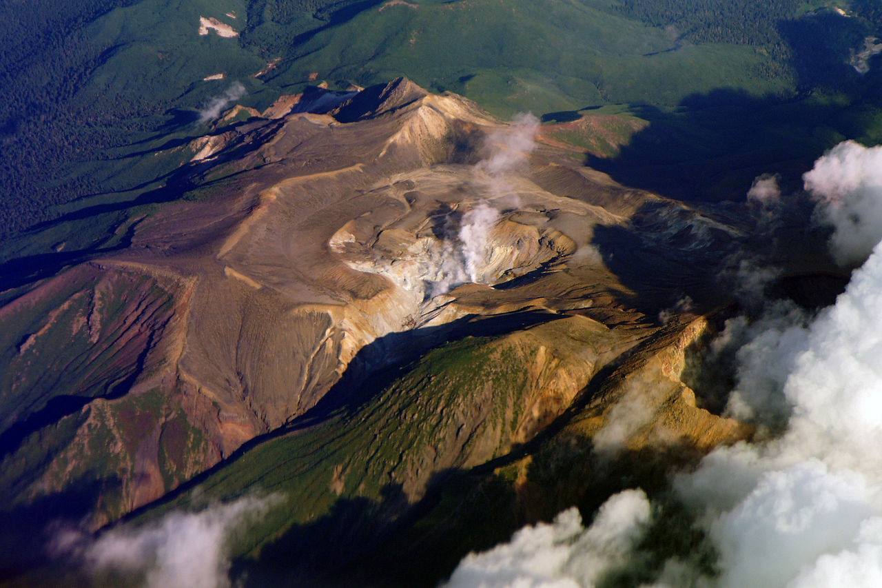
Alert level raised for this volcano in Japan’s Hokkaido , November 23.
TOKYO (Kyodo) — The weather agency said Friday it has raised the eruption alert level for Mt. Meakandake on Japan’s northern main island of Hokkaido due to an increasing number of volcanic earthquakes in the area.
The Japan Meteorological Agency moved the alert level from 1 to 2 on its 5-point scale for the 1,499-meter mountain in eastern Hokkaido, the change meaning that people should no longer approach the crater.
The agency warned that large ash deposit projectiles could be encountered within 500 meters of the crater.
The alert level was raised to 2 in July 2015 but lowered to 1 in November that year. Level 1 indicates to people in the area that they should be mindful that the volcano is potentially active.
Source : Mainichi Japan .

