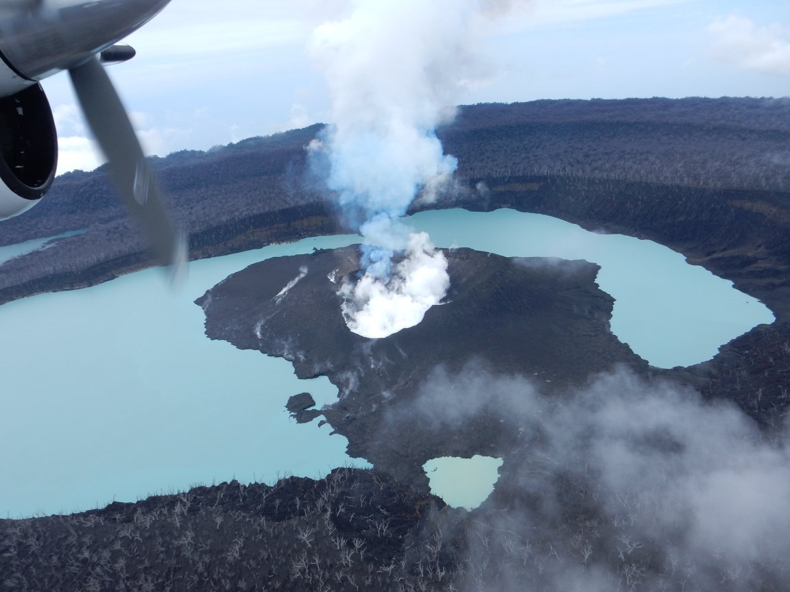
April 07 , 2023 . EN . Colombia : Nevado del Ruiz , Colombia : Chiles / Cerro Negro , Japan : Satsuma Iwo Jima , Kamchatka : Bezymianny , Chile : Lascar .

April 07 , 2023 .


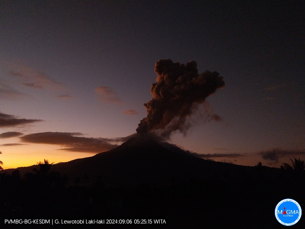
Colombia , Nevado del Ruiz :

Manizales, April 6, 2023 9:30 a.m.

Regarding the monitoring of the activity of the NEVADO DEL RUIZ VOLCANO, the MINISTRY OF MINES AND ENERGY through the COLOMBIAN GEOLOGICAL SERVICE (SGC) informs that:

The recording of seismicity associated with the fracturing of the rock inside the volcanic edifice continues. Yesterday April 5, 7100 events were recorded. This seismic activity continues to be located in the southwestern sector of the volcanic edifice at a distance from the crater of between 2 and 5 km, at depths of 3 to 4 km. From the afternoon, this seismic activity decreased compared to what was recorded during the first hours of the day and the maximum magnitudes reached reached 1.7 ML. So far today, April 6, 2023 (9 a.m.), about 800 earthquakes have been recorded.

The seismic activity related to the movement of fluids inside the volcanic conduits showed an increase compared to the previous day and was associated with various pulsatile and continuous emissions of ash which were confirmed by the web cameras used for volcanic monitoring. . The maximum height of the column of gas and / or ash observed was 1700 m measured from the summit of the volcano and the preferred direction of dispersion of the column was towards the South-West. Outgassing rates remained at levels similar to those seen the previous day. In addition, several thermal anomalies were reported.

It is important to emphasize that the activity of the volcano at LEVEL ORANGE can fluctuate and sometimes decrease compared to previous days, without this meaning that it has returned to a level of lower activity. To change the level and return to the yellow level, a prudential time is required where trends and patterns can be observed that allow us to deduce the possible decrease in activity, which is why it is warned that the level of activity of the Nevado del Ruiz volcano will remain at the ORANGE LEVEL for several weeks. Meanwhile, if there is an acceleration of processes suggesting an impending eruption or the eruption itself occurring, the activity level will turn red.

The community is recommended to remain calm and follow all instructions from the National Disaster Risk Management Unit (UNGRD) and local authorities, as well as to be attentive to the information provided by the Colombian Geological Service on the evolution of the state of the volcano.

The COLOMBIAN GEOLOGICAL SERVICE will continue to be attentive to the evolution of the volcanic phenomenon and will provide timely information on any changes that may occur.

The level of activity of the volcano remains at the ORANGE LEVEL of activity or (II): PROBABLE ERUPTION IN TERM OF DAYS OR WEEKS

Source et photo : SGC.


Colombia , Chiles / Cerro Negro :

Chiles and Cerro Negro Volcanic Complex (CVCCN) Weekly Activity Bulletin

Regarding the monitoring of the activity of the VOLCANOES CHILES AND CERRO NEGRO, the MINISTRY OF MINES AND ENERGY through the COLOMBIAN GEOLOGICAL SERVICE (SGC) informs that:

During the week between March 28 and April 3, 2023 and compared to what was reported the previous week, the activity in the region of the Chiles and Cerro Negro volcanoes showed an increase in both the occurrence and energy, going from 12020 to 18956 earthquakes.
Although in general there is a downward trend, seismicity continues at high levels, maintaining the predominance of earthquakes associated with the fracture of the rock, although earthquakes related to the movement of fluids within the volcanic system have also been recorded. This activity is always accompanied by a deformation of the surface of the CVCCN.

There were reports of five felt earthquakes, with magnitudes of 2.0; 2.5; 3.7; 3.9 and 3.1 on March 29 at 4:20 a.m. and 5:37 a.m.; April 1 at 11:02 p.m. and 11:11 p.m. and April 3 at 2:02 p.m. respectively, these events were reported as felt by the inhabitants of the Chiles Indigenous Reserve in the municipality of Cumbal – Nariño; In addition, the events of April 1 were reported as felt in the municipalities of Ipiales, Túquerres, Aldana and Cuaspud.

The possibility of earthquakes with greater energy that can be felt by the inhabitants of the area of ​​influence is not excluded.

The activity level of the volcanoes remains at:
YELLOW LEVEL ■ (III): CHANGES IN THE BEHAVIOR OF VOLCANIC ACTIVITY.

Source et photo : SGC.


Japan , Satsuma Iwo Jima : 

JMA reported that minor eruptive activity was recorded at Satsuma Iwo-jima, a subaerial part of Kikai’s NW caldera rim, during 27 March-3 April. White gas-and-steam plumes rose 700 m above the crater rim. Surveillance cameras observed nightly incandescence. The Alert Level remained at 2 (on a 5-level scale), and residents were warned to stay 500 m away from the crater.

Kikai is a mostly submerged, 19-km-wide caldera near the northern end of the Ryukyu Islands south of Kyushu. It was the source of one of the world’s largest Holocene eruptions about 6,300 years ago when rhyolitic pyroclastic flows traveled across the sea for a total distance of 100 km to southern Kyushu, and ashfall reached the northern Japanese island of Hokkaido. The eruption devastated southern and central Kyushu, which remained uninhabited for several centuries. Post-caldera eruptions formed Iodake lava dome and Inamuradake scoria cone, as well as submarine lava domes. Historical eruptions have occurred at or near Satsuma-Iojima (also known as Tokara-Iojima), a small 3 x 6 km island forming part of the NW caldera rim. Showa-Iojima lava dome (also known as Iojima-Shinto), a small island 2 km E of Tokara-Iojima, was formed during submarine eruptions in 1934 and 1935. Mild-to-moderate explosive eruptions have occurred during the past few decades from Iodake, a rhyolitic lava dome at the eastern end of Tokara-Iojima.

Source : Agence météorologique japonaise (JMA), GVP.

Source : Ray Go.


Kamchatka , Bezymianny :

VOLCANO OBSERVATORY NOTICE FOR AVIATION (VONA)

Issued: April 07 , 2023
Volcano: Bezymianny (CAVW #300250)
Current aviation colour code: RED
Previous aviation colour code: orange
Source: KVERT
Notice Number: 2023-48
Volcano Location: N 55 deg 58 min E 160 deg 35 min
Area: Kamchatka, Russia
Summit Elevation: 2882 m (9452.96 ft)

Volcanic Activity Summary:
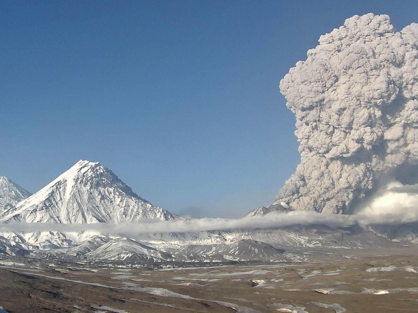
Volcanic ash emission gradually increased. Probably, a new block of lava is squeezed out on the lava dome, it’s accompanied by ash explosions and hot avalanches. Satellite data by KVERT showed an ash plume extended about 230 km to the east-south-east from the volcano.
An eruption of the volcano continues. Ash explosions up to 10-15 km (32,800-49,200 ft) a.s.l. could occur during next several days. Ongoing activity could affect international and low-flying aircraft.

Volcanic cloud height:
5000-5500 m (16400-18040 ft) AMSL Time and method of ash plume/cloud height determination: 20230407/0400Z – Video data

Other volcanic cloud information:
Distance of ash plume/cloud of the volcano: 230 km (143 mi)
Direction of drift of ash plume/cloud of the volcano: ESE / azimuth 103 deg
Time and method of ash plume/cloud determination: 20230407/0320Z – Himawari-9 14m15

Source et photo : Kvert.


Chile , Lascar :

Special Report on Volcanic Activity (REAV) Antofagasta Region, Láscar Volcano, April 6, 2023, 7:30 p.m. local time (mainland Chile)

The National Geology and Mining Service of Chile (Sernageomin) discloses the following information, obtained through the monitoring equipment of the National Volcanic Monitoring Network (RNVV), processed and analyzed at the Observatory of Volcanoes of the Southern Andes ( Ovdas):

After the recording of energetic seismicity and the establishment of the lava dome housed in the active crater at the end of January 2023, the analyzes obtained from multi-parameter data (seismological, geodetic, geochemical and remote sensing) suggest that after nearly 2 months of observation, activity returned to low energy levels, but still above its baseline monitoring threshold.

The particular aspects, such as a volcano-tectonic seismicity and of the « tornillos » type with little recursiveness, a weak or null evolution of the volume of the dome, a development of gas columns at low pressure with the absence or at low content of particulate matter, and a low content of SO2 concentrations, suggest the stagnation of an eruptive process whose progression has so far reached a certain equilibrium.

Despite the above, it should be remembered that the evolution of the activity is conditioned by the presence of a lava dome on the surface, where different scenarios would be expected, which could induce a sudden or progressive explosive activity. As a result, the technical alert level has changed to Yellow, and permanent monitoring of the activity is maintained, with a possible assignment zone with a radius of 5 km around the active crater.

Source : Sernageomin .

Photo : Vulcanopro.


November 18, 2022. EN. El Salvador : San Miguel (Chaparrastique) , Italy : Vulcano , Colombia : Puracé / Los Coconucos Volcanic Chain , Japan : Satsuma Iwo-jima , Mexico : Popocatepetl .

November 18 , 2022.


El Salvador , San Miguel ( Chaparrastique) :

Special Report No. 3
WARNING: in the face of light and intermittent explosions and degassing of the San Miguel volcano, it is called upon to be vigilant and not to carry out activities around its central crater.

Broadcast date and time: November 17, 2022, 11:00:00 a.m.
In the surroundings of the San Miguel volcano, slight explosions, gas and water vapor emanations continue to be recorded, with the probability of generating interruptions in the activities taking place near its crater, which is why it is called to BE CAREFUL mainly of the inhabitants of the area of the municipalities of San Jorge, Chinameca, San Rafel Oriente and of the sectors near the volcano in the municipality of San Miguel.


On Tuesday, six small explosions were recorded at 8:15 a.m., 9:26 a.m., 11:55 a.m., 12:39 p.m., 3:20 p.m. and 5:51 p.m. On Wednesday, November 16, nine fumes were recorded, at 8:44 a.m., 9:28 a.m., 10:51 a.m., 12:23 a.m., 1:26 p.m., 2:34 p.m., 3:14 p.m., 5:18 p.m. pm and 7:06 p.m.

During this Thursday morning, our surveillance camera recorded three explosions at 6:29, 8:44. and 9:49 a.m., which generated clouds of gas and ash (in the last two episodes) a few tens of meters high and which dissipated in the following minutes.

The monitoring parameters of the San Miguel volcano are detailed below:
seismicity:
Variations in seismicity recorded by the Volcanic Station of San Miguel (VSM) indicate that currently the count of daily earthquakes retains its typical behavior; no intensification is observed in its internal processes.


Figure 1. Seismic recording of the VSM station.

Gas :
Gas measurements made in the field with mobile DOAS equipment indicated 150 tons per day of sulfur dioxide; the historical base threshold for normal behavior of the San Miguel volcano is 300 tons per day.

Deformation:
All parameters remain without significant changes, according to the latest soil deformation measurements.

Temperature:
Temperature measurements for the past few days have shown no increase and are below their baseline of 60ºC.

We continuously monitor the seismicity of the San Miguel volcano, from our observatory, in addition to performing gas measurements and taking ash samples in the field to continue analyzing the evolution of its activity.

Source : Marn.

Photo : Marn / Epa


Italy , Vulcano :

WEEKLY BULLETIN, from November 07, 2022 to November 13, 2022 (issue date November 15, 2022)

ACTIVITY STATUS SUMMARY
In the light of the monitoring data, it is highlighted:
1) Temperature of the crater fumaroles: Along the summit rim, the maximum emission temperature has extremely stable values around 372°C.
2) CO2 flux in the crater area: The CO2 flux in the crater area remains at medium-high values.
3) SO2 flux in the crater area: at a moderately medium-high level
4) Geochemistry of fumarolic gases: There are no updates.
5) CO2 fluxes at the base of the La Fossa cone and in the Vulcano Porto area: The CO2 fluxes recorded at the sites of Rimessa, C. Sicilia show stable values, always above background levels. The P4max site displays low values, while values close to the background noise are recorded on the Faraglione site.

6) Geochemistry of thermal aquifers: Stable but high temperature values ​​and a clear decrease in conductivity values ​​are recorded in the Camping Sicilia well. There are no updates on the level and conductivity values ​​measured in the waters of the Bambara well.
7) Local seismicity: Low occurrence rate of local micro-seismicity.
8) Regional seismicity: No earthquake with Ml>=1.0 was located last week in the Vulcano region.
9) Deformations – GNSS: Data from the GNSS network does not show significant variations
10) Deformations – Inclinometry: The inclination measurements do not show any significant variations
11) Gravimetry: There are no significant variations.
12) Other Comments: Mobile GNSS. The GNSS mobile network acquires and transmits movements in real time at a frequency of 1 Hz. The historical series acquired so far do not show significant variations around the Porto di Levante area.

CRATER FUMEROLES TEMPERATURE:
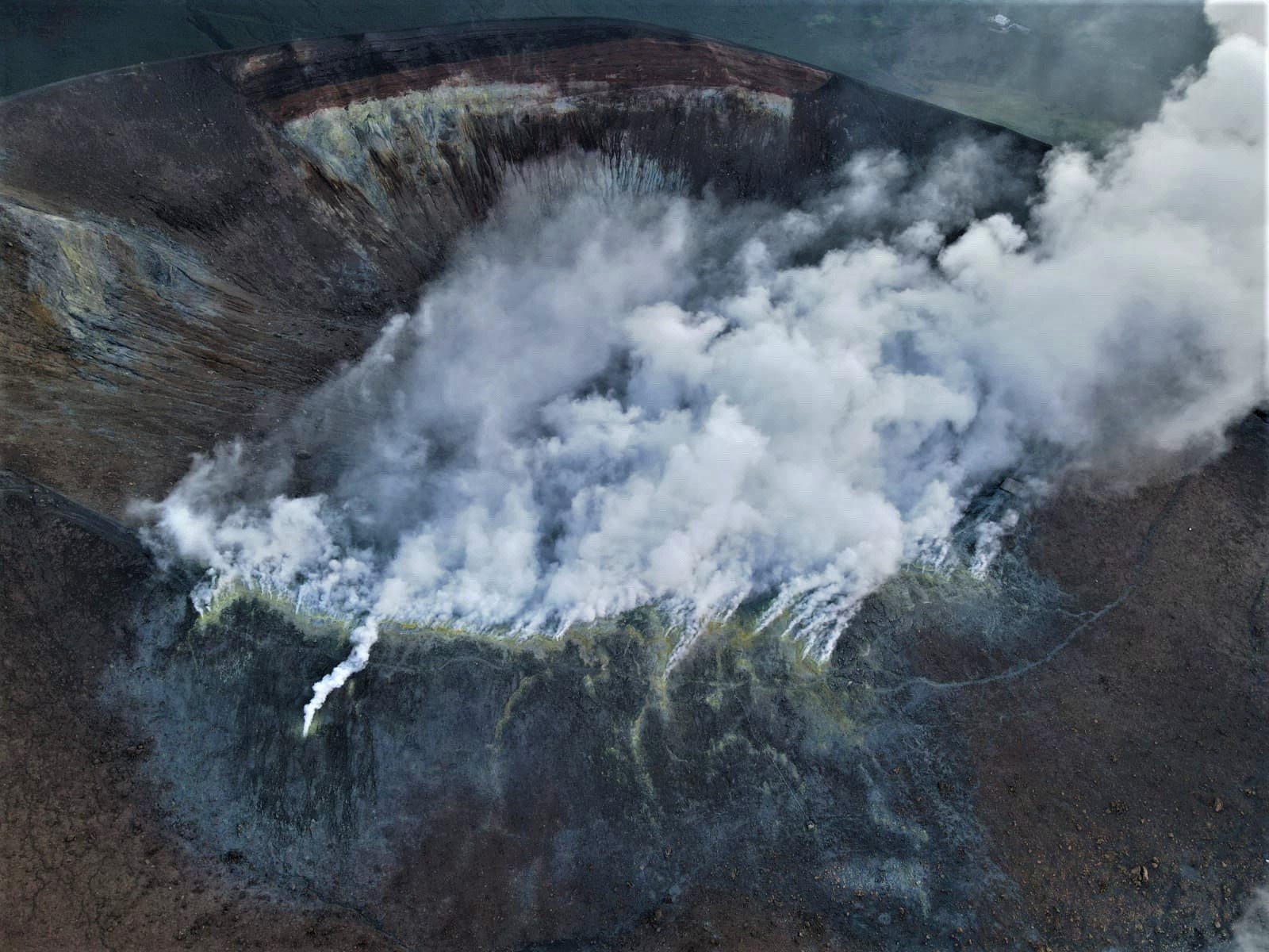
The fumarolic field has homogeneous emission temperatures along the summit fracture line, confirming a thermal anomaly maintained by a stable vapor flow. The range of hourly temperatures recorded on the edge was slightly affected by recent rain events, but remained between 348 and 372°C.

LOCAL SEISMICITY:
During the week in question, the number of micro-shocks with a spectral peak greater than 1 Hz and the rate of occurrence of events of lower frequency (VLP; spectral peak less than 1 Hz), are generally low and on an average comparable to what was observed the previous week. Only a modest increase, which concerned lower frequency events (VLP), was observed in the first days of the week.

Source : INGV.

Read the article : https://www.ct.ingv.it/index.php/monitoraggio-e-sorveglianza/prodotti-del-monitoraggio/bollettini-settimanali-multidisciplinari/709-bollettino-Settimanale-sul-monitoraggio-vulcanico-geochimico-e-sismico-del-vulcano-Vulcano-del-2022-11-15/file

Photos : INGV-Roma1 , INGV.


Colombia , Puracé / Chaine Volcanique los Coconucos :

Puracé Volcano Weekly Activity Bulletin – Los Coconucos Volcanic Range
The activity level of the volcano continues at the yellow Activity Level or (III): changes in the behavior of volcanic activity.

From the analysis and evaluation of the information obtained through the monitoring network of the Puracé volcano – Los Coconucos volcanic chain, during the week of November 8 to 14, 2022, the COLOMBIAN GEOLOGICAL SERVICE – Volcanological and Seismological Observatory of Popayán reports that:

• With regard to the seismic activity recorded, there were no notable variations in terms of the number of events and the energy released. During the week, 718 seismic events were recorded, of which 123 were associated with rock fracturing processes (VT type) and 595 with fluid dynamics in volcanic conduits.
• The geodetic network of GNSS (Global Navigation Satellite System) stations for monitoring ground deformation continues to record a process associated with inflation.
• By monitoring the surface activity with the images obtained during the week through the web cameras Mina, Lavas Rojas, Cerro Sombrero and Curiquinga, it has been highlighted
degassing of the volcanic system, with a white column oriented preferentially to the northwest.


• Concerning the monitoring of volcanic gases, sulfur dioxide (SO2) measurements continue to show changes with a maximum flow of 362 t/day for the week assessed. Other instruments for measuring the concentration of carbon dioxide (CO2) and radon gas (222Rn) in volcanic gases have recorded a considerable increase for the period evaluated within the framework of this active volcanic system.
• Electromagnetic field and infrasound wave monitoring sensors did not record variations associated with changes in volcanic activity.

It is concluded from the above that variations in volcanic activity continue to be recorded, consistent with the behavior expected in a level of activity III (yellow level) which could evolve towards states of greater activity.

Source : SGC

Photo : Ingeominas


Japan , Satsuma Iwo-jima :

JMA reported that minor eruptive activity continued to be recorded at Satsuma Iwo-jima, a subaerial part of Kikai’s NW caldera rim, during 7-14 November. White gas-and-steam plumes rose 600 m above the crater rim. Surveillance cameras observed nightly incandescence. The Alert Level remained at 2 (on a 5-level scale), and residents were warned to stay 500 m away from the crater.


Kikai is a mostly submerged, 19-km-wide caldera near the northern end of the Ryukyu Islands south of Kyushu. It was the source of one of the world’s largest Holocene eruptions about 6,300 years ago when rhyolitic pyroclastic flows traveled across the sea for a total distance of 100 km to southern Kyushu, and ashfall reached the northern Japanese island of Hokkaido. The eruption devastated southern and central Kyushu, which remained uninhabited for several centuries. Post-caldera eruptions formed Iodake lava dome and Inamuradake scoria cone, as well as submarine lava domes.

Historical eruptions have occurred at or near Satsuma-Iojima (also known as Tokara-Iojima), a small 3 x 6 km island forming part of the NW caldera rim. Showa-Iojima lava dome (also known as Iojima-Shinto), a small island 2 km E of Tokara-Iojima, was formed during submarine eruptions in 1934 and 1935. Mild-to-moderate explosive eruptions have occurred during the past few decades from Iodake, a rhyolitic lava dome at the eastern end of Tokara-Iojima.

Source: Japan Meteorological Agency (JMA), GVP.

Photos : The Asahi Shimbun , Hiroshi Shinohara.


Mexico , Popocatepetl :

November 17, 11:00 a.m. (November 17, 5:00 p.m. GMT)

In the last 24 hours, according to the monitoring systems of the Popocatépetl volcano, 106 exhalations and 96 minutes in total of low amplitude exhalation sequences have been detected, all accompanied by water vapor, volcanic gases and, at times, light amounts of ash. ; without having an ash fall report at the time of this report.

In addition, 104 minutes of tremors were recorded, including 28 minutes of harmonic type, a volcano-tectonic earthquake that occurred yesterday at 11:28 p.m. of magnitude 1.4, two minor explosions recorded yesterday at 11:02 p.m. and today at 2:44 a.m. ( local hour ).

At the time of this report, there is an emission of water vapor and gas which is directed towards the North-East (NE).

CENAPRED insistently reiterates the recommendation not to climb towards the crater of the volcano whenever there is the possibility of explosions, as has been seen on several occasions in the past, involving the emission of incandescent fragments and in in case of heavy rains, to move away from the bottom of the ravines because of the danger of mudslides and debris.

The Popocatépetl volcano volcanic alert traffic light is in YELLOW PHASE 2.

Source: Cenapred.

Photo Roberto C. Lopez


18 Novembre 2022. FR. El Salvador : San Miguel ( Chaparrastique) , Italie : Vulcano , Colombie : Puracé / Chaine Volcanique los Coconucos , Japon : Satsuma Iwo-jima , Mexique : Popocatepetl .

18 Novembre 2022.


El Salvador , San Miguel ( Chaparrastique) :

Rapport spécial n° 3
ATTENTION : face aux explosions et dégazages légers et intermittents du volcan San Miguel, il est appelé à être vigilant et à ne pas mener d’activités aux alentours de son cratère central.

Date et heure de diffusion : 17 Novembre 2022, 11:00:00 .
Dans les environs du volcan San Miguel, de légères explosions, des émanations de gaz et de vapeur d’eau continuent d’être enregistrées, avec la probabilité de générer des interruptions dans les activités qui se déroulent à proximité de son cratère, raison pour laquelle il est appelé à FAIRE ATTENTION principalement aux habitants de la zone des municipalités de San Jorge, Chinameca, San Rafel Oriente et des secteurs proches du volcan dans la municipalité de San Miguel.


Mardi, six petites explosions ont été enregistrées à 8h15, 9h26, 11h55, 12h39, 15h20. et 17h51. Le mercredi 16 novembre, neuf émanations ont été enregistrées, à 8h44, 9h28, 10h51, 00h23, 13h26, 14h34, 15h14, 17h18. pm et 19h06

Au cours de ce jeudi matin, notre caméra de surveillance a enregistré trois explosions à 6h29, 8h44. et 9h49, qui ont généré des nuages ​​de gaz et de cendres (dans les deux derniers épisodes) de quelques dizaines de mètres de haut et qui se sont dissipés dans les minutes suivantes.

Les paramètres de suivi du volcan San Miguel sont détaillés ci-dessous :
sismicité :
Les variations de la sismicité enregistrées par la station volcanique de San Miguel (VSM) indiquent qu’actuellement, le décompte des tremblements de terre quotidiens conserve son comportement typique ; aucune intensification n’est observée dans ses processus internes.


Figure 1. Enregistrement sismique de la station VSM.

Gaz   :
Les mesures de gaz effectuées sur le terrain avec un équipement mobile DOAS ont indiqué 150 tonnes par jour de dioxyde de soufre; le seuil de base historique pour un comportement normal du volcan San Miguel est de 300 tonnes par jour.

Déformation:
Tous les paramètres restent sans changements significatifs, selon les dernières mesures de déformation du sol.

Température:
Les mesures de température de ces derniers jours n’ont pas montré d’augmentation et sont en dessous de leur ligne de base de 60º C.

Nous surveillons en permanence la sismicité du volcan San Miguel, depuis notre observatoire  , en plus d’effectuer des mesures de gaz et de prélever des échantillons de cendres sur le terrain pour continuer à analyser l’évolution de son activité.

Source : Marn.

Photo : Marn / Epa


Italie , Vulcano :

BULLETIN HEBDOMADAIRE, du 07 Novembre 2022 au 13 Novembre 2022 .(date d’émission 15 Novembre 2022)

RÉSUMÉ DE L’ÉTAT DE L’ACTIVITÉ
A la lumière des données de suivi, il est mis en évidence :
1) Température des fumerolles du cratère : Le long du rebord sommital la température maximale d’émission a des valeurs extrêmement stables autour de 372°C.
2) Flux de CO2 dans la zone du cratère : Le flux de CO2 dans la zone du cratère reste sur des valeurs moyennes-élevées.
3) Flux de SO2 dans la zone du cratère : à un niveau modérément moyen-élevé
4) Géochimie des gaz fumeroliens : Il n’y a pas de mises à jour.
5) Flux de CO2 à la base du cône de La Fossa et dans la zone de Vulcano Porto : Les flux de CO2 enregistrés sur les sites de Rimessa, C. Sicilia montrent des valeurs stables, toujours au-dessus des niveaux de fond. Le site P4max affiche des valeurs faibles, alors que des valeurs proches du bruit de fond sont enregistrées sur le site Faraglione.

6) Géochimie des aquifères thermiques : Des valeurs de température stables mais élevées et une nette diminution des valeurs de conductivité sont enregistrées dans le puits Camping Sicilia. Il n’y a pas de mises à jour sur les valeurs de niveau et de conductivité mesurées dans les eaux du puits Bambara.
7) Sismicité locale : Faible taux d’occurrence de micro-sismicité locale.
8) Sismicité régionale : Aucun séisme avec Ml>=1.0 n’a été localisé la semaine dernière dans la région de Vulcano.
9) Déformations – GNSS : Les données du réseau GNSS ne montrent pas de variations significatives
10) Déformations – Inclinométrie : Les mesures d’inclinaison ne présente pas de variations significatives
11) Gravimétrie : Il n’y a pas de variations significatives.
12) Autres commentaires : GNSS mobile. Le réseau mobile GNSS acquiert et transmet les mouvements en temps réel à une fréquence de 1 Hz. Les séries historiques acquises jusqu’à présent ne montrent pas de variations significatives autour de la zone de Porto di Levante.

TEMPERATURE DES FUMEROLES DU CRATERE :
Le champ fumerolien a des températures d’émission homogènes tout au long de la ligne de fracture sommitale, confirmant une anomalie thermique entretenue par un flux de vapeur stable. La plage des températures horaires enregistrées sur le bord a été légèrement affectée par les épisodes pluvieux récents, mais est restée comprise entre 348 et 372 °C.

SISMICITÉ LOCALE :
Au cours de la semaine considérée, le nombre de micro-chocs avec pic spectral supérieur à 1 Hz et le taux d’occurrence des événements de plus basse fréquence (VLP ; pic spectral inférieur à 1 Hz  ), sont globalement faibles et sur une moyenne comparable à ce qui a été observé la semaine précédente. Seule une augmentation modeste, qui concernait les événements de moindre fréquence (VLP  ), a été observée dans les premiers jours de la semaine.

Source : INGV.

Lire l’articlehttps://www.ct.ingv.it/index.php/monitoraggio-e-sorveglianza/prodotti-del-monitoraggio/bollettini-settimanali-multidisciplinari/709-bollettino-Settimanale-sul-monitoraggio-vulcanico-geochimico-e-sismico-del-vulcano-Vulcano-del-2022-11-15/file

Photos : INGV-Roma1 , INGV.


Colombie , Puracé / Chaine Volcanique los Coconucos :

Bulletin hebdomadaire d’activité du volcan Puracé – Chaîne volcanique de Los Coconucos
Le niveau d’activité du volcan continue au Niveau d’activité jaune ou (III) : changements dans le comportement de l’activité volcanique.

À partir de l’analyse et de l’évaluation des informations obtenues grâce au réseau de surveillance du volcan Puracé – chaîne volcanique Los Coconucos, au cours de la semaine du 8 au 14 novembre 2022, le SERVICE GÉOLOGIQUE COLOMBIEN – Observatoire volcanologique et sismologique de Popayán rapporte que :

• En ce qui concerne l’activité sismique enregistrée, il n’y a pas eu de variations notables en termes de nombre d’événements et d’énergie libérée. Au cours de la semaine, 718 événements sismiques ont été enregistrés, dont 123 étaient associés à des processus de fracturation des roches (type VT) et 595 à la dynamique des fluides dans les conduits volcaniques.
• Le réseau géodésique de stations GNSS (Global Navigation Satellite System) pour la surveillance de la déformation du sol continue d’enregistrer un processus associé à l’ inflation.
• En surveillant l’activité de surface avec les images obtenues au cours de la semaine à travers les caméras Web Mina, Lavas Rojas, Cerro Sombrero et Curiquinga, il a été mis en évidence
dégazage du système volcanique, avec une colonne blanche orientée préférentiellement vers le Nord-Ouest.


• Concernant le suivi des gaz volcaniques, les mesures de dioxyde de soufre (SO2) continuent de montrer des évolutions avec un débit maximum de 362 t/jour pour la semaine évaluée. Les autres instruments de mesure de la concentration de dioxyde de carbone (CO2) et de gaz radon (222Rn) dans les gaz volcaniques ont enregistré une augmentation considérable pour la période évaluée dans le cadre de ce système volcanique actif.
• Les capteurs de surveillance des champs électromagnétiques et des ondes infrasonores n’ont pas enregistré les variations associées aux changements de l’activité volcanique.

On conclut de ce qui précède que des variations d’activité volcanique continuent d’être enregistrées, conformes aux comportements attendus dans un niveau d’activité III (niveau jaune) qui pourrait évoluer vers des états d’activité plus importante.

Source : SGC

Photo : Ingeominas


Japon , Satsuma Iwo-jima :

Le JMA a signalé qu’une activité éruptive mineure a continué d’être enregistrée sur Satsuma Iwo-jima, une partie subaérienne du bord de la caldeira Nord-Ouest de Kikai, du 7 au 14 novembre. Des panaches blancs de gaz et de vapeur se sont élevés à 600 m au-dessus du bord du cratère. Des caméras de surveillance ont observé une incandescence nocturne. Le niveau d’alerte est resté à 2 (sur une échelle de 5 niveaux) et les habitants ont été avertis de rester à 500 m du cratère.


Kikai est une caldeira de 19 km de large en grande partie submergée près de l’extrémité nord des îles Ryukyu au sud de Kyushu. Elle a été la source de l’une des plus grandes éruptions de l’holocènes au monde il y a environ 6 300 ans lorsque des coulées pyroclastiques rhyolitiques ont traversé la mer sur une distance totale de 100 km jusqu’au Sud de Kyushu et que des chutes de cendres ont atteint l’île d’Hokkaido, au Nord du Japon. L’éruption a dévasté le Sud et le centre de Kyushu, qui est resté inhabité pendant plusieurs siècles. Les éruptions post-caldeira ont formé le dôme de lave Iodake et le cône de scories Inamuradake, ainsi que des dômes de lave sous-marins.

Des éruptions historiques se sont produites à ou près de Satsuma-Iojima (également connu sous le nom de Tokara-Iojima), une petite île de 3 x 6 km faisant partie du bord Nord-Ouest de la caldeira. Le dôme de lave Showa-Iojima (également connu sous le nom d’Iojima-Shinto), une petite île à 2 km à l’Est de Tokara-Iojima, s’est formé lors d’éruptions sous-marines en 1934 et 1935. Des éruptions explosives faibles à modérées se sont produites au cours des dernières décennies à partir de Iodake, un dôme de lave rhyolitique à l’extrémité orientale de Tokara-Iojima.

Source :  Agence météorologique japonaise (JMA), GVP.

Photos : The Asahi Shimbun , Hiroshi Shinohara.


Mexique , Popocatepetl :

17 novembre, 11h00 (17 novembre, 17h00 GMT)

Au cours des dernières 24 heures, selon les systèmes de surveillance du volcan Popocatépetl, 106 expirations et 96 minutes au total de séquences d’expiration de faible amplitude ont été détectées, toutes accompagnées de vapeur d’eau, de gaz volcaniques et, parfois, de légères quantités de cendres. ; sans avoir de rapport de chute de cendres au moment de ce rapport .

De plus, 104 minutes de tremors ont été enregistrées, dont 28 minutes de type harmonique, un séisme volcano-tectonique survenu hier à 23h28 de magnitude 1,4, deux explosions mineures enregistrées hier à 23h02 et aujourd’hui à 02h44 du matin. ( heure locale ).

Au moment de ce rapport, il y a une émission de vapeur d’eau et de gaz qui est dirigée vers le Nord-Est (NE). 

Le CENAPRED réitère avec insistance la recommandation de ne pas monter vers le cratère du volcan chaque fois qu’il y a possibilité d’explosions, comme on l’a vu à plusieurs reprises dans le passé, impliquant l’émission de fragments incandescents  et en cas de fortes pluies , de s’éloigner du fond des ravins en raison du danger de coulées de boue et de débris.

Le feu de circulation d’alerte volcanique du volcan Popocatépetl est en JAUNE PHASE 2.

Source: Cenapred.

Photo Roberto C. Lopez


September 17, 2020. EN . Kamchatka : Bezymianny , Japan : Satsuma Iwo-jima , Ecuador : Sangay , Philippines : Bulusan .

September 17 ,  2020.


Kamchatka , Bezymianny :

55.972°N, 160.595°E
Elevation 2882 m

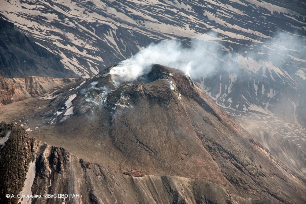
KVERT reported that a new lava dome began growing in the summit crater of Bezymianny around 26 August. A thermal anomaly over the summit was visible during 28-31 August and on 4, 8, and 10 September. Weather clouds sometimes obscured views of the volcano. The Aviation Color Code remained at Yellow (the second lowest level on a four-color scale).

Prior to its noted 1955-56 eruption, Bezymianny had been considered extinct. The modern volcano, much smaller in size than its massive neighbors Kamen and Kliuchevskoi, was formed about 4700 years ago over a late-Pleistocene lava-dome complex and an ancestral edifice built about 11,000-7000 years ago. Three periods of intensified activity have occurred during the past 3000 years. The latest period, which was preceded by a 1000-year quiescence, began with the dramatic 1955-56 eruption. This eruption, similar to that of St. Helens in 1980, produced a large horseshoe-shaped crater that was formed by collapse of the summit and an associated lateral blast. Subsequent episodic but ongoing lava-dome growth, accompanied by intermittent explosive activity and pyroclastic flows, has largely filled the 1956 crater.

Source : GVP , Kvert .

Photo : A. Sokorenko, IVS FEB RAS.


Japan , Satsuma Iwo-jima :

30.793°N, 130.305°E
Elevation 704 m

JMA reported that during 7-14 September white plumes from Satsuma Iwo-jima, a subaerial part of Kikai’s NW caldera rim, rose as high as 1 km above the Iodake crater rim. Incandescence from the crater was visible at night. The Alert Level remained at 2 (on a 5-level scale).


Kikai is a mostly submerged, 19-km-wide caldera near the northern end of the Ryukyu Islands south of Kyushu. It was the source of one of the world’s largest Holocene eruptions about 6,300 years ago when rhyolitic pyroclastic flows traveled across the sea for a total distance of 100 km to southern Kyushu, and ashfall reached the northern Japanese island of Hokkaido. The eruption devastated southern and central Kyushu, which remained uninhabited for several centuries. Post-caldera eruptions formed Iodake lava dome and Inamuradake scoria cone, as well as submarine lava domes.


Historical eruptions have occurred at or near Satsuma-Iojima (also known as Tokara-Iojima), a small 3 x 6 km island forming part of the NW caldera rim. Showa-Iojima lava dome (also known as Iojima-Shinto), a small island 2 km E of Tokara-Iojima, was formed during submarine eruptions in 1934 and 1935. Mild-to-moderate explosive eruptions have occurred during the past few decades from Iodake, a rhyolitic lava dome at the eastern end of Tokara-Iojima.

Source : JMA , GVP.

Photo et carte : Ray go – Own work,  commons.wikimedia.org ,  Yoshiyuki Tatsumi et al 2018.


Ecuador , Sangay :

The Geophysical Institute of the National Polytechnic School reports that:
On the afternoon of September 16, GOES-16 satellite images show an ash cloud from the Sangay volcano moving south, which could generate light ash falls in localities south of the volcano, in the province of Morona Santiago. This phenomenon has been persistent during the current eruptive period which began in May 2019.
The Geophysical Institute of the National Polytechnic School is keeping an eye on the activity of the volcano and will report on any changes that may be recorded.

DAILY REPORT ON THE STATE OF SANGAY VOLCANO, Wednesday September 16, 2020.

Surface activity level: High, Surface trend: No change.
Internal activity level: High, Internal trend: Increasing.


Seismicity: From September 15, 2020, 11:00 a.m. to September 16, 2020, 11:00 a.m.
Long period type events: 20
Explosions: 158
Emission tremor: 6

Rains / lahars:
Last night, rains were recorded in the area without generating any signals associated with secondary lahars.
** In case of heavy rains, lahars can be generated in the Volcán, Upano rivers and other tributaries **

Emission / ash column: Today in the morning on images shared by ECU911 and by the network of volcanic observers, gas and ash emissions were observed which rose 700 m above the crater level looking west. The VAAC recorded 1 ash emission alert, the direction of dispersion was towards the North-East and reached a height of 900 meters above the level of the crater.

Other monitoring parameters: FIRMS recorded 27 thermal alerts on the Sangay in the last 24 hours.
MIROVA recorded 1 moderate thermal alert and 1 high thermal alert on the Sangay during the last 24 hours.

Observations: In the afternoon and night yesterday, the volcano was cloudy. As of this morning, the volcano was mostly clear, the emissions described above and the descent of pyroclastic flows along the south-eastern flank of the volcano were observed. Until the close of this bulletin, there are no reports of ash fall.

Alert level: yellow.

Source : IGEPN.

Photos : IGEPN , flytouio.


Philippines , Bulusan :

BULUSAN VOLCANO BULLETIN 17 September 2020 08:00 A.M.

Bulusan Volcano’s monitoring network recorded one (1) volcanic earthquake during the 24-hour observation period. Ground deformation data from continuous GPS measurements indicate slight inflation on the edifice since July 2020, while the long-term trend since May 2019 denotes that the edifice is still deflated. These parameters indicate that volcanic processes are underway beneath the edifice that may be caused by deep-seated degassing or hydrothermal activity or magmatic intrusion.

Alert Level 1 (Abnormal) status prevails over Bulusan Volcano, which means that it is currently in an abnormal condition. Local government units and the public are reminded that entry into the four-kilometer radius Permanent Danger Zone (PDZ) is strictly prohibited and that vigilance within the two-kilometer Extended Danger Zone (EDZ) on the southeastern sector must be exercised due to the increased possibilities of sudden and hazardous phreatic eruptions. Civil aviation authorities must also advise pilots to avoid flying close to the volcano’s summit as ash from any sudden phreatic eruption can be hazardous to aircraft. Furthermore, people living within valleys and along river/stream channels especially on the southeast, southwest, and northwest sector of the edifice should be vigilant against sediment-laden stream flows and lahars in the event of heavy and prolonged rainfall.

DOST-PHIVOLCS is closely monitoring Bulusan Volcano’s condition and any new development will be communicated to all concerned stakeholders.

Source et photo : Phivolcs .

March 19 , 2018. EN. Ambae , Mayon , Nevados de Chillan , Satsuma-Iojima .

March 19 ,  2018.


Ambae , Vanuatu :

15°24’0”S 167°50’0”E
Summit 4908ft (1496m)
Current Vanuatu Volcano Alert Level: Level 3

Vanuatu’s Ambae volcano rumbling again

19 MARCH 2018. Volcanic activity on Vanuatu’s Ambae island has picked up again, with fresh ashfall reported across the island’s west and south. The entire island was evacuated late last year when the volcano at the island’s centre erupted, blanketing the island in ash, suffocating crops and contaminating water.
The population returned when the eruption settled down after a month, but last night, the volcano’s alert level was raised from level 2 to 3 — what’s called a « state of minor eruption. » The Geohazards Department’s Melinda Aru said the volcano was showing increased activity and an exclusion zone had been extended to three kilometres around the crater lake.
« We’ve got a few reports coming from Ambae concerning ashfall on the west, southwest and northwest as of last week until yesterday. We still have reports from Ambae concerning ash fall. » Melinda Aru said the chance of the eruption increasing to the level seen in October is highly unlikely.

Ambae volcano is in the minor eruption state; Its Alert Level is raised from Level 2 to Level 3 .

The volcanic eruption at Ambae confined inside the Lake Voui is stable at Alert Level 3. Scientific analyses confirm that the current activity is similar to the volcanic activity at the end of October 2017 but with more and sustained emissions of volcanic ashes. The possibility of imminent increasing activity is very low. The restricted area of risk is now limited to the area of 3 km from the active vent.

Observations of February and March 2018 confirm that the activity is continuing from the recent edified volcanic cone (island). Style of Ambae volcano activity is explosive, similar to what is seen and experienced at Yasur on Tanna Island. Explosions are accompanied by volcanic ashes and/or gases cloud. With the current size of the volcanic cone in Lake Voui, people from Ambae may hear explosions, view a minor volcanic ash and/or gas plume and glows over the mountain at night.

These observations and the analysis of seismic data confirms that the volcano activity is in the level of minor eruption state. The volcano activity consist of ongoing emission of ashes, gases and volcanic bombs that may fall around the volcano vents.

Based on its slight decreased seismic activity and observation of ongoing volcanic gas emission and steam plumes on the web camera, the Volcanic Alert Level (VAL) at Ambae was dropped to Level 2 on 7th December 2017. The current activity shows ongoing ashes and gases emission causing more impact to villages. This is consistent with the Alert Level 3 activity. Level 3 indicates ‘Minor eruption; Danger is now at 3 km around the volcanic vent and areas that exposed to the wind direction’ . The possibility that the Ambae volcano activity escalate to the level of moderate eruption is very low .

Source : Radio NZ , Geohazard.

Photo : David Sarginson.


Mayon , Philippines : 

MAYON VOLCANO BULLETIN 19 March 2018 08:00 A.M.

Mayon’s activity in the past 24 hours was characterized by general quiescence, degassing from the summit crater and gravity-driven lava flow. Weak emissions of white steam-laden plumes drifting southwest occurred throughout the day. Lava flows could be observed at night to be moving downslope on the Miisi, Bonga and Basud Gullies within 3.3 kilometers, 4.5 kilometers and 1.9 kilometers of the crater, respectively. A total of seventy (70) rockfall events were recorded by Mayon’s seismic monitoring network. Sulfur dioxide (SO2) emission was measured at an average of 1895 tonnes/day on 18 March 2018. A slight inflation of the lower flanks beginning 11 March 2018 was recorded by electronic tilt, consistent with results of Precise Leveling (PL) surveys on 03 – 06 March 2018. Overall ground deformation data indicate that the edifice is still swollen or inflated relative to pre-eruption baselines.

Alert Level 3 currently prevails over Mayon Volcano. This means that although Mayon’s unrest continues, there is a decreased likelihood of hazardous explosive eruption to occur. PHIVOLCS-DOST reminds the public of sudden explosions, lava collapses, pyroclastic density currents or PDCs and ashfall can still occur and threaten areas in the upper to middle slopes of Mayon. PHIVOLCS-DOST recommends that entry into the six kilometer-radius Permanent Danger Zone or PDZ and a precautionary seven kilometer-radius Extended Danger Zone or EDZ in the south-southwest to east-northeast sector, stretching from Anoling, Camalig to Sta. Misericordia, Sto. Domingo, must be strictly prohibited. People residing close to these danger areas are also advised to observe precautions associated with rockfalls, PDCs and ashfall. Active river channels and those perennially identified as lahar prone areas in the southern and eastern sectors should also be avoided especially during bad weather conditions or when there is heavy and prolonged rainfall. Civil aviation authorities must advise pilots to avoid flying close to the volcano’s summit as airborne ash and ballistic fragments from sudden explosions and PDCs may pose hazards to aircrafts.

PHIVOLCS-DOST is closely monitoring Mayon Volcano’s activity and any new significant development will be immediately communicated to all stakeholders.

Source : Phivolcs


Nevados de Chillan , Chile :

During this period, seventy-five (75) earthquakes classified as volcano-tectonic events (VT) were recorded, related to fracturing processes of rigid materials, with a maximum local amplitude (ML) of 2.4. The strongest earthquake was 4.2 km southeast (SE) of the active crater at a depth of 2.5 km.
Similarly, four thousand nine hundred and thirty (4030) earthquakes associated with fluid dynamics within the volcanic building were recorded, of which two thousand eight hundred and twenty-three (2823) were classified as long-period type events. (LP), with a maximum displacement value (DRC) of 177.7 cm2. Similarly, one thousand two hundred and sixteen tremor events (TR) were recorded, the largest of them with a duration of about 2 minutes and a reduced average maximum displacement of 285.2 cm2.
Between March 1st and 15th, a total of eight hundred (800) explosions were reported, mainly associated with magmatic gases and / or recording of acoustic signals picked up by the microphones array near the volcano, which a maximum pressure of 0.4 Pa at 1 km distance, during the highest recorded explosion.

The images obtained through the cameras installed near the volcanic complex, showed mainly gas emissions associated with the explosions, coming from the craters currently active with column heights lower than 1300 m compared to the level of the crater. In addition, at night, the cameras recorded sporadic glow associated with some explosions and / or increased gas emissions from the active crater.

In order to find information on the growth of the dome located in the active crater, Sernageomin, with the collaboration of the Onemi, made an overflight on March 12, during which it was possible to measure a maximum temperature of 330 ° C on the dome G. Cruz, and note an increase in its extruded volume, which reaches a volume of about 100,000 m3, with a height greater than the lower edge of the crater. There is a persistence of almost uniform extrusion of the order of 0.017 m3 / s, in agreement with the released seismic energy. Finally, there are morphological changes in the area of ​​the dome, with the presence of fracture lines and the formation of blocks.

The deformation recorded during this period continues to be of very small amplitude.
– Sulfur dioxide dioxide (SO2) emissions recorded by the Differential Absorption Spectrometer (DOAS) are at low levels, consistent with the presence of a lava dome. In addition, no SO2 emissions have been reported to the atmosphere in the volcanic complex sector, as published by the Sulfur Dioxide Group, Ozone Monitoring Instrument (OMI) (http: // so2). .gsfc.nasa.gov /) and the National Environmental Satellite Data and Information Service (NESDIS) (http://satepsanoine.nesdis.noaa.gov).
No thermal warnings based on data processed by mean infrared observation of volcanic activity (Mirova) (http://www.mirovaweb.it/) have been reported.

Given the scenario, a partial or complete collapse of the dome accompanied by depressurization of the magmatic bodies and the generation of Vulcanian explosions, volcanic processes can be triggered with ballistic projections and the generation of pyroclastic flows in areas near the volcano. In addition, it is possible that a smaller eruptive column is formed, which could generate a pyroclastic dispersion with a preference towards the East and the area of ​​the Las Trancas Valley. Finally, the valleys of the Gato River, the Las Minas River and the Nubian River can be affected by low volume lahars. This scenario is subject to updates according to the evolution of the eruptive process.
In this context, the development of volcanic seismicity and its characteristics, as well as other monitoring parameters, together with permanent visual aerial observations to control the growth of the dome, will allow to diagnose the evolution of the process.

For this reason, special attention and a volcanic technical alert are maintained at the level:
YELLOW LEVEL: Changes in the behavior of volcanic activity – Probable time for an eruption: WEEKS / MONTH.

Observation: The potential area of ​​assignment is 4 km around the active crater, added to the Gato valleys, the Las Minas River and the upper Nubian River, located northeast (NE) of the active volcanic building. In the current state, these channels can be affected by low volume lahars.

Source : Sernageomin.


Satsuma-Lojima , Japan :

The weather agency raised the volcanic alert level Monday for Satsuma-Iojima Island in Kagoshima Prefecture, southwestern Japan, citing an increase in volcanic earthquakes.

The Japan Meteorological Agency raised the alert level for the volcano from 1 to 2 on a scale of 5, warning against approaching the crater. It had previously advised people that the volcano is active.
The agency warned that areas within approximately 1 kilometer of the crater could be affected by flying rock if an eruption occurs.
It observed volcanic temblors on the island 12 times on Thursday and 51 times as of 11:30 a.m. Monday. The number has been increasing since mid-February, it said.
On Friday, the agency also confirmed a type of tremor that indicates underground magma activity.


Kikai is a mostly submerged, 19-km-wide caldera near the northern end of the Ryukyu Islands south of Kyushu. Kikai was the source of one of the world’s largest Holocene eruptions about 6300 years ago. Rhyolitic pyroclastic flows traveled across the sea for a total distance of 100 km to southern Kyushu, and ashfall reached the northern Japanese island of Hokkaido. The eruption devastated southern and central Kyushu, which remained uninhabited for several centuries. Post-caldera eruptions formed Iodake lava dome and Inamuradake scoria cone, as well as submarine lava domes. Historical eruptions have occurred in the 20th century at or near Satsuma-Iojima (also known as Tokara-Iojima), a small 3 x 6 km island forming part of the NW caldera rim. Showa-Iojima lava dome (also known as Iojima-Shinto), a small island 2 km east of Tokara-Iojima, was formed during submarine eruptions in 1934 and 1935. Mild-to-moderate explosive eruptions have occurred during the past few decades from Iodake, a rhyolitic lava dome at the eastern end of Tokara-Iojima.


Sources : Kyodo news , GVP

19 Mars 2018. FR. Ambae , Mayon , Nevados De Chillan , Satsuma-Lojima.

19 Mars 2018.


Ambae , Archipel du Vanuatu :

15 ° 24’0 « S 167 ° 50’0 » E
Sommet 4908ft (1496m)
Actuel Niveau d’alerte du volcan du Vanuatu: Niveau 3

Le volcan d’Ambae , au Vanuatu , gronde à nouveau .

19 mars 2018. L’activité volcanique de l’île d’Ambae au Vanuatu a repris, avec des chutes de cendres fraîches signalées dans l’Ouest et le Sud de l’île. L’île entière a été évacuée à la fin de l’année dernière lorsque le volcan du centre de l’île est entré en éruption, recouvrant l’île de cendres, étouffant les récoltes et contaminant l’eau.
La population est revenue quand l’éruption s’est calmée après un mois, mais la nuit dernière, le niveau d’alerte du volcan a été relevé du niveau 2 au niveau 3 – ce qu’on appelle un «état d’éruption mineure». Melinda Aru du Département des aléas géographiques a déclaré que le volcan présentait une activité accrue et qu’une zone d’exclusion avait été étendue à trois kilomètres autour du lac de cratère.


«Nous avons reçu quelques rapports d’Ambae concernant des chutes de cendres à l’Ouest, au Sud-Ouest et au Nord-Ouest depuis la semaine dernière et jusqu’à hier, nous avons encore des rapports d’Ambae concernant les chutes de cendres. Melinda Aru a déclaré que la probabilité que l’éruption augmente au niveau observé en octobre est hautement improbable.

Le volcan Ambae est dans l’état mineur d’éruption; Son niveau d’alerte passe du niveau 2 au niveau 3.

L’éruption volcanique sur Ambae confinée à l’intérieur du lac Voui est stable au niveau d’alerte 3. Les analyses scientifiques confirment que l’activité actuelle est similaire à l’activité volcanique à la fin d’octobre 2017 mais avec des émissions plus importantes et soutenues de cendres volcaniques. La possibilité d’une activité croissante imminente est très faible. La zone de risque limitée est maintenant limitée à la zone de 3 km autour de l’évent actif.

Les observations de février et de mars 2018 confirment que l’activité se poursuit depuis le récent cône volcanique édifié (île). Le style de l’activité du volcan Ambae est explosif, semblable à ce qui est vu et vécu sur le Yasur sur l’île de Tanna. Les explosions sont accompagnées de cendres volcaniques et / ou de nuages ​​de gaz. Avec la taille actuelle du cône volcanique dans le lac Voui, les gens d’Ambae peuvent entendre des explosions, voir Des chutes de cendre  volcaniques mineures et / ou un panache de gaz et une incandescence sur la montagne la nuit.

Ces observations et l’analyse des données sismiques confirment que l’activité volcanique est au niveau de l’état d’éruption mineure. L’activité du volcan consiste en l’émission continue de cendres, de gaz et de bombes volcaniques qui peuvent retomber autour des bouches volcaniques.

Sur la base de sa légère activité sismique et de l’observation des émissions de gaz volcaniques et des panaches de vapeur sur la webcam, le niveau d’alerte volcanique (VAL) sur Ambae a été ramené au niveau 2 le 7 décembre 2017. L’activité actuelle montre les émissions de cendres et de gaz causant plus d’impact aux villages. Ceci est cohérent avec l’activité du niveau d’Alerte  3.  Le niveau 3 indique ‘éruption mineure; Le danger est maintenant à 3 km autour de l’évent volcanique et dans les zones exposées à la direction du vent ». La possibilité que l’activité du volcan d’Ambae augmente au niveau d’éruption modérée est très faible.

Source : Radio NZ, Geohazard.

Photo : David Sarginson.


Mayon , Philippines : 

BULLETIN D’ACTIVITE DU VOLCAN MAYON , 19 mars 2018 , 08:00 A.M.

L’activité du Mayon au cours des dernières 24 heures a été caractérisée par une quiescence générale, un dégazage du cratère sommital et une coulée de lave entraînée par la gravité. De faibles émissions de panaches blancs chargés de vapeur dérivant vers le Sud-Ouest se sont produites tout au long de la journée. Des coulées de lave ont pu être observées la nuit  se déplaçant dans les ravins de Miisi, Bonga et Basud à moins de 3,3 km, 4,5 km et 1,9 km du cratère, respectivement. Un total de soixante-dix (70) événements de chutes de pierres ont été enregistrés par le réseau de surveillance sismique du Mayon. Les émissions de dioxyde de soufre (SO2) ont été mesurées à une moyenne de 1895 tonnes / jour le 18 mars 2018. Un léger gonflement des flancs inférieurs à partir du 11 mars 2018 a été enregistré par inclinaison électronique, conformément aux résultats des relevés de nivellement précis du 03 au 06 mars 2018. Les données générales sur la déformation du sol indiquent que l’édifice est encore gonflé par rapport aux lignes de base antérieures à l’éruption.

Le niveau d’alerte 3 prévaut actuellement sur le volcan Mayon. Cela signifie que, bien que les troubles du Mayon se poursuivent, il y a moins de risques d’éruption explosive dangereuse. Le PHIVOLCS-DOST rappelle au public des explosions soudaines, des effondrements de lave, des courants de densité pyroclastiques (PDC) et des chutes de cendres peuvent encore se produire et menacer des zones dans les pentes supérieures à moyennes du Mayon. Le PHIVOLCS-DOST recommande que l’entrée dans la zone de danger permanent de six kilomètres et la zone de danger prolongée de sept kilomètres dans le secteur Sud-Sud-Ouest à Est-Nord-Est, s’étendant d’Anoling, Camalig à Sta. Misericordia, Sto. Domingo, soit  strictement interdite. Les personnes résidant à proximité de ces zones dangereuses sont également invitées à observer les précautions associées aux chutes de pierres, aux PDC et aux chutes de cendres. Les canaux fluviaux actifs et ceux qui sont éternellement identifiés comme des zones sujettes aux lahar dans les secteurs méridionaux et orientaux devraient également être évités, en particulier lorsque le temps est mauvais ou lorsque les précipitations sont abondantes et prolongées. Les autorités de l’aviation civile doivent conseiller aux pilotes d’éviter de voler à proximité du sommet du volcan car les cendres en suspension dans l’air et les fragments balistiques provenant des explosions soudaines et des PDC peuvent présenter des dangers pour les aéronefs.

Le PHIVOLCS-DOST surveille de près l’activité du Mayon et tout nouveau développement important sera immédiatement communiqué à toutes les parties prenantes.

Source : Phivolcs


Nevados de Chillan , Chili :

Au cours de cette période, soixante-quinze (75) séismes classés en événements volcano-tectoniques (VT) ont été enregistrés, liés à des processus de fracturation de matériaux rigides, avec une amplitude locale maximale (ML) de 2,4. Le tremblement de terre le plus puissant se situait à 4,2 km au Sud-Est (SE) du cratère actif, à une profondeur de 2,5 km.
De même, quatre mille neuf cent trente (4030) séismes associés à la dynamique des fluides à l’intérieur du bâtiment volcanique ont été enregistrés, dont deux mille huit cent vingt-trois (2823) ont été classés comme des événements de type longue période (LP), avec une valeur de déplacement réduit (DRC) maximale de 177,7 cm2. De même, mille deux cent seize événements de type tremor (TR) ont été enregistrés, le plus grand d’entre eux avec une durée d’environ 2 minutes et un déplacement maximal moyen réduit de 285,2 cm2.
Entre le 1er et le 15 mars, un total de huit cent (800) explosions ont été rapportées, principalement associées à des gaz magmatiques et / ou à l’enregistrement de signaux acoustiques captés par le réseau de microphones installés près du volcan, qui ont présenté une pression maximale de 0,4 Paà 1 km de distance , durant la plus forte explosion enregistrée.

Les images obtenues à travers les caméras installées à proximité du complexe volcanique, ont montré principalement des émissions de gaz associées aux explosions, provenant des cratères actuellement actifs avec des hauteurs de colonne inférieures à 1300 m par rapport au niveau du cratère. De plus, la nuit, les caméras ont enregistré une incandescence sporadique associée à certaines explosions et / ou à une augmentation des émissions de gaz provenant du cratère actif.

Dans le but de relever des informations sur la croissance du dôme situé dans le cratère actif, le Sernageomin , avec la collaboration de l’Onemi , à réalisé un survol le 12 Mars, durant lequel il a été possible de mesurer une température maximale de 330°C sur le dôme G. Cruz, et noter une augmentation de son volume extrudé , lequel atteint un volume d’environ 100 000 m3, avec une hauteur supérieure au bord inférieur du cratère. On note une persistance de l’extrusion quasi uniforme de l’ordre de 0,017 m3/s , en concordance avec l’énergie sismique libérée. Enfin , on note des changements morphologiques de la superficie du dôme, avec la présence de lignes de fractures et la formation de blocs.

La déformation enregistrée pendant cette période continue d’être de très faible amplitude.
– les émissions de dioxyde de dioxyde de soufre (S02) enregistrées par l’appareil de spectrométrie par absorption différentielle (DOAS) sont à des niveaux faibles, compatibles avec la présence d’un dôme de lave. De plus, aucune émission de S02 n’a été signalée à l’atmosphère dans le secteur du complexe volcanique, tel que publié par le Groupe de dioxyde de soufre , instrument de surveillance de l’ozone (OMI) (http://so2.gsfc.nasa.gov/) et Service national de données et d’informations sur les satellites de l’environnement (NESDIS) (http://satepsanoine.nesdis.noaa.gov).
Aucune alerte thermique en fonction des données traitées par infrarouge moyen d’observation de l’activité volcanique (Mirova) (http://www.mirovaweb.it/) n’ont été signalées .

Compte tenu du scénario , un effondrement partiel ou total du dôme accompagné de dépressurisation du corps magmatiques et la génération d’explosions Vulcaniennes , des processus volcaniques peuvent être déclenchés avec des projections balistiques et la génération d’écoulements pyroclastiques dans les secteurs proches du volcan. De plus, il est possible que se forme une colonne éruptive plus petite, qui pourrait générer une dispersion pyroclastique avec une préférence vers l’Est et vers le secteur de la vallée de Las Trancas  . Enfin, les vallées de la rivière Gato, de la rivière Las Minas et de la rivière Nubie peuvent être affectées par des lahars de faible volume. Ce scénario est sujet à des mises à jour en fonction de l’évolution du processus éruptif.
Dans ce contexte, le développement de la sismicité volcanique et de ses caractéristiques, ainsi que d’autres paramètres de surveillance, accompagnés des observations aériennes visuelles permanentes pour contrôler la croissance du dôme, permettront de diagnostiquer l’évolution du processus. Pour cette raison, une attention particulière et une alerte technique volcanique sont maintenues au niveau:
NIVEAU JAUNE: Changements dans le comportement de l’activité volcanique – Temps probable pour une éruption: SEMAINES / MOIS.
Observation: La zone d’affectation potentielle correspond à 4 km autour du cratère actif, ajouté aux vallées du Gato, la rivière Las Minas et le haut de la rivière Nubie, située vers le nord-est (NE) du bâtiment volcanique actif. Dans l’état actuel, ces canaux peuvent être affectés par des lahars de faible volume.

Source : Sernageomin.


Satsuma-Lojima , Japon :

L’agence météorologique a relevé le niveau d’alerte volcanique lundi pour l’île de Satsuma-Iojima dans la préfecture de Kagoshima, au sud-ouest du Japon, citant une augmentation des séismes volcaniques.
L’Agence météorologique japonaise a relevé le niveau d’alerte du volcan de 1 à 2 sur une échelle de 5, mettant en garde contre l’approche du cratère. Elle avait auparavant informé les gens que le volcan était actif.
L’agence a averti que les zones à moins d’un kilomètre du cratère pourraient être affectées par des retombées de roches si une éruption se produisait.
L’ agence a observé des secousses volcaniques sur l’île 12 fois le jeudi et 51 fois à 11h30 lundi. Ce nombre a augmenté depuis la mi-février, a elle dit.
Vendredi, l’agence a également confirmé un type de tremor qui indique l’activité du magma souterrain.


Le Kikai est une caldeira de 19 km de large principalement submergée près de l’extrémité nord des îles Ryukyu au sud de Kyushu. Kikai a été la source de l’une des plus grandes éruptions holocènes du monde il y a environ 6300 ans. Des coulées pyroclastiques rhyolitiques ont traversé la mer sur une distance totale de 100 km jusqu’au sud de Kyushu, et des chutes de cendres ont atteint l’île japonaise de Hokkaido. L’éruption a dévasté le sud et le centre de Kyushu, qui est resté inhabité pendant plusieurs siècles. Les éruptions post-caldeira ont formé le dôme de lave d’Iodake et le cône de scorie d’Inamuradake, ainsi que des dômes de lave sous-marins. Des éruptions historiques ont eu lieu au 20ème siècle à ou près de Satsuma-Iojima (également connu sous le nom de Tokara-Iojima), une petite île de 3 x 6 km faisant partie de la caldeira au Nord-Ouest. Le Showa-Iojima , dôme de lave (également connu sous le nom de Iojima-Shinto), une petite île située à 2 km à l’est de Tokara-Iojima, s’est formé lors des éruptions sous-marines en 1934 et 1935. Des éruptions explosives légères à modérées se sont produites au cours des dernières décennies depuis Iodake, un dôme de lave rhyolitique à l’extrémité est de Tokara-Iojima.


Sources : Kyodo news , GVP