April 17 , 2022 .
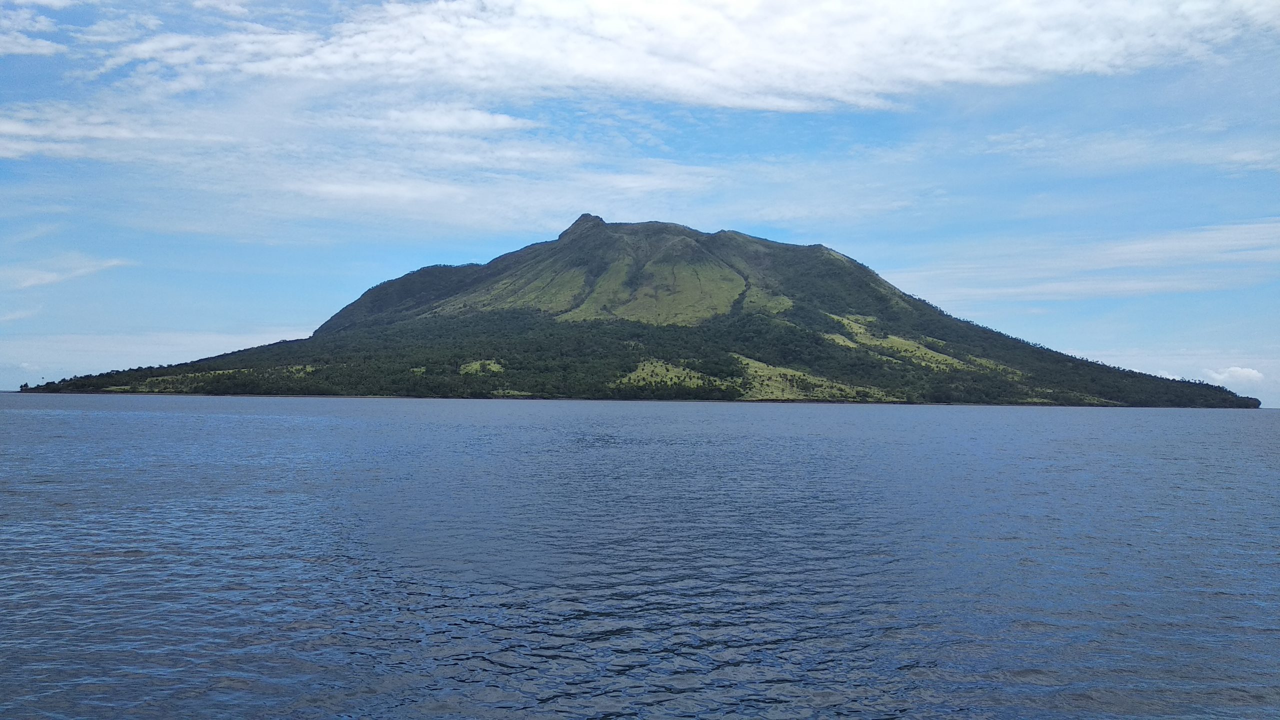
Alaska , Pavlof :
55°25’2″ N 161°53’37 » W,
Summit Elevation 8261 ft (2518 m)
Current Volcano Alert Level: WATCH
Current Aviation Color Code: ORANGE
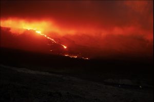
Eruptive activity continues at Pavlof. Seismic tremor was present throughout the past day but no explosions were detected. Web camera images from this morning show steam emissions from the crater near the summit, rising several hundred feet above the summit. Moderately elevated surface temperatures were observed in several satellite images last night, as is common for the current eruption. No ash emissions were observed.

A plume rises from Pavlof volcano, as seen on Alaska Airlines flight 187 ADK to ANC 04/06/2022,
Small explosions associated with the current eruption could happen at any time and may be accompanied by small ash plumes within the immediate vicinity of the volcano. The level of unrest at Pavlof can change quickly and the progression to more significant eruptive activity can occur with little or no warning.
Pavlof is monitored by local seismic and infrasound sensors, satellite data, web cameras, and remote infrasound and lightning networks.
Source : AVO.
Photo : Ferguson-Gould, Tara
Kamchatka , Sheveluch :
VOLCANO OBSERVATORY NOTICE FOR AVIATION (VONA)
Issued: April 17 , 2022
Volcano: Sheveluch (CAVW #300270)
Current aviation colour code: ORANGE
Previous aviation colour code: orange
Source: KVERT
Notice Number: 2022-25
Volcano Location: N 56 deg 38 min E 161 deg 18 min
Area: Kamchatka, Russia
Summit Elevation: 3283 m (10768.24 ft), the dome elevation ~2500 m (8200 ft)
Volcanic Activity Summary:
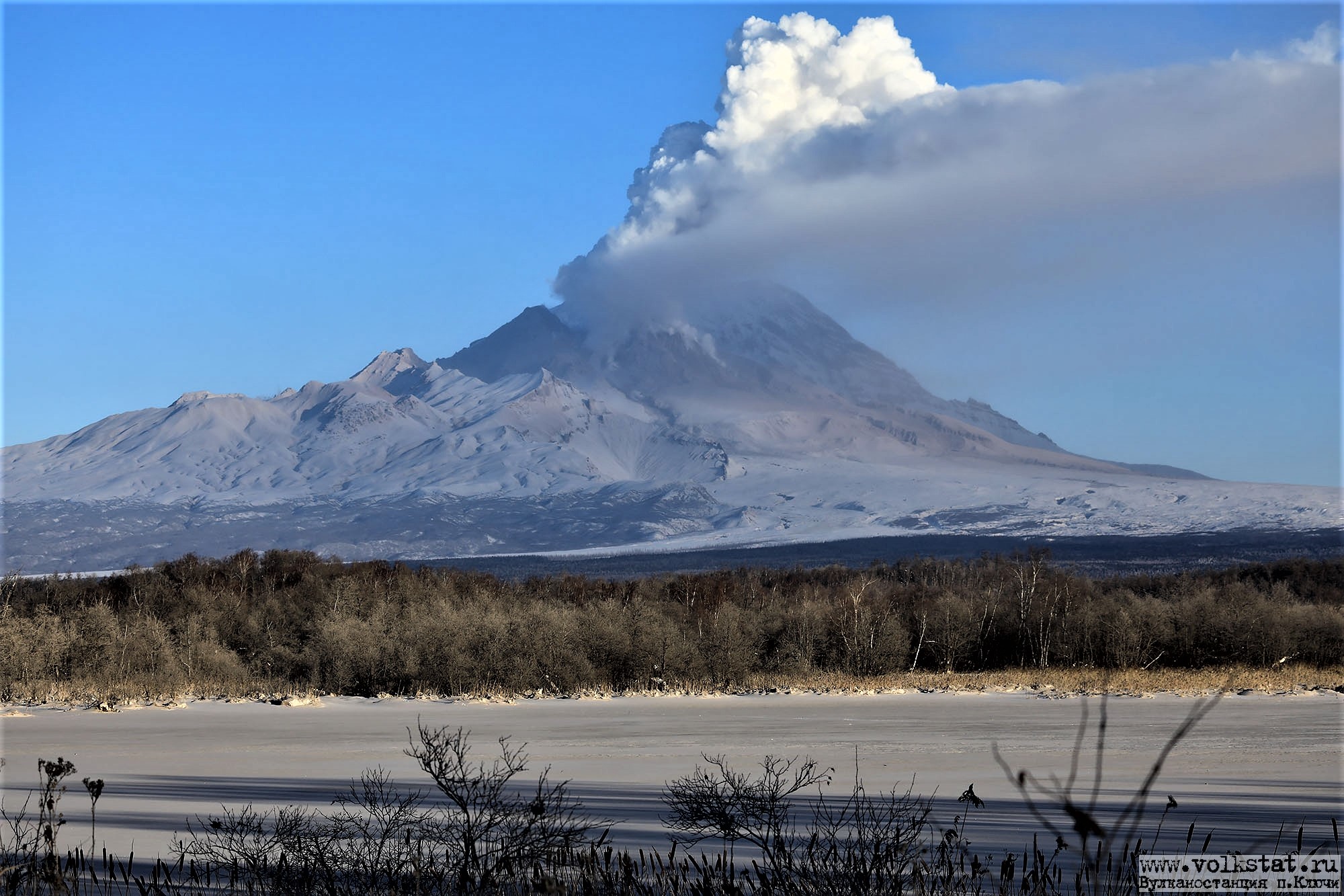
A growth of the lava dome continues, a strong fumarolic activity, and an incandescence of the lava dome, explosions, and hot avalanches accompanies this process. Satellite data by KVERT showed series moderate explosions sent ash up to 4 km a.s.l., ash plume is extending to the south-east of the volcano.
The extrusive eruption of the volcano continues. Ash explosions up to 10-15 km (32,800-49,200 ft) a.s.l. could occur at any time. Ongoing activity could affect international and low-flying aircraft.
Volcanic cloud height:
3500-4000 m (11480-13120 ft) AMSL Time and method of ash plume/cloud height determination: 20220417/0030Z – Video data
Other volcanic cloud information:
distance of ash plume/cloud of the volcano: 15 km (9 mi)
Direction of drift of ash plume/cloud of the volcano: SW
Time and method of ash plume/cloud determination: 20220417/0057Z – Video data
Source : Kvert.
Photo : Volkstat ru / Yu. Demyanchuk .
Indonesia , Anak Krakatau :
VOLCANO OBSERVATORY NOTICE FOR AVIATION – VONA
Issued : April 17 , 2022 .
Volcano : Anak Krakatau (262000)
Current Aviation Colour Code : YELLOW
Previous Aviation Colour Code : orange
Source : Anak Krakatau Volcano Observatory
Notice Number : 2022KRA30
Volcano Location : S 06 deg 06 min 07 sec E 105 deg 25 min 23 sec
Area : Lampung, Indonesia
Summit Elevation : 502 FT (157 M)

Volcanic Activity Summary :
volcanic ash emission is continuing at 06:25 utc (09:25 local)
Volcanic Cloud Height :
Best estimate of ash-cloud top is around 2605 FT (814 M) above sea level, may be higher than what can be observed clearly. Source of height data: ground observer.
Other Volcanic Cloud Information :
ash-cloud moving to south west
Remarks :
Seismic activity is characterized by continuous volcanic tremor
Source : Magma Indonésie .
Photo : Sergey Biryukov ( Archive) :
Indonesia , Ruang :
Increase in activity level of G. Ruang, April 16, 2022.
The results of the assessment of the volcanic activity of G. Ruang, Province of North Sulawesi, for the period from April 1 to April 16, 2022 at 08:00 WITA are as follows:
Introduction
Its last eruption on September 25, 2002 occurred after the volcano had been dormant for more than fifty years. The eruption had produced an eruption column with a height of more than 5 km above the summit, the satellites had detected a height of volcanic ash up to more than 16 km.
Instrumental observation
During the period from April 1 to April 16, 2022, seismometers recorded at least 121 deep volcanic (VA) earthquakes with an amplitude of 4-55 mm, and an earthquake duration of 5-24 seconds, as well than 110 deep tectonic earthquakes, with an amplitude of 3 to 47 mm, and earthquake duration of 35 to 425 seconds. Since April 7, 2022, an increase in the number of deep volcanic earthquakes (type VA) has been observed. However, on April 16, 2022, from 00:00 WITA to 04:47 WITA, there was a very significant change in seismicity, namely the recording of 50 deep volcanic earthquakes, 2 local tectonic earthquakes and 4 earthquakes felt.
Evaluation
Based on the development of seismic activity from January 2022 to April 16 at 06:00 WITA, seismicity fluctuated but in general showed an increase, especially deep volcanic earthquakes since April 7, 2022. This earthquake deep volcanic (VA) occurred due to magma intrusion from the interior and indicates increased volcanic activity on G. Ruang currently.
This increase in volcanic activity has the potential to be followed by an eruption, although the occurrence cannot be established with certainty.
Potential danger
According to the historical records of its eruptions, the main potential threat of G. Ruang comes from explosive eruptions accompanied by ejections of pyroclastic materials in all directions and pyroclastic flows (hot clouds) mainly towards the East, South East, South and South West.
Conclusion:
Based on visual observation, instrumental data and potential eruption hazard until April 16, 2022, from April 16, 2022 at 1:00 p.m. WITA, the activity level of G. Ruang is raised to Level II (alert).
Source : PVMBG.
Photo : Marwan Mohamad.
Hawaii , Kilauea :
19°25’16 » N 155°17’13 » W,
Summit Elevation 4091 ft (1247 m)
Current Volcano Alert Level: WATCH
Current Aviation Color Code: ORANGE
Activity Summary:
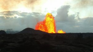
The summit eruption of Kīlauea Volcano, within Halemaʻumaʻu crater, continued over the past 24 hours. All recent activity has been confined to the crater. Everything is status quo for summit and East Rift Zone. No threats are apparent.
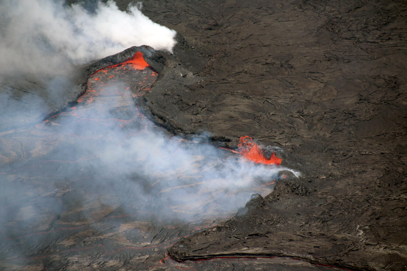
Halemaʻumaʻu crater Lava Lake Observations:
Eruption of lava from the western vent into the active lava lake and onto the crater floor continued over the past 24 hours. The active part of the lava lake showed continuous surface activity, with an occasional flow overtopping the perched levees. Surface activity continues on the crater floor from the west vent, and from breakouts along the northern portion of the crater. Since the beginning of this eruption on September 29, 2021, the crater floor has seen a total rise of about 99 meters (325 feet). The volume of lava effused since the beginning of this eruption was approximately 66 million cubic meters (18 billion gallons) as measured on April 6, 2022.
Summit Observations:
Summit tiltmeters has shown a slight deflationary trend over the past 24 hours. Volcanic tremor remains above background levels. A sulfur dioxide (SO2) emission rate of approximately 2,600 tonnes per day (t/d) was measured on April 14, 2022.
Source : HVO.
Photo : USGS / N. Deligne