September 28 , 2019.
Mexico, Colima :
Weekly technical bulletin of the activity of the volcano of Colima. September 27, 2019
Seismic activity:
Last week, 17 high frequency (HF) events, 1 collapse and 8.5 min of low amplitude tremor were automatically recorded. This week, only a small lahar was recorded in the canyon of the Lumber.
Visual observations:
Intermittent steam and gas emissions from the northeast side of the crater continue to be recorded during the reporting period, but fumaroles were also observed in the western portion. When clouds allowed, the fixed thermal camera located south of the volcano, recorded thermal anomalies related to fumaroles.
Geochemistry:
The flow of SO2 was not measured during the week.
Remote perception:
No thermal anomalies detected by the MIROVA satellite system were observed during the last week.
Diagnostic:
The volcano maintains an explosive activity of low intensity. The occurrence of these events indicates that the gas probably associated with the moving magma has reached surface levels. This activity can continue and increase in intensity over the following days, weeks or months. The staff in charge of monitoring the volcano monitors any changes and developments in the activity.
Possible scenarios from days to weeks:
1. Low to moderate explosions continue.
2. There is a new growth of lava dome in the crater with collapses of glowing material and lava flows.
Source : RESCO-CUEV-Facultad de Ciencias Universidad de Colima .
Lire l’article : https://portal.ucol.mx/content//content/noticias/169/file/Boletin%20semanal%20de%20la%20actividad%20del%20Volcan%20de%20Colima27septiembre2019No140.pdf
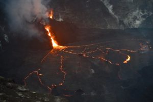
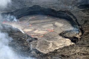
Photo : Protección Civil Jalisco .
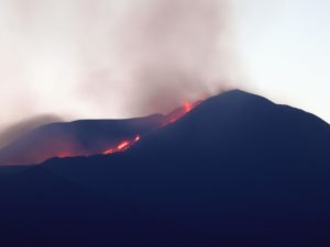
Mexico , Popocatepetl :
September 27, 11:00 am (September 27, 16:00 GMT)
Thanks to the surveillance systems of the Popocatépetl volcano, 224 exhalations have been identified, accompanied by gas and light amounts of ash. In addition, six minor explosions were identified, recorded on 26/09 at 19:27, 22:00 and 22:32, and today (27/09) at 00:24, 13:22 and 16:00, as well as a moderate explosion at 00:00: 15:00 .
In addition, 486 minutes of tremor of low to medium amplitude were recorded. At times, these tremor segments were accompanied by emissions of gas and ash.
At the time of writing, emissions of water vapor, gas and light amounts of ash are dispersed to the southwest.
CENAPRED urges NOT to approach the volcano and in particular the crater, because of the risk of falling ballistic fragments, and in case of heavy rains to stay away from the bottom of the ravines due to the risk of mudslides and debris.
Updated September 27th at 3:00 pm (September 27th at 8:00 pm GMT).
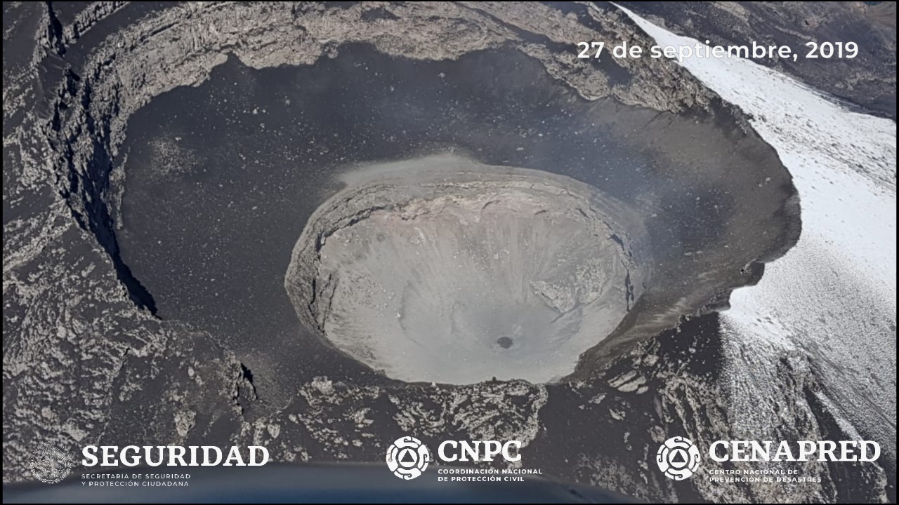
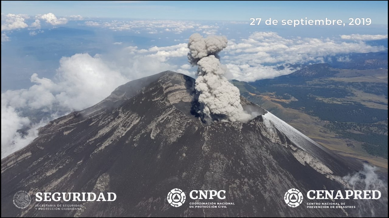
On 27 September, with the support of the National Guard, an overflight of the crater of the Popocatépetl volcano was carried out. During this overview, specialists from the National Center for Disaster Reduction (CENAPRED) of the National Coordination of Civil Protection and researchers of the Institute of Geophysics of UNAM observed in detail the general conditions of the crater and the presence of a dome 30 m in diameter. Similarly, thermal images and photographs were obtained with which it was possible to determine that the internal crater retains its same dimensions (350 m in diameter and 150 m in depth).
The warning light of Popocatépetl is in YELLOW PHASE 2.
Source : Cenapred .
Photos : Cenapred.
Indonesia , Anak Krakatau :
Level of activity level II (Waspada), since March 25, 2019. The Anak Krakatau (157 m altitude) has experienced an increase in its volcanic activity since June 18, 2018 which was followed by a series eruptions from September 2018 to February 2019. Since August 2019, eruptions have taken place but of less intensity. Since yesterday until this morning, the CCTV has observed gray-white smoke at a height of about 200 m above the crater.
The seismograph of September 27, 2019, recorded:
2 earthquakes of eruption
1 explosion earthquake.
1 shallow volcanic earthquake
Tremor continuous with an amplitude of 1 – 10 mm, dominant value of 1 mm
Recommendation: People / tourists are not allowed to approach the crater within 2 km of the crater.
VOLCANO OBSERVATORY NOTICE FOR AVIATION – VONA.
Issued: September 27 , 2019
Volcano: Anak Krakatau (262000)
Current Aviation Colour Code: ORANGE
Previous Aviation Colour Code: orange
Source: Anak Krakatau Volcano Observatory
Notice Number: 2019KRA167
Volcano Location: S 06 deg 06 min 07 sec E 105 deg 25 min 23 sec
Area: Lampung, Indonesia
Summit Elevation: 502 FT (157 M)
Volcanic Activity Summary:
recorded eruption at 08:20 UTC (15:20 local)
Volcanic Cloud Height: Ash-cloud is not visible
Other Volcanic Cloud Information:
visually from cctv crater seen volcanic ash moving to north, volcanic ash white-gray thick 200 meters high from the bottom of the crater.
Remarks:
Eruption recorded on seismogram with maximum amplitude 1 mm and duration 20 second.
Sources : PVMBG, Magma Indonésie .
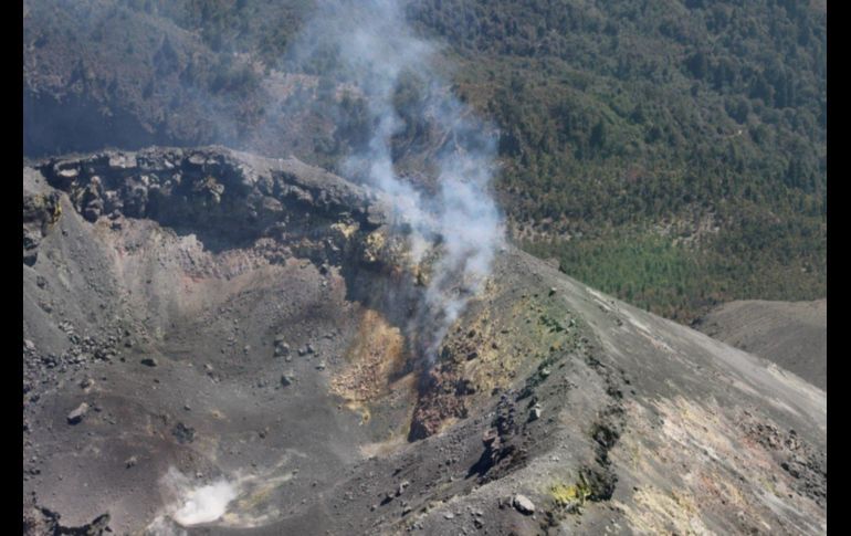
Photo : James reynolds via wulkanyswiata.blogspot.com
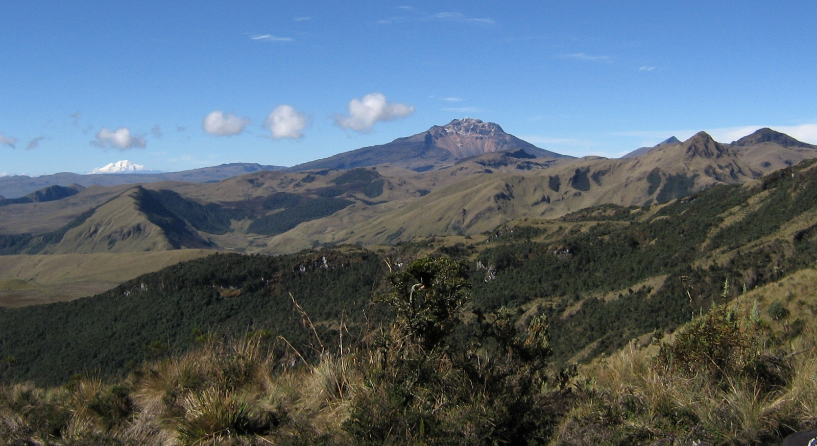
Colombia , Chiles / Cerro Negro :
Special information on volcanoes Chiles / Cerro Negro N ° 2 – 2019
Summary:
On September 27, there was a 4.2 MW earthquake in the Cerro Negro volcano area. As a result of this event, more than 170 earthquakes were detected in this region, which, by their location, were classified as seismic events related to pressures within the volcanic complex. The earthquakes are located on the southwest flank of Cerro Negro volcano at depths less than 7 km below sea level and with a magnitude of 0.8 to 4.0 MLv.
Seismicity:
On Friday, September 27 at 8:44 (TL), a 4.2 MW earthquake occurred in the Cerro Negro volcano region (Figure 1). The quake had a depth of 4.3 km below sea level (kbnm) and was slightly felt in the surrounding cities.
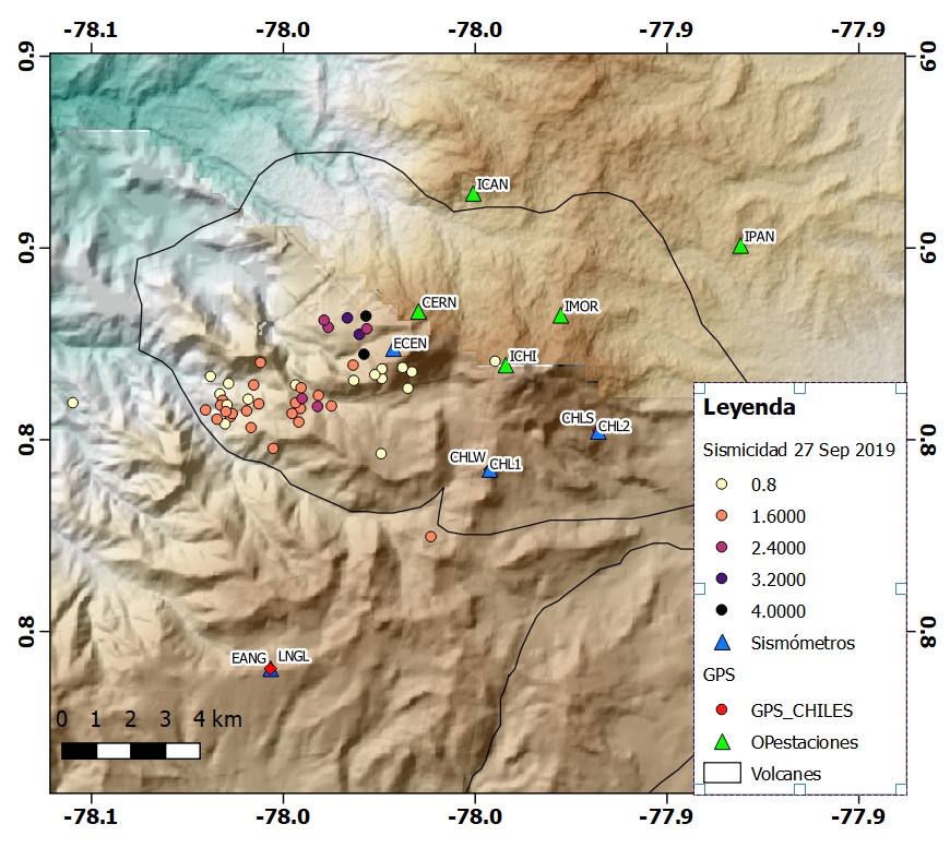
Figure 1. Epicentral location map of the September 27 earthquakes in the Cerro Negro volcano.
Following this event, the National Seismograph Network (RENSIG) of the Institute of Geophysics of the National Polytechnic School (IG-EPN) and the Seismic Monitoring Network of the Pasto-Colombia Volcano Observatory (OVP) recorded several dozens of earthquakes. In the Ecuadorian station CHL1, more than 170 events were clearly counted (Figure 2).
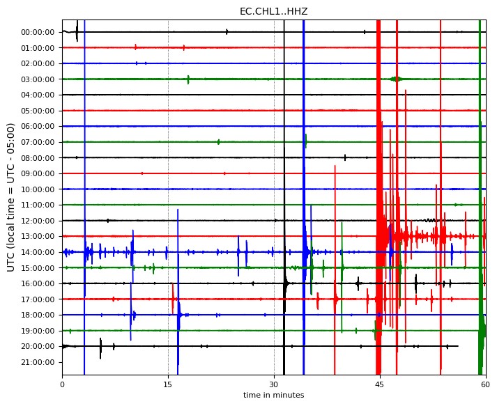
Figure 2. Seismogram of station CHL1 (Chiles 1) corresponding to December 27, 2019 where the increase in seismicity can be observed after 8:44 (TL).
All events were classified as fracturing events triggered by pressures within the Chiles-Cerro Negro volcanic complex. Figure 3 shows the 08:44 (TL) seismic traces at the CHL1, CHL2 and CHMA stations, as well as a trace spectrum of the nearest station (CHL1).
Out of more than 170 events, 51 earthquakes were located, concentrating on the southwest flank of the Cerro Negro volcano (Figure 1), with magnitudes between 0.8 and 4.0 MLv (local magnitude). The events are shallow to a depth of 7 km.
The IG-EPN and the OVP will continue to monitor the activity of the volcano and will promptly report any changes in its behavior.
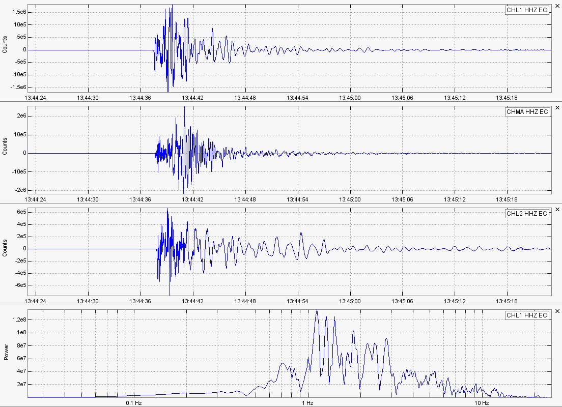
Figure 3. Seismic signals from the 8, 44 (local time) event of September 27 in the Cerro Negro volcano at the CHL1, CHL2 and CHMA stations. In the lower part, the logarithmic scale of the nearest station (CHL1) signal is presented, where it is observed that the amplitudes are concentrated in the frequency range of 1 to 3 Hz.
Source : AC, DP, MM, MR , Institut de géophysique / Ecole Polytechnique Nationale.
Read the article : https://www.igepn.edu.ec/servicios/noticias/1760-informe-especial-del-volcan-chiles-cerro-negro-n-2-2019