Mars 11 , 2019.
La Réunion , Piton de la Fournaise :
Activity Bulletin from Sunday, March 10, 2019 to 19:30 (local time).
Following the stop the surface eruptive activity at the Piton de la Fournaise this day at 6:28 local time, a seismicity is still recorded under the summit area of the volcano. Thus 26 superficial superficial earthquakes and 1 deep earthquake have been recorded since the end of the eruption on March 10 at 6:28 am local time and 19:30 local time. Because of this seismicity, no hypothesis is discarded as to the evolution of the future situation (final shutdown, resumption of activity on the same site, resumption of activity on another site).
Back on the end of the eruption:
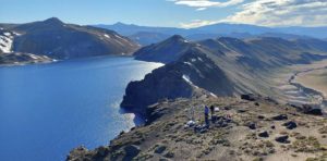
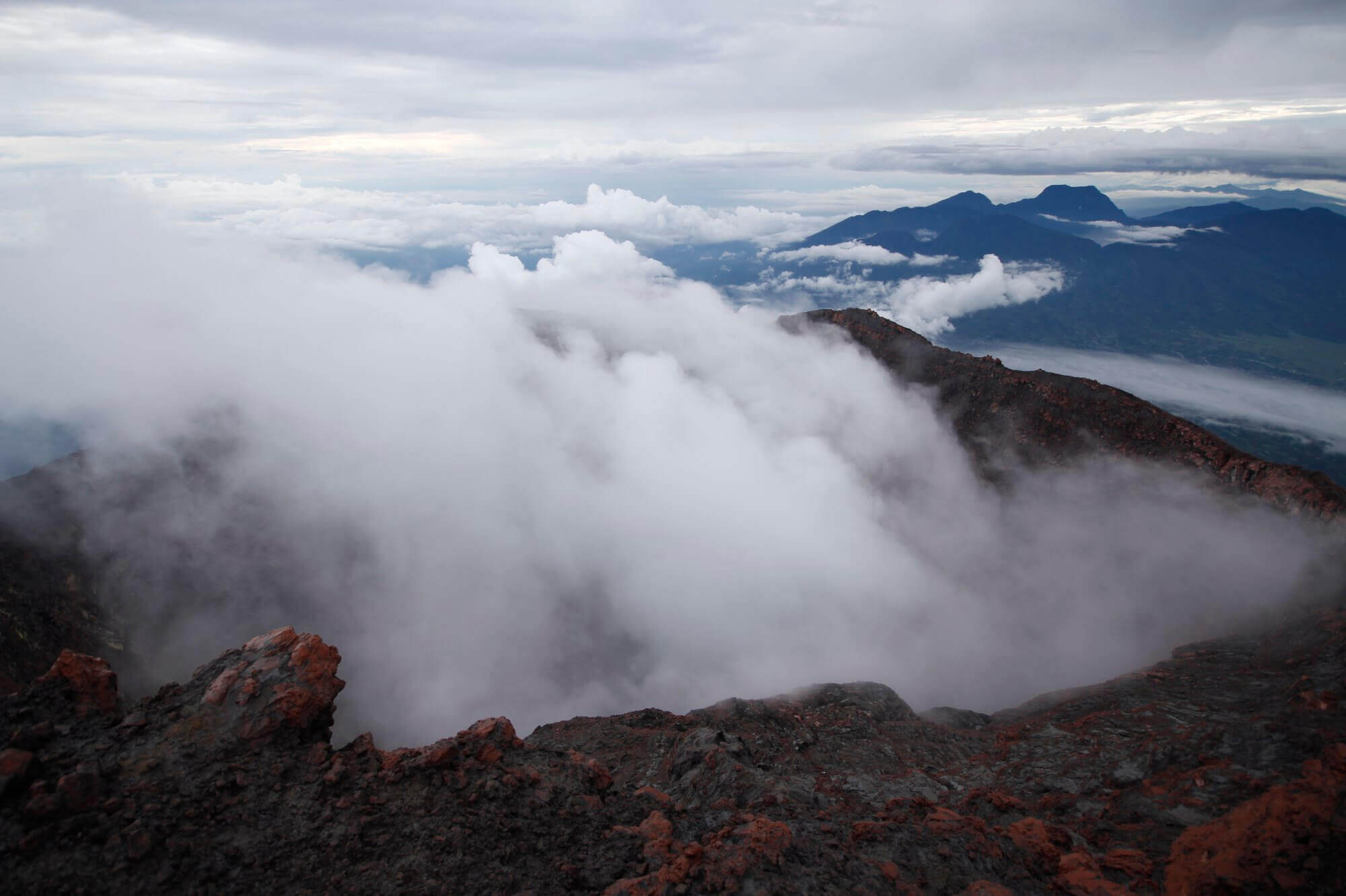
The abrupt cessation of this eruption was preceded by a very intense surface activity and lava fountains a hundred meters high were postponed to 23h on March 9 (Figure 1). These brutal stops are not unusual at Piton de la Fournaise and generally occur for 50% of eruptions.
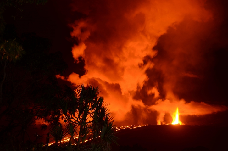
Figure 1: Shooting of the eruptive site on 09 March 2019 around midnight from the RN2. (© A. Finizola LGSR / IPGP.)
The lava volumes emitted on the surface between February 18 and March 10 could be estimated at about 14.5 (+ or – 5) Mm3 from the satellite data, via the HOTVOLC platform (OPGC – University of Auvergne) and MIROVA (University of Turin).
Alert level: Backup.
Source : OVPF
Photo : A. Finizola LGSR/IPGP.
Indonesia , Kerinci :
VOLCANO OBSERVATORY NOTICE FOR AVIATION – VONA.
Issued: March 11 , 2019
Volcano: Kerinci (261170)
Current Aviation Colour Code: YELLOW
Previous Aviation Colour Code: yellow
Source: Kerinci Volcano Observatory
Notice Number: 2019KER05
Volcano Location: S 01 deg 41 min 49 sec E 101 deg 15 min 50 sec
Area: Jambi, West Sumatra, Indonesia
Summit Elevation: 12176 FT (3805 M)
Volcanic Activity Summary:
On March 10, 2019 observed brown ash emission at 09h07 UTC (16h07 local)
Volcanic Cloud Height:
Best estimate of ash-cloud top is around 13136 FT (4105 M) above sea level, may be higher than what can be observed clearly. Source of height data: ground observer.
Other Volcanic Cloud Information:
Ash emission moving to Northeast
Remarks:
Seismic activity is dominated by continuous volcanic tremor.
Volcanic Activity Summary :
On March 11, 2019 observed brown ash emission at 02h19 UTC (09h19 local time)
Volcanic Cloud Height:
Best estimate of ash-cloud top is around 13776 FT (4305 M) above sea level, may be higher than what can be observed clearly. Source of height data: ground observer.
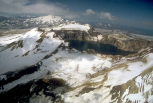
Gunung Kerinci in central Sumatra forms Indonesia’s highest volcano and is one of the most active in Sumatra. It is capped by an unvegetated young summit cone that was constructed NE of an older crater remnant. There is a deep 600-m-wide summit crater often partially filled by a small crater lake that lies on the NE crater floor, opposite the SW-rim summit. The massive 13 x 25 km wide volcano towers 2400-3300 m above surrounding plains and is elongated in a N-S direction. Frequently active, Kerinci has been the source of numerous moderate explosive eruptions since its first recorded eruption in 1838.
Source : Magma Indonésie. GVP.
Photo : Wild Sumatra.
Kamchatka , Sheveluch :
VOLCANO OBSERVATORY NOTICE FOR AVIATION (VONA).
Issued: March 11 , 2019
Volcano:Sheveluch (CAVW #300270)
Current aviation colour code:ORANGE
Previous aviation colour code:orange
Source:KVERT
Notice Number:2019-58
Volcano Location:N 56 deg 38 min E 161 deg 18 min
Area:Kamchatka, Russia
Summit Elevation:10768.24 ft (3283 m), the dome elevation ~8200 ft (2500 m)
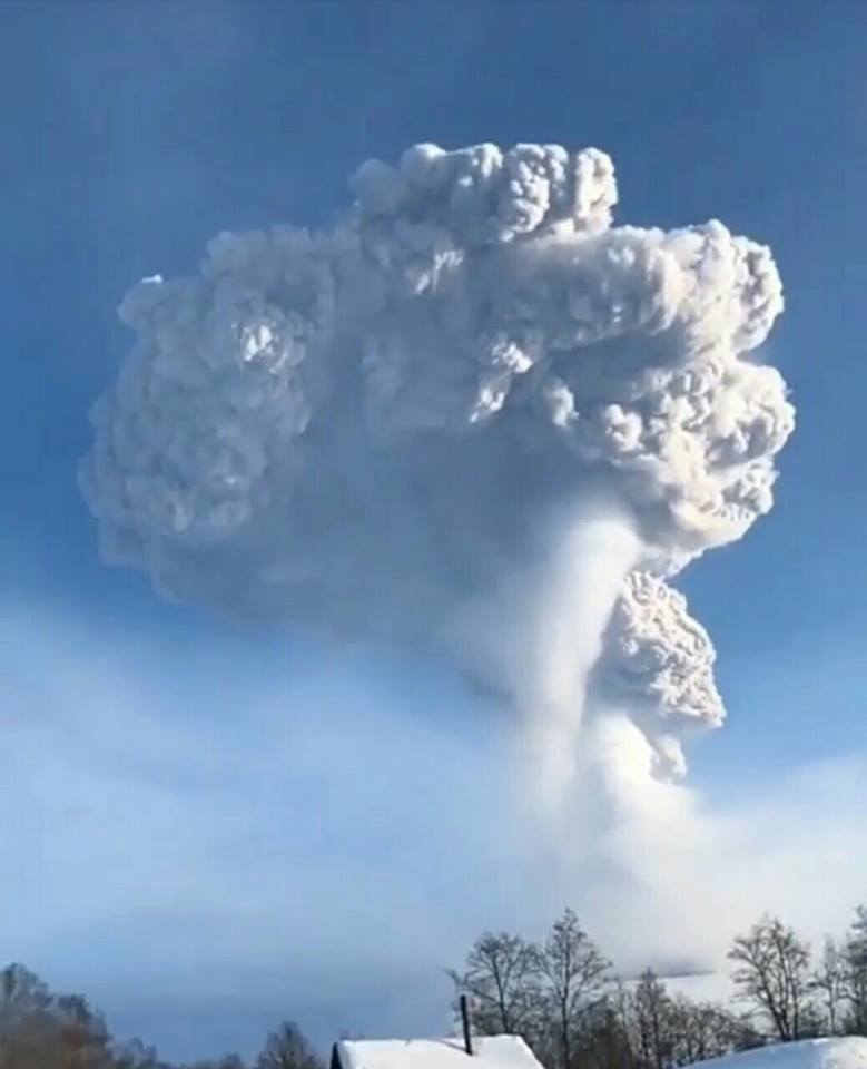
Volcanic Activity Summary:
A growth of the lava dome continues (a viscous lava blocks extrude out on the northern part of it), a strong fumarolic activity and an incandescence of the dome blocks and hot avalanches accompanies this process. According to video and satellite data, an ash plume on the height 4.5-4.7 km a.s.l. continues to drift to the south-east from the volcano.
Explosive-extrusive eruption of the volcano continues. Ash explosions up to 32,800-49,200 ft (10-15 km) a.s.l. could occur at any time. Ongoing activity could affect international and low-flying aircraft.
Volcanic cloud height:
14760-15416 ft (4500-4700 m) AMSL Time and method of ash plume/cloud height determination: 20190311/0010Z – Video data
Other volcanic cloud information:
Distance of ash plume/cloud of the volcano: 43 mi (70 km)
Direction of drift of ash plume/cloud of the volcano: ESE / azimuth 112 deg
Time and method of ash plume/cloud determination: 20190310/2340Z – Himawari-8
Source : Kvert
Photo : Камчатка Сегодня
Guatemala , Fuego :
Type of activity: Vulcanian
Morphology: Composite Stratovolcano
Geographical location: 14 ° 28’54˝ Latitude N; 90 ° 52’54˝ Longitude O.
Height: 3,763msnm.
Weather conditions: Clear weather
Wind: Northeast
Precipitation: 0.0 mm.
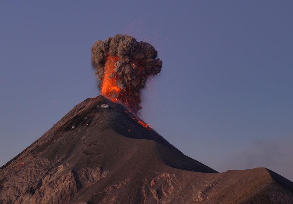
Activity:
Presence of gray degassing with a height of approximately 4200 m (13780 feet). 8 to 12 low to moderate explosions per hour are generated by ejecting columns of gray ash at an approximate height of between 4400 and 4700 m (14436 to 15420 ft) and dispersing in a westerly and northwesterly direction for a distance of about 15 kilometers. There are degassing sounds with a delay of 3 minutes, as well as sensitive shock waves in nearby houses. At night and early in the morning, a constant incandescent source was observed at an approximate height of between 250 and 300 meters. Moderate to strong avalanches on the crater outline fall to Barrancas Seca, Taniluya, Ceniza, Trinidad, Las Lajas and Honda. Ash falls in communities south of the cone are reported, such as Panimache I and II, Morelia, Santa Sofia, Finca Palo Verde, Sangre de Cristo, San Pedro Yepocapa and others located in this direction.
Source : Insivumeh.
Photo : Martin Rietze.
Mexico , Popocatepetl :
March 10, 11:00 am (March 10, 17:00 GMT).
In the last 24 hours, thanks to the monitoring systems of the Popocatépetl volcano, 105 low intensity exhalations have been identified, accompanied by a continuous emission of water vapor, gas and light amounts of ash. In addition, an explosion was recorded yesterday at 23:16, which projected incandescent fragments on the slopes of the volcano up to 1200 m and produced a column of ash with an initial height of 1500 m above the crater. The ash column moved to the northeast. At present, no ash drop has been reported. In addition, a volcano-tectonic earthquake was recorded yesterday at 16:16, with a preliminary magnitude of M 2.1, as well as 94 minutes of low-amplitude tremor and a harmonic tremor episode of moderate amplitude, between 20:03 and 9:02.
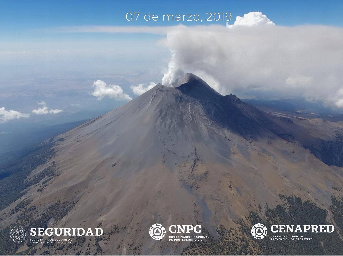
During the morning, a continuous emission of water vapor and gas was observed, towards North-West.
CENAPRED urges NOT to APPROACH the volcano and especially the crater, because of the risk of falling ballistic fragments, and in case of heavy rains, to move away from the bottom of the ravines because of the risk of mudslide and debris.
The warning light of Popocatepetl is located in PHASE 2 YELLOW.
Source : Cenapred.