January 29 , 2019.
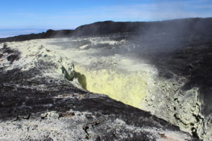
Chile , Copahue :
Special Report on Volcanic Activity (REAV), Bio-Bio Region, Copahue Volcano, 29 January 2019, 01:50 local time (mainland Chile).
The National Geological and Mining Service of Chile (Sernageomin) publishes the following PRELIMINARY information, obtained through monitoring equipment of the National Volcanic Monitoring Network (NVRN), processed and analyzed at the Volcanological Observatory of the Southern Andes (OVDAS) :
Today, Tuesday, January 29, 2019, at 01:02 local time, the monitoring stations installed near the Copahue volcano recorded an earthquake associated with a process of fracturing rocks (Volcano-tectonic type).
The characteristics of the event, after its analysis, are as follows:
TIME OF ORIGIN: 01h02 Local time (04h02 UTC)
LATITUDE: -37.49.24 ° S
LONGITUDE: -71.02.98 ° W
DEPTH: 1,98 KM
LOCAL MAGNITUDE: 3.2 (ML)
OBSERVATIONS:
At the time of issuing this report, 7 replicas of lower magnitudes were recorded. The event was reported as felt by the community of Caviahue, Argentina.
Volcanic Technical Alert Level Remains at Yellow Level
Sernageomin continues online monitoring and will inform in a timely manner about any changes observed.
Source : Sernageomin.
Photo : Auteur inconnu.
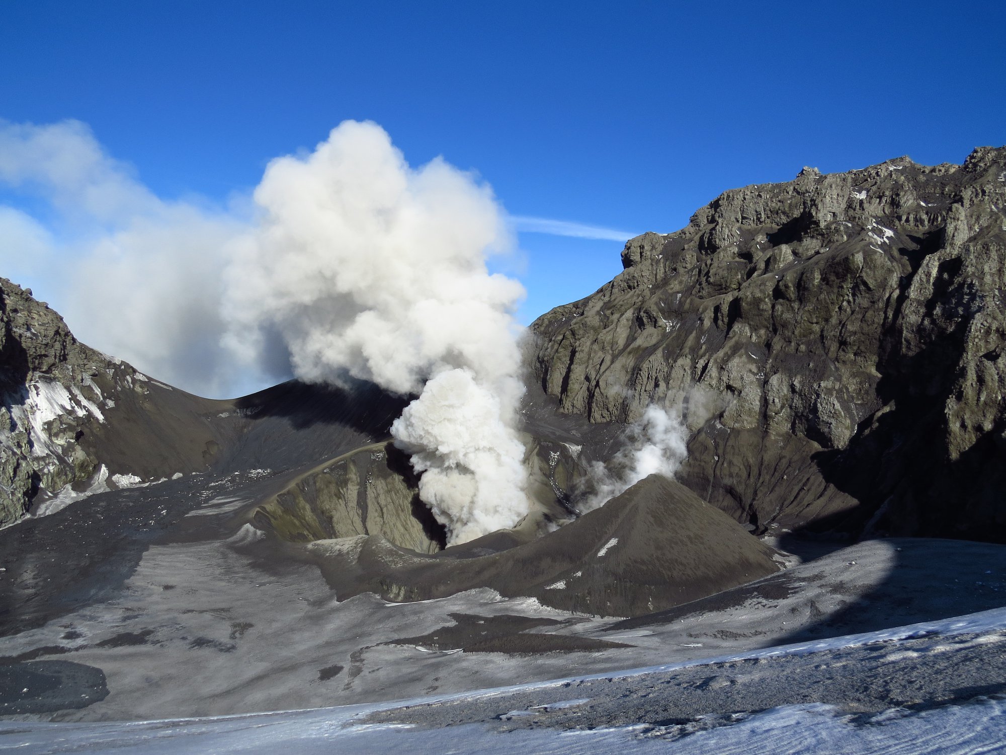
Peru , Sabancaya / Ubinas :
An average of 23 explosions a day was recorded. The activity associated with fluid movements (long-period types) continues to predominate. The earthquakes associated with the rise of the magma (hybrid types) remain very few and not very energetic.
The columns of gas and eruptive ash reached a maximum height of 3,000 m above the crater, with limited visibility. The dispersion of these materials occurred within a radius of about 30 km, mainly to the South and Southwest sectors.
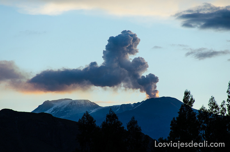 The volcanic gas (SO2) flow recorded on January 24 a maximum value of 3300 tons / day, a value considered important.
The deformation of the surface of the volcanic building does not present any significant changes.
The MIROVA satellite system recorded 4 thermal anomalies, with values between 1 and 3 MW VRP (Rayed Volcano Energy).
In general, eruptive activity maintains moderate levels. No significant changes are expected in the coming days.
The Geophysical Institute of Peru (IGP) recorded on January 24, through the geophysical monitoring network installed on the volcano Ubinas, the presence of a lahar (volcanic huaico) on the southern flank of this volcano, caused by rainfall intense recorded in the Moqueguana mountain range.
From what was observed, the lahar began its descent at 15:00 and continued until 15:53. Immediately, IGP professionals warned the municipality of Ubinas of the occurrence of this event, the same that was corroborated by Mr. Adán Castro, Assistant Civil Defense of this district, who indicated that fluids were falling in the Volcanmayo Gorge. , Chiflón and Antapi, resulting in the interruption of access roads to Ubinas district.
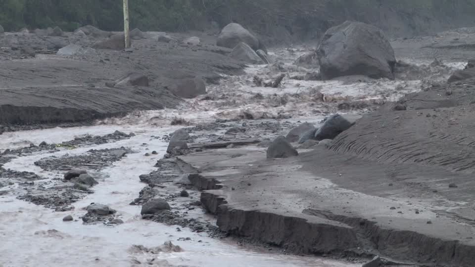
PGI researcher engineer Jose Del Carpio explains that the lahars do not necessarily occur when the volcano erupts, as demonstrated by the event recorded yesterday on Ubinas. « This volcano completed its last eruption in January 2017. The IGP’s permanent monitoring network on this massif can record the particular signals associated with the descent of fluids.We are able to warn the authorities as soon as a lahar begins to go down, « he said.
The Geophysical Institute of Peru, responsible for the seismic and volcanic monitoring in the country, recommends to the authorities of the region of Moquegua and to the population of the valley of Ubinas to remain vigilant vis-a-vis the future appearance of new lahars, this in the context of the current rainy season.
Source : IGP
Photos : Losviajesdeali.com , Igp
Indonesia , Dukono :
VOLCANO OBSERVATORY NOTICE FOR AVIATION – VONA.
Issued: January 28 2019
Volcano: Dukono (268010)
Current Aviation Colour Code: ORANGE
Previous Aviation Colour Code: orange
Source: Dukono Volcano Observatory
Notice Number: 2019DUK05
Volcano Location: N 01 deg 41 min 35 sec E 127 deg 53 min 38 sec
Area: North Maluku, Indonesia
Summit Elevation: 3933 FT (1229 M)
Volcanic Activity Summary:
Eruption with volcanic ash cloud at 09h24 UTC (18h24 local).
Volcanic Cloud Height:
Best estimate of ash-cloud top is around 4893 FT (1529 M) above sea level, may be higher than what can be observed clearly. Source of height data: ground observer.
Other Volcanic Cloud Information:
Ash cloud moving to Southeast.
Remarks:
Eruption and ash emission is continuing.
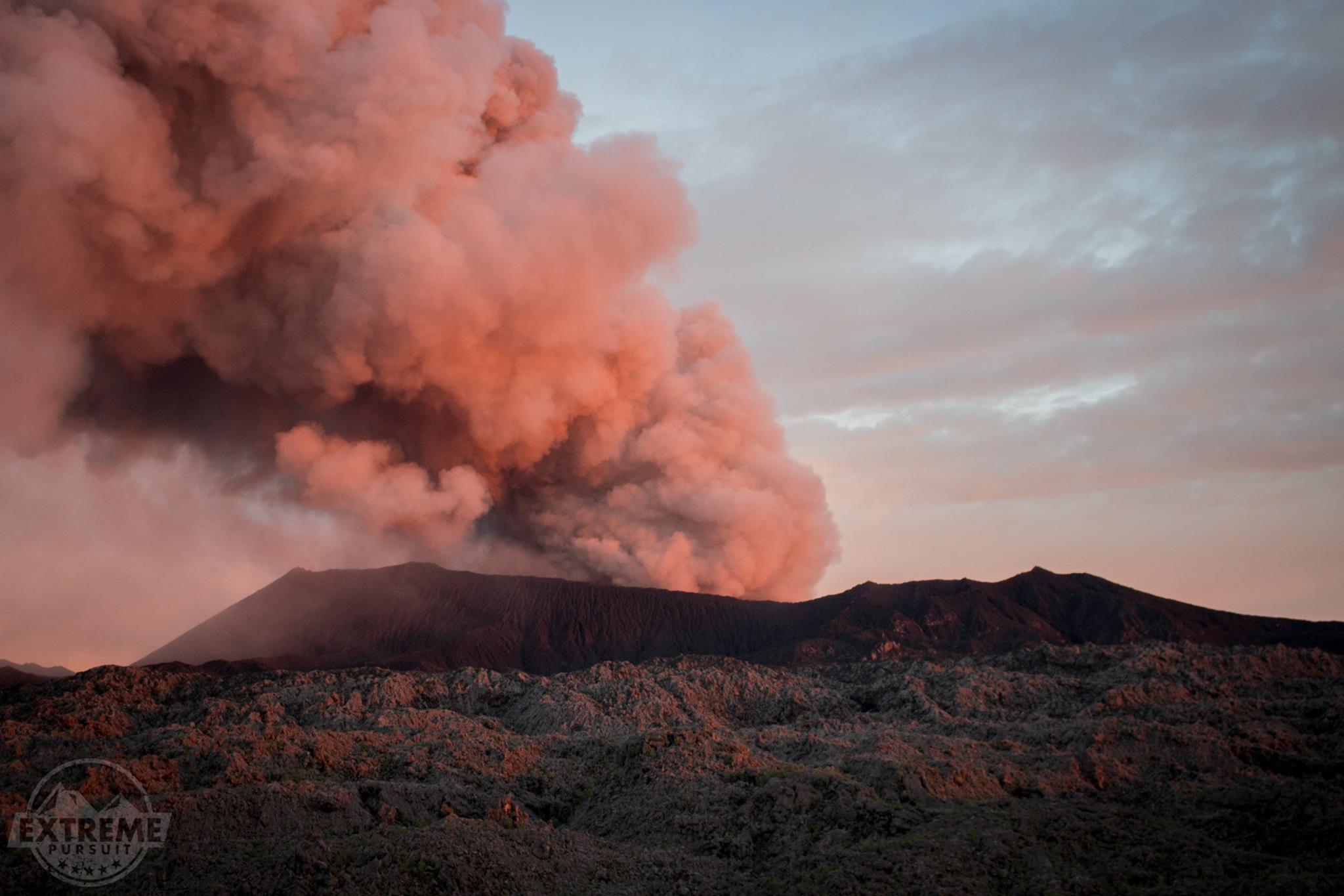
Level II Activity Level (WASPADA). The Dukono volcano (1229 m above sea level) has continuous eruptions.
Since yesterday and until this morning, the volcanic peak was clearly visible until it was covered with fog. The smoke from the main crater is white to gray and is 300 meters above the summit. The wind is blowing weakly to moderate to the east.
By the seismograph records dated January 28, 2019, it was noted:
1 volcanic earthquake
2 distant tectonic earthquakes
Tremor continuous amplitude 0.5 to 2 mm, dominant value: 0.5 mm
Recommendation:
People around G. Dukono and visitors / tourists should not climb and approach the crater of Malupang Warirang within a radius of 2 km.
Source : Magma Indonésia. PVMBG.
Photo : Extreme Pursuit.
Mexico , Popocatepetl :
January 27th at 11:00 am (January 27th at 17:00 GMT)
In the last 24 hours, thanks to the surveillance systems of the Popocatépetl volcano, 61 exhalations have been identified with emission of water vapor, gas and low ash content. In all cases, columns of 200 to 500 m high, low ash, were produced and were dispersed mainly to the east.
During the night, there was a continuous emission of water vapor and other gases.
In addition, 29 minutes of harmonic tremor of low amplitude were recorded.
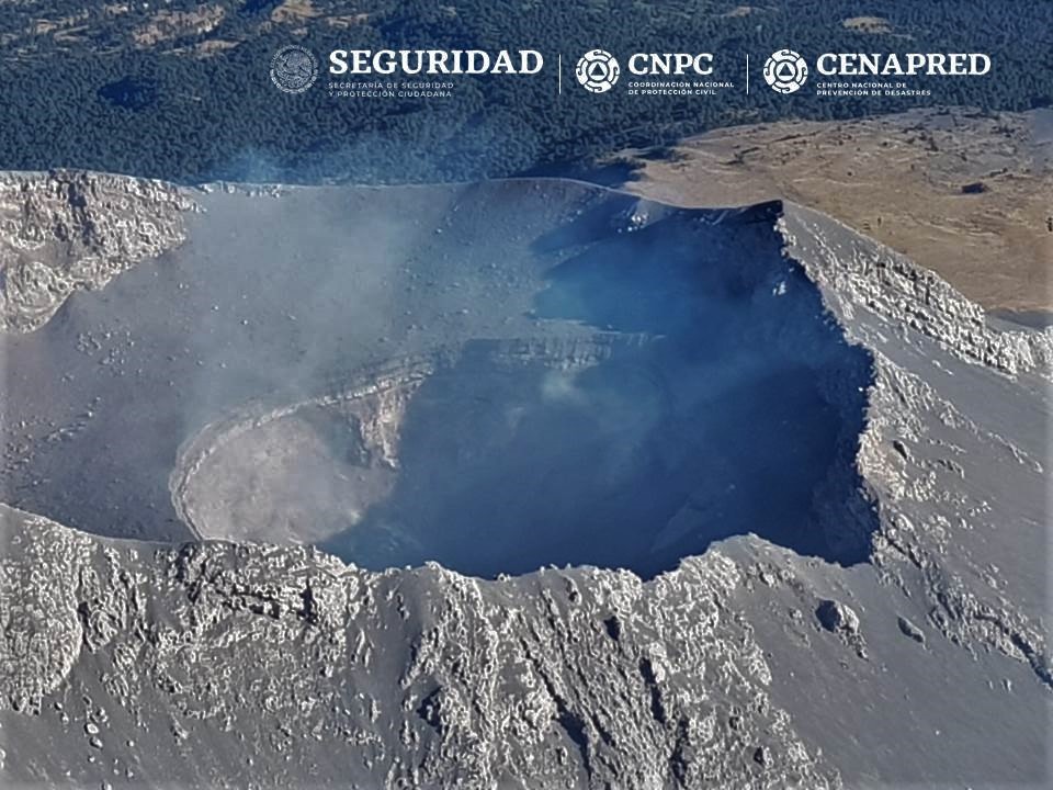
Today in the morning and until the writing of this report, the crater of the volcano is visible, a low emission of volcanic gas scattered to the east is observed.
With the support of the federal police, an overflight took place in the vicinity of the Popocatépetl volcano. It has been observed that the internal crater extends with the same dimensions of 300 m in diameter and about 150 m in depth. There is no visible dome.
CENAPRED urges NOT to APPROACH the volcano and especially the crater, because of the risk of falling ballistic fragments, and in case of heavy rains, to move away from the bottom of the ravines because of the risk of landslides and mudslides.
The Popocatepetl warning light is located at Amarillo Phase 2.
Source : Cenapred.