October 03 , 2018.
Indonesia , Soputan :
VOLCANO OBSERVATORY NOTICE FOR AVIATION – VONA.
Issued: October 03 , 2018.
Volcano: Soputan (266030)
Current Aviation Colour Code: RED
Previous Aviation Colour Code: orange
Source: Soputan Volcano Observatory
Notice Number: 2018SOP05
Volcano Location: N 01 deg 06 min 52 sec E 124 deg 44 min 13 sec
Area: North Sulawesi, Indonesia
Summit Elevation: 5789 FT (1809 M)
Volcanic Activity Summary:
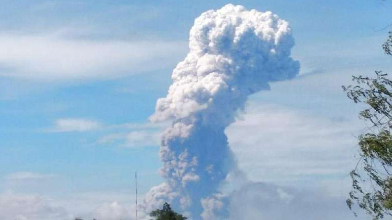
Eruption with volcanic ash cloud at 03h52 UTC (11h52 local). Eruption and ash emission is continuing.
Volcanic Cloud Height:
Best estimate of ash-cloud top is around 21789 FT (6809 M) above sea level, may be higher than what can be observed clearly. Source of height data: ground observer.
Other Volcanic Cloud Information:
Ash-cloud moving to northwest.
Remarks:
Seismic activity is characterized by continuous volcanic tremor.
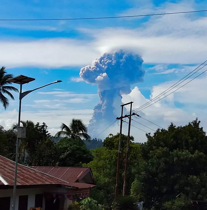
The eruption of G. Soputan, North Sulawesi, on October 3, 2018 at 08h47 had an ash column height observed at ± 4,000 m above the summit (± 1,809 m above sea level) . The column of ash observed is gray to brown with a high intensity and is inclined to the west and north-west. This eruption is recorded on seismograms with a maximum amplitude of 39 mm and a duration of ± 6 minutes.
Currently, G. Soputan is at Level III (SIAGA) status with recommendations:
Communities should not be active in all areas within a radius of 4 km around the top of G. Soputan and within a sectoral expansion zone in the direction of West-South-West up to 6.5 km from the summit , which constitutes a crater opening zone, this to avoid the potential threat of lava and hot clouds.
Communities around G. Soputan are advised to prepare masks covering the nose and mouth to anticipate the potential danger of breathing problems in the event of ash rain.
Communities need to be aware of the potential threat of lahars that may occur after an eruption, especially when the materials carried by the waves are washed away by rivers, especially those along the sides of G. Soputan, such as the rivers Ranowangko, Lawian, Popang and Londola Kelewahu.
Source : Magma indonesia , PVMBG .
Photos : news CGTN , P. A. Capt .
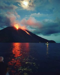
La Réunion , Piton de la Fournaise :
Activity Bulletin from Tuesday, October 2, 2018 at 16:00 (local time).
The eruption started on September 15th at 4:25 am local time continues. The intensity of the volcanic tremor (indicator of surface eruptive intensity) has remained relatively stable over the last 24 hours (Figure 1).
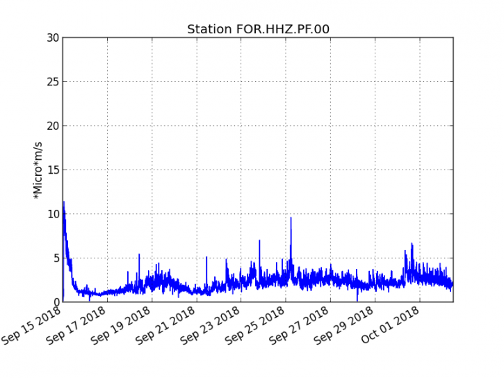
Figure 1: Evolution of the RSAM (indicator of the volcanic tremor and the intensity of the eruption) between 04h00 (00h UTC) on September 15th and 15h00 (11h00 UTC) on October 2nd on the FOR seismic station, located near the crater Chateau Fort (2000 m altitude on the southeast flank of the terminal cone).
– A deep volcano-tectonic earthquake was recorded during the day of 1 October, while no volcano-tectonic earthquake has been recorded during the day
current.
– The resumption of inflation (swelling) of the building, witnessing the influence of a source of pressure at the foot of the volcano, is confirmed.
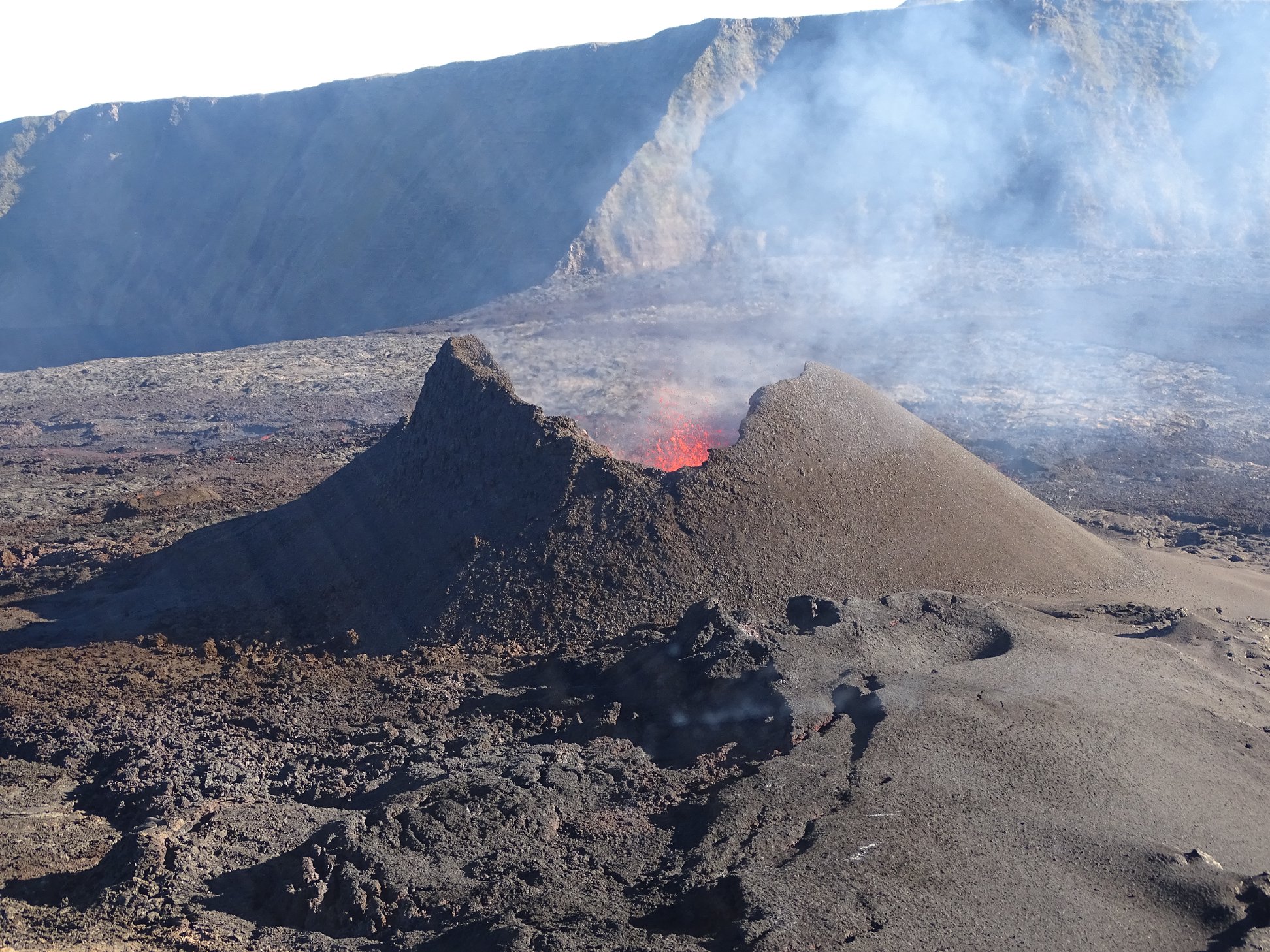
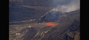
– The surface flows estimated from the satellite data, via the HOTVOLC platform (OPGC – Clermont Auvergne University) ranged from <1 to 4 m3 / s over the last 24 hours. Note that the eruptive activity now taking place mainly in lava tunnels, detections of abnormal hot spots are increasingly difficult and therefore these values of underrated flow rates.
Source : OVPF.
Photo : OVPF affiche.
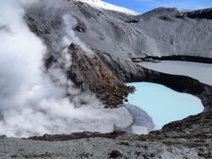
Colombia , Chiles / Cerro Negro :
Weekly activity bulletin of volcanoes Chiles and Cerro Negro.
The activity level of the volcanoes is maintained at the level: YELLOW LEVEL ■ (III): CHANGES IN THE BEHAVIOR OF THE VOLCANIC ACTIVITY
Following the activity of the CHILE volcanoes and CERRO NEGRO, the COLOMBIAN GEOLOGICAL SERVICE (SGC) reports that:
For the period evaluated, between September 25 and October 1, 2018, and compared to previous periods, seismicity in the Chiles – Cerro Negro volcano region showed a remarkable increase from 1745 to 3000 events. The majority of earthquakes continue to be located south-southwest of the Chiles volcano at distances up to 5 km and at depths less than 7 km from the summit of Chiles volcano (4,700 m).
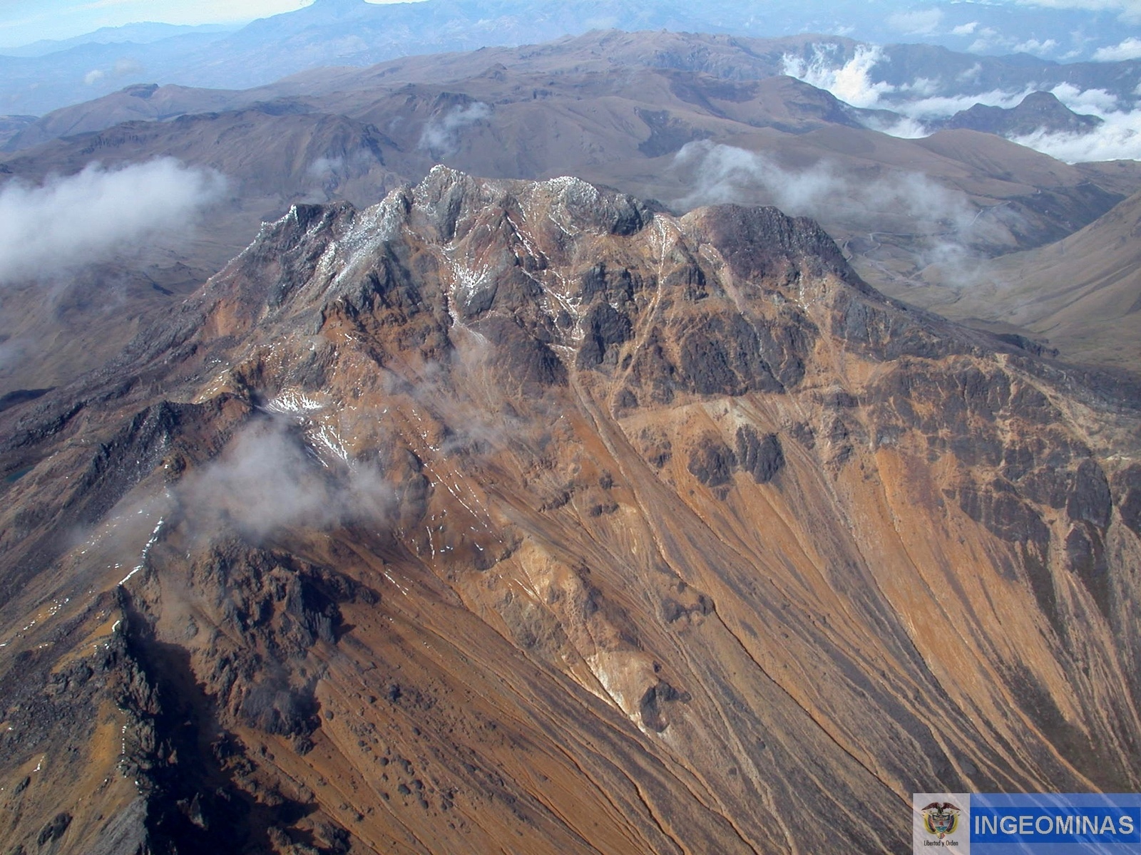
Other earthquakes occurred southeast of the volcano, at a maximum distance of 16 km and at a depth of less than 10 km. The magnitude values were less than 2.2 degrees on the Richter scale and for this period, no event was reported as having been felt.
The Colombian Geological Service and the Institute of Geology of the National Polytechnic School of Ecuador closely monitor the evolution of this seismic activity and the volcanic phenomenon and inform in a timely manner about the detected changes.
Source : SGC
Photo : Ingeominas.
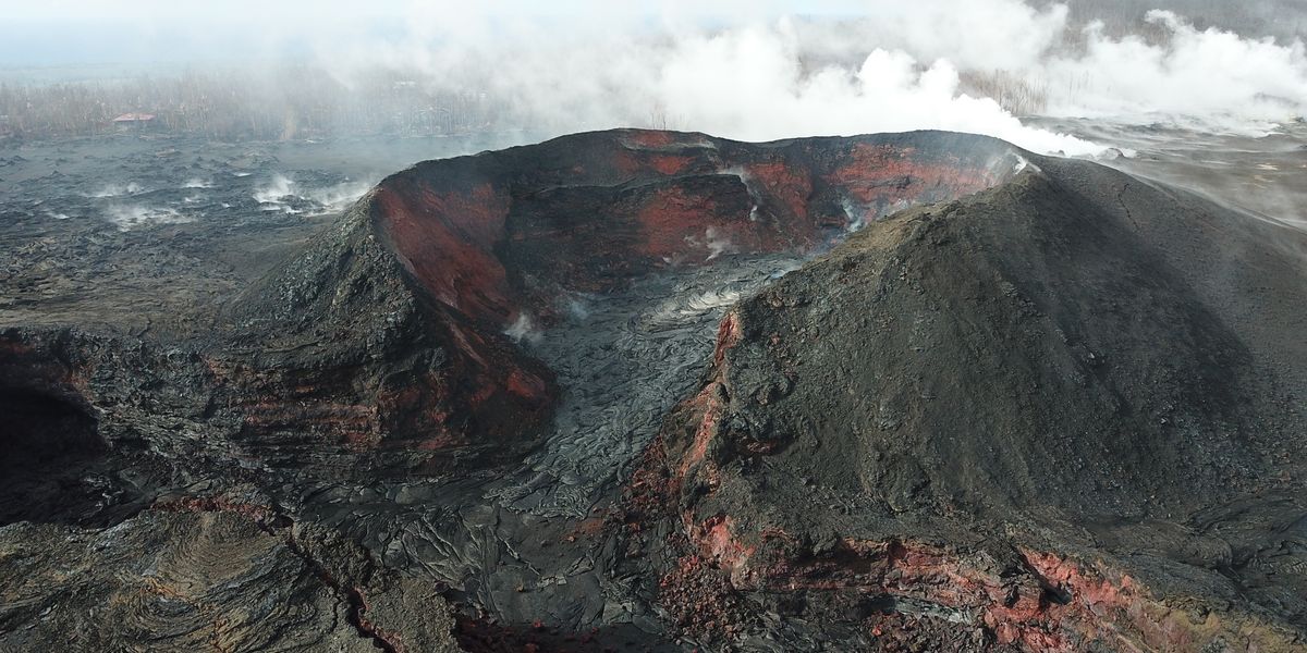
Hawaï , Kilauea :
19°25’16 » N 155°17’13 » W,
Summit Elevation 4091 ft (1247 m)
Current Volcano Alert Level: WATCH
Current Aviation Color Code: ORANGE
Kīlauea summit and East Rift Zone
On Kīlauea Volcano’s lower East Rift Zone (ERZ), no significant incandescence was visible overnight in the collapse pit within the fissure 8 cone. Minor fuming has been visible during the day. On the middle ERZ, a rockfall at Puʻu ʻŌʻō produced a small ash plume around noon yesterday, October 1.
Seismicity and ground deformation remain low at the summit of Kīlauea. Rates of tilting throughout both the summit and the ERZ are much lower than those observed during the recent period of major eruptive activity.
There have been no changes in seismicity during the past week. Small aftershocks from the magnitude-6.9 earthquake in early May are still being generated along faults located on the south flank of Kīlauea.
Sulfur dioxide (SO2) emission rates at the summit, Puʻu ʻŌʻō, and the lower ERZ are drastically reduced; the combined rate is well less than 300 tonnes/day, which is the lowest sustained rate since before 1983. SO2 emission rates from the summit were approximately 30 tonnes/day on September 26, and emission rates from Puʻu ʻŌʻō were approximately 70 tonnes/day on September 30. On the lower ERZ, SO2 emission rates were below the detection threshold of the measurement technique when last measured on September 28. Minor amounts of hydrogen sulfide (H2S) are being emitted at the summit, Puʻu ʻŌʻō, and the lower ERZ.
The Hawaiian Volcano Observatory (HVO) continues to closely monitor Kīlauea’s seismicity, deformation, and gas emissions for any sign of reactivation, and maintains visual surveillance of the summit and the East Rift Zone. HVO will continue to issue daily updates and additional messages as needed.
Source : HVO.
Photo : hawaiinewsnow