April 28 , 2018.
Piton de la Fournaise , La Réunion :
Update 17h30.
Activity Bulletin from Saturday, April 28, 2018 at 4:00 pm (local time)
The eruption started on April 27, 2018 at 23:50 local time continues. Nevertheless, the volcanic tremor (indicator of surface eruptive intensity) has been decreasing since the opening of eruptive fissures on the surface (Figure 1).

Figure 1: Evolution of RSAM (Indicator of Volcanic Tremor and Intensity of Eruption) between 20:00 (16:00 UTC) April 27 and 16:00 (12:00 UTC) April 28 at BOR Seismic Station (at the top) . (© OVPF / IPGP)
Surface flows estimated from satellite data, via the HOTVOLC platforms (OPGC – Clermont Ferrand) and MIROVA (University of Turin) were included at the beginning of eruption between 8 and 15 m3 / s. At 16h today, they were between 3 and 7 m3 / s.
– No significant deformation was recorded during the day on the cone terminal.
– a volcano-tectonic earthquake was recorded during the day under the Piton de la Fournaise building.
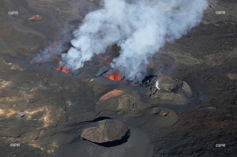
Overflights of the eruptive site realized this day thanks in particular to the help of the SAG and the PGHM made it possible to make a first cartography of the eruptive cracks and lava flows (Figure 2).
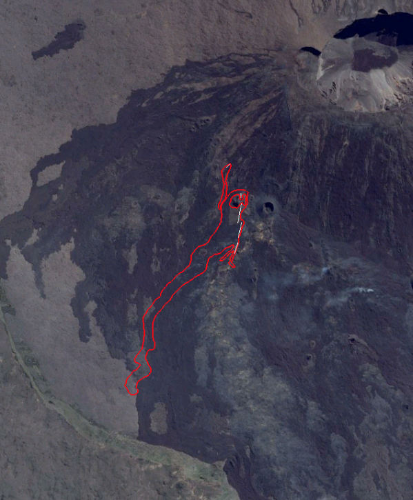
Figure 2: Approximate plot of eruptive fissures (in white) and lava flows (in red) on 28/04/2018, 9:00 local time, deduced from aerial images. (Background image: google earth, the fumaroles in the east are from an earlier flow). (© OVPF / IPGP)
The comparison between various aerial photographs and satellite images shows that the front of the casting has progressed little between 05h45 and 09h (local time), and remained 300 m from the rampart approximately.
Source : OVPF
Photo : Imazpress