December 5 , 2025.
Colombia , Puracé – Los Coconucos Volcanic Range :
Popayán, December 4, 2025, 8:45 a.m.
Regarding the monitoring of activity in the Los Coconucos volcanic chain, the Colombian Geological Survey (SGC), an agency under the Ministry of Mines and Energy, reports the following:
Since the publication of yesterday’s extraordinary bulletin and up to the date of this announcement, seismicity associated with fluid movements within the volcanic edifice has been recorded.
This seismicity, of the tremor (TR) and long-period (LP) type, is primarily located beneath the Puracé volcano crater and is linked to the sustained emission of gases into the atmosphere.
In addition, continuous tremor has also been recorded.
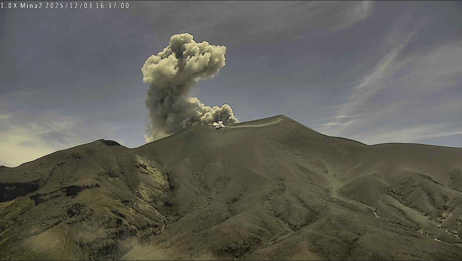
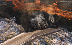
On several occasions, these signals were accompanied by ash emissions, with columns reaching heights of between 100 and 800 meters, their dispersal depending on wind variations. Among those that occurred yesterday, the one recorded at 3:14 p.m. was remarkable, reaching a height of nearly 800 meters above the summit of the volcano. In total, ten ash emissions were recorded at the Puracé crater, prompting alerts to the Civil Aviation Authority. Furthermore, the network of observers reported light ashfall yesterday in the towns of Cristales and Puracé, located north of the volcano; the village of Río Negro and the town of Paletará, to the southwest; the Agua Hirviendo hot springs, to the west; and San Juan, to the northeast.
Furthermore, yesterday’s favorable atmospheric conditions allowed for the acquisition of satellite images revealing a temperature increase inside the crater of the Purace volcano, likely linked to the heat released by gases emitted from the volcano’s interior to the surface.
Regarding geochemical parameters, satellite detection also recorded sulfur dioxide (SO₂) emissions that dispersed southeastward within a 200 km radius of the volcano, following the direction of the prevailing winds. The amount of SO₂ emitted remains consistent with previously observed values. As long as the orange alert remains in effect, temporary fluctuations in volcanic activity are possible. This means that activity may decrease temporarily compared to previous days or weeks, without necessarily indicating a return to a stable level of activity. For a return to more stable activity (yellow alert), a reasonable timeframe is necessary to assess all monitored parameters and identify trends that could indicate reliable stability.
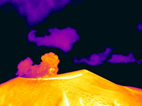
Recording from the Mina thermal camera, located 2.2 km north of the Puracé volcano. Gas and ash plume recorded at 3:14 PM on December 3, 2025, reaching a height of 800 m above the summit of the Puracé volcano.
Given the above, the Colombian Geological Survey (SGC) recommends staying away from the volcano’s crater and its surroundings, closely monitoring the situation through special bulletins and other information published on our official channels, and following the instructions of local and regional authorities and the National Unit for Disaster Risk Management (UNGRD). The volcanic activity level remains at orange alert: volcano exhibiting significant variations in monitored parameters.
Source et photo : SGC
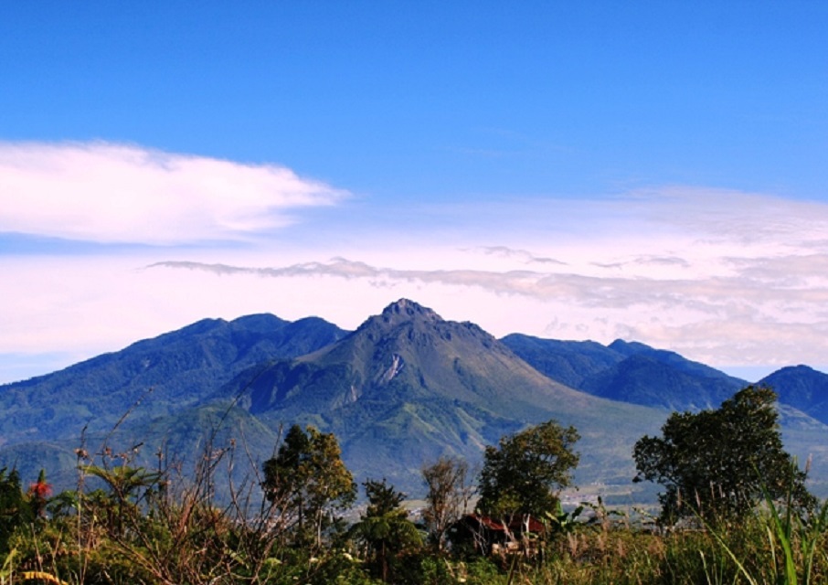
Indonesia , Bur Ni Telong :
SPECIAL REPORT ON THE EXTENSION OF THE SAFETY ZONE OF MOUNT BUR NI TELONG, ACEH, TO LEVEL II (WASPADA) ON DECEMBER 4, 2025
Bur Ni Telong Volcano is a stratovolcano reaching an altitude of 2,624 meters, located at coordinates 96°49’16” East longitude and 4°46’10” North latitude. It is administratively situated in the Bener Meriah Regency, Aceh Province.
From December 1 to 3, 2025, Mount Bur Ni Telong experienced an increase in deep volcanic seismic activity, with 87 recorded events and 19 local tectonic earthquakes. Visual observations showed that the volcano remained clearly visible until it became shrouded in fog. No smoke was observed at the crater. On December 4, 2025, between 00:00 and 13:17 (West Indonesia time), 39 shallow volcanic earthquakes, 1 deep volcanic earthquake and 2 local tectonic earthquakes were recorded.
An increase in seismic activity at Mount Bur Ni Telong was observed starting in July 2025. The most recent surge in seismicity occurred on November 25, 2025, with the recording of 28 deep volcanic earthquakes and 10 local tectonic earthquakes. The increase in seismic activity, whether local, deep, or shallow, observed in early December 2025, indicates an upwelling of magma or volcanic fluids toward the surface, accompanied by a significant buildup of pressure.

Based on visual and instrumental observations, the activity level of Mount Bur Ni Telong remains at Level II (waspada) as of 3:00 PM (West Indonesia Time) on December 4, 2025, with an extended safety margin. The public, visitors, and climbers are advised to avoid approaching the Bur Ni Telong crater within a 3 km radius and to stay away from fumarole and solfatara areas during cloudy or rainy weather due to potentially lethal gas concentrations.
The activity level of Mount Bur Ni Telong will be reassessed immediately in the event of significant visual or seismic changes.
Source et photos : PVMBG.
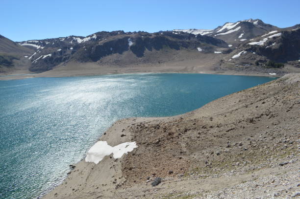
Chile , Laguna del Maule :
Special Volcanic Activity Report (REAV), Maule Region, Laguna del Maule Volcanic Complex, December 3, 2025, 5:10 a.m. local time (Continental Chile)
The Chilean National Geology and Mining Service (Sernageomin) announces the following PRELIMINARY information, obtained through the monitoring equipment of the National Volcanic Monitoring Network (RNVV), processed and analyzed at the Southern Andean Volcano Observatory (OVDAS):
On Wednesday, November 29, 2025, at 4:45 a.m. (07:45 UTC), monitoring stations installed near the Laguna del Maule volcanic complex recorded activity associated with rock fracturing within the volcanic system (volcanotectonics).
The characteristics of the highest-energy earthquake after analysis are as follows:
TIME OF ORIGIN: 04:45 local time (07:45 UTC)
LATITUDE: 36.068° S
LONGITUDE: 70.508° W
DEEP: 7.0 km
LOCAL MAGNITUDE: 3 (ML)
Observation:
Recurring seismic activity is observed at the Laguna del Maule volcanic complex, with lower-energy volcano-tectonic (VT) events continuing.
The volcanic technical alert remains at YELLOW.
Source : Sernageomin
Photo : Claudio Arriagada
Guatemala , Fuego :
During the night and early morning, weak, moderate, and strong explosions were recorded, capable of generating rumbling sounds audible up to 20 km away. Although these explosions occur sporadically throughout the day, their frequency does not increase, but they pose a danger due to the quantity of ballistic projectiles ejected. It is therefore recommended to avoid approaching the crater and the plateau. The weak and moderate explosions are recorded at a rate of 5 to 9 per hour, accompanied by ash columns reaching an altitude of 4,800 m, which disperse to the west and northwest over distances of 10 to 40 km. Incandescent materials were observed falling back around the crater and flowing towards the ravines of Ceniza, Taniluyá, Seca, Santa Teresa, Trinidad, Las Lajas, El Jute and Honda, sometimes reaching the vegetation line.
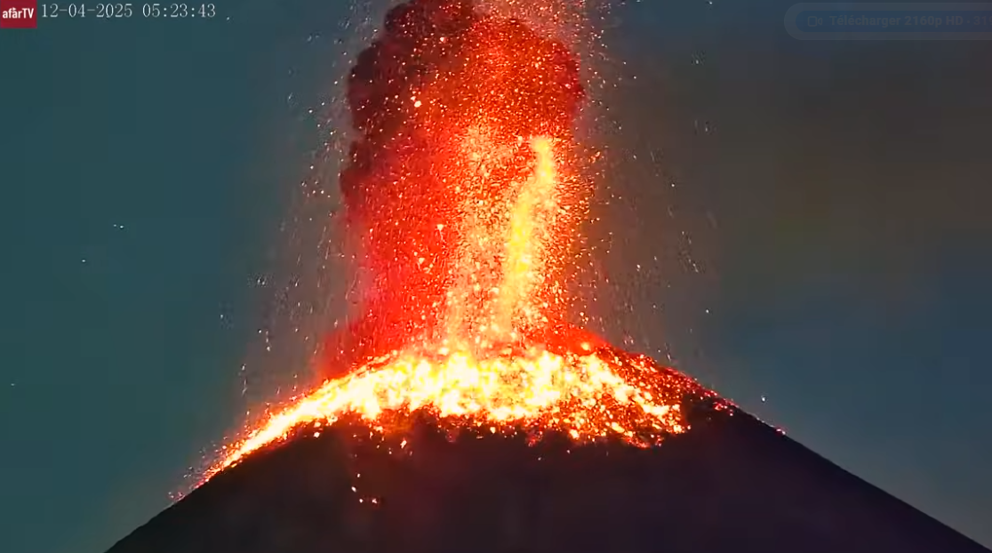
The Instituto Nacional de Sismología, Vulcanologia, Meteorologia e Hidrología (INSIVUMEH) reported that eruptive activity at Fuego continued during 25 November-2 December. Daily Strombolian explosions recorded by the seismic network, at rates of 4-15 per hour, generated gas-and-ash plumes that rose as high as 1.1 km above the summit and drifted as far as 40 km NW, W, and SW. Occasional rumbling sounds, shock waves, and/or sounds associated with gas emissions were reported. Explosions occasionally ejected incandescent material as high as 200 m above the summit and showered the upper flanks with incandescent material. Daily incandescent avalanches of material descended the flanks, including the Las Lajas (SE), Seca (W), Taniluya (SSW), Trinidad (SSW), Santa Teresa (W), El Jute (ESE), Honda, and Ceniza (SSW) drainages, occasionally reaching vegetated areas. Ashfall was reported in areas downwind on most days including Panimache (8 km SW), Sangre de Cristo, Finca Palo Verde, El Porvenir (10 km S), Morelia (10 km SW), Santa Sofia (12 km SW), Los Yucales (12 km SW), and Yepocapa.
The Coordinadora Nacional para la Reducción de Desastres (CONRED) reported that a tourist climbing near the crater on 30 November was injured and had to be carried down by companions and rescuers.
Sources: Instituto Nacional de Sismologia, Vulcanologia, Meteorologia, e Hidrologia (INSIVUMEH), Coordinadora Nacional para la Reducción de Desastres (CONRED), GVP.
Hawaii , Kilauea :
HAWAIIAN VOLCANO OBSERVATORY DAILY UPDATE , U.S. Geological Survey
Thursday, December 4, 2025, 9:35 AM HST (Thursday, December 4, 2025, 19:35 UTC)
19°25’16 » N 155°17’13 » W,
Summit Elevation 4091 ft (1247 m)
Current Volcano Alert Level: WATCH
Current Aviation Color Code: ORANGE
Activity Summary:
Summit inflation resumed mid-day yesterday and continued until 5 a.m. HST this morning. A slight deflation of the summit is occurring now. Overall inflation of the summit, glow from the vents, and intermittent spattering indicate that another fountaining episode is likely. Models suggest the onset of episode 38 fountains will occur between December 6 and 9, based on ground deformation models.

Summit Observations:
Overnight moderate glow was observed with flames from both vents. Persistent low to moderate tremor continues which were punctuated by minor seismic tremor bursts suggestive of irregular gas pistoning at depth. Weak spattering was intermittently observed in the south vent overnight in webcams.
As of this morning, about 12.8 microradians of inflationary tilt have been recorded by UWD since the end of episode 37, with modest inflation recorded in the past day that ended at 5:00 a.m HST. The summit is currently deflating slightly.
Gas emissions continue from the vent area, with a white outgassing plume rising above the crater this morning. Sulfur dioxide (SO2) gas emissions are typically between 1,200 and 1,500 tonnes per day during eruptive pauses between lava fountaining.
Observations in the rift zone:
Seismicity and ground deformation rates remain very low in the eastern and southwestern rift zones. SO2 emissions from the eastern rift zone remain below the detection threshold.
Source et photo : HVO