November 27 , 2025.
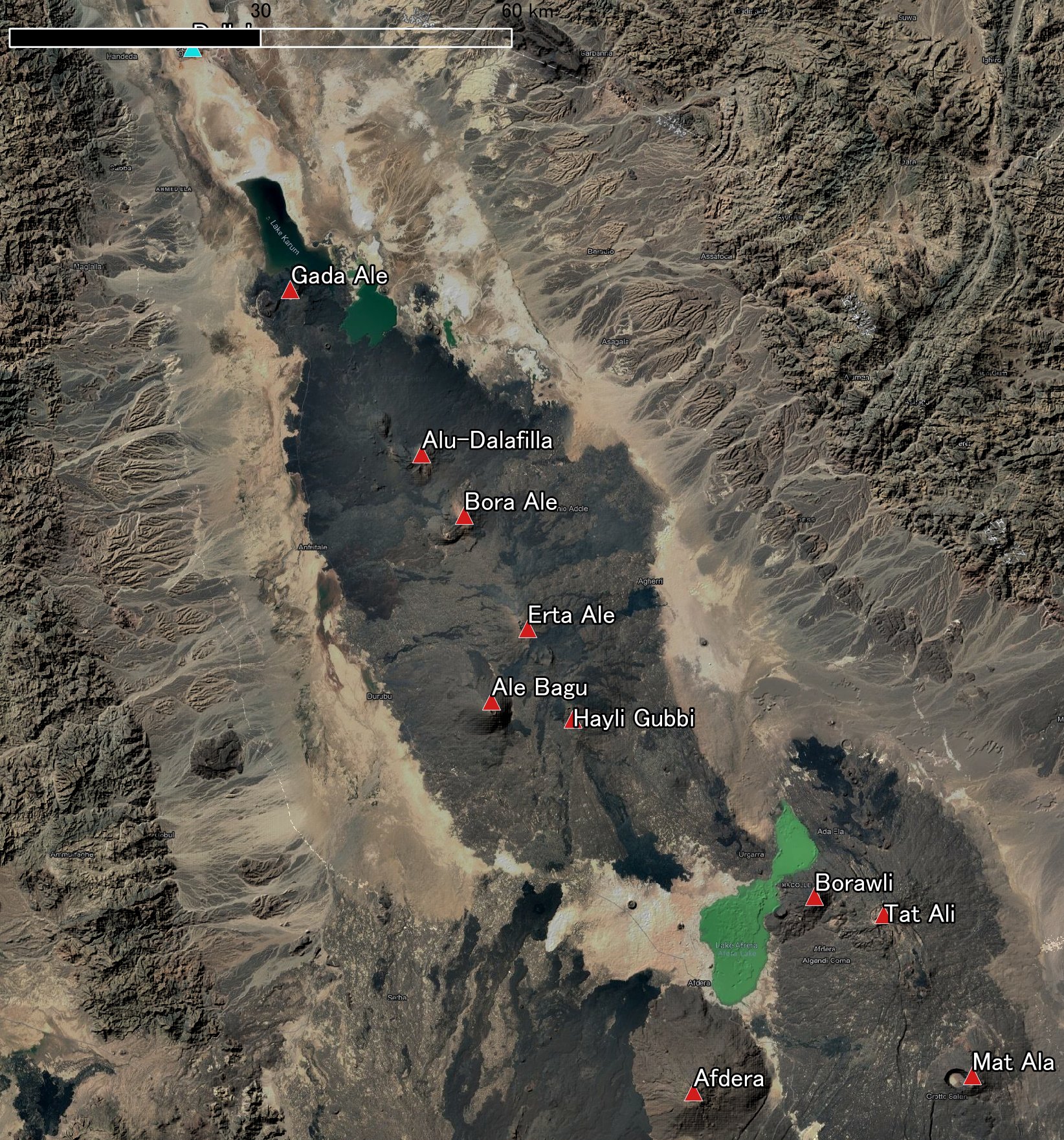
Ethiopia , Hayli Gubbi :
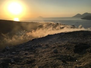
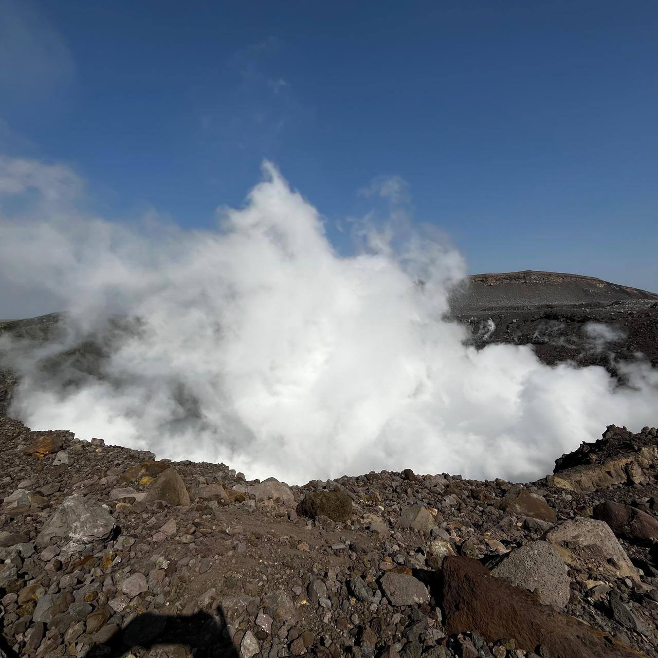
An ash plume from the first recorded explosive eruption at Hayli Gubbi was detected in satellite data at around 11h30 on 23 November. According to a news report, residents described hearing a loud sound and feeling a shock wave; an explosion was heard 50 km from Semera (190 km S of Hayli Gubbi). Ash plumes quickly rose to 13.7 km (45,000 ft) a.s.l., later reaching as high as 15.2 km (50,000 ft) a.s.l. At around 1400 satellite data showed that the plume was spreading into the upper troposphere and contained approximately 220,000 tons of sulfur dioxide. A sequence of satellite images showed the higher ash plume drifting ENE. The images also showed a lower altitude cloud of pyroclastic material moving to the N about 130 km and spreading about 60 km laterally.
That plume appeared to be on or low to the ground, and followed terrain, suggesting that it was the dilute part of a pyroclastic density current. Photos included in news reports showed ash plumes rising from the flat ground at some distance from the crater, consistent with material rising from a PDC, although the exact location of the photos was unknown. News reports noted that many surrounding villages, including Afdera (28 km W), were covered in ashfall; no deaths were reported. Several flights were cancelled or diverted across various countries in the region. Although the Toulouse VAAC reported that eruptive activity ceased by 2300, a large ash plume with a significant sulfur dioxide component persisted over Yemen, with lower-level ash continuing to drift over Ethiopia.
The Toulouse VAAC stated that by 00h57 on 24 November a substantial ash and sulfur dioxide cloud was present over Yemen and Oman, and by 10h58 the plume was situated between Oman and Pakistan, moving ENE at altitudes of 7.6-13.7 km (25,000-45,000 ft) a.s.l. By 17h00 a broad ash cloud was spreading E across southern Pakistan and northeastern India, with a possible plume of resuspended ash rising to 4.6 km (15,000 ft) a.s.l. detected near the Gulf of Aden. By 23h00 the ash cloud was detected over northern Indian (over Delhi, 4,130 km NE) and was moving quickly towards China. News media reported flight disruptions in India on 25 November.
According to the UK Centre for Observation and Modelling of Earthquakes Volcanoes and Tectonics (COMET) response reports, explosive activity at Erta Ale (12 km NW) on 15 July was accompanied by an intrusion of magma along a dike that propagated SE towards Hayli Gubbi. Sentinel satellite imagery on 16 July showed a line of fissure vents that produced lava flows outside the S caldera of Erta Ale (6 km S of the northern pit craters). Another group of four fissure vents opened further along the rift to the SE, with the most distant only 2 km from the Hayli Gubbi crater. No lava lakes were seen in the pit craters after 18 July, but satellite data indicated uplift in the region during 21 July-3 August, and an anomalous white cloud within Hayli Gubbi’s crater was observed on 25 July. Satellite data showed that the white plume covered the crater floor in most of the images (several per month) at least through 18 November.
Sources: Toulouse Volcanic Ash Advisory Centre (VAAC), Copernicus, Associated Press, The UK Centre for Observation and Modelling of Earthquakes, Volcanoes and Tectonics (COMET), Gulf News, Simon Carn, Afar Communication Bureau, The Week, Hindustan Times, GVP.
Photos : Kagura Sarutobi , Seifegebreil Shifferaw , Volcanews via Bernard Duyck ,
Japan , Sakurajima :
The Japan Meteorological Agency (JMA) reported ongoing eruptive activity at Minamidake Crater (Aira Caldera’s Sakurajima volcano) during 17-24 November with 25 eruptive events and eight explosions. Nightly crater incandescence was visible in webcam images. Sulfur dioxide emissions were characterized as extremely high, averaging 3,500 tons per day on 17 November. Explosions were recorded at 05h54 on 17 November, at 07h17, at 07h32, and at 23h05 on November 18, at 18h14 on 19 November, at 00h27 and 19h29 on 21 November, and at 21h20 on 24 November.
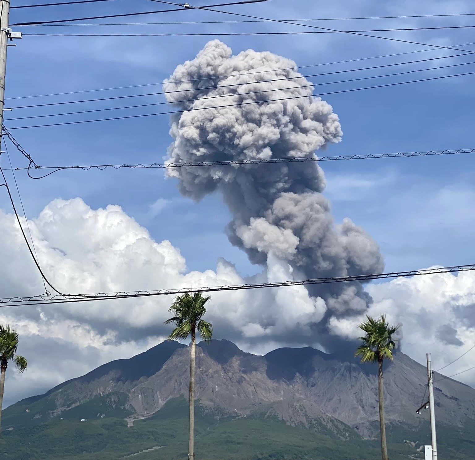
Ash plumes from most of the explosions rose 400-2,400 m above the crater rim and drifted SE and E; no emissions from the 24 November explosion were visible, possibly due to weather conditions. Most of the explosions ejected somewhat large or large blocks as far as 1 km from the vent. Eruptive events during 17-19 and 21 November produced ash plumes that rose as high as 2.1 km above the crater rim and drifted E and SE. The Alert Level remained at 3 (on a 5-level scale), and the public was warned to be cautious within 2 km of both the Minimadake and Showa craters.
Sources: Japan Meteorological Agency (JMA), GVP.
Photo : Kumiko Nagai.
Iceland , Reykjanes Peninsula :
Magma beneath Svartsengi continues to accumilate ,Updated 25 November 2025
Key Points
The rate of magma accumulation beneath Svartsengi has remained fairly stable over the past two weeks
The likelihood of a magma intrusion and an eruption remains elevated in the coming weeks
It is not possible to estimate the timing of the next eruption with greater accuracy than within a few months
The hazard assessment remains unchanged until 9 December
Assessment of the likelihood of a new magma intrusion and eruption based on modelling results
Uplift and magma accumulation beneath Svartsengi continues. The rate of magma inflow has remained relatively stable over the past two weeks. Modelling results indicate that approximately 16–17 million m³ of magma has accumulated beneath Svartsengi since the last eruption in July.
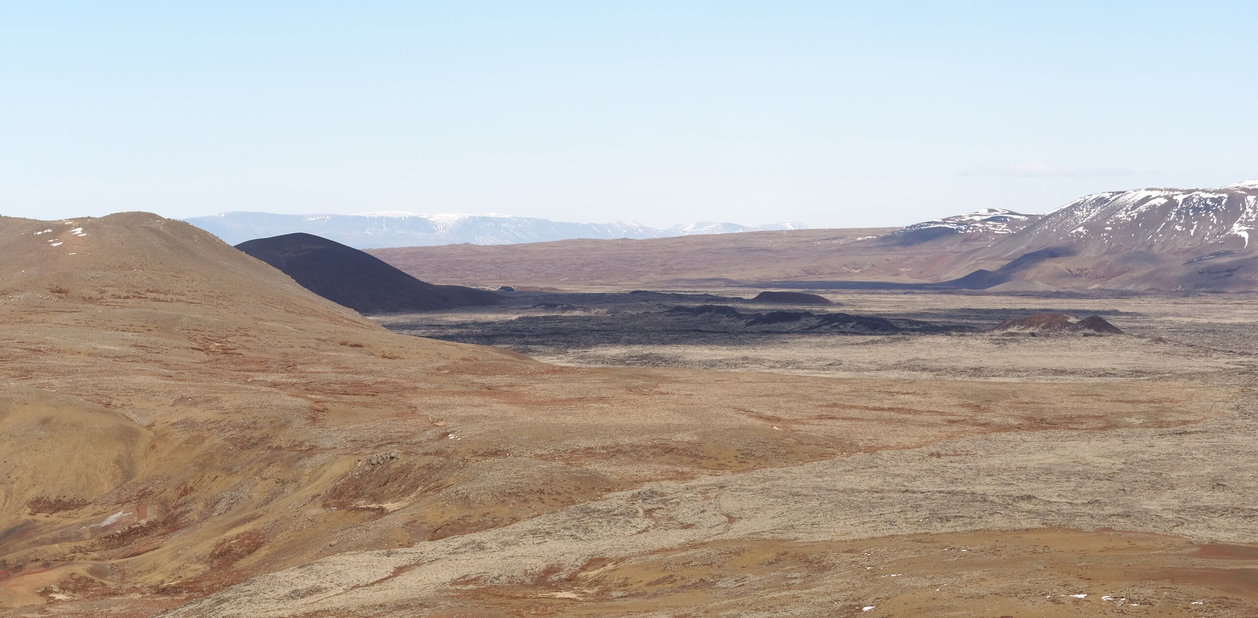
View of the Sundhnúkur craters from Þorbjörn Mountain, Reykjanes peninsula, Iceland
The amount of magma that intruded from Svartsengi into the Sundhnúksgígar crater row during the eruption that began on 16 July was estimated to be around 11–13 million m³. Based on previous eruptions along the Sundhnúkagígar crater row, the likelihood of a new magma intrusion and eruption is thought to increase once roughly the same volume of magma has reaccumulated beneath Svartsengi as was withdrawn during the preceding event.
In early October, modelling results indicated that about 11 million m³ of magma had reaccumulated beneath Svartsengi. At that time, a period began—still ongoing—during which the likelihood of a new magma intrusion and eruption is considered elevated.
Slower magma accumulation increases uncertainty in the timing of the next event
In the lead-up to eruptions along the Sundhnúksgígar crater row, the rate of magma accumulation has varied. The current magma inflow into the storage area beneath Svartsengi is estimated at around 1 m³/s. Modelling of geodetic data shows that the overall inflow rate has gradually decreased over time since the start of the activity in 2023. The slower the accumulation, the more difficult it becomes to estimate the timing of the next eruption. Based on current knowledge of the eruptions along the Sundhnúkagígar crater row, it is not possible to predict the timing of the next event with accuracy greater than a few months.
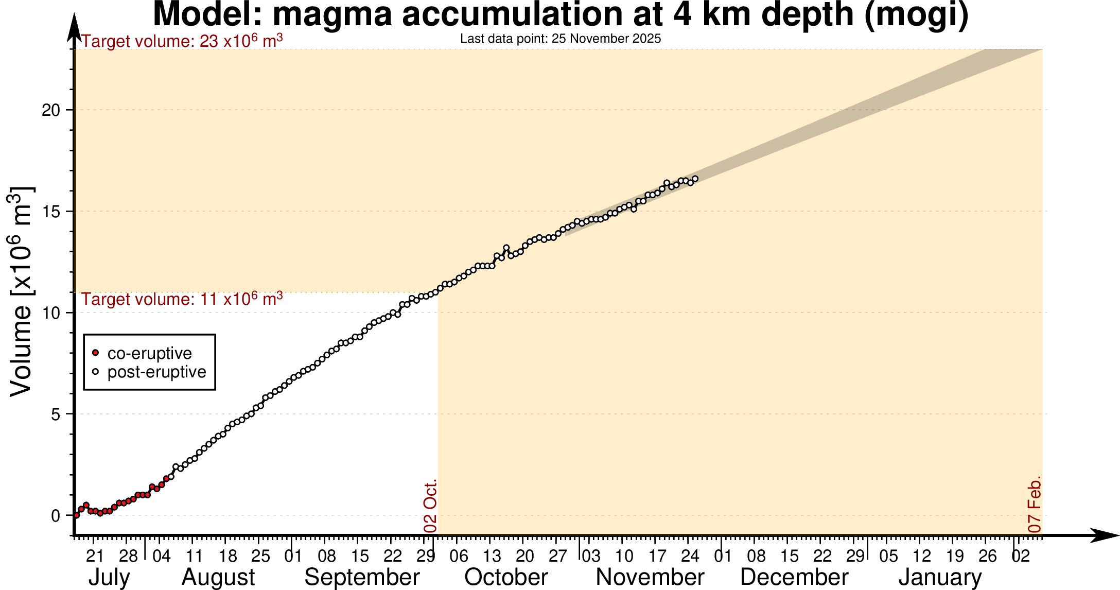
Experience from recent events has also shown that the accumulation rate does not need to change much for the timing of the next possible eruption to shift by several weeks. Uncertainty in the timing of the next event is therefore considerable, and the current magma accumulation period could continue for an extended time.
The magma volume recharged to the Svartsengi reservoir prior the past four events in Sundhnúks crater row has been assessed to have an upper bound of 23 millions m3. If a similar volume needs to be recharged before the next dike or eruption is triggered, and assuming the current accumulation rate remains unchanged, then this upper bound volume would be reached by early February 2026. The following graph illustrates the magma accumulation beneath Svartsengi since the most recent eruption along the Sundhnúkagígar crater row.
Source : IMO.
Photos : Jakub Hałun , IMO.
Indonesia , Ibu :
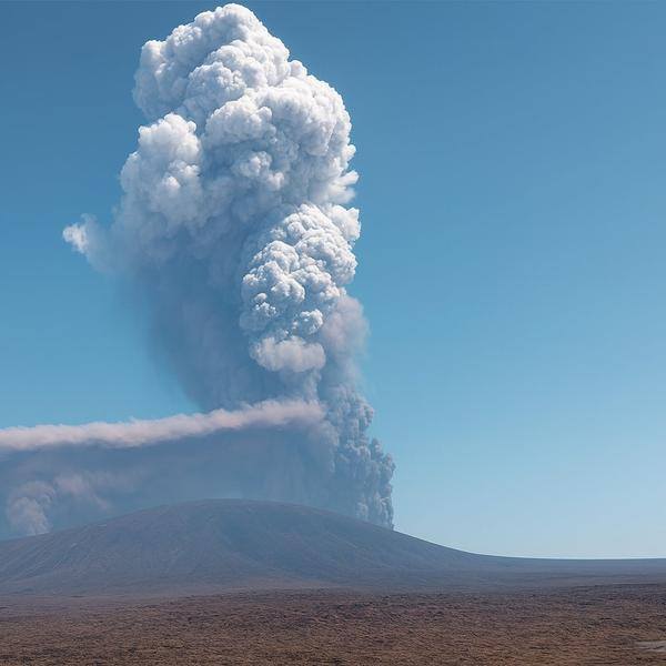
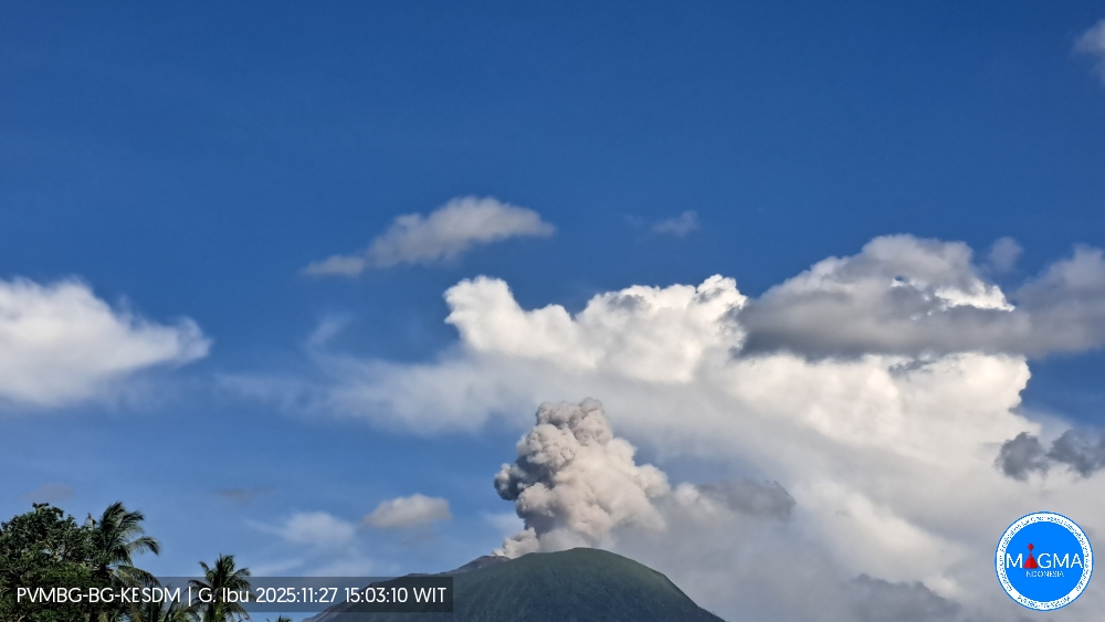
Mount Ibu erupted on Thursday, November 27, 2025, at 3:00 PM (local time). An ash column was observed approximately 700 meters above the summit (at an altitude of about 2,025 meters). This column was white and of moderate to strong intensity, drifting east and southeast. At the time of writing, the eruption was still ongoing.
Seismic Observations
125 eruption earthquakes with amplitudes of 12 to 28 mm and durations of 31 to 68 seconds.
2 avalanche earthquakes with amplitudes of 2 mm and durations of 37 to 45 seconds.
4 emission earthquakes with amplitudes of 5 to 10 mm and durations of 32 to 46 seconds.
15 harmonic tremors with amplitudes of 2 to 28 mm and durations of 33 to 133 seconds.
119 low-frequency earthquakes with amplitudes of 2 to 12 mm and durations of 17 to 29 seconds.
143 shallow volcanic earthquakes with amplitudes of 2 to 8 mm and durations of 7 to 21 seconds.
One deep volcanic earthquake with amplitudes of 3 mm and durations of 1.3 and 18 seconds.
Five local tectonic earthquakes with amplitudes between 2 and 14 mm and durations of 26 to 35 seconds.
Twenty-four distant tectonic earthquakes with amplitudes between 2 and 20 mm and durations between 37 and 170 seconds.
Recommendations
1. Residents living near Mount Ibu and visitors/tourists are advised to refrain from all activity within a 2 km radius and for a distance of 3.5 km towards the crater opening in the northern part of the active Mount Ibu crater.
Source et photo : Magma Indonésie.
Colombia , Chiles / Cerro Negro :
San Juan de Pasto, November 25, 2025, 5:10 PM
Regarding the monitoring of activity at the Chiles-Cerro Negro Volcanic Complex (CVCCN), the Colombian Geological Survey (SGC), an agency under the Ministry of Mines and Energy, reports the following:
During the period from November 18 to 24, 2025, the main variations in monitored parameters compared to the previous week were as follows:
● Seismic activity continued to decrease in frequency, with a slight increase in energy released. Seismicity related to rock fracturing predominated, with some earthquakes associated with fluid dynamics also recorded.
● Seismicity related to rock fracturing was localized beneath Chiles Volcano, within a 2 km radius, at depths between 1 and 5 km, with a maximum magnitude of 2.7.
None of these earthquakes were felt.
● Data on volcanic deformation from satellite sensors, GNSS stations, and tiltmeters continue to show variations in the volcanic zone.
Based on the assessment and correlation of monitored parameters, the Geological Survey of Colombia (SGC) recommends closely monitoring its evolution through weekly bulletins and other information disseminated through its official channels, as well as following instructions from local and departmental authorities and the National Unit for Disaster Risk Management (UNGRD).
Volcanic activity remains at the yellow alert level: active volcano exhibiting changes in the reference behavior of monitored parameters and other manifestations.
Source et photo : SGC.