November 22 , 2025.
Indonesia , Sangeangapi :
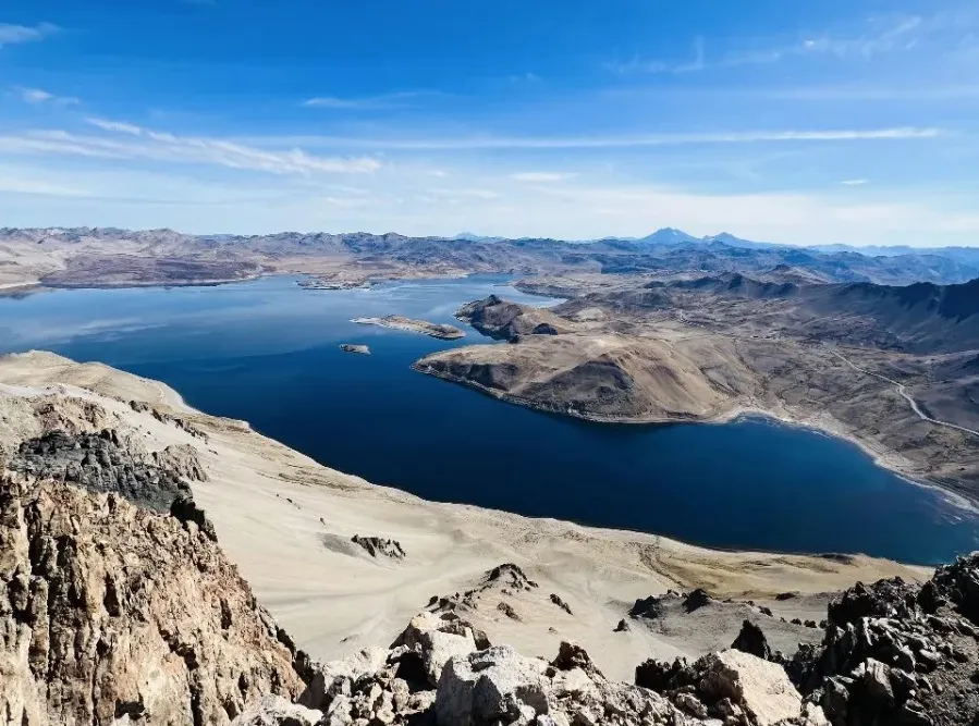
SPECIAL REPORT ON INCREASED ACTIVITY AT MOUNT SANGEANGAPI, WEST NUSA TENGGARA PROVINCE, FROM LEVEL I (NORMAL) TO LEVEL II (WASPADA) ON NOVEMBER 22, 2025.
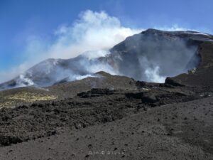
On November 22, 2025, intense seismic activity was recorded at Mount Sangeangapi, located on Sangeang Island, Bima Regency, West Nusa Tenggara Province. Visual observation of Mount Sangeangapi revealed fumes escaping from the main crater. Overall, activity at Mount Sangeangapi has intensified, as evidenced by visual observations and seismic data.
Visual monitoring revealed that the fumes were from a new eruption, unlike the last eruption in 2014. This indicates that magma rising to the surface seeks the easiest opening to exit, which explains why eruption points can move within a volcano.
Seismic activity at Mount Sangeangapi increased significantly between November 1 and 22, 2025. The number of « emission » earthquakes rose, notably on November 18, 2025, reaching 43. Five « Tornilo » type earthquakes were also recorded. During this period, 25 deep volcanic earthquakes, six shallow volcanic earthquakes, 31 local tectonic earthquakes, and 56 distant tectonic earthquakes were also recorded.
Following this analysis, as of 6:00 AM (Central Indonesian Time) on November 22, 2025, the activity level of Mount Sangeangapi was raised from Level I (Normal) to Level II (Waspada). The public, visitors and tourists are strongly advised to avoid any contact with the center of activity (main crater) and the coastal area located to the East-Southeast, over a distance of 6.5 kilometers.
Source et photo : PVMBG.
Hawaii , Kilauea :
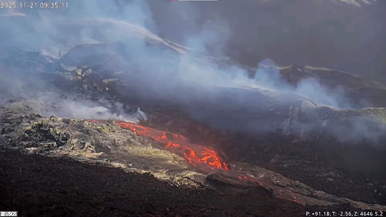
HAWAIIAN VOLCANO OBSERVATORY DAILY UPDATE , U.S. Geological Survey .
Friday, November 21, 2025, 9:36 AM HST (Friday, November 21, 2025, 19:36 UTC)
19°25’16 » N 155°17’13 » W,
Summit Elevation 4091 ft (1247 m)
Current Volcano Alert Level: WATCH
Current Aviation Color Code: ORANGE
Activity Summary:
Overnight, there was strong glow from the north and south vents with brief periods of spattering. Inflationary tilt is being recorded by summit tiltmeters. Models suggest that episode 37 will probably occur between November 22 to November 26 with November 23-25 mostly likely.
Summit Observations:
Strong glow was observed from both vents overnight, along with intermittent spattering from the north vent between 9:30 PM and 12:30AM. Slumping due to gravity was observed earlier this week along the southwest crater rim. Low level, continuous tremor has been recorded since early Tuesday morning.
Inflation continues at the summit. UWD recorded 1.2 microradian of inflationary tilt in the past 24 hours for a total of 19.8 microradians recorded since the end of episode 36 on November 9.
Plumes of gas are visible from both the south and north vents, and sulfur dioxide (SO2) gas emissions remain at eruption pause levels, typically between 1,200 and 1,500 tonnes per day.
Source et photo : HVO
Alaska , Shishaldin :
Signs of volcanic unrest at Shishaldin continued this week. Low-level seismicity is ongoing, with frequent small earthquakes occurring daily. Infrasound signals were detected on a majority of days when wind noise did not obscure them. The infrasound signals are likely caused by gas bubbles bursting through magma deep within the volcanic vent.
Satellite data show no evidence of elevated temperatures or other changes within the summit crater, indicating no lava at or near the surface. Rare clear webcam views of the volcano over the past week showed steam emissions at the summit.
Shishaldin Volcano is monitored by local seismic and infrasound sensors, web cameras, and a telemetered geodetic network. In addition to the local monitoring network, AVO uses nearby geophysical networks, regional infrasound and lighting data, and satellite images to monitor the volcano.
Source : AVO
Photo : Mulliken, Katherine
Chile , Laguna del Maule :
Seismology
The seismic activity of the period was characterized by the recording of:
11,462 VT-type seismic events, associated with rock fracturing (volcano-tectonics). The most powerful earthquake, with a local magnitude (ML) of 3.6, was located 1.1 km east-southeast and at a depth of 8.8 km from the center of the lagoon.
16 LP-type seismic events, associated with fluid dynamics within the volcanic system (long period). The amplitude of the largest earthquake, measured by the reduced displacement parameter (DR), was 6 cm².
1 HB-type seismic event, associated with both rock fracturing and fluid dynamics within the volcanic system (hybrid). The amplitude of this earthquake, measured by the reduced displacement parameter (DR), was 4 cm².
Fluid Geochemistry
No anomalies were reported in sulfur dioxide (SO₂) emissions into the atmosphere near the volcanic complex, according to data published by the Sulfur Dioxide Group of the Tropospheric Monitoring Instrument (TROPOMI) and the Ozone Monitoring Instrument (OMI).
Satellite Thermal Anomalies
During the study period, no thermal alerts were recorded in the area associated with the volcanic complex, based on the analytical processing of Landsat 8 and Sentinel-2-L2A satellite images, combined using false color.
Geodesy
Geodetic monitoring, carried out using 5 GNSS stations and satellite imagery, indicates that:
– The inflation process of the system continues, with a maximum vertical uplift rate of 2.5 cm/month at the station closest to the center of the lagoon. This value is slightly higher than that of the previous period, remains high, but is equivalent to the values recorded by the instruments.
Horizontal displacements maintain their trends and, like vertical displacements, show a slight decrease over this period, stabilizing at approximately 2.6 cm/month.
The line connecting the GNSS stations located to the east and west of the lagoon continues to lengthen, reaching 3.0 cm/month.
Radar interferometry (InSAR) of the Sentinel-1A images highlights the deformation pattern characteristic of the ongoing inflationary process. Despite some areas of low consistency with this technique, the observed displacement amplitudes are consistent with the measurements from the GNSS stations mentioned previously.
Furthermore, relative displacements of 2 to 4 cm were observed in the lava flow in the Las Nieblas sector.
Thus, the deformation of the volcanic system continues at speeds higher than the average recorded since 2012, revealing slight spatial variations in the source of deformation.
Surveillance Cameras
Images from the fixed camera installed near the volcanic complex recorded neither degassing plumes nor variations related to surface activity.
During the first half of November, the Laguna del Maule volcanic complex maintained seismic activity above its baseline threshold, with abundant volcano-tectonic (VT) seismicity distributed across several foci around the lagoon. Epicentral areas of volcanic activity persist in the central and eastern sectors of the complex, as well as in the Troncoso sector, despite variations in daily productivity compared to previous months. During this period, a VT earthquake of local magnitude 3.8 was recorded in the central sector of the lagoon. Furthermore, surface deformation remains active, consistent with the system’s characteristic inflationary pattern. However, GNSS data show a slight decrease in vertical rates, although they remain high in instrumental data. Overall, the persistence of VT seismicity, with energetic earthquakes and the ongoing deformation process, indicates that the volcanic system remains dynamic and unstable, with parameters exceeding its reference threshold.
The volcanic alert level remains: YELLOW TECHNICAL ALERT: Changes in volcanic activity behavior.
Source : Sernageomin.
Photo : OAVV
Colombia , Nevado del Ruiz :
Manizales, November 18, 2025, 11:30 PM
Regarding the monitoring of activity at the Nevado del Ruiz volcano, the Colombian Geological Survey (SGC), an agency under the Ministry of Mines and Energy, reports the following:
During the week of November 11-17, 2025, the volcano continued to exhibit unstable behavior. Compared to the previous week, the main variations in monitored parameters were as follows:
– Seismicity associated with fluid dynamics in volcanic conduits, linked to long-duration signals, increased in the number of earthquakes and in seismic energy released; however, its energy level remained low. As for short-duration signals associated with ash emissions, they maintained similar levels in the number of events and showed a decrease in seismic energy released, with energy levels ranging from low to moderate. Thanks to the cameras (conventional or thermographic) used to monitor the volcano, it was possible to confirm several pulsed ash emissions and some variations in the apparent temperature of the emitted materials.

– Seismic activity associated with rock fracturing processes within the volcanic edifice increased slightly in the number of recorded earthquakes and decreased in seismic energy released. The events were low-energy (magnitude less than 1) and were primarily located in the Arenas crater, at depths of up to 2 km, and on the southwest flank, at distances of up to 5 km from the crater and at depths between 2 and 6 km measured from the summit of the volcano. To a lesser extent and in a scattered fashion, seismicity was also observed on the other flanks of the volcano. In addition, on November 13, low-energy seismicity related to the activity of the lava dome (protuberance or mound) located at the bottom of the crater was recorded.
The volcano continued to emit water vapor and volcanic gases, primarily sulfur dioxide (SO₂), into the atmosphere from the Arenas crater. The estimated SO₂ flux, associated with degassing processes, was variable and slightly higher than the previous week.
The height of the gas, water vapor, or ash plume remained below 500 m above the volcano’s summit. On November 14 at 11:58 PM, during an ash eruption, it reached a maximum height of 2,000 m. Regarding the direction of dispersal, the plume showed a tendency toward the western flank (from northwest to west-southwest), with a preference for the northwest and west-southwest flanks of the volcanic structure. Ashfall was reported in the valleys of Los Nevados National Natural Park and in the municipality of Manizales.
– During the monitoring of thermal anomalies at the bottom of the Arenas crater, using satellite platforms, detection remained limited by heavy cloud cover in the volcanic area. However, some low-energy anomalies were reported.
Source et photo : SGC.