November 19 , 2025.
Italy , Stromboli :
WEEKLY BULLETIN, November 10, 2025 to November 16, 2025. (Publication date: November 18, 2025)
ACTIVITY SUMMARY
Based on monitoring data, the following points should be noted:
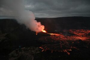
1) VOLCANOLOGICAL OBSERVATIONS: During this period, ordinary Strombolian-type eruptive activity was observed, with ejecta and lava flow in the North Crater area. The total hourly frequency fluctuated between high values (16 and 23 events/hour). The intensity of the explosions was mainly low to medium in the North and South Central Crater areas.
2) SEISMOLOGY: The monitored seismic parameters showed no significant variation.
3) GROUND DEFORMATION: No significant changes were reported based on GNSS network data. The inclination of the Timpone del Fuoco station is currently undergoing maintenance and is therefore not mentioned in this bulletin.
4) GEOCCHEMISTRY: Average SO₂ flux.
High CO₂ flux from the ground in the Pizzo area (STR02).
C/S ratio in the pen: Average C/S ratio.
Dissolved helium isotope ratio (R/Ra) in the thermal aquifer: Increased to very high values.
CO₂ flux from the ground in the San Bartolo area: Very high values.
CO₂ flux from the ground in the Scari area: High values.
5) SATELLITE OBSERVATIONS: The thermal activity observed by satellite in the summit area was generally moderate, corresponding to the eruptive activity of November 13, 2025.
VOLCANOLOGICAL OBSERVATIONS
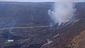
During the observation period, Stromboli’s eruptive activity was characterized by the analysis of images recorded by the INGV-OE monitoring cameras located at 190 m (SCT-SCV) and at Punta dei Corvi (SPCT). Explosive activity was primarily due to five eruptive vents located in the northern crater area and at least two vents located in the central-southern area.
A lava flow began on November 9 in the northern area.
Observations of explosive activity captured by monitoring cameras
In the northern (N) crater area, five active winds were observed: two in sector N1 and three in sector N2.
These vents produced explosive activity of low (less than 80 m high) and medium intensity (less than 150 m high) intensity.
The eruptive products were primarily composed of coarse material (bombs and lapilli).
In addition, ejections were observed in sectors N1 and N2, with intense activity in sector N1.
The average frequency of explosions ranged from 8 to 20 events per hour.
In the Central-South (CS) crater area, two main winds were observed.
These vents produced explosions of fine material mixed with coarse material, and explosions of coarse material of low to medium intensity.
The average frequency of explosions ranged from 0 to 8 events per hour.
Effusive event of November 13, 2025
On November 13, starting at 19:20 UTC, following intense lava ejection activity at vents located north of sector N1, a lava flow was observed extending along the Sciara del Fuoco. The narrow, enclosed flow channel prevented direct observation of the lava flow, which appeared to have a very low effusion rate. By late afternoon on November 15, the lava flow seemed to be slowly being fed and cooling.
Source: INGV
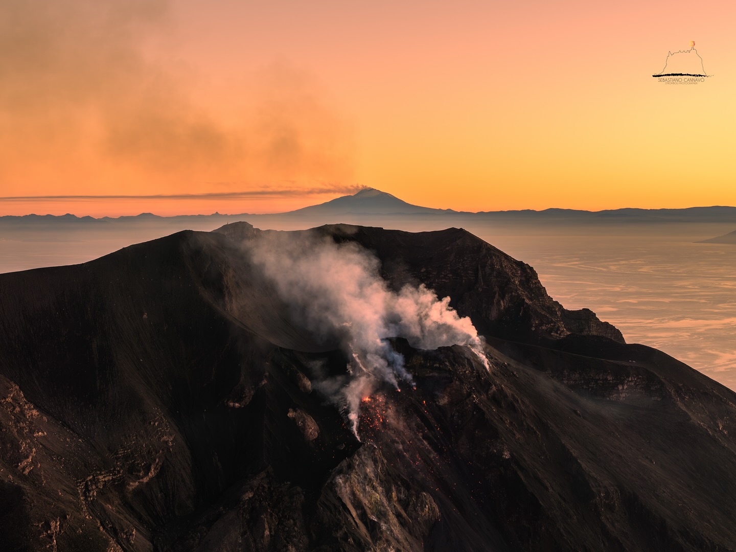
Photo : Stromboli stati d’animo / Sebastiano Cannavo
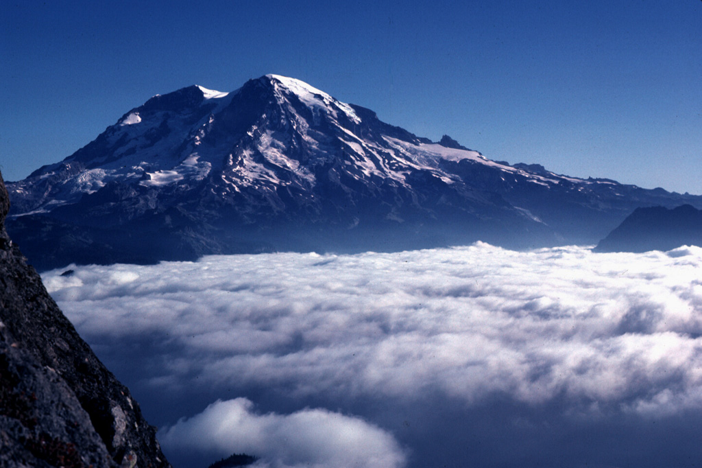
United – States , Mount Rainier :
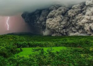
Washington’s Mount Rainier has suddenly awoken and is buzzing with almost nonstop activity for days, stoking fears that an eruption could come soon.
The mountain is one of America’s most dangerous volcanoes, towering over millions of people in major cities such as Seattle, Tacoma, and Yakima in Washington, and Oregon’s most populous city of Portland.
Starting on Saturday, Mount Rainier has been experiencing constant vibrations beneath the surface which can be best described as thousands of tiny vibrations blending together.
The constant seismic rumblings were spotted by the Pacific Northwest Seismic Network (PNSN), where seismometers on Mount Rainier have recorded three straight days of nearly nonstop, high-energy seismic signals across the west flank of the volcano.
Unlike the seismic activity tied to major earthquakes, the patterns being seen in Washington look more like a volcanic tremor, a type of nonstop hum or roar that begins when magma, hot water, and gas moves around inside a volcano.
It doesn’t mean Mount Rainier is going to erupt at any moment, but it is a warning sign that volcanic activity could eventually build towards a critical level.
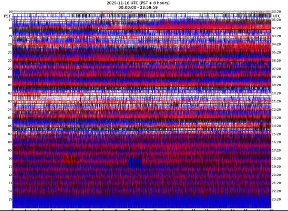
Geologists will be watching for key signs of this volcanic tremor escalating, including its severity increasing in the coming days, actual earthquakes starting inside the volcano, and the ground at Mount Rainier beginning to swell.
When this volcano eventually explodes, it won’t be scorching lava flows or choking clouds of ash that threaten Americans, but the lahars: violent, fast-moving mudflows that can tear across entire communities in mere minutes.
Source : Dailymail . Co.
Photos : Lee Siebert, 1981 (Smithsonian Institution). USGS.
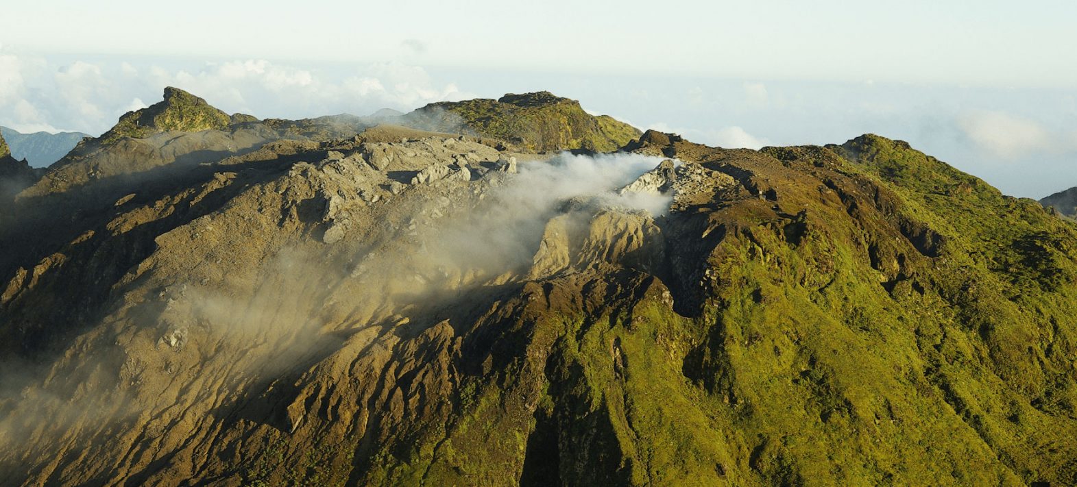
Colombia , Chiles / Cerro Negro :
San Juan de Pasto, November 18, 2025, 5:10 PM
Regarding the monitoring of activity at the Chiles-Cerro Negro Volcanic Complex (CVCCN), the Colombian Geological Survey (SGC), an agency under the Ministry of Mines and Energy, reports the following:
During the period from November 11 to 17, 2025, the main variations in monitored parameters compared to the previous week were as follows:
● Seismic activity decreased in both frequency and energy release. Seismicity due to rock fracturing remained predominant, followed by that associated with fluid dynamics.
● Seismicity was primarily located south and west of Chiles Volcano, within a 3.6 km radius of its summit. Three main sources were identified: the first, between the collapse zone and the southern summit of Chiles; The second was to the west; and the third to the northwest of the same volcano. It should be noted that in this last case, the earthquakes were recorded primarily on November 17th. Most of the earthquakes occurred at depths between 2 and 5 km. The largest, with a magnitude of 2.3, occurred 1.3 km west of the summit of Chiles Volcano, at a depth of 4.2 km.

● Recordings of volcanic deformation from satellite sensors, GNSS stations, and tiltmeters continue to show variations in the volcanic zone.
Based on the assessment and correlation of monitored parameters, the Geological Survey of Colombia (SGC) recommends closely monitoring its evolution through weekly bulletins and other information published via its official channels, as well as following instructions from local and departmental authorities and the National Unit for Disaster Risk Management (UNGRD).
Volcanic activity remains at the yellow alert level: Active volcano with changes in the baseline behavior of monitored parameters and other manifestations.
Source et photo : SGC.
La Guadeloupe , La Soufrière :
Monthly Bulletin, Paris Institute of Earth Physics. Guadeloupe Volcanological and Seismological Observatory.
Summary
– Seismicity: 455 earthquakes were detected, 365 of which occurred between October 1st and 6th (seismic swarm). The vast majority, of negative magnitude, occurred at a depth of less than 1 km beneath the dome of La Soufrière. One earthquake of positive magnitude (+0.95) occurred on October 12th at a depth of 2.5 km beneath the dome.
The energy released (2.75 MJ) is higher than the previous month (0.5 MJ), but remains within the lower range of values recorded since 2018.
– Deformation: The deformation regime of the La Soufrière dome is stationary.
– Fumaroles: The temperatures of the fumaroles in the South Crater fissure are decreasing, with 193°C at the CSS vent and 175°C at the CSN vent. The composition of the non-condensable gases does not show any major changes that would indicate magma upwelling.
– Hydrothermal fluids: The temperatures, compositions, and pH of Lake Tarissan and the hot springs do not show any abnormal disturbances in the hydrothermal system.
Based on the observations summarized in this bulletin, and in accordance with the measures planned by the authorities, the volcanic alert level (see attached table) remains:
Alert: Yellow
Source et photo : OVSG.
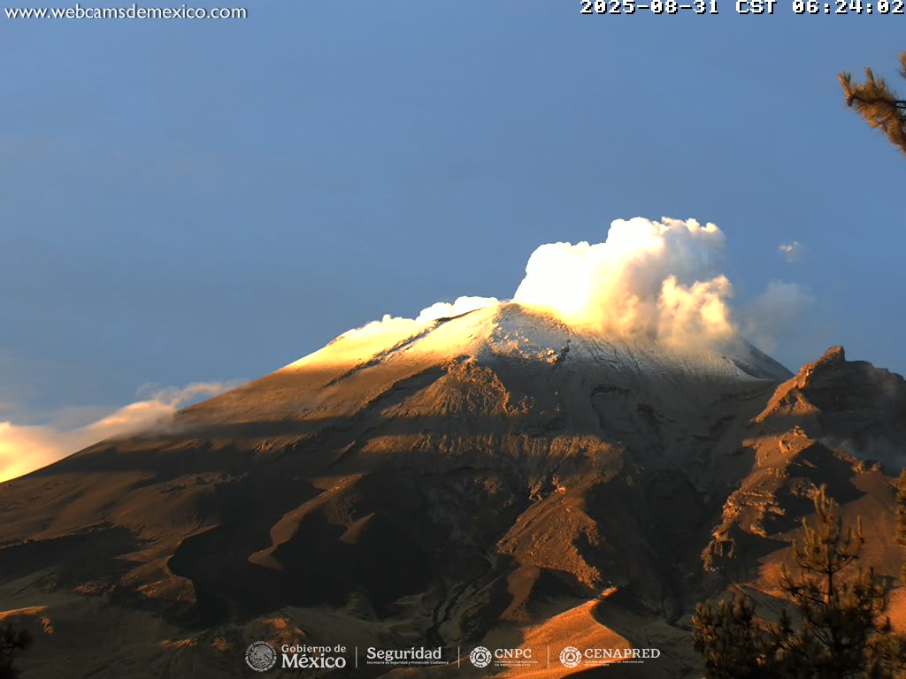
Mexico , Popocatepetl :
November 18, 11:00 AM (November 17, 5:00 PM GMT)
Activity over the past 24 hours
Nine low-intensity exhalations have been detected, accompanied by water vapor and volcanic gases.
Currently, a continuous emission of water vapor and other volcanic gases is being observed, drifting northward. The alert level for Popocatépetl volcano is at yellow (phase 2).
The scenarios considered for this phase are as follows:
A few low- to medium-intensity explosions
Earthquakes of varying magnitude
Light to moderate ash deposits over surrounding towns and some more distant towns
Ejection of incandescent fragments within the 12-kilometer exclusion zone
Possibility of lahars, flowing down ravines due to ash accumulation on the slopes and its interaction with the expected rainfall in the coming weeks
Possibility of pyroclastic flows not reaching inhabited areas
Source et photo : Cenapred