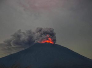
November 17 , 2025.
Colombia , Cumbal :
San Juan de Pasto, November 11, 2025, 3:10 PM, Cumbal Volcanic Complex
Regarding the monitoring of activity at the Cumbal Volcanic Complex (CVC), the Colombian Geological Survey (SGC), an agency under the Ministry of Mines and Energy, reports the following:
During the week of November 4-10, 2025, the main variations in monitored parameters compared to the previous week were as follows:
● Within the fluctuating limits characteristic of this volcanic complex, seismic activity and energy emissions increased. Seismicity associated with rock fracturing was predominant.
● Most seismic events occurred near the summit of the complex, within a 3 km radius and at depths of up to 4 km from the La Plazuela crater (4,700 m above sea level). The largest earthquake reached a magnitude of 0.6.
● Gas emissions were observed from the El Verde fumarole field.
● Other monitored parameters (such as ground deformation) did not show significant variations and remain stable.
In light of the above, the Geological Survey of Colombia (SGC) recommends closely monitoring the situation through weekly bulletins and other information published via its official channels, as well as following the instructions of local and departmental authorities and the National Disaster Risk Management Unit (UNGRD).
● Volcanic activity remains at the yellow alert level: Active volcano with changes in the reference behavior of monitored parameters and other manifestations.
Source et photo : SGC
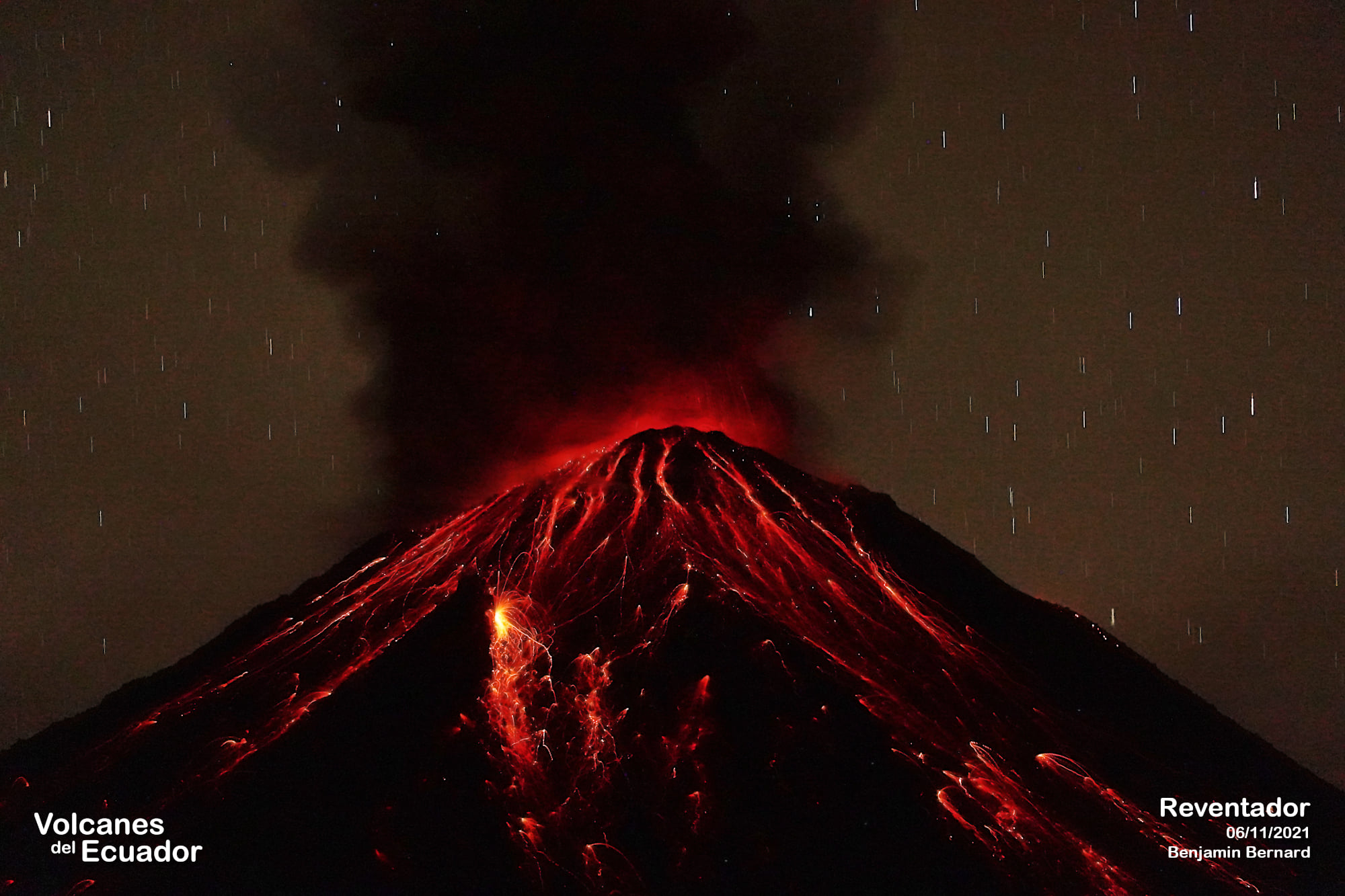
Ecuador , El Reventador :
REVENTADOR VOLCANO DAILY STATE REPORT, Sunday, November 16, 2025.
Information Geophysical Institute – EPN.
Surface Activity Level: High, Surface Trend: No Change
Internal Activity Level: Moderate, Internal Trend: No Change
From November 15, 2025, 11:00 AM to November 16, 2025, 11:00 AM:
Seismicity:
Below is the count of seismic events recorded at the reference station.
Explosion (EXP) 68
Long Period (LP) 8
Emission Tremor (TREMI) 11
Harmonic Tremor (TRARM) 8
Rainfall/Lahars:
No rainfall has been recorded in the volcano area. **Heavy rainfall could remobilize accumulated material, generating mudflows and debris flows that would cascade down the volcano’s flanks and into nearby rivers.**
Emissions/Ash:
Over the past 24 hours, several gases and ash emissions have been observed using the monitoring camera system and satellite imagery. The plumes reached heights of between 900 and 2,000 meters above the crater, drifting west, east, and east-southeast.
Regarding this activity, the Washington VAAC agency published three reports corresponding to emissions whose plumes rose between 1,600 and 1,900 meters above the crater, drifting toward the Northwest, Southwest, and West-Northwest.
Gas:
The Mounts satellite system detected 16.10 tons of SO₂ (sulfur dioxide), measured yesterday at 1:29 p.m. local time.
Observation:
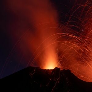
From yesterday afternoon until the publication of this report, the volcano remained mostly covered in clouds. However, during last night and early this morning, incandescent glows were observed at the crater, and incandescent material descended to within 1,000 meters of the crater rim.
Alert Level – SGR: Orange
Source : IGEPN
Photo : Benjamin Bernard / FB.
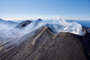
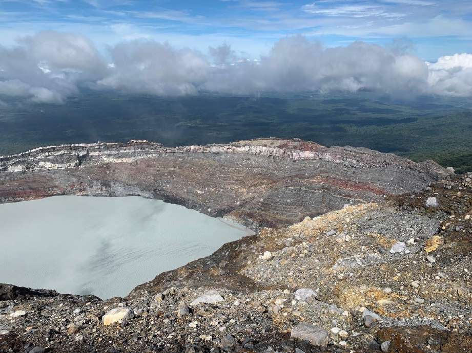
Costa Rica , Rincon de la Vieja :
Latitude: 10.83°N;
Longitude: 85.34°W;
Altitude: 1916 m.
Current Activity Level: Alert.
Three small eruptions and one exhalation were recorded this week. The largest occurred on Saturday at 3:20 a.m. None generated lahars. Following Saturday’s eruption, background tremor decreased in amplitude and remains low as of the date of this report. Brief tremor pulses were observed throughout most of the week, with variations in amplitude, frequency, and duration between events. Long-period and tornillo-type events continued to occur. The number of long-period events is low. The dominant frequency of tornillos shows a downward trend. Geodetic observations indicate subsidence of the volcanic massif, more pronounced at the summit.
This week, DOAS stations recorded a slight decrease in SO₂ emissions (202 ± 266 t/d) compared to the previous week (261 ± 46 t/d). However, the most recent measurements show significant dispersion. The MultiGAS station continues to record low gas concentrations. The last satellite detection of atmospheric SO₂ was on October 14 and amounted to only 3 tonnes. Two springs located on the northern flank of the Rincón volcano, monitored by OVSICORI-UNA, are showing stable temperatures with little fluctuation, similar to measurements taken in recent years. The Paila Burbujas spring, located at the Blue River Resort, recorded a temperature of 62 degrees Celsius at the end of October, while the Neftalí spring, located about 30 meters from Paila Burbujas, measured a lower temperature of 49 degrees Celsius. The slight temperature fluctuations of these sources are mainly due to precipitation patterns.
Source : Ovsicori .
Photo : Juan Carlos López del ICE.
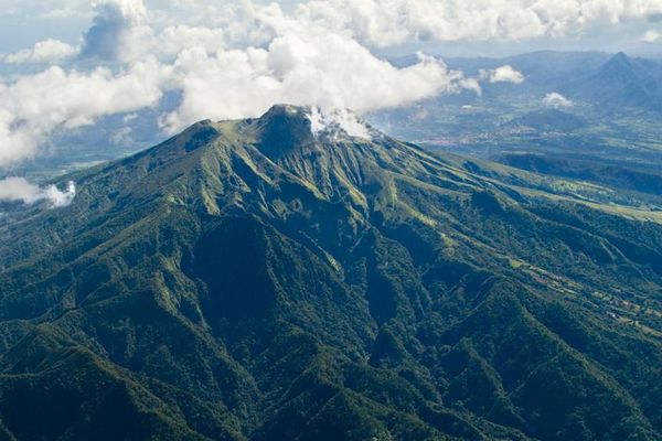
La Martinique , Mount Pelée :
Weekly Report, Paris Institute of Earth Physics, Martinique Volcanological and Seismological Observatory
Saint-Pierre, November 14, 2025, 4:00 PM local time (GMT-4)
Volcanic activity decreased this week with 59 volcanic earthquakes observed.
Between November 7, 2025, 4:00 PM UTC and November 14, 2025, 4:00 PM UTC, the Martinique Volcanological and Seismological Observatory recorded:
• 54 shallow, low-energy volcano-tectonic earthquakes. The majority of these originated from the well-known seismically active zones of Mount Pelée, located between 1.0 and 1.4 km below the volcano’s summit. Shallow volcano-tectonic seismicity is associated with microfracturing within the volcanic edifice, linked to the overall reactivation of the volcano observed since 2019.
• Two shallow hybrid earthquakes that could not be located, but whose signals indicate they originate from the same area as the shallow volcano-tectonic earthquakes. These shallow hybrid earthquakes exhibit low-frequency enriched signals and are associated with the circulation of fluids (gases, hydrothermal fluids) within the volcanic edifice.
• One deep hybrid earthquake and two deep long-period earthquakes. They are located in the vicinity of Mount Pelée at depths between 20 and 32 km, and their local magnitudes range from Mlv = 1.0 to Mlv = 1.8. The seismic signals of these types of earthquakes are enriched in (or contain only) low frequencies and are associated with the circulation of magmatic fluids deep within the Mount Pelée volcanic system.
No earthquakes were felt by the population.
The previous week, the OVSM (Mountain Seismological Observatory) recorded 127 volcanic earthquakes. As of November 14, 2025, and over the past four weeks, the OVSM has observed a total of 505 volcanic earthquakes, an average of 126 to 127 earthquakes per week.
During phases of volcanic reactivation of volcanoes similar to Mount Pelée, seismic activity of varying intensity and frequency is common. The probability of an eruptive activity in the short term remains low. However, considering all the observations collected since the end of 2018 and their nature, and based on recent observations from the OVSM-IPGP (Paris Institute of Earth Physics), we cannot rule out a change in the situation in the medium term (weeks, months).
For more details on observations and interpretations of volcanic activity over the longer term, please refer to the OVSM’s monthly bulletins.
The volcanic alert level, in accordance with the provisions made by the authorities, is currently YELLOW: vigilance.
Source : Direction de l’OVSM-IPGP.
Photo : Parc naturel Martinique.
Hawaii , Kilauea :
HAWAIIAN VOLCANO OBSERVATORY DAILY UPDATE , U.S. Geological Survey
Sunday, November 16, 2025, 9:17 AM HST (Sunday, November 16, 2025, 19:17 UTC)
19°25’16 » N 155°17’13 » W,
Summit Elevation 4091 ft (1247 m)
Current Volcano Alert Level: WATCH
Current Aviation Color Code: ORANGE
Activity Summary:
The Kīlauea summit eruption is paused. Overnight, the south vent showed persistent glow, while rare glow was visible from the north vent. Inflationary tilt is being recorded by summit tiltmeters. Models suggests that episode 37 could occur between November 21 to November 25.
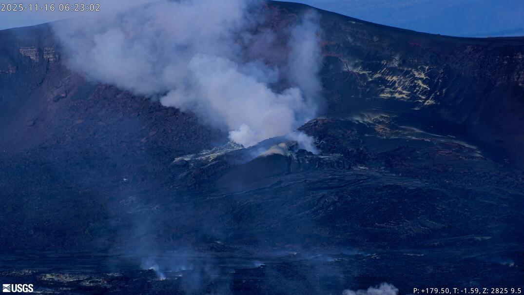
Summit Observations:
Glow was observed from both vents overnight. The glow varied from weak to strong, mainly visible from the south vent. Tremor spikes continue every 5–10 minutes and appear to be related to gas pistoning deeper in the vents.
UWD recorded just under 1 microradian of inflationary tilt due to a slight deflation in the past 24 hours and has recorded almost 14 microradians of inflationary tilt since episode 36 ended on November 9.
Plumes of gas from both the south and north vents are visible this morning and sulfur dioxide (SO2) gas emissions remain at eruption pause levels, typically between 1,200 and 1,500 tonnes per day.
Rift Zone Observations:
Rates of seismicity and ground deformation remain very low in the East Rift Zone and Southwest Rift Zone, with no significant earthquake activity in the past 24 hours. SO2 emissions from the East Rift Zone remain below the detection limit.
Source et photo : HVO.