Septembre 17 , 2025 .
Italy / Sicily , Etna :
WEEKLY BULLETIN, from September 8, 2025 to September 14, 2025. (Publication date: September 16, 2025)
ACTIVITY STATUS SUMMARY
Based on monitoring data, the following points are highlighted:
1) VOLCANOLOGICAL OBSERVATIONS: Variable rate degassing activity in the summit craters.
2) SEISMOLOGICAL OBSERVATIONS: Low seismic activity due to fracturing. Volcanic tremor amplitude of medium intensity.
3) INFRASOUND: Moderate infrasound activity.
4) GROUND DEFORMATION: No significant variation is reported in the ground deformation time series.

5) GEOCHEMISTRY: Medium-intensity SO2 fluxes.
The CO2 flux from the soil remains low.
Dissolved CO2 partial pressure in groundwater (Ponteferro): No update available.
Helium isotope ratio at peripheral sites: No update available.
6) SATELLITE OBSERVATIONS: Thermal activity observed by satellite in the summit area was generally low, with some isolated moderate-level thermal anomalies.
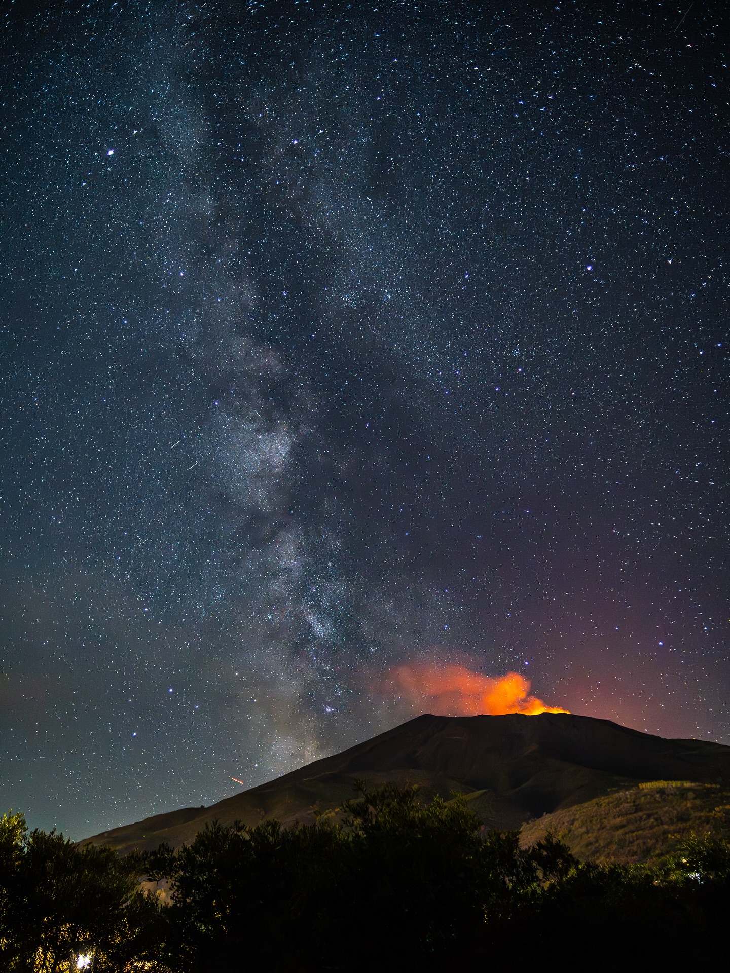
VOLCANOLOGICAL OBSERVATIONS
During the observation period in question, Mount Etna’s volcanic activity was monitored through the analysis of images from the INGV surveillance camera network, Osservatorio Etneo (INGV-OE).
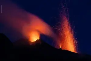
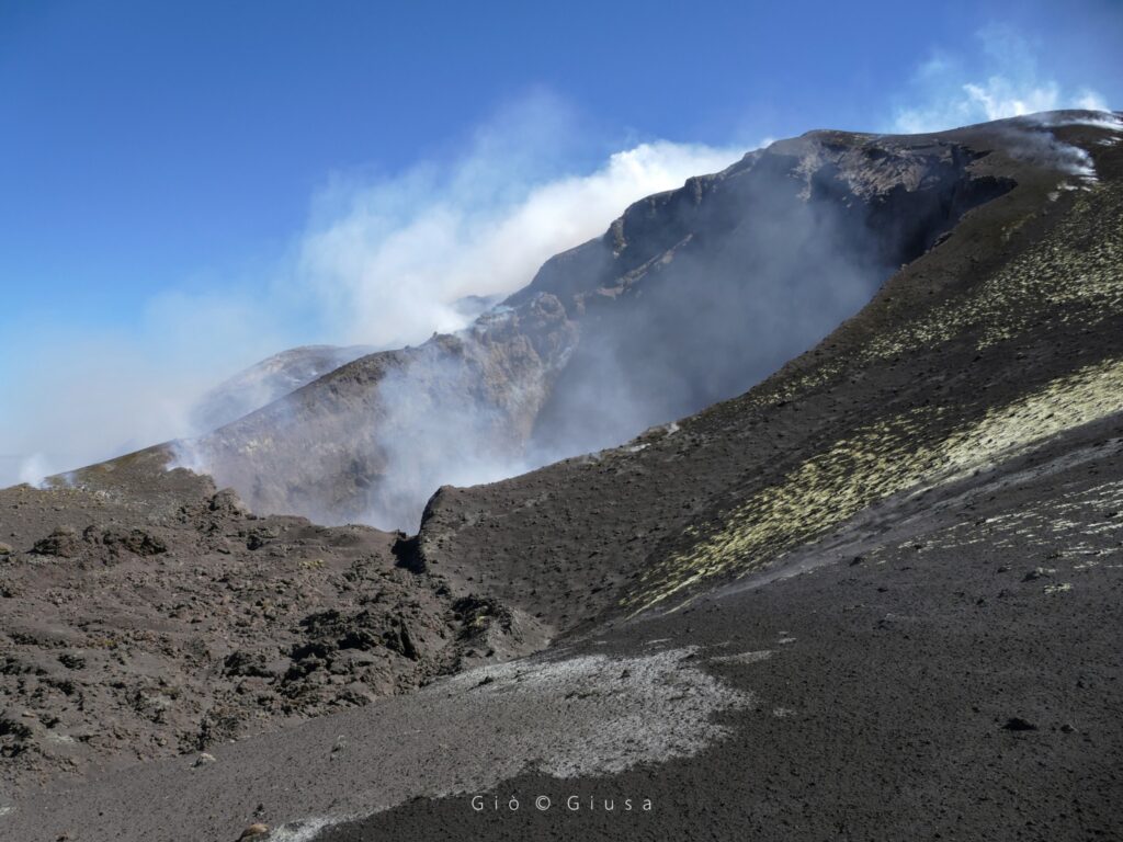
The craters generally exhibit diffuse degassing, attributable to various fumarolic systems, while the Bocca Nuova (BN) crater exhibits degassing generated mainly by the pit crater BN1. The Northeast (CNE) crater is notably affected by continuous degassing generated by a vent located at the crater floor.
Source : INGV
Photo : Gio Giusa
Italy , Stromboli :
WEEKLY BULLETIN, from September 8, 2025 to September 14, 2025. (Publication date: September 16, 2025)
SUMMARY OF ACTIVITY STATUS
Based on monitoring data, the following points are highlighted:
1) VOLCANOLOGICAL OBSERVATIONS: During the period studied, ordinary Strombolian eruptive activity was observed. The total hourly frequency of explosions fluctuated around average values (8 to 12 events/hour). Intensity was low and medium in the North and South-Central crater areas.
2) SEISMOLOGY: The monitored seismological parameters show no significant variation.
3) GROUND DEFORMATION: No significant variation is reported in the ground deformation time series.
4) GEOCHEMISTRY: SO2 flux at an average level. Soil CO2 fluxes in the Pizzo region (STR02): No update.
The C/S ratio in the plume remains at average values.
Dissolved helium isotope ratio (R/Ra) in the thermal aquifer: No update. The latest values (July 9) remain high.
Soil CO2 fluxes in the Scari region are at medium to high levels.
5) SATELLITE OBSERVATIONS: Thermal activity observed by satellite in the summit area was generally low, with some isolated moderate-level thermal anomalies.
VOLCANOLOGICAL OBSERVATIONS
During the observation period, Stromboli’s eruptive activity was characterized by analyzing images recorded by INGV-OE surveillance cameras located at an altitude of 190 m (SCT-SCV) and at Punta dei Corvi (SPCT). Explosive activity was mainly produced by four eruptive vents located in the North Crater area and by at least two vents located in the Central-South Crater area.
Due to adverse weather conditions, visibility of the crater terrace on September 13 was insufficient for an accurate description of the eruptive activity.
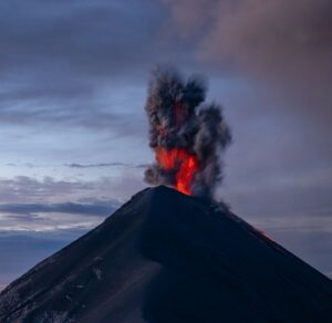
In the North (N) Crater area, four active vents were observed, producing explosive activity of low intensity (the eruptive products reached a height of less than 80 m) and sometimes of medium intensity (the products reached a height of between 80 and 150 m). The eruptive products consisted mainly of coarse materials (bombs and lapilli). The average explosion frequency ranged from 6 to 11 events/hour.
In the area of the Centre-Sud (CS) crater, medium to low intensity explosions of fine materials, sometimes mixed with coarse materials, were observed. The average explosion frequency ranged from 0 to 3 events/hour.
Source : INGV
Photo : Stromboli stati d’animo / Sebastiano Cannavo
Indonesia , Lewotobi Laki-laki :
LEWOTOBI LAKI-LAKI’S ACTIVITY LEVEL DECREASED FROM LEVEL IV (AWAS) TO LEVEL III (SIAGA) ON SEPTEMBER 16, 2025.
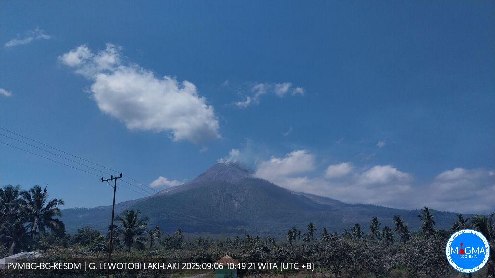
Lewotobi Laki-laki is one of two twin volcanoes located in East Flores Regency, East Nusa Tenggara Province. It rises to approximately 1,584 meters above sea level. On September 6, 2025, Mount Lewotobi Laki-laki exhibited increased activity, resulting in its elevation from Level III (Siaga) to Level IV (Awas). After its elevation to Level IV (Awas), Mount Lewotobi experienced several eruptions. Currently, Mount Lewotobi Laki-laki’s activity appears to be decreasing.
The latest activity monitoring for Mount Lewotobi Laki-laki is as follows:
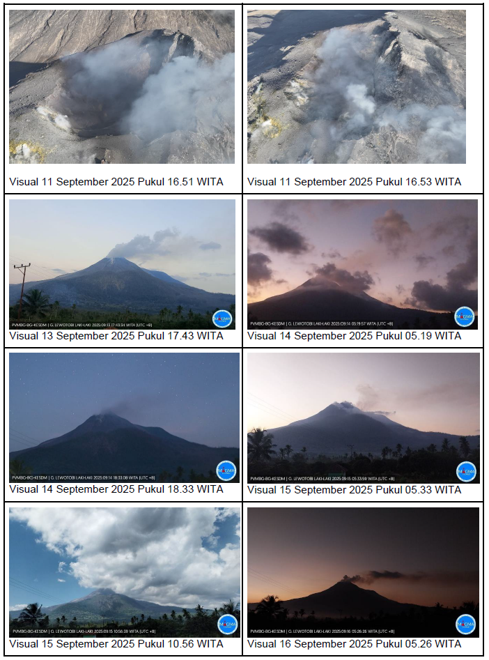
Visual observations conducted from September 9 to 16, 2025, at 8:00 a.m. WITA (Central Indonesia Time), showed that the volcano was clearly visible until it was covered by moderate fog. White smoke, thin, moderate, or thick, was observed escaping from the main crater, reaching a height of approximately 50 to 700 meters above the summit. Avalanches occurred, but their distance and direction were not visually observed.
The earthquake types recorded between September 9 and 16, 2025, at 8:00 a.m. WITA (Central Indonesian Time) were as follows:
8 avalanche earthquakes,
19 emission earthquakes,
4 harmonic tremors,
181 non-harmonic tremors,
7 low-frequency earthquakes,
49 deep volcanic earthquakes,
12 local tectonic earthquakes,
41 distant tectonic earthquakes.
Visual observations show fluctuating smoke heights and a decreasing trend, with low to moderate pressure. Smoke escaping through cracks on the northwest and northeast flanks appears thin. The smoke escaping from these fissures represents a fragile zone that could potentially be the site of a directed blast type eruption (direct eruption in a single direction) that could move towards the northwest, north, northeast and west of Mount Lewotobi Laki-laki.
Seismic data show a fluctuating pattern dominated by daily nonharmonic tremors. Deep volcanic, eruptive, avalanche, and local tectonic earthquakes continue to occur, but in fewer numbers compared to the same previous period. The overall seismic pattern shows relatively large fluctuations in seismic activity, indicating unstable magma dynamics and subsurface fluid movements, likely influenced by tectonic factors around Mount Lewotobi Laki-laki.
Tiltmeter deformation data during this period show a fluctuating but relatively stable trend, indicating that magma input to shallow areas is not yet significant. Global Navigation Satellite System (GNSS) data from the last five days show a deflationary trend that does not indicate significant magma input, but rather a shift toward shallow areas.
Based on the analysis and evaluation of visual and instrumental monitoring, the activity level of Mount Lewotobi Laki-laki has been lowered from Level IV (AWAS) to Level III (SIAGA) effective September 16, 2025 at 15:00 WITA (Central Indonesian Time).
Source and photo : PVMBG.
United States : Mount Saint Helens :
CASCADES VOLCANO OBSERVATORY INFORMATION STATEMENT , U.S. Geological Survey
Tuesday, September 16, 2025, 10:42 AM PDT (Tuesday, September 16, 2025, 17:42 UTC)
46°12′ N 122°10’48 » W,
Summit Elevation 8363 ft (2549 m)
Current Volcano Alert Level: NORMAL
Current Aviation Color Code: GREEN
Summary:
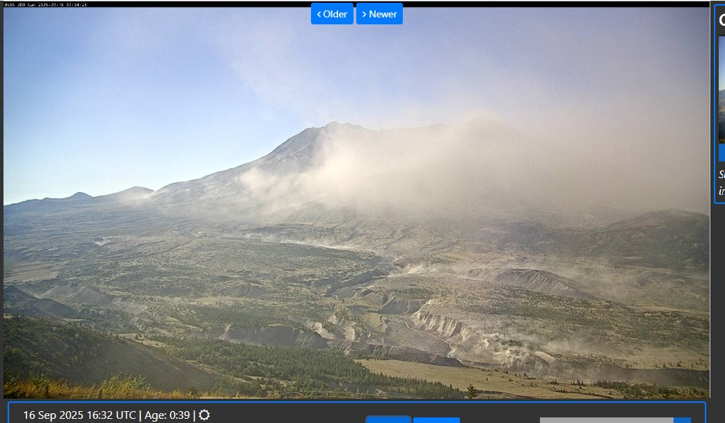
Stong winds are resuspending ash at Mount St. Helens.
There is no change in Volcano Alert Level or Aviation Color Code at this time. Mount St. Helens remains at normal, background levels of activity.
Current Observations
Strong easterly–southeasterly winds in the vicinity of Mount St. Helens have picked up loose volcanic ash deposited during the 1980 eruptions and are carrying it to the west–northwest. The resuspended ash has been reported by commercial pilots in the area.
This phenomenon is not the result of recent volcanic activity and occasionally occurs during times of high winds and dry snow-free conditions in the Mount St. Helens area. No eruption is in progress and Mount St. Helens remains at Aviation Color Code GREEN and Alert Level NORMAL. Resuspended volcanic ash should be considered hazardous and could be damaging to aircraft and health.
Current monitoring
The USGS monitors volcanoes with instrument networks and satellites; conducts research on volcano processes; and communicates important information to the public to mitigate risk and safeguard society. The USGS Cascades Volcano Observatory jointly operates the monitoring network at Mount St. Helens with the Pacific Northwest Seismic Network
Source et photo : CVO
Iceland , Reykjanes Peninsula :
Hazard assessment unchanged but will be reassessed in one week
Updated 16 September
Uplift and magma accumulation beneath Svartsengi continues.
Approximately 8–9 million cubic meters of magma have accumulated beneath Svartsengi since the last eruption.
The likelihood of a new event increases when around 11 million cubic meters have accumulated, expected towards the end of September. However, there remains considerable uncertainty.
The hazard map remains unchanged but will be reassessed next week.
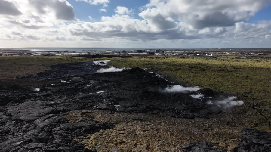
Uplift and magma accumulation
Measurements show that magma accumulation beneath Svartsengi continues at a similar rate as in recent weeks. Model calculations estimate that about 8–9 million cubic meters of magma have accumulated since the last eruption, which began on 16 July. The volume that drained from the accumulation area in that eruption was estimated at around 12 million cubic meters.
Likelihood of a new eruption
Based on previous events in the Sundhnúkur crater row, the likelihood of a new dike intrusion and eruption increases once a similar volume of magma has accumulated beneath Svartsengi as drained during the last event. If the accumulation rate remains unchanged, this volume will be reached in the latter part of September, as noted in the last hazard map update. However, experience shows that the thresholds for when an eruption begins vary between events. In some cases, eruptions have started at a lower volume, while in others a higher volume has been required. Therefore, an eruption may begin at any time, even though magma accumulation is still below 12 million cubic meters.
Source : IMO .