September 8 , 2025 .
New Zealand , White Island :
Observation flight shows no ash in the steam plume from Whakaari. Volcanic Alert Level remains at 2 and Aviation Colour Code remains Yellow.
Published: Mon Sep 8 2025 2:00 PM
An observation flight has confirmed that no ash is currently present in the volcanic plume at Whakaari. On 28 August, some short-lived minor eruptive activity was observed and produced a thin covering of ash across the island. There is no eruptive activity currently occurring. The Volcanic Alert Level remains at level 2 and the Aviation Colour Code remains Yellow.
On August 28, our Whakatāne webcam recorded an eruption plume (dark-coloured cloud) rising from Whakaari/White Island. The eruption consisted of occasional, short-lived, relatively dark plumes containing ash. Poor weather conditions since then have made it difficult to confirm any further activity. An observation flight (3 September) confirmed this has since ceased.
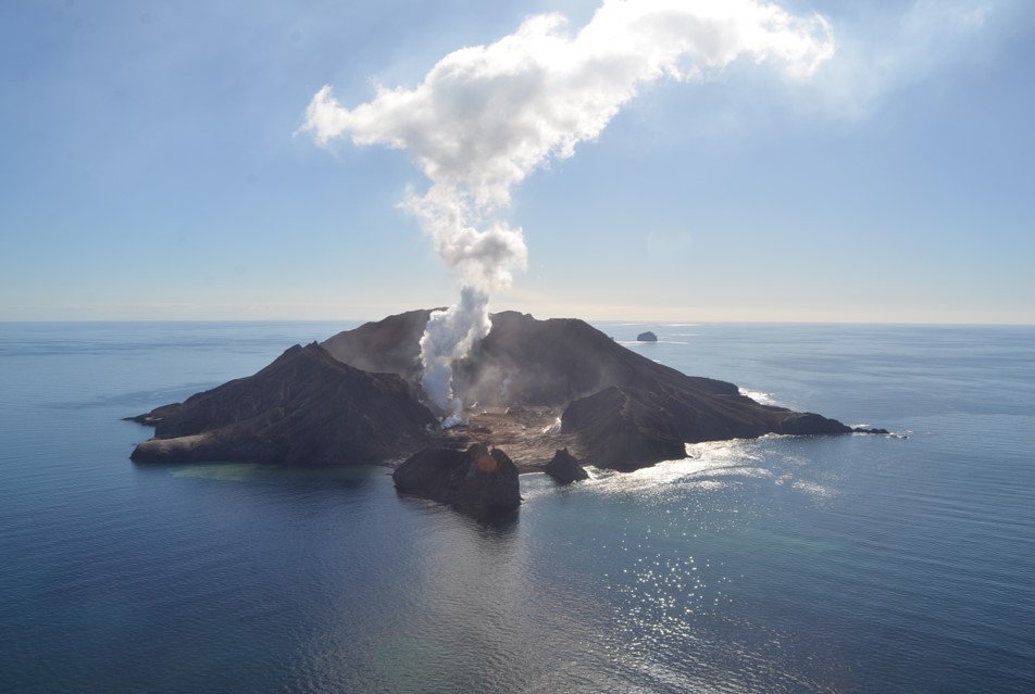
Image from observation flight, 3 September 2025, showing a white steam and gas plume, containing no volcanic ash.
Footage from the observation flight confirms that the recent activity was minor and only thin ashfall deposits are present on the island. The active vent area is unchanged, indicating no large-scale activity occurred. The eruptive activity has not been sustained and there was no eruptive activity occurring during the observation flight. A vent temperature of 164 °C was measured, typical of volcanic unrest, not eruptive activity. This fumarole temperature is relatively low compared to periods when heightened activity was present in the vent area (vent temperatures often exceeded 400-600 °C when shallow magma was present beneath the vent). Data from gas flights and satellites also confirm that the gas output remains steady, consistent with the minor level of activity observed. Our observations are consistent with moderate to heightened unrest and the Volcanic Alert Level remains at 2. We will continue to monitor the activity and provide updates when new data and observations allow.
The flight also confirmed some changes in the activity of the fumaroles (steam vents) elsewhere on the island. The area of vents on the south side of the main crater (known as Fumarole 0) have dried out and an inclined vent is now active. Also, several sources on the north side of the crater in the Fumarole 13/14 area were active. The level of activity in these areas is variable.
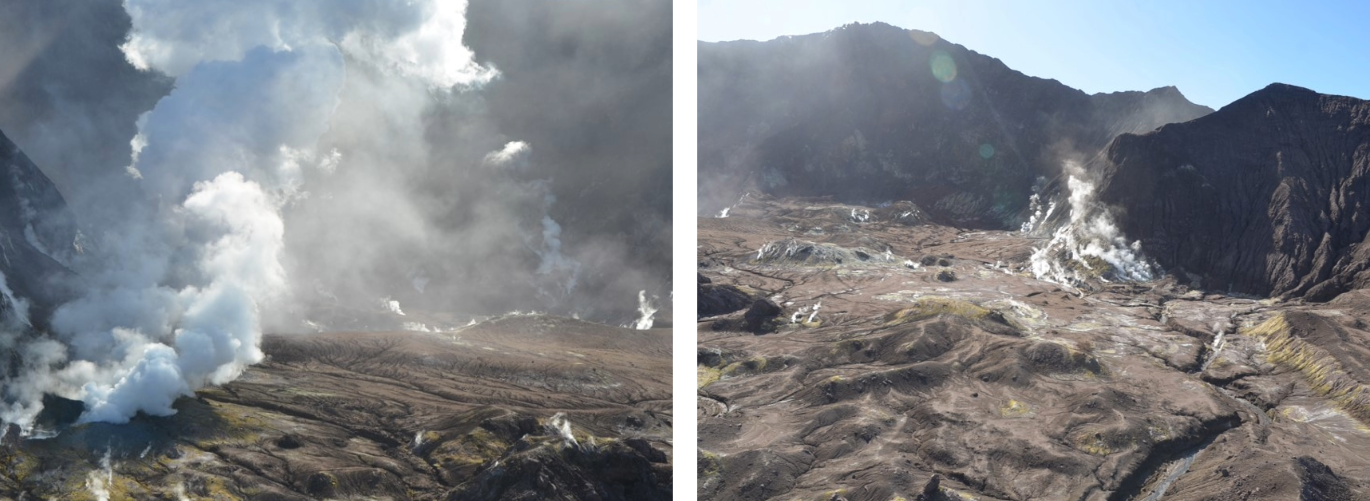
Aerial views on 3 September showing the active inclined vent at the Fumarole 0 area (left) and several active vents in the Fumarole 13/14 area (right).
The Volcanic Alert Level reflects the current level of volcanic activity and is not a forecast of future activity. While Volcanic Alert Level 2 is mostly associated with volcanic unrest hazards (including discharge of steam and hot volcanic gases, earthquakes, landslides and hydrothermal activity), the potential for eruption hazards remains.
The Earth Sciences New Zealand Volcano Monitoring Group and National Geohazards Monitoring Centre will continue to closely monitor for any further changes in activity. The Te Kaha and Whakatāne web cameras continue to provide observations of the plumes’ status, but local weather conditions may impact how the activity appears from the Bay of Plenty coast. As conditions allow, we will continue to conduct our regular overflights to perform observations and gas flux measurements. We also monitor sulphur dioxide emissions and ground deformation via satellite, whilst we also collaborate with MetService colleagues to monitor the plume in the atmosphere.
Source : Geonet / Geoff Kilgour / Duty Volcanologist
Photos : Brad Scott.
Indonesia , Marapi :
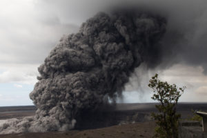
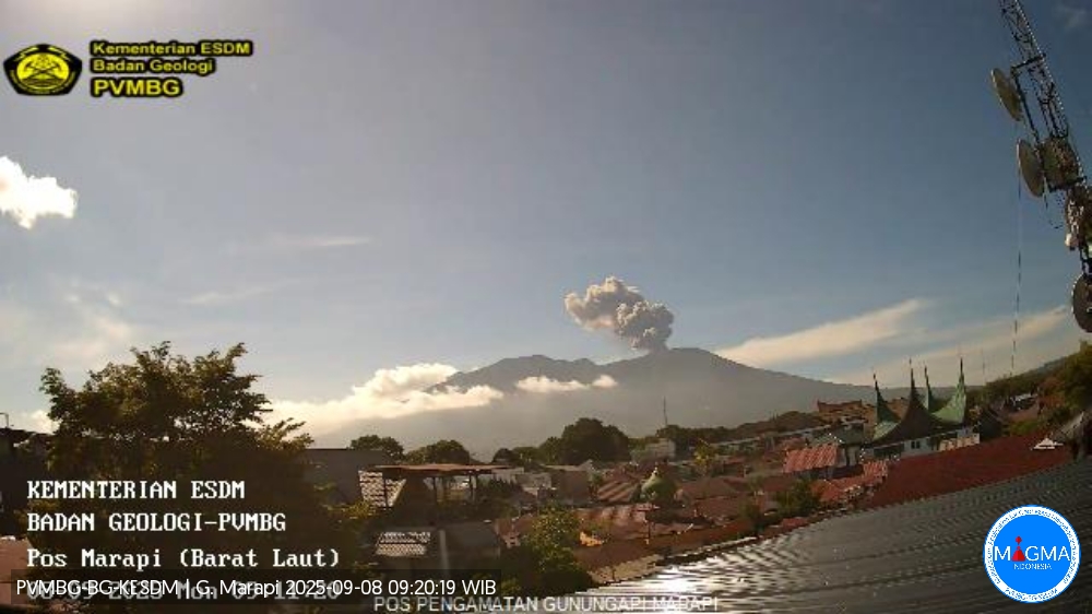
An eruption of Mount Marapi occurred on Sunday, September 7, 2025, at 8:16 p.m. WIB. An ash column was observed about 1,200 m above the summit (about 4,091 m above sea level). The ash column was gray and dense, oriented northeast. This eruption was recorded by seismograph with a maximum amplitude of 30.4 mm and a duration of 54 seconds.
VOLCANO OBSERVATORY NOTICE FOR AVIATION – VONA
Issued : September 7 , 2025
Volcano : Marapi (261140)
Current Aviation Colour Code : ORANGE
Previous Aviation Colour Code : orange
Source : Marapi Volcano Observatory
Notice Number : 2025MAR066
Volcano Location : S 0 deg 22 min 52 sec E 100 deg 28 min 23 sec
Area : West Sumatra, Indonesia
Summit Elevation : 9251 FT (2891 M)
Volcanic Activity Summary :
Eruption with volcanic ash cloud at 13h16 UTC (20h16 local).
Volcanic Cloud Height :
Best estimate of ash-cloud top is around 13091 FT (4091 M) above sea level or 3840 FT (1200 M) above summit. May be higher than what can be observed clearly. Source of height data: ground observer.
Other Volcanic Cloud Information :
Ash cloud moving to northeast. Volcanic ash is observed to be gray. The intensity of volcanic ash is observed to be thick.
Remarks :
Eruption recorded on seismogram with maximum amplitude 30.4 mm and maximum duration 54 second.
Source et photo : Magma Indonésie .
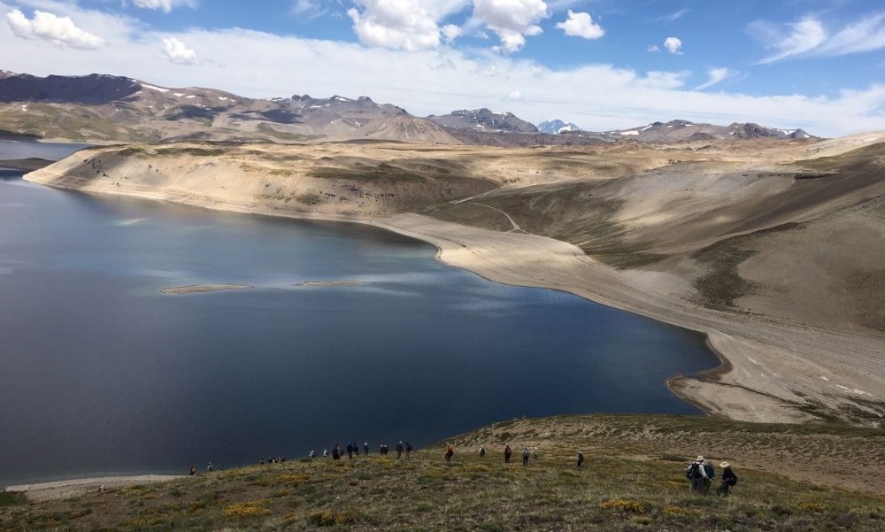
Chile , Laguna del Maule :
Special Report on Volcanic Activity (REAV), Maule Regions, Laguna del Maule Volcanic Complex, September 7, 2025, 5:30 p.m. local time (Continental Chile)
The National Geology and Mining Service of Chile (SERNAGEOMIN) announces the following preliminary information, obtained using the monitoring equipment of the National Volcanic Monitoring Network (RNVV), processed and analyzed at the Southern Andean Volcano Observatory (OVDAS):
On Sunday, September 7, 2025, at 5:15 p.m. (20:15 UTC), monitoring stations installed near the Laguna del Maule volcanic complex recorded an event associated with rock fracturing within the volcanic system.
The characteristics of the highest-energy earthquake after analysis are as follows:
TIME OF ORIGIN: 5:15 PM local time (8:15 PM UTC)
LATITUDE: 36.102°S
LONGITUDE: 70.506°W
DEPTH: 7.6 km
LOCAL MAGNITUDE: 4.2 (ML)
Observation:
The recurrent seismic activity observed at the Laguna del Maule volcanic complex, with volcano-tectonic (VT) events, continues at moderate to low levels.
The Volcanic Technical Alert remains at YELLOW.
Source : Sernageomin
Photo : auteur inconnu.
Ecuador , Sangay :
SANGAY VOLCANO DAILY STATUS REPORT, September 7, 2025.
Information Geophysical Institute – EPN.
Surface Activity Level: Moderate, Surface Trend: No Change
Internal Activity Level: Moderate, Internal Trend: No Change
Seismicity: From September 6, 2025, 11:00 a.m. to September 7, 2025, 11:00 a.m.:
Seismicity:
Below is the count of seismic events recorded at the reference station.
Explosion (EXP): 54
Precipitation/Lahars:
Precipitation was recorded in the volcanic area without generating mudflows or debris flows. **Heavy rainfall could remobilize accumulated material, generating mudflows and debris flows that would cascade down the volcano’s flanks and flow into adjacent rivers.**
Ash Emission/Plume:
Due to cloud cover in the volcano area, gas and/or ash emissions could not be observed using the surveillance camera network or the GOES-19 satellite system. However, the Washington-based VAAC reported an ash cloud erupting 1,500 meters above the crater level, in a southwesterly direction.
Gas:
The MOUNTS satellite system detected 5.35 tons of sulfur dioxide (SO2), measured on 09/06/2025 at 13:38 LT.
Other monitoring parameter:
The FIRMS satellite system recorded 12 thermal anomalies over the past 24 hours.
Observation:
Due to cloud cover in the area, no incandescence could be observed at the volcano.
As of the closing date of this report, the volcano remains completely cloudy.
Alert level: Yellow
Source : IGEPN
Photo : Volcan Sangay / FB.
Costa Rica , Rincon de la Vieja :
Latitude: 10.83°N;
Longitude: 85.34°W;
Altitude: 1,916 m.
Current Activity Level: Alert.
This week, two moderate eruptions and one exhalation were recorded. The most intense eruption occurred on August 31 at 3:30 a.m. and the second on September 3 at 1:24 p.m. On September 3, residents of Dos Ríos de Upala reported whitish sediment from the volcano, carried by the Río Azul at 2:30 p.m. This report followed heavy rainfall. It is believed that the sediment was carried into the channels by material from the crater floor, ejected by the two eruptions and deposited on the rim. However, for neither eruption was there any visual corroboration to confirm whether it was both or just one of them that produced the ejection of sediment and ash outside the crater lake. These events are phreatic in nature and of moderate amplitude.

Tremor is still observed with two distinct sources, one high-frequency and continuous, and the other low-frequency and fragmented (short tremors). This tremor was variable during this week. Four days before the eruption on August 31, the background tremor gradually decreased until it almost disappeared. After the eruption on August 31, the tremor reappeared in a fragmented form (short tremors). Long-period « tornillos » events and proximal volcano-tectonic (VT) earthquakes were also recorded. Geodetic observations show subsidence and ground movement toward the south of the summit. The uplift at the base of the volcanic edifice is disappearing. This week, DOAS stations detected an SO2 flux of 160 ± 105 t/d. However, no traces of SO2 have been recorded in the atmosphere by satellite measurements since August 12.
Source : Ovsicori .
Photo : Federico Chavarría-Kopper – Ovsicori