August 30 , 2025 .
Italy / Sicily , Etna :
Etna Activity Update, August 29, 2025, 6:24 PM (4:24 PM UTC).
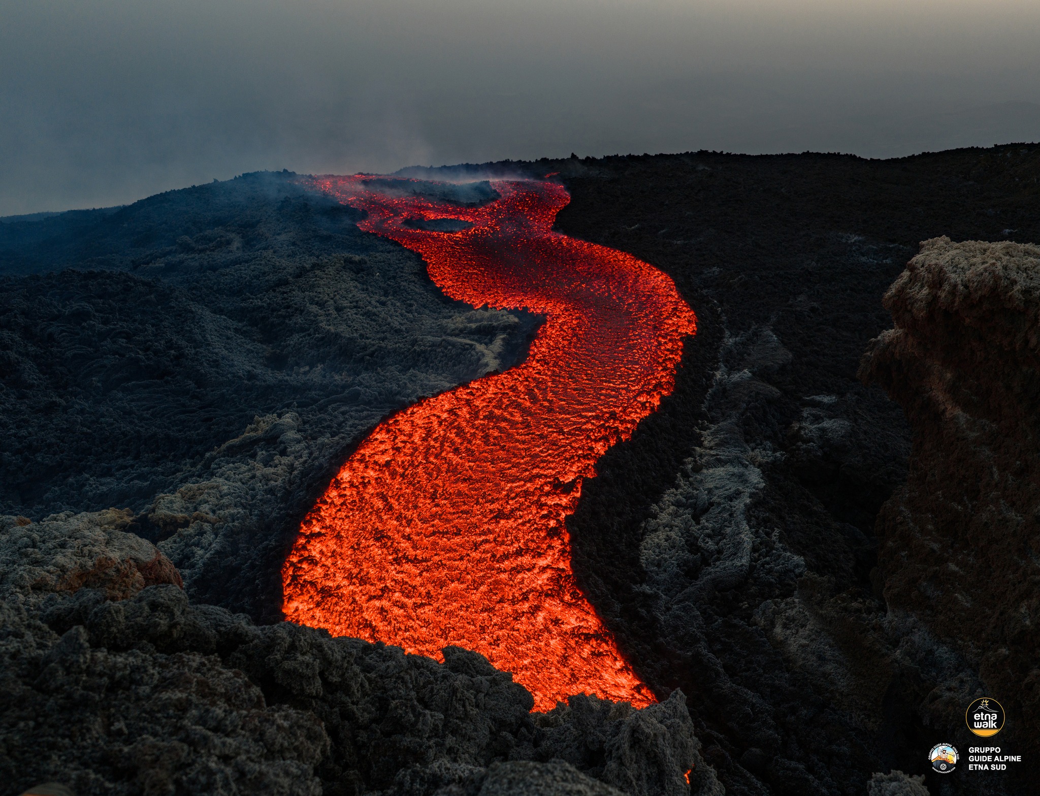
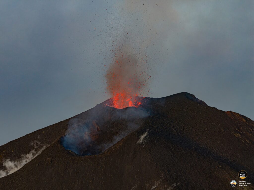
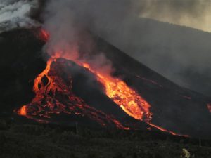
The National Institute of Geophysics and Volcanology, Osservatorio Etneo, announces that, based on analysis of surveillance camera images and volcanological and drone surveys carried out by INGV personnel in the summit area, Strombolian activity continues with varying intensity at the Southeast Crater. This activity produces modest and sporadic ash emissions that disperse rapidly in the summit area under the action of high-altitude winds. In the most intense phases, Strombolian activity is characterized by an increase in the number of explosions and by pyroclastic products that fall beyond the crater rim.
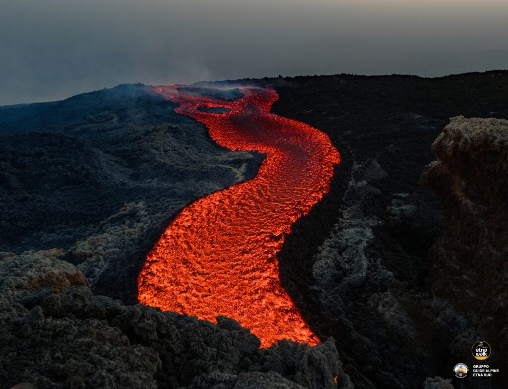
Effusive activity persists from the vent located at an altitude of 2,980 m. This vent feeds a lava field composed of at least three main flows, which, at a distance from the effusive vent, also divide into additional lava flows. The most advanced front, around 10:00 UTC, reached an altitude of approximately 2,350 m above sea level, just upstream of the 1610 vents and Mount Pecoraro. Furthermore, measurements show that the lava field produced by the effusive vent at an altitude of 3,100 m is inactive and cooling, while that of the vent at an altitude of 3,200 m is active. It is still being fed, and the most advanced front, which is developing in a southeasterly direction, was located at an altitude of approximately 2,870 m above sea level at 10:00 UTC.
From a seismic point of view, over the last 24 hours, the average amplitude of the volcanic tremor has remained high, and the centroids of its sources remain confined to the area of the Southeast Crater, at an altitude of approximately 3,000 meters above mean sea level. After the intense infrasound activity recorded yesterday, a clear decrease in the frequency and amplitude of infrasound events has been observed since the early hours of the day. The latter, of low and medium amplitude, appear to be located in the Southeast Crater.
The ground deformation signals recorded by the networks show no significant variation compared to recent days. The DRUV dilatometer station continues to display a slow variation in decompression, accumulating to date, since the beginning of the current effusive activity, a total of approximately -55 nanodeformations.
Further information will be provided shortly.
Source : INGV
Photos : Etna Walk / Giuseppe Distefano / Marco Restivo .
Alaska , Shishaldin :
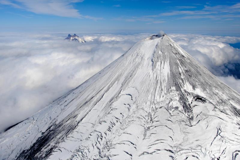
On Monday, AVO raised the Aviation Color Code to YELLOW and the Volcano Alert Level to ADVISORY at Shishaldin Volcano based on elevated seismicity, stronger and more frequent infrasound signals, and an increase in sulfur dioxide gas emissions. These signs of unrest continued over the past week. No other changes have been observed in satellite or webcam data, other than a more robust gas plume from the summit of the volcano.
Shishaldin Volcano is monitored by local seismic and infrasound sensors, web cameras, and a telemetered geodetic network. In addition to the local monitoring network, AVO uses nearby geophysical networks, regional infrasound and lighting data, and satellite images to monitor the volcano.
Source : AVO.
Photo : Loewen, Matt
Indonesia , Ili Lewotolok :
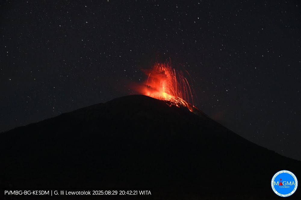
An eruption of Mount Ili Lewotolok occurred on Friday, August 29, 2025, at 8:42 PM WITA. An ash column was observed about 400 m above the summit (about 1,823 m above sea level). The ash column was white to gray in color, of moderate intensity, and directed westward. This eruption was recorded by seismograph with a maximum amplitude of 15.9 mm and a duration of 41 seconds.
Seismic Observations
28 eruption earthquakes with amplitudes ranging from 5.1 to 8.2 mm and lasting from 31 to 32 seconds.
32 emission earthquakes with amplitudes ranging from 1.4 to 4.9 mm and lasting from 28 to 30 seconds.
1 deep volcanic earthquake with amplitude of 5.2 mm and lasting from 12 seconds.
Recommendations
At activity level III (SIAGA):
[1] Residents living near Mount Ili Lewotolok, as well as visitors, mountaineers, and tourists, are advised to refrain from entering or carrying out activities within a 3 km radius of the activity center of Mount Ili Lewotolok. Be aware of the potential dangers of lava avalanches and pyroclastic flows originating from the southern, southeast, western, and northeast sectors of Mount Ili Lewotolok.
(2) The public is advised not to panic if they hear a rumbling or roaring noise coming from the crater of Mount Ili Lewotolok, as this noise is characteristic of volcanic activity during an eruption. This powerful rumbling noise can cause severe vibrations in several parts of the building, including windows and glass doors.
Source et photo : Magma Indonésie .
Colombia , Nevado del Ruiz :
Manizales, August 26, 2025, 6:30 p.m.
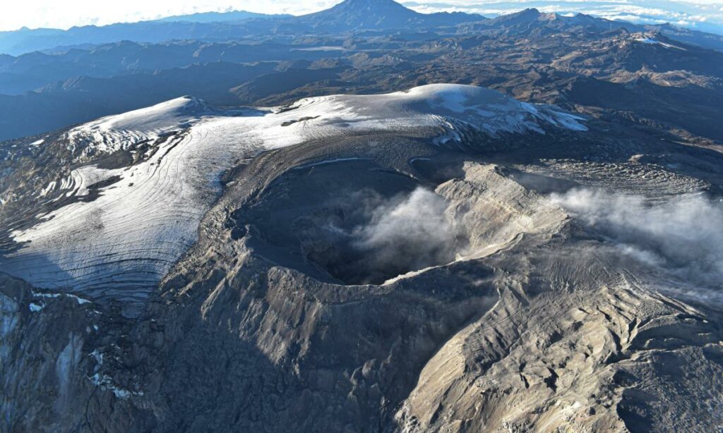
Regarding the monitoring of the activity of the Nevado del Ruiz volcano, the Colombian Geological Survey (SGC), an entity affiliated with the Ministry of Mines and Energy, reports that:
– During the week of August 19-25, 2025, the volcano continued to exhibit unstable behavior. Compared to the previous week, the main variations in the monitored parameters were:
– Seismicity related to fluid dynamics in volcanic conduits increased, with an increase in the number of recorded earthquakes and the seismic energy released. This seismicity was characterized mainly by short-duration signals, with mostly low energy levels, and even moderate in some cases. Thanks to the cameras (conventional or thermographic) used for monitoring the volcano, it was possible to confirm several pulsating ash emissions and variations in the apparent temperature of the materials emitted during these emissions. The ash emission on August 19 at 10:20 p.m. stands out for its moderate energy level and for the fact that it was associated with the highest apparent temperature variation observed during the week.
– Seismic activity associated with rock fracturing processes within the volcanic edifice increased the number of recorded earthquakes and maintained similar levels of released seismic energy. The earthquakes were mainly located in the Arenas Crater and in the northeast, east, and southeast sectors, within 5 km of the Arenas Crater. To a lesser extent, scattered earthquakes were recorded in the distal sectors of the volcano.
The depth of the earthquakes ranged from less than 1 km to 9 km from the volcanic summit. The strongest earthquake of the week occurred on August 19 at 12:09 p.m. in the Arenas Crater, at a depth of 2 km, with a magnitude of 1.4. Additionally, on August 22, seismic activity related to the lava dome (prominence or mound) located at the crater floor was recorded, characterized by low event levels and low seismic energy release.
The emission of water vapor and gases, mainly sulfur dioxide (SO₂), into the atmosphere through the Arenas crater was variable throughout the week. Estimated values of the flux associated with SO₂ degassing decreased compared to those recorded the previous week. This trend was also highlighted by satellite monitoring conducted to assess this parameter.
The vertical height of the gas, water vapor, or ash column reached a maximum value of 500 m measured above the volcano’s summit. The maximum dispersion height was estimated at 1,800 m during the ash emission recorded on August 21 at 2:24 p.m. Regarding the dispersion direction, the column tended towards the west-northwest and west-southwest of the volcano. When monitoring thermal anomalies at the floor of Arenas crater using satellite monitoring platforms, detection continued to be limited by persistent atmospheric conditions of high cloud cover in the volcanic area. However, some low-energy anomalies were reported.
Source et photo : SGC.
Granada , Kick ’em Jenny :
The University of the West Indies Seismic Research Centre (UWI SRC) has advised the National Disaster Management Agency (NaDMA) of increased seismic activity at the Kick ’em Jenny (KeJ) Submarine Volcano.
The unrest event began at 10 pm (local time) on the night of Wednesday, 27 August 2025.
Approximately 800 tremors were detected between 10 pm on 27 August to 8 am on 28 August. The largest events measured so far are in the range of Magnitude 2.2–2.4. There have been no reports of these tremors being felt in Grenada. While activity is continuing, its intensity has decreased compared to the start of the unrest.
The UWI SRC will continue to monitor the Submarine Volcano and provide updated analyses of the situation.
Based on the information from UWI SRC, the alert level for Kick ’em Jenny remains at YELLOW. This means that all marine interests should maintain the exclusion zone of 1.5 km.
The last period of unrest at KeJ occurred between 10 and 14 February 2024, during which over 3,400 events were recorded. The maximum magnitude then was 3.3, and no T-phases (explosion signals) were observed.
The National Disaster Management Agency (NaDMA) will continue to monitor the situation and provide updates to the public.
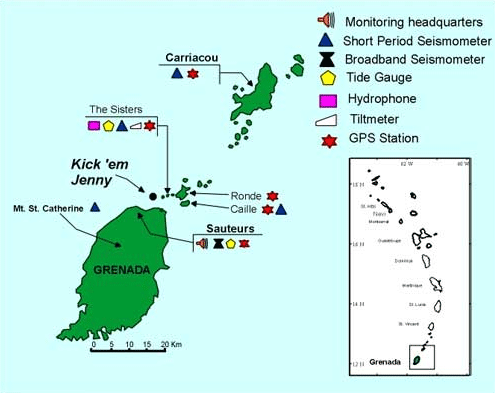
Kick ’em Jenny, an active submarine volcano 8 km off the N shore of Grenada, rises 1,300 m from the sea floor. Recent bathymetric surveys have shown evidence for a major arcuate collapse structure, which was the source of a submarine debris avalanche that traveled more than 15 km W. Bathymetry also revealed another submarine cone to the SE, Kick ’em Jack, and submarine lava domes to its S. These and subaerial tuff rings and lava flows at Ile de Caille and other nearby islands may represent a single large volcanic complex. Numerous eruptions have occurred since 1939, mostly documented by acoustic signals. Prior to the 1939 eruption, when an eruption cloud rose 275 m above the ocean and was witnessed by a large number of people in northern Grenada, there had been no written mention of the volcano. Eruptions have involved both explosive activity and the quiet extrusion of lava flows and lava domes in the summit crater; deep rumbling noises have sometimes been heard onshore. Recent eruptions have modified the morphology of the summit crater.
Sources : Now Grenada . com ,GVP.
Photo : UWI/SRC .

