August 27 , 2025 .
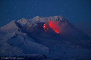
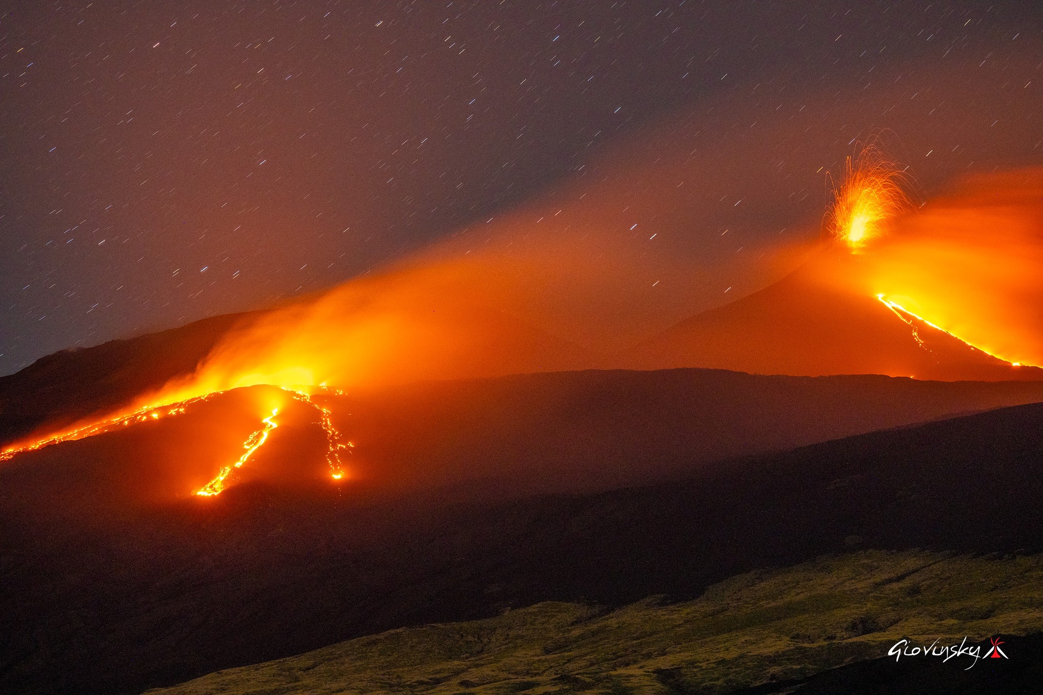
Italy / Sicily , Etna :
WEEKLY BULLETIN, from August 18, 2025 to August 24, 2025. (Publication date: August 26, 2025)
ACTIVITY SUMMARY
Monitoring data highlight the following:
1) VOLCANOLOGICAL OBSERVATIONS: Effusive activity from a vent located at an altitude of 2,980 m; effusive activity from a vent located at an altitude of 3,100 m, at the base of the saddle between the Bocca Nuova crater and the Southeast crater; effusive activity from a vent located at an altitude of 3,200 m. On the southern flank of the Southeast Crater, Strombolian activity occurred at the Southeast Crater with sporadic and moderate emissions of volcanic ash, and degassing of varying intensity at the Bocca Nuova, Voragine, and Northeast Craters.
2) SEISMOLOGY: No seismic activity due to fracturing with Ml >= 2.0; the average amplitude of the volcanic tremor showed a general trend of gradual increase, with both gradual and sudden oscillations.
3) INFRASOUND: High infrasound activity, sometimes discontinuous.
4) GROUND DEFORMATION: The GNSS (HF) ground deformation monitoring network did not measure any significant variations. The ECP inclinometer station and the DRUV dilatometer recorded variations consistent with ongoing eruptive activity. 5) GEOCHEMISTRY: SO2 fluxes increasing toward medium-high values.
Soil CO2 fluxes (Etnagas Network): The flux is increasing, remaining at low values.
Dissolved CO2 in groundwater (EtnaAcque Network): No update.
Helium isotope ratio at peripheral sites: The latest data from August 5 are high.
6) SATELLITE OBSERVATIONS: Thermal activity observed by satellite in the summit area was generally high to very high, consistent with ongoing effusive activity.
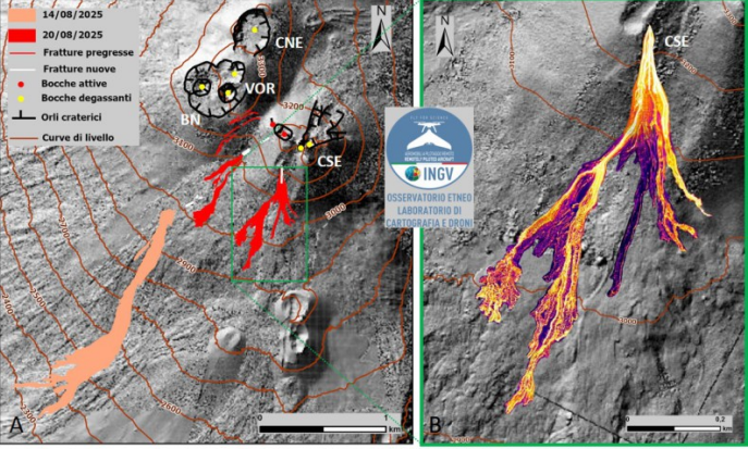
On the left, the map of lava flows emitted from August 14 (in orange) and 20 (in red), superimposed on the shaded relief of the summit area of Etna, obtained by processing drone images acquired on June 4 and 24, 2025. Geoid contour lines are plotted every 100 meters. CSE = Southeast Crater, CNE = Northeast Crater
VOR = Voragine, BN = Bocca Nuova; on the right, thermal orthomosaic of the lava flow emitted at an altitude of 3,200 m.
VOLCANOLOGICAL OBSERVATIONS
During the week, Mount Etna’s volcanic activity was monitored through the analysis of images acquired by the video surveillance cameras of the National Institute of Geophysics and Volcanology, Osservatorio Etneo (INGV-OE), and through daily observations carried out by INGV-OE staff in the summit area. Effusive activity continued throughout the week at the vent opened on August 14. In addition, on August 20, two new vents opened: one at an altitude of 3,100 m, at the base of the saddle between the Bocca Nuova crater and the Southeast crater, and the other at an altitude of 3,200 m, on the southern flank of the Southeast crater. The map of the lava flow produced by the three effusive vents was compiled from drone images taken on August 23 and 24 and a Skysat satellite image from August 24. During the period studied, the Southeast Crater (SEC) exhibited Strombolian activity of varying intensity, accompanied by low levels of volcanic ash emissions, while the other summit craters exhibited degassing activity at varying rates.
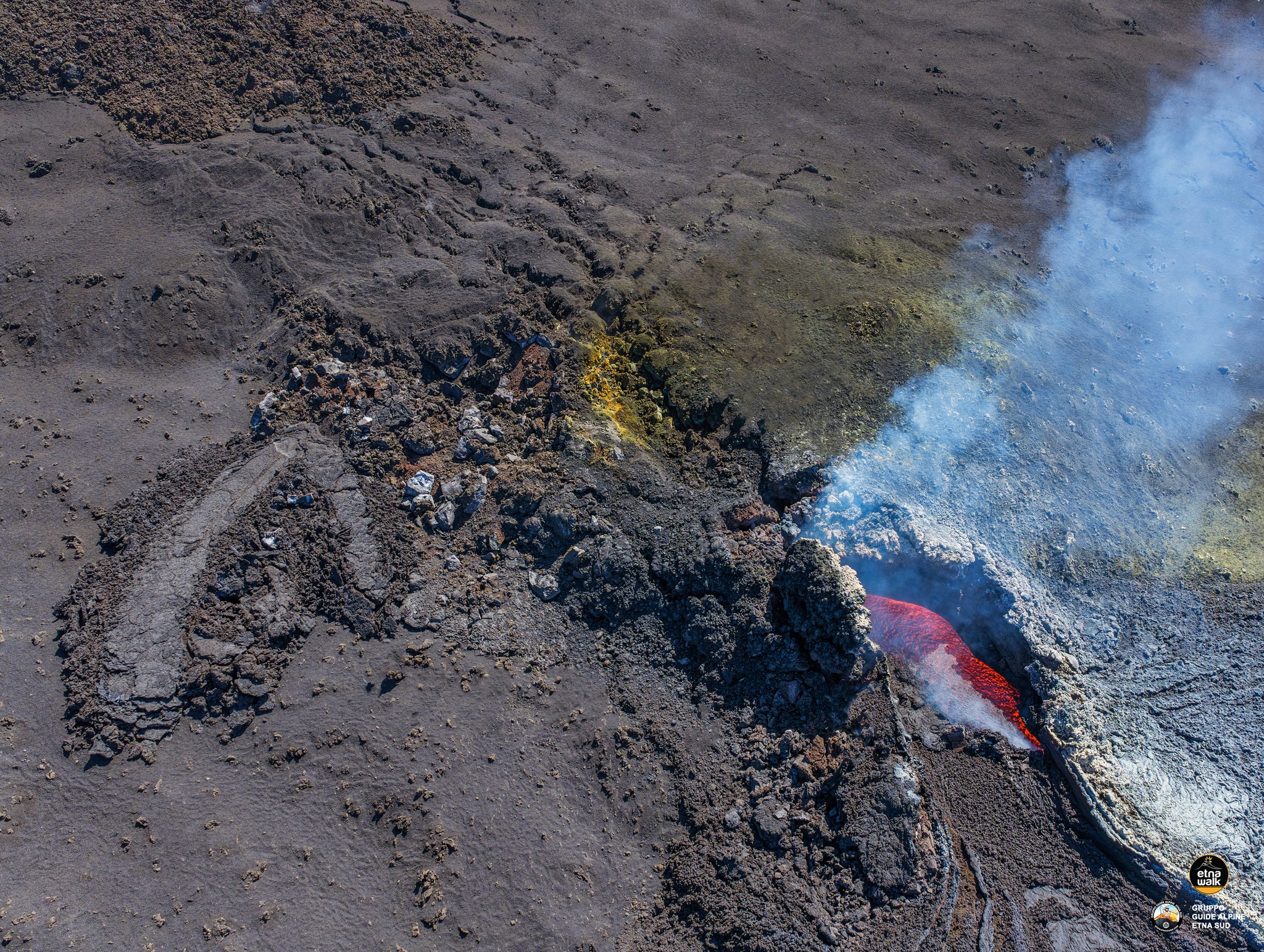
Effusive activity from the vent located at an altitude of 2,980 m continued throughout the week. This vent formed a lava field that, in its proximal portion, was largely filled with caves. In its distal portion, the flow formed several main branches progressing southwestward, with overlapping flows. The most advanced front reached an altitude of 2,250 m asl, as recorded by a drone survey on August 23. On August 24, at approximately 11:30 UTC, INGV-OE personnel at the summit observed that the vent was no longer being fed and the lava field was cooling.

On the morning of 20 August 2025, a new effusive chimney opened at the base of the saddle, between the Southeast Crater and the Bocca Nuova, at an altitude of 3,100 m above sea level. The opening was observed by INGV-OE personnel present at the summit and was initially characterized by spatter activity. This chimney fed a lava flow along the western flank, the most advanced front of which reached, on 24 August, an altitude of about 3,000 m above sea level. Also on 20 August, from 13:40 UTC, another effusive chimney opened on the upper southern flank of the Southeast Crater, at an altitude of about 3,200 m above sea level. This chimney fed a lava field composed of several branches that propagated towards the southwest and south. By 24 August, the most advanced front in a southwesterly direction had reached an altitude of 2,950 m above sea level. The lava flow of 14 August reached a length of just under 2 km. The flow emitted by the vent located at 3,100 m above sea level, in the saddle between the Southeast Crater and the Bocca Nuova, is 670 m long, while the flow emitted at 3,200 m above sea level, on the southern flank of the Southeast Crater, reached 880 m. The average thickness of the flows, estimated by direct field observations, is about 1.5 m, and the volume emitted up to 24 August is equal to 0.6 × 10^6 m^3.
This estimate must be considered preliminary, as adverse weather conditions prevented photogrammetric surveys. It is estimated that the uncertainty associated with the volume could reach 50%. Furthermore, drone images show the presence of a fracture field oriented mainly north-northeast / south-southwest, extending from the effusive source located at an altitude of 2,980 m to the rim of the southeast crater. Fractures are also present near the effusive source, at an altitude of 3,200 m.
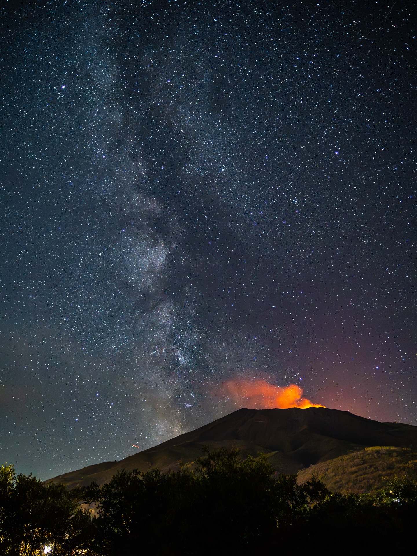
Throughout the week, Strombolian activity continued at the southeast crater, as described in ETNA Bulletin No. 34/2025. This activity was characterized by eruptions of pyroclastic material that fell back beyond the crater rim. Sporadic and moderate volcanic ash emissions were also observed at the Southeast Crater, rapidly diluted and dispersed by high-altitude winds. Finally, variable-rate degassing activity was observed in the remaining summit craters.
Source : INGV.
Photos : INGV , Giovinsky Aetnensis , Etna walk / Giuseppe Distefano .
Italy , Stromboli :
WEEKLY BULLETIN, from August 18, 2025 to August 24, 2025. (Publication date: August 26, 2025)
ACTIVITY SUMMARY
Monitoring data highlights the following:
1) VOLCANOLOGICAL OBSERVATIONS: During this period, ordinary Strombolian eruptive activity was observed, with spattering in the northern zone. The total hourly frequency ranged from moderate (8 events/h) to high (16 events/h). The intensity of the explosions was low and moderate in the northern and central-southern crater zones.
2) SEISMOLOGICAL: The monitored seismic parameters show no significant variation.
3) GROUND DEFORMATION: Ground deformation monitoring networks did not measure any significant variations. 4) GEOCHEMISTRY: SO2 flux at an average level
CO2 flux from the soil in the Pizzo area (STR02): Due to technical issues, no updates are available. The latest recorded values (August 3) are average to high.
The C/S ratio in the plume remains at average to moderately high values.
Helium isotope ratio (R/Ra) dissolved in the thermal aquifer: No update. The latest values (July 9) are high.
The CO2 flux in the soil in the Scari area is high.
5) SATELLITE OBSERVATIONS: Thermal activity observed by satellite in the summit area has been generally low.
VOLCANOLOGICAL OBSERVATIONS
During the observation period, Stromboli’s eruptive activity was characterized by analyzing images recorded by the INGV-OE surveillance cameras located at 190 m (SCT-SCV) and at Punta dei Corvi (SPCT). Explosive activity was mainly produced by four eruptive vents located in the North Crater (N) area and by at least two vents located in the Center-South (CS) area. Due to cloud cover on August 21, visibility of the crater terrace was insufficient for an accurate description of the eruptive activity.
Observations of Explosive Activity Captured by Surveillance Cameras
Four active vents were observed in the North Crater area, producing explosive activity of low intensity (less than 80 m high) and sometimes of medium intensity (less than 150 m high). Additionally, on August 18, low eruptions were observed in the N2 sector. The eruptive products were mainly coarse materials (bombs and lapilli). The average explosion frequency ranged from 5 to 13 events/h.
In the South-Central zone, the observed eruptive activity consisted of medium- to low-intensity fine-material explosions. The average explosion frequency ranged from 1 to 7 events/h.
Source : INGV.
Photo : Stromboli stati d’animo / Sebastiano Cannavo
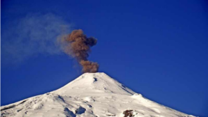
Kamchatka , Karymsky :
VOLCANO OBSERVATORY NOTICE FOR AVIATION (VONA)
Issued: August 27 , 2025
Volcano: Karymsky (CAVW #300130)
Current aviation colour code: ORANGE
Previous aviation colour code: orange
Source: KVERT
Notice Number: 2025-82
Volcano Location: N 54 deg 2 min E 159 deg 26 min
Area: Kamchatka, Russia
Summit Elevation: 1486 m (4874.08 ft)
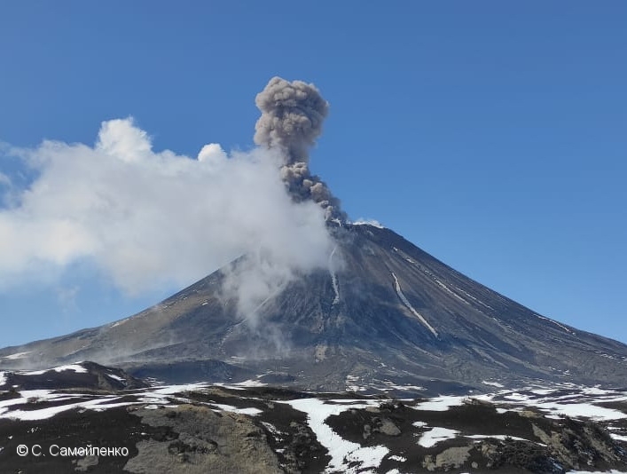
Volcanic Activity Summary:
The moderate explosive eruption of the volcano continues. Explosions sent ash up to 2.5-3 km a.s.l., and an ash cloud is observing in 18 km to the east-northeast of the volcano.
The moderate explosive eruption of the volcano continues. Ash explosions up to 6 km (19,700 ft) a.s.l. could occur at any time. Ongoing activity could affect low-flying aircraft.
Volcanic cloud height:
2500-3000 m (8200-9840 ft) AMSL Time and method of ash plume/cloud height determination: 20250827/0040Z – Himawari-9 14m15
Other volcanic cloud information:
Distance of ash plume/cloud of the volcano: 18 km (11 mi)
Direction of drift of ash plume/cloud of the volcano: ENE / azimuth 70 deg
Time and method of ash plume/cloud determination: 20250827/0040Z – Himawari-9 14m15
Source : KVERT
Photo : S. Samoylenko
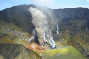
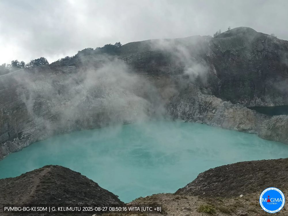
Indonesia , Kelimutu :
Increase in Lake Danau Water Temperature and the Odor of Sulfur Gas at Kelimutu Volcano on August 26, 2025
Based on the results of temperature measurements and visual observations on August 26, 2025, Kelimutu Volcano, East Nusa Tenggara Province, showed a significant increase in temperature compared to previous measurements at Crater II (Tiwu Ko’ofai Nuwamuri), from 25.3°C on August 18, 2025, to 34.2°C. Meanwhile, the color of the lake water remained light blue. This increase in temperature was followed by a very strong smell of sulfur and the appearance of smoke on the surface of the water in Crater II Lake.
Mount Kelimutu has three crater lakes: Crater 1 (Tiwu Ata Polo), Crater 2 (Tiwu Koofai Nuwamuri), and Crater 3 (Tiwu Ata Bupu). Significant changes in the activity of Mount Kelimutu occur in Crater 2.
Although there was an increase in temperature followed by a strong sulfur odor, there was no significant change in the seismicity of G. Kelimutu.
G. Kelimutu is a tourist volcano with a relatively high number of visitors. Considering all this data, people around Mount Kelimutu and visitors are encouraged to wear masks due to the strong sulfur odor and to avoid approaching the crater rim, especially Crater II, to avoid the risk of phreatic eruptions.
The regional government and the BPBD are urged to continue coordinating with the Kelimutu Volcano Observation Post in Kolorongo Village, Waturaka Village, Ende Regency, East Nusa Tenggara, as well as the Bandung Volcanology and Geological Disaster Mitigation Center.
Source : PVMBG
Photo: PVMBG
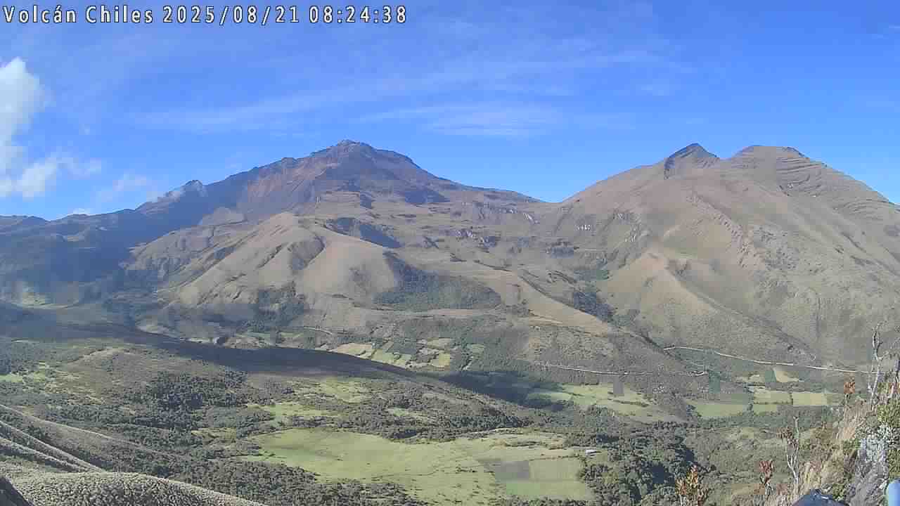
Colombia , Chiles / Cerro Negro :
San Juan de Pasto, August 26, 2025, 5:15 p.m.
Regarding the monitoring of the activity of the Chiles-Cerro Negro Volcanic Complex (CVCCN), the Colombian Geological Survey (SGC), an entity affiliated with the Ministry of Mines and Energy,
reports that:
From August 19 to 25, 2025, the main variations in the monitored parameters compared to the previous week were:
● Although a decrease in the number of earthquakes was observed, the seismic energy released increased. Seismicity associated with rock fractures was predominant, but a significant contribution from seismicity associated with fluid dynamics was highlighted.
● The earthquakes were located mainly at the summit and in the collapse zone of Chiles Volcano, at distances of less than 1 km, at depths between 2.6 and 3.6 km from its summit (approximately 4,700 m above sea level), and with magnitudes less than 1. The other earthquakes were scattered, at distances between 2 and 8 km, at depths between 3.5 and 8 km, and with a maximum magnitude of 1.7. The largest earthquake was recorded on August 21 at 10:07 p.m., at the summit of Cerro Negro Volcano, at a depth of 3.6 km.
● Data recorded by satellite sensors and ground-based measuring stations continue to indicate changes related to inflation processes in the volcanic area. Based on the assessment and correlation of monitored parameters, the SGC recommends closely monitoring their developments through weekly bulletins and other information published through our official channels, as well as instructions from local and departmental authorities and the National Disaster Risk Management Unit (UNGRD).
Volcanic activity remains on yellow alert: active volcano with changes in the baseline behavior of monitored parameters and other manifestations.
Source et photo : SGC