July 21 , 2025.
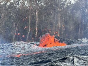
Hawaii , Kilauea :
HAWAIIAN VOLCANO OBSERVATORY STATUS REPORT , U.S. Geological Survey
Sunday, July 20, 2025, 4:56 AM HST (Sunday, July 20, 2025, 14:56 UTC)
19°25’16 » N 155°17’13 » W,
Summit Elevation 4091 ft (1247 m)
Current Volcano Alert Level: WATCH
Current Aviation Color Code: ORANGE
Activity Summary:
Precursory low-level activity for episode 29 of the ongoing Halemaʻumaʻu eruption began around 3:55 a.m. HST on July 20 with spattering at the north vent, followed shortly thereafter by dome fountains and lava overflows starting around 4:11 a.m. HST. Sustained, high lava fountaining may begin soon. According to the National Weather Service, winds are forecast to blow from the north to northeast directions today, Sunday, July 20, which suggests that volcanic gas emissions and volcanic material may be distributed to the south and southwest.
All eruptive activity is confined to Halemaʻumaʻu crater within Hawaiʻi Volcanoes National Park; commercial airports in Hawaii County (KOA and ITO) will not be affected by this activity.

In recent episodes of the ongoing eruption within Halemaʻumaʻu, low-level precursory activity has lasted from a few hours to a few days. This activity can include eruptive vent spattering, small dome fountains, and lava overflows. Due to the heightened level of pressurization reached during the most recent eruptive pause, precursory activity for episode 29 may be brief, and sustained, high lava fountaining may begin soon.
At the start of previous episodes, precursory activity has rapidly escalated into sustained high fountaining over minutes to tens of minutes. During previous episodes, fountains reached heights of more than 1,000 feet (300 meters) and the eruptive plume reached heights of up to 20,000 feet (6,000 meters) above ground level soon after sustained high fountaining began.
The tiltmeter at Uēkahuna (UWD) has recorded approximately 17.8 microradians of inflationary tilt since the end of the last episode, during which it recorded 15 microradians of deflationary tilt. Low level seismic tremor continues beneath Halemaʻumaʻu crater.
Most episodes of Halemaʻumaʻu lava fountaining since December 23, 2024, have continued for around a day or less and have been separated by pauses in eruptive activity lasting generally at least several days.
information.
No changes have been detected in the East Rift Zone or Southwest Rift Zone. A VAN/VONA will be issued when sustained high lava fountaining begins, marking the start of episode 29, or earlier if the situation warrants a further update.
Kīlauea Volcano Alert Level/Aviation Color Code remain at WATCH/ORANGE. All current and recent activity is within Hawaiʻi Volcanoes National Park.
Issued: Sunday, July 20, 2025, 5:29 AM HST
Volcanic Activity Summary:
Episode 29 high fountains of the ongoing Halemaʻumaʻu eruption began around 5:15 a.m. HST on July 20. Lava fountains from the north vent gradually transitioned from low dome fountains less than 100 feet (30 meters high) to vertical fountains exceeding 200 feet (60 meters) around that time, accompanied by the onset of summit deflationary tilt and heightened seismic tremor. Past episodes have produced incandescent lava fountains over 1,000 feet (300 meters) high and eruptive plumes up to 20,000 feet (6,000 meters) above ground level; similar behavior may be expected within the next couple hours. According to the National Weather Service, winds are blowing from the north to northeast directions today, Sunday, July 20, which suggests that volcanic gas emissions and volcanic material may be distributed to the south and southwest.
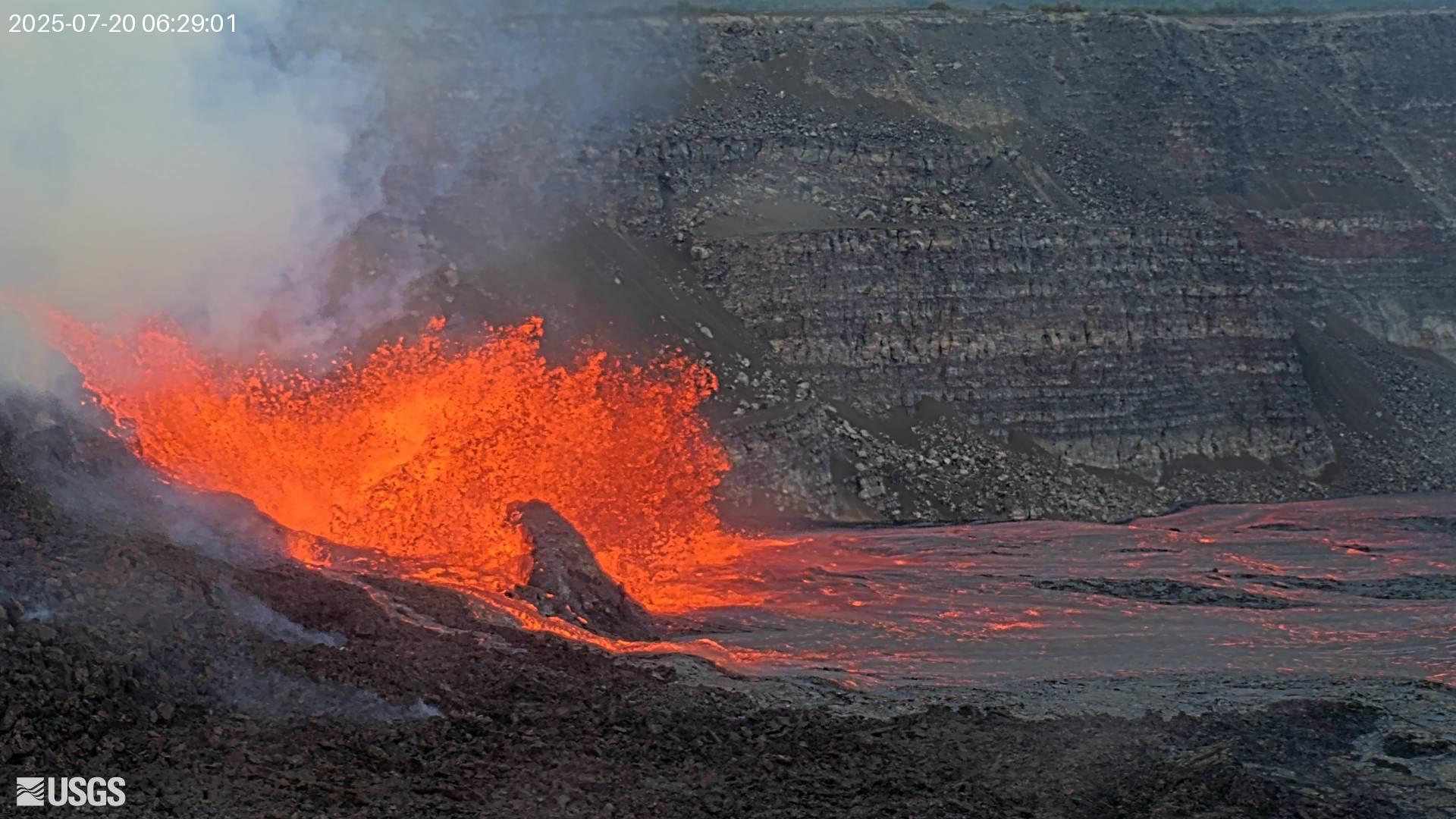
Episode 29 was preceded by north vent lava spattering that began around 3:55 a.m., followed shortly thereafter by dome fountains and lava overflows starting around 4:11 a.m. Fountains from the north vent are reaching 330 feet (100 meters) high and feeding multiple lava streams as of 5:25 a.m. HST.
Inflationary tilt reached just over 17.5 microradians since the end of episode 28, during which it recorded 15 microradians of deflationary tilt. Seismic tremor began increasing and tilt at UWD switched from inflationary to deflationary at about 4:24 a.m. HST. Further sharp increases in tremor and deflation occurred when sustained high lava fountains began.
Issued: Sunday, July 20, 2025, 6:59 PM HST
Volcanic Activity Summary:
Episode 29 of the ongoing Halemaʻumaʻu eruption ended abruptly around 6:35 p.m. HST on July 20 after over 13 hours of continuous lava fountaining.
The north vent stopped erupting around 6:35 p.m. HST, marking the end of the episode; the weakly-active south vent had stopped erupting several hours earlier. Lava fountains did not exceed 330 feet (100 meters) during this episode, as most lava was sprayed laterally within Halemaʻumaʻu crater. An estimated 1.8 billion gallons (7 million cubic meters) of lava erupted during the episode, covering approximately 80% of the crater floor.
Volcanic gas emissions have greatly decreased since fountaining stopped, and the sulfur dioxide (SO2) emission rate will likely range from 1,200–1,500 tonnes/day during the new eruptive pause. Spatter deposits and lava flows from this episode on the floor of Halemaʻumaʻu within the southern part of Kaluapele (Kīlauea caldera) may continue to exhibit slow movement and/or incandescence as they cool and solidify over the coming days.

The Uēkahuna tiltmeter (UWD) recorded approximately 18.5 microradians of deflationary tilt during this episode. The end of the episode was coincident with a rapid change from deflation to inflation at the summit and a decrease in seismic tremor intensity.
Most episodes of Halemaʻumaʻu lava fountaining since the eruption started on December 23, 2024, have continued for around a day or less and have been separated by pauses in eruptive activity lasting generally at least several days.
HVO continues to closely monitor Kīlauea and will issue a VAN/VONA at the start of the next eruptive episode. If possible, HVO will also issue a Status Report beforehand at the onset of low-level precursory activity. Between episodes, daily updates will be published each morning as regularly scheduled.
Kīlauea Volcano Alert Level/Aviation Color Code remain at WATCH/ORANGE. All current and recent activity is within Hawaiʻi Volcanoes National Park.
Source : HVO
Photos : Volcano Hideaways , USGS.
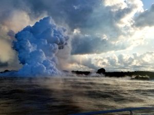
Iceland , Reykjanes Peninsula :
Eruption ongoing on the Sundhnúkur crater row
Updated 11:45, 20 July
Important to monitor the gas dispersion forecast and your own reaction to the pollution
The eruption at the Sundhnúkur crater row has caused significant air pollution in recent days, both due to gas pollution (SO₂) and volcanic haze (SO₄). Volcanic haze has been detected widely, but the air quality monitoring network operated by the Environment and Energy Agency does not fully capture its distribution and concentration. We therefore encourage the public to monitor the Icelandic Meteorological Office’s gas dispersion forecast carefully and, above all, pay attention to symptoms that might result from prolonged exposure to polluted air.

The eruption remained steady overnight, with activity in two craters in the central part of the fissure. Lava continues to flow eastward into Fagradal, but poor visibility makes it difficult to assess developments.
The Icelandic Meteorological Office forecast predicts gas pollution in South and West Iceland today, 20 July. Light and variable winds until late Monday could cause persistent volcanic haze over the southwest part of the country.
Vulnerable groups, such as children, older people, and people with heart or lung conditions, are particularly advised to avoid spending extended periods outdoors if they experience any discomfort. Guidance on how to protect oneself and loved ones from volcanic air pollution can be found on the website of the Directorate of Health.
Source : HVO
Photo : Ragnar Visage / FB.
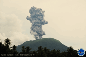
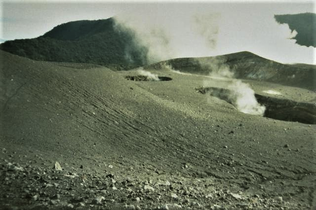
Indonesia , Gede :
SPECIAL REPORT ON THE EVOLUTION OF MOUNT GEDE ACTIVITY, JULY 18, 2025
Mount Gede is a stratovolcano rising to an altitude of 2,958 m and located at coordinates 106.965°E and -6.77°N. Mount Gede has seven craters: Gemuruh, Gedeh, Sela, Ratu, Lanang, Wadon, and Baru.
Visual observations conducted from July 1 to 18, 2025, at 6:00 a.m. (West Indonesian Time), showed that the volcano was clearly visible until it was partially obscured by fog. White smoke of varying intensity from Wadon crater rose 50 to 100 meters above the summit.
Seismic data from July 1 to 18, 2025, at 6:00 a.m. (West Indonesia Time), included two Tornillo-type earthquakes, 18 deep volcanic earthquakes, nine local tectonic earthquakes, and 38 distant tectonic earthquakes.
Visual observations indicate that surface activity is still dominated by hydrothermal processes, with the crater smoke consisting primarily of moderately pressured water vapor. No ash was observed in the crater smoke, indicating the absence of an above-normal pressure increase or eruption. The state of the crater smoke has remained unchanged since January 2025. The recorded earthquake pattern indicates gas flow toward the surface. The presence of deep volcanic earthquakes indicates that pressure dynamics within the Mount Gede magma system remain relatively normal.
With the state of crater smoke and earthquakes still dominated by tectonic activity, the activity level of Mount Gede is still set at Level I (Normal) with recommendations for the community around Mount Gede and visitors/tourists not to descend, approach, or spend the night within a 600-meter radius of the Wadon Crater.
Source : PVMBG
Photo : Gede Suantika, 1993 (Observatoire volcanologique d’Indonésie).
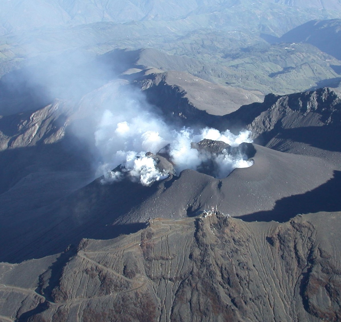
Colombia , Galeras :
San Juan de Pasto, July 15, 2025, 4:45 p.m.
Regarding the monitoring of the activity of the Galeras Volcano, the Colombian Geological Survey (SGC), an entity attached to the Ministry of Mines and Energy, reports that:
During the week of July 8 to 14, 2025, the main variations in the monitored parameters compared to the previous week were:
● In areas of low volcanic activity, an increase in the occurrence and release of seismic energy was observed. The predominance of seismic activity associated with rock fracture processes in the volcanic region continued.
● The earthquakes exhibited low energy levels and occurred mainly near the main crater, at distances less than 1.5 km and at depths less than 3 km from the Galeras summit (4,200 m above sea level). A few other events were located, scattered at distances between 2 and 7 km, at depths between 3 and 8 km, and with magnitudes less than 1.
● Low-altitude white gas columns were observed, with variable dispersion depending on the wind, emanating from the fumarole fields of El Paisita, to the north, and Las Chavas, to the west of the active cone.
● Other volcanic monitoring parameters showed stability.
Based on the above, the SGC recommends closely monitoring developments through weekly bulletins and other information published through our official channels, as well as instructions from local and departmental authorities and the National Disaster Risk Management Unit (UNGRD).
Volcanic activity remains on alert: Yellow: Active volcano with changes in the baseline behavior of monitored parameters and other manifestations.
Source et photo : SGC.
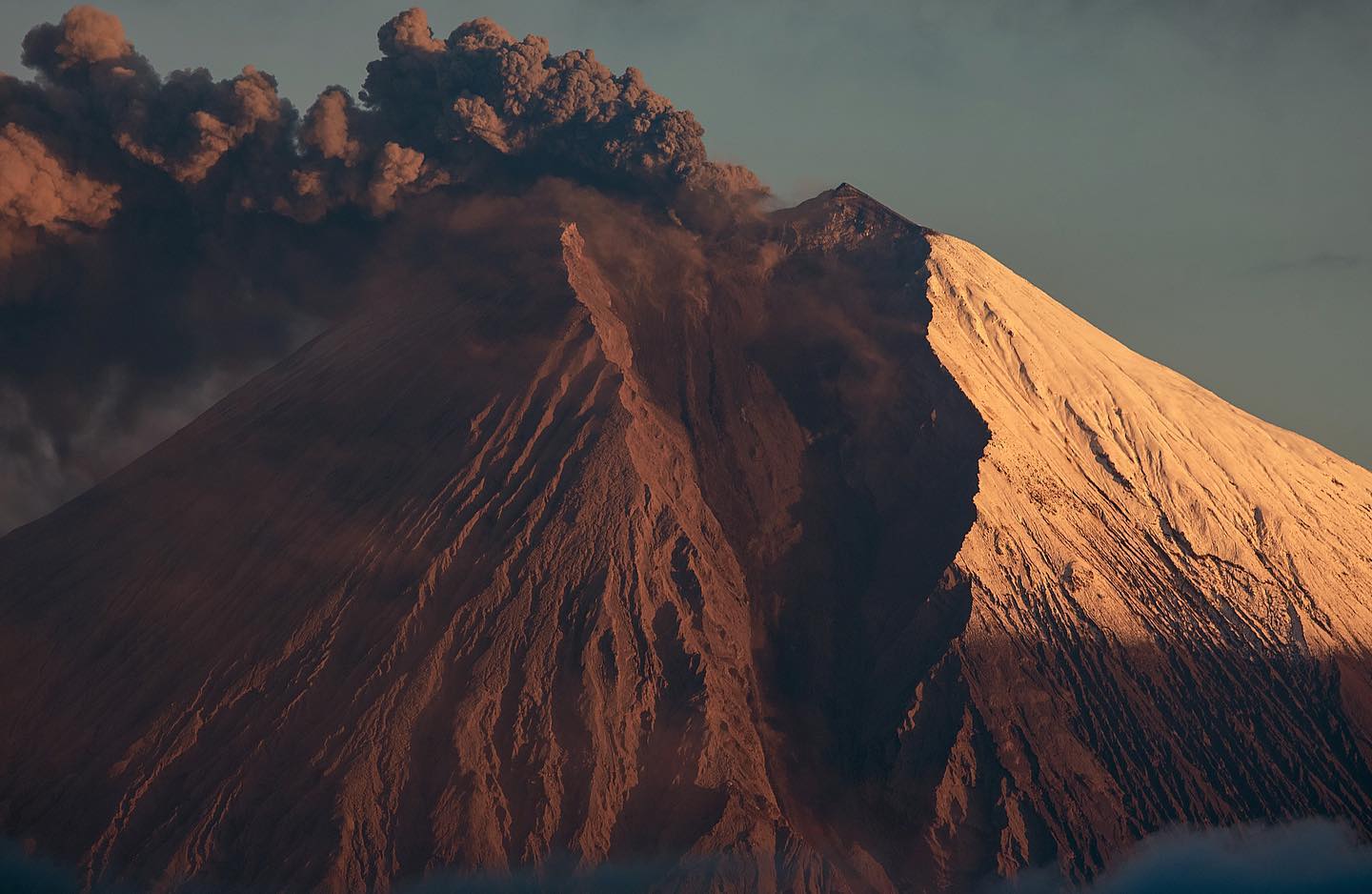
Ecuador , Sangay :
SANGAY VOLCANO DAILY STATUS REPORT, Sunday, July 20, 2025.
Information Geophysical Institute – EPN.
Surface Activity Level: High, Surface Trend: No Change
Internal Activity Level: Moderate, Internal Trend: No Change
Seismicity: From July 19, 2025, 11:00 a.m. to July 20, 2025, 11:00 a.m.:
Seismicity:
Below is the count of seismic events recorded at the reference station.
Explosion (EXP): 70
Rainfall/Lahars:
Since yesterday afternoon, no rain has been recorded in the volcanic area. **Heavy rains could remobilize accumulated material, generating mud and debris flows that would cascade down the volcano’s flanks and flow into adjacent rivers**.
Emission/Ash:
Due to cloud cover in the volcanic area, it was not possible to observe gas and/or ash emissions via the surveillance camera network. However, yesterday afternoon and this morning, using the GOES-19 satellite system, two gas plumes were detected heading west, at an altitude of 700 and 800 meters above the crater. In this regard, the Washington VAAC issued a report indicating an ash plume heading west, at an altitude of 900 meters above the crater.
Gas:
The MOUNTS satellite system detected 15 tons of sulfur dioxide (SO2), measured on July 19, 2025, at 1:58 PM LT.
Observation:
From yesterday afternoon until the closing of this report, the volcano remained completely cloudy.
Alert Level: Yellow
Source : IGEPN
Photo :#Eqphos_fotografía