May 11 , 2025 .
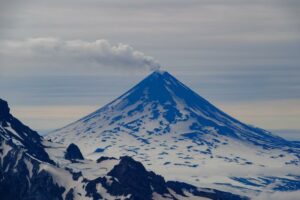
Guatemala , Fuego :
Weather Conditions: Partly cloudy.
Wind: East.
Precipitation: 13.7 mm.
Activity:
The Fuego Volcano Observatory reports volcanic activity, consisting of weak to moderate explosions occurring at a rate of 4 to 8 per hour, which expel columns of gray gas and ash to heights of up to 4,500 meters above sea level (14,764 feet), which are driven southwestward by the wind up to 12 kilometers away. White fumaroles (water vapor and other magmatic gases) have also been observed at heights of 100 to 200 meters above the crater.
The explosions were accompanied by rumbling sounds and weak shock waves, some of which produced rockfalls (avalanches) toward the Santa Teresa and Ceniza ravines. During the night and early morning, webcams observed the incandescence in the crater and the incandescent material from the explosions. A weak fall of fine gray to light brown particles was recorded in the communities on the southwest flank, from Panimaché to Santa Sofía.
Source : Insivumeh.
Photo : Diego Rizzo .
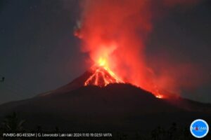
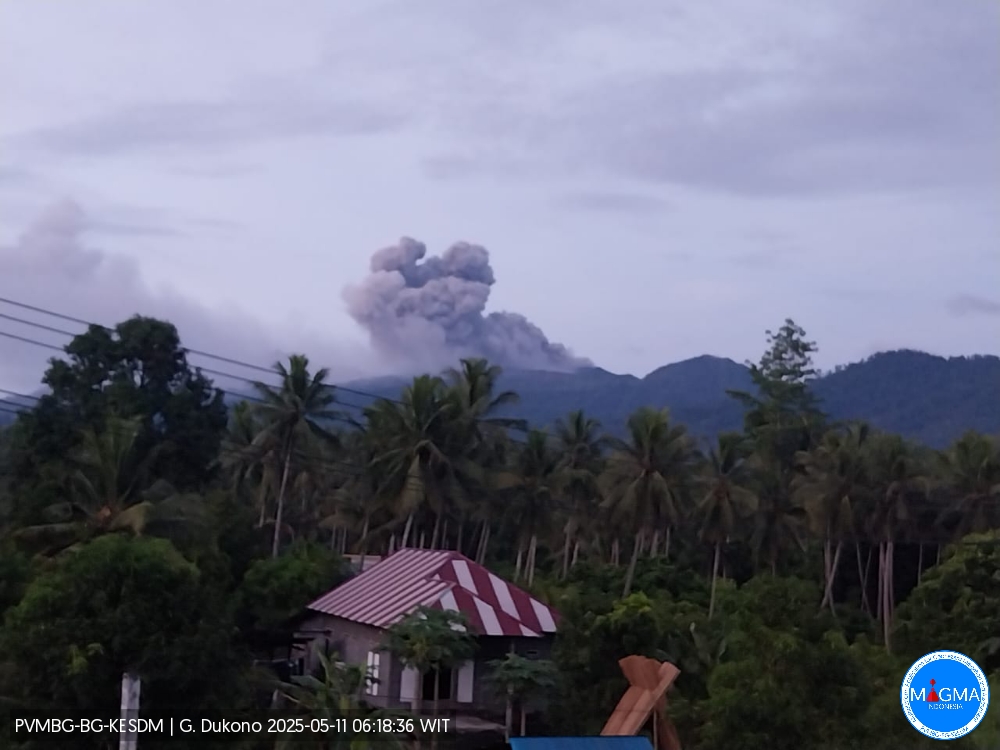
Indonesia , Dukono :
An eruption of Mount Dukono occurred on Sunday, May 11, 2025, at 06:09 WIT with an observed ash column height of ± 600 m above the peak (± 1687 m above sea level). The ash column was observed to be white to gray in color with moderate to thick intensity, oriented toward the east. At the time of writing, the eruption was still ongoing.
Seismicity Observation:
180 eruption earthquakes with an amplitude of 6 to 34 mm and a duration of 31.15 to 139.02 seconds.
1 distant tectonic earthquake with an amplitude of 10 mm and an earthquake duration of 116.67 seconds.
1 continuous tremor earthquake with an amplitude of 1-4 mm, with a dominant value of 2 mm.
Recommendation
(1) People around Mount Dukono and visitors/tourists should not engage in activities, climb, or approach the Malupang Warirang Crater within a 4 km radius. (2) Since volcanic ash eruptions occur periodically and the distribution of ash follows the direction and speed of the wind, so the area where the ash lands is not constant, people around Mount Dukono are recommended to always carry masks/nose and mouth covers to use when needed to avoid the threat of volcanic ash to the respiratory system.
Source et photo : Magma Indonésie .
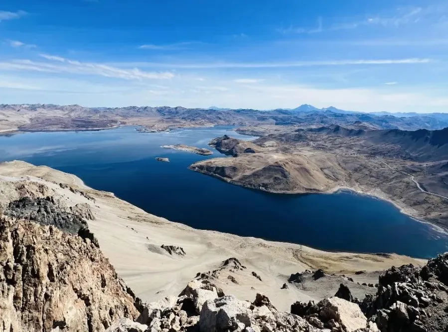
Chile , Laguna del Maule :
Seismology
The seismological activity for the period was characterized by the recording of:
3,976 VT-type seismic events, associated with rock fracturing (volcano-tectonics). The most powerful earthquake had a local magnitude (LM) value of 2.3, located 12.5 km and with a depth of 7.1 km from the center of the lagoon.
One HB-type seismic event, associated with both rock fracturing and fluid dynamics within the volcanic system (hybrid). The earthquake size, estimated from the reduced displacement (RD) parameter, was equal to 7 cm².
Fluid Geochemistry
No anomalies in sulfur dioxide (SO2) emissions into the atmosphere were reported in the area near the volcanic complex, according to data published by the Tropospheric Monitoring Instrument (TROPOMI) and the Sulfur Dioxide Group of the Ozone Monitoring Instrument (OMI).
Satellite Thermal Anomalies
During the period, no thermal alerts were recorded in the area associated with the volcanic complex, according to analytical processing of Sentinel 2-L2A satellite images, combined with false-color bands.
Geodesy
Analysis of the data provided by geodetic monitoring in the volcanic complex indicates that:
– The previously reported inflationary process continues.
– The rates of rise remain slightly above average, with values reaching 2 cm/month.
– Slight variation in the GNSS monitoring line (distance between GNSS stations) crossing the complex, reaching a maximum of 1.8 cm/month.
– The deformation pattern observed by radar interferometry is maintained.
It is therefore observed that the deformation of the volcanic complex continues, both in amplitude and direction, similar to previous periods, but with a slight increase highlighted by deformation rates considered high.
Surveillance Cameras
The images provided by the fixed camera installed near the volcanic complex did not record any degassing plumes or variations related to surface activity.
Satellite Geomorphological Analysis
No morphological variations associated with volcanic activity were identified from Planet Scope and Sentinel 2 L2A satellite images.
Activity remained at levels considered low, suggesting stability within the volcanic complex.
The technical volcanic alert remains in effect for:
GREEN TECHNICAL ALERT: Active volcano with stable behavior – No immediate risk
Observation:
The affected area is considered to be within a 2 km radius of the passive CO2 degassing zone.
Source : Sernageomin.
Photo : OAVV.
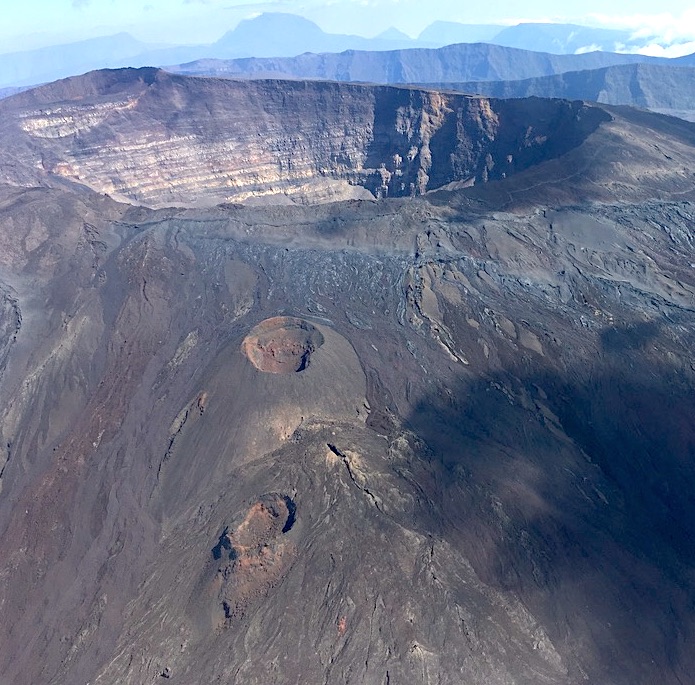
La Réunion , Piton de la Fournaise :
Seismicity
In April 2025, the OVPF-IPGP recorded a total of:
• 13 shallow volcano-tectonic earthquakes (0 to 2.5 km above sea level) beneath the summit craters;
• 0 deep earthquakes (below sea level);
• 6 long-period earthquakes;
• 220 rockfalls.
The month of April 2025 was marked by low seismicity beneath the Piton de la Fournaise, with only 13 shallow volcano-tectonic earthquakes and no deep earthquakes recorded.
Only two shallow volcano-tectonic earthquakes could be located beneath the summit craters. The others, of lower magnitude, could not be located. Numerous (220) landslides in the Dolomieu Crater, at the level of the ramparts of the Enclos Fouqué and at the Cassé de la Rivière de l’Est were also recorded.
Gas Geochemistry
Soil CO2 Concentration
Since the last eruption of Piton de la Fournaise (July 2 – August 10, 2023), a general downward trend in soil CO2 emissions has been recorded, associated with moderate positive pulses.
Phenomenology
No eruptive activity during April 2025.
Summary
Since April 2024, magma replenishment and pressurization of the shallow reservoir have ceased.
In April 2025, seismicity remained low, with only 13 shallow volcano-tectonic earthquakes and no deep earthquakes recorded. Slight summit deflation and a decrease in soil CO2 concentrations are still observed.
Source et photo : OVPF
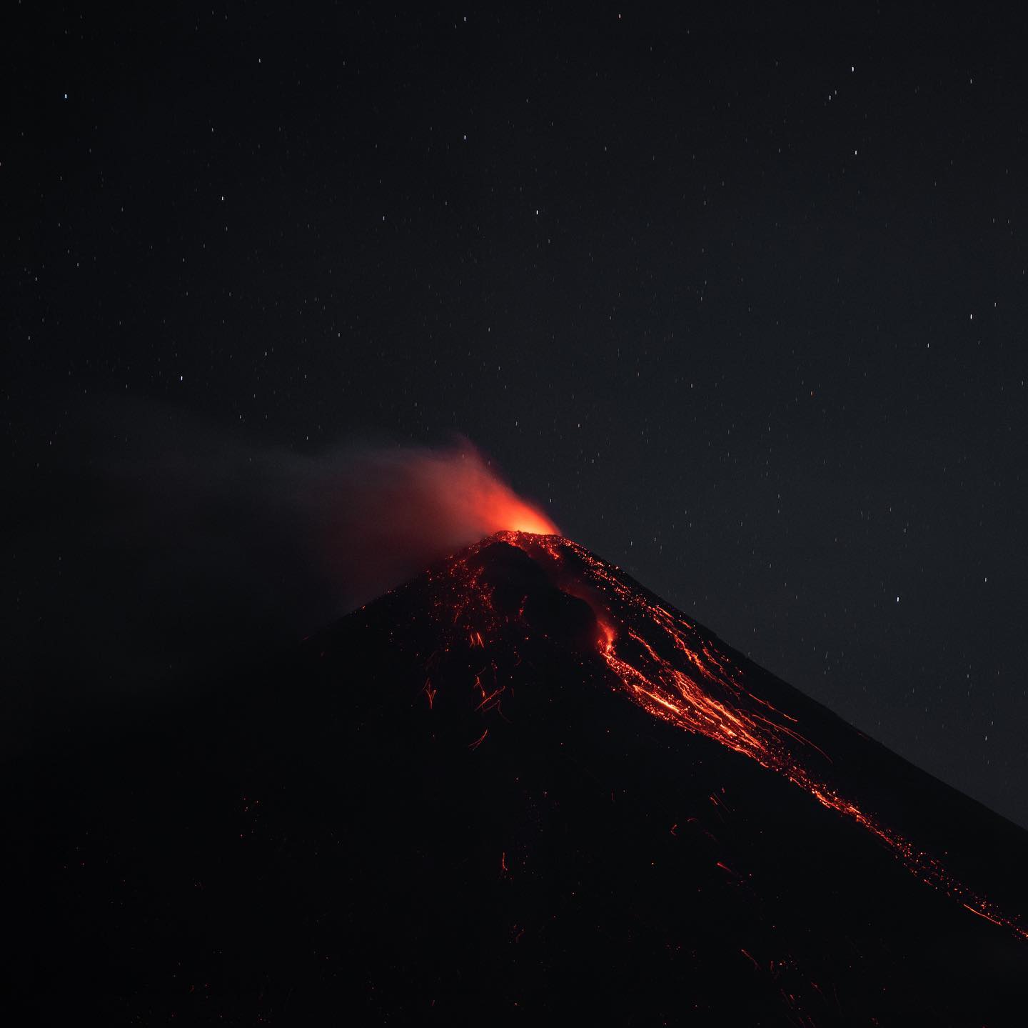
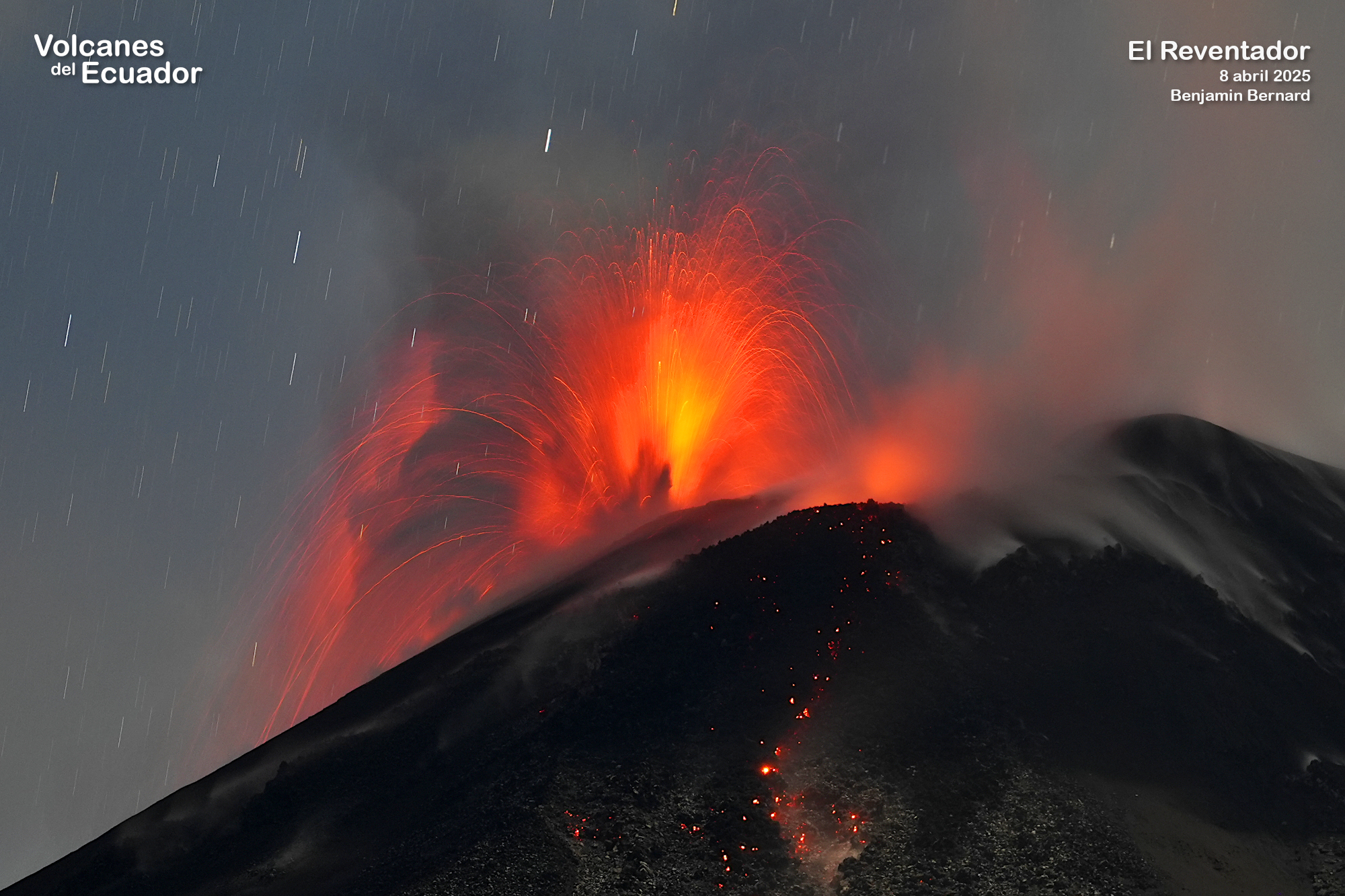
Ecuador , El Reventador :
DAILY STATUS REPORT OF REVENTADOR VOLCANO, Saturday, May 10, 2025.
Information Geophysical Institute – EPN.
Surface Activity Level: High, Surface Trend: No change
Internal Activity Level: Moderate, Internal Trend: No change
From May 9, 2025, 11:00 a.m. to May 10, 2025, 11:00 a.m.:
Seismicity:
Below is the count of seismic events recorded at the reference station.
Explosion (EXP) 78
Long Period (LP) 18
Emission Tremor (TREMI) 22
Harmonic Tremor (TRARM) 8
Rainfall/Lahars:
Precipitation was recorded in the volcano area without generating mudflows or debris flows. **Heavy rainfall could remobilize accumulated material, generating mudflows and debris flows that would cascade down the volcano’s flanks and flow into adjacent rivers.
Emission/Ash Column:
Yesterday afternoon, the surveillance camera system recorded several gas and ash emissions reaching heights of 700 to 1,000 meters above the crater in a southwest and west direction. Associated with this activity, the Washington VAAC agency issued three reports of ash clouds moving from west to northwest with heights of 1,010 meters above the crater level.
Other Monitoring Parameters:
The MIROVA-VIIRS satellite system recorded one thermal anomaly in the last 24 hours.
Observation:
Last night, the surveillance camera system observed the descent of incandescent material down the flanks, up to 1,200 meters below the crater level. As of the closing date of this report, the volcano remained cloudy most of the time.
Alert Level – SGR: Orange
Source : IGEPN
Photo : Benjamin Bernard via volcanes ecuador / FB. ( 08/04/2025)