May 10 , 2025 .
Indonesia , Dukono :
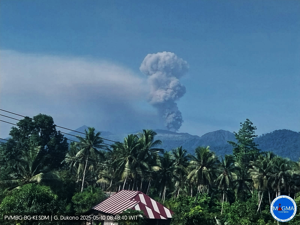
An eruption of Mount Dukono occurred on Saturday, May 10, 2025, at 7:21 a.m. WIT, with an observed ash column height of ± 1,500 m above the peak (± 2,587 m above sea level). The ash column was observed to be white to gray in color with a thick, eastward-oriented eruption. At the time of writing, the eruption was still ongoing.
Seismicity Observation
207 eruption earthquakes with amplitudes ranging from 6 to 34 mm and durations ranging from 30.13 to 88.97 seconds.
1 Continuous Tremor earthquake with amplitudes ranging from 1 to 4 mm, dominant value 2 mm.
Recommendation
(1) People around Mount Dukono and visitors/tourists should not engage in any activities, climb, or approach the Malupang Warirang crater within a 4 km radius.
(2) Given that volcanic ash eruptions occur periodically and the distribution of ash follows wind direction and speed, so the area where ash lands is not constant, people around Mount Dukono are advised to always wear masks/mouth and nose coverings to avoid the threat of volcanic ash to the respiratory system.
Source et photo : Magma Indonésie .
Hawaii , Kilauea :
Friday, May 9, 2025, 9:20 AM HST (Friday, May 9, 2025, 19:20 UTC)
19°25’16 » N 155°17’13 » W,
Summit Elevation 4091 ft (1247 m)
Current Volcano Alert Level: WATCH
Current Aviation Color Code: ORANGE
Activity Summary:
Episode 20 of the ongoing Halemaʻumaʻu eruption ended on May 6. The eruption is currently paused. Episode 21 is likely to start in the next 2-4 days.
Kīlauea’s current eruption in Halemaʻumaʻu crater within Kaluapele (the summit caldera) began on December 23, 2024. There have now been 20 episodes separated by pauses in activity. All eruptive activity remains within Hawaiʻi Volcanoes National Park. No significant activity has been noted along Kīlauea’s East Rift Zone or Southwest Rift Zone. Current hazards include volcanic gas emissions and windblown volcanic glass (Pele’s hair) and tephra that have impacted Hawaiʻi Volcanoes National Park and nearby communities.
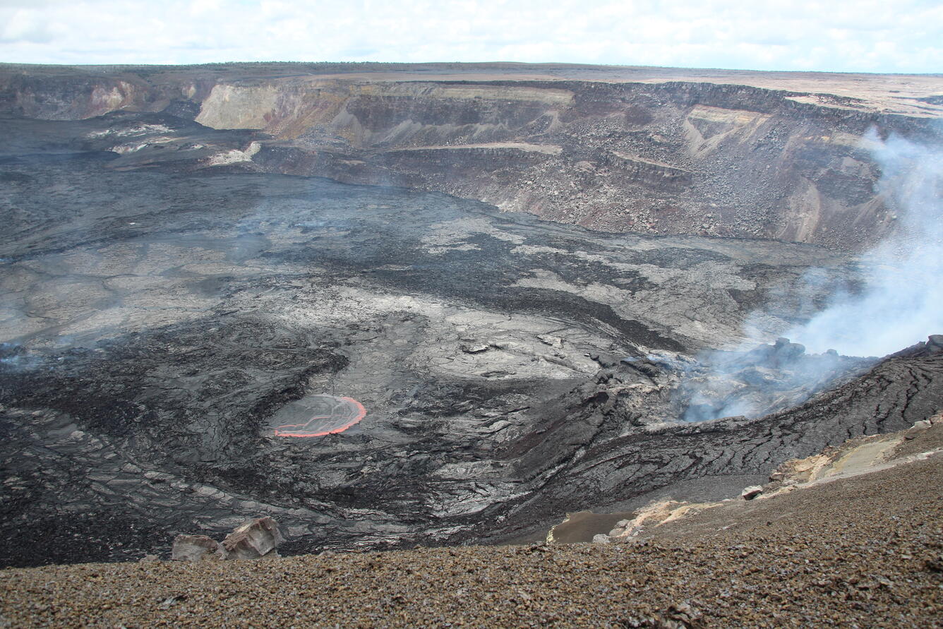
On May 7, 2025, about 13 hours after the end of episode 20 of the ongoing eruption at Kīlauea volcano, USGS Hawaiian Volcano Observatory scientists observed a lava ooze-out (center left in image) north of north vent (right side of image). Residual ooze-outs have occurred despite eruptive activity ceasing at the vents, as adjustments and changes in pressure in the molten material beneath the solidified crater floor result in material oozing out. Both the north and south vents are seen degassing in this image on the right side.
Summit Observations:
Episode 20 ended at 9:58 p.m. HST on May 6. Orange glow was visible overnight from both vents, indicating that magma remains close to the surface. Occasional lava spatter from the north vent was visible this morning between 4:00 and 5:30 a.m. Glow that was visible in previous nights across Halema’uma’u crater floor from cooling lava flows has diminished.
Tiltmeters at Uēkahuna (UWD) and Sand Hill (SDH) have recorded approximately 3 microradians of inflationary tilt since the end of episode 20. Low level tremor continues. Occasional short pulses in tremor early this morning coincided with some instances of visible spatter.
Sulfur dioxide (SO2) emission rates have decreased since the end of episode 20. SO2 emission rates during pauses between episodes are on the order of 1,200 tonnes per day (t/d).
Source : HVO
Photo : USGS / N. Deligne.
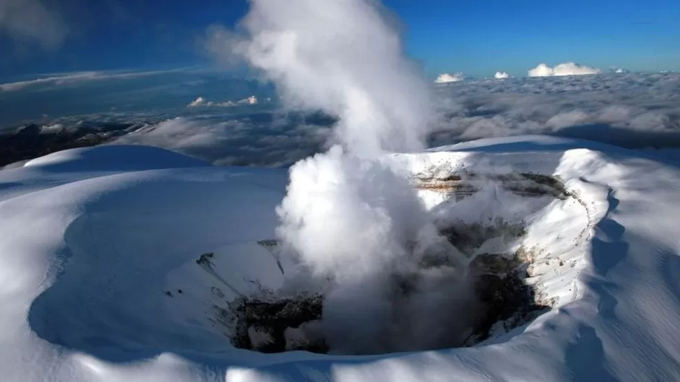
Colombia , Nevado del Ruiz :
Manizales, May 6, 2025, 7:00 p.m.
Monitoring the activity of the Nevado del Ruiz volcano, the Colombian Geological Survey (SGC), an entity affiliated with the Ministry of Mines and Energy, reports that:
During the week of April 29 to May 5, 2025, the volcano continued to exhibit unstable behavior. Compared to the previous week, the main variations in the monitored parameters were:
– Seismic signals related to fluid dynamics in volcanic conduits increased in the number of recorded earthquakes and in the seismic energy released.
The energy levels of the seismic signals were mostly low, and sometimes moderate. Some of these events were associated with pulsatile ash emissions or changes in the apparent temperature of the emitted material. Both phenomena were confirmed using cameras (conventional or thermographic) used to monitor the volcano. – Seismic activity associated with rock fracturing processes within the volcanic edifice decreased the number of recorded earthquakes and increased the seismic energy released. The earthquakes were located mainly in the Arenas crater and on the northeast, southeast, and southwest flanks of the volcano, at distances less than 5 km from the crater.
The depth of the earthquakes ranged from less than 1 km to 7 km from the volcanic summit. The highest magnitude of the week was 1.2, corresponding to the earthquake recorded on May 2 at 8:33 a.m., located 4 km northeast of the crater, at a depth of 5 km.
Seismicity related to the activity of the lava dome (prominence or mound) located at the crater floor decreased significantly in the number of events. The energy levels of episodes of this type of seismicity were low.
– The emission of water vapor and volcanic gases into the atmosphere, mainly sulfur dioxide (SO₂), through the Arenas crater varied throughout the week. Estimated values of the SO₂ outgassing flux increased compared to the previous week, partly due to favorable atmospheric conditions (wind direction and speed) for data collection. Satellite monitoring, which is carried out in addition to the evaluation of this parameter, also revealed significant SO₂ releases.
– The vertical height of the gas or ash column remained mainly below 900 m, measured above the volcanic summit, with a maximum dispersion height of 1,400 m. The highest height reached was 1,800 m during the ash emission recorded on April 29 at 4:41 a.m. The dispersion direction showed a preferential trend mainly towards the northwest and, to a lesser extent, towards the west of the volcano.
– When monitoring thermal anomalies at the floor of the Arenas crater using satellite monitoring platforms, detection was limited due to persistent cloudy atmospheric conditions in the area. Despite this, some reports of low energy levels were obtained.
Source et photo : SGC.
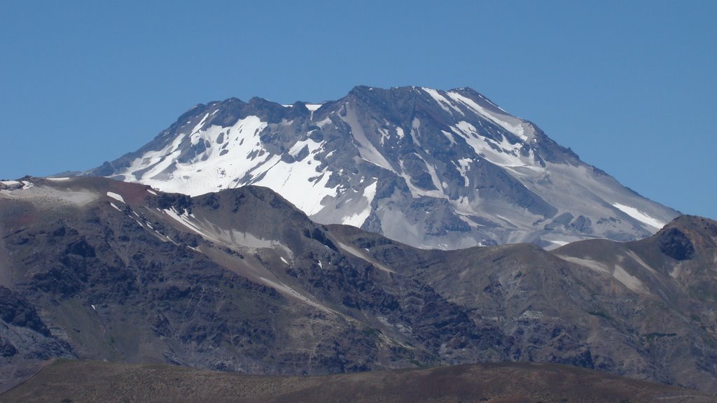
Chile , Descabezado Grande :
Special Report on Volcanic Activity (REAV), Del Maule region, Descabezado Grande volcanic complex, May 9, 2025, 10:50 PM local time (Continental Chile)
The National Geology and Mining Service of Chile (Sernageomin) announces the following preliminary information, obtained using the monitoring equipment of the National Volcanic Monitoring Network (RNVV), processed and analyzed at the Volcanological Observatory of the Southern Andes (OVDAS):
On Friday, May 9, 2025, at 10:42 PM local time (02:42 UTC), monitoring stations installed near the Descabezado Grande volcanic complex recorded an earthquake associated with rock fracturing within the volcanic system (VT volcano-tectonic type).
The earthquake characteristics after analysis are as follows:
TIME OF ORIGIN: 22:42 local time (02:42 UTC)
LATITUDE: 35.565° S
LONGITUDE: 70.745° W
DEPTH: 3.4 km
LOCAL MAGNITUDE: 3.2 (ML)
Observations:
No changes in the volcano’s seismic behavior were recorded after the event.
The Volcanic Technical Alert remains at Green.
Source et photo : Sernageomin.
Guatemala , Santiaguito :
14°44’33˝ North Latitude;
91°34’13˝ West Longitude.
Elevation: 2,500 m
Atmospheric Conditions: Cloudy.
Wind: East.
Precipitation: 5.4 mm.
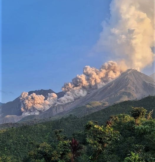
Activity:
Early in the morning, outgassing was observed repeatedly, reaching 700 meters above Caliente Dome. Similarly, incandescence from the dome of Caliente Dome and the middle part of the lava flow indicates that lava extrusion in blocks in a west and southwest direction continues. The monitoring network of seismic and acoustic sensors can identify weak and moderate explosions, which can cause incandescence and columns of gas and ash up to 3,500 meters above sea level (10,498 feet), as well as avalanches in east, south, southwest, and west directions. Ash could spread 15 to 40 km to the west and southwest, potentially causing fine ashfall on farms and communities near the volcano. The Santiaguito volcano continues to have high activity, so the occurrence of moderate to strong block and ash flows, as well as possible long-distance pyroclastic flows in different directions, cannot be ruled out. The recommendations of special bulletin BESAN-002-2025 should be followed.
Source : Insivumeh
Photo : Edgar Cabrera / CONRED ( 2022)