April 07 , 2025 .
Indonesia , Dukono :
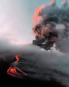
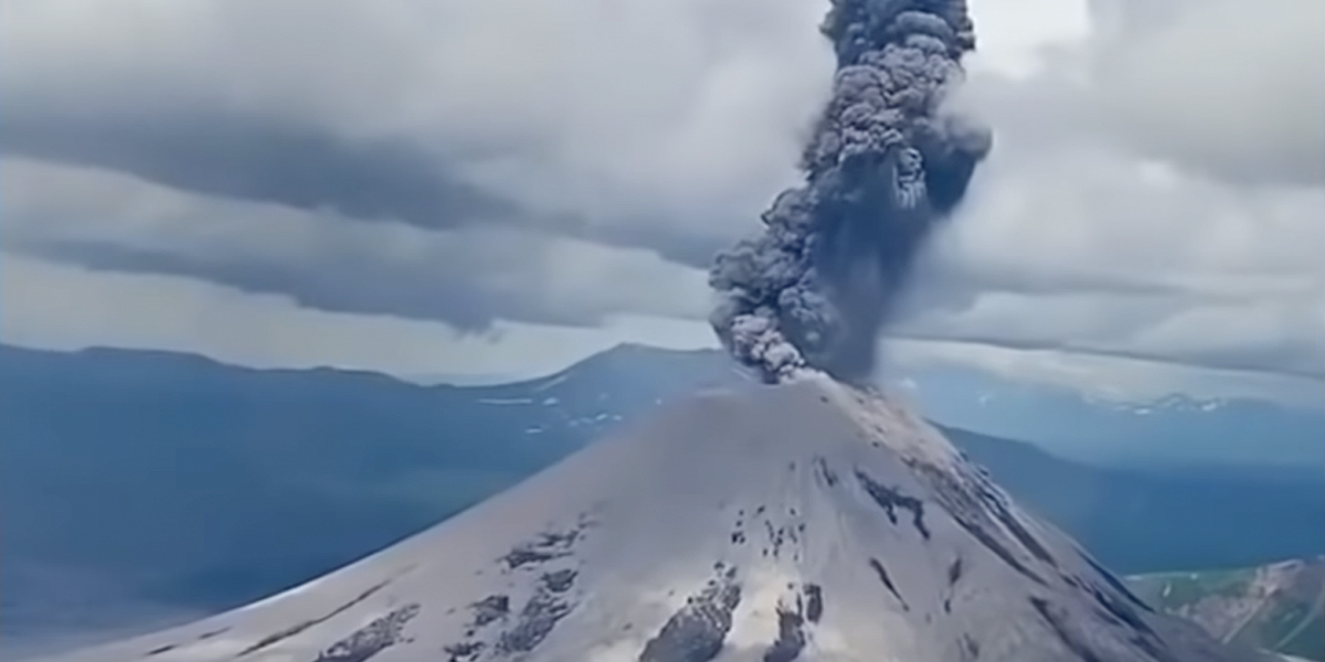
An eruption of Mount Dukono occurred on Monday, April 7, 2025 at 07:55 WIT with an observed ash column height of ± 2300 m above the peak (± 3387 m above sea level). The ash column was observed to be white to gray in color with moderate to thick intensity, oriented north and northwest. At the time of writing, the eruption was still ongoing.

VOLCANO OBSERVATORY NOTICE FOR AVIATION – VONA
Issued : April 7 , 2025
Volcano : Dukono (268010)
Current Aviation Colour Code : ORANGE
Previous Aviation Colour Code : orange
Source : Dukono Volcano Observatory
Notice Number : 2025DUK057
Volcano Location : N 01 deg 41 min 35 sec E 127 deg 53 min 38 sec
Area : North Maluku, Indonesia
Summit Elevation : 3478 FT (1087 M)
Volcanic Activity Summary :
Eruption with volcanic ash cloud at 22h55 UTC (07h55 local).
Volcanic Cloud Height :
Best estimate of ash-cloud top is around 10838 FT (3387 M) above sea level or 7360 FT (2300 M) above summit. May be higher than what can be observed clearly. Source of height data: ground observer.
Other Volcanic Cloud Information :
Ash cloud moving from north to northwest. Volcanic ash is observed to be white to gray. The intensity of volcanic ash is observed from medium to thick.
Remarks :
Eruption and ash emission is continuing. Eruption recorded on seismogram with maximum amplitude 20 mm. Tremor recorded on seismogram with maximum amplitude 3 mm.
Source et photo : Magma Indonésie .
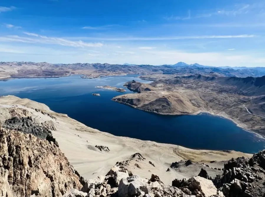
Chile , Laguna del Maule :
Special Report on Volcanic Activity (REAV), Maule Regions, Laguna del Maule Volcanic Complex, April 6, 2025, 9:36 PM local time (Continental Chile)
The National Geology and Mining Service of Chile (SERNAGEOMIN) announces the following preliminary information, obtained using the monitoring equipment of the National Volcanic Monitoring Network (RNVV), processed and analyzed at the Southern Andean Volcano Observatory (OVDAS):
On Sunday, April 6, 2025, starting at 7:21 PM (23:21 UTC), monitoring stations installed near the Laguna del Maule volcanic complex recorded an increase in the occurrence of volcano-tectonic earthquakes (associated with rock fracturing within the volcanic system), reaching a total of 109 earthquakes in the last 3 hours. characterizing this seismic episode as a swarm of volcano-tectonic earthquakes.
The characteristics of the earthquake after analysis are as follows:
TIME OF ORIGIN: 8:35 PM local time (11:35 PM UTC)
LATITUDE: 36.100° S
LONGITUDE: 70.584° W
DEPTH: 6.4 km
LOCAL MAGNITUDE: 2 (ML)
Observation:
At the time of this report, seismic activity is decreasing, both in occurrence and seismic energy.
The technical volcanic alert remains at GREEN.
Source : Sernageomin
Photo : OAVV
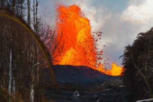
Colombia , Galeras :
San Juan de Pasto, April 1, 2025, 4:50 a.m.
Monitoring the activity of the Galeras Volcano, the Colombian Geological Survey (SGC), an entity affiliated with the Ministry of Mines and Energy, reports that:
Between March 25 and 31, 2025, volcanic activity showed a decrease in seismic activity. Compared to the previous week, the main variations in the monitored parameters were:
• A slight decrease in seismic activity was recorded, although the energy levels released increased. The predominance of seismic activity associated with rock fracture processes within the volcanic system continued.
• Most of the earthquakes were located in an area close to the main crater, at distances of less than 1 km and at depths no greater than 3 km from the summit of Galeras (4,200 m above sea level). Other events were scattered across the volcanic region, with distances up to 6 km, depths between 5 and 14 km, and a maximum magnitude of 1.4.

• Gas emissions were observed mainly from the fumarole fields of El Paisita, to the north, and Las Chavas, to the west of the active cone, with low white columns and variable dispersion depending on the wind direction.
• Other volcanic monitoring parameters showed stability.
Based on the above, the SGC recommends closely monitoring developments through weekly bulletins and other information published through our official channels, as well as instructions from local and departmental authorities and the National Disaster Risk Management Unit (UNGRD).
Volcanic activity remains on alert. Yellow: active volcano with changes in the baseline level of monitored parameters and other manifestations.
Source et photo : SGC
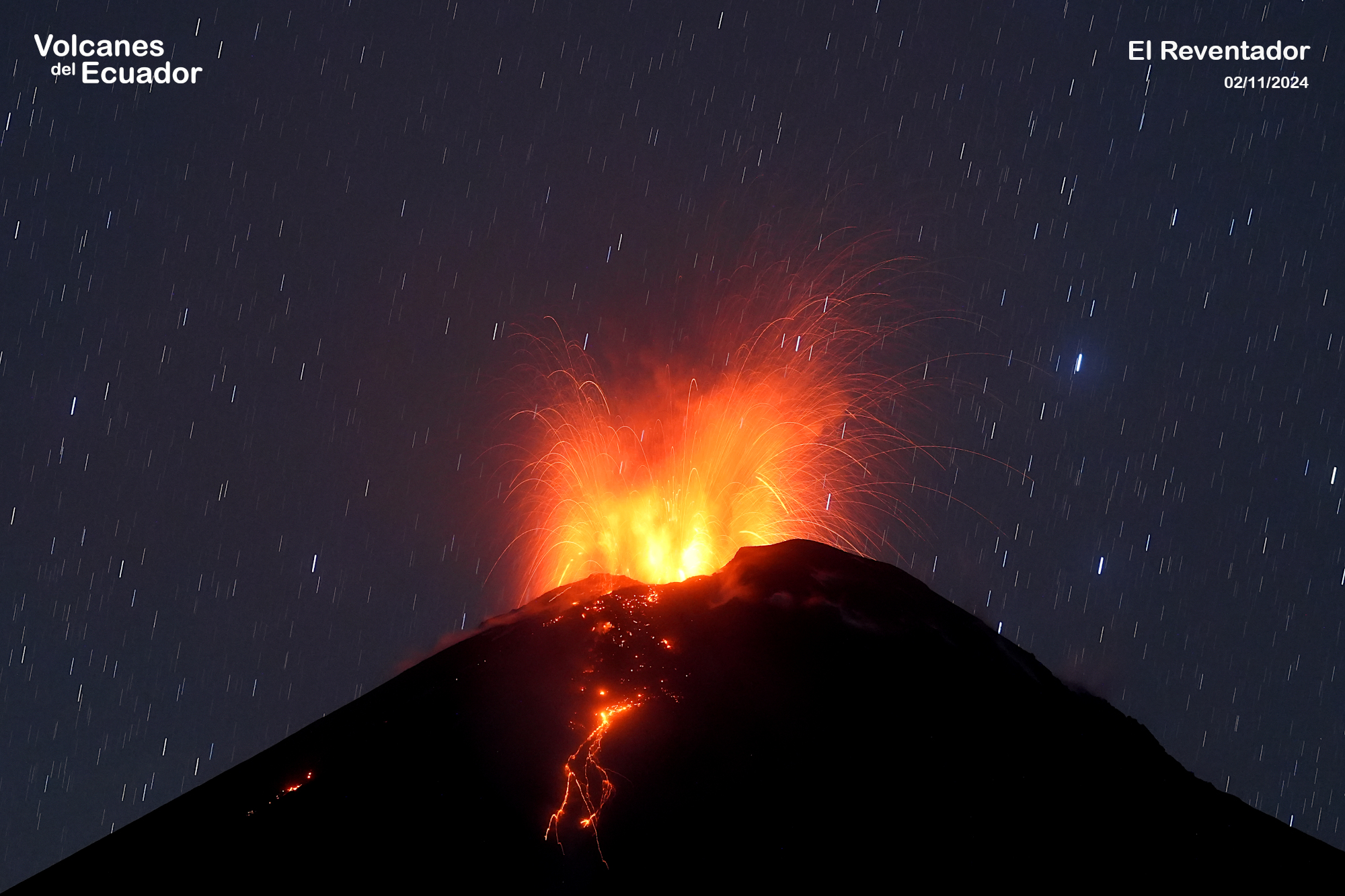
Ecuador , El Reventador .
DAILY STATUS REPORT OF REVENTADOR VOLCANO, Sunday, April 6, 2025.
Information Geophysical Institute – EPN.
Surface Activity Level: High, Surface Trend: Ascending
Internal Activity Level: Moderate, Internal Trend: No change
From April 5, 2025, 11:00 a.m. to April 6, 2025, 11:00 a.m.:
Seismicity:
Below is the count of seismic events recorded at the reference station.
Explosion (EXP) 52
Long Period (LP) 16
Emission Tremor (TREMI) 6
Harmonic Tremor (TRARM) 3
Rainfall/Lahars:
According to meteorological sources, no rainfall has been recorded at the volcano and its surroundings, and no mud or debris flows have been generated. **In the event of more intense rainfall in the area, it could remobilize the accumulated material and generate mud and debris flows that would descend the volcano’s flanks and flow into adjacent rivers.
Emission/Ash Column:
The surveillance camera system observed several gas and ash emissions, with columns reaching heights between 400 and 1,200 meters above the crater, in northwest and southwest directions. In connection with this activity, the Washington VAAC Agency published five reports of emissions, all with a column height equal to 700 meters above the crater level, oriented north-northwest and northwest.
Other monitoring parameters:
Over the past 24 hours, the FIRMS satellite system has detected six thermal alerts.
Observation:
From yesterday afternoon until the submission of this report, the volcano remained mostly cloudy. However, last night, incandescent material was observed using a network of surveillance cameras, reaching as far as 1,000 meters below the crater level.
Alert Level – SGR: Orange
Source : IGEPN
Photo : Benjamin Bernard , Volcanes del Ecuador , 2/11/2024
Kamchatka , Karymsky :
VOLCANO OBSERVATORY NOTICE FOR AVIATION (VONA)
Issued: March 30 , 2025
Volcano: Karymsky (CAVW #300130)
Current aviation colour code: YELLOW
Previous aviation colour code: orange
Source: KVERT
Notice Number: 2025-15
Volcano Location: N 54 deg 2 min E 159 deg 26 min
Area: Kamchatka, Russia
Summit Elevation: 1486 m (4874.08 ft)
Volcanic Activity Summary:
A moderate activity of the volcano continues, but its eruptive event was observed on 12 November, 2024, last time. Satellite data by KVERT continues to show sometimes a weak thermal anomaly over the volcano. KVERT continues to monitor the Karymsky volcano.
A moderate activity of the volcano continues. The danger of ash explosions up to 10 km (32,800 ft) a.s.l. remains. Ongoing activity could affect international and low-flying aircraft.
Volcanic cloud height: NO ASH CLOUD PRODUSED
Other volcanic cloud information: NO ASH CLOUD PRODUSED
Source : Kvert
Photo : Daily Afisha. Ru( 2021)