April 05 ,2025.
Alaska , Spurr :
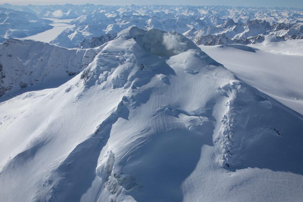
Volcanic unrest continues at Mount Spurr volcano and is characterized by ongoing earthquake activity, surface deformation, and volcanic gas emissions. Seismicity remains elevated with about 52 located earthquakes last week. While this is lower than previous weeks, earthquake rates have gone up and down during this current period of unrest. Gas emissions from the summit were detected in satellite data on March 28. High resolution satellite data from March 28 showed some collapsing of ice on the crater wall, adding ice to the summit crater lake. Minor steam emissions could be seen from the summit earlier in the week. Ground deformation at Mount Spurr has slowed down over the last week, similar to the pause in deformation observed for several weeks this past November and December. The Mount Spurr monitoring network is functioning well.
Spurr summit looking west, taken during an overflight of Spurr and Crater Peak, March 17, 2025. The depression in the snow and ice at the top of the summit holds the crater lake and fumaroles, steam from which is visible in the image.
AVO continues to closely monitor activity at Mount Spurr for signals indicating the volcano is moving closer to an eruption using local seismic, infrasound, and GNSS stations, web cameras, regional infrasound, lightning networks, and satellite data. Based on previous eruptions, additional changes in earthquakes, ground deformation, the summit lake, and fumaroles would be expected if magma moves closer to the surface. Therefore, if an eruption occurred, it would be preceded by additional signals that would allow advance warning.
Source : AVO
Photo : Ketner, Dane
Iceland , Reykjanes Peninsula :
Deformation measurements indicate that uplift may have resumed
Updated April 4, at 14:55 UTC
Indications that uplift has resumed in Svartsengi
Seismic activity near the dike has decreased
Deformation measurements still show movement at GPS stations around the northern part of the dike
Uncertainty remains about the coming days, and magma movements within the dike cannot yet be ruled out
Triggered seismic activity at Trölladyngja last night, the largest measuring 3.9 in magnitude
The hazard assessment has been updated and is valid until April 8 unless conditions change
GPS measurements indicate that uplift may have resumed in Svartsengi, as shown in the accompanying figure. The most likely cause is continued magma accumulation beneath Svartsengi, though part of the uplift may be attributed to the effects of the dike formation on April 1. This is because when dikes form, they push the crust away on either side. At this stage, it is difficult to determine the rate of magma accumulation, and it may take up to a week to assess how it evolves beneath Svartsengi.
Deformation data also shows that movement continues at GPS stations around the northern part of the dike, including in Vogar and near Keilir. Satellite images showing changes between April 2 and 3 at 16:00 confirm this movement. The same data also reveals measurable fault displacements of a few millimetres in the eastern part of Grindavík.
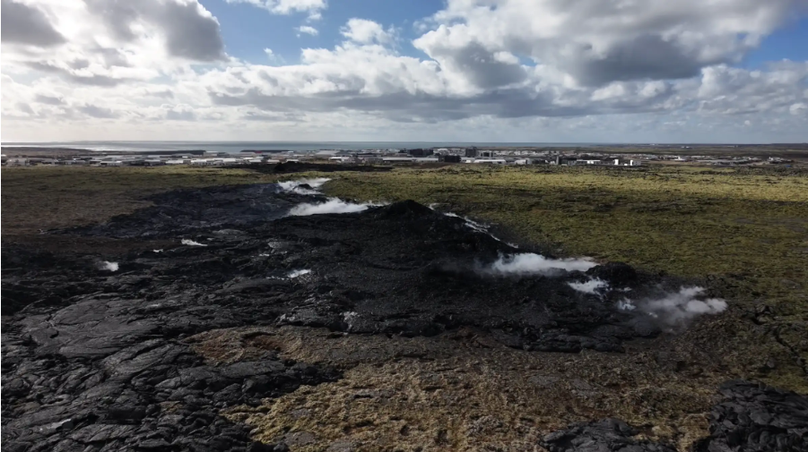
The map shows the location of all reviewed earthquakes on the Reykjanes Peninsula over the past 24 hours. It also shows preliminary estimates of the dike’s location, extending from Grindavík in the south to an area about 3 km northwest of Keilir.
Decreasing seismicity but deformation and microseismic activity persist
Seismic activity over the northern part of the dike continues to decrease, though small earthquakes are still being recorded in the area. During the past night and this morning, about 20 to 30 earthquakes were measured per hour, most below magnitude 1.0. At peak activity, over 100 earthquakes were detected per hour. Most earthquakes are spread from Stóra-Skógfell in the south to just north of Keilir. Their depths are mostly between 4 and 6 km, which has remained stable in recent days.
The vast majority of magma that left Svartsengi is now within the dike formed on April 1, in some places at depths of around 1.5 km, according to modeling data. Deformation due to the dike and microseismic activity in its northern part remain unusually high, even though it is decreasing. Due to this, there is still considerable uncertainty about developments in the coming days, and magma movements within the dike cannot be ruled out.
Source : IMO
Photo : RÚV – Víðir Hólm Ólafsson , IMO.
Indonesia , Lewotobi Laki-laki :
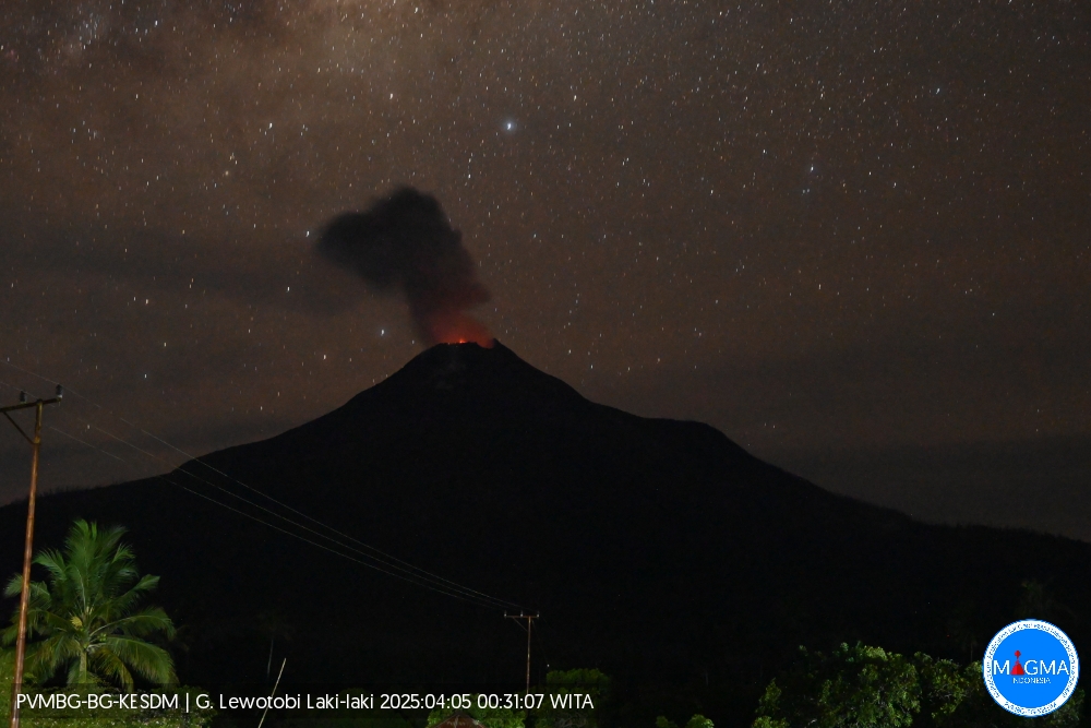
An eruption of Mount Lewotobi Laki-laki occurred on Saturday, April 5, 2025, at 00:27 WITA with an observed ash column height of ± 800 m above the peak (± 2384 m above sea level). The ash column was observed to be gray in color with a thick intensity, oriented toward the north and northeast. This eruption was recorded on a seismograph with a maximum amplitude of 5.6 mm and a duration of 148 seconds.
VOLCANO OBSERVATORY NOTICE FOR AVIATION – VONA
Issued : April 05 , 2025
Volcano : Lewotobi Laki-laki (264180)
Current Aviation Colour Code : ORANGE
Previous Aviation Colour Code : orange
Source : Lewotobi Laki-laki Volcano Observatory
Notice Number : 2025LWK178
Volcano Location : S 08 deg 32 min 20 sec E 122 deg 46 min 06 sec
Area : East Nusa Tenggara, Indonesia
Summit Elevation : 5069 FT (1584 M)
Volcanic Activity Summary :
Eruption with volcanic ash cloud at 16h27 UTC (00h27 local).
Volcanic Cloud Height :
Best estimate of ash-cloud top is around 7629 FT (2384 M) above sea level or 2560 FT (800 M) above summit. May be higher than what can be observed clearly. Source of height data: ground observer.
Other Volcanic Cloud Information :
Ash cloud moving from north to northeast. Volcanic ash is observed to be gray. The intensity of volcanic ash is observed to be thick.
Remarks :
Eruption recorded on seismogram with maximum amplitude 5.9 mm and maximum duration 148 second.
Source et photo : Magma Indonésie.
Colombia , Chiles / Cerro Negro :
San Juan de Pasto, April 1, 2025, 4:50 a.m.
Monitoring the activity of the Chiles and Cerro Negro volcanoes, the Colombian Geological Survey (SGC), an entity affiliated with the Ministry of Mines and Energy, reports that:
Between March 25 and 31, 2025, the most notable variations compared to the previous week were:
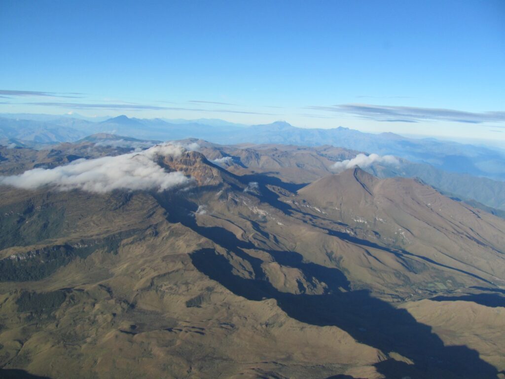
● A significant increase was recorded in both the frequency and energy released by earthquakes. The predominance of seismic activity associated with rock fractures within the volcano continued, and fluid dynamic events were recorded, some of them with very low frequency content. ● The vast majority of earthquakes were located at the summit and collapse zone of Chiles Volcano, at distances of less than 1.3 km, at depths of less than 4 km from its summit (4,700 m above sea level) and with a maximum magnitude of 2.2. Another group of events was located south of Chiles Volcano at distances of up to 6 km, at depths of between 5 and 18 km and with a maximum magnitude of 2.1. A third group of earthquakes was located southeast of Chiles Volcano, at distances of 8 to 11 km, at depths of between 9 and 12 km from its summit, and with magnitudes of less than 1.0.
● With fluctuations in trends and rates of change, instruments recording crustal deformation and satellite remote sensing have continued to show changes associated with an inflationary process in this volcanic area.
Based on the above, the SGC recommends closely monitoring developments through weekly bulletins and other information published through our official channels, as well as instructions from local and departmental authorities and the National Disaster Risk Management Unit (UNGRD).
Volcanic activity remains on Yellow alert: Active volcano with changes in the behavior of the baseline of monitored parameters and other manifestations.
Source et photo : SGC.
Costa Rica , Poas :
Updated April 4, 2025
OVSICORI-UNA observed:
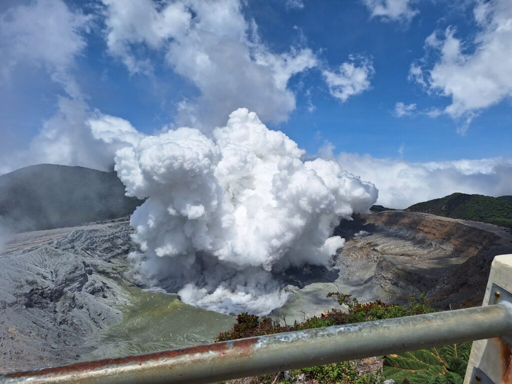
● Continuous eruption with very frequent explosions (every two minutes) with ash columns reaching up to 500 m, with one eruption reaching 1000 m (March 29, 2025).
● The eruptions are phreatomagmatic in nature.
● Ash emission is almost continuous, with dispersion mainly towards the northwest and southwest.
● Intense variable seismic tremors and volcano-tectonic seismicity.
● Vertical deformation of the volcano’s summit uplift.
● Significant increase in degassing.
● Ash with a juvenile glass content of approximately 10%.
Since Sunday, March 23, a new phase of this eruptive cycle characterized by almost continuous phreatomagmatic eruptions of moderate energy has been observed.
A high probability scenario of eruptions persists, which could impact areas of Poás Volcano National Park visited by tourists (fall of « bombs » or rocks, ash, gas, aerosols), as well as populations around Poás (ash, gas, aerosols) in the coming days and weeks.
The volcano’s activity level is at WARNING level 3 out of 4.
Eruptive Activity
At midnight on Sunday, March 23rd, an eruptive phase began and is ongoing at the time of writing. Between March 23rd and 26th, the eruption was continuous, with few interruptions but with variations in amplitude. Starting on the 27th, eruptive activity began to show interruptions of a few minutes between pulses. Despite this, the activity remains very frequent. Over the past week, two main eruption patterns have been identified, alternating for periods of several hours.
The first mode consists of very frequent eruptive pulses (one every few seconds) but with a height no greater than 100 m. The second consists of stronger and more sustained eruptions, which recur less frequently.
Seismic and Acoustic Activity
This week, the seismic signal has been dominated by eruptive activity. Seismic tremor increases during periods when the acoustic pulses of eruptions are energetic, although eruption heights are low (< 100 m). Conversely, the amplitude of seismic tremor decreases when higher (< 500 m) and longer eruptions occur, which are manifested acoustically mainly by short tremors. Regarding volcano-tectonic seismic activity, an increase in the number of events was recorded on March 30. However, despite this 6-hour swarm, no further events were recorded during the week. The number of long-duration events has increased slightly in recent days.
Geodetic Observations
Geodetic monitoring has detected moderate vertical uplift of the volcano, affecting the immediate crater area as well as the remaining GNSS stations located at the summit. This uplift is the largest observed so far in the current eruptive cycle, which began in December 2024. In recent days, a rapid decrease in its extension has been recorded, accompanied by moderate uplift.
Source : Ovsicori
Photo : Peter Mertsch / FB.


