February 27 , 2025.
Hawaii , Kilauea :
Wednesday, February 26, 2025, 8:34 AM HST (Wednesday, February 26, 2025, 18:34 UTC)
19°25’16 » N 155°17’13 » W,
Summit Elevation 4091 ft (1247 m)
Current Volcano Alert Level: WATCH
Current Aviation Color Code: ORANGE
Activity Summary:
Episode 11 of the Kīlauea summit eruption paused today at 7:06 a.m. HST on February 26 within Hawai’i Volcanoes National Park after erupting for 12 hours and 44 minutes.
Episode 11 of the ongoing Halemaʻumaʻu eruption began at 6:22 p.m. HST on February 25 and fountains reached peak heights of around 600 feet (180 m) 1-2 hours later. Kīlauea’s current eruption in Halemaʻumaʻu crater within Kaluapele (the summit caldera) began on December 23, 2024. There have been 11 episodes of lava fountaining separated by pauses in activity. All eruptive activity remains within Hawai’i Volcanoes National Park. No significant activity has been noted along Kīlauea’s East Rift Zone or Southwest Rift Zone.
Current hazards include volcanic gas emissions and windblown volcanic glass (Pele’s Hair) that may impact Hawai’i Volcanoes National Park and nearby communities.
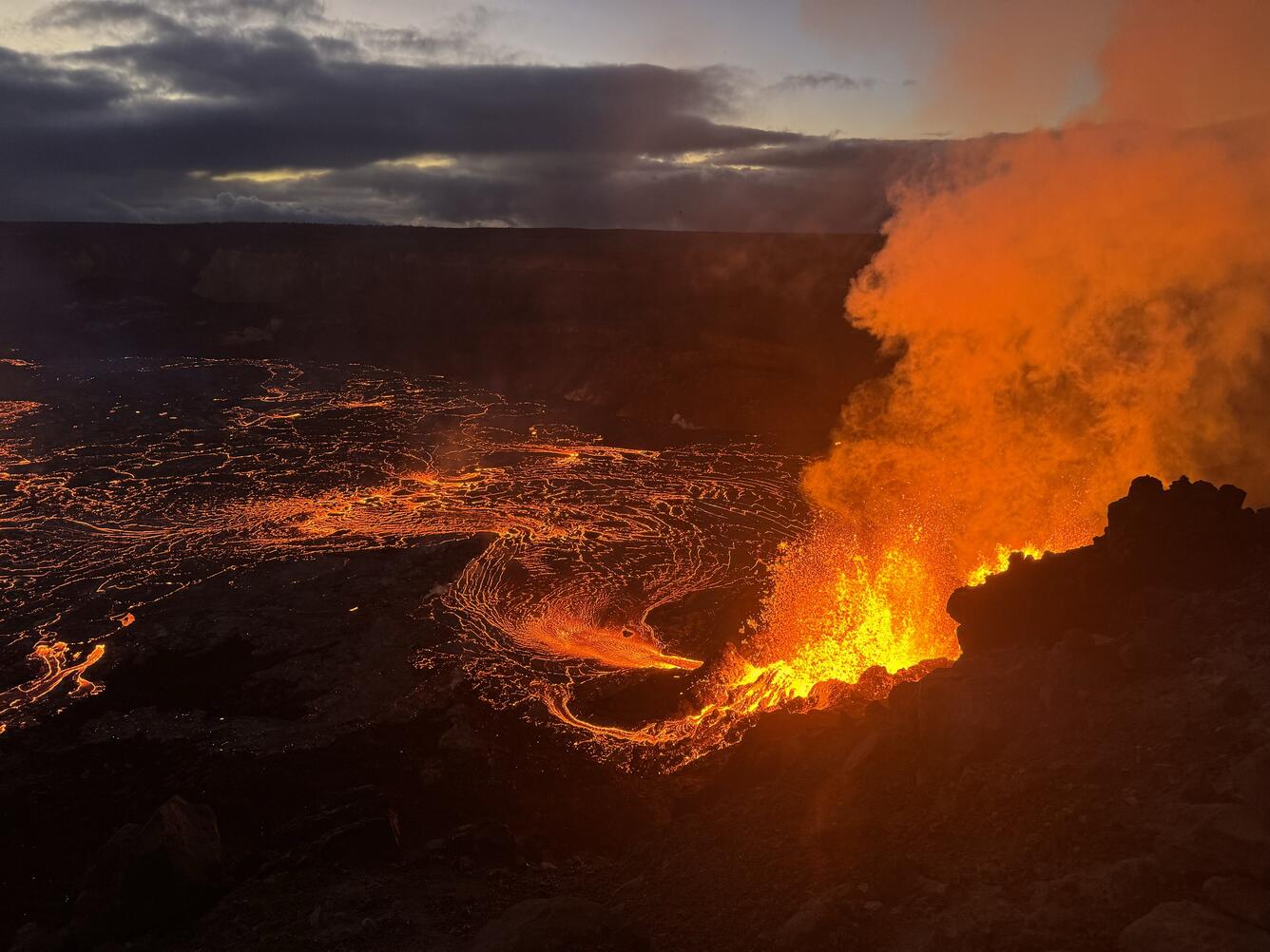
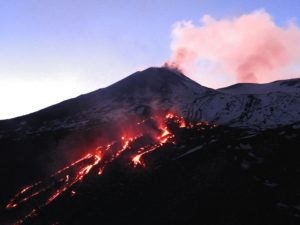
Hawaiian Volcano Observatory geologists visited the caldera rim at Kīlauea this morning and observed the end of the summit eruption’s eleventh episode, as fountains shut down at both eruptive vents between approximately 6:30 and 7:00 am. This photo shows fountaining at the north vent feeding a lava flow spreading east across the crater floor, about ten minutes before the shutdown
Summit Observations:
Lava flows and fountains stopped erupting from the south vent within Halemaʻumaʻu crater at about 7:06 a.m. HST on February 26. Lava flows from episode 11 covered approximately 75%-80% of the Halemaʻumaʻu crater floor. and sent lava flows onto the down dropped block around the September 2023 vents. Both the north and south vents continue to degas. The north vent began erupting at 6:22 p.m. HST last night February 25 with low fountains. Over the next hour the fountains grew in height to approximately 600 feet (180 m). Small spatter fountains began at the south vent just before 7 p.m. HST and by 8 p.m. HST were producing small flows. The south vent fountains and flows increased in size by 9:00 p.m. HST and continued fountaining together until 6:35 a.m. HST on February 26 when fountaining stopped at the north vent. The south vent fountains began to drop at this time and by 7:06 a.m. HST lava fountaining and flows stopped at the south vent marking the end of Episode 11.
The onset of episode 11 was preceded by the appearance of glow along the row of September 2023 vents on the east side of Halemaʻumaʻu crater. The glow began at one cone on the evening of February 24 and became visible along the entire 2023 fissure around 6 p.m. HST on February 25. Glow on the 2023 fissure remained persistent through much of the night. This suggests that magma within the vent system may have intruded into the molten interior of Halemaʻumaʻu crater prior to the onset of episode 11. Similar glow was not observed along the 2023 vents prior to or during episode 10.
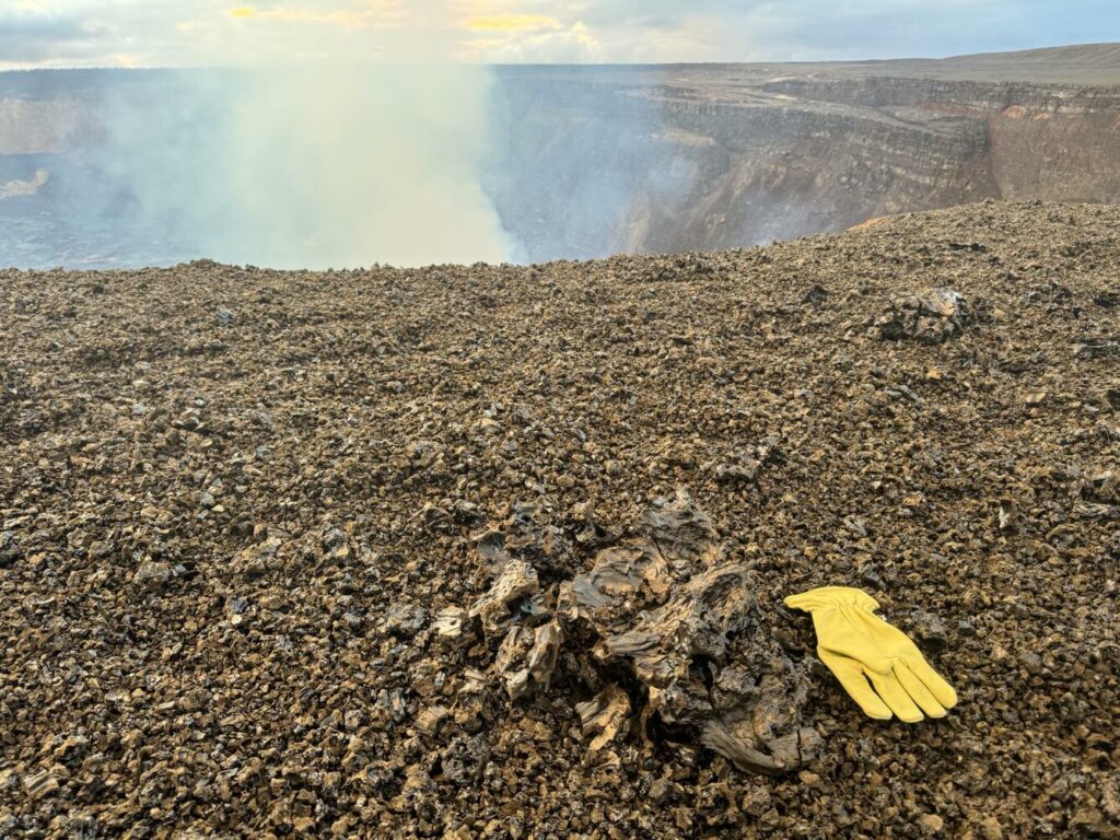
Large amounts of pumice, Peleʻs hair, and lighweight reticulite were deposited up on the west rim of Halemaʻumaʻu crater last night blanketing the area. A few light weight « ribbon » bombs up to about 1-2 feet (0.3-0.6 m) were also found on top of the pumice.
Recent lava fountaining at the summit of Kīlauea has produced large frothy clasts that have landed on the western caldera rim, in addition to many smaller clasts that have produced a thick carpet of new tephra.
Summit tilt changed rapidly from inflation to deflation at the onset of the eruption (6:22 p.m. HST February 25) and dropped about 10 microradians during the eruption. Tilt turned back to inflation at 6:35 a.m. HST February 26 when fountaining at the north vent stopped. Seismic tremor increased rapidly at the onset of the eruption and decreased sharply when the north vent fountains stopped and returned to the high background levels when the fountaining at the south vent stopped a half an hour later. The Uēkahuna (UWD) tiltmeter has recorded less than 0.5 microradians of inflationary tilt since the end of episode 11. No seismicity was recorded at Kīlauea’s summit over the past 24 hours.
Volcanic gas emissions remain elevated. Based on measurements made during earlier episodes and pauses, sulfur dioxide (SO2) emission rates are likely to be approximately 1,000 t/d during the current pause. An SO2 emission rate of 2,100 t/d was measured at 11am on February 20.
Rift Zone Observations:
Rates of seismicity and ground deformation remain very low in the East Rift Zone and Southwest Rift Zone with no significant earthquake activity in the past 24 hours. Sulfur dioxide (SO2) emissions from the East Rift Zone remain below detection limit.
Source : HVO
Photos : USGS / M. Patrick.
Tonga Archipelago , Home Reef :
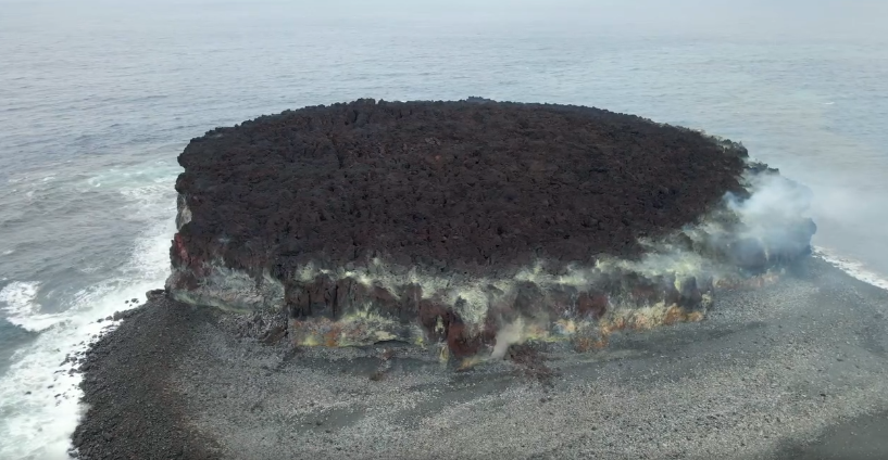
The Tonga Geological Services reported that increased thermal activity at Home Reef was identified in satellite images since 8 February with the latest signs of activity detected on 20 February. Satellite images from 8 February showed a larger crater that was about 78 m in diameter and about 50 m deep. The crater was had an estimated area of 4,350 square meters. Large blocks were scattered 65-75 m from the center of the crater, likely ejected during a recent eruptive event; the largest block was about 14 x 15 m. Small plumes rose from the vent that were ash-rich near the base and mostly comprised of gas and steam at higher levels. Satellite imagery on 20 February showed discolored water to the SW and a thermal anomaly over the vent. The Maritime Alert Level remained at Orange (the third level on a four-level scale), and mariners were advised to stay at least 2 nautical miles (3.7 km) away from the island. The Aviation Color Code remained at Yellow (the second level on a four-level scale), and the Alert Level for residents of Vava’u and Ha’apai remained at Green (the first level on a four-level scale).
Home Reef, a submarine volcano midway between Metis Shoal and Late Island in the central Tonga islands, was first reported active in the mid-19th century, when an ephemeral island formed. An eruption in 1984 produced a 12-km-high eruption plume, large amounts of floating pumice, and an ephemeral 500 x 1,500 m island, with cliffs 30-50 m high that enclosed a water-filled crater. In 2006 an island-forming eruption produced widespread dacitic pumice rafts that drifted as far as Australia. Another island was built during a September-October 2022 eruption.
Sources : Tonga Geological Services, Government of Tonga , GVP.
Photo : Lacelid Productions ( capture d’écran ), 2024.
New Zealand , Ruapehu :
Volcanic Activity Bulletin , Thu Feb 27 2025 12:00 AM; Ruapehu Volcano
Volcanic Alert Level remains at 1
Aviation Colour Code remains at Green
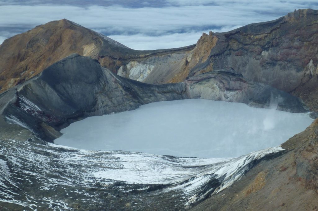
Ruapehu’s Crater Lake remains at 20°C with a steady heat flux and low but continuous sulphur dioxide emissions. The Volcanic Alert Level remains at 1 and the Aviation Colour Code at Green.
Since our last update in December, temperatures at Te Wai ā-moe (Ruapehu Crater Lake) have hovered around 20 ºC. Based on our modelling of heat flux into the lake this corresponds to a continuous heat input of about 100 MW during most of the past two months. Heat input typically ranges from around 50 to over 3-400 MW when the lake is very hot (over 35 °C).
Sulphur dioxide emissions measured by our continuous gas emission detectors also show low-level but continuous gas flux of around 100 – 150 tonnes per day. High gas flux rates can exceed 500 tonnes per day. These observations are consistent with minor volcanic input from depth into the Crater Lake keeping it warm. The lake has not heated as much as it normally does during a heating cycle, however, the flow of gas through the lake implies that vents are not completely sealed. The last three heating cycles in the lake have been weaker than usual, indicating a lower state of unrest at the volcano over the last 2 years.
Crater Lake water samples taken on 4 February 2025 show a dilution trend which is expected in summer as a more meltwater enters the lake, along with the relatively low input of gas and concentrated fluids into the lake.
Our recent observations are consistent with the ongoing, low-level volcanic unrest at Ruapehu and, therefore the Volcanic Alert Level remains at 1. The Aviation Colour Code remains Green.
More information:
Mt Ruapehu is an active volcano and has the potential to erupt with little or no warning when in a state of minor volcanic unrest.
Source : Geonet / Yannik Behr / Volcanologue de service .
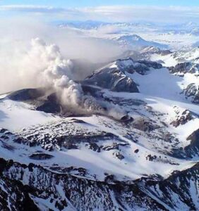
Photo : Geonet .
Indonesia , Ili Lewotolok :
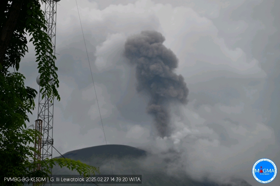
An eruption of Mount Ili Lewotolok occurred on Thursday, 27 February 2025 at 14:39 WITA with an observed ash column height of ±700 m above the peak (±2123 m above sea level). The ash column was observed to be grey in colour with a thick intensity, oriented towards the West. This eruption was recorded on a seismograph with a maximum amplitude of 29.8 mm and a duration of 90 seconds.s.
Seismicity observation:
173 eruption earthquakes with an amplitude of 20.6 to 38.7 mm and a duration of 32 to 173 seconds.
72 emission earthquakes with an amplitude of 1.6 to 17.5 mm and a duration of 21 to 81 seconds.
16 harmonic tremors with an amplitude of 1.2 to 5.3 mm and an earthquake duration of 77 to 296 seconds.
14 non-harmonic tremors with an amplitude of 1.6-5.4 mm and a duration of 97-215 seconds.
3 deep volcanic earthquakes with an amplitude of 5.8 to 23 mm, and an earthquake duration of 14 to 17 seconds.
2 distant tectonic earthquakes with amplitude 1.2-2.2 mm, and earthquake duration 154-224 seconds.
Recommendations
(1) The community around Mount Ili Lewotolok and visitors/climbers/tourists should not enter and do any activities within a 2 km radius around the activity center of Mount Ili Lewotolok, and the community of Lamatokan village and Jontona village should always be aware of the potential threat of avalanche/landslide hazard, lahars from the eastern part of the peak/crater of Mount Ili Lewotolok.
(2) The community around Mount Ili Lewotolok, as well as visitors/climbers/tourists and the community of Jontona and Todanara villages shall not enter and carry out activities in the South and South-East sectoral areas within 2.5 km from the activity centre of Mount Ili Lewotolok, and shall be aware of the potential threat of avalanche/landslide hazard, lahars from the South and South-East parts of the peak/crater of Mount Ili Lewotolok.
Source et photo : Magma Indonésie .
Colombia , Galeras :
San Juan de Pasto, February 25, 2025, 5:00 p.m. .
Following the monitoring of the activity of the Galeras volcano, the Colombian Geological Survey (SGC), an entity attached to the Ministry of Mines and Energy, reports that:
Between February 18 and 24, 2025, volcanic activity showed an increase in seismicity levels. Compared to the previous week, the main variations in the monitored parameters were:
• An increase in the frequency of seismic activity and the energy released was observed.
Earthquakes associated with rock fracture processes within the volcano continued to predominate.
• Most of the fracture earthquakes were located near the volcanic cone, at depths less than 3 km from the summit (4,200 m above sea level). Other events were located scattered in different areas of the volcanic edifice, reaching distances of up to 18 km and depths of less than 11 km. The maximum magnitude recorded for these earthquakes was 2.1.
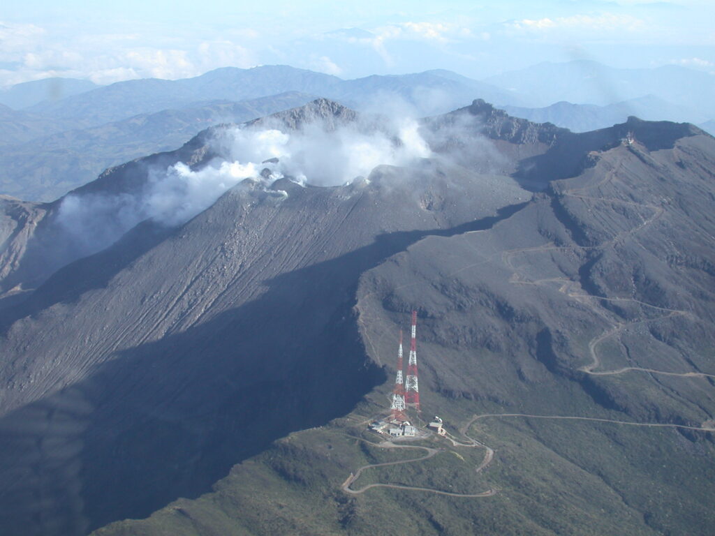
• Low-altitude white gas emissions were detected, the dispersion of which varied depending on the wind direction. These emissions came from both the main crater and the fumarole fields of Las Chavas, to the west, and El Paisita, to the north of the active cone.
• The other parameters of the volcanic monitoring showed stability.
Based on the above, the SGC recommends closely monitoring the evolution through the weekly bulletins and other information published through our official channels, as well as the instructions of the local and departmental authorities and the National Disaster Risk Management Unit (UNGRD).
The volcanic activity remains in yellow alert status: active volcano with changes in the behavior of the base level of the monitored parameters and other manifestations.
Source et photo : SGC

