February 20 , 2025.
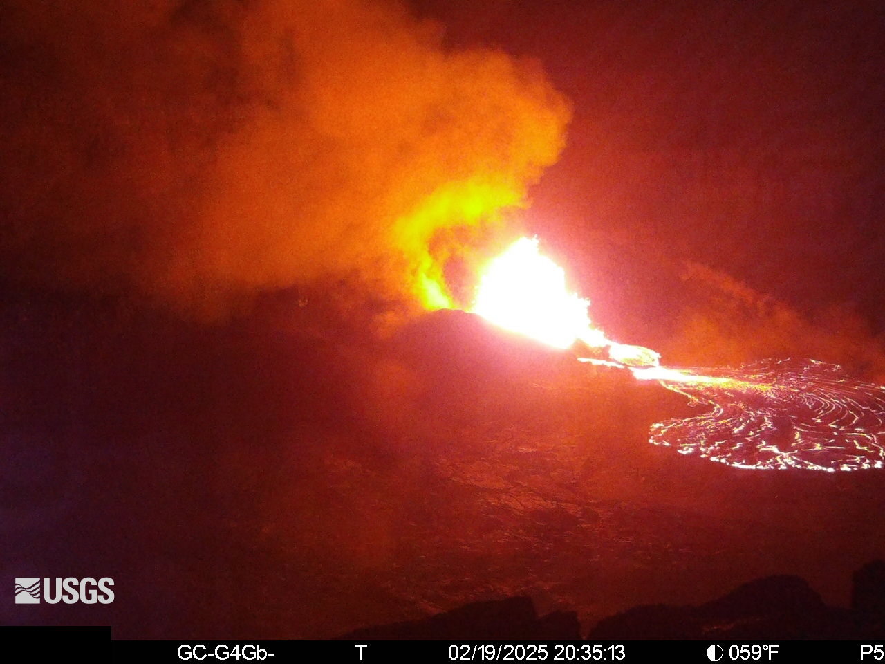
Hawaii , Kilauea :
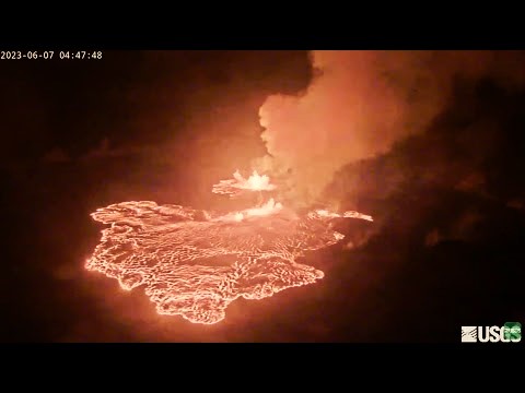
Episode 10 of the Halema’uma’u eruption began at 8:22 pm HST on February 19. Low-level fountaining (30-50 feet high) from the north vent is feeding a flow that is spreading on the crater floor.
Ongoing hazards include volcanic gas emissions and windblown volcanic glass (Pele’s Hair) that may impact Hawaiʻi Volcanoes National Park and nearby communities.
19°25’16 » N 155°17’13 » W,
Summit Elevation 4091 ft (1247 m)
Current Volcano Alert Level: WATCH
Current Aviation Color Code: ORANGE
Activity Summary:
Episode 10 of the ongoing Halemaʻumaʻu eruption began at 8:22 p.m. HST on February 19, 2025 with low level fountaining within Halema’uma’u Caldera.
Fountains from the north vent are 300-400 feet (90-125 meters) high and feeding multiple lava streams between 8:22 and 9:05 p.m. HST. Less than 10% of Halemaʻumaʻu is current covered with lava flows as of 8:45 p.m.
Inflationary tilt reached just over 10 microradians since the end of the last episode. Seismic tremor began increasing and tilt at UWD switched from inflation to deflation at about 8:22 p.m. HST, about the same time lava flows began erupting onto the crater floor.
Each episode of Halemaʻumaʻu lava fountaining since December 23, 2024, has continued for 13 hours to 8 days and episodes have been separated by pauses in eruptive activity lasting a less than 24 hours to 12 days.
No changes have been detected in the East Rift Zone or Southwest Rift Zone. HVO continues to closely monitor Kīlauea and will issue an eruption update tomorrow morning unless there are significant changes before then.
Kīlauea Volcano Alert Level/Aviation Color Code remain at WATCH/ORANGE. All current and recent activity is within Hawaiʻi Volcanoes National Park.
Source et photo : HVO
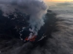
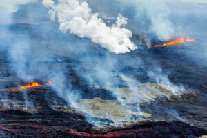
Italy / Sicily , Etna :
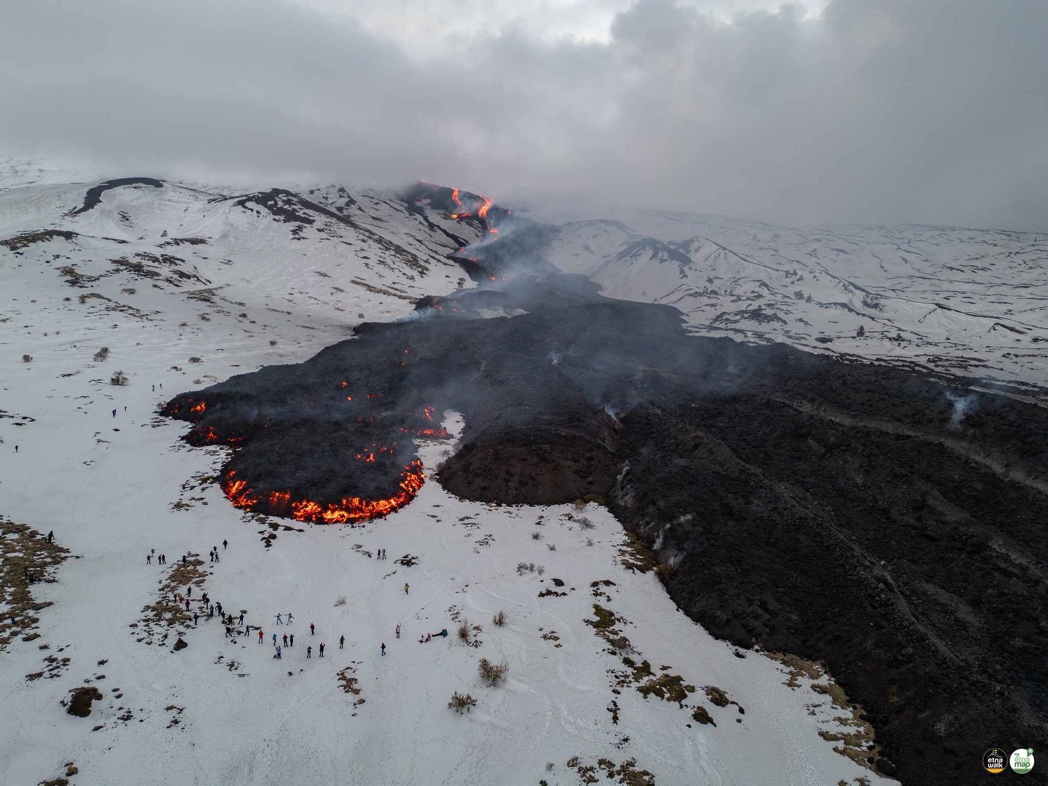
Sezione di Catania – Osservatorio Etneo (INGV) reported that the new eruption that began at Etna on 6 February continued during 10-16 February. Activity observed through webcams and during daily field inspections was characterized by the effusion of a lava flow from a fissure and explosive activity at the summit. The lava flow from the fissure that opened at the base of Bocca Nuova Crater on 8 February continued to effuse lava. The lava flow advanced down the SW flank, descending to 2,150 elevation by 11 February and 1,960 elevation by 13 February. The distal end of the flow was 6-8 m thick. Photogrammetric data collected by drones on 14 and 16 February, combined with satellite data, showed that the lava flow advanced 380 m during that 48-hour period. The total flow length was 4.2 km and covered an estimated area of 0.3 square kilometers (300,000 square meters). There were reports of phreatic explosions from the interaction with lava and snow that ejected lava fragments a few hundred meters, particularly on 12 February.
Explosive activity at SE Crater originated from at least two vents based on webcam views and a 12 February field inspection. During the field inspection weak explosive activity originated from a vent located between SE Crater and Bocca Nuova Crater. Minor ash emissions rose from SE Crater and quickly dissipated downwind, depositing ash near the summit. Ash emissions intensified on 12, 14, and 16 February; the Aviation Color Code was raised to Red (the highest level on a four-color scale) on 12 February then back to Orange on 13 February, to Red on 14 February and back to Orange that same day, again to Red on 16 February, and back to orange on 18 February. Although weather conditions sometimes obscured views, the ash emissions rose no higher than an estimated maximum altitude of 5.5 km a.s.l. (about 2.1 km above the summit). According to a news report flights in and out of the Catania-Fontanarossa Airport were disrupted during 12-17 February.
Sources : Sezione di Catania – Osservatorio Etneo (INGV), Euronews , GVP.
Photo : Giuseppe Distefano / Marco Restivo / Etnawalk via FB.
Indonesia , Dukono :
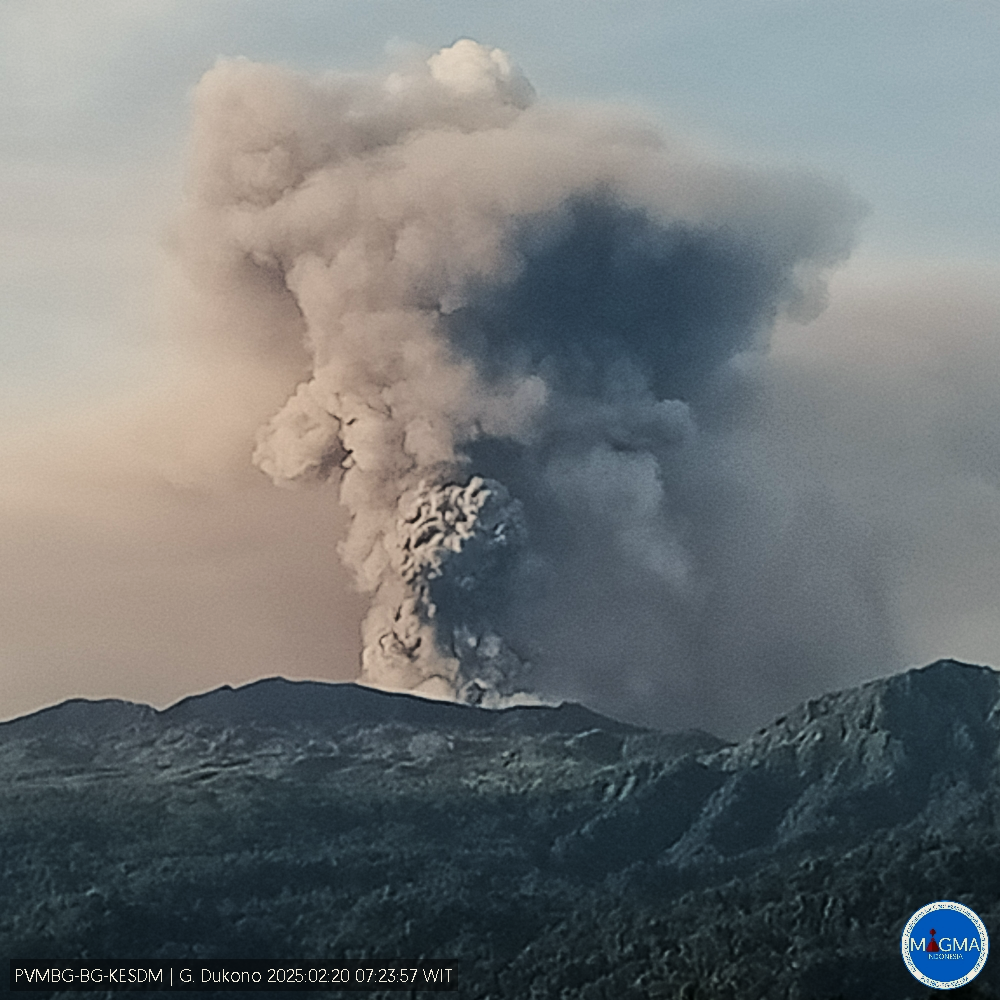
An eruption of Mount Dukono occurred on Thursday, 20 February 2025 at 09:14 WIT with an observed ash column height of ±2000 m above the peak (±3087 m above sea level). The ash column was observed to be white to grey in colour with a thick intensity, oriented towards the south. At the time of writing, the eruption was still ongoing.
VOLCANO OBSERVATORY NOTICE FOR AVIATION – VONA
Issued : February 20 , 20250
Volcano : Dukono (268010)
Current Aviation Colour Code : ORANGE
Previous Aviation Colour Code : unassigned
Source : Dukono Volcano Observatory
Notice Number : 2025DUK010
Volcano Location : N 01 deg 41 min 35 sec E 127 deg 53 min 38 sec
Area : North Maluku, Indonesia
Summit Elevation : 3478 FT (1087 M)
Volcanic Activity Summary :
Eruption with volcanic ash cloud at 00h14 UTC (09h14 local).
Volcanic Cloud Height :
Best estimate of ash-cloud top is around 9878 FT (3087 M) above sea level or 6400 FT (2000 M) above summit. May be higher than what can be observed clearly. Source of height data: ground observer.
Other Volcanic Cloud Information :
Ash cloud moving to south. Volcanic ash is observed to be gray. The intensity of volcanic ash is observed to be thick.
Remarks :
Eruption recorded on seismogram with maximum amplitude 34 mm and maximum duration 55.33 second.
Source et photo : Magma Indonésie .
Peru , Huaynaputina :
The Instituto Geofísico del Perú (IGP) reported that several lahars carrying blocks descended the S flank of Huaynaputina during 11-17 February and traveled towards the Tambo River. The lahars were recorded at 1309 on 11 February, at 1725 on 14 February, at 1712 on 15 February, at 1813 on 16 February, and at 1546 on 17 February. The public was warned to stay away from the drainage and to be cautious when traveling along the Quinistaquillas-Sijuaya highway.
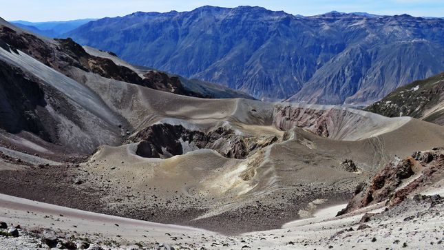
Huaynaputina (whose name means « new volcano ») was the source of the largest historical eruption of South America in 1600 CE. It has no prominent topographic expression and lies within a 2.5-km-wide collapse depression and further excavated by glaciers within a Tertiary to Pleistocene edifice. Three overlapping ash cones with craters up to 100 m deep were constructed during the 1600 CE eruption on the floor of the older crater, whose outer flanks are heavily mantled by ash deposits from the 1600 eruption. This powerful fissure-fed eruption may have produced nearly 30 km3 of dacitic tephra, including pyroclastic flows and surges that traveled 13 km to the E and SE. Lahars reached the Pacific Ocean, 120 km away. The eruption caused substantial damage to the major cities of Arequipa and Moquengua.
Sources : Instituto Geofísico del Perú (IGP) , GVP
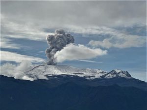
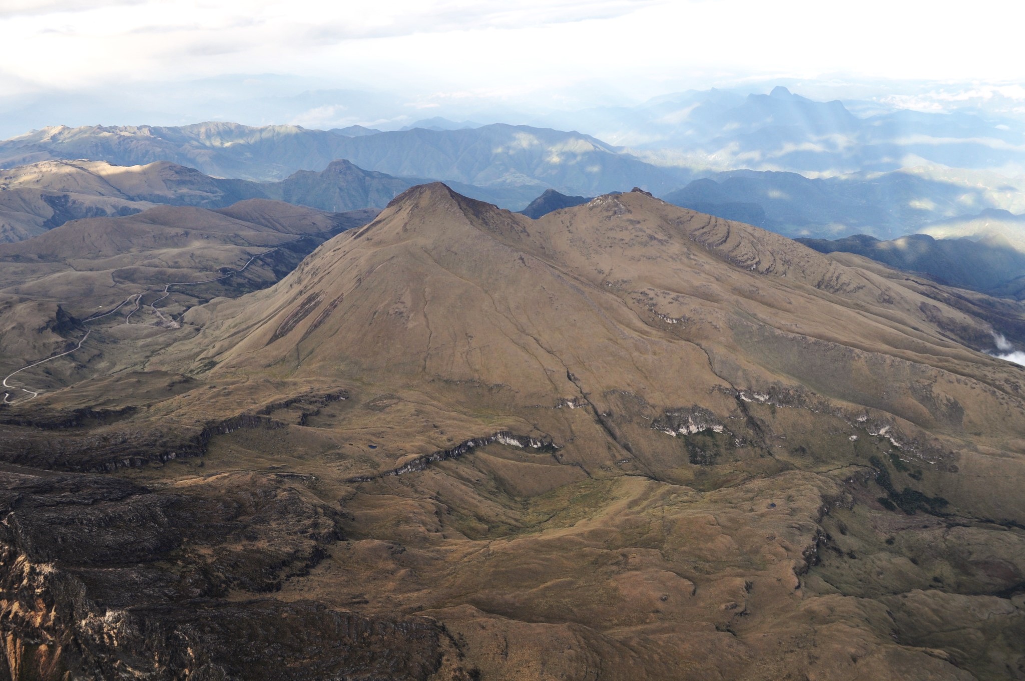
Colombia , Chiles / Cerro Negro :
San Juan de Pasto, February 18, 2025, 3:40 p.m. .
Following the monitoring of the activity of the Chiles and Cerro Negro volcanoes, the Colombian Geological Survey (SGC), an entity attached to the Ministry of Mines and Energy, reports that:
During the period from February 11 to 17, 2025, volcanic activity showed significant fluctuations in its main parameters. Compared to the previous period, the most notable changes were:
• A significant increase was recorded in both the occurrence and the seismic energy released, maintaining the predominance of seismicity associated with rock fracture within volcanic systems, with a significant recording of events associated with the movement of fluids, some of them with very low frequency contents.
• Earthquakes associated with rock fracture were located mainly at the summit and in the collapse zone of the Chiles volcano, at distances of up to 2 km, with depths between 2 and 5 km from the summit of the volcano (4700 m above sea level), with a maximum magnitude of 2.2.
Another group of earthquakes was located scattered in several sectors to the southeast and southwest of the Chiles volcano, at distances of up to 9 km and depths of up to 14 km from the summit of Chiles, with a maximum magnitude of 1.5.
• Instruments that record crustal deformation and remote satellite sensors continue to show changes related to an inflationary process in this volcanic area.
Based on the above, the SGC recommends closely monitoring the developments through weekly bulletins and other information published through our official channels, as well as instructions from local and departmental authorities and the National Disaster Risk Management Unit (UNGRD).
Volcanic activity remains in yellow alert status: active volcano with changes in the behavior of the base level of monitored parameters and other manifestations.
Source et Photo : SGC