January 21 , 2025.
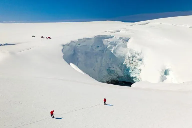
Iceland , Bárðarbunga :
A statement from Civic Protection has officially ended the “uncertainty phase” at Bárðarbunga volcano, located on the northwestern corner of the Vatnajökull glacier in South Iceland.
Alarming rumblings
As reported, last Tuesday morning a series of earthquakes located at or near the volcano, some of a magnitude around 5, had scientists concerned that a magma intrusion might have been underway in the area.
This prompted Civic Protection to issue an “uncertainty phase” for the area, meaning that the situation might develop into something more serious and requires continuous attention. A code orange was also issued for flying in the area, which also means to proceed with caution.
Calm since then
Were an eruption to occur at Bárðarbunga, there are a few scenarios that could play out. As the volcano lies partially under Vatnajökull, the magma rising to the surface could take the path of least resistance, resulting in an eruption such as that which happened at the Holuhraun lava field in 2014. Should the magma rising up under the glacier itself, glacial flooding, an ash cloud eruption, or both could occur.
Activity at and near Bárðarbunga has mercifully been very low since last week, however, and so Civic Protection no longer felt the need to keep the uncertainty phase in effect. That said, scientists will continue to monitor the situation closely.
Source : icelandreview.com
Photo: Golli. Bárðarbunga.
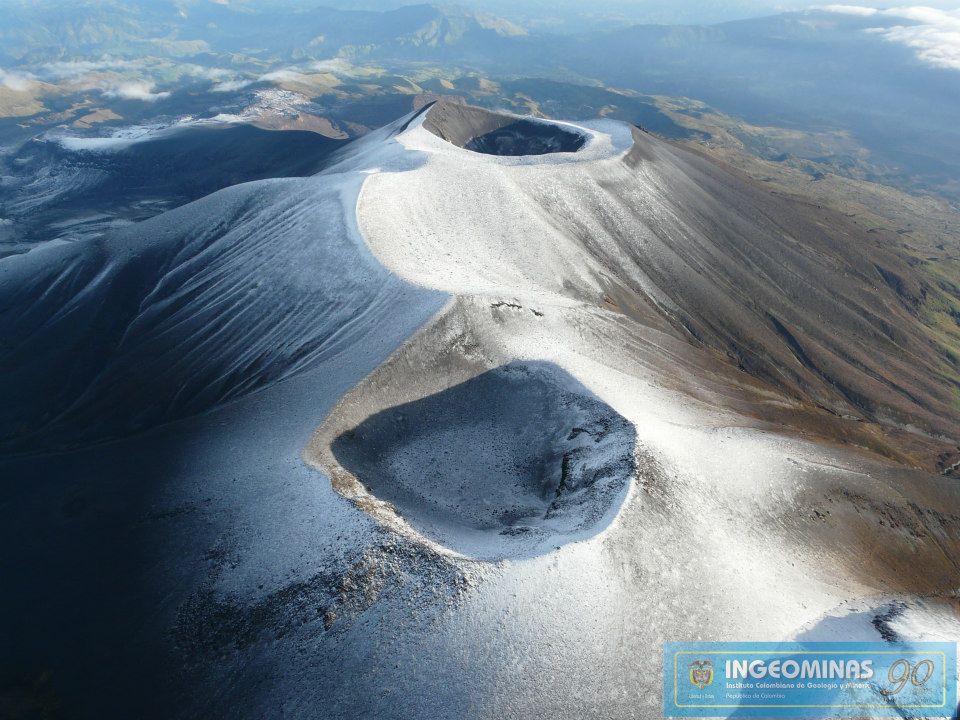
Colombia , Puracé / Los Coconucos volcanic chain :
Popayan, January 20, 2025, 4:00 a.m. .
Following the monitoring of the activity of the Puracé volcano, the Colombian Geological Survey (SGC), an entity attached to the Ministry of Mines and Energy, reports that:
● Since the night of January 19 at 11:06 p.m., a seismic signal of the « tremor » type has been continuously recorded, which has shown an increase in size and is associated with an increase in internal pressure in the volcano. This activity has been related to the movement of fluids inside the volcano’s conduits, through which ash has been emitted into the atmosphere. The dispersion of this emission has occurred in a southwest direction of the volcano.
● Other monitoring techniques have not shown significant variations in the measured parameters and, at the time of publication of this bulletin, activity levels have returned to levels consistent with increased seismic activity.
● Residents of the towns of Puracé and Coconuco have reported ashfall, also claiming to be able to smell sulfur.
● In Yellow Alert status, the volcano may present phenomena such as sporadic ash emissions (minor eruptions) whose magnitude and effects are limited and the dispersion of ash depends on the wind direction, presence of some incandescence, small explosions in the crater, low-energy thermal anomalies, noises, felt earthquakes, odors, precipitation of elemental sulfur near the crater and in hot springs and fumaroles, degassing in areas other than the crater, formation of fissures, appearance of minor lahars, among others.
Based on the above, the SGC recommends closely monitoring the developments through bulletins and other information published through our official channels, as well as instructions from local and departmental authorities and the National Disaster Risk Management Unit (UNGRD)
Popayan, January 20, 2025, 1:00 p.m.
Following the monitoring of the activity in the Los Coconucos volcanic chain, the Colombian Geological Survey (SGC), an entity attached to the Ministry of Mines and Energy, specifies that:
The increase in seismic activity reported in the extraordinary bulletin published today at 4:00 a.m. was located in the northwest part of the Los Coconucos volcanic chain and the emission of ash recorded by acoustic pressure sensors, webcams installed in the upper part of the volcano, as well as reported by neighboring populations, had as its focus the crater of the Curiquinga volcano. This volcano is part of the Los Coconucos volcanic chain, located in the Central mountain range, between the departments of Cauca and Huila, and is composed of fifteen eruptive centers, including the Puracé volcano.
In addition, it is reported that:
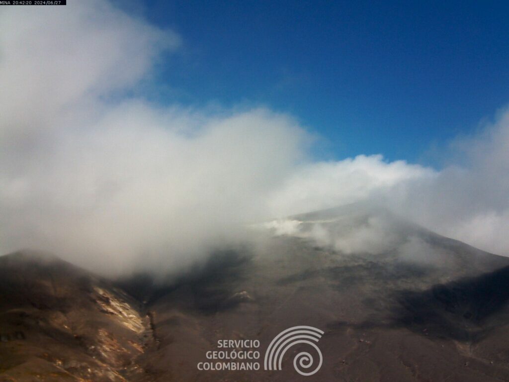
● According to the images obtained with the cameras installed by the SGC and the reports made by the inhabitants of the area of influence, four gas emission points have been identified, two on the Puracé volcano and two new emission points on Curiquinga.
● At the time of publication of this bulletin, the seismic signal continues to be recorded with lower energy and has been accompanied by fluid seismicity and, to a lesser extent, fracture earthquakes.
● During the ash emission, a deformation process was recorded on the Popayán, Timbío, Coconuco and Sotará (Cauca), Puracé and Curiquinga volcanoes, which tended to stabilize at the time of publication of this bulletin.
● Regarding the monitoring of volcanic gases, an increase in the flow of sulfur dioxide (SO2) was recorded.
● It is not excluded that an activity may occur that could indicate an acceleration of the process, implying greater activity in some of the volcanoes of the Northwest that make up the Los Coconucos volcanic chain.
Based on the above, the SGC recommends closely monitoring the evolution through the extraordinary bulletins and other information published through our official channels, as well as the instructions of the local and departmental authorities and the National Disaster Risk Management Unit (UNGRD).
The state of volcanic activity remains in yellow alert: active volcano with changes in the behavior of the base level of the monitored parameters and other manifestations.
Source : SGC
Photos : Ingeominas , SGC ( archive 06/2024)
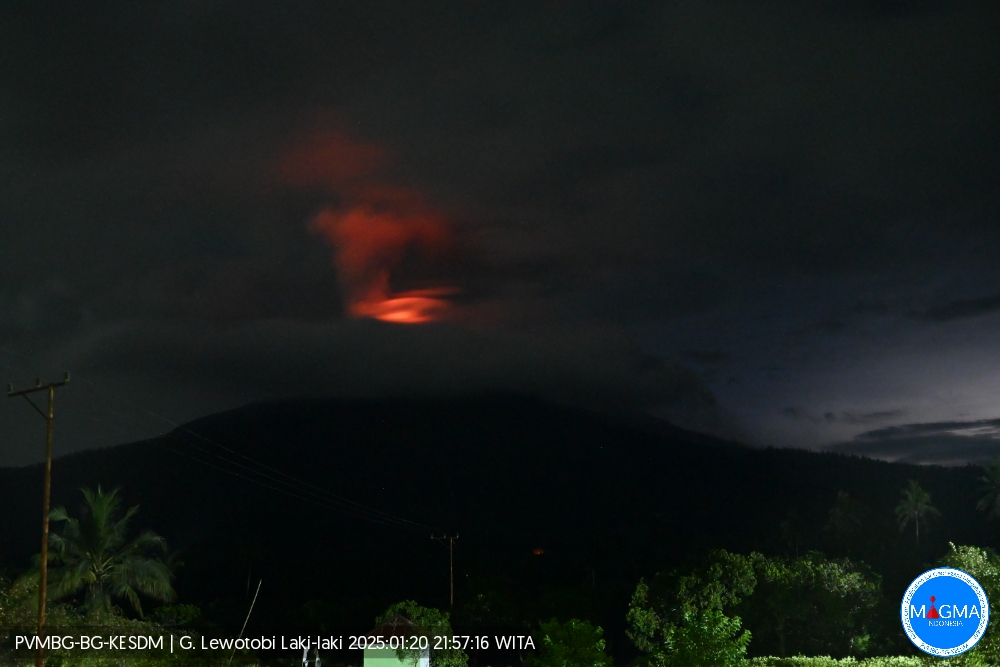
Indonesia , Lewotobi Laki-laki :
An eruption of Lewotobi Laki-laki occurred on Monday, 20 January 2025 at 21:48 WITA with an observed ash column height of ±700 m above the peak (±2284 m above sea level). The ash column was observed to be grey in colour with a thick intensity, oriented towards the northeast and east. This eruption was recorded on a seismograph with a maximum amplitude of 11 mm and a duration of 64 seconds.
VOLCANO OBSERVATORY NOTICE FOR AVIATION – VONA
Issued : January 20 , 2025
Volcano : Lewotobi Laki-laki (264180)
Current Aviation Colour Code : ORANGE
Previous Aviation Colour Code : orange
Source : Lewotobi Laki-laki Volcano Observatory
Notice Number : 2025LWK021
Volcano Location : S 08 deg 32 min 20 sec E 122 deg 46 min 06 sec
Area : East Nusa Tenggara, Indonesia
Summit Elevation : 5069 FT (1584 M)
Volcanic Activity Summary :
Eruption with volcanic ash cloud at 13h48 UTC (21h48 local).
Volcanic Cloud Height :
Best estimate of ash-cloud top is around 7309 FT (2284 M) above sea level or 2240 FT (700 M) above summit. May be higher than what can be observed clearly. Source of height data: ground observer.
Other Volcanic Cloud Information :
Ash cloud moving from northeast to east. Volcanic ash is observed to be gray. The intensity of volcanic ash is observed to be thick.
Remarks :
Eruption recorded on seismogram with maximum amplitude 11 mm and maximum duration 64 second.
Source et photo : Magma Indonésie.
Hawaii , Kilauea :
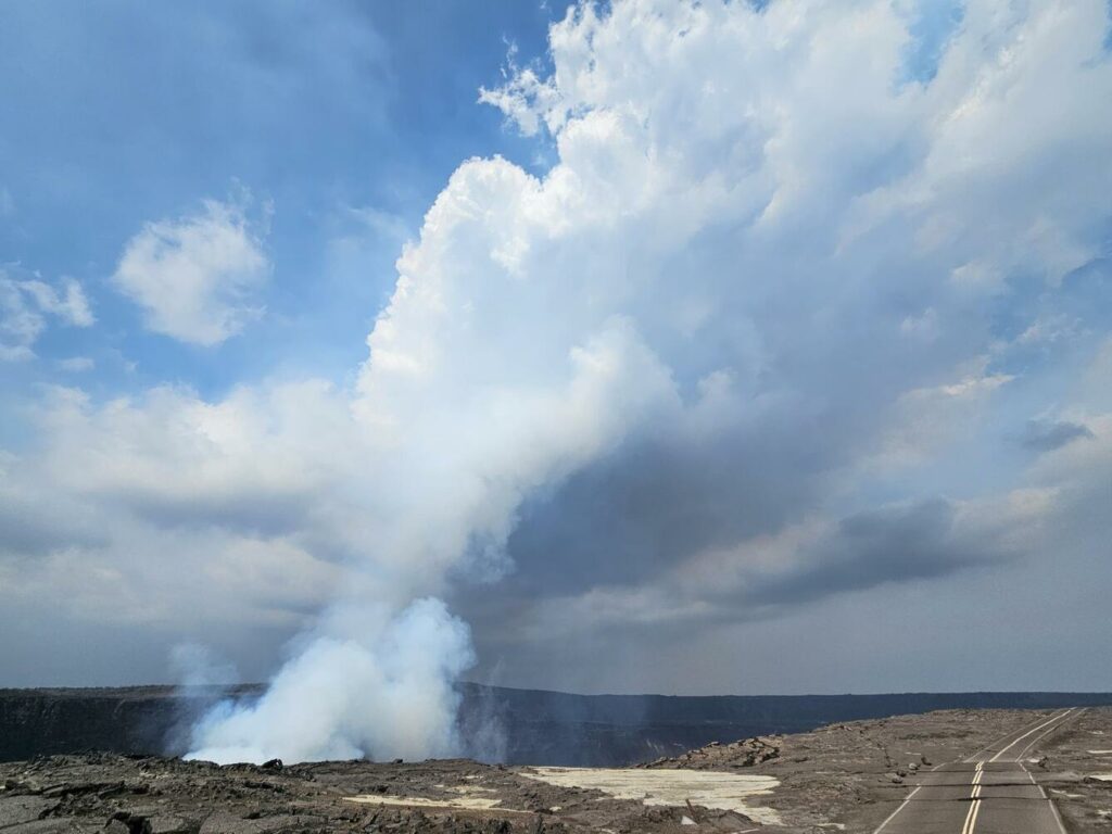
The current eruption at the summit of Kīlauea is the sixth eruption since 2020 within Halema’uma’u crater, which sits inside the southern part of Kaluapele. The recent summit eruptions have lasted from one week to more than a year. Like most of the other eruptions, this event began with vigorous lava effusion and volcanic gas emissions from an initial fissure system. The current eruption is marked by episodic fountaining not seen in any of the other eruptions. There have been four fountaining episodes to date lasting from a few hours to over a week. The onset of fountaining of each episode is accompanied by strong deflation of the summit region. Pauses or periods of repose between all of the fountaining episodes are marked by an immediate change from deflation to inflation of the summit as magma recharge repressurizes the magma chamber.
A view of the nearly vertical eruption plume at Kīlauea summit during the afternoon on January 17, 2025. Photo taken from within the closed area of Hawaiʻi Volcanoes National Park and showing Crater Rim Drive.
The prior four episodes all began after the Uēkahuna tiltmeter recorded between 6 and 12 microradians of inflationary tilt. The Uēkahuna tiltmeter has recorded about 2 microradians of inflationary tilt in past 24 hours and is currently inflating at a rate of 2 microradians per day. If this relatively high rate of inflationary tilt continues and magma remains high in the vent as indicated by strong glow at night, it suggests that there is a high probability that the fifth fountaining episode could begin sometime between Tuesday January 21 and Friday January 24. If the rate of inflation slows, the probable window of time for resumption of activity would be longer.
HVO continues to closely monitor Kīlauea and is in contact with Hawai‘i Volcanoes National Park and the Hawai‘i County Civil Defense Agency about eruptive hazards.
Source : HVO
Photo : USGS / P. Nadeau
Peru , Sabancaya :
Analysis period: from January 13, 2025 to January 19, 2025, Arequipa, January 20, 2025
Alert level: ORANGE
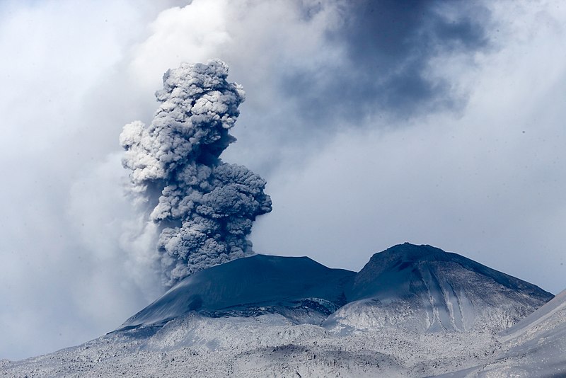
The Geophysical Institute of Peru (IGP) reports that the eruptive activity of the Sabancaya volcano continues. During this period, an average of 6 explosions per day have been recorded, with columns of ash and gas up to 1900 m above sea level above the summit of the volcano. Therefore, the volcanic alert level remains at ORANGE
The IGP has recorded and analyzed the occurrence of 131 earthquakes of volcanic origin, associated with the circulation of magmatic fluids inside the Sabancaya volcano, as well as earthquakes related to rock fracturing. An average of 6 explosions per day have been recorded.
Columns of ash and gas have been observed up to 1900 m above sea level above the summit of the volcano. The predominant direction of these emissions has been towards the East, Northeast and Southeast sectors of the volcano over a distance of less than 10 KM.
A slight inflation process continues to be recorded in the North sector (around the Hualca Hualca volcano).
Satellite recordings have identified the presence of 8 thermal anomalies, with a maximum value of 2 MW, associated with the presence of a lava body on the surface of the volcano’s crater.
Moderate emissions (1081 tons/day) of sulfur dioxide (SO2) have been observed
RECOMMENDATIONS
• Maintain the orange volcanic alert level.
• Do not approach within a radius of less than 12 km of the crater.
Source : Cenvul
Photo : Galeria del Ministerio de Defensa del Perú ( 2020 )

