January 15 , 2025.
Italy , Stromboli :
WEEKLY BULLETIN, from January 06, 2025 to January 12, 2025. (issue date January 14, 2025)
SUMMARY OF ACTIVITY STATUS
In light of the monitoring data, it is highlighted:
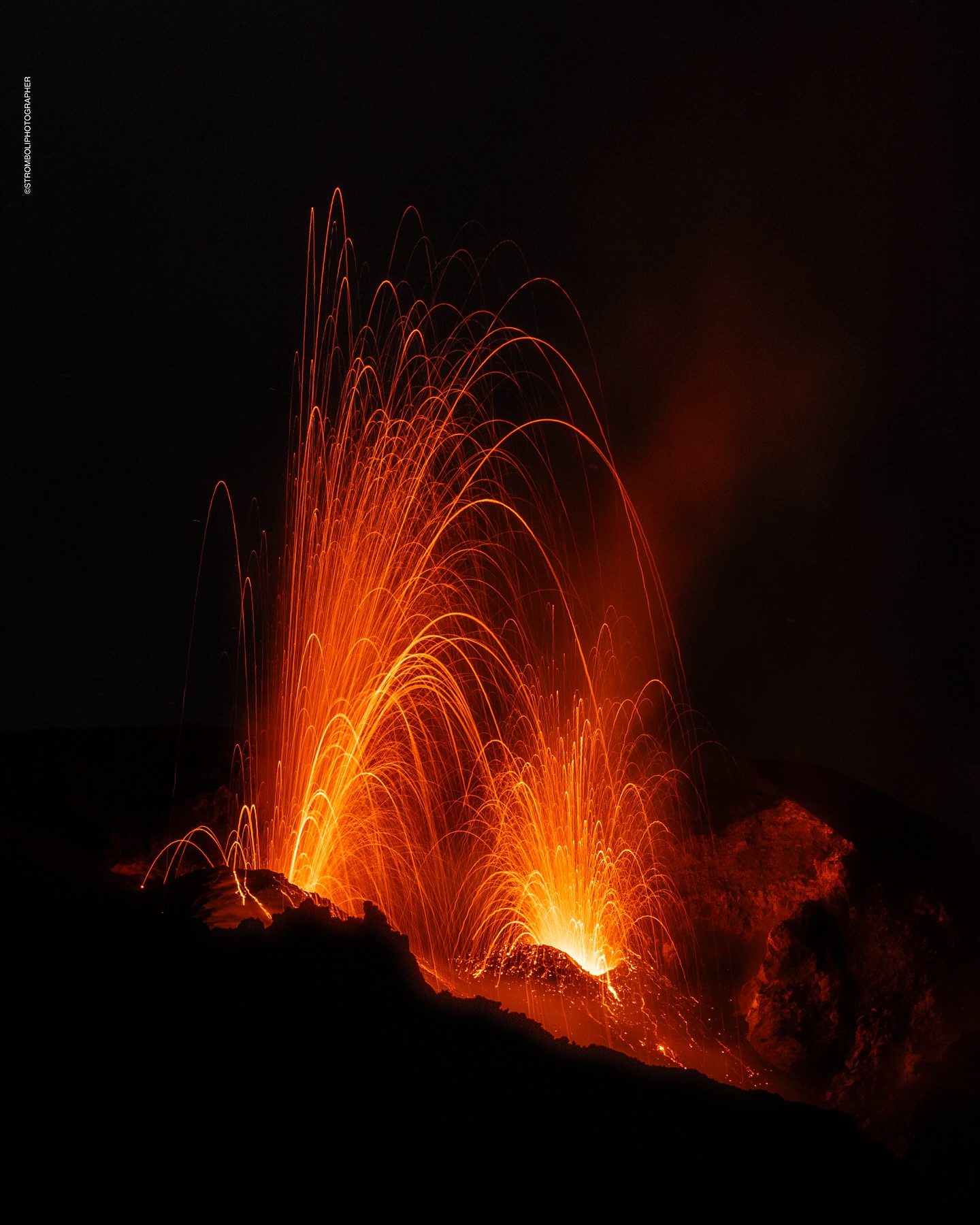
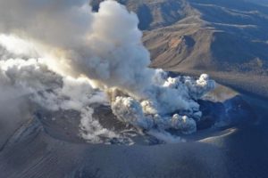
1) VOLCANOLOGICAL OBSERVATIONS: During this period, intense eruptive activity was observed with splashes coming from the North Crater area. The total hourly frequency was oscillating between average values (9-13 events/h). The intensity of the explosions was low and medium in the North Crater area and medium to high in the Center-South area.
2) SEISMOLOGY: The monitored seismic parameters do not show significant variations.
3) GROUND DEFORMATIONS: The ground deformation monitoring networks did not show significant variations over the past week.
4) GEOCHEMISTRY: SO2 flux at medium level
Soil CO2 flux from the Pizzo area (STR02): due to technical issues, there are no updates.
CO2/SO2 ratio in the plume (Stromboli Plume Network): high values.
Helium isotope ratio (R/Ra) dissolved in the thermal aquifer: last updated on 19 December 2024, with increasing values.
Soil CO2 flux in the San Bartolo area at medium values.
Soil CO2 flux in the Scari area at medium-high values.
5) SATELLITE OBSERVATIONS: The thermal activity observed by satellite in the summit area was generally low level.
VOLCANOLOGICAL OBSERVATIONS
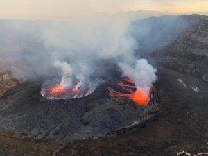
During the observation period, the eruptive activity of Stromboli was characterized by the analysis of the images recorded by the INGV-OE surveillance cameras placed at an altitude of 190 m (SCT-SCV) and at Punta dei Corvi (SPCT). The explosive activity was produced mainly by four eruptive vents located in the northern area of the crater and by three vents located in the central-southern area.
Due to unfavorable weather conditions, the visibility of the crater terrace on 10, 11 and 12 January was insufficient for a correct description of the eruptive activity.
Observations of explosive activity captured by surveillance cameras
In the area of the northern crater (N), four active vents were observed that produced explosive activity of low intensity (less than 80 m in height) and sometimes of medium intensity (less than 150 m in height). In addition, low and discontinuous projection activity was observed at the vents of sector N2. The emitted products were mainly composed of coarse materials (bombs and lapilli). The average frequency of explosions varied between 5 and 8 events/h.
In the Centre-Sud (CS) zone, explosive activity was produced by at least three vents, the explosions were of variable intensity from medium (less than 150 m high) to high (more than 250 m high) emitting fine materials sometimes mixed with coarse materials. The average frequency of explosions varied between 4 and 5 events/h.
Source : INGV
Photo : Stromboli stati d’animo / Sebastiano Cannavo
Iceland , Bárðarbunga :
Strong earthquake swarm in Bárðarbunga. Largest earthquake magnitude 5.1 . Approximately 130 earthquakes recorded since this morning. Most significant swarm since the 2014 Holuhraun eruption .
Updated January 14, 2025
The largest earthquake was of magnitude 5.1 at 8:05, and 17 earthquakes measured magnitude 3 or higher
Seismic activity in Bárðarbunga has increased in recent months
The swarm was highly intense until 9:00 this morning, after which activity began to decrease
The aviation color code for Bárðarbunga has been raised to yellow
The volcano is unusually large, with several possible scenarios for future developments
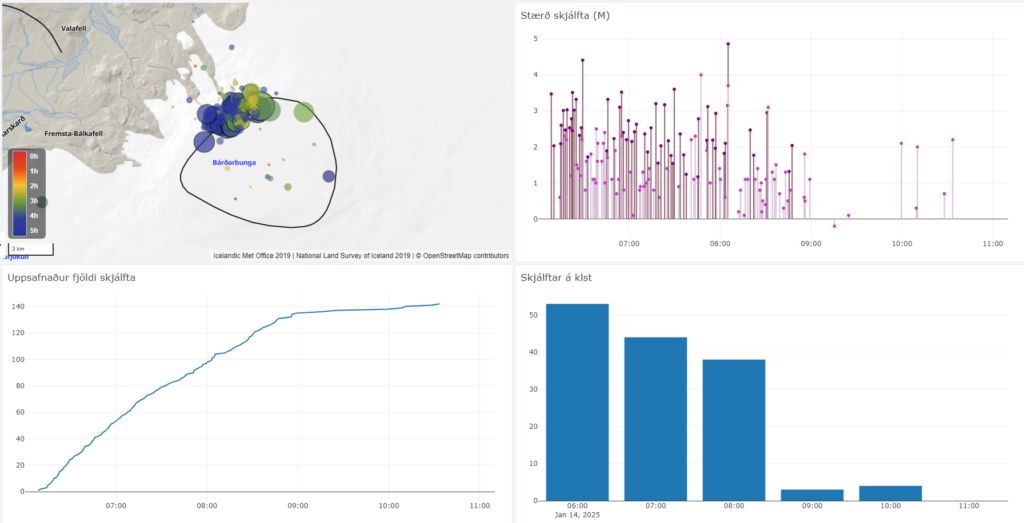
A strong earthquake swarm began shortly after 6:00 UTC today in the northwestern part of the Bárðarbunga caldera. Approximately 130 earthquakes have been recorded since the swarm began, with the largest reaching magnitude 5.1 at 8:05 UTC.
Additionally, 17 other earthquakes with a magnitude of 3 or higher were detected, including at least two measuring magnitude 4 or above. These estimates may change as analysis of the events is ongoing.
Earthquake activity was most intense until around 9:00 UTC, after which it began to decrease, though earthquakes are still being recorded in the area. It is too early to determine whether the swarm is subsiding.
A composite image from the Icelandic Meteorological Office’s earthquake monitoring system. The map in the upper left corner shows the locations of the earthquakes, with the black circle indicating the Bárðarbunga caldera outline. The upper-right graph displays earthquake magnitudes, where darker bars represent reviewed events, and lighter bars represent unreviewed data. The lower-left graph shows the cumulative number of earthquakes, while the lower-right graph indicates the hourly earthquake count.
Increased inflation and magma accumulation since 2015
This is the most significant activity in Bárðarbunga since the 2014-2015 eruption in Holuhraun. The observed seismicity is consistent with increased pressure caused by magma accumulation, which has been ongoing since the last eruption in 2015. Earthquake activity has been increasing gradually in Bárðarbunga over recent months. Notably, four earthquakes measuring magnitude 5 or higher were detected in 2024. Additionally, geodetic deformation data suggests an increased rate of inflation at the volcano.
Multiple scenarios considered
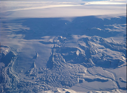
IMO will continue to monitor the activity closely, but it is difficult to predict how it will develop at this point. Bárðarbunga is unique in that it is an unusually large volcanic system, partly covered by a glacier, and several scenarios are possible.
Extensive research, along with hazard assessments and contingency planning, was conducted during the 2014–2015 eruption, which will prove valuable should further volcanic activity occur.
Magma intrusions, or dyke formations, from the caldera could lead to eruptions outside the caldera, as seen in the 2014-2015 Holuhraun eruption and the Gjálp eruption in 1996. Alternatively, an eruption could even occur within the caldera itself. Should an eruption take place beneath the glacier, it may trigger explosive ash emissions and glacial outburst floods (jökulhlaup). However, if an eruption occurs outside the glacier, it will likely result in a lava-producing event.
As a precaution, the aviation colour-code for Bárðarbunga has been raised to Yellow, indicating heightened activity above normal background levels.
Source : IMO
Photos : Ljósmynd: Oddur Sigurðsson/Veðurstofa Íslands , IMO.
Indonesia , Ibu :
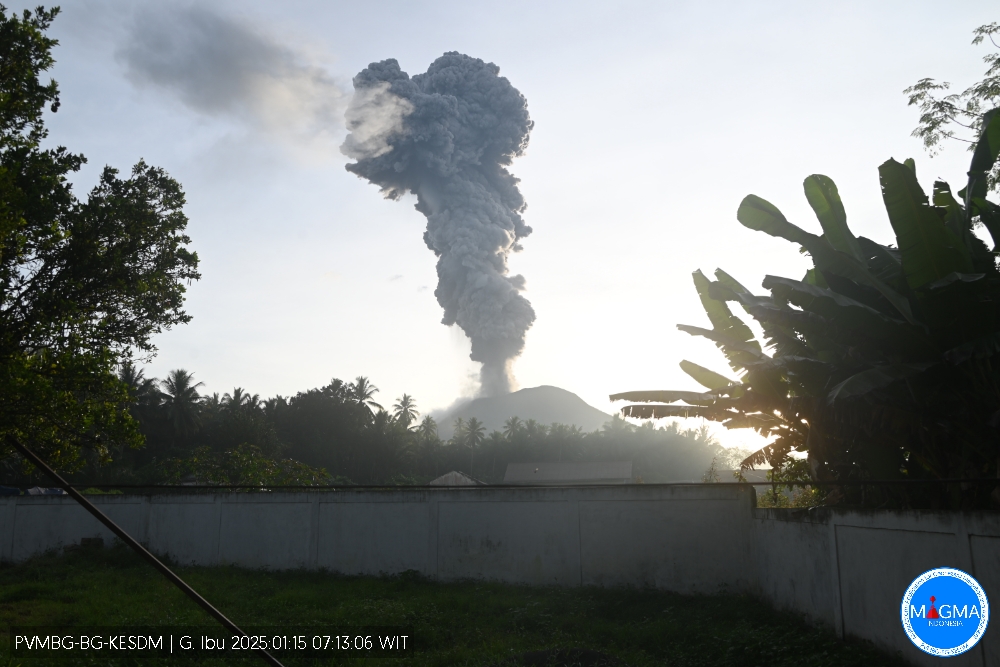
An eruption of Mount Ibu occurred on Wednesday, 15 January 2025 at 07:11 WIT with an observed ash column height of ± 4000 m above the peak (± 5325 m above sea level). The ash column was observed to be grey in colour with a thick intensity, oriented towards the West and Northwest. This eruption was recorded on a seismograph with a maximum amplitude of 28 mm and a duration of 131 seconds.
The volcano is in almost continuous activity and explosions follow one another.
VOLCANO OBSERVATORY NOTICE FOR AVIATION – VONA
Issued : January 15 , 2025
Volcano : Ibu (268030)
Current Aviation Colour Code : ORANGE
Previous Aviation Colour Code : orange
Source : Ibu Volcano Observatory
Notice Number : 2025IBU070
Volcano Location : N 01 deg 29 min 17 sec E 127 deg 37 min 48 sec
Area : North Maluku, Indonesia
Summit Elevation : 4240 FT (1325 M)
Volcanic Activity Summary :
Eruption with volcanic ash cloud at 22h11 UTC (07h11 local).
Volcanic Cloud Height :
Best estimate of ash-cloud top is around 17040 FT (5325 M) above sea level or 12800 FT (4000 M) above summit. May be higher than what can be observed clearly. Source of height data: ground observer.
Other Volcanic Cloud Information :
Ash cloud moving to west. Volcanic ash is observed to be gray. The intensity of volcanic ash is observed to be thick.
Remarks :
Eruption recorded on seismogram with maximum amplitude 28 mm and maximum duration 131 second.
Source et photo : Magma Indonésie
Colombia , Chiles / Cerro Negro :
San Juan de Pasto, January 14, 2025, 3:30 p.m. .
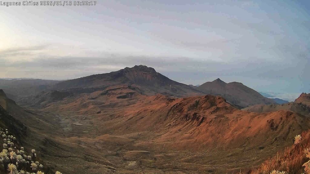
Following the monitoring of the activity of the Chiles and Cerro Negro volcanoes, the Colombian Geological Survey (SGC), an entity attached to the Ministry of Mines and Energy, reports that:
During the week of January 7 to 13, 2025, volcanic activity showed stable behavior. Compared to the previous week, the main variations in the monitored parameters were:
● During the period evaluated, both the occurrence and the released seismic energy showed a slight decrease compared to the values reported the previous week.
● The seismicity related to the rock fracture within the volcanic edifice was predominant compared to the rest of the seismicity recorded.
● Most of the seismic activity was located in the area known as the Chiles Volcano Collapse Zone, extending from its summit, approximately 1.1 km to the north and at a depth of between 2.5 and 4.3 km, relative to the summit of the volcano (4700 m above sea level). A few other events were located scattered at distances of up to 5 km to the west of Chiles Volcano (in the Cerro Negro Volcano area) and at depths of up to 3.1 km from the Chiles summit. The maximum magnitude of this type of event was 1.0.
● Instruments that record crustal deformation and remote satellite sensors continue to show changes related to an inflationary process in the volcanic area.
Based on the above, the SGC recommends closely monitoring the developments through weekly bulletins and other information published through our official channels, as well as instructions from local and departmental authorities and the National Disaster Risk Management Unit (UNGRD).
Volcanic activity remains in yellow alert status: active volcano with changes in the behavior of the base level of monitored parameters and other manifestations.
Source et photo: SGC
Nicaragua , Telica :
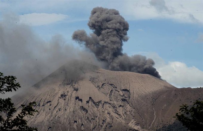
Telica Volcano Records Explosions and Rumblings Are Heard in León .
In recent days, Telica has recorded explosions, rumblings and micro-earthquakes that can be felt even in León. Experts expect that once the vents are cleaned, the volcano’s activity will decrease in the coming days.
In the last three days, the Telica Volcano has experienced explosions, rumblings and micro-earthquakes that have caused concern among residents in the surrounding area. Agustín Moreira, an expert from the Observatory of Natural Phenomena (OFENA), explained that this activity is due to the release of energy and the natural process of cleaning the crater and internal conduits of the volcano.
According to Moreira, recent rains have caused landslides inside the volcano’s crater, increasing internal pressure. This phenomenon generates explosions by releasing the accumulated material and allows the volcano to keep its conduits free for future eruptions.
« What is happening in the Telica volcano, we must remember that part of what the competent authorities say, which is INETER, is that it is a release of energy. Let us remember that these volcanoes, with the rains that have passed, have had landslides inside « This increases the pressure on the volcano and it must keep its chimney completely clear to avoid this type of explosion », Moreira explained to 100%Noticias.
Rumblings are heard in the University City
Although this behavior is normal for a volcano like Telica, the rumblings and tremors continue to be noticeable even in the city of León and other neighboring communities, causing alarm among the population.
« These rumblings can be heard around the volcano, even in the city of León, you can hear the rumblings of the volcano itself. You have to be very calm and patient to be aware of this type of volcano. « We must not forget that these are natural phenomena, unpredictable and that suddenly take on this type of activity. We hope that the Telica volcano will soon decrease its activity as the volcano’s conduits or chimneys are cleaned, » he said.
The expert recommended that residents of nearby areas take precautionary measures, such as protecting food and drinking water to avoid contamination by volcanic ash and gases.
The explosions do not represent a threat
For his part, Eduardo Mayorga, geologist geophysicist, stressed that this is the first eruptive activity of Telica in 2025. According to Mayorga, the volcano has presented an increase in its tremor since January 8 and last Sunday, the 12th, at 4 a.m. the continuous micro-seismicity began that culminated with the first explosions recorded on Tuesday, January 14.
Source : 100% Noticias . ni
Photo : Enfoque Noticias , 2021

