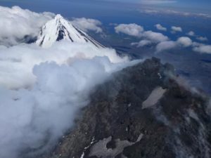
January 06 , 2025.
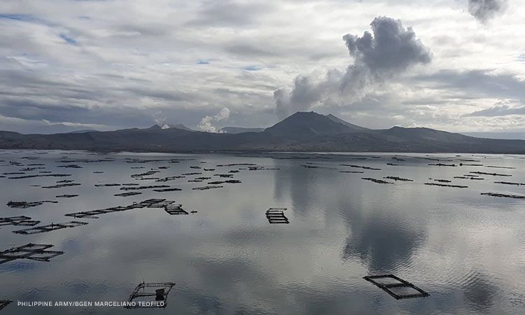
Philippines , Taal :
TAAL VOLCANO ADVISORY , 06 January 2025 , 1:00 PM
Notice of increased seismic energy release from Taal Volcano.
Since 04 January 2025, stations of the Taal Volcano Network (TVN) situated on Taal Volcano Island (TVI) have been recording a pronounced increase in real-time seismic energy measurement or RSAM. A total of only twelve (12) volcanic earthquakes including six (6) tremor events were recorded by the TVN since 01 January 2025. Visual observations also noted the absence of a degassing plume from the Taal Main Crater since the start of RSAM increase. Taal has been degassing sustained levels of sulfur dioxide or SO2 for the past four years with the latest emission measured on 30 December 2024 averaging 2,753 tonnes/day. The sharp increase in RSAM and the lack of observable degassing from the Main Crater may indicate blockage or plugging of volcanic gas pathways within the volcano, which may lead to short-term pressurization and trigger a phreatic or even a minor phreatomagmatic eruption.
DOST-PHIVOLCS reminds the public that Alert Level 1 prevails over Taal Volcano, which means that it is still in abnormal condition and should not be interpreted to have ceased unrest nor ceased the threat of eruptive activity. At Alert Level 1, sudden steam-driven or phreatic or minor phreatomagmatic eruptions, volcanic earthquakes, minor ashfall and lethal accumulations or expulsions of volcanic gas can occur and threaten areas within TVI. Furthermore, degassing of high concentrations of volcanic SO2 continues to pose the threat of potential long-term health impacts to communities around Taal Caldera that are frequently exposed to volcanic gas. DOST-PHIVOLCS strongly recommends that entry into TVI, Taal’s Permanent Danger Zone or PDZ, especially the vicinities of the Main Crater and the Daang Kastila fissure, must remain strictly prohibited. Local government units are advised to continuously monitor and assess volcanic SO2 exposure of, and potential impacts on, their communities and undertake appropriate response measures to mitigate these hazards.
DOST-PHIVOLCS is closely monitoring Taal Volcano’s activity and any new significant development will be immediately communicated to all stakeholders.
Source : DOST-PHIVOLCS
Photo : Marceliano Teofilo
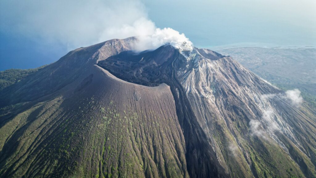
Indonesia , Ili Lewotolok :
Press release on the activity of Ili Lewotolok volcano, January 5, 2025.
The Ili Lewotolok volcano is administratively included in the Lembata regency region of East Nusa Tenggara province. The geographical position of the summit of Mount Ili Lewotolok is at 123° 30′ 18″ E and 8° 16′ 18″ S with a height of 1,423 m above sea level.
The eruption period of Mount Ili Lewotolok in 2020 began with the first eruption on November 27 with an eruptive column height of ± 500 meters above the summit. This was followed by the second (main) eruption on November 29, 2020 with an eruptive column height of more than 4,000 meters above the summit. The last eruption occurred on July 6, 2024, with the eruptive column reaching 300 meters from the summit. After this eruption, the observed visual activity was until now dominated by smoke escaping from the crater.
The results of visual observations are as follows:
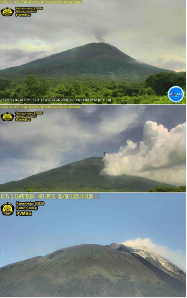
For the period from 1 to 31 December 2024, white smoke from the main crater was observed with light to thick intensity between 5 and 400 meters from the summit. The weather is sunny to rainy, with light to strong winds.
From 1 to 4 January 2024, white smoke from the main crater was observed with light to thick intensity approximately 10 to 100 meters from the summit. The weather is sunny to rainy, with light winds.
On 5 January 2025, white to grey smoke from the main crater was observed with medium-high intensity reaching 20 to 100 meters from the summit, the wind was light.
Results of seismic observations on Mount Ili Lewotolok with the following details:
December 1-31, 2024: 394 emission earthquakes were recorded, 1 Tornillo earthquake, 1 hybrid earthquake, 43 shallow volcanic earthquakes, 183 deep volcanic earthquakes, 48 local tectonic earthquakes and 50 distant tectonic earthquakes, as well as 1 earthquake that was felt on the II MMI scale.
January 1-4, 2024: 44 emission earthquakes were recorded, 3 shallow volcanic earthquakes, 8 deep volcanic earthquakes, 6 local tectonic earthquakes and 8 distant tectonic earthquakes.
January 5, 2024 until 12:00 WITA: 9 emission earthquakes were recorded, 1 shallow volcanic earthquake, 1 deep volcanic earthquake, 1 local tectonic earthquake and 1 distant tectonic earthquake.
In general, it was observed that there was an increase in activity in the crater in the form of puffs of white to gray smoke compared to the past only white. This change in the color of the smoke indicates the presence of material from the interior of the crater or the crater walls that was carried away during the emission.
Based on the results of instrumental observations, as of January 5, 2024, seismic data show that emission earthquakes still dominate the activity, but a significant increase occurred for shallow volcanic and deep volcanic earthquakes in December 2024, reaching 43 and 183 occurrences. The daily average of shallow volcanic earthquakes is only 1 event/day and that of deep volcanic earthquakes ranges from 1 to 5 events/day. The emergence of shallow volcanic and deep volcanic earthquakes indicates a significant increase in pressure/stress on the Ili Lewotolok Mountain body, which is related to shallow and deep magmatic input.
This increase in seismic activity has not been observed significantly from the deformation data, as in the results of deformation observations using the Tiltmeter method, which show still slow/small changes in tilt. Similarly, distance measurements by EDM (Electronic Distance Measurement) show a slight shortening of the tilt value, which indicates changes in swelling or deformation of the body of Ili Lewotolok that are not yet significant.
Based on the latest instrumental monitoring data of Mount Ili Lewotolok, the volcanic activity of Mount Ili Lewotolok shows that seismic and visual activity is still high. The activity level of G. Ili Lewotolok is still at Level II (WASPADA).
Source : PVMBG
Photos : 11/2024 , Matthew Davison , PVMBG
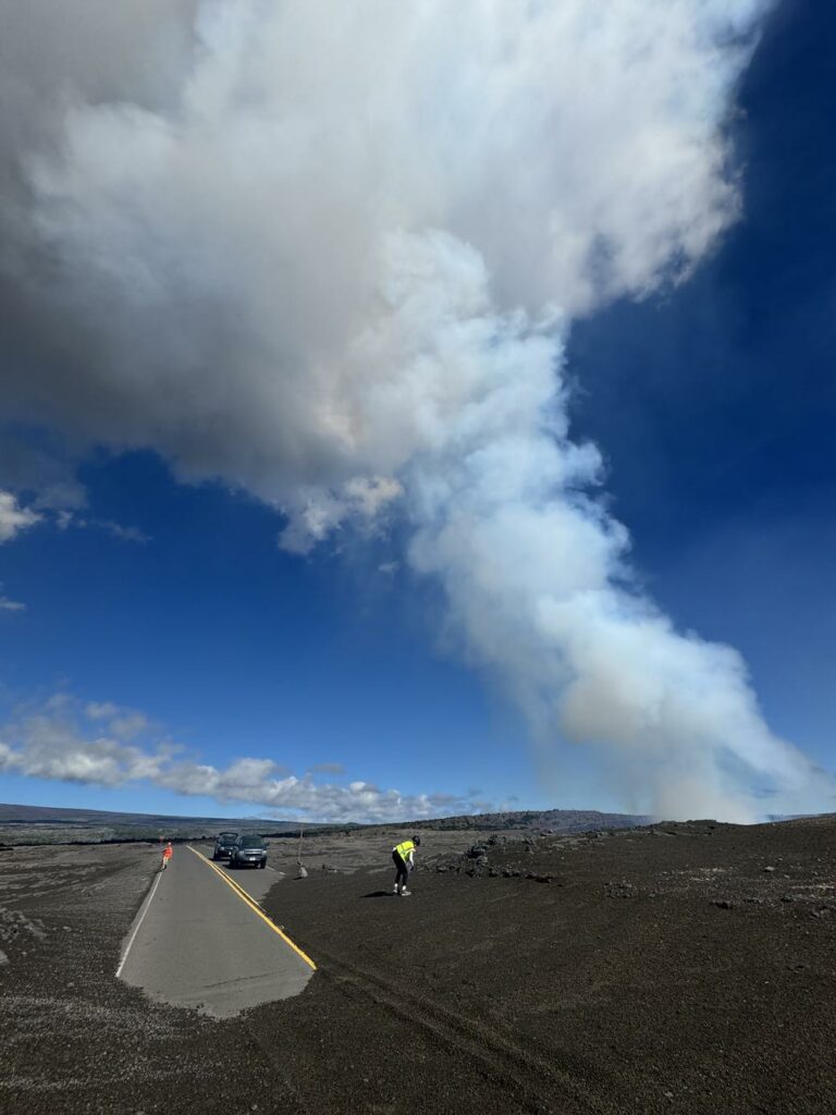
Hawaii , Kilauea :
Sunday, January 5, 2025, 8:46 AM HST (Sunday, January 5, 2025, 18:46 UTC)
19°25’16 » N 155°17’13 » W,
Summit Elevation 4091 ft (1247 m)
Current Volcano Alert Level: WATCH
Current Aviation Color Code: ORANGE
Activity Summary:
The eruption at Kīlauea volcano that began on Monday, December 23 remains paused as of 8:40 pm on Friday, January 3. Glow from the crater floor remains but is much diminished from the previous night. Glow could persist for days. No unusual activity has been noted along Kīlauea’s East Rift Zone or Southwest Rift Zone.
Summit Instrumental Observations:
Seismicity at the summit over the last 24 hours remains low with 5 small detected earthquakes. Seismic tremor decreased with the south vent at the summit shutting down and remains at background levels. Summit tiltmeters reversed from deflationary tilt to inflationary tilt around the same time that the lava fountain shut down. After decreasing by almost 25 microradians during the eruption, the summit tiltmeters have increased by 1.5 to 2 microradians since 8:40 pm on January 3. The last SO2 emission rate measured was ~30,000 tonnes per day on January 2 during fountaining. Emissions of SO2 remain elevated, but lower than those recorded during eruptive activity, and will be affected by wind conditions.
Summit Eruption Observations:
Webcam images over the past 24 hour show diminished glow on the crater floor from residual lava after the lava fountain from the south vent shut down rapidly around 8:40 pm on January 3 (the north vent shut down at 2:16 pm on January 2). The area where the automatic laser rangefinder is pointing on the crater floor increased in elevation by nearly 50 ft (15 m) over the eruption, but has gradually fallen by approximately 13 ft (4 m) since the lava fountain shut down at 8:40 pm on January 3, with 3 ft (1 m) of that over the past 24 hours. There has been no visible flow of lava back into the vent after the pause, and the gradual drop in lava level is more likely due to loss of gas bubbles (summit lavas are 50% or more bubbles) or very slow leaking of lava into the vent beneath the crust.
Rift Zone Observations:
Shallow earthquake counts on the East Rift Zone remain at low levels. Over the last 24 hours, there were 4 earthquakes in the East Rift Zone. The ESC tiltmeter in the upper part of the East Rift Zone was deflating in association with the summit eruption, but is now flat with the eruption pausing. Deformation rates remain low in the middle and lower East Rift Zone and Southwest Rift Zone as recorded by GPS instruments and tiltmeters.
Source : HVO
Photo : USGS / M. Patrick.
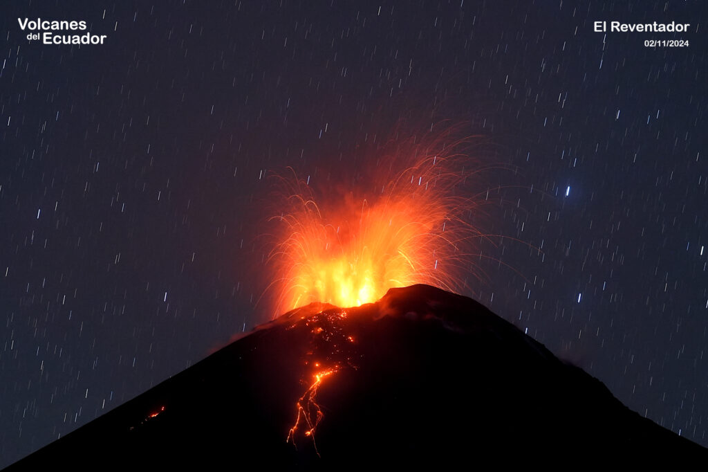
Ecuador , El Reventador :
DAILY REPORT ON THE STATE OF THE REVENTADOR VOLCANO, Sunday, January 05, 2025.
Information Geophysical Institute – EPN.
Surface Activity Level: High, Surface Trend: No Change
Internal Activity Level: Moderate, Internal Trend: No Change
From January 04, 2025, 11:00h to January 05, 2025, 11:00h:
Seismicity:
The count of seismic events recorded at the station is detailed below.
Explosion (EXP) 78
Long Period (LP) 24
Emission Tremor (TREMI) 6
Harmonic Tremor (TRARM) 6
Rainfall / Lahars:
Since yesterday afternoon until the publication of this report, thanks to the satellite and meteorological monitoring system, no rain has been recorded in the areas surrounding the volcano. **In the event of heavy rain, it could remobilize the accumulated materials, generating mud and debris flows that would descend the sides of the volcano and flow into the adjacent rivers.
Emissions / ash column:
Since yesterday afternoon, at the time of writing this report, thanks to the surveillance camera system and satellite images, several emissions of gas and ash have been recorded with heights between 300 and 800 meters above the level of the crater in the southwest directions. In connection with this activity, the Washington VAAC agency generated four emission reports with heights of 700 meters above the crater level and in the West, Southwest and West-Southwest directions.
Other monitoring parameter:
In the last 24 hours, the FIRMS satellite system recorded 2 thermal anomalies.
Observation:
Since yesterday evening, thanks to the surveillance camera system, several episodes of incandescence and descent of material have been observed up to 700 meters below the crater level. At the end of this report, the volcano remains completely cloudy.
Source : IGEPN
Photo : 02/11/2024 04:29, Benjamin Bernard / volcanesdelecuador
Ethiopia , Dofen / Fentale :
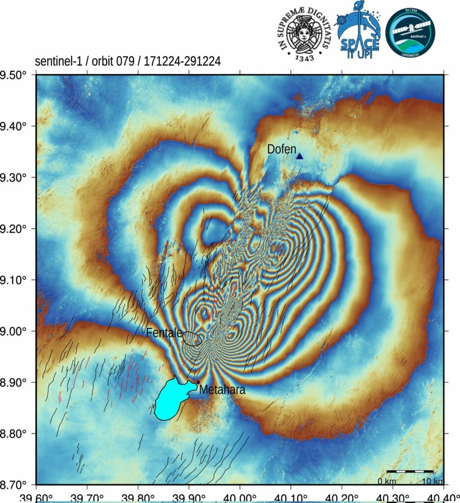
The Dofen shield volcano rises 450 m above the Awash plain in the northern Main Ethiopian Rift. Numerous cinder cones, constructed along a 10-km-long, N-S-trending line, occur on the flanks of the dominantly rhyolitic volcano. The northern cones are younger, have well-preserved morphologies, and display strong fumarolic activity. A major fumarole in a wide S-flank crater has precipitated large amounts of sulfur. The latest eruptions occurred during the Holocene (WoldeGabriel 1987, pers. comm.), and it is known as the « smoking mountain ».
Fentale is a volcanic complex at the N end of the Main Ethiopian Rift that includes a main stratovolcano and caldera with various subsidiary features. Products are primarily rhyolitic obsidian lava flows with minor tuffs. Welded pantelleritic ash flows accompanied formation of a 2.5 x 4.5 km elliptical summit caldera, with steep-sided walls, that trends WNW-ESE, perpendicular to the rift. Post-caldera vents lie along the same orientation. Lava flows that appear to be more recent are present on the NE and SW flanks, and even darker trachytic and obsidian lava flows occur on the caldera floor. An eruption during the 13th century destroyed an Abyssinian town and church to the south. In 1820 CE basaltic lava flows effused from a 4-km-long fissure on the S flank; lava also flowed onto the caldera floor. During 2015 there was a seismic swarm and deformation NE of Fentale, caused by a dike intrusion that Temtime et al. (2020) determined was about 6 km long (striking N29°E) and 2 m wide, with a depth range of 5.4-8 km below the surface (volume change of about 33 x 106 m3).
Sources : GVP
Photo : Sentinel 1

