January 04 , 2025.
Hawaii , Kilauea :
Friday, January 3, 2025, 8:28 AM HST (Friday, January 3, 2025, 18:28 UTC)
19°25’16 » N 155°17’13 » W,
Summit Elevation 4091 ft (1247 m)
Current Volcano Alert Level: WATCH
Current Aviation Color Code: ORANGE
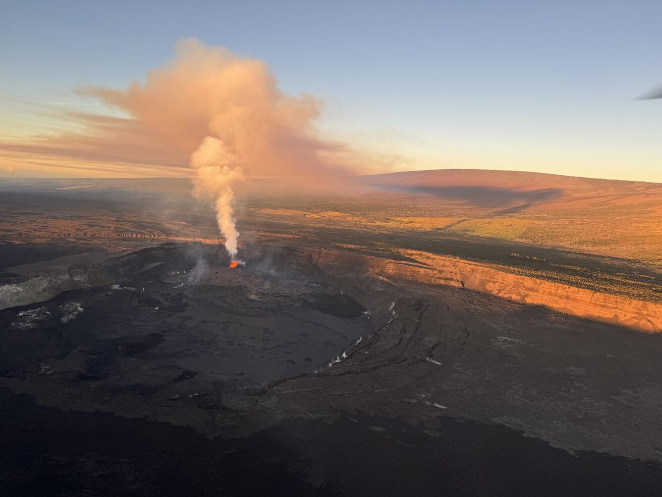
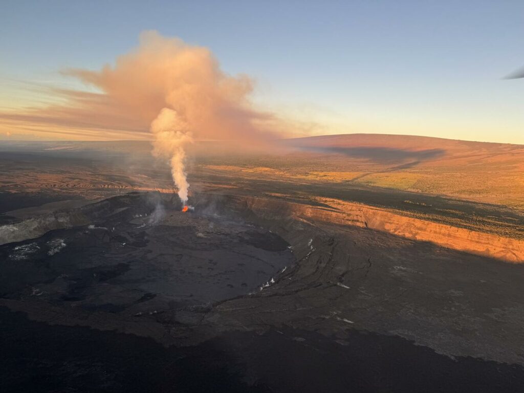
Hawaiian Volcano Observatory geologists captured this aerial view of Kīlauea summit on January 3, 2025. The shadow of Kīlauea eruption plume is visible on Mauna Loa.
Activity Summary:
The eruption at Kīlauea volcano that began on Monday, December 23 continues this morning. Over the past day, vents in the southwest portion of the caldera have continued producing a fan of lava flows covering most of the crater floor during sustained lava fountaining. Eruptive activity has been confined to Halemaʻumaʻu and the down-dropped block within the caldera. No unusual activity has been noted along Kīlauea’s East Rift Zone or Southwest Rift Zone.
Summit Instrumental Observations:
Seismicity at the summit over the last 24 hours has been low with 4 small detected earthquakes and 1 in the upper ERZ. Seismic tremor remains increased during this period of lava fountaining but has remained constant over the past 24 hours. Summit tiltmeters continue to record deflationary tilt that began just after midnight on December 29. SO2 emissions remain elevated at ~30,000 tonnes per day (measured on January 2), with a gas plume rising above the caldera this morning that is being carried to the southwest.
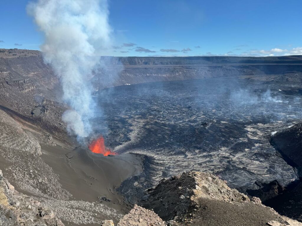
View of the large pyroclastic cone that continued to erupt lava at the summit of Kīlauea against the west wall of the caldera. Lava flows from the vents over a large area in the southwest part of Halema’uma’u Crater.
Summit Eruption Observations:
Webcam images indicate that the eruption within Kaluapele (the summit caldera) continues this morning from a vent on the southwest side of Halemaʻumaʻu. The north vent shutdown at 2:16 pm on January 2 after parts of the cone collapsed into the fountain. The remaining lava fountain is 60-100 ft (20-30 m) high and feeding flows that are covering most of the crater floor to the down-drop block. The area where the automatic laser rangefinder is pointing on the crater floor fell by approximately 10 ft (3 m) from 8–10 am on January 2 as a result of a lava dam in the north part of the lava lake breaking free. The lava lake at the laser rangefinder location has since recovered by approximately 3 ft (1 m).
Rift Zone Observations:
Shallow earthquake counts on the East Rift Zone (ERZ) remain at low levels. Over the last 24 hours, there was 1 earthquakes in the East Rift Zone. The ESC tiltmeter in the upper part of the East Rift Zone shows deformation associated with the ongoing summit eruption. Deformation rates remain low in the middle and lower East Rift Zone and Southwest Rift Zone as recorded by GPS instruments and tiltmeters.
Source : HVO
Photos : USGS / M. Patrick.
Iceland , Reykjanes Peninsula :
Magma Accumulation Beneath Svartsengi Continues
Latest data suggests that the likelihood of magma intrusion and potentially an eruption will increase as of January.
Geodetic model results estimate magma inflow rates similar to the rate leading up to the last eruption.
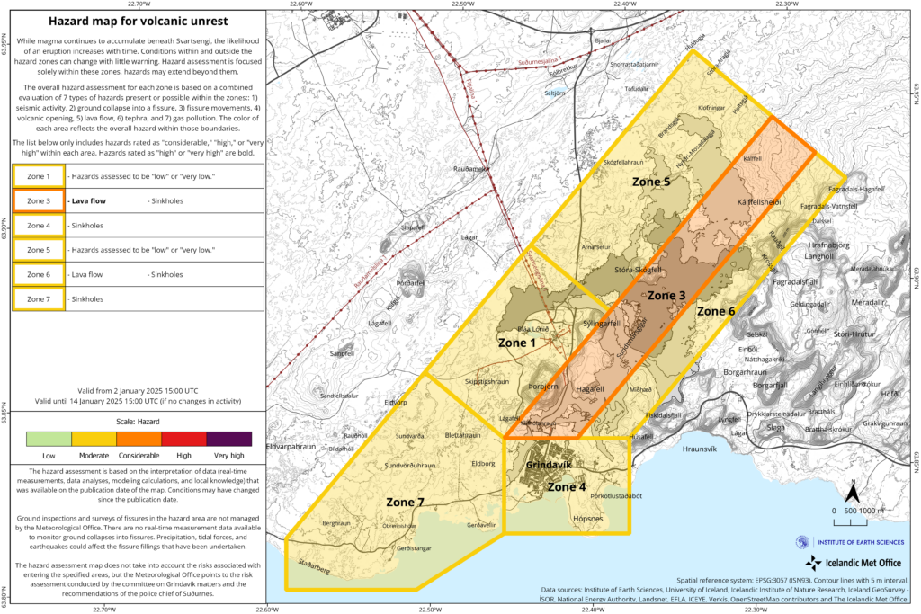
Updated hazard assessment valid until January 14, 2025, unless conditions change.
Deformation data up to December 30, 2024, indicates that magma accumulation beneath Svartsengi continues.
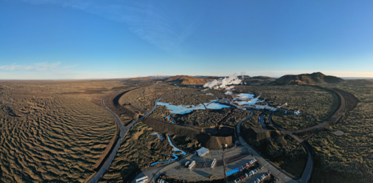
Protective barriers surrounding the Svartsengi area in early November 2024.
The likelihood of a new magma intrusion and potentially an eruption is expected to increase when the volume of magma beneath Svartsengi matches the amount that left the magma region during the magma intrusion and eruption on November 20. Geodetic model results estimate this volume to be between 12 and 15 million cubic meters.
According to the latest deformation data, the magma inflow rate is currently estimated at just over 3 m³/s, similar to the rate observed before the last eruption. If magma accumulation continues at the current rate, the magma volume beneath Svartsengi is projected to reach 12 million m³ by late January and approximately 13.5 million m³ by the first week of February. Therefore, the likelihood of magma intrusion and potentially an eruption along the Sundhnúkur crater row may increase as of late January.
These estimates are based on calculated magma inflow rates over time, and small changes in these rates can affect projections for the timing of a potential eruption.
Lava Field Remains Hazardous to Hikers
The Icelandic Meteorological Office’s hazard assessment has been updated and remains valid, barring any changes, until January 14, 2025.
The main change concerns Zone 6, where the overall hazard level has been revised from significant (orange) to moderate (yellow). The overall hazard in Zone 6 is now considered lower due to a reduced lava flow hazard. However, while the danger due to the lava flow is currently deemed lower, the existing lava field remains hot and dangerous to cross.
Earthquake Swarms Near Eldey Common in Recent Years
Seismic activity has been minimal along the Sundhnúkur crater row since the last eruption ended on December 8, 2024.
However, some seismic activity has been recorded in other nearby areas. Approximately 200 earthquakes, including two over magnitude 3, were detected during a swarm from December 29–31, 2024, near Eldey on the Reykjanes Ridge. Earthquake swarms near Eldey have been frequent in recent years, with nearly 60 earthquakes over magnitude 3 recorded there in the past four years.
While occasional earthquakes are still being detected, the swarm has mostly subsided. Regular small earthquakes continue to occur in the western part of Fagradalsfjall, where over 60 minor earthquakes have been recorded in the past month, most at depths of 6–8 km.
Source : IMO.
Photos: The Icelandic Met Office / Bjarki Kaldalóns Friis
Ethiopia , Fentale :
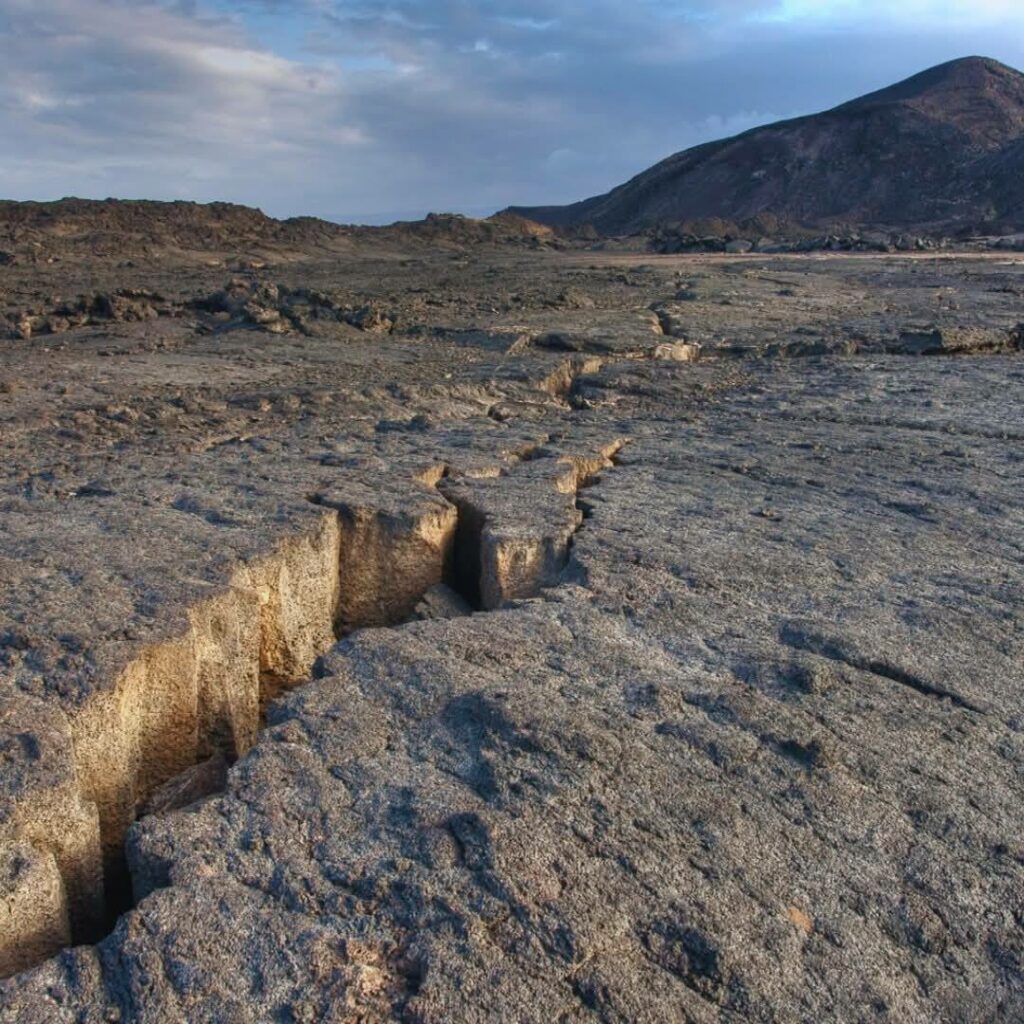
Residents of Awash Fentale in the Afar region have reported that over 30 houses have collapsed due to frequent earthquakes, forcing many to flee their homes and seek refuge in neighboring areas.
“The area most affected by the earthquakes is Segento Kebele in Dulecha district, where the damage is extensive,” she stated. “The second most affected area is Awash Fentale district, where houses are collapsing day by day.”
Since late September 2024, the Awash Fentale Mountain area—an earthquake-prone zone—has experienced a series of seismic events. Initially classified as minor, the intensity of the earthquakes in the region increased in the following weeks, including a 4.9-magnitude tremor in early October. This quake was felt not only in the Awash Fentale area but also as far as the capital, causing widespread concern.
Subsequent earthquakes have continued to be recorded, with tremors reaching Addis Abeba, Afar, Dire Dawa, and surrounding areas. Although the seismic activity in the region remained relatively mild in November, it escalated again in December, culminating in a 5.0-magnitude earthquake that struck the Awash area in late December 2024. This quake, which occurred on December 29, was one of seven tremors registered on that day, signaling an active seismic period. The epicenter was located approximately 14 kilometers from Awash town.
Experts attribute these seismic events to the East African Rift System, one of the world’s most geologically active features.
Fentale is a large stratovolcano at the N end of the Main Ethiopian Rift. It consists primarily of rhyolitic obsidian lava flows with minor tuffs. Welded pantelleritic ash flows accompanied formation of a 2.5 x 4.5 km summit caldera, with steep-sided walls. Elliptically shaped, it trends WNW-ESE, perpendicular to the Ethiopian Rift. Post-caldera vents lie along the same orientation. Trachytic and obsidian lava flows occur on the caldera floor, and fresh-looking lava flows descend the flanks. An eruption during the 13th century destroyed an Abyssinian town and church to the south. In 1820 CE basaltic lava flows effused from a 4-km-long fissure on the S flank; lava also flowed onto the caldera floor.
Sources : Addis Standard , GVP.
Photo : Lieu et auteur inconnu
Indonesia , Ibu :
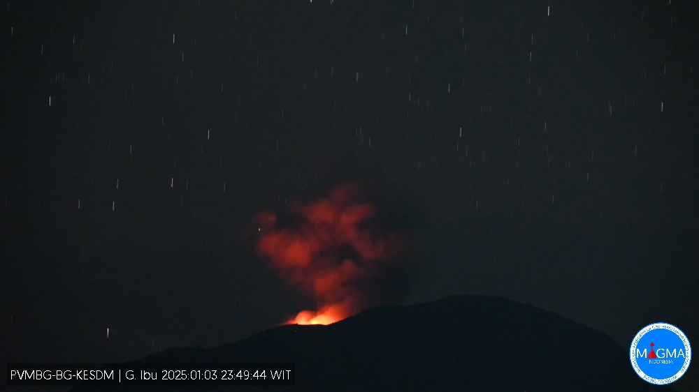
An eruption of Mount Ibu occurred on Friday, 3 January 2025 at 23:46 WIT with the height of the ash column observed at ±500 m above the summit (±1825 m above sea level). The ash column was observed to be grey with a thick intensity, oriented towards the East. This eruption was recorded on a seismograph with a maximum amplitude of 28 mm and a duration of 61 seconds.
VOLCANO OBSERVATORY NOTICE FOR AVIATION – VONA
Issued : January 03 ,2025
Volcano : Ibu (268030)
Current Aviation Colour Code : ORANGE
Previous Aviation Colour Code : orange
Source : Ibu Volcano Observatory
Notice Number : 2025IBU013
Volcano Location : N 01 deg 29 min 17 sec E 127 deg 37 min 48 sec
Area : North Maluku, Indonesia
Summit Elevation : 4240 FT (1325 M)
Volcanic Activity Summary :
Eruption with volcanic ash cloud at 14h46 UTC (23h46 local).
Volcanic Cloud Height :
Best estimate of ash-cloud top is around 5840 FT (1825 M) above sea level or 1600 FT (500 M) above summit. May be higher than what can be observed clearly. Source of height data: ground observer.
Other Volcanic Cloud Information :
Ash cloud moving to east. Volcanic ash is observed to be gray. The intensity of volcanic ash is observed to be thick.
Remarks :
Eruption recorded on seismogram with maximum amplitude 28 mm and maximum duration 61 second.
Source et photo : Magma Indonésie.
Indonesia , Merapi :
MOUNT MERAPI ACTIVITY REPORT, from December 27, 2024 to January 2, 2025. Published on January 03, 2025.
OBSERVATION RESULT
Visual
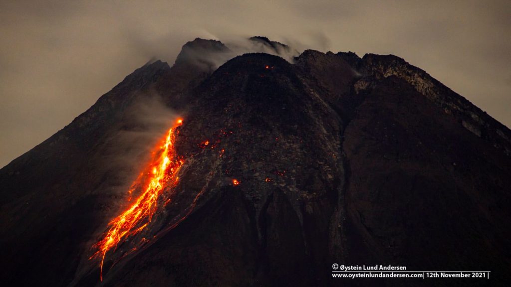
The weather around Mount Merapi is generally clear in the morning and night, while it is foggy from noon to evening. White smoke, thin to thick, low to moderate pressure and 25 m high, was observed from Mount Merapi Jrakah observation post on January 1, 2025 at 17:40 WIB. This week, lava avalanches were observed 62 times in the Southwest (upstream of Kali Bebeng) up to a maximum of 1,900 m, 10 times upstream of Kali Krasak up to a maximum of 1,800 m and 6 times in the West (upstream of Kali Bebeng and Kali Sat/Putih) up to a maximum of 1,500 m. The morphology of the Southwest dome was observed to have changed due to lava avalanche activity. For the middle dome, no significant morphological changes were observed. Based on the photographic analysis, the volume of the Southwest dome was measured at 3,315,900 m3. Meanwhile, the central dome is 2,361,800 m3.
Seismicity
This week, the seismicity of Mount Merapi recorded:
92 shallow volcanic earthquakes (VTB),
259 multi-phase earthquakes (MP),
1 low-frequency earthquake (LF),
1,055 earthquakes (RF),
11 tectonic earthquakes (TT).
The intensity of earthquakes this week is still quite high.
Deformation
The deformation of Mount Merapi monitored by EDM this week showed an average shortening rate of 0.2 cm/day, relatively the same as last week.
Rainfall and Lahars
This week, there was rain at the Mount Merapi observation post with a rainfall intensity of 71 mm/hour for 45 minutes at Kaliurang post on 1 January 2025. No additional flows or lahars were reported in the rivers that originate on Mount Merapi.
Conclusion
Based on the results of visual and instrumental observations, it was concluded that:
The volcanic activity of Mount Merapi is still quite high in the form of effusive eruptive activity. The activity status is set at the « SIAGA » level.
Source : BPPTKG.
Photo : Oystein Lund Andersen

