December 27 , 2024 .
Italy , Stromboli :
Statement on the activity of Stromboli 26 December 2024, 20:19 (19:19 UTC) .
The National Institute of Geophysics and Volcanology, Osservatorio Etneo, reports that from 18:30 UTC, on the images of the surveillance cameras, the beginning of a lively activity of projections was observed at two of the vents of the North crater area, which rapidly intensified, and feeds an overflow of lava since 18:55 UTC. Currently, the lava front is slowly extending on the upper part of the Sciara del Fuoco, and causes frequent rolling of incandescent blocks.
At 18:30 UTC a fairly abrupt increase in the amplitude of the volcanic tremor was also observed, from average values to very high values in a few minutes, at which level the signal is currently maintained. No variation is observed in the frequency of occurrence of explosion earthquakes.
No detectable deformation is observed from the GPS network data (HF). Inclinometric data are not currently available.
Further updates will be communicated shortly.
Source : INGV
Photo : Stromboli stati d’animo / Sebastiano Cannavo
Hawaii , Kilauea :
Thursday, December 26, 2024, 9:36 AM HST (Thursday, December 26, 2024, 19:36 UTC)
19°25’16 » N 155°17’13 » W,
Summit Elevation 4091 ft (1247 m)
Current Volcano Alert Level: WATCH
Current Aviation Color Code: ORANGE
Activity Summary:
The eruption at Kīlauea volcano that began on Monday, December 23, paused for a second time yesterday morning. Vigorous lava fountains diminished around 11 a.m., with only weak bubbling and drainback present afterwards. Inflation of the summit following the shutdown indicates that a resumption in activity is possible in the coming days, but not certain. Eruptive activity has been confined to Halemaʻumaʻu and the downdropped block within the caldera. No unusual activity has been noted along Kīlauea’s East Rift Zone or Southwest Rift Zone.
This photo was taken at 9:20 a.m. HST on Christmas Day, December 25, and shows vigorous lava fountains and a towering gas plume at the summit of Kīlauea. Just an hour later, eruptive activity at the vent began to greatly decrease.
Summit Instrumental Observations:
Seismicity at the summit over the last 24 hours has been low with just 3 small earthquakes. Seismic tremor diminished yesterday morning around 11 a.m. as fountaining shut down. Summit tiltmeters have recorded inflationary tilt since the shutdown of eruptive activity. SO2 emissions remain elevated, with a gas plume rising above the caldera this morning, but outgassing vigor decreased greatly with the shutdown of fountaining yesterday morning.
Summit Eruption Observations:
Webcam images indicate that the eruption within Kaluapele (the summit caldera) paused yesterday morning around 11 a.m., with an abrupt decrease in lava fountaining from vents on the southwest side of Halemaʻumaʻu crater. HVO geologists in the field yesterday morning observed residual, low level spattering and lava draining back into the vent following the shutdown. Yesterday morning, lava flows were spreading across the Halema‘uma‘u crater floor, but these flows stagnated once vent activity shut down. Drainback into the vent followed the shutdown in activity but ceased around 5 p.m. yesterday. This morning, webcam images show that major effusion is still paused, with only very tiny spattering at one vent that produced a very small lava flow around the vent.
Source : HVO
Photo : USGS / L. Gallant .
Indonesia , Raung :
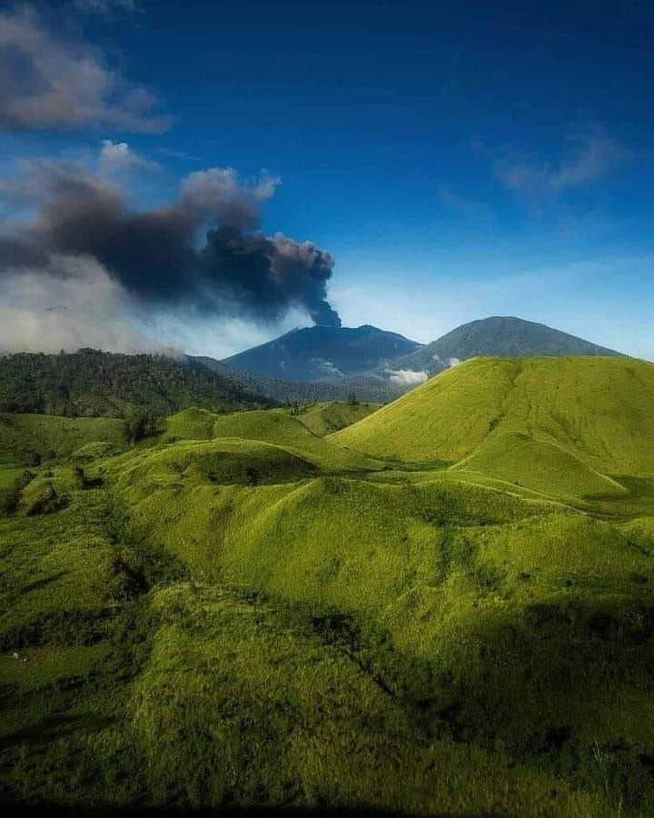
Raung Volcano Eruption – East Java, .24 December 2024 .
Raung Volcano, has been at Activity Level II (WASPADA) since 19 December 2023 with a recommendation against any activity within a 3 km radius of the crater/peak.
Results of visual observations for the period 1-23 December 2024.
Raung was clearly visible until it was covered by fog. In clear weather, light, medium to thick white gas emissions can be observed at about 50-500 meters above the summit. The color of the exhaled gas shows that water vapor is dominant, no rock/ash material has been brought to the surface. Seismicity records during the same period included: 197 emission earthquakes, 3 shallow volcanic earthquakes, 4 local tectonic earthquakes, 34 deep tectonic earthquakes and 23 continuous tremors with an amplitude of 0.5 to 17 mm, dominant value 2.5 mm.
On December 24, 2024, at 09:30 WIB, an eruption occurred with an eruptive column height of about 2,000 m above the summit (± 5,332 m above sea level). The eruptive column was gray with a thick intensity, oriented towards the East. This eruption was recorded on a seismogram with a maximum amplitude of 32 mm and a duration of ± 4 minutes 42 seconds. Visual observations of the subsequent eruption column could not be made properly because the summit and body of the volcano were covered with fog. Subsequent eruptions occurred 3 (three) times at 10:25, 10:31 and 10:35 WIB, but the eruption column was not observed because it was covered with fog. The eruption was recorded on a seismogram with a maximum amplitude of 13-23 mm and a duration of 1 minute 54 seconds to 3 minutes 25 seconds.
The eruption of Mount Raung is normal, given that the current activity level of Mount Raung is Level II (WASPADA) with fluctuating activity and the possibility of an eruption occurring at any time. As an anticipation of the eruption of Mount Raung, on 17 December 2024, a press release was issued regarding the increase in seismic activity of Mount Raung. The products of the eruption of Mount Raung are currently limited in distribution around the crater, especially for ejected (incandescent) rocks, with the exception of volcanic ash rain that may fall in certain areas depending on wind direction and speed. Thus, there is currently no change in the hazard threat on Mount Raung, and the activity level is considered to be still relevant at Level II (WASPADA).
Regarding the eruption activities of Mount Raung, the public should comply with the recommendations issued by the Geological Agency through the Center for Volcanology and Geological Disaster Mitigation, and not be provoked by false and irresponsible news regarding the activities of Mount Raung, and follow instructions from relevant agencies. The authority is the Geological Agency which will continue to coordinate with the BNPB, BMKG, K/L, the regional government and other related agencies.
Source : Magma Indonésie.
Photo : Igan S Sutawidjaja ( archive 2021)
Colombia , Galeras :
San Juan de Pasto, December 24, 2024, 4:30 p.m.
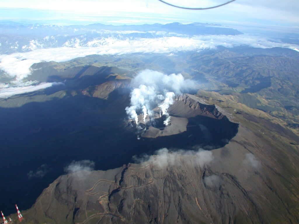
From the monitoring of the activity of the Galeras volcano, the Colombian Geological Survey (SGC), an entity attached to the Ministry of Mines and Energy, reports that:
In the week of December 17 to 23, 2024, the activity of the volcano showed a decrease in seismicity. Compared to the previous week, the main variations in the monitored parameters were:
• There was a decrease in both the frequency of earthquakes and the seismic energy released.
• The predominance of fracture seismicity within the volcanic system continued in parallel with the recording of earthquakes associated with fluid movements.
• Fracture seismicity was located mainly in the vicinity of the main crater, at distances less than 1 km, with depths less than 3 km from the summit (4200 m) and magnitudes less than 1. Other earthquakes were located scattered beneath the volcanic edifice at distances up to 7 km, with depths up to 10 km from the summit (4200 m) and a maximum magnitude of 1.4.
• Small gas emissions were observed in the fumarole fields of Las Chavas, to the west, and El Paisita, to the north of the active cone, with white columns, low height and variable dispersion due to wind action.
• Other volcanic monitoring parameters showed stability.
Based on the above, the SGC recommends to closely monitor the evolution through the weekly bulletins and other information published through our official channels, as well as the instructions of the local and departmental authorities and the National Unit for Disaster Risk Management (UNGRD).
Volcanic activity remains in yellow alert status: active volcano with changes in the behavior of the base level of the monitored parameters and other manifestations.
Source et photo : SGC.
Peru , Sabancaya :
Analysis period: from December 16, 2024 to December 22, 2024, Arequipa, December 23, 2024
Alert level: ORANGE
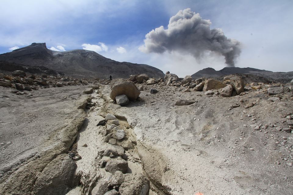
The Geophysical Institute of Peru (IGP) reports that the eruptive activity of the Sabancaya volcano continues. During this period, an average of 6 explosions per day have been recorded, with columns of ash and gas up to 1,800 m above sea level above the summit of the volcano. Therefore, the volcanic alert level remains at ORANGE
The IGP has recorded and analyzed the occurrence of 159 earthquakes of volcanic origin, associated with the circulation of magmatic fluids inside the Sabancaya volcano, as well as earthquakes related to rock fracturing. An average of 6 explosions per day have been recorded.
Columns of ash and gas have been observed up to 1800 m above sea level above the summit of the volcano. The predominant direction of these emissions has been towards the West and North-West sector of the volcano over a distance of less than 10 KM.
A slight inflation process continues to be recorded in the North sector (around the Hualca Hualca volcano).
Satellite recordings have identified the presence of 2 thermal anomalies, with a maximum value of 1 MW, associated with the presence of a body of lava on the surface of the volcano’s crater.
Moderate emissions (632 tons/day) of sulfur dioxide (SO2) have been observed
RECOMMENDATIONS
• Maintain the orange volcanic alert level.
• Do not approach within a radius of less than 12 km of the crater.
Source : Cenvul
Photo : Zintia Roxana Fernández Licla ( archive)


