December 24 , 2024.
Hawaii , Kilauea :
HVO/USGS Volcanic Activity Notice
Current Volcano Alert Level: WATCH
Previous Volcano Alert Level: WARNING
Current Aviation Color Code: ORANGE
Previous Aviation Color Code: RED
Issued: Monday, December 23, 2024, 6:43 AM HST
Source: Hawaiian Volcano Observatory
Notice Number: 2024/H438
Location: N 19 deg 25 min W 155 deg 17 min
Elevation: 4091 ft (1247 m)
Area: Hawaii
Volcanic Activity Summary:
Kīlauea volcano is erupting within Halemaʻumaʻu crater in the summit caldera. As of 6:30 a.m. HST, the eruption has stabilized within the crater and there are no immediate threats to infrastructure. The USGS Hawaiian Volcano Observatory is lowering Kīlauea’s volcano alert level from WARNING to WATCH and its aviation color code from RED to ORANGE.
The ongoing eruption of Kīlauea is occurring within a closed area of Hawai’i Volcanoes National Park. The eruption began at approximately 2:20 a.m., and vents are continuing to erupt on the floor of the southwest part of the summit caldera. The primary hazard of concern at this time is high levels of volcanic gas which can have far-reaching effects down-wind (generally southwest) of the summit. The plume of volcanic gas and fine volcanic particles is reaching elevations of 6,000-8,000 feet above sea level (2,000-4,000 feet above ground level) and winds are transporting it to the southwest, within the closed area of Hawaiʻi Volcanoes National Park.
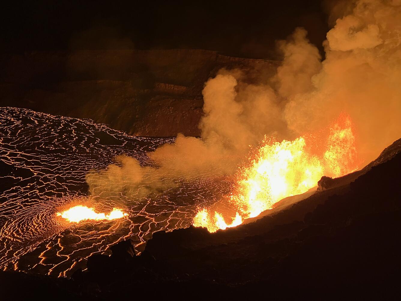
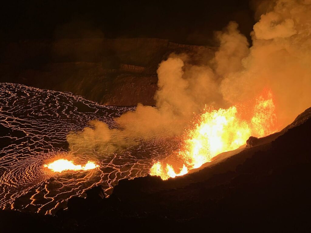
From the closed area of Hawaiʻi Volcanoes National Park, USGS Hawaiian Volcano Observatory geologists documented the new eruption within Kalupele that started this morning at 2:20 a.m. HST. HVO geologists collected samples of the new eruption that were being deposited on the caldera rim west of the caldera and they documented the lava fountains that were reaching up to 80 meters (260 feet) at approximately 4:30 a.m. HST.
At 4:30 a.m., lava fountains were observed with heights up to 80 meters (262 feet). Molten material, including lava bombs, is being ejected from the vents on the caldera floor up onto the west caldera rim, within the closed area of Hawaiʻi Volcanoes National Park. The volcanic gas and ejecta hazards west of the erupting vents stress the hazardous nature of this closed area of Kīlauea’s summit. By 5:30 a.m., lava covered an estimated area of 400 acres of the caldera floor.
Eruptive activity is currently confined to the summit region. No significant changes have been observed in the rift zones.
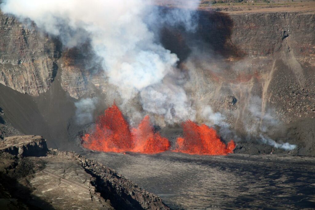
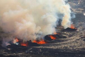
This aerial view, captured during a USGS Hawaiian Volcano Observatory monitoring overflight, shows the lava fountains active in the west part of Kīlauea caldera. The eruption began this morning at 2:20 a.m. HST, December 23, and fountains reached up to 90 meters (290 feet) overnight. During the overflight, fountain heights were slightly lower, around 70 meters (230 feet). New lava flows away from the fountains (to the right in the photo), while tephra material (molten material that travels through the air before it is deposited on the ground), is visible behind and downwind of the fountains (to the left in the photo).
Monday, December 23, 2024, 5:14 PM HST (Tuesday, December 24, 2024, 03:14 UTC)
Current Volcano Alert Level: WATCH
Current Aviation Color Code: ORANGE
Activity Summary:
The eruption of Kīlauea slowed significantly between 3:00 and 4:00 p.m. and appears to be paused.
The eruption in Halema’uma’u crater within Kaluapele (Kīlauea summit caldera) that began at 2:20 a.m. HST this morning, December 23, continued through most of the day within a closed area of Hawaiʻi Volcanoes National Park. There was no immediate threat to human life or infrastructure, but emission rates of volcanic gases were very high. Webcam imagery and field crew observations showed continued lava fountaining from vents in the southwest portion of the caldera with new lava covering approximately 650 acres, including all of Halema’uma’u and most of the adjacent downdropped block. The area covered so far is a little more than 1 square mile (2.6 square kilometers) and represents about one quarter of the area of Kaluapele. The lava is estimated to be about 1 yard (1 meter) thick, giving an estimated average effusion rate of 110 cubic yards per second (85 cubic meters per second) for the first 8 hours of the eruption. Initial fountain heights were estimated to be about 260 to 300 feet (80-90 meters) and had decreased to about 55 yards (50 m) by 1:00 p.m.
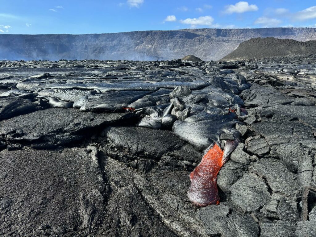
A lobe of molten pāhoehoe lava on the floor of Kaluapele (Kīlauea caldera) on December 23, 2024.
Vigorous fountaining produced a plume of volcanic gas and particles that was transported downwind, in a southwest direction over a closed area of Hawaiʻi Volcanoes National Park. Conditions prevented measuring SO2 gas emission rates by normal methods, but nearby monitoring stations estimated over 100,000 tonnes of SO2 per day around 8:00 a.m.and decreasing by half in the early afternoon. These estimates are similar to values measured in the early stages of previous summit eruptions in the past 4 years.
Around 3 p.m. today, tilt at the summit stopped showing deflation and seismic tremor began decreasing. By 3:30 p.m., lava fountains were barely visible. By 4 p.m., fountaining had stopped and seismic tremor was close to background levels. Visible volcanic gas emissions have also decreased significantly. These observations indicate that the eruption has slowed significantly and appears to be entering a pause.
HVO continues to closely monitor Kīlauea and will issue an eruption update tomorrow morning unless there are significant changes overnight.
Source : HVO
Photos : USGS / N. Deligne. USGS / M. Zoeller. USGS / M. Patrick .
Italy , Stromboli :
December 24, 2024, 06:20 (05:20 UTC) . Statement on Stromboli activity .
The National Institute of Geophysics and Volcanology, Osservatorio Etneo, reports pyroclastic flows.
Further updates will be provided shortly.
December 24, 2024, 07:02 (06:02 UTC) . Statement on Stromboli activity .
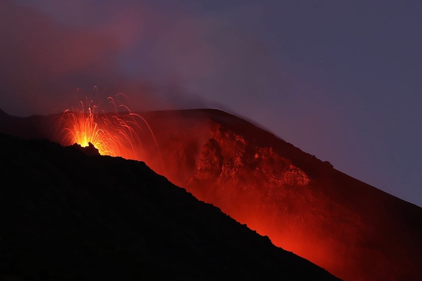
The National Institute of Geophysics and Volcanology, Osservatorio Etneo, reports that the intensification of spattering activity in the North Crater area has fueled a lava overflow whose front remains confined to the upper part of the Sciara del Fuoco. In particular, the overflow was generated at 05:20 UTC, following an explosion somewhat more intense than ordinary explosions, which occurred at 05:14 UTC and whose pyroclastic products were channeled inside the upper part of the canyon.
From a seismic point of view, at 05:14 UTC, a seismic signal with slightly higher than normal energy was recorded, which can be associated with the explosive event. This signal was followed by a phase of increased tremor lasting about 5 minutes. At the same time, a sudden increase in the tremor amplitude was recorded, from high to very high values. Currently the amplitude values are high.
The deformation data measured by the clinometric and GPS (HR) networks do not show significant variations related to the event.
Further updates will be communicated shortly.
Source : INGV
Photo : Thomas Bretscher via Stromboli stati d’animo.
Indonesia , Raung :
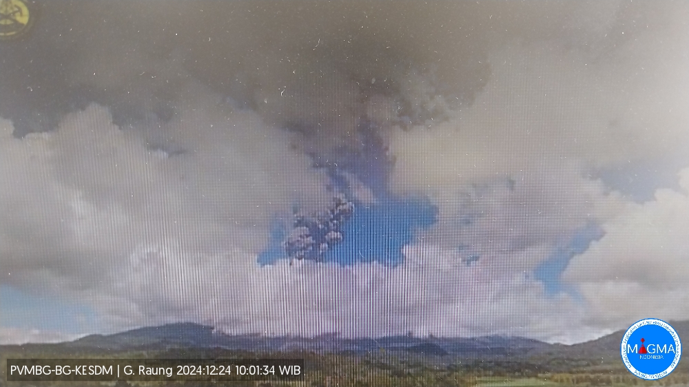
An eruption of Mount Raung occurred on Tuesday, December 24, 2024 at 09:30 WIB with the height of the ash column observed at ± 2000 m above the summit (± 5332 m above sea level). The ash column was observed to be gray with a thick intensity, oriented towards the East. This eruption was recorded on a seismograph with a maximum amplitude of 32 mm and a duration of 282 seconds.
VOLCANO OBSERVATORY NOTICE FOR AVIATION – VONA
Issued : December 24 , 2024
Volcano : Raung (263340)
Current Aviation Colour Code : ORANGE
Previous Aviation Colour Code : yellow
Source : Raung Volcano Observatory
Notice Number : 2024RAU003
Volcano Location : S 08 deg 07 min 30 sec E 114 deg 02 min 31 sec
Area : East java, Indonesia
Summit Elevation : 10662 FT (3332 M)
Volcanic Activity Summary :
Eruption with volcanic ash cloud at 02h30 UTC (09h30 local).
Volcanic Cloud Height :
Best estimate of ash-cloud top is around 17062 FT (5332 M) above sea level or 6400 FT (2000 M) above summit. May be higher than what can be observed clearly. Source of height data: ground observer.
Other Volcanic Cloud Information :
Ash cloud moving to east. Volcanic ash is observed to be gray. The intensity of volcanic ash is observed to be thick.
Remarks :
Eruption recorded on seismogram with maximum amplitude 32 mm and maximum duration 282 second. Tremor recorded on seismogram with maximum amplitude 9 mm. Seismic activity characterized by continuous tremor
Source et photo : Magma Indonésie.
Ecuador , El Reventador :
DAILY STATUS REPORT OF THE REVENTADOR VOLCANO , Monday, December 23, 2024.
Information Geophysical Institute – EPN.
Surface Activity Level: High , Surface Trend: No Change
Internal Activity Level: Moderate , Internal Trend: No Change
From December 22, 2024, 11:00 a.m. to December 23, 2024, 11:00 a.m.:
Seismicity:
The count of seismic events recorded at the station is detailed below.
Explosion (EXP) 55
Long Period (LP) 12
Emission Tremor (TREMI) 11
Harmonic Tremor (TRARM) 6
Rainfall / Lahars:
Since yesterday afternoon until the publication of this report, thanks to the satellite and meteorological monitoring system, no rain has been recorded in the areas surrounding the volcano. **In the event of heavy rains, they could remobilize the accumulated materials, generating mud and debris flows that would descend the sides of the volcano and flow into adjacent rivers.
Column emissions / ash:
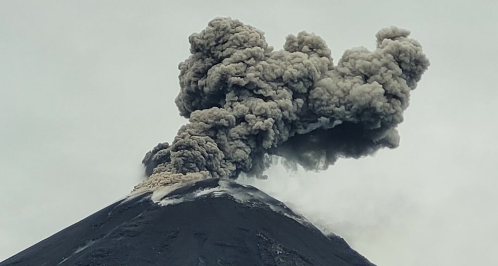
In the last 24 hours, thanks to the surveillance camera system, emissions of gas and ash have been observed, the columns of which have reached heights of between 400 and 800 meters above the level of the crater, with southwest and west-southwest directions. In connection with this activity, the VAAC agency in Washington published a report indicating an emission of a column height equal to 1,100 meters above the level of the crater that was directed towards the Southwest.
Observation:
Since yesterday afternoon until the closing of this report, the volcano has remained mostly cloudy. However, thanks to the network of surveillance cameras, episodes of incandescence have been observed at the level of the crater, accompanied by descents of material along the flanks up to 850 meters below the level of the crater.
Source : IGEPN
Photo : IGEPN
Mexico , Popocatepetl :
December 23, 11:00 (December 23, 17:00 GMT)
Activity of the last 24 hours
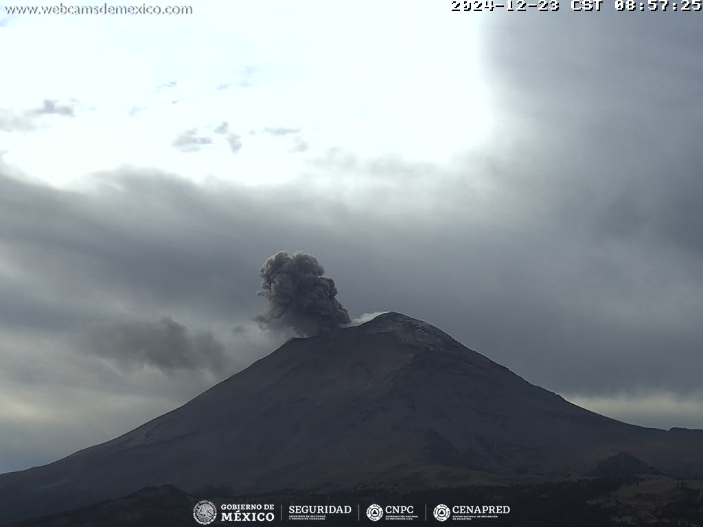
65 low intensity exhalations were detected, accompanied by water vapor, volcanic gases and small amounts of ash. In addition, 672 minutes of high frequency and low amplitude tremors were recorded.
During the morning and at the time of this report, a continuous emission of water vapor, volcanic gases and ash was observed, with dispersion towards the East.
The Popocatépetl volcanic alert fire is in yellow phase 2.
The scenarios anticipated for this phase are:
A few small to moderate explosions
Occurrence of tremors of varying amplitude
Light to moderate ash rains in the surrounding towns and in some more distant towns
Ejection of incandescent fragments within the 12-kilometer exclusion radius
The occurrence of lahars can be expected to descend into the ravines, due to the accumulation of ash on the slopes and its interaction with the rains expected in the coming weeks.
Possibility of pyroclastic flows not reaching the populations
Source et photo : Cenapred.

