December 22, 2024 .
Iceland , Grjótarvatn :
Seismic activity in Grjótarvatn has increased in the last months . The possibility of magma accumulation at depth is considered
20.12.2024
The M3,2 earthquake on the evening of December 18 is the largest so far
No ground deformation has been detected on GNSS observations
No indication that magma is moving within the upper crust
Small fissure eruptions are characteristic of volcanic activity within Ljósufjöll volcanic system
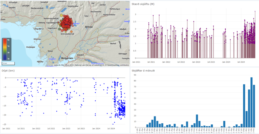
Screenshot from the Skjálfta-Lísa system.
An earthquake with magnitude M3.2 was detected near Grjótárvatn on the evening of December 18. The IMO received reports that the earthquake had been felt around Borgarfjörður and Akranes. Seismic activity has been measured around Grjótarvatn regularly since spring 2021, but in recent months it has been increasing, as shown in the figure below. The earthquake detected on December 18 is the largest since the autumn of 2021 when two earthquakes of magnitude M3 occurred. Prior to this, significant seismic activity was last detected there in 1992, when two earthquakes of magnitude M3 occurred, one larger than M3.2, and several others above M2.0. The earthquake catalogue which we are referring to here goes back to 1991 .
The IMO has increased the monitoring of the area with new installations of equipment in Hítardalur both a seismometer (at the end of September) and a GNSS station (at the beginning of November). The new seismometer has improved the monitoring system’s ability to detect small earthquakes. Indeed, before it was installed, few earthquakes below M1.0 were detected because the nearest seismometer was relatively far away, at about 30 km from the active area. However, the increased level of seismicity is not an artifact of a more sensitive monitoring network. If we consider only those earthquakes above M1.0, it is evident that seismic activity in the area was increasing before the installation of the new station.
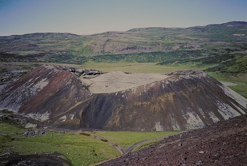
Litli-Grábrók, , part of Ljósufjöll volcanic system.
After the seismic station was installed closer to the active area, the earthquake location improved significantly. The depth of the majority of the earthquakes in the area is now well constrained to be at a depth between 15-20 km. Since the GNSS station was installed in Hítardalur, the data does not show any detectable deformation at the surface. Analysis of satellite data (InSAR) from the period 2019 to summer 2024 also shows no evidence of surface deformation.
Yesterday morning (19 December) the regular scientific meeting to assess the situation in the Reykjanes peninsula took place. Specialists from the IMO and the Earth Sciences department at the University of Iceland took the opportunity to also discuss the newest data and ongoing activity at Grjótarvatn.
It is currently not possible to determine the cause of the ongoing seismic activity, but two possibilities are considered: magma accumulation at depth or intra-plate tectonic movements.
More analysis is needed to assess with certainty which process is responsible for the ongoing activity at Grjótarvatn. However, the current monitoring data indicates that there is no evidence of magma migrating to shallow depths. The IMO will plan the deployment of additional stations (seismic and GNSS) to better constrain the ongoing phenomena and monitor its evolution.
In the event that magma starts propagating towards the surface, it is most likely that larger precursors will be detected, such as a rapid increase in seismic activity (in terms of number and magnitude of earthquakes), a migration in their depth and/or ground deformation.
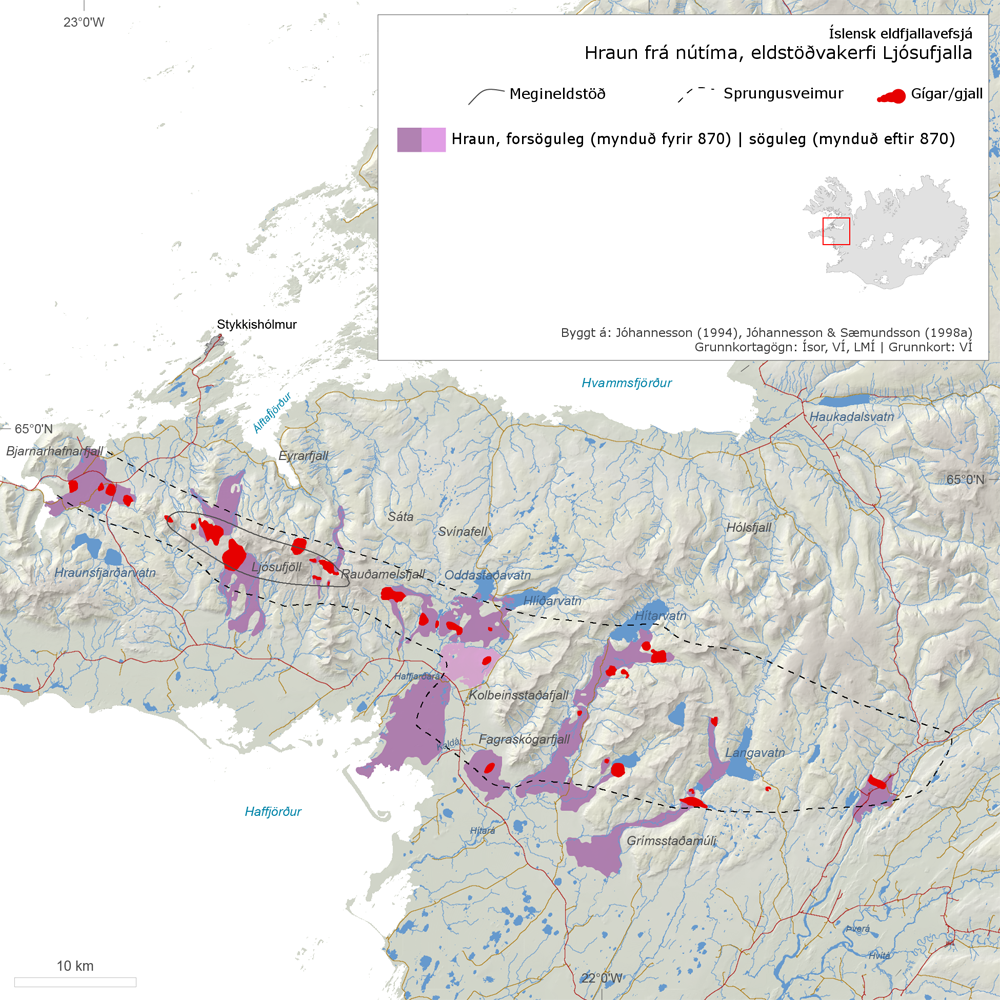
Ljósufjöll volcanic system, Holocene lava flows and scoria deposits.
Eruptive history
Grjótarvatn is within the volcanic system of Ljósufjöll in the Snæfellsnes Volcanic Zone. The last eruption of Ljósufjöll was a small effusive eruption which occurred in the 10th century CE and produced the Rauðhálsahraun lava field, of about 13 km2 (at about 15 km northwest from Grjótarvatn). On average, during the last 10,000 years, this volcanic system has erupted every 400 years. In the event of an eruption here, the most likely scenario is a small effusive eruption (< 0.1 km3), or mildly explosive, with lava fountaining and lava flows. If an eruption occurred, a small area would be expected to be affected by the main associated volcanic hazards which are: lava flows, gas pollution and very localized tephra fallout.
Source : IMO
Photos : IMO , H. Grobe( 1984) , IMO.
Indonesia , Ibu :
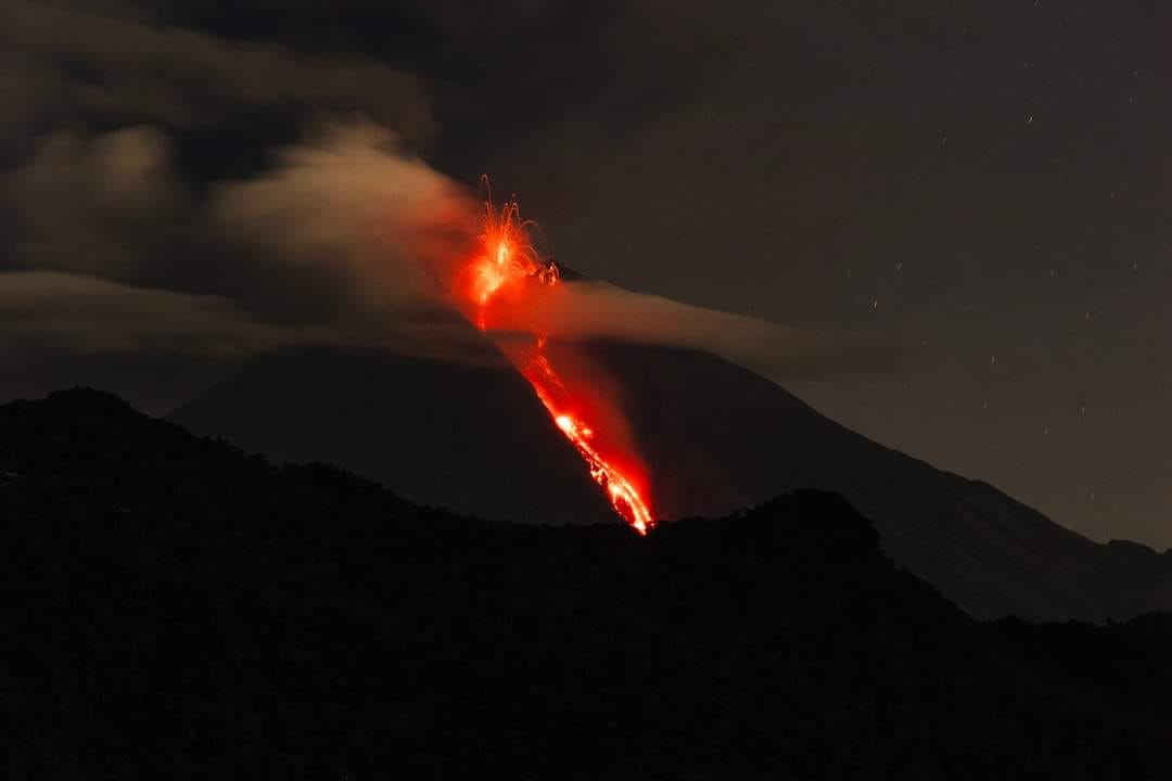
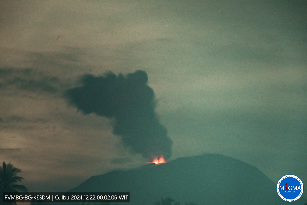
An eruption of Mount Ibu occurred on Sunday, 22 December 2024 at 00:00 WIT with the height of the ash column observed at ± 600 m above the summit (± 1925 m above sea level). The ash column was observed to be grey with a thick intensity, oriented towards the North-East. This eruption was recorded on a seismograph with a maximum amplitude of 28 mm and a duration of 62 seconds.
Seismicity observation:
20 eruption/explosion earthquakes with an amplitude of 18 to 28 mm and a duration of 50 to 89 seconds.
47 emission earthquakes with an amplitude of 3 to 18 mm and an earthquake duration of 23 to 56 seconds.
3 harmonic tremors with an amplitude of 3 to 10 mm and an earthquake duration of 19 to 59 seconds.
70 shallow volcanic earthquakes with an amplitude of 2 to 13 mm and an earthquake duration of 4 to 18 seconds.
42 deep volcanic earthquakes with an amplitude of 2 to 11 mm, and an earthquake duration of 6 to 18 seconds.
5 distant tectonic earthquakes with an amplitude of 3 to 24 mm, and the duration of the earthquake was 38 to 110 seconds.
Recommendation
1. Communities around Mount Ibu and visitors/tourists are advised not to carry out activities within a radius of 4 km, with a sectoral extension of 5.5 km towards the crater opening in the northern part of the active crater of Mount Ibu.
2. In the event of ashfall, people who carry out activities outside the house are advised to protect their nose, mouth (mask) and eyes (goggles).
Source et photo : Magma Indonésie
Colombia , Cerro Machín :
Manizales, December 17, 2024, 6:00 p.m.
From the monitoring of the activity of the Cerro Machín volcano, the Colombian Geological Survey (SGC), an entity attached to the Ministry of Mines and Energy, reports that:
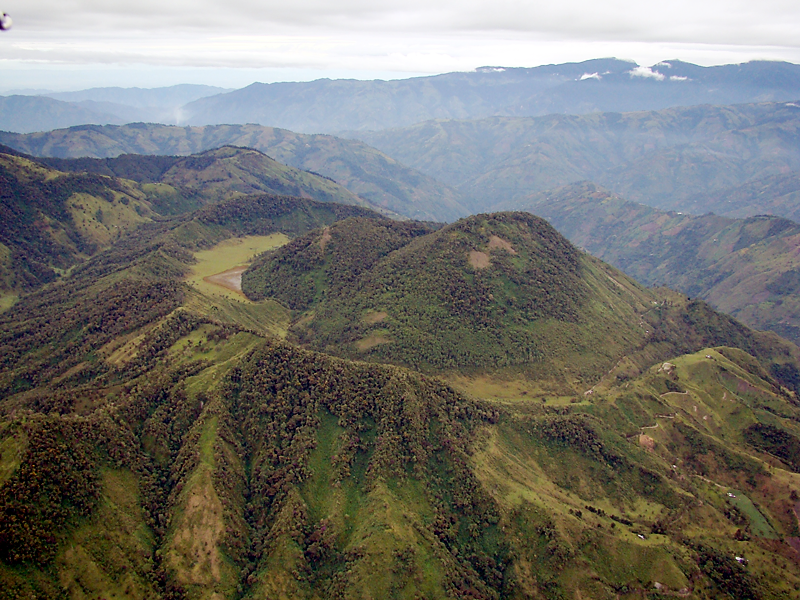
For the week of December 10 to 16, 2024, the recording of seismicity associated with the fracturing of rocks inside the volcanic edifice continued. Compared to the previous week, seismic activity decreased in the number of events and in the seismic energy released. The earthquakes were located on the southeast flank of the volcano, at distances of less than 2 km from its central part and at depths of 5 km measured from the summit. The magnitude of the earthquakes was less than 1 (low energy level).
The other parameters measured and used for the diagnosis of volcanic activity have not presented significant changes during the period evaluated.
Based on the above, at the SGC we recommend to closely monitor the evolution through weekly bulletins and other information published through our official channels, as well as the instructions of local and departmental authorities and the National Unit for Disaster Risk Management (UNGRD).
The alert status due to volcanic activity remains Yellow: active volcano with changes in the behavior of the basic level of the monitored parameters and other manifestations.
Source et photo : SGC
Guatemala , Fuego :
Atmospheric conditions: Clear.
Wind: East.
Precipitation: 0.0 mm.
Activity:
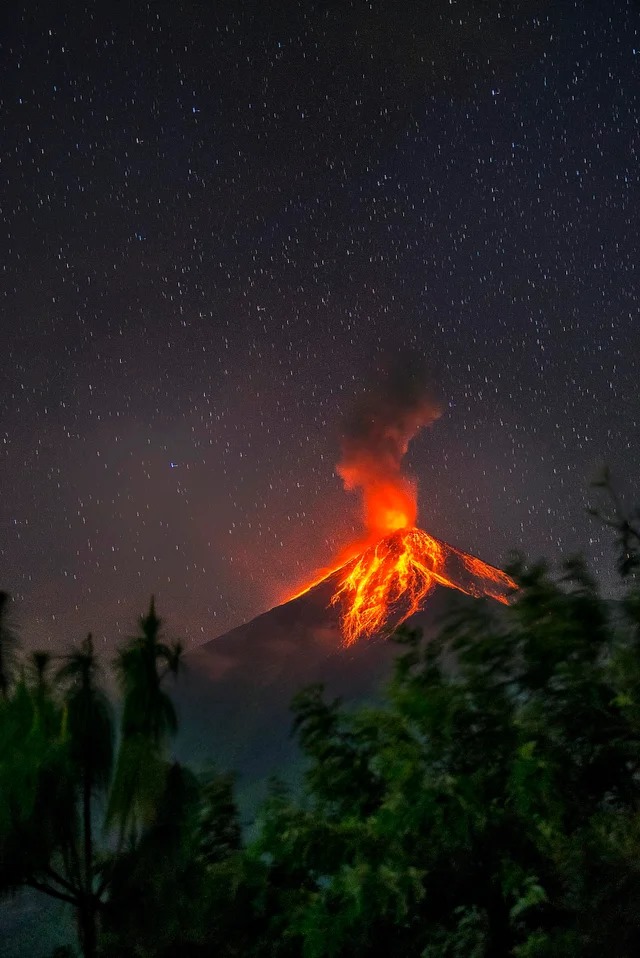
The Fuego Volcano Observatory reports favorable conditions for observing the crater. Between 6 and 8 explosions per hour of weak and moderate characteristics are reported, which raise columns of gas 4,500 to 4,800 meters above sea level (14,764 to 15,748 feet). These move southwest and west under the action of the wind at distances of 10 to 30 km.
.
These explosions are accompanied by rumbling sounds and weak to moderate shock waves. Likewise, some may be accompanied by weak avalanches that can reach the edge of the vegetation. Likewise, incandescent materials ejected up to 250 meters above the crater level have been observed. Due to the wind direction, a weak fall of fine ash is expected on Panimache I and II, Morelia, Los Yucales, Finca Palo Verde, Yepocapa and their surroundings. Regarding explosive activity, follow the recommendations described in the special bulletin BEFGO-101-2024.
Source : Insivumeh
Photo : Massoud Ufo Jorge
Ecuador , Sangay :
DAILY STATE REPORT OF SANGAY VOLCANO , Saturday, December 21, 2024 .
Information Geophysical Institute – EPN.
Surface Activity Level: Moderate , Surface Trend: No change
Internal Activity Level: Moderate , Internal Trend: No change
Seismicity: From December 20, 2024, 11:00 a.m. to December 21, 2024, 11:00 a.m. :
Seismicity:
Below is the count of seismic events recorded at the reference station
Explosion (EXP): 68
Rainfall / Lahars:
The presence of rain in the area of the volcano or in the surrounding area, which could generate mud and debris flows, has not been recorded by the surveillance cameras. **In the event of heavy rain, it could remobilize the accumulated materials, generating mud and debris flows that would descend the sides of the volcano and flow into the adjacent rivers.
Emissions / ash column:
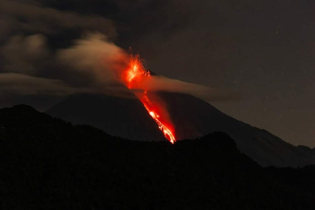
Since yesterday evening, thanks to the surveillance camera network, several emissions of gas and ash have been recorded with heights between 600 and 1000 meters above the level of the crater in a southwesterly direction. Associated with this activity, the VAAC agency in Washington has published three reports of ash emissions with heights of 900 meters above the level of the crater in a westerly direction.
Gas:
The MOUNTS satellite system detected 4.4 tons of sulfur dioxide (SO2), recorded at 13:10 TL on 20/12/2024.
Other monitoring parameter:
The FIRMS satellite system recorded 6 thermal anomalies in the last 24 hours.
Observation:
During last night, several episodes of incandescence were recorded at the crater.
Until the closing of this report, the volcano remains cloudy.
Alert level: yellow
Source : IGEPN
Photo : Luis Lema via volcan Sangay FB , 30/03/2024

