December 11 , 2024.
Indonesia , Dukono :
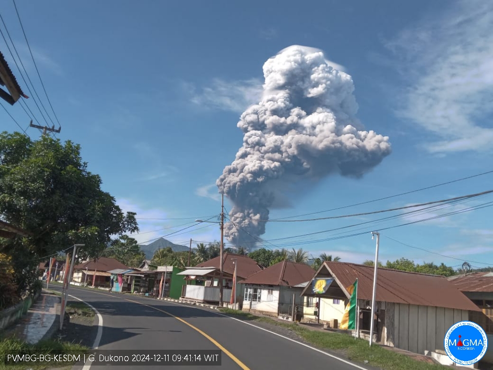
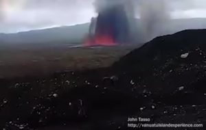
An eruption of Mount Dukono occurred on Wednesday, 11 December 2024 at 08:54 WIT with the height of the ash column observed at ± 3000 m above the summit (± 4087 m above sea level). The ash column was observed to be grey to black in colour with a thick intensity, oriented towards the northwest. At the time of writing, the eruption was still ongoing.
VOLCANO OBSERVATORY NOTICE FOR AVIATION – VONA
Issued : Décember 11 , 2024
Volcano : Dukono (268010)
Current Aviation Colour Code : RED
Previous Aviation Colour Code : red
Source : Dukono Volcano Observatory
Notice Number : 2024DUK032
Volcano Location : N 01 deg 41 min 35 sec E 127 deg 53 min 38 sec
Area : North Maluku, Indonesia
Summit Elevation : 3478 FT (1087 M)
Volcanic Activity Summary :
Eruption with volcanic ash cloud at 23h54 UTC (08h54 local).
Volcanic Cloud Height :
Best estimate of ash-cloud top is around 13078 FT (4087 M) above sea level or 9600 FT (3000 M) above summit. May be higher than what can be observed clearly. Source of height data: ground observer.
Other Volcanic Cloud Information :
Ash cloud moving to northwest. Volcanic ash is observed to be gray to dark. The intensity of volcanic ash is observed to be thick.
Remarks :
Eruption and ash emission is continuing. Eruption recorded on seismogram with maximum amplitude 34 mm. Tremor recorded on seismogram with maximum amplitude 4 mm.
Source et photo : Magma Indonésie.
Italy / Sicily , Etna :
WEEKLY BULLETIN, from December 02, 2024 to December 08, 2024. (issue date December 10, 2024)
SUMMARY STATUS OF ACTIVITY
In light of the monitoring data, it emerges:
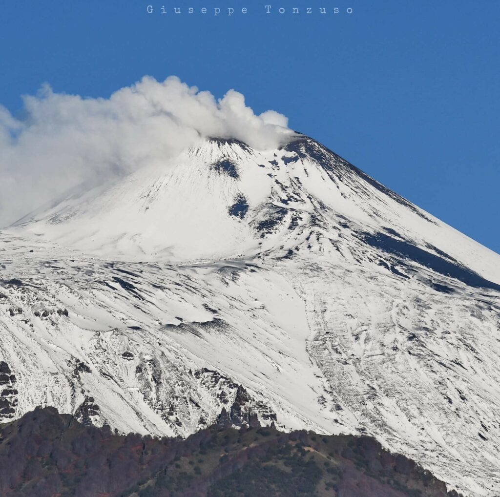
1) VOLCANOLOGICAL OBSERVATIONS: Degassing activity at the summit craters.
2) SEISMOLOGY: Absence of seismic fracturing activity with Ml>=2.0. Average amplitude of volcanic tremor at a predominantly medium-low level.
3) INFRASOUND: Low-level infrasound activity with sources located in the Northeast crater area.
4) GROUND DEFORMATIONS: Over the past week, ground deformation monitoring networks have not recorded any significant changes.
5) GEOCHEMISTRY: SO2 flux at medium level
Soil CO2 flux (EtnaGas network): slightly increasing, medium degassing values.
The partial pressure of dissolved CO2 in groundwater (Ponteferro) shows values in seasonal variability.
The isotopic ratio of peripheral sites: there are no updates; last data on medium-high values (20/11/2024).
6) SATELLITE OBSERVATIONS: The thermal activity observed by satellite in the summit area was generally low.
VOLCANOLOGICAL OBSERVATIONS
During the week, the monitoring of the volcanic activity of Etna was carried out through the analysis of the images of the surveillance cameras of the INGV, Osservatorio Etneo (INGV-OE) .
During the period analyzed, the observation of the summit area and the craters was discontinuous due to the presence of an extensive and irregular cloud cover. In the visibility windows, it was observed that the overall activity of Etna was characterized by a continuous degassing of variable intensity and regime.
Volcanic tremor:
The temporal trend of the average amplitude of the volcanic tremor, throughout the week, remained mainly at a medium-low level. The centroid of the tremor sources is mainly located in an area between the Bocca Nuova crater and the Northeast crater, at an altitude between 1,700 and 3,000 meters above mean sea level.
Source : INGV
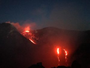
Photo : Giuseppe Tonzuso ( 7/12/2024)
Italy , Stromboli :
WEEKLY BULLETIN, from 02 December 2024 to 08 December 2024. (issue date 10 December 2024)
SUMMARY STATUS OF ACTIVITY
In light of the monitoring data, it emerges:
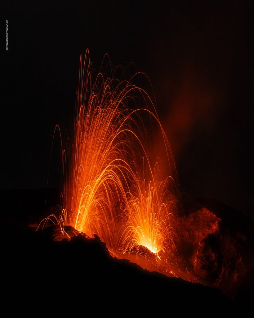
1) VOLCANOLOGICAL OBSERVATIONS: During the period under review, intense eruptive activity was observed with splashes coming from the northern area of the crater and with the emission of a modest lava flow that on 4 December affected the medium-high area of the Sciara del Fuoco. The total hourly frequency of explosions fluctuated around medium (12 events/hour) and high (20 events/hour) values. The intensity was low to medium in the northern crater area and medium to high in the central-southern area.
2) SEISMOLOGY: The monitored seismological parameters do not show significant variations.
3) GROUND DEFORMATIONS: The ground deformation monitoring networks of the island have not shown any significant changes to report for the period under review.
4) GEOCHEMISTRY: SO2 flux in the plume at an average level
The CO2 flux from the soil in the STR02 summit area reaches high values.
C/S ratio in the plume: is at high values.
Helium isotope ratio in the thermal aquifer at high values.
CO2 flux at Mofeta in the San Bartolo area: values are at average degassing levels.
CO2 flux at Scari: at average values
5) SATELLITE OBSERVATIONS: The thermal activity observed by satellite in the summit area was generally low to moderate in correspondence with the eruptive activity in the northern area of the crater on 4 December 2024.
VOLCANOLOGICAL OBSERVATIONS
During the observation period, the eruptive activity of Stromboli was characterized through the analysis of images recorded by the INGV-OE surveillance cameras located at 190 m altitude (SCT-SCV) and at Punta dei Corvi (SPCT). The explosive activity was mainly produced by 4 eruptive vents located in the North crater area and by 3 vents located in the Centre-South crater area.
On December 4, a modest lava flow occurred from the North crater area.
Observations of explosive activity captured by surveillance cameras
In correspondence with the North Crater (N) area, four active vents were observed that produced low-intensity explosive activity (the erupted products reached a height of less than 80 m) and sometimes medium (height of the products between 80 and 150 m). In addition, projection activity was observed at the mouths of the N2 sector, sometimes intense on 2, 4, 6 and 8 December. The products emitted in eruption were mainly coarse materials (bombs and lapilli). The average frequency of explosions ranged from 9 to 13 events/hour.
In the Centre-South (CS) area, explosive activity was produced by at least three vents; the explosions varied in intensity from medium (less than 150 m in height) to high (more than 250 m in height) with emission of fine material sometimes mixed with coarse material. The average frequency of explosions varied between 3 and 8 events/hour
Source : INGV
Photo : Stromboli stati d’animo / Sebastiano Cannavo.
Chile , Villarica :
Seismology
The seismological activity of the period was characterized by the recording of:
11 VT-type seismic events, associated with rock fracturing (Volcano-Tectonic). The most energetic earthquake had a Local Magnitude (ML) value equal to 1.0, located 4.8 km to the East-Southeast of the volcanic edifice, at a depth of 4.9 km in reference to the crater.
2018 LP-type seismic events, associated with fluid dynamics within the volcanic system (Long Period). The size of the largest earthquake evaluated from the Reduced Displacement (DR) parameter was equal to 48 cm2
21 TR-type seismic events, associated with the dynamics maintained over time of fluids within the volcanic system (TRemor). The size of the largest earthquake evaluated from the Reduced Displacement (DR) parameter was equal to 4 cm2.
1 VLP type seismic event, associated with the dynamics of large volumes of fluids inside the volcanic system (Very Long Period). The size of the earthquake evaluated from the Reduced Displacement (RD) parameter was equal to 1 cm2.
Fluid Geochemistry
The sulfur dioxide (SO2) emission data obtained by the Differential Optical Absorption Spectroscopy (DOAS) equipment, corresponding to the Los Nevados and Tralco stations, installed respectively 10 km in an East-Northeast direction and 6 km East-Southeast from the active crater, presented an average value of 533 ± 111 t/d. These values are considered the basis of this volcanic system. The maximum daily average for the month was 1,526 t/d on November 20, associated with less than optimal measurement conditions.
No anomalies were reported in sulfur dioxide (SO2) emissions to the atmosphere in the area near the volcano, according to data published by the Tropopheric Monitoring Instrument (TROPOMI) and the Ozone Monitoring Instrument (OMI) Sulphur Dioxide Group.
Thermal anomalies by satellites
During the period, no thermal alerts were recorded in the area associated with the volcanic system, according to the analytical processing of Sentinel 2-L2A satellite images, in combination with false-color bands.
Geodesy
According to the data provided by the GNSS network, which measures the deformation of the volcano, a period of stability can be observed in the system, as evidenced by its low deformation rates, both horizontal and vertical, which do not exceed 0.8 cm/month. Thanks to radar interferometry data (InSar), no obvious deformation is observed in the volcano either.
Surveillance cameras
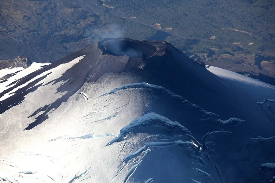
The images provided by the surveillance cameras, installed near the volcano, recorded columns of passive and occasional degassing, the maximum height reached was 200 m above the crater, on November 17. No incandescence or explosion was recorded with emission of pyroclastic material or ash.
Satellite geomorphological analysis
According to the photo-interpretation of Skysat Collect images from 16, 17, 18 and 28 November, degassing is observed from inside the crater and molten material cannot be visualized on the surface. No evidence of deposits associated with recent explosive activity has been identified.
The activity has remained at levels considered low, suggesting stability of the volcanic system. The volcanic technical alert is maintained at:
GREEN TECHNICAL ALERT: Active volcano with stable behavior – There is no immediate risk
Observation:
Monitoring of the superficial and instrumental activity of the Villarrica volcano indicates a decrease in the frequency of explosions with emission of high-temperature volcanic material outside the crater. As this is an open-duct volcanic system, sudden explosions without precursors cannot be excluded. Based on what has been observed in previous periods, the impact of these explosions is mainly concentrated at distances of less than 500 m, measured from the center of the crater. However, in the current scenario, the low surface activity and the decrease in monitoring parameters suggest a low probability of occurrence of this type of activity. The associated hazards consist of the ejection of ballistic pyroclasts, the emission of ash and volcanic gases.
Source : Sernageomin
Photo : Aton
Hawaii , Kilauea :
Tuesday, December 10, 2024, 10:15 AM HST (Tuesday, December 10, 2024, 20:15 UTC)
19°25’16 » N 155°17’13 » W,
Summit Elevation 4091 ft (1247 m)
Current Volcano Alert Level: ADVISORY
Current Aviation Color Code: YELLOW
Activity Summary:
Kīlauea volcano is not erupting. Seismicity at the volcano’s summit, East Rift Zone, and Southwest Rift Zone is low and deformation is steady.
Summit Observations:
Earthquake activity at Kīlauea’s summit region was generally low over the past week. Overall, there were 120 earthquakes in the summit, all below magnitude-2.0. The tiltmeter at Uēkahuna, northwest of Kaluapele, the summit caldera, remained relatively flat with no significant changes over the past week. The tiltmeter at Sand Hill, southwest of Kaluapele, continues to show slow weak inflation (about 4 microradians over the past week). The most recent measurement of the sulfur dioxide (SO2) emission rate from the summit was approximately 70 tonnes per day on October 17, a value representative of noneruptive conditions at Kīlauea.
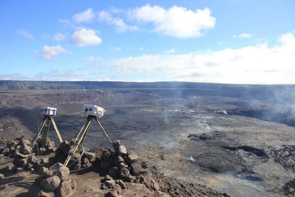
The KWcam on the eastern rim of Kaluapele (Kīlauea caldera) has been sending blurry images due water condensation inside the camera enclosure. On December 3rd, 2024, HVO staff visited the webcam to dry out the enclosure and search for any perforations that may be the source of the leak.
Rift Zone Observations:
Shallow earthquake counts in the upper and middle East Rift Zone (ERZ) have returned to low levels following the small uptick last week. There were approximately 70 located earthquakes in the middle ERZ, and approximately 70 in the upper ERZ as well, with most below magnitude-2.0. Deformation remains steady in the ERZ, as recorded by GPS instruments and tiltmeters. There are no indications of any changes downrift in the lower East Rift Zone.
Source : HVO
Photo : USGS / H. Winslow .

