December 10 , 2024.
Philippines , Kanlaon :
KANLAON VOLCANO BULLETIN , 09 December 2024 , 03:03 PM
Notice of alert level raise from Alert Level 2 to Alert Level 3 of Kanlaon Volcano.
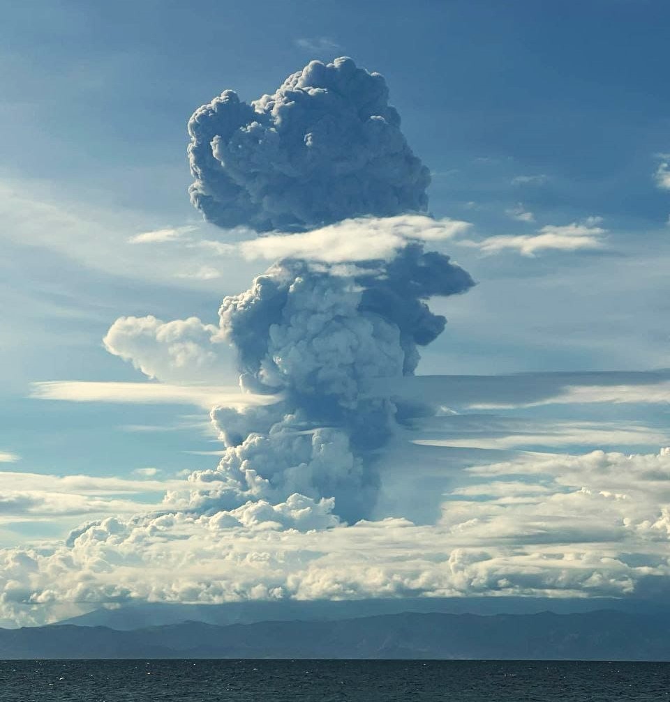
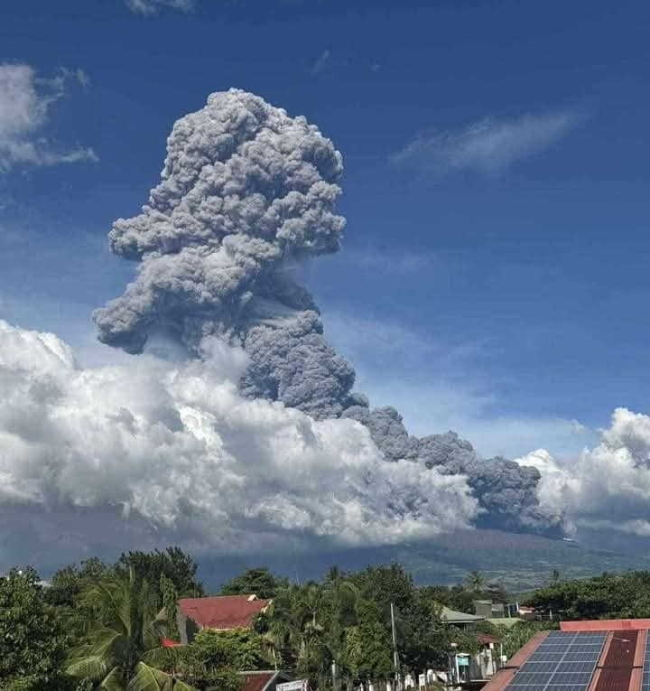
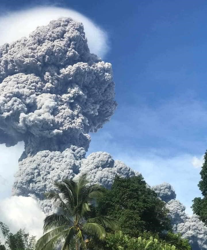
An explosive eruption occurred at the summit vent of Kanlaon Volcano at 3:03 PM today, 9 December 2024. The eruption produced a voluminous plume that rapidly rose to 3,000 meters above the vent and drifted west-southwest. Pyroclastic density currents or PDCs descended the slopes on the general southeastern edifice based on IP and thermal camera monitors.
In view thereof, DOST-PHIVOLCS is raising the Alert Level of Kanlaon Volcano from Alert Level 2 (increasing unrest) to Alert Level 3 (magmatic unrest). This means magmatic eruption has begun that may progress to further explosive eruptions. All local government units are advised to evacuate the 6-km radius from the summit of the volcano and must be prepared for additional evacuation if activity warrants.
Urgent Evacuation of 87,000 People Underway as Kanlaon Volcano Erupts, Defense Secretary Directs Immediate Action
As the threat of eruption from Kanlaon Volcano intensifies, an urgent evacuation operation is underway, affecting approximately 87,000 residents in the surrounding areas. Department of National Defense – Philippines Secretary and National Disaster Risk Reduction and Management Council (NDRRMC) Chairman Gilberto Teodoro, Jr. has activated the National Inter-agency Coordinating Cell (IACC) to coordinate response efforts, emphasizing the necessity for in-person duty from member agencies at the NDRRMOC starting tomorrow, December 10, 2024.
The gravity of the situation is particularly acute in La Castellana, where an estimated 46,900 individuals are within the 4-6 km danger zone. Authorities are focusing on Barangay Sag-ang due to prevailing westward wind directions, which pose additional risks from ashfall. Transportation support is urgently needed for the evacuation of communities in Barangay Cabagnaan, as well as those in Himamaylan, Hinigaran, Isabela, Pontevedra, and Moises Padilla. A staging area has been established in front of the La Castellana municipal hall, and schools with suspended classes will be utilized as evacuation centers.
In preparation for the worst-case scenario, Panaad Stadium in Bacolod City has been designated as the primary evacuation center, with the capacity to accommodate up to 30,000 evacuees. Water tanks will be prepositioned in evacuation centers to ensure an adequate supply.
In Region VII (Negros Oriental), 50 families have been evacuated to Española Memorial School, and ongoing forced evacuations are affecting around 1,800 families and 5,000 individuals across five barangays within a 6 km danger zone.
KANLAON VOLCANO ERUPTION UPDATE , 10 December 2024 , 03:30 AM
Summary of Observations:
An explosive eruption occurred at the summit vent of Kanlaon Volcano at 3:03 PM yesterday, 9 December 2024, that lasted three (3) minutes and fifty-five (55) seconds based on its seismic record. The event was detected by all thirteen stations of the Kanlaon Volcano Network (KVN) as well as by several stations of the Philippine Seismic Network (PSN) in Central Visayas. The eruption produced a voluminous plume that rapidly rose to 4,000 meters above the vent and was bent and drifted by strong winds to the west-southwest. Ashfall was reported over a wide area west of the volcano.
In addition, the explosive eruption produced a strong pressure or shock wave that was experienced as a loud booming sound and rattled objects within at least a thirty-kilometer radius of the volcano summit based on social media data. Infrasound stations of the Kanlaon Volcano Network (KVN) located approximately five kilometers from the crater recorded the pressure wave at 150 Pa or 138 dB SPL, levels that could be harmful to human hearing. Weaker infrasound signals were also recorded by stations of Mayon and Bulusan Volcano Networks.
Prior to the eruption, emissions from the summit were noticeably weaker than past days, resulting in a lower SO2 flux average 1,669 tonnes/day measured earlier in the day. Only six weak-volcano-tectonic earthquakes were detected for the day and no precursory seismic activity preceded the eruption. Ground deformation monitors have been detecting short-term inflation of upper southeast flank since late November 2024, indicating pressurization in the shallow parts of the edifice. However, this inflation phase was much weaker than deformation recorded in the third week of June to July 2024, at which time no eruptive activity transpired. Kanlaon has also been emitting ash aseismically (no seismic signal) since 19 October 2024. Microscopic examination of 23 samples of the most significant of some 90 detected ash emissions revealed that the ashes have been wholly composed of pulverized old rock within the volcano and bore no fragments from new magma. Ash from the 9 December 2024 eruption has been collected for similar analysis in order to help evaluate the triggers of this event.
Source : DOST-PHIVOLCS
Photos : via Alex Terry , Miss Ching Lagawing .
Iceland , Rekjanes Peninsula :
The Seventh Eruption at the Sundhnúkar Crater Row Concludes
Clear Signs of Uplift in the Svartsengi Area
Updated 9. December at 15:10 UTC
The last activity in the crater was observed via webcams around 7 a.m. yesterday
No activity was detected in the crater during today’s drone flight
The eruption lasted for 18 days
The hazard assessment will be updated later today
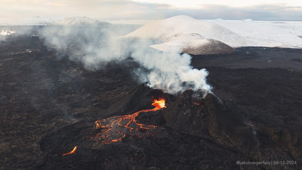
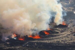
The eruption east of Stóra-Skógfell has ended. This was confirmed today during a drone survey conducted by Civil Protection, which observed no eruptive activity in the area. The last glow in the crater was seen on webcams on the morning of December 8. The eruption began in the evening on November 20 and lasted for 18 days, and out of the seven eruptions that have occurred since December, 2023, it is the second-largest eruption by area.
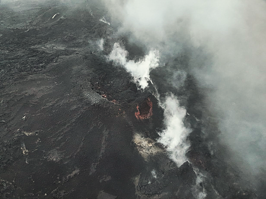
A photo of the crater taken around noon today, showing no activity in the crater. (Photo: Björn Oddsson – Civil Protection, National Commissioner of the Icelandic Police).
As previously reported, ground uplift has resumed around Svartsengi and continued over the past few days. This indicates that magma accumulation has begun again in the reservoir beneath Svartsengi.
Source : IMO
Photos : Jakob Vegerfors , Björn Oddsson – Protection civile, Commissaire national de la police islandaise
Indonesia , Lewotobi Laki-laki :
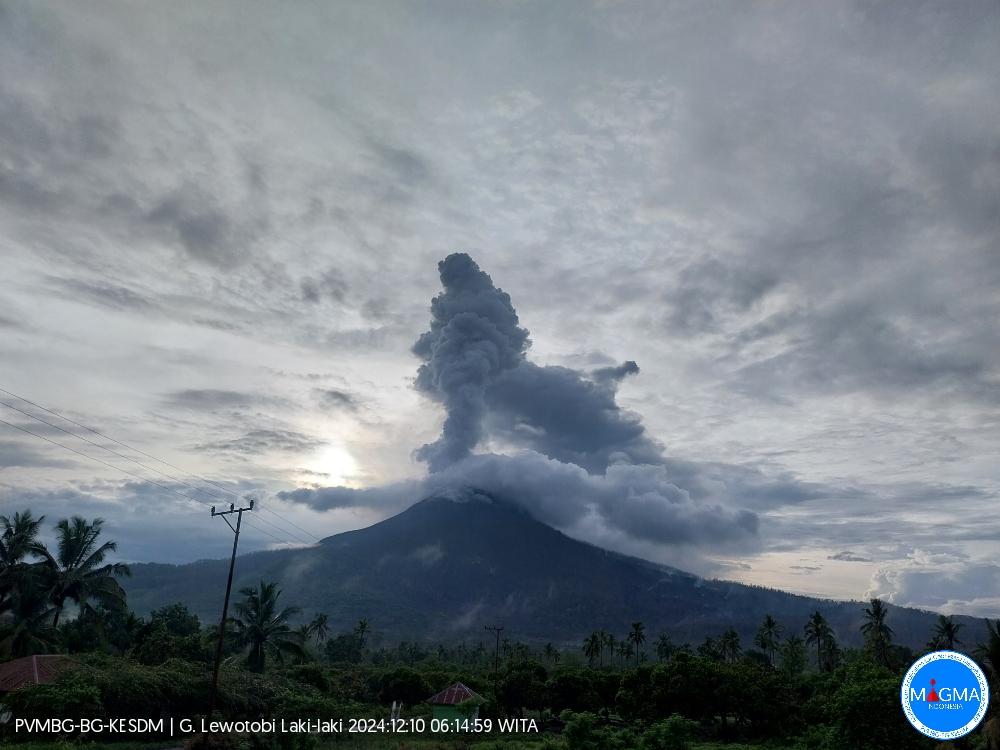
An eruption of Lewotobi Laki-laki occurred on Tuesday, 10 December 2024 at 06:07 WITA with the height of the ash column observed at ±2000 m above the summit (±3584 m above sea level). The ash column was observed to be white to grey in colour with a thick intensity, oriented to the west and northwest. At the time of writing, the eruption was still ongoing.
VOLCANO OBSERVATORY NOTICE FOR AVIATION – VONA
Issued : December 10 , 2024
Volcano : Lewotobi Laki-laki (264180)
Current Aviation Colour Code : ORANGE
Previous Aviation Colour Code : orange
Source : Lewotobi Laki-laki Volcano Observatory
Notice Number : 2024LWK807
Volcano Location : S 08 deg 32 min 20 sec E 122 deg 46 min 06 sec
Area : East Nusa Tenggara, Indonesia
Summit Elevation : 5069 FT (1584 M)
Volcanic Activity Summary :
Eruption with volcanic ash cloud at 22h07 UTC (06h07 local).
Volcanic Cloud Height :
Best estimate of ash-cloud top is around 11469 FT (3584 M) above sea level or 6400 FT (2000 M) above summit. May be higher than what can be observed clearly. Source of height data: ground observer.
Other Volcanic Cloud Information :
Ash cloud moving from west to northwest. Volcanic ash is observed to be white to gray. The intensity of volcanic ash is observed to be thick.
Remarks :
Eruption recorded on seismogram with maximum amplitude 10.5 mm and maximum duration 293 second. Tremor recorded on seismogram with maximum amplitude 2.9 mm.
Source et photo : Magma Indonésie .
La Guadeloupe , La Soufrière :
Institut de physique du globe de Paris, Observatoire volcanologique et sismologique de Guadeloupe
Wednesday, December 4, 2024 at 14:00 (local time) – 18:00 UTC
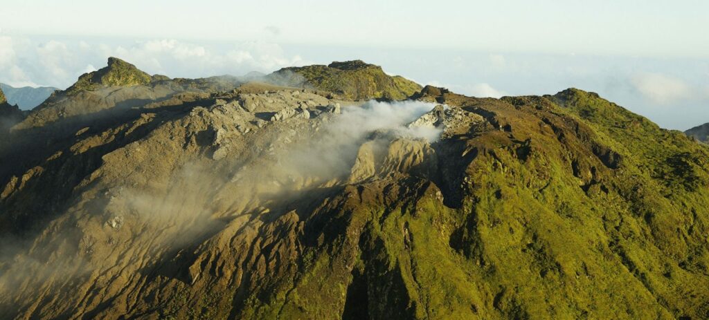
Volcanic activity report / Sequence of earthquakes in the La Soufrière area of Guadeloupe – Basse Terre
A sequence of volcanic earthquakes began on Sunday, December 1, 2024 at 21:30 local time (Monday, December 2, 2024, 01:30 universal time, UT*) in the area of the La Soufrière volcano and ended on Tuesday, December 3, 2024 at 18:00 local time (Tuesday, December 3, 2024, 22:00 universal time, UT*).
During this sequence, the OVSG-IPGP networks recorded 121 earthquakes of very low magnitude (M < 1).
No earthquakes were reported as felt. The events are located at a depth of < 2.5 km below the summit of the La Soufrière dome
The alert level remains: yellow, vigilance.
Source et photo : Direction de l’OVSG-IPGP
* heure locale= TU – 4h00
Mexico , Popocatepetl :
December 9, 11:00 (December 9, 17:00 GMT). Activity in the last 24 hours
24 exhalations were detected, accompanied by water vapor, volcanic gases and ash; In addition, 180 minutes of high-frequency, very low-amplitude tremor segments were recorded.
During the morning and at the time of this report, a continuous emission of water vapor and volcanic gases was observed, with dispersion towards the North – Northeast (NNE).
The Popocatépetl volcanic alert fire is in yellow phase 2.
The scenarios anticipated for this phase are:
A few small to moderate explosions
Occurrence of tremors of varying amplitude
Light to moderate ash rains in the surrounding towns and in some more distant towns
Ejection of incandescent fragments within the 12-kilometer exclusion radius
The occurrence of lahars can be expected to descend into the ravines, due to the accumulation of ash on the slopes and its interaction with the rains expected in the coming weeks.
Possibility of pyroclastic flows not reaching the populations
Source et photo : Cenapred.

