December 07 , 2024.
Iceland : Reykjanes Peninsula :
Land Uplift Resumes in Svartsengi
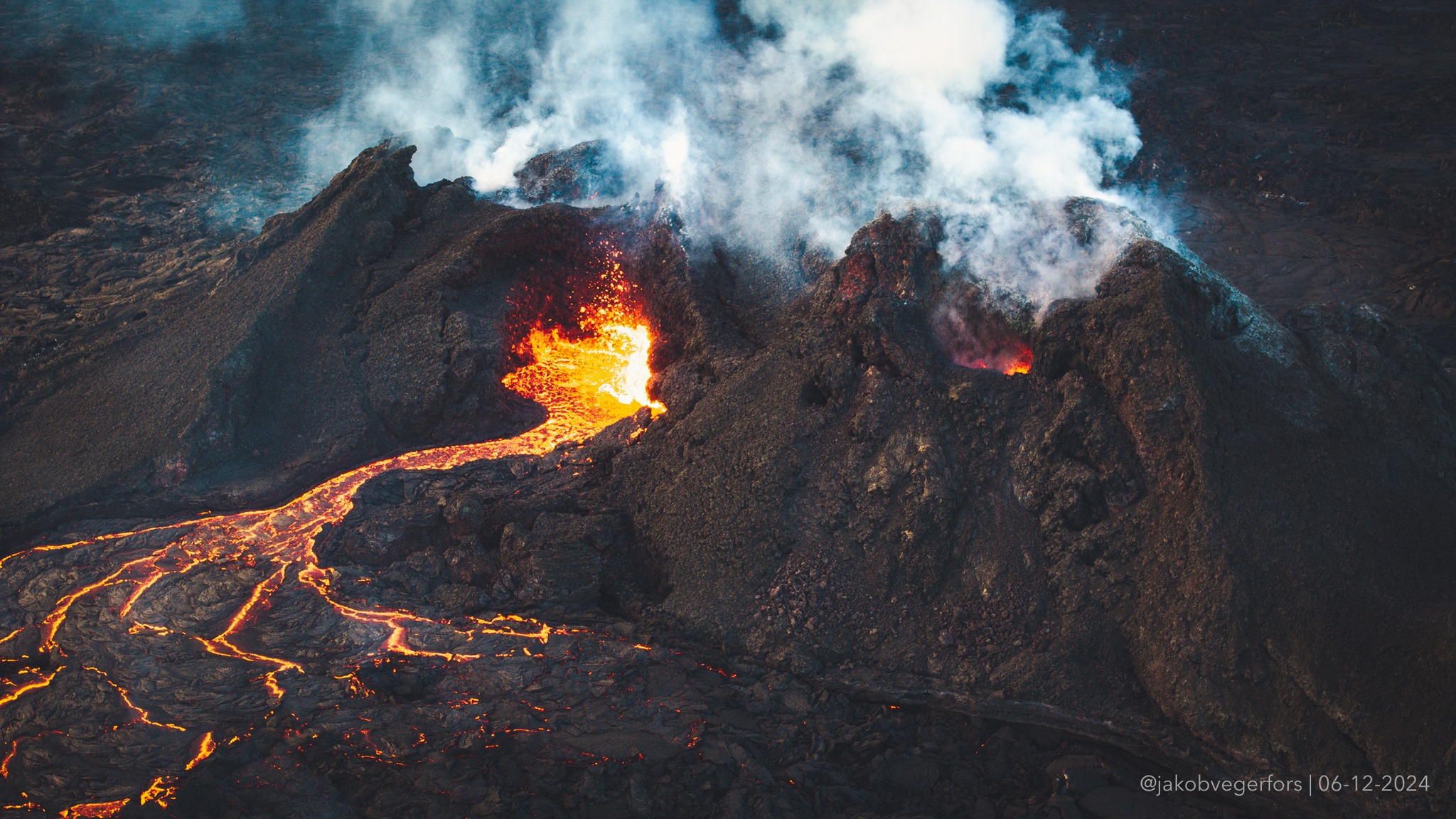
Eruptive activity is gradually decreasing
Updated 6 December at 15:00 UTC
GPS measurements and satellite data confirm that land uplift has resumed at Svartsengi
Gas pollution persists despite decreasing eruptive activity
The hazard assessment remains unchanged
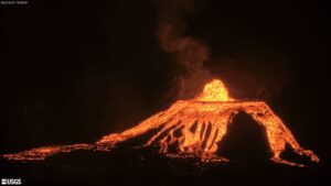
Eruptive activity has been gradually decreasing in recent days. The reduced activity is visible on webcams, and volcanic tremor has been slowly declining over the past few days.
The active lava flow remains within the existing lava field, with little to no noticeable advancement beyond its margins.
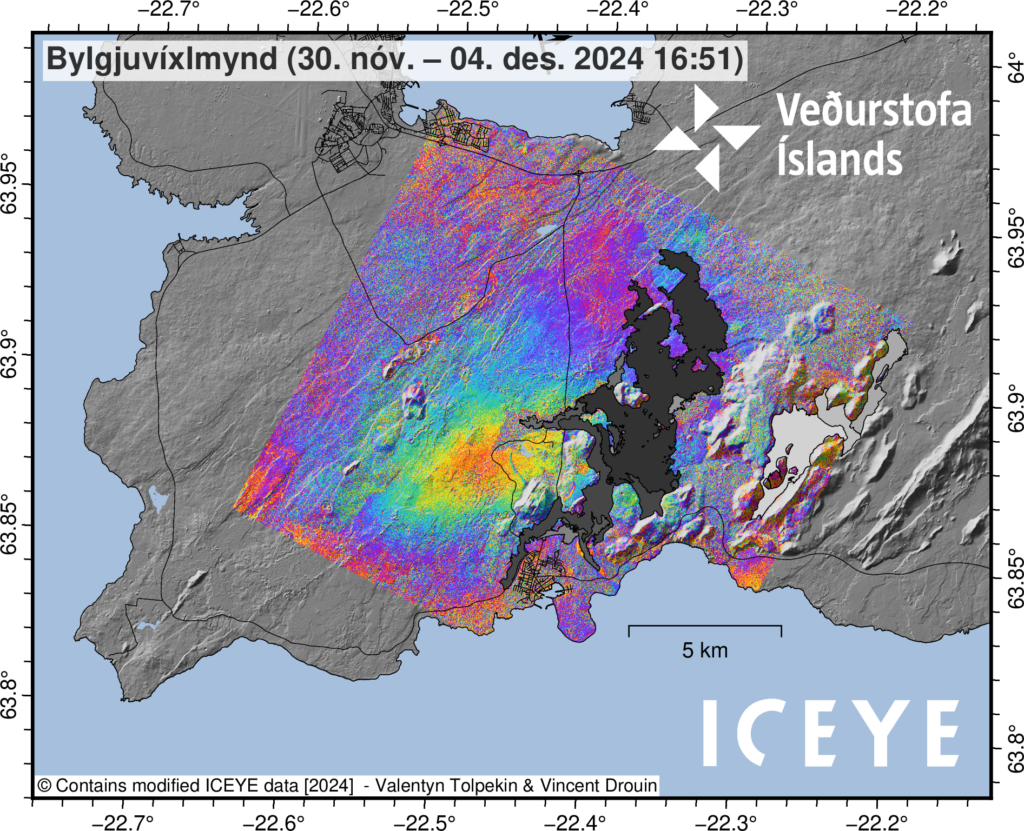
The latest deformation data indicate that land uplift has resumed in Svartsengi. GPS measurements exhibit a gradual upward trend at several stations. The latest satellite images from ICEYE confirm the signals received from GPS instruments.
Image showing LOS (Line of Sight) displacement during the period from November 30 to December 4, 2024. The image is derived from ICEYE satellite data (InSAR). The red area indicates land uplift (~1 cm).
Gas pollution remains a concern despite diminished activity
Despite the reduced volcanic activity, gas pollution persists. The gas dispersion forecast predicts light variable winds today, making significant gas pollution unlikely in the area.
For the weekend, northerly winds are expected on Saturday, shifting to southerly winds on Sunday. Consequently, gas may be detected in Vogur on Sunday.
Source : IMO
Photos : Jakob Vegerfors , 6/12/2024 , IMO.
Indonesia , Dukono :
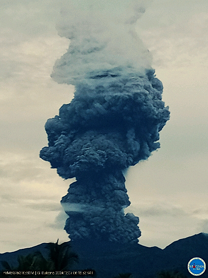
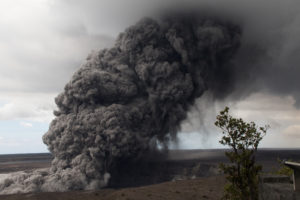
An eruption of Mount Dukono occurred on Saturday, 7 December 2024 at 06:15 WIT with the height of the ash column observed at ±4800 m above the summit (±5887 m above sea level). The ash column was observed to be grey to black in colour with a thick intensity, oriented towards the northwest. At the time of writing, the eruption was still ongoing.
VOLCANO OBSERVATORY NOTICE FOR AVIATION – VONA
Issued : Décember 06 , 2024
Volcano : Dukono (268010)
Current Aviation Colour Code : RED
Previous Aviation Colour Code : orange
Source : Dukono Volcano Observatory
Notice Number : 2024DUK023
Volcano Location : N 01 deg 41 min 35 sec E 127 deg 53 min 38 sec
Area : North Maluku, Indonesia
Summit Elevation : 3478 FT (1087 M)
Volcanic Activity Summary :
Eruption with volcanic ash cloud at 21h15 UTC (06h15 local).
Volcanic Cloud Height :
Best estimate of ash-cloud top is around 18838 FT (5887 M) above sea level or 15360 FT (4800 M) above summit. May be higher than what can be observed clearly. Source of height data: ground observer.
Other Volcanic Cloud Information :
Ash cloud moving to northwest. Volcanic ash is observed to be gray to dark. The intensity of volcanic ash is observed to be thick.
Remarks :
Eruption and ash emission is continuing. Eruption recorded on seismogram with maximum amplitude 34 mm. Tremor recorded on seismogram with maximum amplitude 4 mm.
Source et photo : Magma Indonésie
Indonesia , Merapi :
MOUNT MERAPI ACTIVITY REPORT, November 29 – December 5, 2024, published on December 6, 2024
OBSERVATION RESULT
Visual
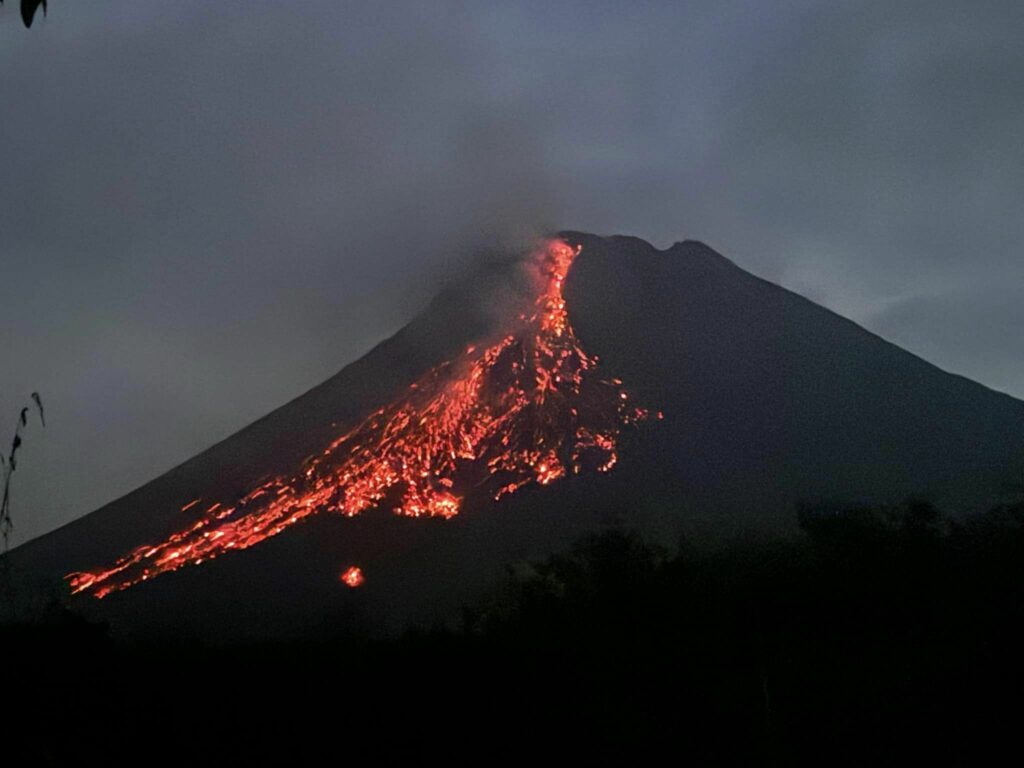
The weather around Mount Merapi is generally clear in the morning and night, while it is foggy from noon to evening. White smoke, thin to thick, low to moderate pressure and 400 m high was observed from the Kaliurang Mount Merapi observation post on December 5, 2024 at 05:30 WIB. This week, a hot cloud avalanche occurred in the southwest (upstream of Kali Krasak) with a sliding distance of 1,400 m. Lava avalanches were observed 84 times in the South-West (upstream of the Bebeng River) up to a maximum of 1,800 m, 8 times upstream of the Krasak River up to a maximum of 1,500 m and 1 time in the West (upstream of the Senowo) up to a maximum of 500 m. The sound of an avalanche was heard once from the Babadan station with low intensity. Changes were observed in the morphology of the South-West dome due to the dome growth activity, lava avalanches and hot cloud avalanches. For the morphology of the middle dome, there is no significant morphological change. Based on the morphological analysis of the Babadan2 camera, the volume of the South-West dome has experienced a measurable growth of 3,272,300 m3. As for the central dome, it is 2,361,800 m3.
Seismicity
This week, the seismicity of Mount Merapi recorded
1 hot cloud avalanche earthquake (WCA),
5 shallow volcanic earthquakes (VTB),
900 times multi-phase earthquakes (MP),
1 low-frequency earthquake (LF),
1,513 avalanche earthquakes (RF),
5 tectonic earthquakes (TT).
The intensity of earthquakes this week is still quite high.
Deformation
The deformation of Mount Merapi monitored by EDM this week shows an average shortening rate of 0.4 cm/day, higher than last week.
Rain and Lahars
This week, there was rain at Mount Merapi observation post with a rainfall intensity of 111 mm/hour for 40 minutes at Kaliurang post on 5 December 2024 and additional flow was reported in the Boyong and Gendol rivers.
Conclusion
Based on the results of visual and instrumental observations, it was concluded that:
Mount Merapi volcanic activity is still quite high in the form of effusive eruptive activity. The activity status is set at the “SIAGA” level.
Source : BPPTKG
Photo : Maud Charlatte( 03/10 /2024)
Chile , Puyehue-Cordon Caulle :
Seismology
95 VT-type seismic events, associated with rock fracturing (Volcano-Tectonic). The most energetic earthquake had a Local Magnitude (ML) value of 3.2, located 4.7 km to the South-Southwest, at a depth of 3.8 km in reference to the 2011 crater.
11 LP-type seismic events, associated with fluid dynamics within the volcanic system (Long Period). The size of the largest earthquake evaluated from the Reduced Displacement (DR) parameter was equal to 3 cm2.
Fluid Geochemistry
No anomalies were reported in sulfur dioxide (SO2) emissions into the atmosphere in the area near the volcanic complex, according to data published by the Tropospheric Monitoring Instrument (TROPOMI) and the Ozone Monitoring Instrument (OMI) Sulphur Dioxide Group.
Thermal anomalies by satellites
According to the analytical processing of Sentinel 2-L2A satellite images, in combination with false-color bands, no abnormal radiance is observed in the volcanic complex. Regarding the processing of Landsat 8-9 images in thermal band, the results obtained do not represent variations attributable to volcanic activity.
Geodesy
Based on the data obtained through the GNSS network, it is observed that the uplift process continues at magnitudes slightly lower than the annual average obtained in recent years, reaching a maximum of 0.78 cm/month.
Surveillance cameras
The images provided by the fixed cameras, installed near the complex, have not recorded degassing columns or variations related to surface activity.
Satellite geomorphological analysis
Thanks to the analysis of Sentinel 2 and Planet Scope Scene satellite images, no morphological changes attributable to volcanic activity are detected.
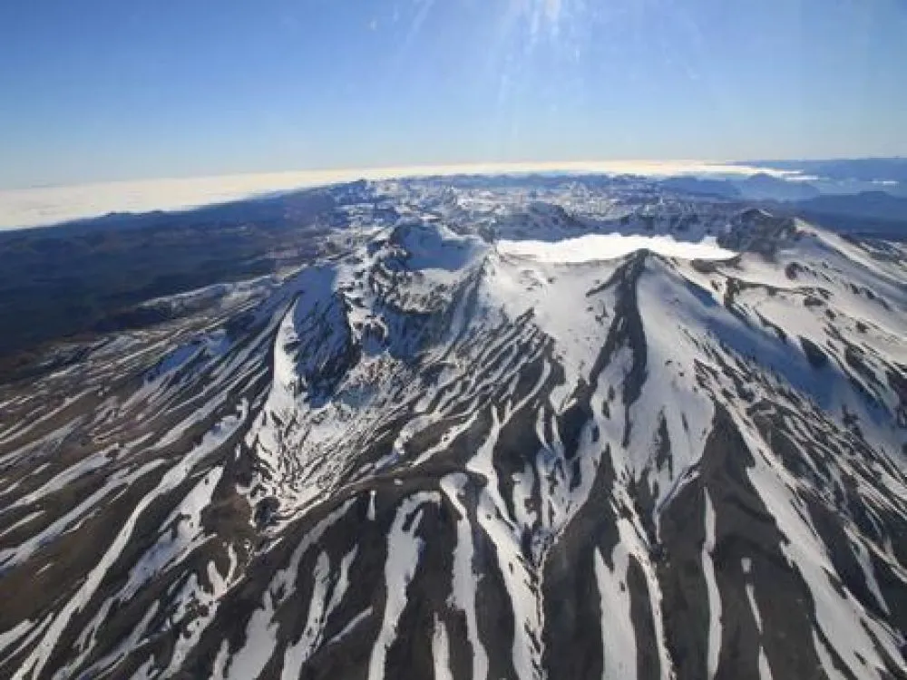
According to the data from the geodetic network, the inflationary deformation process continues with rates similar to those observed in recent months. Seismicity, although it remains low in the records, maintains the sporadic presence of events of notable magnitude, spatially distributed in nearby sources. Other remotely detected surface volcanic features remain absent. Other remotely detected surface volcanic features remain absent.
In conclusion, the continuity in deformation and the presence of seismicity, mean that the volcanic technical alert is maintained at:
YELLOW TECHNICAL ALERT: Changes in the behavior of volcanic activity.
Source et photo : Sernageomin
Italy , Campi Flegrei :
Weekly Bulletin, from 25 November 2024 to 01 December 2024. (Issue date 03 December 2024)
SUMMARY STATUS OF ACTIVITY
In light of the monitoring data, it emerges:
1) SEISMOLOGY: In the week from 25 November to 1 December 2024, in the Campi Flegrei area, 42 earthquakes of magnitude Md≥0.0 (Mdmax=2.2±0.3) were located.
2) DEFORMATIONS: Since the beginning of August, the average value of the lifting speed in the maximum deformation zone is about 10±3 mm/month at the Rione Terra GNSS station (RITE).
3) GEOCHEMISTRY: There are no significant variations in the geochemical parameters monitored in the reference week compared to the already known trends of increasing flow rates and heating of the hydrothermal system. The temperature sensor installed in a fumarole emission 5 meters from the main fumarole of Pisciarelli last week showed an average value of ~97 °C.
CAMPI FLEGREI – UPDATE (06 December 2024 15:33)
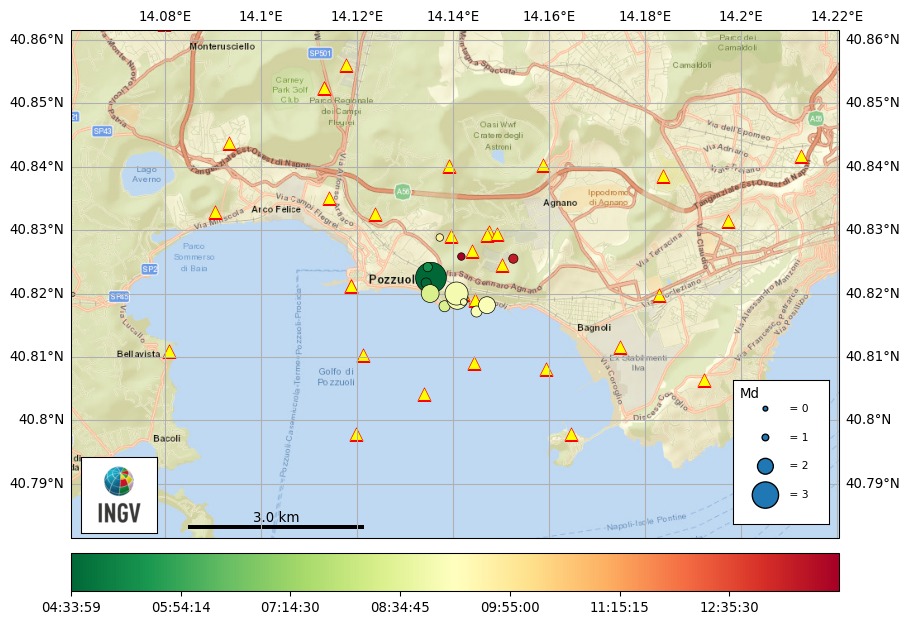
Since 05:33 (local time) on 06 December 2024, a seismic swarm is underway in the Campi Flegrei area. At 15:33, 27 earthquakes with magnitude Md ≥ 0.0 and maximum magnitude Md = 3.4 ± 0.3 have been previously detected.
In the image, the locations of events with magnitude greater than or equal to 1.0.
Updates will follow depending on the evolution of the phenomenon.
CAMPI FLEGREI – END OF THE EARTHQUAKE SWARM (06 December 2024, 18:14)
INGV Osservatorio Vesuviano reports the conclusion of the seismic swarm that began at 05:33 (local time) on 06 December 2024 and consisted preliminary of 26 localized earthquakes of magnitude Md ≥ 0.0 and maximum magnitude Md = 3.4 ± 0.3 in the Campi Flegrei.
The image shows the location of the largest event.
Source et photo : INGV Vulcani

