November 27 , 2024.
Iceland : Reykjanes Peninsula :
The Eruption Continues
The rate of subsidence at Svartsengi has decreased alongside reduced eruptive activity
Updated 26. November at 19:00 UTC
One vent, located east of Stóra-Skógfell, remains active
Lava is generally flowing eastward toward Fagradalsfjall
Eruption tremor has remained stable since yesterday
No uplift can be confirmed despite indications of changes in GNSS measurements
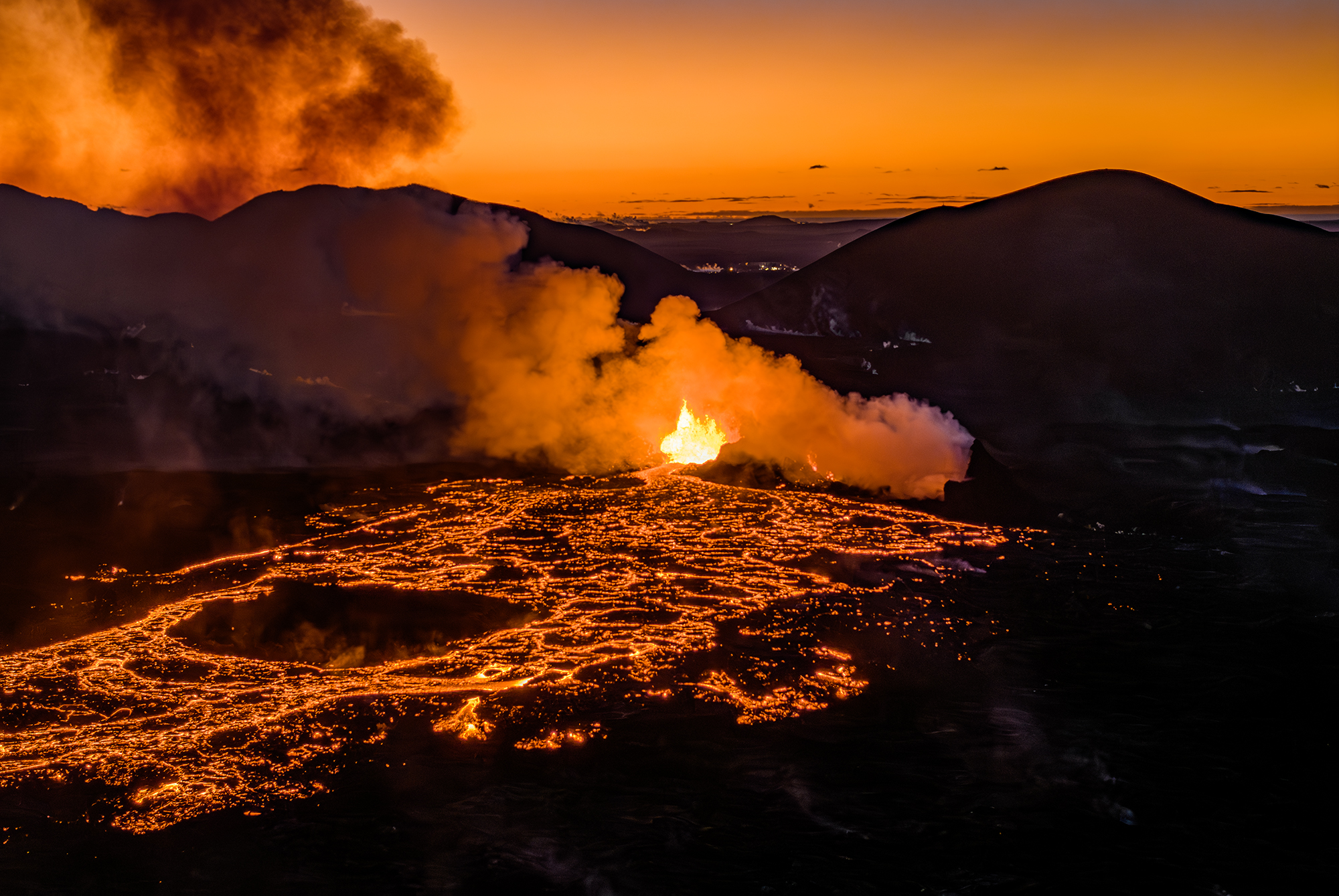
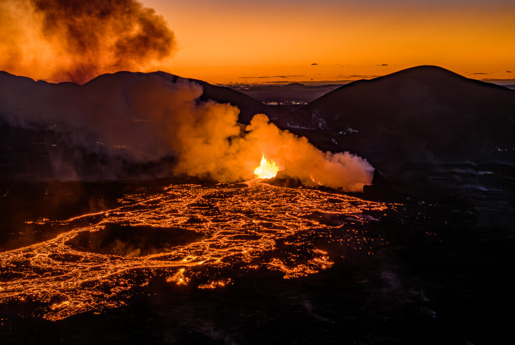
Activity at the eruption site has been relatively stable since yesterday. Eruption tremor has remained consistent since yesterday, in conjunction with steady eruptive activity at the active vent overnight. Currently, activity is confined to the northernmost vent, located directly east of Stóra-Skógfell. The majority of lava from this vent is flowing eastward toward Fagradalsfjall.
It cannot be ruled out that lava may still be flowing beneath the solidified surface of the lava field that extended westward toward Svartsengi, despite no visible movements being observed in that part of the lava field overnight.
As volcanic activity diminishes, subsidence at Svartsengi is also decreasing. However, it cannot be definitively stated whether uplift has resumed, despite the most recent GNSS measurement points indicating changes in that direction. Since daily changes are so small, conclusions cannot be drawn from individual data points; instead, trends over a period of several days must be examined. In the last two eruptions, subsidence decreased gradually for over a week before uplift became measurable again. Therefore, it is likely that up to a week of additional measurements will be required before it can be determined whether uplift and magma accumulation beneath Svartsengi will resume.
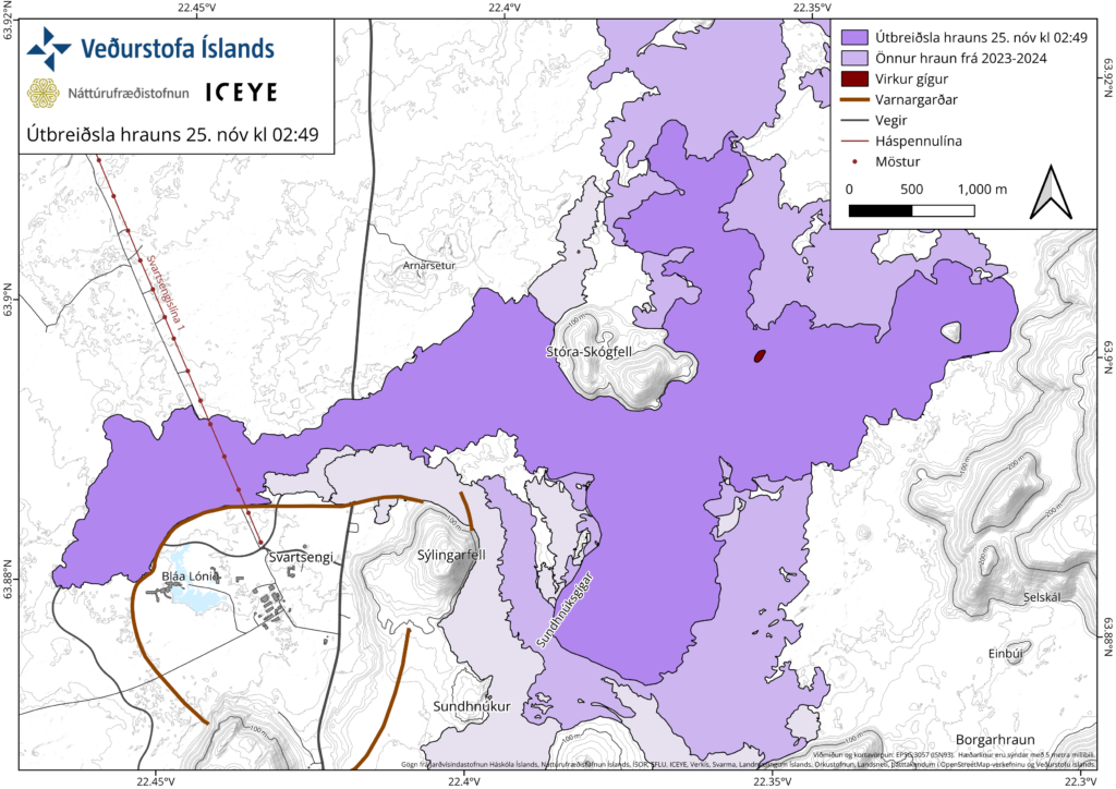
The attached map, based on data from aerial surveys by the Icelandic Institute of Natural History and satellite data from Iceye, shows the extent of the lava field formed during this eruption, as it was at 02:49 yesterday, November 25.
Source : IMO
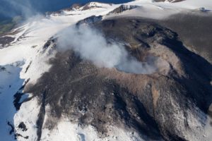
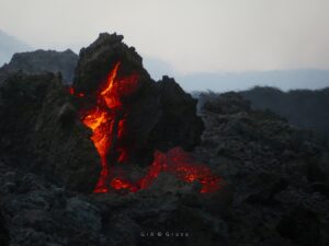
Photos : VF/Ísak Finnbogason , IMO .
Italy , Stromboli :
WEEKLY BULLETIN, from November 18, 2024 to November 24, 2024. (issue date November 26, 2024)
SUMMARY STATUS OF ACTIVITY
In light of the monitoring data, it emerges:
1) VOLCANOLOGICAL OBSERVATIONS: During this period, intense eruptive activity with splashes was observed from the northern area of the crater. The total hourly frequency was oscillating between average values (5-9 events/h). The intensity of the explosions was low in the northern crater area and medium to high in the central-southern area.
2) SEISMOLOGY: The monitored seismological parameters do not show significant variations.
3) GROUND DEFORMATIONS: The island’s ground deformation monitoring networks did not show any significant changes to report for the period under review.
4) GEOCHEMISTRY: SO2 flux at medium level
The CO2 flux from the ground in the STR02 summit area reaches very high values.
C/S ratio in the plume: is at high values.
Helium isotope ratio in the thermal aquifer: there are no updates. Latest data from 24/10/2024 on average values.
CO2 flow at Mofeta in the San Bartolo area: in average values.
CO2 flux at Scari: values around 180 g/m2/day updated on 19/11/2024
5) SATELLITE OBSERVATIONS: The thermal activity observed by satellite in the summit area was generally low level.
VOLCANOLOGICAL OBSERVATIONS
During the observed period, the eruptive activity of Stromboli was characterized through the analysis of images recorded by the INGV-OE surveillance cameras located at an altitude of 190 m (SCT-SCV) and at Punta dei Corvi (SPCT). The explosive activity was mainly produced by 4 (four) eruptive vents located in the North area of the crater and by 3 (three) vents located in the Central South area.
Observations of the explosive activity captured by the surveillance cameras
In the North (N) crater area, four active vents were observed that produced explosive activity of low intensity (less than 80 m in height) and sometimes of medium intensity (less than 150 m in height). Furthermore, a low activity of projections was observed mainly at the vents of the N2 sector. The products emitted in eruption were mainly coarse materials (bombs and lapilli). The average frequency of explosions oscillated between 5 and 9 events/h.
In the Centre-Sud (CS) zone, the explosive activity was produced by at least three chimneys, the explosions varied in intensity from medium (less than 150 m in height) to high (more than 250 m in height) emitting fine materials mixed with coarse materials. The average frequency of explosions was variable and less than 1 event/h.
Source : INGV.
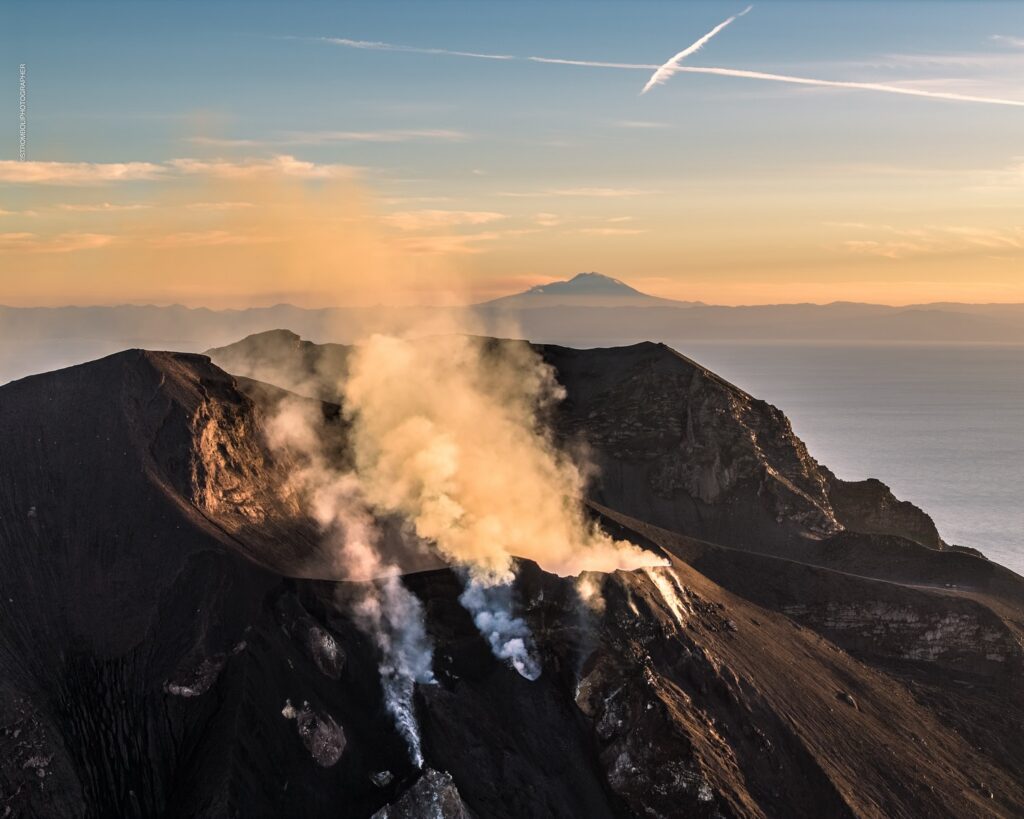
Photo : Stromboli stati d’animo / Sebastiano Cannavo ( 23/11/224, avec l’Etna au fond)
Italy / Sicily , Etna :
WEEKLY BULLETIN, from November 18, 2024 to November 24, 2024. (issue date November 26, 2024)
SUMMARY STATUS OF ACTIVITY
In light of the monitoring data, it emerges:
1) VOLCANOLOGICAL OBSERVATIONS: Degassing activity at the summit craters with slight emission of very diluted ash.
2) SEISMOLOGY: Absence of seismic fracturing activity with Ml>=2.0. Average amplitude of volcanic tremor at a predominantly medium-low level.
3) INFRASOUND: Moderate infrasound activity with sources located in the Northeast crater area.
4) GROUND DEFORMATIONS: Over the past week, ground deformation monitoring networks have not recorded any significant changes.
5) GEOCHEMISTRY: SO2 flux at a medium and increasing level.
The CO2 flux from the soil is at medium values.
The partial pressure of dissolved CO2 in groundwater has values within the seasonal variability.
The helium isotope ratio in peripheral sites is at medium-high values (last updated on 20/11/2024).
6) SATELLITE OBSERVATIONS: The thermal activity observed by satellite in the summit area was generally low.
VOLCANOLOGICAL OBSERVATIONS
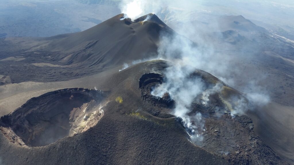
Monitoring of the volcanic activity of Etna was carried out through the analysis of images from the INGV surveillance camera network, Osservatorio Etneo (INGV-OE). During the period analyzed, the observation of the entire summit area, and in particular of the craters, was discontinuous due to the presence of extensive cloud cover.
During the period studied, Etna’s activity was characterized by continuous degassing of varying intensity at the summit craters. In particular, degassing was observed at Bocca Nuova (BN), and at the Northeast Crater (CNE), with a slight emission of ash that is strongly diluted in the plume outside the volcanic area.
Source : INGV.
Photo : Etnair srl
Hawaii , Kilauea :
Tuesday, November 26, 2024, 8:49 AM HST (Tuesday, November 26, 2024, 18:49 UTC)
19°25’16 » N 155°17’13 » W,
Summit Elevation 4091 ft (1247 m)
Current Volcano Alert Level: ADVISORY
Current Aviation Color Code: YELLOW
Activity Summary:
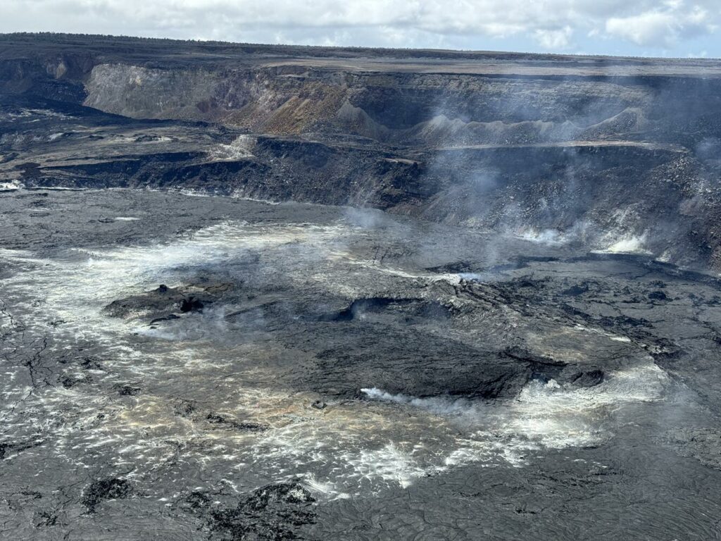
Kīlauea volcano is not erupting. Seismicity at the volcano’s summit, East Rift Zone, and Southwest Rift Zone is low and deformation is steady.
Summit Observations:
Earthquake activity at Kīlauea’s summit region was generally low over the past week, with a slight increase in activity in the South Caldera region beginning around November 23. Overall, there were 124 earthquakes in the summit, all below magnitude-2.1. Summit tiltmeters have remained fairly steady, however a tiltmeter southwest of Kaluapele showed an increase in tilting starting on Saturday, at the same time as the uptick in South Caldera seismicity. The most recent measurement of the sulfur dioxide (SO2) emission rate from the summit was approximately 60 tonnes per day on September 17, a value representative of noneruptive conditions at Kīlauea.
Rift Zone Observations:
Shallow earthquake counts in the upper and middle East Rift Zone (ERZ) were low over the past week. There were 57 located earthquakes in the middle ERZ, all below magnitude-1.7. Extension across the rift has slowed in the past couple weeks, as recorded by GPS instruments, indicating slowed inflation of the rift zone magma body. Rift zone tiltmeters have been steady, showing no significant changes.
Source : HVO
Photo : USGS M. Patrick. (05/2024).
Indonesia , Lewotobi Laki-Laki :
Safety Distance Reduction Recommended for Lewotobi Laki-laki, East Nusa Tenggara on November 26, 2024 at 15:00 WITA.
Mount Lewotobi Laki (Lewotobi Laki) is one of the twin volcanoes located in the southeastern part of the island of Flores, East Nusa Tenggara province. This mountain is 1,584 meters above sea level and is an active stratovolcano.
The visual observations and seismicity of Lewotobi Laki-laki from November 16 to 25, 2024 are as follows:
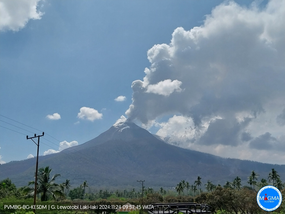
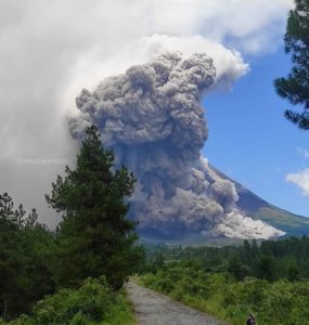
The volcano is clearly visible until it is covered by fog. White and gray smoke is observed from the main crater of medium to thick intensity at a height of about 500-3,000 meters from the summit. The average height of the eruption column is 500-2000 meters from the summit, the eruption ash column is gray in color. Avalanches were observed at a sliding distance of 500-1000 meters from the summit, and the sliding direction was westward.
The seismicity recorded on November 25, 2024 was:
17 eruption earthquakes
12 avalanche earthquakes
178 emission earthquakes
14 harmonic tremors,
9 non-harmonic tremors,
14 low-frequency earthquakes,
1 shallow earthquakes,
10 deep volcanic earthquakes,
1 local tectonic earthquake,
11 distant tectonic earthquakes,
34 continuous tremors with an amplitude of 1.4-47.3 mm, dominant value of 37 mm.
The incidence of eruptions during this period has decreased, but there are still moderate to strong emissions accompanied by thunderous noises.
The height of the eruptive column of Lewotobi Laki-laki has also decreased to an average of 500 to 2,000 meters from the summit of the peak, whereas it previously reached an average of 1,000 to 3,000 meters.
Deep volcanic and shallow volcanic earthquakes are still recorded, but their number has slightly decreased compared to the previous period, indicating that there is currently still a reserve of magma from the depths to the shallower surface.
Lava flows are still occurring with a stable slip distance of 3.8 km in the West-Northwest direction and about 2 km in the Northeast direction, however, this increase in distance still has the potential to occur given the still high slope inclination and the lava temperature.
The number of local and distant tectonic earthquakes has decreased compared to the previous period. Local tectonic earthquakes around Lewotobi Laki-laki are an indicator of activity. Therefore, we should be vigilant for a sudden increase in the number of local tectonic events that will affect the height of the eruption or the current activity.
Currently, eruption materials have been deposited around the slopes of Lewotobi Laki-laki and could potentially turn into lahars in the event of heavy rains.
The results of visual and seismic monitoring show that volcanic activity is still relatively high, although there is a decreasing trend compared to the previous period. Eruption events can still occur, but with less intensity than during this period.
Based on the results of visual and instrumental monitoring, the volcanic activity of Lewotobi Laki-laki is still at Level IV (AWAS), with the following recommended changes:
Communities around the volcano and visitors/tourists do not carry out any activities within a radius of 7 km around the eruption center of Lewotobi Laki-laki.
The public should follow the guidelines of the regional government and not believe in rumors whose source is unclear.
Communities around Lewotobi Laki-laki are wary of the risk of lahar flooding in the rivers that originate at the top of Lewotobi Laki-laki during heavy rainfall, especially in the areas of Dulipali, Padang Pasir, Nobo, Klatanlo, Hokengjaya, Boru, Nawakote.
Source : PVMBG
Photo : Magma Indonésie.

