November 20 , 2024.
Italy , Stromboli :
WEEKLY BULLETIN, from November 11, 2024 to November 17, 2024. (issue date November 19, 2024)
SUMMARY STATUS OF ACTIVITY
In light of the monitoring data, it emerges:
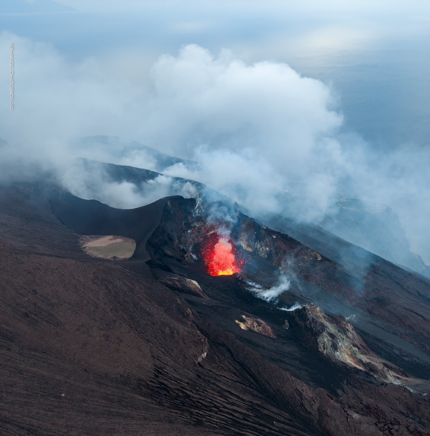
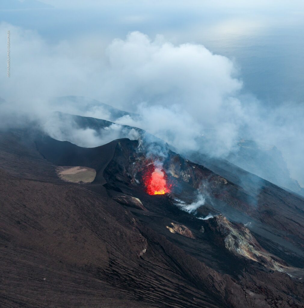
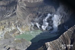
1) VOLCANOLOGICAL OBSERVATIONS: During the period in question, intense eruptive activity was observed with splashes, sometimes intense, from the northern area of the crater. The total hourly frequency of explosions fluctuated around average values (6-12 events/hour). The intensity of the explosions was low in the northern crater area and medium to high in the central-southern area.
2) SEISMOLOGY: The monitored seismological parameters do not show significant variations.
3) GROUND DEFORMATIONS: The ground deformation monitoring networks do not show significant variations.
4) GEOCHEMISTRY: SO2 flux at medium level with high values on 7 and 11 November.
Soil CO2 flux in the summit area STR02 on high values.
C/S ratio in the plume: is at very high values.
Helium isotope ratio in the thermal aquifer: there are no updates. Latest data from 24/10/2024 on average values
CO2 flux at Mofeta in the San Bartolo area: medium-high values.
CO2 flux at Scari: values around 190 g/m2/day.
5) SATELLITE OBSERVATIONS: The thermal activity observed by satellite in the summit area was generally low level.
VOLCANOLOGICAL OBSERVATIONS
During the observation period, the eruptive activity of Stromboli was characterized through the analysis of images recorded by the INGV-OE surveillance cameras located at an altitude of 190 m (SCT-SCV) and at Punta dei Corvi (SPCT). The explosive activity was mainly produced by four eruptive vents located in the North Crater area (ZONE N) and by three vents located in the Centre-South Crater area (ZONE CS).
Observations of the explosive activity captured by the surveillance cameras
In correspondence with the North Crater area, four active vents were observed that produced explosive activity of low intensity (the eruption products reached a height of less than 80 m) and sometimes of medium intensity (height of the products between 80 and 150 m). In addition, splashes were observed, sometimes intense on 12, 13 and 16 November. The products emitted during the eruption were mainly coarse materials (bombs and lapilli). The average frequency of explosions ranged from 6 to 11 events/hour.
In the Centre-South area, explosive activity was produced by at least three vents; the explosions varied in intensity from medium (less than 150 m high) to high (more than 250 m high) with emission of fine materials mixed with coarse materials. The average frequency of explosions varied between 1 and 2 events/hour
Source : INGV.
Photo : Stromboli stati d’animo / Sebastiano Cannavo
Italy / Sicily , Etna :
WEEKLY BULLETIN, from November 11, 2024 to November 17, 2024. (issue date November 19, 2024)
SUMMARY STATUS OF ACTIVITY
In light of the monitoring data, it emerges:
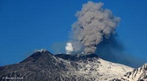
1) VOLCANOLOGICAL OBSERVATIONS: Degassing activity at the summit craters.
2) SEISMOLOGY: Absence of seismic activity due to fracturing with Ml>=2.0; the tremor amplitude remained at the average level.
3) INFRASOUND: Low infrasound activity.
4) GROUND DEFORMATIONS: There are no significant variations in the signals from the deformation monitoring networks.
5) GEOCHEMISTRY: SO2 flux at an average and increasing level.
The soil CO2 flux is at average-high values.
The partial pressure of dissolved CO2 in groundwater has values within seasonal variability.
The helium isotope ratio in peripheral sites is at medium-high values (last updated on 29/10/2024).
6) SATELLITE OBSERVATIONS: The thermal activity observed by satellite in the summit area was generally low.
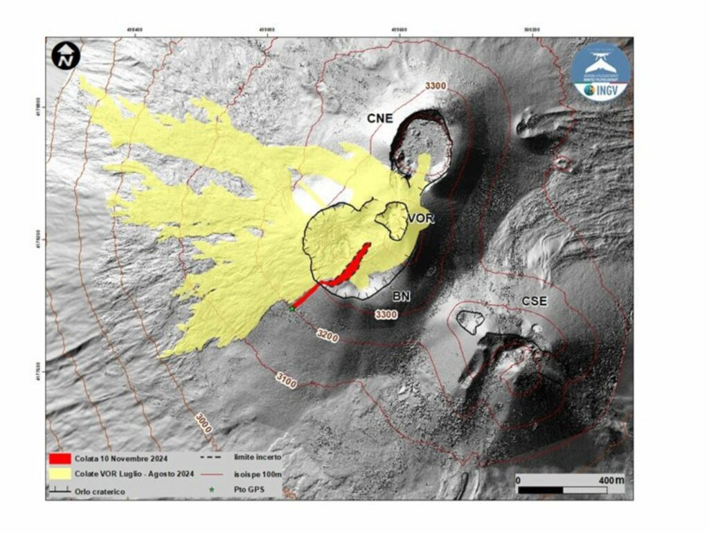
Map of the November 10 lava flow superimposed on a shaded terrain model obtained from the processing of images acquired by drone on September 12, 2024, for the BN, VOR and CNE craters, and on July 31, 2024 for the CSE. The ellisoidal contour lines are plotted every 100, CSE = Southeast crater, CNE = Northeast crater VOR = Voragine, BN = Bocca Nuova
VOLCANOLOGICAL OBSERVATIONS
Monitoring of the volcanic activity of Etna was carried out thanks to the analysis of images from the INGV surveillance camera network, Osservatorio Etneo (INGV-OE) and an inspection carried out on November 14 by INGV staff in the summit area. During the period analyzed, the observation of the entire summit area, and in particular of the craters, was inconsistent due to the presence of extensive cloud cover.
During the period studied, Etna’s activity was characterized by continuous degassing of varying intensity at the summit craters.
In particular, degassing was observed at the eastern vent of the Southeast Crater (CSE), and at the Northeast Crater (CNE). After the paroxysmal activity of 10 November 2024, widespread degassing is also present at the Bocca Nuova Crater (BN).
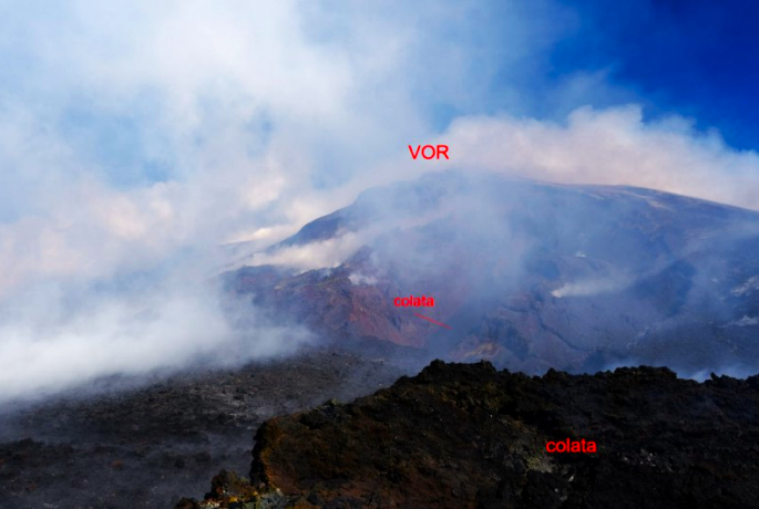
Summit area taken on 14 November 2024 from the southern edge of the Bocca Nuova (BN). In the background the Voragine crater. The intra-crater flow formed on 14 November 2024 is indicated.
On 14 November, INGV staff went to inspect the summit craters and made fundamental observations to reconstruct the phenomena that occurred on 10 November. On that day, from about 09:40 UTC to about 18:00 UTC, the geophysical signals showed variations consistent with the development of a lava fountain activity (see Etna Weekly Bulletin No. 46/2024 of 12/11/2024) that was not observed due to very unfavourable weather conditions.
Despite the harsh environmental conditions due to the strong wind and the intense degassing propagated from the ground, the observations made allowed to establish that the lava fountain was generated by the Voragine Crater (VOR). During the phenomenon, a modest-sized intra-crater flow occurred that formed a lava overflow from the southwest edge of the crater rim.
The flow map (Fig. ) was developed using ground observations and SkySat satellite images from 16 November and Sentinel 2 from 14 November. The limits of the intracrater flow are approximate because the data were affected by the presence of widespread degassing. In addition, the small lava overflow was well observed: from the edge of the Bocca Nuova, the flow advanced in a southwest direction for just under 160 m, reaching an altitude of 3,200 m and overlapping the lava field formed during the Voragine activity of July-August 2024. The flow has a total length of about 470 m.
The material present within the Bocca Nuova is highly disorganized and fractured; there is intense and widespread degassing, even if there are some points where the gas emission is concentrated.
Source : INGV.
Photos : INGV , Guide Etna Nord – Compagnia Guide Etna ( 3/11/2024 )
Indonesia , Lewotobi Laki-laki :
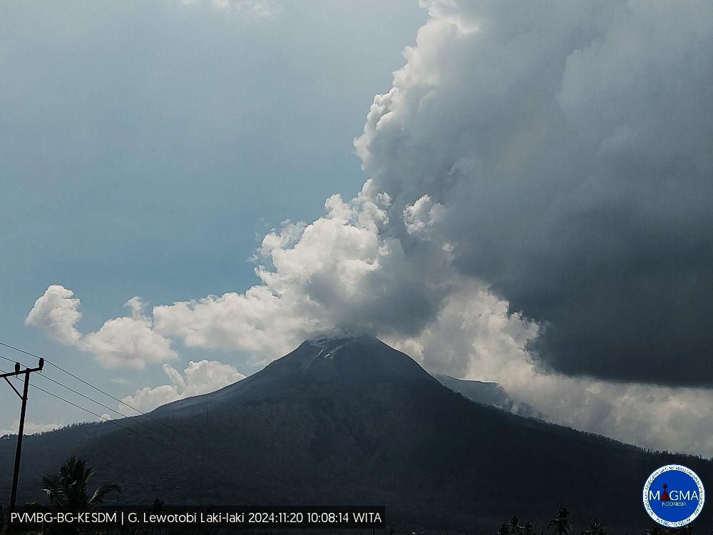
An eruption of Lewotobi Laki-laki occurred on Wednesday, 20 November 2024 at 10:05 WITA with the height of the ash column observed at ±1,500 m above the summit (±3,084 m above sea level). The ash column was grey in colour with moderate to thick intensity, oriented southwest and northwest. At the time of writing, the eruption was still ongoing.
VOLCANO OBSERVATORY NOTICE FOR AVIATION – VONA
Issued : November 20 , 2024
Volcano : Lewotobi Laki-laki (264180)
Current Aviation Colour Code : ORANGE
Previous Aviation Colour Code : orange
Source : Lewotobi Laki-laki Volcano Observatory
Notice Number : 2024LWK798
Volcano Location : S 08 deg 32 min 20 sec E 122 deg 46 min 06 sec
Area : East Nusa Tenggara, Indonesia
Summit Elevation : 5069 FT (1584 M)
Volcanic Activity Summary :
Eruption with volcanic ash cloud at 02h05 UTC (10h05 local).
Volcanic Cloud Height :
Best estimate of ash-cloud top is around 9869 FT (3084 M) above sea level or 4800 FT (1500 M) above summit. May be higher than what can be observed clearly. Source of height data: ground observer.
Other Volcanic Cloud Information :
Ash cloud moving from southwest to northwest. Volcanic ash is observed to be gray. The intensity of volcanic ash is observed from medium to thick.
Remarks :
Eruption recorded on seismogram with maximum amplitude 42.18 mm and maximum duration 45 second. Tremor recorded on seismogram with maximum amplitude 29.6 mm.
Source et photo : Magma Indonésie.
Colombia , Galeras :
San Juan de Pasto, November 19, 2024, 2:40 p.m.
Regarding the monitoring of the activity of the Galeras volcano, the Colombian Geological Survey (SGC), an entity attached to the Ministry of Mines and Energy, reports that:
During the week of November 12 to 18, 2024, the activity of the volcano maintained a stable behavior. Compared to the previous week, the main variations in the monitored parameters were:
• A decrease was recorded in the occurrence and in the seismic energy released.
• The seismicity associated with the fracture of the material inside the volcano continues to dominate, both in terms of occurrence and energy level.
• The fracture seismicity was located mainly in the vicinity of the main crater, at distances less than 1 km, with depths less than 3 km from the summit (4200 m) and with magnitudes less than 1.0. The rest of the earthquakes were located scattered throughout the volcanic region at distances of up to 14 km, with depths of up to 12 km from the summit (4,200 m) and with a maximum magnitude of 0.9.
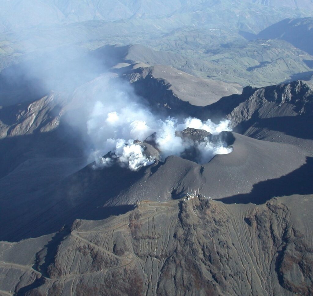
• Gas emissions were observed from the fumarole fields of Las Chavas to the West and El Paisita to the North of the active cone, with white columns, low height and variable dispersion due to wind action.
• The other volcanic monitoring parameters showed stability.
Based on the above, the SGC recommends closely monitoring the evolution through the weekly bulletins and other information published through our official channels, as well as the instructions of local and departmental authorities and the National Disaster Risk Management Unit (UNGRD).
Volcanic activity remains in yellow alert status: active volcano with changes in the behavior of the base level of the monitored parameters and other manifestations.
Source : SGC
Photo : SGC (10/2024)
Ecuador , El Reventador :
DAILY STATUS REPORT OF THE REVENTADOR VOLCANO, Tuesday, November 19, 2024.
Information Geophysical Institute – EPN.
Surface Activity Level: High, Surface Trend: No Change
Internal Activity Level: Moderate, Internal Trend: No Change
From November 18, 2024, 11:00 a.m. to November 19, 2024, 11:00 a.m.:
Seismicity:
The count of seismic events recorded at the station is detailed below.
Explosion (EXP) 81
Long Period (LP) 10
Emission Tremor (TREMI) 8
Harmonic Tremor (TRARM) 3
Rainfall / Lahars:
No rain has been recorded in the volcano area. **Heavy rains could remobilize the accumulated materials, generating mud and debris flows that would descend the sides of the volcano and flow into adjacent rivers**.
Emissions / Ash Column:
Since yesterday afternoon, thanks to the network of surveillance cameras, several emissions of gas and ash have been recorded with heights between 300 and 800 meters above the level of the crater, in the West and Southwest directions. Regarding these emissions, the Washington VAAC has published three emission reports with heights of 400 and 700 meters above the level of the crater, in the West and Southwest directions.
Other monitoring parameter:
The FIRMS satellite system recorded 11 thermal anomalies and the MIROVA-VIIRS satellite system recorded 1 thermal anomaly, during the last 24 hours.
Observation:
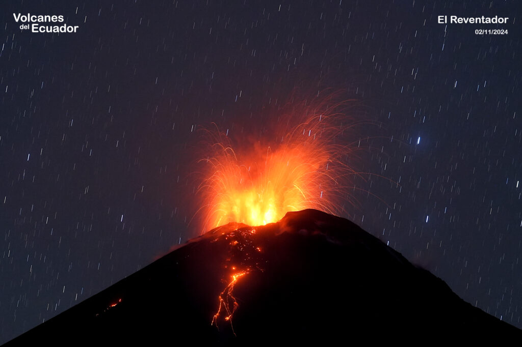
During the night of yesterday and early today, several episodes of incandescent material descending on the flanks of the volcano were observed up to 800 meters below the crater level.
At the end of this report, the volcano remains partly cloudy.
Alert level: Orange
Source : IGEPN
Photo : 02/11/2024 04:29, Benjamin Bernard / volcanesdelecuador

