November 07 , 2024.
Indonesia , Lewotobi Laki-laki :
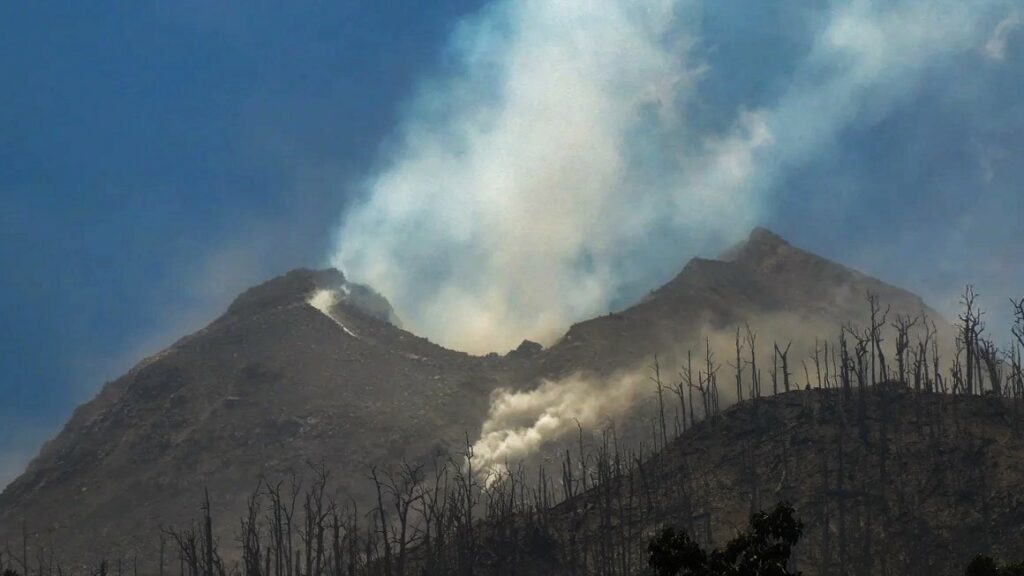
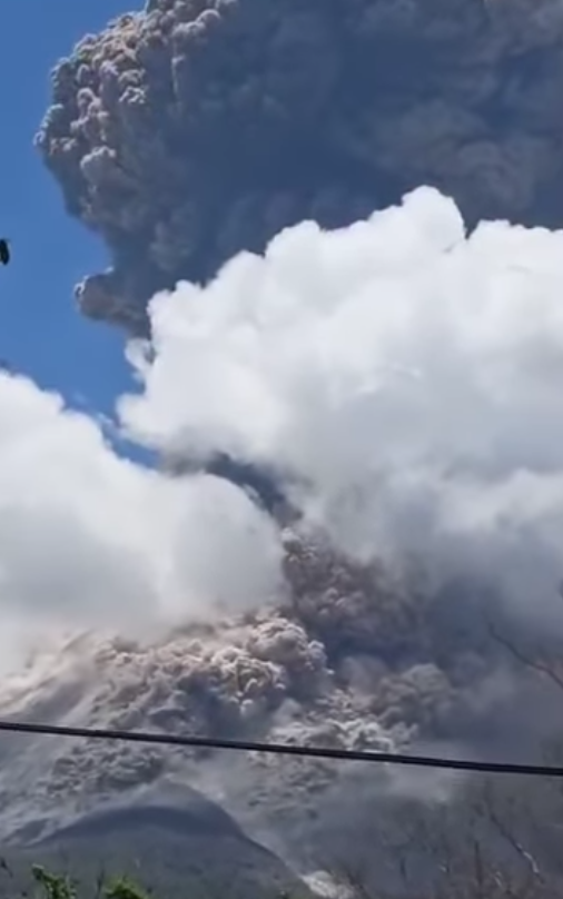
The Pusat Vulkanologi dan Mitigasi Bencana Geologi (PVMBG) reported that eruptive activity intensified at Lewotobi Laki-laki during 30 October-5 November, which included a major eruption resulting in fatalities. The large explosive eruption began at 23h57 on 3 November, generating pyroclastic flows that traveled down the flanks in all directions, ejecting ballistic projectiles, and forming a large vent within the summit crater. Seismic data indicated that the explosion lasted about 24 minutes, until 00h21 on 4 November. Darkness prevented direct ash plume observations, but the Darwin VAAC issued an aviation advisory for ash to 12 km altitude (10.3 km above the summit) based on infrared data from the HIMAWARI-9 satellite. Within 3 minutes of the eruption onset, at 00h00 on 4 November, the Alert Level was raised to Level 4 (the highest on a four-level scale), the Aviation Color Code was elevated from Orange to Red (the highest on a four-color scale), and the hazard exclusion zone was expanded to a 7-km radius around both the Laki-laki and Perempuan craters.
The BNPB Operations Control Center (Pusdalops) reported at 07h45 on 5 November that nine people had died as a result of the eruption, another person was in critical condition, and 63 has serious or minor injuries. At least six of those who died came from Klatanlo Village, 3 km NW of the summit. As many as 10,295 people, or 2,734 families, were evacuated to unaffected areas 15-20 km from the volcano. Many areas were covered in ash, incandescent ejecta started fires in residential areas, and homes were damaged within a 7-km radius. There were six villages affected in Wulanggitang District (Pululera, Nawokote, Hokeng Jaya, Klatanlo, Boru, and Boru Kedang), four villages in the Ile Bura District (Dulipali, Nobo, Nurabelen, and Riang Rita), and four villages in the Titehena District (Konga, Kobasoma, Bokang Wolomatang, and Watowara). Multiple impact craters from ballistic ejecta were discovered, with the furthest reported at 7 km; one at an unreported location measured approximately 13 m wide and 3 m deep.
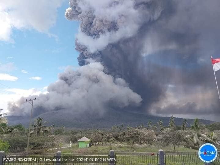
An eruption of Lewotobi Laki-laki occurred on Thursday, 7 November 2024 at 10:48 WITA with the height of the ash column observed at ±5000 m above the summit (±6584 m above sea level). The ash column was observed to be brown with thick intensity, oriented towards the southwest, west and northwest. At the time of writing, the eruption was still ongoing.
Ash from the eruptions disrupted airspace navigation around Fransiskus Xaverius Seda Airport, Soa Airport, Haji Hasan Aroeboesman Airport, Frans Sales Lega Airport, Komodo International Airport, Gewayantana Airport, Wunopito Airport, and Kabir Airport, which led to the cancellation of several flights. By 16h00 on 4 November, all airports resumed flights, except for Komodo International Airport, which remained closed until 06h30 on 5 November.
Explosions continued on 4 November, with five events producing ash plumes that reached at least 300 m above the summit and incandescent material visible in nighttime webcam images. A total of three explosions were recorded on 5 November, which produced ash plumes that rose to 1 km above the summit.
.
Prior to the major 3-4 November events, eight explosions recorded during 30-31 October produced ash plumes that reached approximately 1 km above the summit. On 1 November, PVMBG reported a significant increase in the number of deep volcanic earthquakes, and another eight explosions generated ash plumes that reached approximately 2 km above the summit. Explosive activity continued to increase, with Strombolian explosions at 02h50 and 04h20 generating eruption columns that reached 1.5-2 km above the summit; lightning was observed within the eruption columns. No explosions were recorded between 23h59 on 1 November and 23h57 on 3 November, although seismicity remained elevated.
Sources : Pusat Vulkanologi dan Mitigasi Bencana Geologi (PVMBG, also known as CVGHM), Antara News, Darwin Volcanic Ash Advisory Centre (VAAC), Badan Nacional Penanggulangan Bencana (BNPB), Radio Republik Indonesia , GVP.
Photos : Getty via FB , Magma Indonésia , Wulkany swiata /FB.
Hawaii , Lōʻihi Seamount ( Kamaehuakanaloa ) :
HVO reported that Kamaehuakanaloa volcano (formerly Loihi Seamount), located offshore SE of the Island of Hawaii, began a period of heightened seismic unrest at around 18h00 on 1 November. A swarm of more than 70 earthquakes occurred, with 32 events being greater than M 2.0 and two events greater than M 4.0. The largest earthquake, a M 4.3 event, occurred at 12h05 on 2 November at a depth of 5.8 km (3.6 miles) below sea level and 4.8 km (3.0 miles) below the summit. There was only one report of someone feeling the earthquake. Seismic activity slightly declined later that day around midnight, though it remains above background levels as of 2 November. The Alert Level remained at Unassigned and the Aviation Color Code remained Unassigned as well.
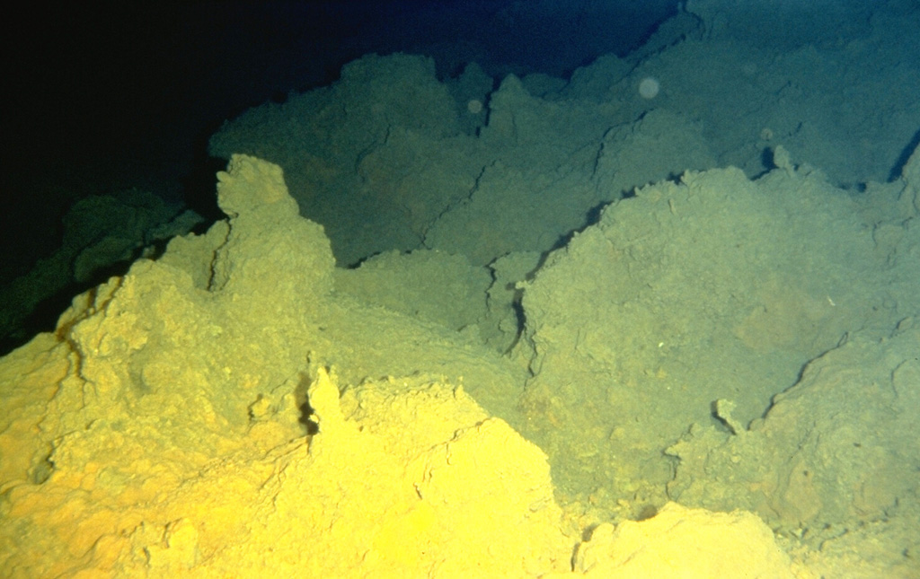
Sulfur deposited from fumarolic vents coats lava flows on Lōʻihi seamount. Lōʻihi, the youngest Hawaiian volcano, rises to within 975 m of the sea surface 35 km off the SE coast of the island of Hawaii. Two rift zones, oriented N-S, give the volcano an elongated form, and prompted its name, which is the Hawaiian word for « long. » Fresh, sediment-free lava flows indicate the young age of the submarine volcano, and seismic swarms related to intrusive or eruptive activity have been recorded frequently.
The Kama’ehuakanaloa seamount, previously known as Lōʻihi, lies about 35 km off the SE coast of the island of Hawaii. This youngest volcano of the Hawaiian chain has an elongated morphology dominated by two curving rift zones extending north and south of the summit. The summit region contains a caldera about 3 x 4 km and exhibits numerous lava cones, the highest of which is about 975 m below the ocean surface. The summit platform also includes two well-defined pit craters, sediment-free glassy lava, and low-temperature hydrothermal venting. An arcuate chain of small cones on the western edge of the summit extends north and south of the pit craters and merges into the crests prominent rift zones. Seismicity indicates a magmatic system distinct from that of Kīlauea. During 1996 a new pit crater formed at the summit, and lava flows were erupted. Continued volcanism is expected to eventually build a new island; time estimates for the summit to reach the ocean surface range from roughly 10,000 to 100,000 years.
Sources: US Geological Survey Hawaiian Volcano Observatory (HVO) , GVP.
Photo: Hawaii Undersea Research Laboratory (University of Hawaii).
Italy , Stromboli :
Statement on the activity of Stromboli, 06 November 2024, 19:26 (18:26 UTC) .
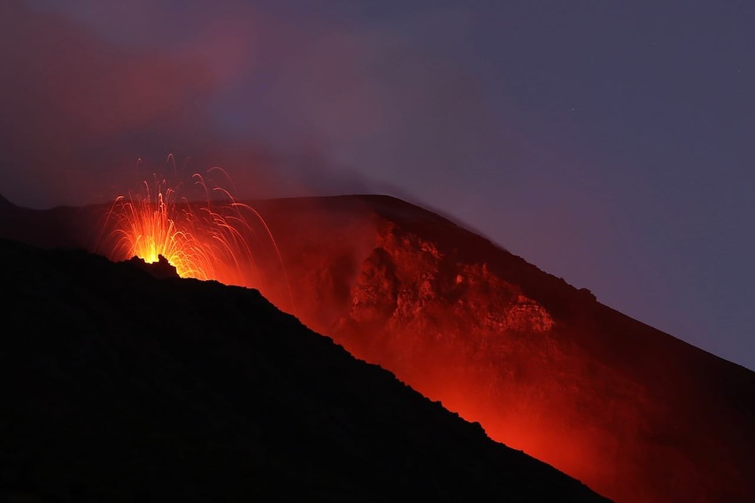
The National Institute of Geophysics and Volcanology, Osservatorio Etneo, reports that starting from 17:55 UTC, following an increase in the activity of projections from the area of the North crater, Following an increase in the activity of crackling coming from the area of the North crater, we observe the progressive formation of a lava overflow that causes the rolling of blocks and lava along the Sciara del Fuoco and up to the coast. The lava flow front is currently located in the upper part of the Sciara del Fuoco.
From a seismic perspective, starting at approximately 16:45 UTC, a rapid increase in the tremor amplitude was observed, moving from the mid-level to the high-level, where it is still maintained. No significant changes were reported in the frequency of occurrence and amplitude of explosion earthquakes.
Signals from GNSS and tilt-sensing networks do not show significant variations.
Further updates will be provided shortly.
Source : INGV
Photo : Thomas Bretscher via Stromboli stati d’animo.
Papua New Guinea , Rabaul :
The Rabaul Volcano Observatory reported that activity at Rabaul Caldera remained at background levels during 1-31 October. Fumarolic activity produced thin, white emissions from small fumaroles on the crater floor and inner walls. Seismicity included 11 high-frequency volcano-tectonic (VT) earthquakes, with nine located at depths of 1-9 km, primarily near the Vulcan and Tavurvur vents. Deformation monitoring revealed ongoing inflation since January 2024, with a cumulative vertical displacement of about 7 cm. Temperature measurements of two hotspots within the crater remained below 50 degrees Celsius, which is consistent with background levels. The Alert Level remained at Stage 1 (the first level on a four-level scale).
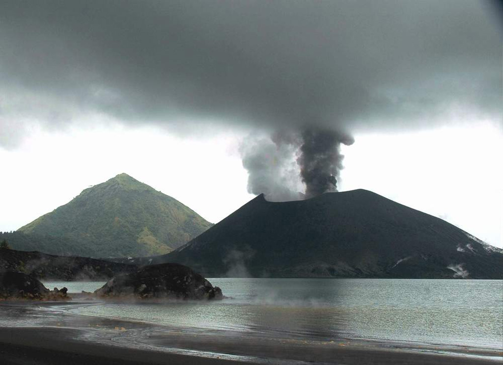
Tavurvur cone at Rabaul is seen in eruption in this 25 May 2005 view looking from the NW across Matupit Harbor. Two plumes, one white and the other dark gray, are originating from separate vents. Intermittent small-to-moderate explosive eruptions took place throughout much of the year. The conical peak in the background is Turanguna.
The low-lying Rabaul caldera on the tip of the Gazelle Peninsula at the NE end of New Britain forms a broad sheltered harbor utilized by what was the island’s largest city prior to a major eruption in 1994. The outer flanks of the asymmetrical shield volcano are formed by thick pyroclastic-flow deposits. The 8 x 14 km caldera is widely breached on the east, where its floor is flooded by Blanche Bay and was formed about 1,400 years ago. An earlier caldera-forming eruption about 7,100 years ago is thought to have originated from Tavui caldera, offshore to the north. Three small stratovolcanoes lie outside the N and NE caldera rims. Post-caldera eruptions built basaltic-to-dacitic pyroclastic cones on the caldera floor near the NE and W caldera walls. Several of these, including Vulcan cone, which was formed during a large eruption in 1878, have produced major explosive activity during historical time. A powerful explosive eruption in 1994 occurred simultaneously from Vulcan and Tavurvur volcanoes and forced the temporary abandonment of Rabaul city.
Sources : Rabaul Volcano Observatory (RVO) , GVP.
Photo: Roy Price, 2005 (Université de Floride du Sud).
Japan , Suwanosejima :
The Japan Meteorological Agency (JMA) reported that eruptive activity at Suwanosejima’s Ontake Crater continued during 28 October-4 November. Discrete eruption events were recorded at 00h45, 07h12, 14h48, and 16h58 on 29 October. Eruptions on 29 October produced ash plumes that reached 1-1.6 km above the crater rim. One explosive event, captured by infrasound monitoring equipment at 16h06 on 2 November, produced white emissions that reached 300 m above the crater rim and drifted SE. A continuous eruption from 12h30 until about 22h04 on 4 November produced ash emissions to at least 1.2 km above the crater rim; the plume drifted SE. Tremor accompanied the eruption events and ashfall was reported by the Suwanosejima Branch of the Toshima Village Office (3.5 km SSW). The Alert Level remained at 2 (the second level on a five-level scale) and the public was warned to stay at least 1.5 km away from the crater.
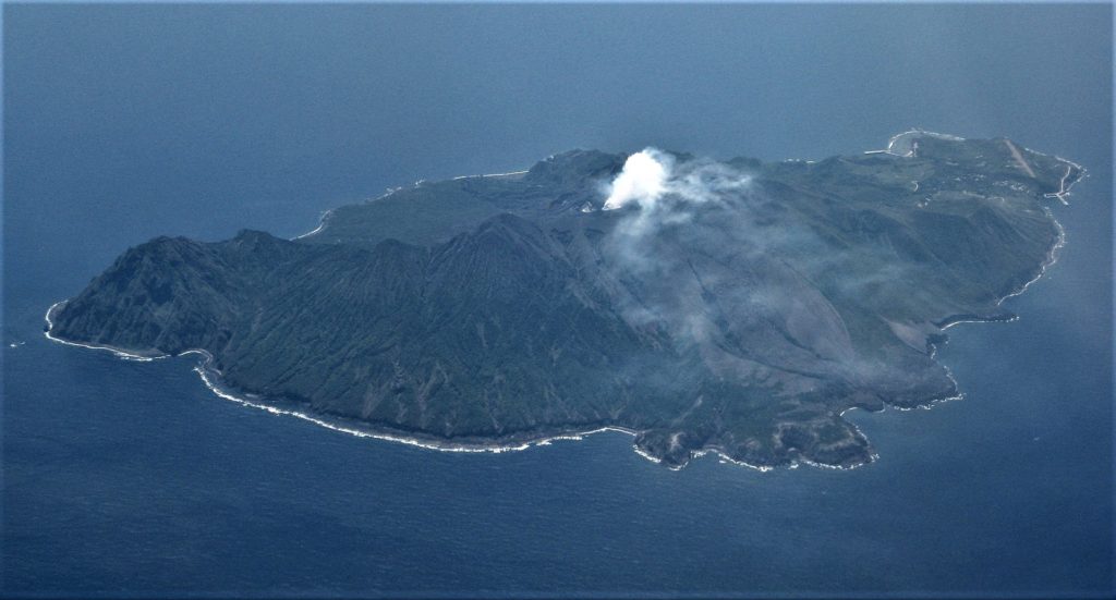
The 8-km-long island of Suwanosejima in the northern Ryukyu Islands consists of an andesitic stratovolcano with two active summit craters. The summit is truncated by a large breached crater extending to the sea on the E flank that was formed by edifice collapse. One of Japan’s most frequently active volcanoes, it was in a state of intermittent Strombolian activity from Otake, the NE summit crater, between 1949 and 1996, after which periods of inactivity lengthened. The largest recorded eruption took place in 1813-14, when thick scoria deposits covered residential areas, and the SW crater produced two lava flows that reached the western coast. At the end of the eruption the summit of Otake collapsed, forming a large debris avalanche and creating an open collapse scarp extending to the eastern coast. The island remained uninhabited for about 70 years after the 1813-1814 eruption. Lava flows reached the eastern coast of the island in 1884. Only about 50 people live on the island.
Sources : Agence météorologique japonaise (JMA) , GVP.
Photo : Ray Go.

