October 14 , 2024.
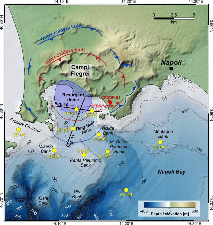
Italy , Campi Flegrei :
Weekly Bulletin, from 30 September 2024 to 06 October 2024. (Issue date 08 October 2024)
SUMMARY STATUS OF ACTIVITY
In light of the monitoring data, it emerges:
1) SEISMOLOGY: In the week of 30 September to 6 October 2024, in the Campi Flegrei area, 32 earthquakes of magnitude Md≥0.0 (Mdmax=2.4±0.3) were located.
2) DEFORMATIONS: Since the beginning of August, a reduction in the speed of ground uplift has been recorded, the average value of which is approximately 10±3 mm/month at the RITE GNSS station.
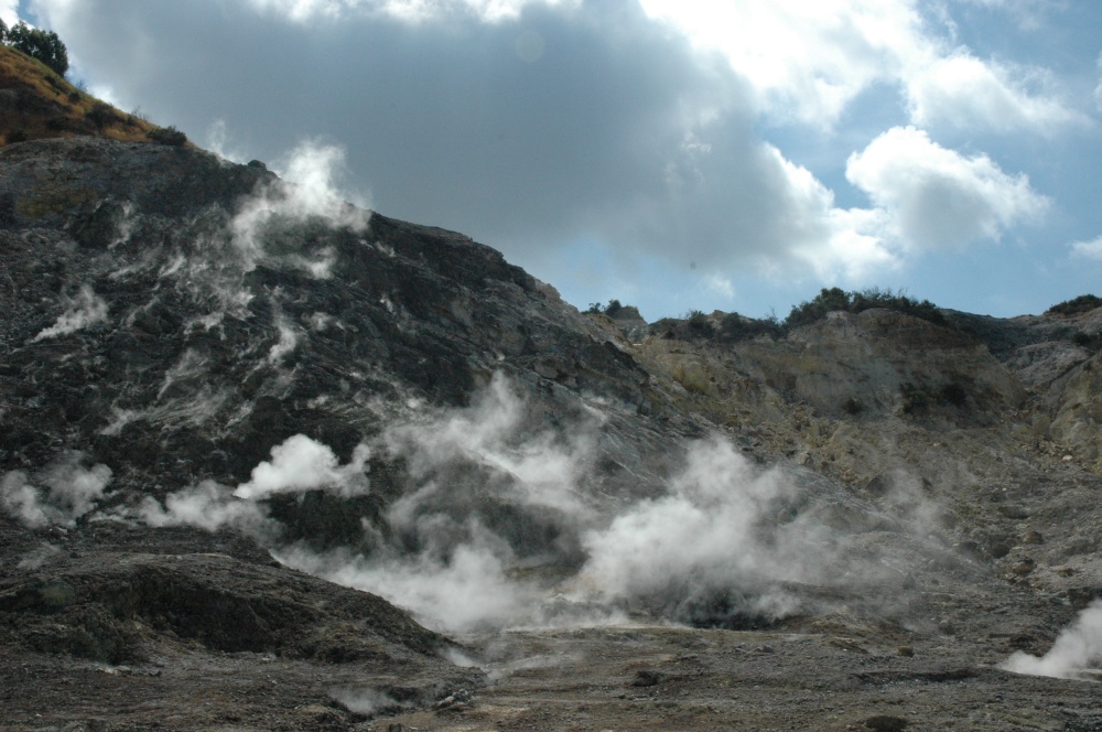
3) GEOCHEMISTRY: There are no significant variations in the geochemical parameters monitored in the reference week compared to the already known trends of increasing flow rates and heating of the hydrothermal system. The temperature sensor installed in a fumarole emission 5 meters from the main fumarole of Pisciarelli showed an average value of ~95°C, the condensation temperature of the fumarole fluid.
SEISMOLOGY
From 30 September to 6 October 2024, in the Campi Flegrei area, 32 earthquakes of magnitude Md≥0.0 (Mdmax=2.4±0.3) were located;
14 earthquakes were recorded during two seismic swarms:
the first, from 04:00 UTC on 10/05/2024, composed of 8 earthquakes with 0.0≤Md≤2.4 (±0.3), occurred in the Pozzuoli area;
the second, from 18:02 UTC on 10/06/2024, composed of 6 earthquakes with 0.0≤Md≤2.0 (±0.3), occurred in the Pozzuoli area.
An earthquake of magnitude Md 2.6 occurred in the area of Campi Flegrei.
13 October 2024 ,06:07:53 (UTC) 1 day ago
13 October 2024 ,08:07:53 (UTC +02:00) Italian time
with geographic coordinates (lat, lon) 40.8340, 14.1480 at a depth of 2 km.
GEOCHEMISTRY
During the reference week, the data continuously monitored by the geochemical network did not show significant variations in the acquired parameters, although confirming the heating and pressurization trends of the hydrothermal system and the increase in the flow rate of emitted fluids.
In the Pisciarelli area (north-eastern external slope of the Solfatara), which in recent years has shown the greatest variations in the degassing process, the values of the soil CO2 flux recorded continuously by the FLXOV8 station highlight the continuation of the multi-year trends already identified. In the last week, the CO2 fluxes measured from the ground did not show significant variations compared to previous periods.
Source : INGV
Photos : Stanley-goodspeed ( 2022) , Sacchi et al (2019) via Anne Widmer / FB.
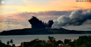
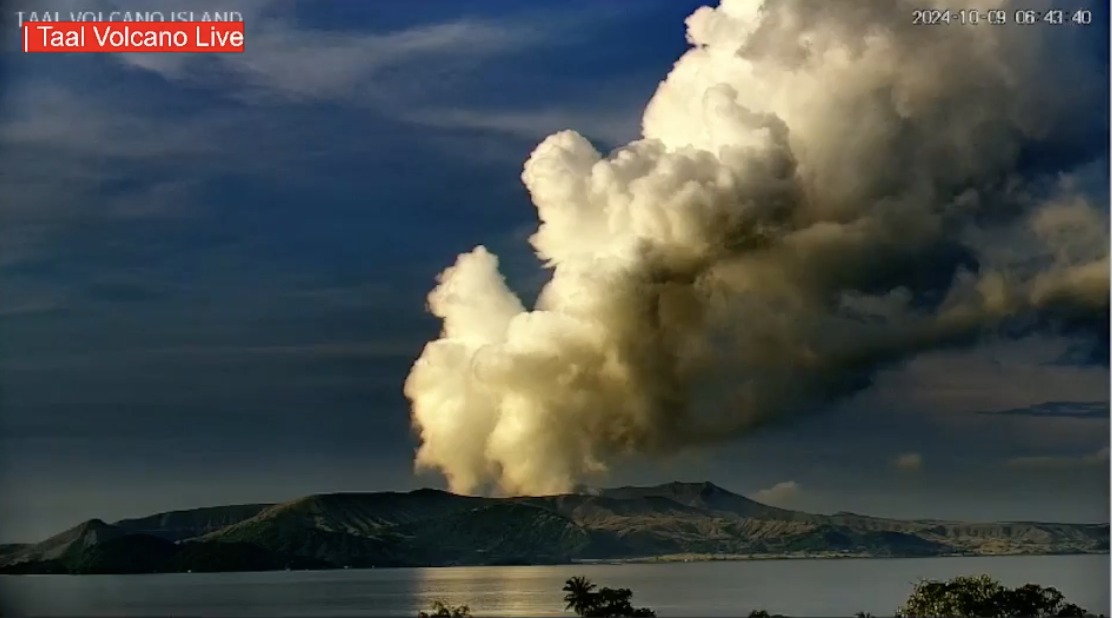
Philippines , Taal :
Two phreatic eruption events were reported in Taal Volcano on Sunday, the Philippine Institute of Volcanology and Seismology (PHIVOLCS) said Monday.
In its bulletin, PHIVOLCS said the phreatic eruptions lasted three to 13 minutes.
Phreatic eruptions are steam-driven explosions that occur when water beneath the ground or on the surface is heated by magma, lava, hot rocks, or new volcanic deposits, PHIVOLCS said.
A weak emission of plumes of up to 600 meters tall were observed from the volcano, which drifted to the west-southwest direction.
Taal Volcano emitted 1,256 tons of sulfur dioxide gas on Saturday and its Main Crater Lake had an upwelling of hot volcanic fluids.
A long-term deflation of the Taal Caldera and a short-term inflation of the general northern and southeastern flanks of the Taal Volcano Island were also observed.
No volcanic earthquakes were recorded in the volcano, PHIVOLCS said.
Alert Level 1 is maintained over Taal Volcano, which means the volcano is in abnormal condition and should not be interpreted to have ceased unrest nor ceased the threat of eruptive activity.
The possible hazards under Alert Level 1 are sudden steam-driven or phreatic explosions, volcanic earthquakes, minor ashfall and lethal accumulations or expulsions of volcanic gas.
Sources : Gmanetwork , Phivolcs.
Photo : Webcam volcano live.
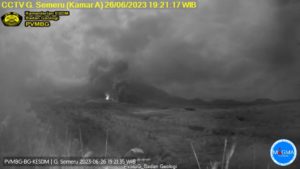
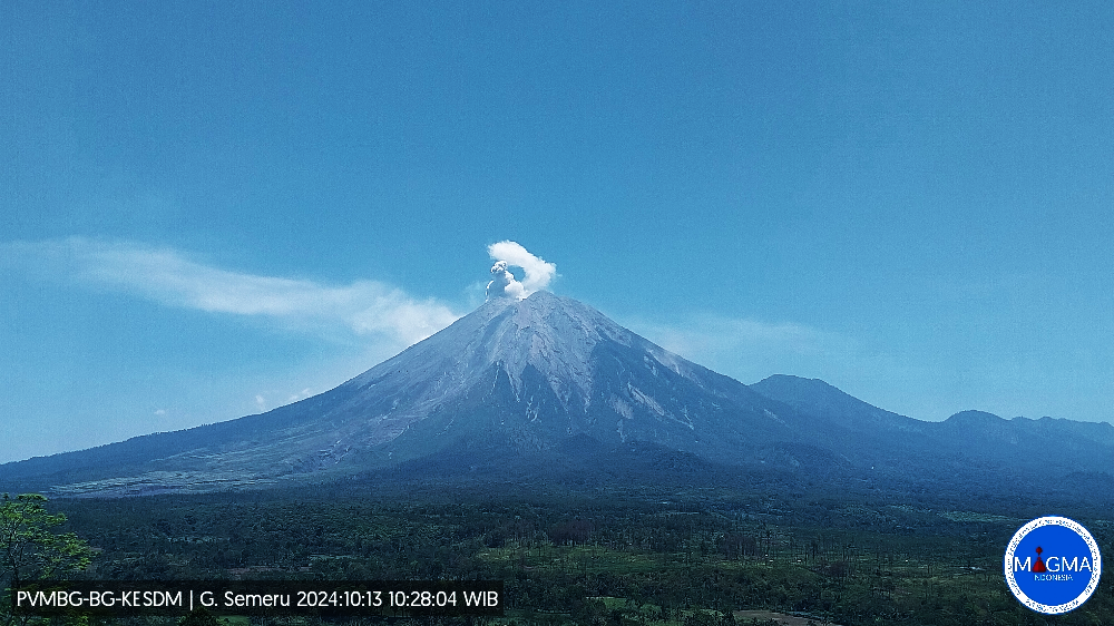
Indonesia , Semeru :
Semeru erupted on Sunday, October 13, 2024 at 10:27 WIB with the height of the ash column observed at ± 800 m above the summit (± 4476 m above sea level). The ash column was observed to be white to gray in color with a thick intensity, oriented towards the southwest and west. This eruption was recorded on a seismograph with a maximum amplitude of 22 mm and a duration of 100 seconds.
VOLCANO OBSERVATORY NOTICE FOR AVIATION – VONA
Issued : October 13 , 2024
Volcano : Semeru (263300)
Current Aviation Colour Code : ORANGE
Previous Aviation Colour Code : orange
Source : Semeru Volcano Observatory
Notice Number : 2024SMR2490
Volcano Location : S 08 deg 06 min 29 sec E 112 deg 55 min 12 sec
Area : East java, Indonesia
Summit Elevation : 11763 FT (3676 M)
Volcanic Activity Summary :
Eruption with volcanic ash cloud at 03h27 UTC (10h27 local).
Volcanic Cloud Height :
Best estimate of ash-cloud top is around 14323 FT (4476 M) above sea level or 2560 FT (800 M) above summit. May be higher than what can be observed clearly. Source of height data: ground observer.
Other Volcanic Cloud Information :
Ash cloud moving from southwest to west. Volcanic ash is observed to be white to gray. The intensity of volcanic ash is observed to be thick.
Remarks :
Eruption recorded on seismogram with maximum amplitude 22 mm and maximum duration 100 second.
Source et photo : Magma Indonésie.
Colombia , Nevado del Huila :
Popayán, October 8, 2024, 3:30 p.m.
From the monitoring of the activity of the Nevado del Huila volcano, the Colombian Geological Survey (SGC), an entity attached to the Ministry of Mines and Energy, reports that:
In the week of October 1 to 7, 2024, the seismic activity of this volcano remained stable compared to what was recorded in previous weeks. An event that occurred on October 4 at 01:04 (local time) was highlighted, which had a magnitude of 3.4 ML, located 12.6 km northeast of the volcano and at a depth of 10 km, however, no reports have been received of having been felt, nor has there been an increase in activity after this earthquake. Seismic energy and the number of events were at low levels, consistent with the baseline established for this volcano.
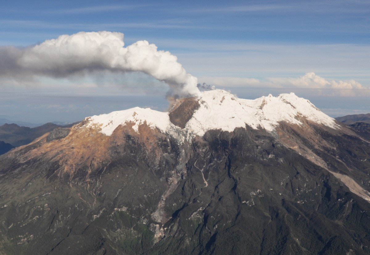
Thanks to the webcams, the degassing processes of the fumaroles located in Pico Central were evident. The other parameters measured for the assessment of volcanic activity did not show significant changes.
The alert status for volcanic activity remains in yellow alert: active volcano with changes in the behavior of the base level of the monitored parameters and other manifestations.
Source et photo : SGC
Ecuador , El Reventador :
DAILY STATUS REPORT OF THE REVENTADOR VOLCANO , Sunday, October 13, 2024.
Information Geophysical Institute – EPN.
Surface Activity Level: High , Surface Trend: No Change
Internal Activity Level: Moderate , Internal Trend: No Change
From October 12, 2024, 11:00 a.m. to October 13, 2024, 11:00 a.m.:
Seismicity:
The count of seismic events recorded at the station is detailed below.
Explosion (EXP) 88
Long Period (LP) 14
Emission Tremor (TREMI) 15
Harmonic Tremor (TRARM) 3

Rainfall / Lahars:
Since yesterday afternoon, thanks to satellite image monitoring and weather forecasts, the presence of moderate rains has been observed in the volcano area, without generating mud or debris flows. **In the event of heavy rains, these could remobilize the accumulated materials, generating mud and debris flows that would descend the sides of the volcano and flow into adjacent rivers.
Emissions / ash column:
Since yesterday afternoon, thanks to satellite image monitoring, no emissions of gas or ash have been observed. Similarly, the Washington-VAAC agency has not published an activity report either.
Other monitoring parameter:
In the last 24 hours, the MIROVA-SENTINEL satellite system has detected 1 thermal anomaly.
Observation:
From yesterday until the date of this report, through monitoring of weather forecast media and external reports, it was observed that the volcano remained cloudy to partly clear most of the time.
Alert Level: Orange
Source : IGEPN
Photo : E. Telenchana/IG-EPN ( 09/2024)