October 13 , 2024.
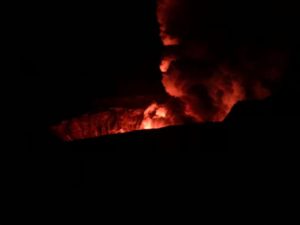
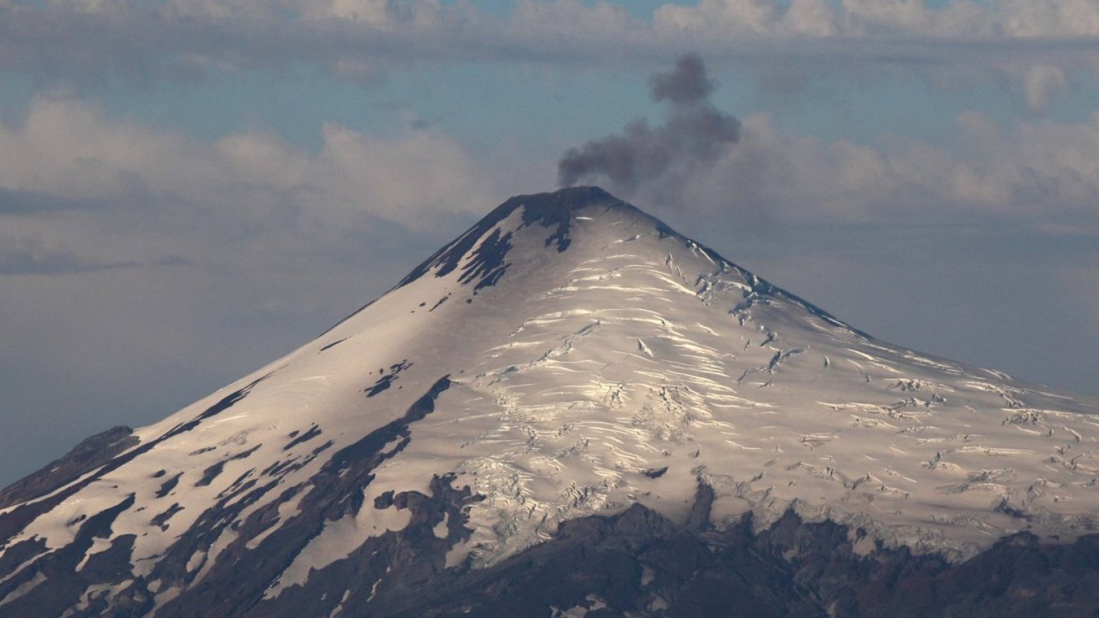
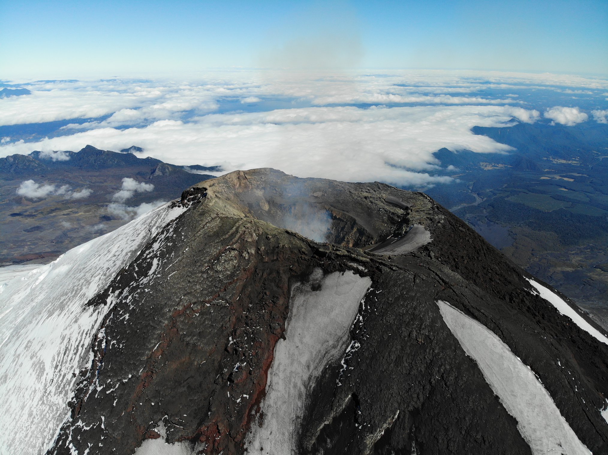
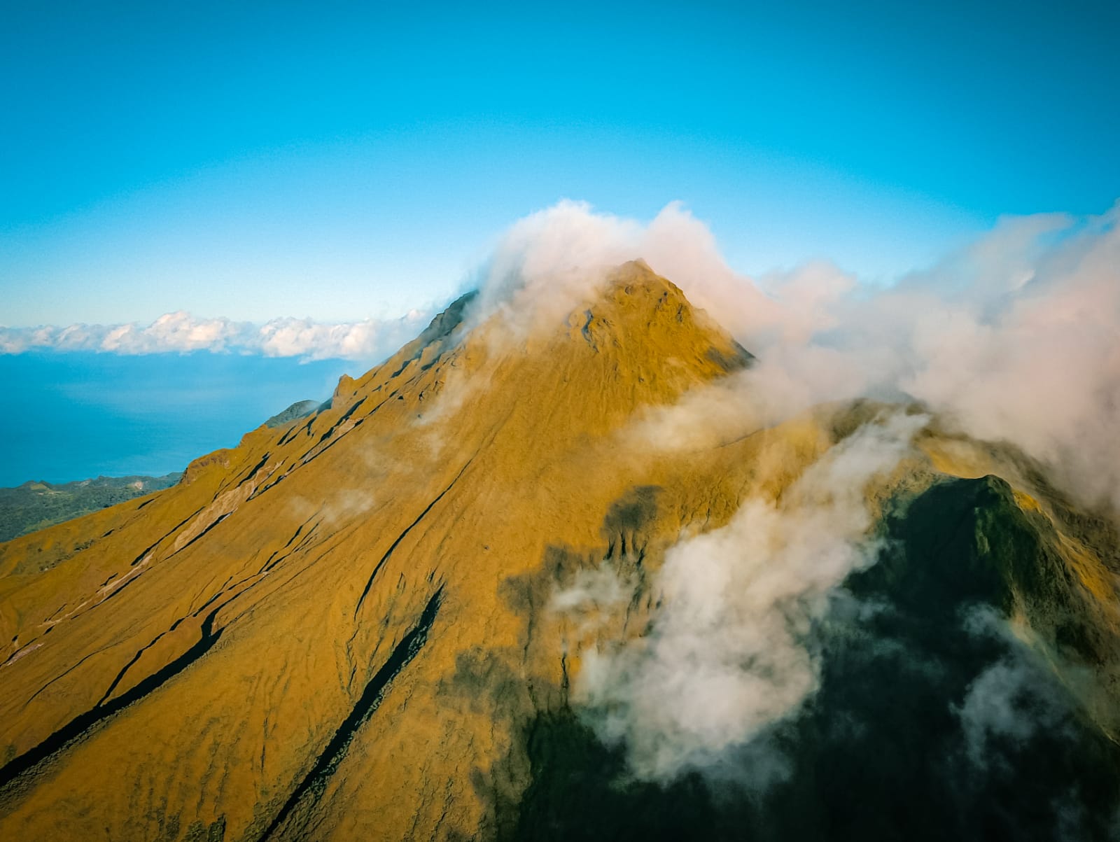
Chile , Villarica :
Seismology
The seismological activity of the period was characterized by the recording of:
A continuous seismic tremor signal associated with the fluid dynamics inside the volcano, which during the period and evaluated with the RSAM parameter, presented energy values between 0.1 and 0.2 μm/s.
35 VT type seismic events, associated with rock fracturing (Volcano-Tectonic). The most energetic earthquake had a Local Magnitude (ML) value equal to 1.3, located 10.8 km to the East-Southeast of the volcanic edifice, at a depth of 7.9 km from the crater.
425 LP type seismic events, associated with the fluid dynamics inside the volcanic system (Long Period). The size of the largest earthquake evaluated from the Reduced Displacement (DR) parameter was equal to 8 cm2.
2 TR-type seismic events, associated with the dynamics maintained over time of the fluids inside the volcanic system (TRemor). The size of the largest earthquake evaluated from the Reduced Displacement (DR) parameter was equal to 1 cm2.
Fluid Geochemistry
The sulfur dioxide (SO2) emissions data obtained by the Differential Optical Absorption Spectroscopy (DOAS) equipment, corresponding to the Los Nevados and Tralco stations, installed respectively 10 km in an East-Northeast direction and 6 km East-Southeast from the active crater, presented an average value of 525 ± 93 t/d. These values are considered the basis of this volcanic system. The maximum daily average of the fortnight was 618 t/d calculated for September 26, consistent with the decrease in surface activity.
No anomalies were reported in sulfur dioxide (SO2) emissions into the atmosphere in the area near the volcano, according to data published by the Tropopheric Monitoring Instrument (TROPOMI) and the Ozone Monitoring Instrument (OMI) Sulphur Dioxide Group.
Geodesy
The analysis of geodetic data, based on data from 5 GNSS stations installed on the volcano, indicates that:
– The horizontal and vertical displacement rates have moderate magnitudes. In general, they are influenced by cyclical variations of an annual nature, data loss and increased dispersion of time series. For the current period, the vertical variation rates are generally reported slightly higher than those of the previous period, with a specific maximum of 1.1 cm/month.
– The distance variation between the different GNSS stations shows slight variations during this period, reaching a maximum of 0.4 cm/month.
Based on the trends and directions of displacements of the current period, no deformation patterns are observed at the level of the volcanic edifice that suggest relevant internal changes.
Surveillance cameras
The images provided by the fixed camera, installed near the volcano, recorded low-height degassing columns, with a maximum of 120 m above the crater level. No other variations associated with surface activity were identified. During most of the period evaluated, weather conditions prevented the visibility of the volcano.
Volcanic activity during the second half of September remained stable, with low levels of seismic energy of the continuous signal and little recurrence of seismic signals related to volcanic activity. On the other hand, there is a decrease in the values obtained for SO2 emission and a decrease in surface activity, without recording explosions or emission of pyroclastic material. The above suggests a lower activity of the magmatic system, linked to a deepening of its lava lake.
Due to the above, a change in the technical volcanic alert level is determined for:
GREEN TECHNICAL ALERT: Active volcano with stable behavior – There is no immediate risk
Observation:
Monitoring of the superficial and instrumental activity of the Villarrica volcano indicates a decrease in the frequency of explosions with emission of high-temperature volcanic material outside the crater. Being an open-duct volcanic system, it is not possible to exclude sudden explosions without precursors. From what has been observed in previous periods, the impact of these explosions is concentrated mainly at distances of less than 500 m, measured from the center of the crater. However, in the current scenario, the low surface activity as well as the decrease in monitoring parameters suggest a low probability of occurrence of this type of activity. The associated hazards consist of the ejection of ballistic pyroclasts, the emission of ash and volcanic gases.
Source : Sernageomin.
Photos : 24 horas , Take a Way ( 2020).
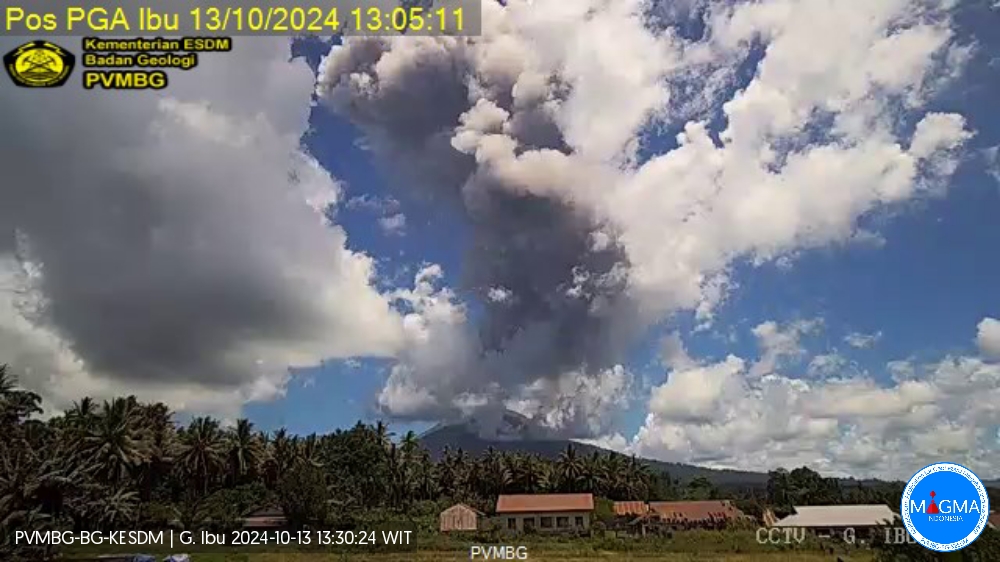
Indonesia , Ibu :
An eruption of Mount Ibu occurred on Saturday, 12 October 2024 at 08:00 WIT with the height of the ash column observed at ±2,000 m above the summit (±3,325 m above sea level). The ash column was observed to be grey to black in colour with a thick intensity, oriented towards the southwest and west. This eruption was recorded on a seismograph with a maximum amplitude of 28 mm and a duration of 96 seconds.
VOLCANO OBSERVATORY NOTICE FOR AVIATION – VONA
Issued : October 12 , 2024
Volcano : Ibu (268030)
Current Aviation Colour Code : ORANGE
Previous Aviation Colour Code : orange
Source : Ibu Volcano Observatory
Notice Number : 2024IBU943
Volcano Location : N 01 deg 29 min 17 sec E 127 deg 37 min 48 Area : North Maluku, Indonesia
Summit Elevation : 4240 FT (1325 M)
Volcanic Activity Summary :
Eruption with volcanic ash cloud at 23h00 UTC (08h00 local).
Volcanic Cloud Height :
Best estimate of ash-cloud top is around 6800 FT (2125 M) above sea level or 2560 FT (800 M) above summit. May be higher than what can be observed clearly. Source of height data: ground observer.
Other Volcanic Cloud Information :
Ash cloud moving to west. Volcanic ash is observed to be gray. The intensity of volcanic ash is observed to be thick.
Remarks :
Eruption recorded on seismogram with maximum amplitude 28 mm and maximum duration 96 second.
Source et photo : Magma Indonésie .
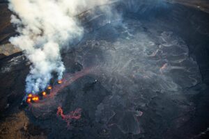
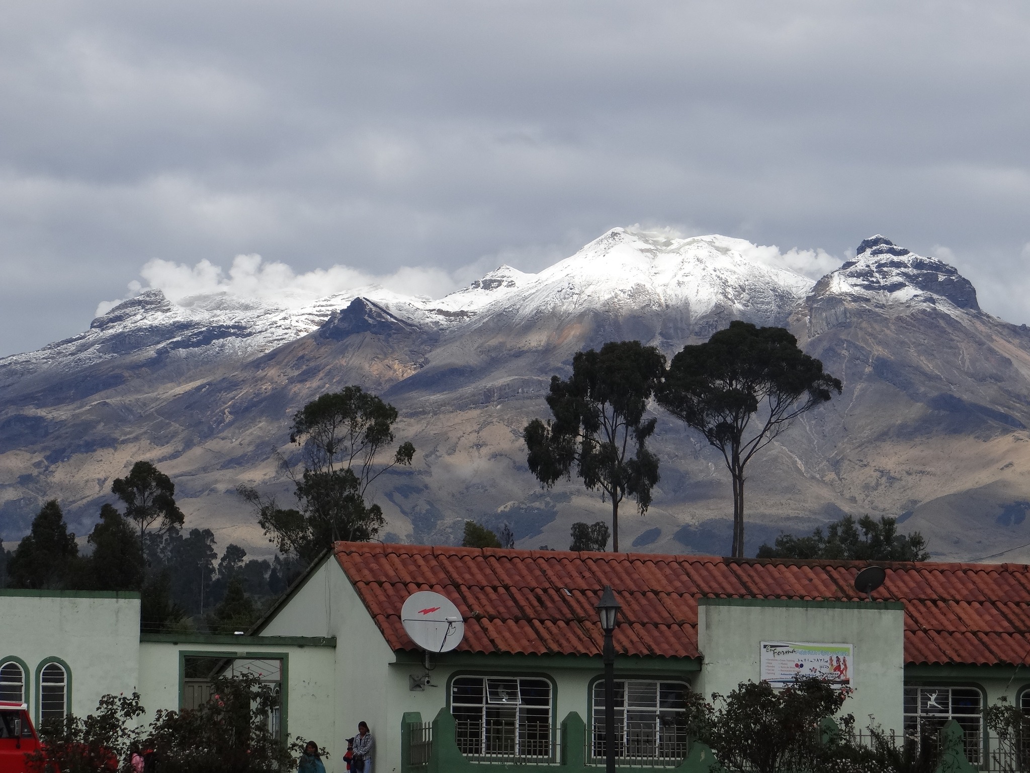
Colombia , Cumbal :
San Juan de Pasto, October 8, 2024, 3:55 p.m.
From the monitoring of the activity of the Cumbal Volcanic Complex (CVC), the Colombian Geological Survey (SGC), an entity attached to the Ministry of Mines and Energy, reports that:
During the week of October 1 to 7, 2024, the activity of the Cumbal volcanic complex maintained a stable behavior. Compared to the previous week, the main variations in the monitored parameters were:
● Within the framework of the fluctuating behavior of seismicity, characteristic of this volcanic complex, an increase in seismic occurrence was recorded with an increase in its released energy.
● The predominance of seismicity associated with rock fracture remained, but the greatest energy came from earthquakes associated with sustained fluid transit within the volcanic system.
● Two low-energy earthquakes with a maximum magnitude of 0.6 were located.
● Small gas emissions were recorded with white columns, of low height and variable dispersion, depending on the wind regime in the area, coming from the fumarole fields of El Verde, northeast of the CVC; and from the fumarole fields of Los Rastrojos, Las Bandas and Boca Vieja, located southwest of the CVC.
● The other volcanic monitoring parameters showed stability.
Based on the above, the SGC recommends to closely monitor its evolution through the weekly bulletins and other information published through our official channels, as well as the instructions of the local and departmental authorities and the National Disaster Risk Management Unit (UNGRD).
Volcanic activity remains in yellow alert status: active volcano with changes in the behavior of the base level of the monitored parameters and other manifestations.
Source et photo : SGC
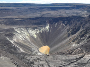
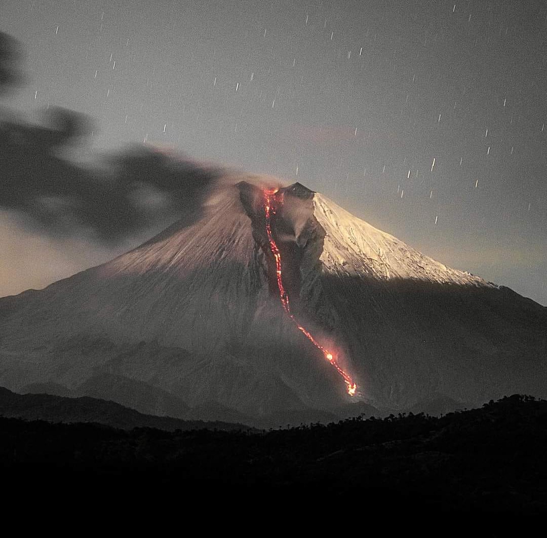
Ecuador , Sangay :
DAILY STATE REPORT OF SANGAY VOLCANO , Saturday, October 12, 2024 .
Information Geophysical Institute – EPN.
Surface Activity Level: High , Surface Trend: Ascending
Internal Activity Level: High , Internal Trend: No change
Seismicity: From October 11, 2024, 11:00 a.m. to October 12, 2024, 11:00 a.m.:
Seismicity:
Below is the count of seismic events recorded at the reference station
Explosion (EXP): 183
Rainfall/Lahars:
Thanks to surveillance cameras and satellite images, the presence of rain has been observed in the area, without lahars being generated. **Heavy rains could remobilize the accumulated materials and generate mudflows with debris (lahars) that could descend on the sides of the volcano, or even flow into adjacent rivers.
Column emissions/ash:
In the last 24 hours, thanks to the GOES-16 surveillance camera system and satellite images, several emissions of gas and ash have been observed, the columns of which have reached heights of between 300 and 1000 meters above the level of the crater, in the West and West-Southwest directions.
In relation to this activity, the VAAC agency in Washington generated 3 emission reports with a column height equal to 850, in the West and West-Southwest directions.
Other monitoring parameter:
In the last 24 hours, the MIROVA-VIIRS satellite system detected 1 thermal anomaly, while FIRMS recorded 3 thermal anomalies.
Observation:
Since yesterday afternoon and until the submission of this report, the volcano has remained mostly cloudy. However, during the last night, thanks to the surveillance camera system, several episodes of incandescence were observed at the crater level, accompanied by descents of incandescent materials through the South-East ravine, up to 1000 meters below the crater level.
Alert level: yellow
Source : IGEPN
Photo : Eqphos_fotografía
La Martinique , Mount Pelée :
Weekly report, Institut de physique du globe de Paris / Observatoire volcanologique et sismologique de Martinique.
Activity of Mount Pelée, Saint-Pierre, October 11, 2024 at 16:45 local time (GMT-4)
Volcanic activity remains relatively low this week with 10 earthquakes of volcanic origin observed.
Between October 4, 2024 at 16:00 (UT) and October 11, 2024 at 16:00 (UT), the OVSM recorded 10 low-energy earthquakes of the volcano-tectonic type. These earthquakes were clearly identified as originating from one of the well-known seismically active zones at Mount Pelée, located between 1.0 and 1.4 km deep below the summit of the volcano. The superficial seismicity of the volcano-tectonic type is associated with micro-fracturing in the volcanic edifice in connection with the global reactivation of the volcano observed since the end of 2018.
No earthquake was felt by the population.
The previous week, the OVSM had recorded 8 earthquakes of volcanic origin. As of October 11, 2024 and during the last 4 weeks, the OVSM has therefore observed a total of 100 volcanic earthquakes, or an average of 25 earthquakes per week.
During the volcanic reactivation phases of volcanoes similar to Mount Pelée, it is usual to observe seismic activity that varies in intensity and frequency.
For more details on observations and interpretations of volcanic activity over the longer term, refer to the OVSM monthly bulletins.
The alert level is currently YELLOW: vigilance.
Source : Direction de l’OVSM-IPGP.
Photo : rci.fm ( 04/2021)