September 09 , 2024.
Indonesia , Lewotobi Laki-laki :
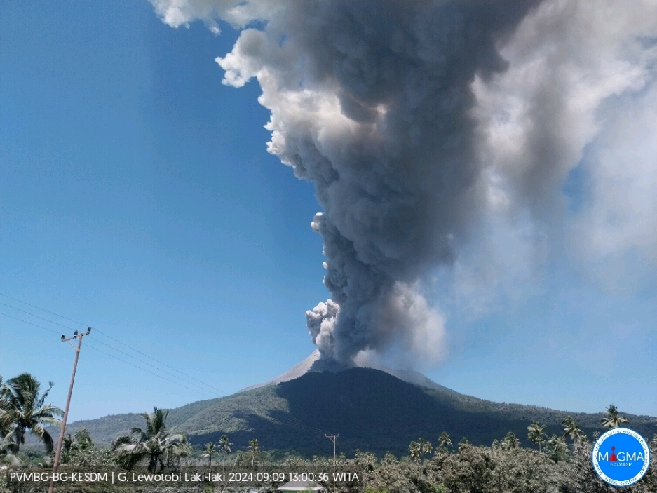
An eruption of Lewotobi Laki Laki occurred on Monday, September 9, 2024, at 12:52 WITA with the height of the ash column observed at ± 800 m above the summit (± 2384 m above sea level). The ash column was observed to be gray with a thick intensity, oriented towards the northwest. This eruption was recorded on a seismograph with a maximum amplitude of 10.3 mm and a duration of 552 seconds.
VOLCANO OBSERVATORY NOTICE FOR AVIATION – VONA
Issued : September 09 , 2024
Volcano : Lewotobi Laki-laki (264180)
Current Aviation Colour Code : ORANGE
Previous Aviation Colour Code : orange
Source : Lewotobi Laki-laki Volcano Observatory
Notice Number : 2024LWK478
Volcano Location : S 08 deg 32 min 20 sec E 122 deg 46 min 06 sec
Area : East Nusa Tenggara, Indonesia
Summit Elevation : 5069 FT (1584 M)
Volcanic Activity Summary :
Eruption with volcanic ash cloud at 04h52 UTC (12h52 local).
Volcanic Cloud Height :
Best estimate of ash-cloud top is around 7629 FT (2384 M) above sea level or 2560 FT (800 M) above summit. May be higher than what can be observed clearly. Source of height data: ground observer.
Other Volcanic Cloud Information :
Ash cloud moving to northwest. Volcanic ash is observed to be gray. The intensity of volcanic ash is observed to be thick.
Remarks :
Eruption recorded on seismogram with maximum amplitude 10.3 mm and maximum duration 552 second.
Source et photo : Magma Indonésie.
Russia / Kuril Islands , Ebeko :
VOLCANO OBSERVATORY NOTICE FOR AVIATION (VONA)
Issued: September 06 , 2024
Volcano: Ebeko (CAVW #290380)
Current aviation colour code: ORANGE
Previous aviation colour code: orange
Source: KVERT
Notice Number: 2024-73
Volcano Location: N 50 deg 41 min E 156 deg 0 min
Area: Northern Kuriles, Russia
Summit Elevation: 1156 m (3791.68 ft)
Volcanic Activity Summary:
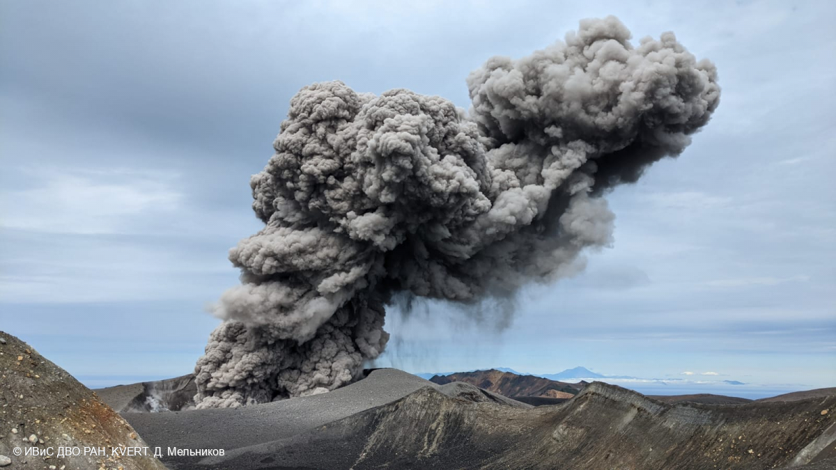
A moderate explosive eruption of the volcano continues. According to visual data from Severo-Kurilsk, an explosion sent ash up to 1.8 km a.s.l., and an ash cloud drifted to the east of the volcano.
A moderate explosive eruption of the volcano continues. Ash explosions up to 6 km (19,700 ft) a.s.l. could occur at any time. Ongoing activity could affect low-flying aircraft and airport of Severo-Kurilsk.
Volcanic cloud height:
1500-1800 m (4920-5904 ft) AMSL Time and method of ash plume/cloud height determination: 20240909/0054Z – Visual data
Other volcanic cloud information:
Distance of ash plume/cloud of the volcano: 5 km (3 mi)
Direction of drift of ash plume/cloud of the volcano: E
Time and method of ash plume/cloud determination: 20240909/0054Z – Visual data
Source : Kvert
Photo : D. Melnikov. IVS FEB RAS, KVERT , ( 28/7/2024 )
Italy , Campi Flegrei :
During the month of August 2024, 634 earthquakes were recorded in the Campi Flegrei area with a maximum magnitude = 3.7 ± 0.3. Of these, 574 events (90.5% of the total) had a magnitude lower than 1.0 or not determinable due to the low amplitude of the signal that is not clearly distinguishable from the background noise, 52 events (8.2% of the total) had a magnitude between 1.0 and 1.9, 7 events (1.1% of the total) had a magnitude between 2.0 and 2.9 and 2 events (0.2% of the total) had a magnitude between 3.0 and 3.9. In total, 430 events were located (about 68% of those recorded), located mainly between Pozzuoli, Agnano, the Solfatara-Pisciarelli area, Bagnoli and in the Gulf of Pozzuoli, with depths concentrated in the first 3 km and a maximum depth of about 4.5 km.
Furthermore, some hybrid events located in the Accademia area at superficial depths have been identified, whose analysis has highlighted the involvement of hydrothermal fluids.
Since mid-April 2024, the average value of the uplift speed in the maximum deformation zone is about 20±3 mm/month at the Rione Terra GNSS station (RITE). In August, there was a reduction in the uplift speed, the value of which will be defined with the data of the coming weeks. The lift recorded at the RITE GNSS station is about 132.5 cm since November 2005, of which about 14.5 cm since January 2024.
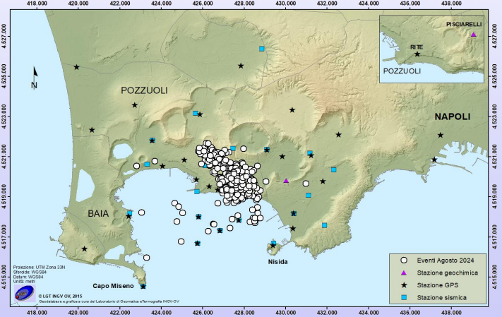
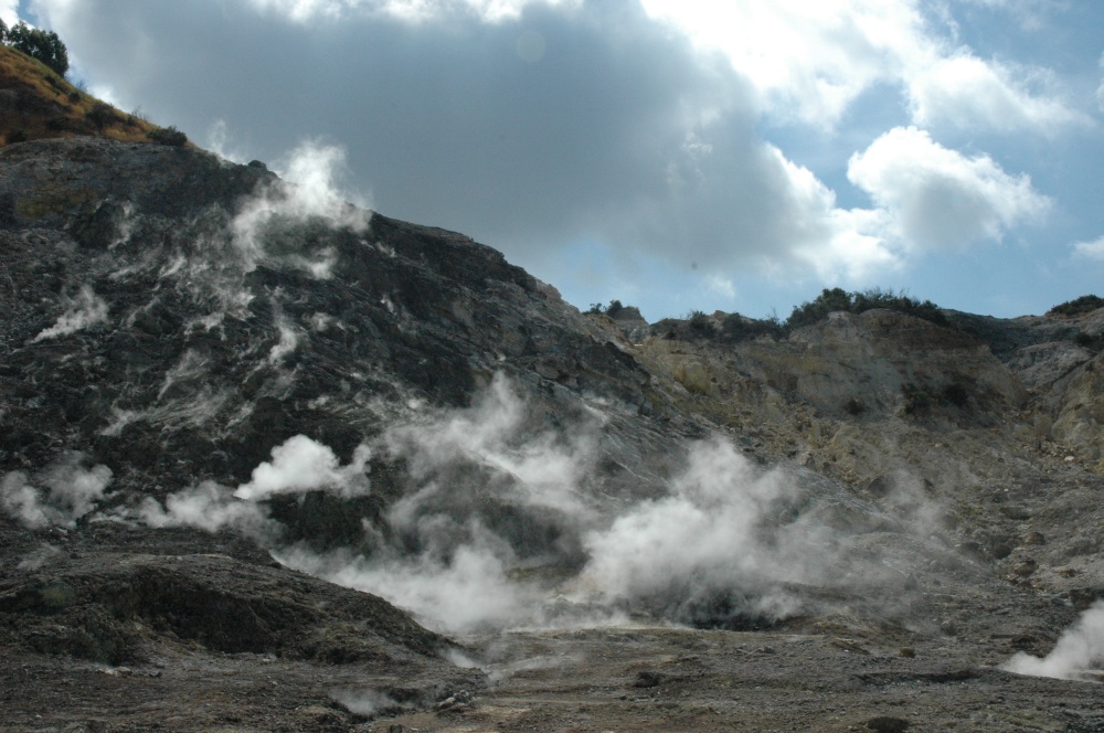
The maximum surface temperature values of the IR time series in the Pisciarelli and Solfatara areas show stable trends.
Geochemical parameters confirm the multi-year trends of heating and pressurization of the hydrothermal system. The CO2 flux from the ground in the Solfatara area is confirmed high, estimated at about 5000 t/d, values comparable to those found in the plume of active volcanoes with persistent degassing.
Source : INGV.
Photos : Stanley-goodspeed ( 11/2022) , INGV.
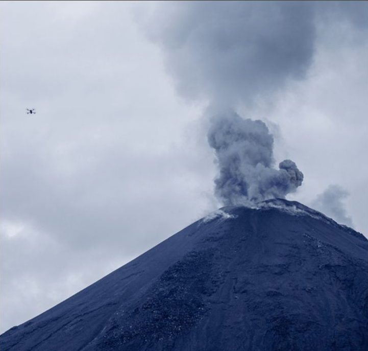
Ecuador , El Reventador :
DAILY REPORT ON THE STATE OF THE REVENTADOR VOLCANO , Sunday, September 8, 2024.
Information Geophysical Institute – EPN.
Surface Activity Level: High , Surface Trend: No changes
Internal Activity Level: Moderate , Internal Trend: No changes
From September 7, 2024, 11:00 a.m. to September 8, 2024, 11:00 a.m.:
Seismicity:
Due to data transmission problems, it was not possible to count the volcanic events of the last 24 hours.
Precipitation / Lahars:
Rainfall was recorded in the volcano area without generating mudflows or debris flows. **In case of heavy rains, these could remobilize the accumulated materials, generating mudflows and debris that would descend the sides of the volcano and flow into adjacent rivers.**
Emissions/ash column:
Due to transmission problems, it was not possible to observe emissions via the surveillance camera system. In addition, due to cloud cover in the volcanic sector, it was not possible to observe emissions via the GOES-16 satellite system. The Washington agency VAAC has not published emissions reports in the last 24 hours.
Other monitoring parameters:
The FIRMS satellite system recorded 2 thermal anomalies in the last 24 hours.
Observation:
Thanks to satellite monitoring, since yesterday afternoon until the closing of this report, the volcanic sector remains cloudy.
Alert level: Orange
Source et Photo :IGEPN
La Réunion , Piton de la Fournaise :
Press release from the Institut de physique du globe de Paris , Piton de la Fournaise Volcanological Observatory , 06/09/2024 – 08:30 local time – 04:30 UTC
Earthquake felt
On Friday, September 6, 2024, 08:10 (local time – or 04:10 UTC), an earthquake was felt by residents of the island, mainly in the northern and northwestern sector of the island.
This earthquake was recorded by the seismometers of the Piton de la Fournaise Volcanological Observatory. The first analyses of this earthquake made it possible to locate it, at a depth of 19 km in the La Roche Ecrite sector. Its magnitude was measured at 2.4 on the Richter scale. There is currently a high level of uncertainty about its location.
The OVPF staff is working to refine the location calculations for this event. Also, information regarding location and intensity could change marginally.

This type of event, felt by the population, is recorded several times a year. This event is isolated and is of tectonic origin. At present, this earthquake has not been followed by aftershocks.
Call for testimonies on felt earthquakes: the real intensities (effects of an earthquake in a given place) can only be correctly determined by collecting testimonies. If you felt this earthquake, even weakly, you are invited to report it to the BCSF (French Central Seismological Bureau) on the site http://www.franceseisme.fr/
Source : OVPF https://www.ipgp.fr/communiques-et-bulletins-de-lobservatoire/?categorie=&domaine=&date=&observatoire-associe=391&motcle=
Photo : OVPF