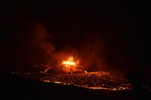
Iceland , Reykjanes Peninsula :
The eruption North of Stóra-Skógfell is over . The hazard map has been updated
Updated 6. September at 16:00 UTC
No visible activity at the craters since yesterday evening
Ground uplift has started again in the Svartsengi area
The eruption lasted 14 days
The hazard assessment is updated
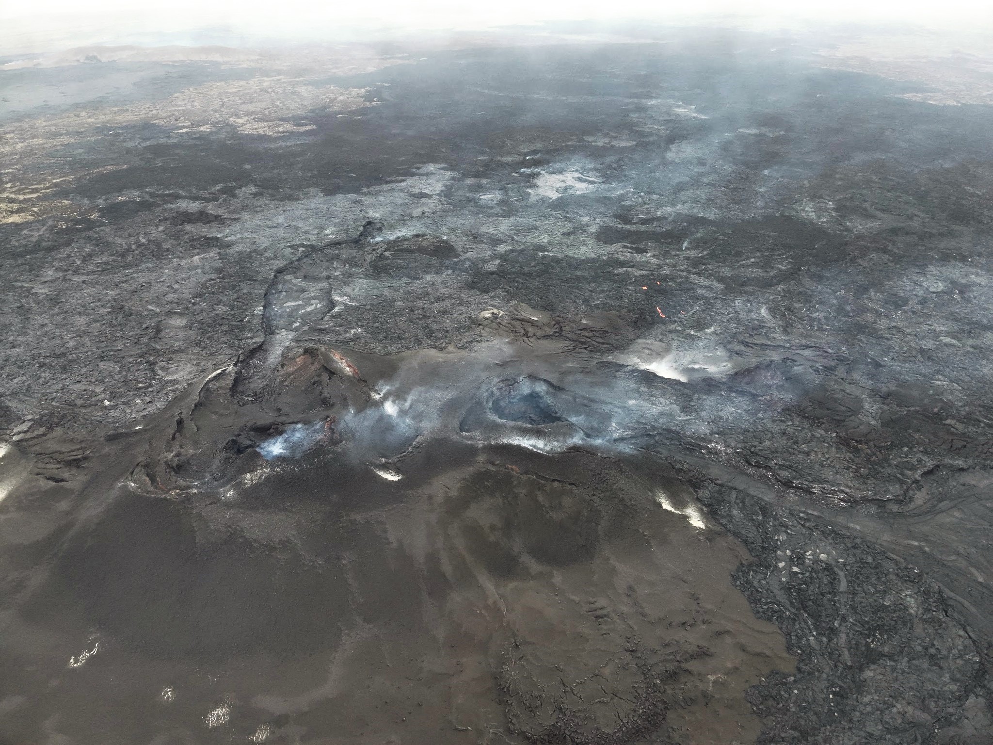
The eruption which commenced on 22 August is now declared over, hence the hazard assessment has been updated. The main changes affect Zone 3, where the eruptive fissures opened at the beginning of the eruption. Zone 3 is now assessed to be at high hazard level (red) since the likelihood for vent openings, gas pollution and tephra fallout are assessed to be lower than before. Zone 6 is now assessed to be at considerable hazard as the likelihood of gas pollution is reduced. Within Zone 1 (Svartsengi) hazards are assessed to have either low or very-low likelihood.
Ground uplift has resumed in the Svartsengi area, indicating that magma has begun to accumulate in the magma body at a depth of 4–5 km. IMO will continue to monitor the rate of ground deformation, but preliminary results from geodetic modelling indicate that magma is accumulating at a rate similar to that estimated in periods following the end of previous eruptions.
Source : IMO
Photo : Ljósmynd: Almannavarnir/Björn Oddsson ,
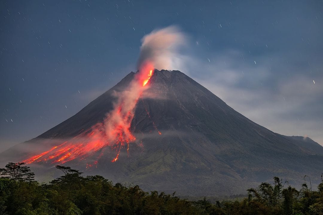
Indonesia , Merapi :
MOUNT MERAPI ACTIVITY REPORT, August 30 – September 5, 2024
OBSERVATION RESULT
Visual
The weather around Mount Merapi is generally clear in the morning and night, while it is foggy from noon to evening. White smoke, thin to thick, low to moderate pressure and 250 m high was observed from the Mount Merapi Selo observation post on August 30, 2024 at 10:30. This week, 3 hot avalanche clouds descended to the southwest (upstream of the Bebeng River) with a maximum sliding distance of 1,300 m. Lava avalanches were observed 232 times upstream of the Bebeng River with a maximum distance of 1,800 m. The noise of avalanches was heard 3 times from Babadan station with low to moderate intensity. It was observed that the morphology of the Southwest dome was changing due to dome growth activities, lava avalanches and hot cloud avalanches. For the morphology of the middle dome, there is no significant morphological change. Based on the analysis of aerial photos dated August 21, 2024, the volume of the Southwest dome was measured as 2,777,900 m3 and that of the central dome as 2,366,900 m3.
Seismicity
This week, the seismicity of Mount Merapi recorded:
3 hot cloud avalanche (WCA) earthquakes,
4 shallow volcanic earthquakes (VTB),
20 multi-phase (MP) earthquakes,
1 low-frequency (LF) earthquake,
976 avalanche (RF) earthquakes,
11 tectonic earthquakes (TT).
The intensity of earthquakes this week is lower than last week.
Deformation
The deformation of Mount Merapi monitored by EDM this week showed an average shortening rate of 0.2 cm/day, lower than last week.
Rainfall and lahars
This week, there was no rain at the Mount Merapi observation post and no additional runoff was reported in the rivers that originate on Mount Merapi.
Conclusion
Based on the results of visual and instrumental observations, it was concluded that:
The volcanic activity of Mount Merapi is still quite high in the form of effusive eruptive activity. The activity status is set at the « SIAGA » level
Source : BPPTKG
Photo : Merapi news ( 07/2024)
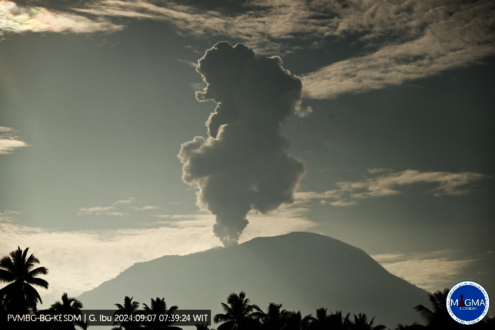
Indonesia , Ibu :
An eruption of Ibu occurred on Saturday, 7 September 2024 at 07:38 WIT with the height of the ash column observed at ±1,500 m above the summit (±2,825 m above sea level). The ash column was observed to be grey in colour with a thick intensity, oriented towards the South-West. This eruption was recorded on a seismograph with a maximum amplitude of 14 mm and a duration of 99 seconds.
VOLCANO OBSERVATORY NOTICE FOR AVIATION – VONA
Issued : September 7 , 2024
Volcano : Ibu (268030)
Current Aviation Colour Code : ORANGE
Previous Aviation Colour Code : orange
Source : Ibu Volcano Observatory
Notice Number : 2024IBU700
Volcano Location : N 01 deg 29 min 17 sec E 127 deg 37 min 48 sec
Area : North Maluku, Indonesia
Summit Elevation : 4240 FT (1325 M)
Volcanic Activity Summary :
Eruption with volcanic ash cloud at 22h38 UTC (07h38 local).
Volcanic Cloud Height :
Best estimate of ash-cloud top is around 5840 FT (1825 M) above sea level or 1600 FT (1500 M) above summit. May be higher than what can be observed clearly. Source of height data: ground observer.
Other Volcanic Cloud Information :
Ash cloud moving to southwest. Volcanic ash is observed to be gray. The intensity of volcanic ash is observed to be thick.
Remarks :
Eruption recorded on seismogram with maximum amplitude 14 mm and maximum duration 42 second.
Source et photo : Magma Indonésie
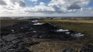
Colombia , Cumbal :
San Juan de Pasto, September 3, 2024, 4:20 p.m. Cumbal Volcanic Complex.
From the monitoring of the activity of the Cumbal Volcanic Complex (CVC), the Colombian Geological Survey (SGC), an entity attached to the Ministry of Mines and Energy, reports that:
During the week between August 27 and September 2, 2024, the activity of the CVC maintained a stable behavior. Compared to the previous week, the main variations in the monitored parameters were:
● A slight increase in the frequency of events and a slight decrease in the energy released by earthquakes were recorded.
● The predominance of seismicity associated with the fracture of rock materials, of low energy level, remained.
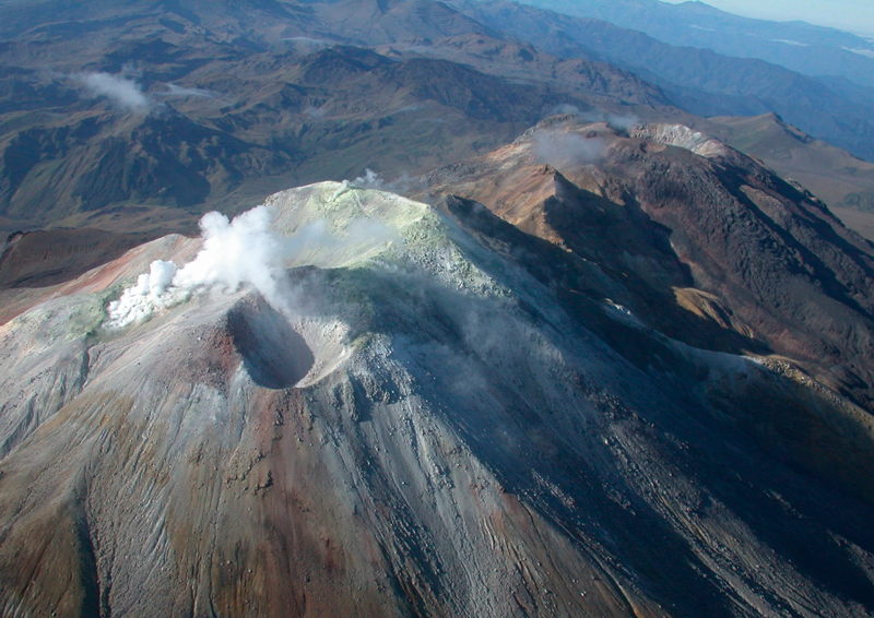
● Small gas emissions continue with white columns, of low height and variable dispersion, depending on the speed and direction of the winds. Emissions were recorded from the El Verde fumarole field, northeast of the CVC, as well as from the other fumarole fields of Las Bandas, Rastrojos and Boca Vieja, located southwest of the CVC.
● The other volcanic monitoring parameters remained stable.
Based on the above, the SGC recommends closely monitoring the evolution through the weekly bulletins and other information published through our official channels, as well as the instructions of the local and departmental authorities and the National Disaster Risk Management Unit (UNGRD).
Volcanic activity remains in yellow alert status: active volcano with changes in the behavior of the base level of the monitored parameters and other manifestations.
Source et photo : SGC
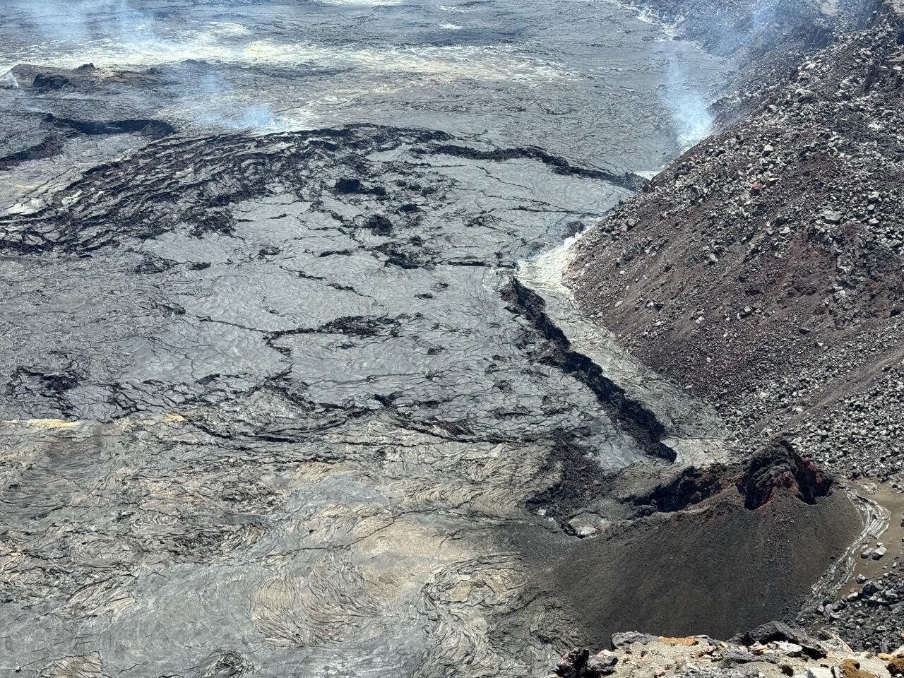
Hawaii , Kilauea :
Friday, September 6, 2024, 8:59 AM HST (Friday, September 6, 2024, 18:59 UTC)
19°25’16 » N 155°17’13 » W,
Summit Elevation 4091 ft (1247 m)
Current Volcano Alert Level: ADVISORY
Current Aviation Color Code: YELLOW
Activity Summary:
Kīlauea is not erupting. Earthquake activity remains elevated in Kīlauea’s upper East Rift Zone (UERZ). Changes in the character and location of unrest can occur quickly, as can the potential for eruption, but there are no signs of imminent eruption at this time. There are no significant changes in activity in the lower East Rift Zone and Southwest Rift Zone.
Summit Observations:
Approximately 43 earthquakes were detected beneath Kaluapele (Kīlauea’s summit caldera) over the past 24 hours at depths of 1–3 km (0.6–1.9 mi) below the ground surface, most with magnitudes of less than M2.0. Rates of deformation at the summit remained relatively low, with slightly fluctuating tilt at summit tiltmeters over the past day. An overall gradual inflationary trend has been measured by GPS instruments around the summit region in recent months. The most recent measurement of the summit’s SO2 emission rate was approximately 75 tonnes per day on August 20, 2024.
Rift Zone Observations:
Over the past 24 hours, there have been approximately 95 earthquakes beneath Kīlauea’s UERZ region, extending from Puhimau Crater southeast to Maunaulu, an increase from yesterday. Most earthquakes have been smaller than M2.0. Events have remained at depths of 1–3 km (0.6–1.8 miles) beneath the surface. Currently, deformation remains stable over the past 24 hours.
Activity in the middle East Rift Zone (MERZ) remains low. There were no significant changes in the POC tiltmeter over the past day. GPS instruments have recorded overall inflation in the region over the past month.
Measurements from continuous gas monitoring stations downwind of Puʻuʻōʻō in the middle East Rift Zone—the site of 1983–2018 eruptive activity—remain below detection limits for SO2, indicating that SO2 emissions from this area are negligible.
At this time, there is no evidence of elevated seismicity or ground deformation beneath the lower East Rift Zone, and Southwest Rift Zone activity remains low. Current activity is restricted to the summit and upper East Rift Zone region.
Source : HVO
Photo : USGS / M. Patrick. ( 05/224)