August 31 , 2024 .
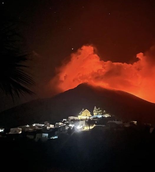
Indonesia , Merapi :
MOUNT MERAPI ACTIVITY REPORT, August 23-29, 2024 .
OBSERVATION RESULT
Visual
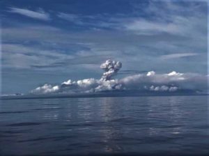
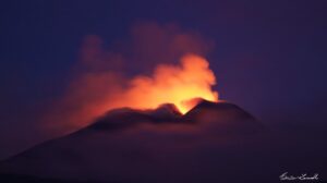
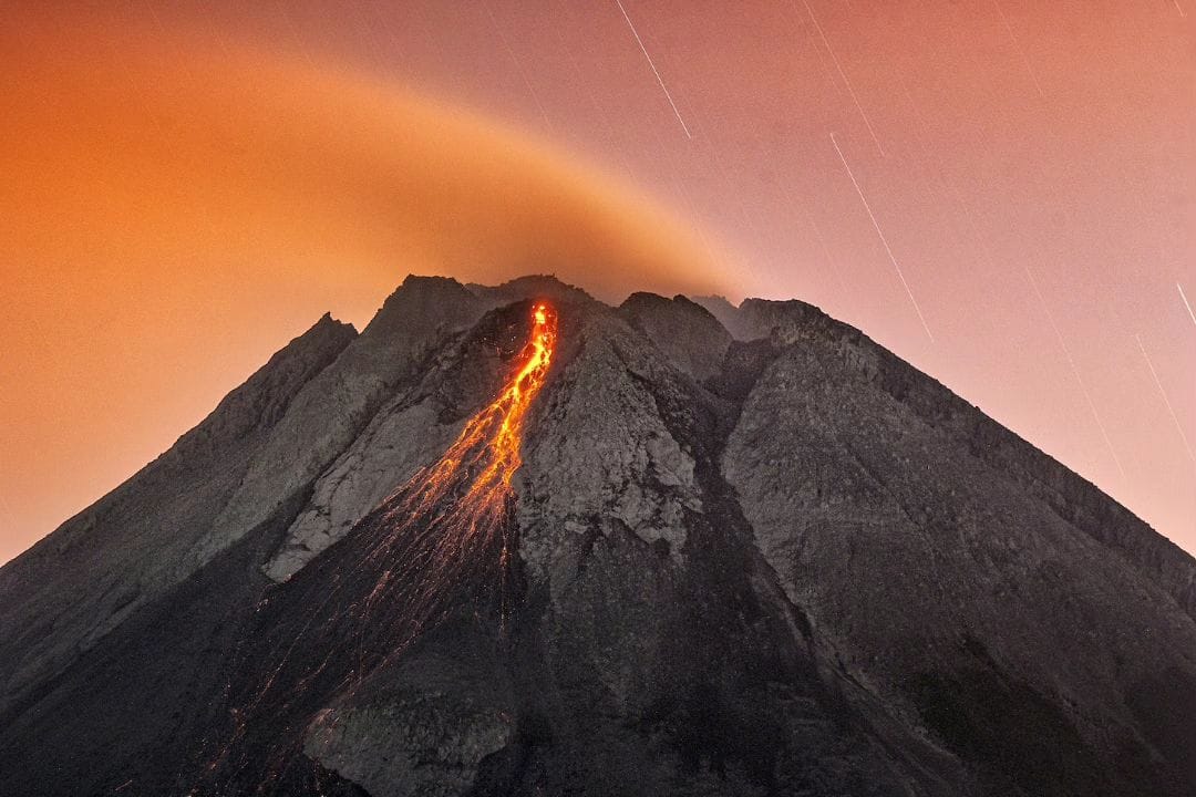
The weather around Mount Merapi is generally clear in the morning and night, while it is foggy from noon to evening. White smoke, thin to thick, low to moderate pressure and 200 m high was observed from the Babadan Mount Merapi observation post on August 29, 2024 at 06:00 WIB. This week, 8 hot cloud avalanches descended towards the southwest (upstream of the Bebeng River) with a maximum sliding distance of 1,500 m. Lava avalanches were observed 327 times upstream of Bebeng River up to a maximum of 2,000 m and twice westward (upstream of Sat/Putih River) up to 1,300 m. The sound of avalanches was heard 6 times from Babadan station with low to moderate intensity.
The morphology of the southwest dome was observed to change due to dome growth activities, lava avalanches, and hot cloud avalanches. The highest hot spot was observed at 243 °C, which is relatively the same as the previous measurement temperature. For the morphology of the middle dome, there is no significant morphological change. The highest hot spot was observed at 212.5 °C, which is lower than the previous measurement temperature. Based on the analysis of aerial photos dated August 21, 2024, the volume of the Southwest Dome was measured at 2,777,900 m3 and that of the Central Dome at 2,366,900 m3.
Seismicity
This week, the seismicity of Mount Merapi recorded:
8 hot cloud avalanches (APG),
9 shallow volcanic earthquakes (VTB),
33 multi-phase earthquakes (MP),
4 low-frequency earthquakes (LF),
963 avalanche earthquakes (RF),
9 tectonic earthquakes (TT).
The intensity of earthquakes this week is lower than last week.
Deformation
The deformation of Mount Merapi monitored by EDM this week showed an average shortening rate of 0.3 cm/day, relatively the same as last week.
Rainfall and Lahars:
This week, there was no rain at the Mount Merapi observation post and no additional runoff or lahars were reported in the rivers that originate on Mount Merapi.
Conclusion
Based on the results of visual and instrumental observations, it was concluded that:
The volcanic activity of Mount Merapi is still quite high in the form of effusive eruptive activity. The activity status is set at the “SIAGA” level.
Source : BPPTKG
Photo : Merapi news / FB ( 12/07/2024)
Kamchatka , Karymsky :
VOLCANO OBSERVATORY NOTICE FOR AVIATION (VONA)
Issued: August 30 , 2024
Volcano: Karymsky (CAVW #300130)
Current aviation colour code: ORANGE
Previous aviation colour code: red
Source: KVERT
Notice Number: 2024-64
Volcano Location: N 54 deg 2 min E 159 deg 26 min
Area: Kamchatka, Russia
Summit Elevation: 1486 m (4874.08 ft)
Volcanic Activity Summary:
According to visual data from volcanologists at Uzon volcano, six explosions of the Karymsky volcano sent ash up to 10 km a.s.l. AMC of Elizovo reported that pilots detect a hight of ash plumes about 6-7 km a.s.l. According to satellite data, an ash plume extended to the east-northeast of the volcano.
An activity of the volcano continues. Ash explosions up to 10 km (32,800 ft) a.s.l. could occur at any time. Ongoing activity could affect international and low-flying aircraft.
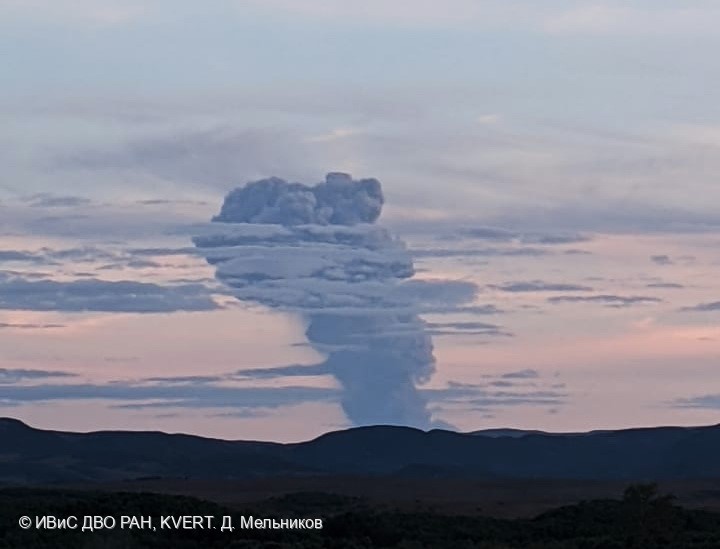
The explosions sent ash of the Karymsky volcano up to 10 km a.s.l. on 30 August, 2024.
Volcanic cloud height:
6000-7000 m (19680-22960 ft) AMSL Time and method of ash plume/cloud height determination: 20240830/0800Z – AMC Elizovo
Other volcanic cloud information:
Distance of ash plume/cloud of the volcano: 48 km (30 mi)
Direction of drift of ash plume/cloud of the volcano: ENE / azimuth 75 deg
Time and method of ash plume/cloud determination: 20240830/0840Z – Himawari-9 14m15
Source : Kvert
Photo : D. Melnikov. IVS FEB RAS, KVERT
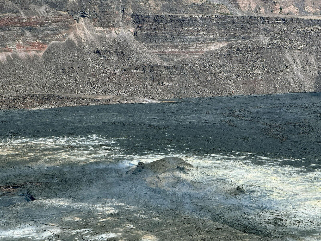
Italy , Stromboli :
Statement on the activity of Stromboli, 30 August 2024, 15:45 (13:45 UTC).
The National Institute of Geophysics and Volcanology, Osservatorio Etneo, reports that after a few hours of reduced effusive activity, in the late morning, the rate of lava emission increased again on the upper part of the Sciara del Fuoco, where the lava flow advances in the furrow dug during the activity of July 2024, with an active front at about 450-400 m above sea level. This activity is associated with numerous landslides which, descending in the same furrow, reach the coastline.
Statement on the activity of Stromboli, 30 August 2024, 17:44 (15:44 UTC)
The National Institute of Geophysics and Volcanology, Osservatorio Etneo, reports that the new effusive phase reported in the press release of 13:40 UTC is accompanied by an intense activity of projections at the vents of the North crater area, while from the South crater area sporadic ash emissions continue.
From a seismic point of view, the average amplitude of the volcanic tremor still remains at very high levels. From the analysis of the seismograms, seismic signals associated with landslides due to the rolling of incandescent blocks along the Sciara del Fuoco are observed. No significant changes have been reported in the frequency of occurrence and amplitude of explosion earthquakes.
The inclinometric data from the Timpone del Fuoco station and the high-frequency GNSS data do not show significant variations.
Further updates will be communicated shortly.
Source : INGV
Photo : Amici dell’Isola di Stromboli
Alaska , Shishaldin :
Friday, August 30, 2024, 9:00 AM AKDT
Over the past several months, signs of volcanic unrest at Shishaldin Volcano have been declining. Slightly elevated seismicity, small infrasound signals and weak gas emissions continue to be detected but there is no indication of explosive activity or the presence of lava in the crater. This level of activity is expected to persist and continue to wane as the volcano settles after the eruption that began in July 2023 and continued until November 2023. The volcano appears to have returned to a background condition and poses no immediate threat of eruptive activity. Accordingly, AVO is lowering the Aviation Color Code to GREEN and the Volcano Alert Code to NORMAL. Resumption of volcanic activity would likely be preceded by increased seismicity, infrasound, elevated temperatures, and gas emissions .
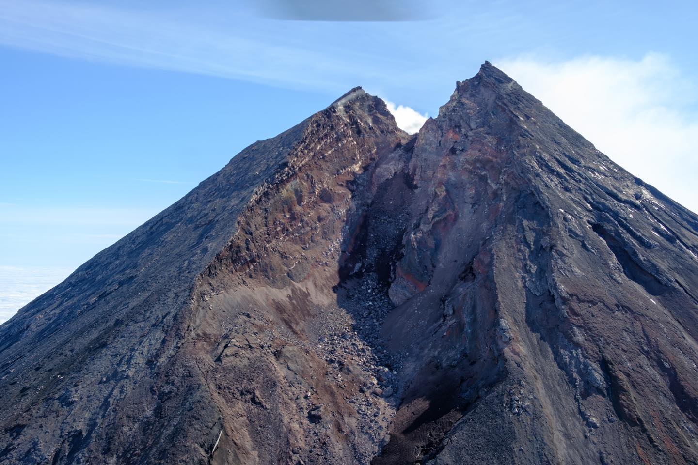
The southwest side of the summit cone of Shishaldin Volcano viewed during a gas and structure-from-motion survey on July 30, 2024. The sharp notch in the summit crater formed during the 2023 eruption.
Shishaldin Volcano is monitored by local seismic and infrasound sensors, web cameras, and a telemetered geodetic network. In addition to the local monitoring network, AVO uses nearby geophysical networks, regional infrasound and lighting data, and satellite images to monitor the volcano.
Source : AVO
Photo : M Loewen, USGS/AVO.
Hawaii , Kilauea :
Friday, August 30, 2024, 8:54 AM HST (Friday, August 30, 2024, 18:54 UTC)
19°25’16 » N 155°17’13 » W,
Summit Elevation 4091 ft (1247 m)
Current Volcano Alert Level: ADVISORY
Current Aviation Color Code: YELLOW
Activity Summary:
Kīlauea is not erupting. Earthquake activity remains elevated in Kīlauea’s upper East Rift Zone (UERZ), and has increased over the past day. Changes in the character and location of unrest can occur quickly, as can the potential for eruption, but there are no signs of imminent eruption at this time. There are no significant changes in activity in the lower East Rift Zone and Southwest Rift Zone.
Summit Observations:
Approximately 36 earthquakes were detected beneath Kaluapele (Kīlauea’s summit caldera) over the past 24 hours at depths of 1–3 km (0.6–1.9 mi) below the ground surface, most with magnitudes of less than M2.0. Rates of deformation at the summit remained relatively low, with deflationary tilt at summit tiltmeters over most of the past day. An overall gradual inflationary trend continues to be seen on GPS instruments around the summit region. The most recent measurement of the summit’s SO2 emission rate was approximately 75 tonnes per day on August 20, 2024.
Rift Zone Observations:
Over the past 24 hours, there have been approximately 87 earthquakes beneath Kīlauea’s UERZ region, extending from Puhimau Crater southeast to Maunaulu, which is an increase over the past day. Most earthquakes have been smaller than M2.0. Events have remained at depths of 1–3 km (0.6–1.8 miles) beneath the surface. Currently, deformation remains stable over the past 24 hours.
Activity in the middle East Rift Zone (MERZ) remains low. There were no significant changes in the POC tiltmeter over the past day. GPS instruments have recorded overall inflation in the region over the past month.
Measurements from continuous gas monitoring stations downwind of Puʻuʻōʻō in the middle East Rift Zone—the site of 1983–2018 eruptive activity—remain below detection limits for SO2, indicating that SO2 emissions from this area are negligible.
At this time, there is no evidence of elevated seismicity or ground deformation beneath the lower East Rift Zone, and Southwest Rift Zone activity remains low. Current activity is restricted to the summit and upper East Rift Zone region.
Source : HVO
Photo : USGS/ M. Patrick ( 04/2024)