August 23 , 2024 .
Iceland : Reykjanes Peninsula :
Updated 22 August at 21:25 UTC
At 20:48 UTC an intense earthquake swarm started in the Sundhnúkur crater row between Stóra-Skógfell and Sýlingarfell.
Increased pressure has also been measured in boreholes. These are clear signs that a dyke propagation has started and it is likely that an eruption is imminent.
Updated 22 August 21:26 UTC
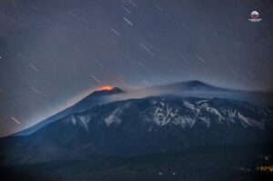
A volcanic eruption has started. A fissure opened east of Sýlingarfell and at 09:30 a gas plume that reached about 1 km in height dispersed to the south.
Updated 22 August at 21:50 UTC
The eruptive fissure initially expanded both to the north and to the south. The length of the fissure has not been estimated at this point. Currently, no seismic activity is detected south of the eruptive fissure. The seismic activity is mainly to the north, which indicates that the magma is breaking its way to the north rather than to the south.
Volcanic eruption has started at Sundhnúks crater row
Updated 23 August at 01:10 UTC
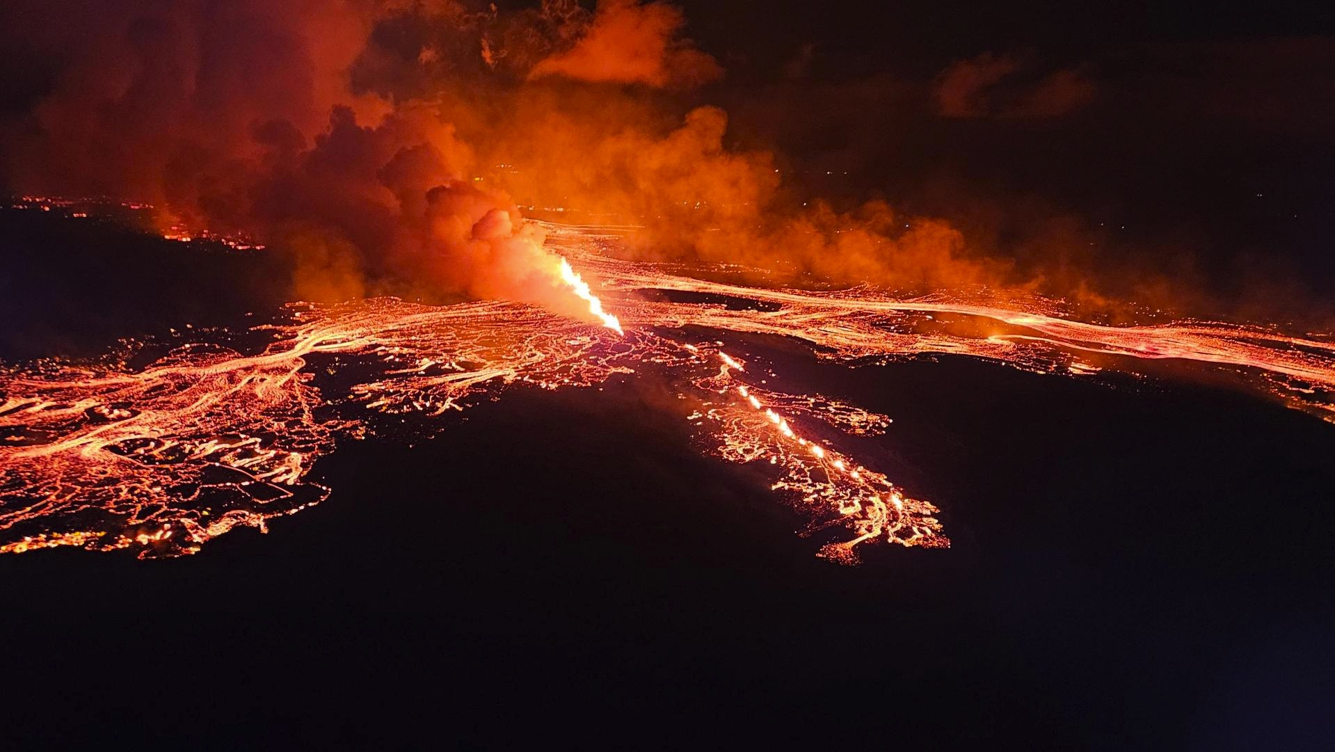
The length of the eruptive fissure appears to remain the same for the last hour (approx. 3.9 km).
The seismicity is fairly stable and the main activity is at the northern end of the eruptive fissure. It is therefore unlikely that the fissure will extend to the south. It cannot be ruled out that the eruptive fissure could extend to the north.
The lava flow continues both to the east and west towards Grindavíkurvegur. No lava flow is observed to the south towards Grindavík.
The Coast Guard will carry out another surveillance flight later tonight.
The next update will be provided tomorrow morning. IMO maintains a 24-hour monitoring of all natural hazards and will publish posts on Facebook later in the night with the latest information about the volcanic activity.
Updated August 23 at 05:10 UTC ( FB)
A new fissure opened last night at the northern end of the fissure that opened last night. Lava from the new fissure is flowing toward Litla-Skógfell, but activity remains mostly at the old fissure.
The bursting of GPS counters and continued earthquakes north of the old fissure after the eruption began indicated that magma was still trying to force its way through the Earth’s crust.
Photo : Défense civile Islande.
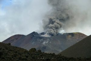
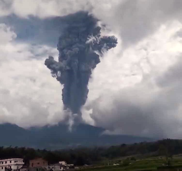
Indonesia , Marapi :
An eruption of Mount Marapi occurred on Thursday, August 22, 2024 at 01:20 WIB with the height of the ash column observed at ± 1000 m above the summit (± 3891 m above sea level). The ash column was observed to be gray with a thick intensity, oriented towards the West. This eruption was recorded on a seismograph with a maximum amplitude of 19 mm and a duration of 65 seconds.
SEISMICITY OBSERVATIONS:
1 eruption earthquake with an amplitude of 19 mm and a seismic duration of 65 seconds.
9 emission earthquakes with an amplitude of 1.1 to 9.8 mm and earthquake duration of 24 to 109 seconds.
1 shallow volcanic earthquake with an amplitude of 1.3 mm and an earthquake duration of 21 seconds.
2 deep volcanic earthquakes with an amplitude of 2.7 to 4 mm, and an earthquake duration of 15 to 16 seconds.
2 local tectonic earthquakes with an amplitude of 3.5 to 6 mm, and an earthquake duration of 22 to 25 seconds.
1 continuous tremor with an amplitude of 1-2 mm, dominant value 1 mm.
RECOMMENDATION
1. People around Mount Marapi and visitors/tourists/climbers are not allowed to enter and carry out activities within a 3 km radius around the activity centre (Verbeek Crater) of Mount Marapi.
2. Communities living around the valleys/streams/river banks that originate at the summit of Mount Marapi should always be aware of the potential threat of lahars that may occur, especially during the rainy season.
Source : Magma Indonésie
Photo : Jro Yudhiani ( 23/08/2024 FB via Volcanodiscovery).
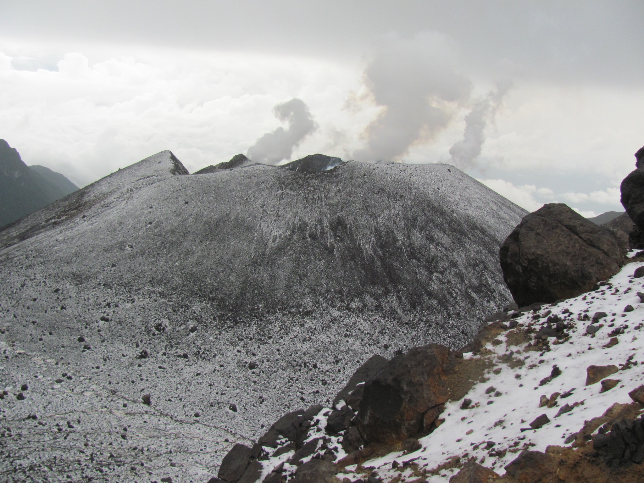
Colombia , Galeras :
Pasto, August 20, 2024, 6:55 p.m.
From the monitoring of the activity of the Galeras volcano, the Colombian Geological Survey (SGC), an entity attached to the Ministry of Mines and Energy, reports that:
In the week of August 13 to 19, 2024, the activity of the volcano maintained a stable behavior. Compared to the previous week, the main variations in the monitored parameters were:
● There was a significant decrease in the occurrence and released seismic energy.
● The predominance of seismicity associated with rock fracturing continues.
● A group of earthquakes related to the fracture were located near the volcanic summit, at distances of less than 1 km and at depths of up to 2 km from the summit (4,200 m above sea level). A second group of events was located southeast of the summit, at a distance of 3 km and at depths between 2 and 4 km. For all the localized earthquakes, the maximum magnitude was 1.6.
● Small gas emissions continued, mainly from the fumaroles of Las Chavas, to the west; El Paisita, to the north of the crater; and from the active cone area, with white gas columns, of variable height and dispersion due to the action of the winds.
● The other volcanic monitoring parameters showed stability.
Based on the above, the SGC recommends closely monitoring its evolution through the weekly bulletins and other information published through our official channels, as well as the instructions of local and departmental authorities and the National Disaster Risk Management Unit (UNGRD).
Volcanic activity remains in yellow alert status: active volcano with changes in the behavior of the base level of the monitored parameters and other manifestations.
Source et photo : SGC
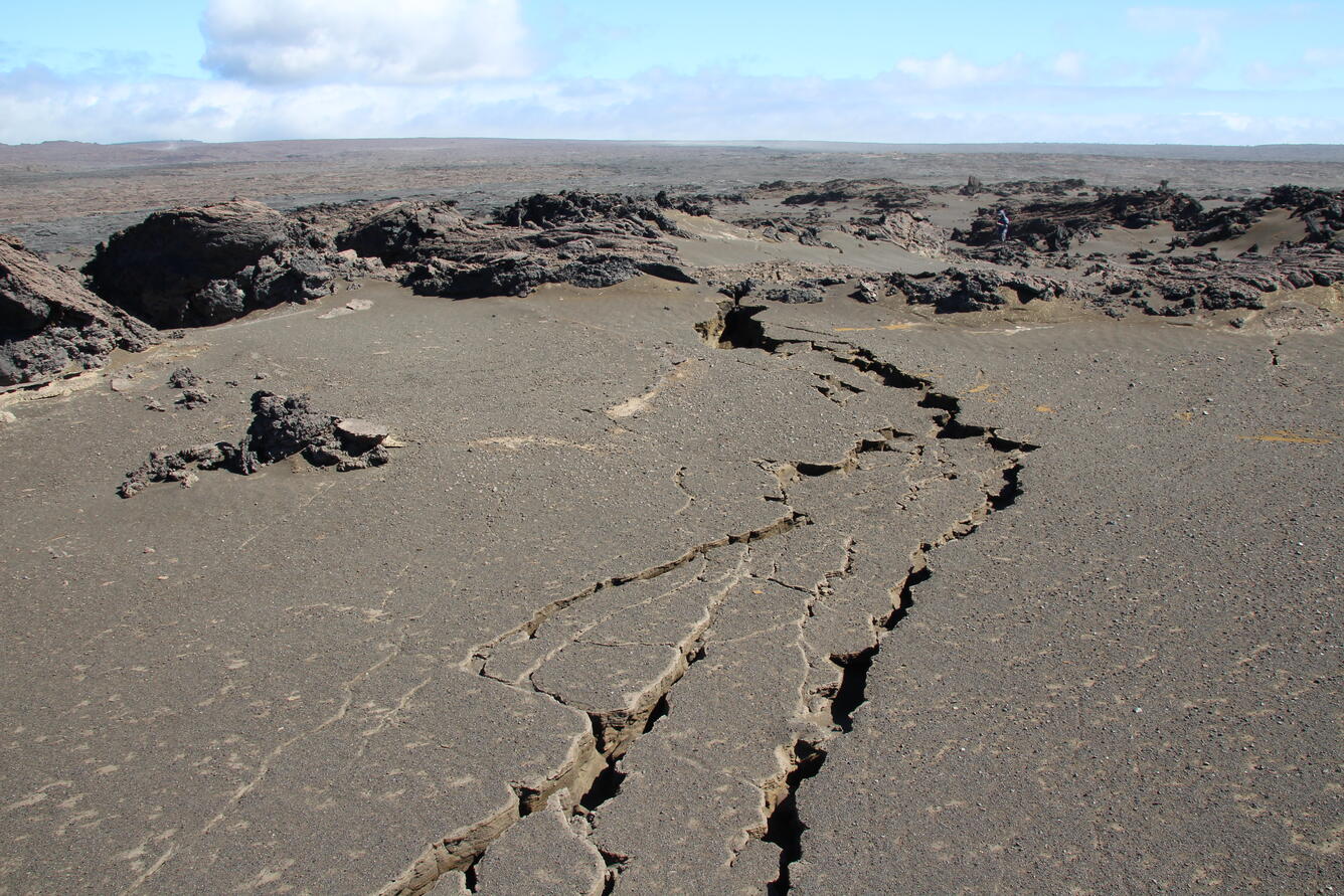
Hawaii , Kilauea :
Thursday, August 22, 2024, 9:15 AM HST (Thursday, August 22, 2024, 19:15 UTC)
19°25’16 » N 155°17’13 » W,
Summit Elevation 4091 ft (1247 m)
Current Volcano Alert Level: ADVISORY
Current Aviation Color Code: YELLOW
Activity Summary:
Kīlauea is not erupting. A magnitude-4.7 earthquake occurred at 12:52 AM HST, 9 mi (15 km) south of Fern Forest on the Island of Hawaiʻi at a depth of 4 mi (7 km) below sea level. An information statement was released this morning with further details. The earthquake had no apparent impact on either Mauna Loa or Kīlauea volcanoes. Increased earthquake activity and rates of ground deformation at Kīlauea’s upper East Rift Zone (UERZ) began early Tuesday morning (8/20). Activity is still elevated but has continued at a decreased rate. Changes in the character and location of unrest can occur quickly, as can the potential for eruption, but there are no signs of imminent eruption at this time. There are no significant changes in activity in the lower East Rift Zone and Southwest Rift Zone.
Summit Observations:
Approximately 21 earthquakes were detected beneath Kaluapele (Kīlauea’s summit caldera) over the past 24 hours at depths of 1–3 km (0.6–1.9 mi) below the ground surface with magnitudes of less than M2.0. Rates of deformation at the summit remained relatively low with minor local deflation, likely in response to unrest in the upper East Rift Zone (UERZ). An overall gradual inflationary trend continues to be seen on GPS instruments around the summit region. The most recent measurement of the summit’s SO2 emission rate was approximately 75 tonnes per day on August 20, 2024.
Rift Zone Observations:
Over the past 24 hours, there have been approximately 65 earthquakes beneath Kīlauea’s UERZ region, extending from Puhimau Crater southeast to Maunaulu. Most earthquakes have been smaller than M2.0, though there was 1 event larger than M3.0. Events have remained at depths of 1–3 km (0.6–1.8 miles) beneath the surface. Most earthquakes have been too small to feel, but several were reported felt in Hawaiʻi Volcanoes National Park and surrounding communities.
Earthquake activity was accompanied by elevated rates and changing patterns of ground deformation recorded by the ESC tiltmeter northeast of Pauahi Crater in Kīlauea’s UERZ on Tuesday (8/19). Deformation as of Thursday morning is relatively level (flat).
Activity in the middle East Rift Zone (MERZ) remains low. Earthquake locations are scattered around Makaopuhi crater within Hawaiʻi Volcanoes National Park. Depths range from 1–3 km (0.6–1.9 mi) below the ground surface with magnitudes less than M2.0. There has been no significant change in deformation at the POC tiltmeter overnight. GPS instruments continue to record inflation in the region.
Measurements from continuous gas monitoring stations downwind of Puʻuʻōʻō in the middle East Rift Zone—the site of 1983–2018 eruptive activity—remain below detection limits for SO2, indicating that SO2 emissions from this area are negligible.
At this time, there is no evidence of seismicity or ground deformation beneath the lower East Rift Zone, and Southwest Rift Zone activity remains low. Current activity is restricted to the summit and upper East Rift Zone region.
Source : HVO
Photo : USGS / N. Deligne ( 02/224)
Alaska , Shishaldin :
No major changes were detected in the past day at Shishaldin Volcano, where minor volcanic unrest continues. Small earthquakes were detected in local seismic data. No unusual activity observed in partly cloudy satellite and webcam views of the volcano over the past day.
Minor rock falls associated with collapse of the unstable summit crater area may occur without warning. This can lead to small clouds of dust (volcanic ash), which dissipate quickly and create dark-colored deposits near the summit. There have been no significant ash-producing explosive eruptions since November 2023.
Northeast flank of Shishaldin Volcano viewed from high on the north flank of the neighboring Isanotski Peaks. A faint degassing plume is visible drifting north from the summit. Westdahl volcano is visible in the distance to the left of Shishaldin.
Local seismic and infrasound sensors, web cameras, and a geodetic network are used to monitor Shishaldin Volcano. In addition to the local monitoring network, AVO uses nearby geophysical networks, regional infrasound and lighting data, and satellite images to detect eruptions.
Source : AVO
Photo : Loewen, Matt (1er août 2024 )